Contributory members are able to log private notes and comments about each site
Sites Anne T has logged on trip number: 47 (View all trips)
View this log as a table or view the most recent logs from everyone
Moor Head (Brundean Laws)
Trip No.47 Entry No.1 Date Added: 3rd Oct 2017
Site Type: Standing Stones
Country: Scotland (Scottish Borders)
Visited: Yes on 20th Sep 2017. My rating: Condition 2 Ambience 3 Access 4

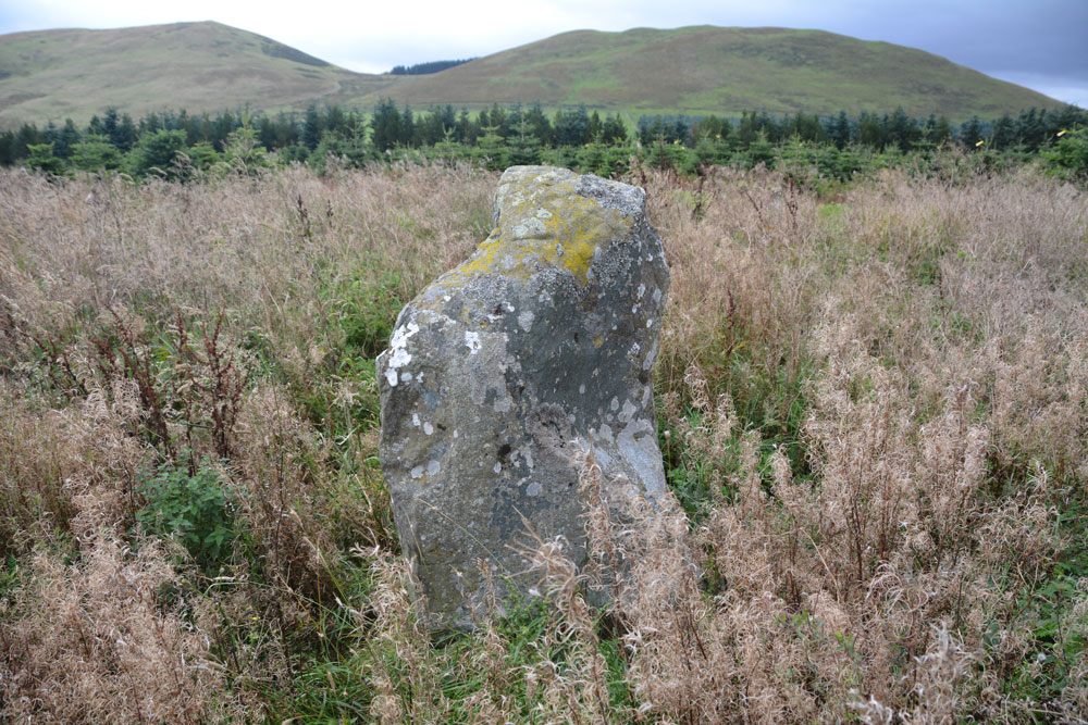
Moor Head (Brundean Laws) submitted by Anne T on 3rd Oct 2017. Looking east across the top of the taller stone, showing it's irregular shaped top.
(View photo, vote or add a comment)
Log Text: Moor Head (Brundean Laws), Scottish Border: This was our first stop on our journey to Armadale, and a part of the world we’ve been to before on a walk up Dere Street, but not stopped at these stones before. We parked at Brundean Laws farm entrance at NT 71651 11987 and walked up the track past the first few houses, to where the track divides at NT 72183 11509 just before Brundean Laws Farm, taking the right hand fork as we faced the main farmhouse. The area where the standing stones are has not been mowed, so stands out as a taller circle of grass around a telegraph pole at the south eastern end of the large field in which the stones stand.
We followed the track that heads of westwards until we were level with the stones, then headed the 30 metres or so to unmown area in which they stood. There is one main stone which is clearly a standing stone, with a second recumbent stone to its south east. A second, broken, stone pokes up out of a mound of smaller stones, which I thought was a quarried stone which had just been dumped, but checking with the Canmore record, this is the second standing stone. With the tall grass and thistles around the stones, it was difficult to tell if there were any more stones undergoot.
The stones do stand on a slight mound (although Canmore says they are 170 metres SSW of Moor Head summit) and if the Christmas tree forest hadn’t been to it’s north, west and south, would have had a commanding view over the surrounding hills which towered above this spot.
Haughhead Kip (Eckford)
Trip No.47 Entry No.2 Date Added: 3rd Oct 2017
Site Type: Sculptured Stone
Country: Scotland (Scottish Borders)
Visited: Yes on 20th Sep 2017. My rating: Condition 3 Ambience 4 Access 4

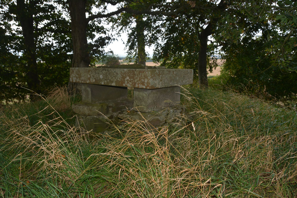
Haughhead Kip (Eckford) submitted by Anne T on 3rd Oct 2017. First view of the 'altar' with the inscribed stone on top, sited on top of the mound/tumulus.
(View photo, vote or add a comment)
Log Text: Haughhead Kip Tumulus & Inscribed Stone, Scottish Borders: This is one of the strangest sites I’ve been to recently, although in a lovely location. Sited just to the east of the A698, north of the B6401 and south of Kale Water, to the north west of the little village of Eckford, we parked on a corner of this narrow road at NT 72558 26695, where there was just enough room to pull the car right off the road. The B6401 was a busy little road, and we avoided cars walking west back to the field with the tumulus.
There is a gate into the field at NT 72289 26736, and it wasn’t until we were 20-30 metres into the field that we realised it had been planted with really tiny cabbage or turnip plants, drilled into wide rows. Being so close to the tumulus, we carefully picked our way across the rest of the field until we got to the gate to the tumulus at about NT 72184 26830. From there, it was a little climb up to what I can only describe as either an altar or a tumbledown box grave.
Certainly worth stopping to see. Canmore debates whether or not the mound was erected to contain the altar. Due to it’s location close to Kale Water, I think it was a tumulus used to locate the inscribed stone on top of it, to give it greater importance.
Castle Hill (Ancrum)
Trip No.47 Entry No.4 Date Added: 4th Oct 2017
Site Type: Hillfort
Country: Scotland (Scottish Borders)
Visited: Saw from a distance on 20th Sep 2017. My rating: Condition 2 Ambience 4 Access 4

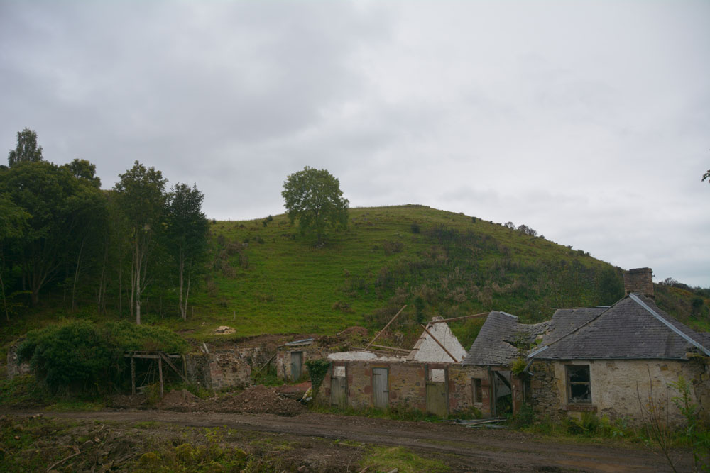
Castle Hill (Ancrum) submitted by Anne T on 4th Oct 2017. Walking through the gate at the eastern side of the ruins, and walking over the old pack horse bridge, the western side of the hillfort can be seen. We were unable to get any further along this path as it was closed due to building works. There is another route to the eastern side of the fort from Ancrum village.
(View photo, vote or add a comment)
Log Text: Castle Hill Hillfort, Ancrum, Scottish Borders: It was getting late in the evening, with dusk coming on, so sadly there wasn’t time to drive back into Ancrum and back round the other side to clamber up to this enticing hill fort, which is visible from Ancrum Old Church and can also be clearly seen on UK Grid Reference Finder. We did try walking across the pack horse bridge across Ale Water, letting ourselves out of the wrought iron gates at the eastern side, but the cottage and adjacent barns we’d have needed to walk through were a building site and were cordoned off.
Decided to leave this for another day, and drove back past the market cross to photograph that before heading off to Armadale.
Ancrum Old Church
Trip No.47 Entry No.3 Date Added: 3rd Oct 2017
Site Type: Sculptured Stone
Country: Scotland (Scottish Borders)
Visited: Yes on 20th Sep 2017. My rating: Condition 3 Ambience 5 Access 4

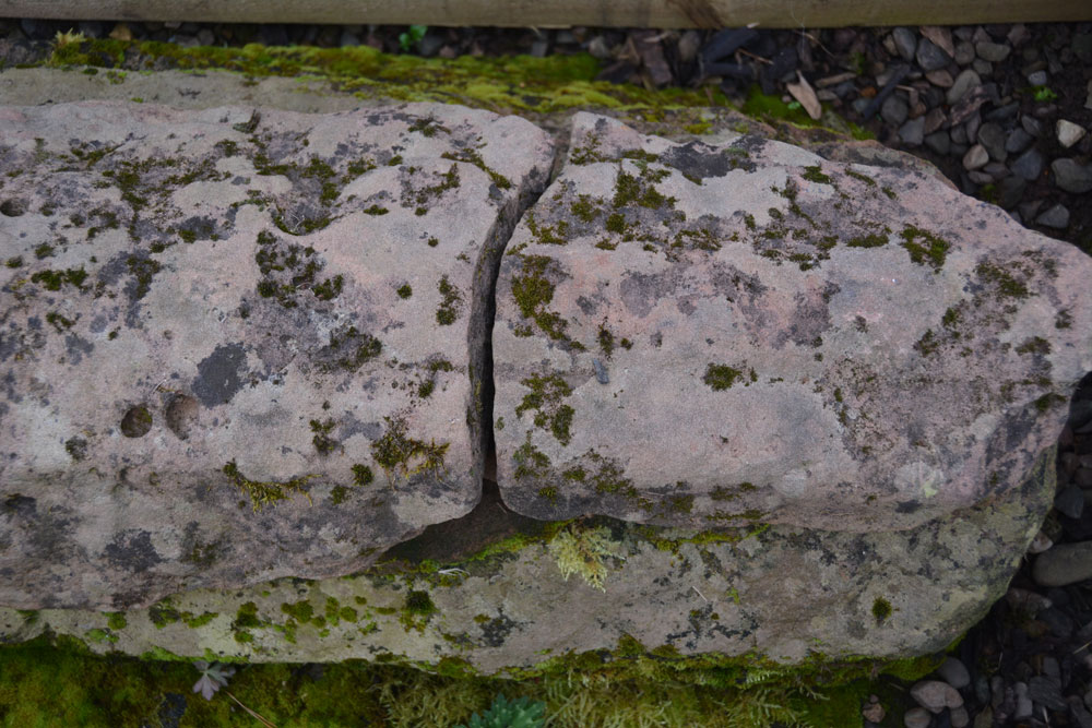
Ancrum Old Church submitted by Anne T on 3rd Oct 2017. A close up of the end of the hogback, trying to see if the camera would pick up any of the relief carving still left on the stone - sadly, no.
(View photo, vote or add a comment)
Log Text: Ancrum Old Church, Scottish Borders: This is a very beautiful location, just to the west of Ale Water and north of the B6400, west of the village of Ancrum. There is parking for 3-4 cars at the south western end of the church yard. A gate and steps lead down into the church yard; the ruined church stands at the northern end of the graveyard.
We walked all around the church, at first unsure of where to look. In the end, by holding my mobile above my head, I managed to get the Canmore record up, so we knew exactly where to look.
Ancrum 1 and 2 are within the village, within private grounds. We did spot the two inscribed slabs, a hogback and a cross base. There was a young man flying a drone all around the church and churchyard, and his dog kept following us. I tried to engage him in conversation, but only got that he was making a film for ‘his own purposes’.
We wandered over the old pack horse bridge to the eastern side of Ale Water, but this was a building site. We could see the western end of Castle Hill hillfort. By this time, it was getting late and the climb looked steep, so we bottled out of the climb, stopping off to look at Ancrum Market Cross on the way to Armadale.
