Contributory members are able to log private notes and comments about each site
Sites Anne T has logged on trip number: 95 (View all trips)
View this log as a table or view the most recent logs from everyone
Twizel Standing Stone
Trip No.95 Entry No.6 Date Added: 9th Sep 2018
Site Type: Standing Stone (Menhir)
Country: England (Northumberland)
Visited: Yes on 6th Sep 2018. My rating: Condition -1 Ambience 3 Access 4

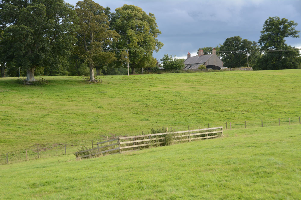
Twizel Standing Stone submitted by Anne T on 9th Sep 2018. The red arrow marks the spot where this standing stone/rubbing post should have been located. Next time we drive by, we'll knock on the door of the farmhouse and ask to check the spot.
(View photo, vote or add a comment)
Log Text: Site of possible standing stone, Twizel: The boulder no longer appears to be in the field, although there is a small raised area in the field – as this is England, we couldn’t find anyone to ask permission to walk into the field, so photographed it from the fence near the cottage. For a last stop of the day, a little disappointing, as a standing stone would have 'wrapped things up nicely'.
Norham Cross
Trip No.95 Entry No.5 Date Added: 9th Sep 2018
Site Type: Ancient Cross
Country: England (Northumberland)
Visited: Yes on 6th Sep 2018. My rating: Condition 3 Ambience 4 Access 5

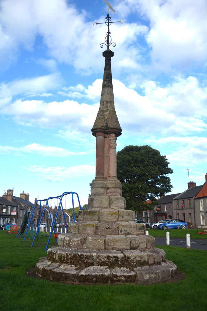
Norham Cross submitted by Anne T on 9th Sep 2018. Norham Cross, looking eastwards across the children's playground and up the main street in the village, to the Castle at the top of the hill.
(View photo, vote or add a comment)
Log Text: Norham Village Cross: (Before looking at this cross, we stopped off to look at the Victorian Jubilee Fountain just over the border in Scotland, which still has its original pump handle, although this doesn't work). We passed this cross several times today, but with it being immediately next to the children’s playground, there were children sitting on its lower steps, and propping their bicycles against it. When we passed by on the way back from seeing the holy wells at Upsettlington, there was fortunately no children around it, so we stopped to take photographs, much to the amusement of two ladies passing by who stopped to watch. It was nice to see the cross still very much part of village life today.
Whilst the top part of this cross looks Victorian/relatively recent, the steps look much, much older and are very worn.
Nun's Well (Upsettlington)
Trip No.95 Entry No.4 Date Added: 9th Sep 2018
Site Type: Holy Well or Sacred Spring
Country: Scotland (Scottish Borders)
Visited: Yes on 6th Sep 2018. My rating: Condition 3 Ambience 4 Access 4

Nun's Well (Upsettlington) submitted by Anne T on 9th Sep 2018. Nun's Well from the south east. The well itself is the feature captured by the fluted, domed stone bowl.
(View photo, vote or add a comment)
Log Text: Nun's Well, Upsettlington: From St. Mary's Well, walking up the hill to the gate which leasds into the next field, we walked back down hill towards a steam. The well monument can be seen between two large trees, just before a small burn leading westwards into the RiverTweed. The trees on the western bank of the river hid the view of the water, but what a magnificent spot.
I didn’t realise until we got home and brought up the Canmore record that the actual well is hidden by the stone dome, which is outside the monument enclosure.
The monument seems to be built on much older steps, which are held together with a large number of iron staples. These aren’t mentioned in the Canmore record.
St Mary's Well (Upsettlington)
Trip No.95 Entry No.3 Date Added: 9th Sep 2018
Site Type: Holy Well or Sacred Spring
Country: Scotland (Scottish Borders)
Visited: Yes on 6th Sep 2018. My rating: Condition 3 Ambience 3 Access 4

St Mary's Well (Upsettlington) submitted by Anne T on 9th Sep 2018. St Mary's Well from just uphill to its north east, heading for the gate into the next field, where Nun's Well can be found.
(View photo, vote or add a comment)
Log Text: St Mary's Well, Upsettlington: From Monk’s Well, and in the same field, we walked east-north-east towards this fenced off area of the field. To our left hand side, raised some 0.5m+ above ground level, and seemingly in a perfect circle, was a funny wooded area; closer inspection revealed it was being used as a large, tree-covered feeding station for pheasants/grouse? There was no record on Canmore of this being a cairn or the site of a hillfort.
St Mary’s Well, with its inscription barely legible on the top, reminded me very much of the well houses in Durham City. The structure was very overgrown, although underneath the name of the well, there was still the remains of a metal pipe leading into the well trough below (the latter was hidden by vicious nettles).
The latest visit report recorded by Canmore in 1971 says the well is now dry, but the inscription is still intact.
From here, we walked northwards, uphill, to a gate into the next field which contained Nun’s Well.
Monk's Well (Upsettlington)
Trip No.95 Entry No.2 Date Added: 9th Sep 2018
Site Type: Holy Well or Sacred Spring
Country: Scotland (Scottish Borders)
Visited: Yes on 6th Sep 2018. My rating: Condition 2 Ambience 3 Access 4

Monk's Well (Upsettlington) submitted by Anne T on 9th Sep 2018. Lifting up the larger pallet, there is a smaller, partly rotten wooden pallet which hides more ?dressed stone pieces and what looks like a manhole cover. Being partly sunk into the ground, it was not possible to lift this up for further investigation to confirm it was Monk's Well or not.
(View photo, vote or add a comment)
Log Text: Monk's Well, Upsetllington: From St Cuthbert's Church in Norham with its Saxon pillar, we went to Norham Castle (well worth looking round, and free of charge). This was the start of quite a treat - three holy wells in two adjacent fields!
From the castle, we crossed the bridge over the River Tweed, going from England to Scotland, following the B6470 to a left hand turn, by a Victorian water fountain by the side of the crossroads. This turning led to Upsettlington, which seems to have been renamed Ladykirk at some point (all the signs and house names read ‘Ladykirk’ Lodge, etc).
At the cross roads between the houses, at the entrance to the main house, we turned left towards Black Row, the Smithy and East Lodge, parking by the phone box. We let ourselves into the field (gate to the left of the phone box), only to find there were four horses galloping from the far side of the field towards us, and a fence between us and the well. We decided to drive back along the road towards the B6470, where there was another gate into a stock-free field. This field also contained two of the wells and gave access through a gate into the field with Nun’s Well.
There was a large pallet at the point where the grid reference for this well was. Lifting the pallet, a smaller pallet, half buried in the mud beneath, with a man-hole cover underneath. Some 20m to the south east there was a modern man hole cover, demarked from the rest of the field by three stakes placed in a triangle, with a pipe leading down the slope. Which of these is the real well, we weren’t sure. There were a few possibly dressed stones peeping above the turf near the pallet.
Having photographed both possible well sites, it looked as if the ‘staked site’ had possibly been the site for a drinking trough, but there had been so much ground disturbance it was difficult to tell.
St Cuthbert's Church (Norham)
Trip No.95 Entry No.1 Date Added: 9th Sep 2018
Site Type: Ancient Cross
Country: England (Northumberland)
Visited: Yes on 6th Sep 2018. My rating: Condition 3 Ambience 5 Access 5

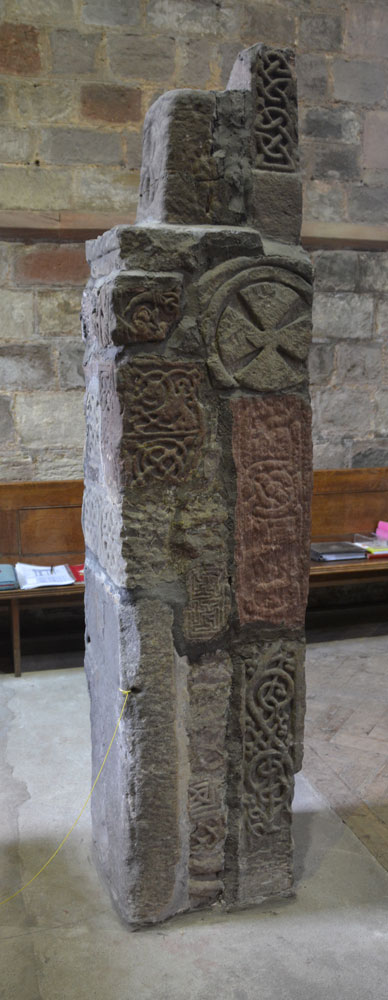
St Cuthbert's Church (Norham) submitted by Anne T on 9th Sep 2018. This is the side of the pillar which faces the south door into the church.
(View photo, vote or add a comment)
Log Text: Anglo Saxon Pillar, Norham: The journey seemed to take a lot longer than anticipated, and we didn’t arrive here until almost 3pm. At first, keeping the tower of the church in view, we went the wrong way, past the village cross and the first school, then turned round, travelling back along West Street (the B6470), turning down North Way to Church Lane. We spotted the churchyard first; the church is at the bottom of Church Lane, so we ended up parking near the gate at the bottom at NT 89710 47356 and walking up to the south porch along the path.
Andrew thought there were originally 25 stones here, but there are actually only 18, built into a ‘pillar’, with different sides showing, some recorded separately on the Corpus. A few of the fragments have been lost between their finding in 1833 and today, but the Corpus holds some drawings from the 19th century.
After photographing the Saxon pillar, we looked around outside, spotting the musket ball holes where Oliver Cromwell’s army had shooting practice, and looked at the site of the original Saxon church, which is on a mound slightly higher than the modern church.
