Contributory members are able to log private notes and comments about each site
Sites Anne T has logged on trip number: 102 (View all trips)
View this log as a table or view the most recent logs from everyone
St Mary The Virgin (Ponteland)
Trip No.102 Entry No.1 Date Added: 10th Oct 2018
Site Type: Ancient Cross
Country: England (Northumberland)
Visited: Yes on 9th Oct 2018. My rating: Condition 3 Ambience 4 Access 5

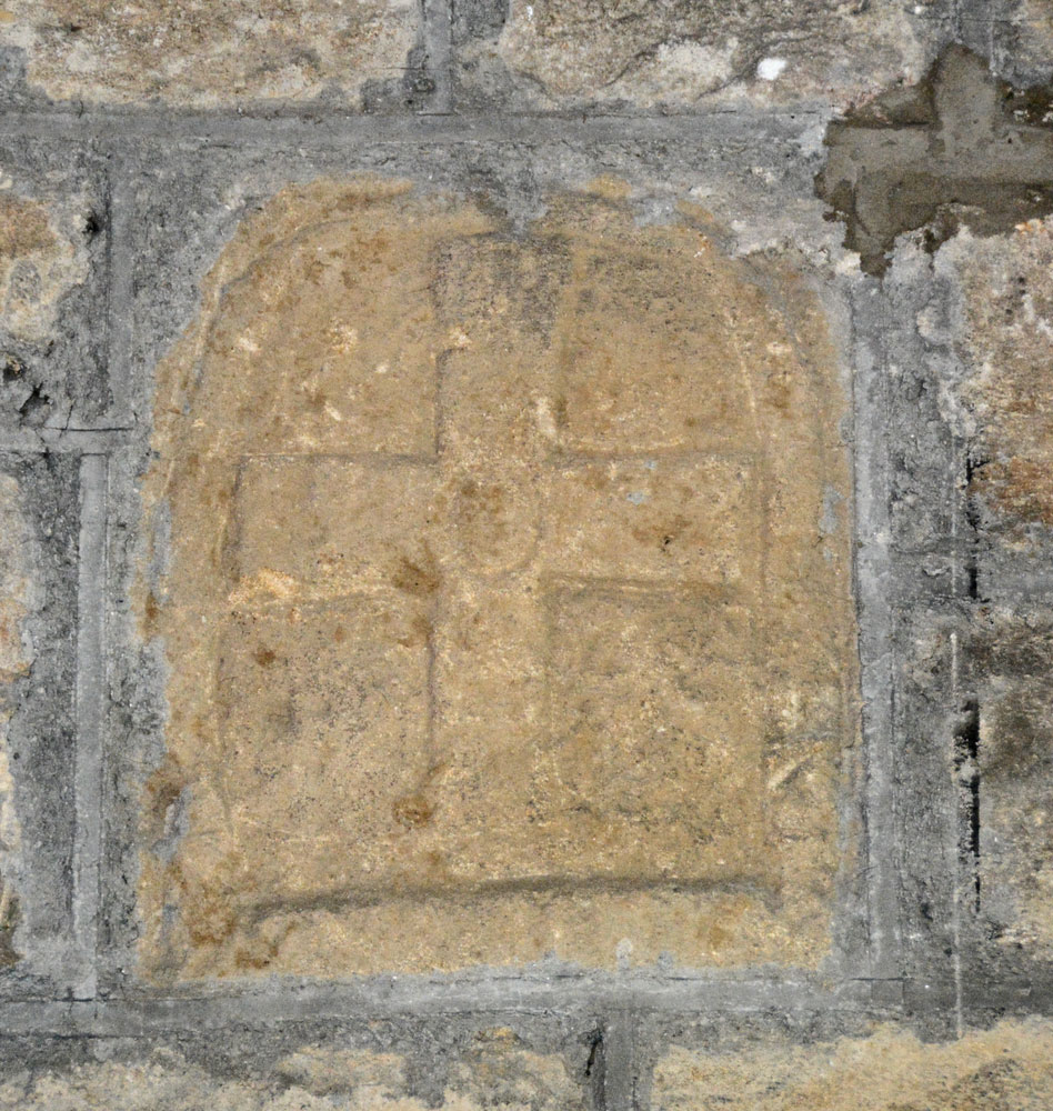
St Mary The Virgin (Ponteland) submitted by Anne T on 10th Oct 2018. The round headed, tenth century grave marker, to be found built into the south wall of the tower. Having moved the boxes off top of the cupboard, to get the best view, I had to sit half way up the wooden staircase to the top of the tower, and point the camera through the slats toward the stone. We also needed a torch as well as a flash to illuminate the stone to bring out the shadows to see the shape of the cross.
(View photo, vote or add a comment)
Log Text: 10th century grave marker, Ponteland: As this stone was one of only a few listed on the Corpus in Northumberland that we had still to see, we had previously visited on 20th September 2018, but were unable to get into the tower. Today, I’d arranged to meet church warden David Butler, plus another David, who had arranged to open the tower for us. They were building benches for memorials, so I had to step over the boxes.
The grave marker was largely hidden behind boxes on top of the cupboards, so we moved the crates, then I climbed half way up the wood steps to get a photo. Great fun!
We got into a conversations about wells, as we were heading off to Bamburgh. David told us that there used to be wells in Ponteland (he lives in a street called Ladywell), there are none remaining.
St Aidan's Church (Bamburgh)
Trip No.102 Entry No.2 Date Added: 12th Oct 2018
Site Type: Early Christian Sculptured Stone
Country: England (Northumberland)
Visited: Yes on 9th Oct 2018. My rating: Condition 3 Ambience 4 Access 5

St Aidan's Church (Bamburgh) submitted by Anne T on 12th Oct 2018. "All that remains (of the original wooden church on this site) is a forked beam which can now be seen in the ceiling above the font. Bede’s account of Aidan’s death describes him as leaning against a beam when he died, in a shelter built for him outside the church. With the beam surviving at least two fires it became an object of veneration and was through to have miraculous healing qualities. People came to touch it and even take bits away. Years later it was built into the baptistry to k...
(View photo, vote or add a comment)
Log Text: St Aidan's Church, Bamburgh: We hadn’t intended to visit this church, but having seen two wells located in the property immediately to its east, we decided to take a look before heading off to the castle. The church is open during daylight hours, and is very welcoming, with lights in the nave, chancel and sanctuary, and a great display of literature and guide books.
With this church being so old (there was a cell of St Aidan and a monastery on the site), I was surprised there was no remnant of a preaching cross or cross base. To ensure I didn’t miss anything, I picked up the laminated church guide and ran through the features. It mentioned a timber from the original church, placed in the ceiling above the font. The church was so dark at this point (right at the west end of the church) that I sought lights to illuminate the spot, and looking up, indeed there was a very large (cruck) timber.
The guide also mentioned two old tombstones in the churchyard which are said to be older than the present church. I found one, but not the other.
Grace Darling also has a memorial in the churchyard.
Walking down the eastern wall of the churchyard and looking over to the farm buildings beyond, we identified the sites of two wells marked on the 1860 OS map.
St Aidan's Well (Bamburgh)
Trip No.102 Entry No.3 Date Added: 12th Oct 2018
Site Type: Holy Well or Sacred Spring
Country: England (Northumberland)
Visited: Yes on 9th Oct 2018. My rating: Condition 3 Ambience 3 Access 5

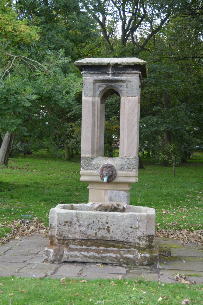
St Aidan's Well (Bamburgh) submitted by Anne T on 12th Oct 2018. First view of St Aidan's Well, standing just east of it, looking west across the triangular village green.
(View photo, vote or add a comment)
Log Text: St Aidan's Well, Bamburgh: This well seemed to form a ‘hub’ for visitors, with a school party and tourists sitting on the benches and grass around this structure, so we needed to make two trips to this well. By 5.30pm there was no one around (apart from the blue wheelie bins lined up along the street!). Obviously a modern structure, but this appears to be the original holy well associated with the church.
The well is now dry, which is a shame, as I'd have loved to see the water gushing into the basin. It might be a modern well housing, but this may well be an ancient site.
In 1947, when Revd Binnall and Miss Dodds produced their list and descriptions of Holy Wells in Northumberland and Durham, the village green was a small plantation of trees. Pastscape notes the name 'St Aidan's Well' is not known locally, but I don't know what it is called. The antiquarian notes mention it was mentioned as 'Edvn. Well' although I'm not sure was Edvn means.
Bamburgh Castle
Trip No.102 Entry No.4 Date Added: 10th Oct 2018
Site Type: Sculptured Stone
Country: England (Northumberland)
Visited: Yes on 9th Oct 2018. My rating: Condition 3 Ambience 4 Access 3

Bamburgh Castle submitted by Anne T on 10th Oct 2018. This piece of carved stone is recorded in the Corpus of Anglo Saxon Stone Sculpture as the 'Bamburgh Castle' stone. Its style dates it to the last quarter of the eighth century to the first quarter of the ninth. Originally described in the 19th century as part of a large cross head, it is know known to be part of the arm of a stone chair or throne. A reproduction can be found outside the keep of the castle, although the Corpus says it is not clear if it is meant to be part of the back or seat.
(View photo, vote or add a comment)
Log Text: Wells and Anglo Saxon Stones at Bamburgh Castle: Note: there is disabled parking next to the State Rooms, but there are many stairs in and around the castle. It’s been a long time since we last came here, and the visit today happened because I’d been sent a 1947 Antiquarian paper about the holy wells of Northumberland. There was also one piece of AS stone in the archaeological museum; listed on the Corpus, which we had still to see.
It was sunny but windy, high up above the sea. It was expensive to get in, but actually was worth the money, as we spent hours here, both wandering around inside and outside.
We found another stone with Celtic Heads in the small Stones Museum, along with a 9th century mortar stone which had been reused to hold a post.
The carved Anglo Saxon stone was in the new Archaeological Museum and Activity area, and there is a recreation of the chair/throne the chair may have looked like outside the keep. This was a favourite for photographs for visitors, so we looked at when it got quieter at the end of the castle opening hours.
Before our visit, I had contacted the castle to try and ascertain the location of three wells inside the castle. There is one well in bottom of keep; the other on the outside wall of the castle at its north western end (no longer visible, but the site can be seen, although covered in sand). The third well we thought we’d found, as we walked up the old Victorian footpath to the castle from the beach, but we were mistaken as we’d had the 1860 OS map orientated wrongly!
Once we’d been round the castle near the ticket office (found when walking back to the car park from the old Victorian footpath from the beach to the castle).
Leper's Well (Bamburgh)
Trip No.102 Entry No.5 Date Added: 13th Oct 2018
Site Type: Holy Well or Sacred Spring
Country: England (Northumberland)
Visited: Yes on 9th Oct 2018. My rating: Condition -1 Ambience 3 Access 4

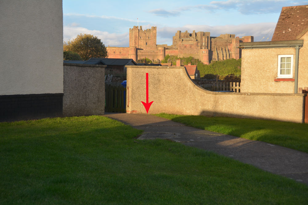
Leper's Well (Bamburgh) submitted by Anne T on 12th Oct 2018. We tracked down the grid reference/location of the leper's well from the 1860 OS map, but there is nothing here now apart from a modern manhole cover. Does anyone else know anything about this well? In 1955, Pastscape record an entry that says "the well here is modern". I wondered when it disappeared.
(View photo, vote or add a comment)
Log Text: Leper's Well, Bamburgh: Guided by the grid reference given on Pastscape, we walked down Doctor's Lane from St Aidan's Well. Some of the old stone walls around properties, and at the sides of the lanes running off here are ancient, and we thought they could well belong to the old leper hospital.
The grid reference took us to the corner of a row of cottages, where there was a modern manhole cover. The well was last recorded in 1955, so it looks as if it has now been destroyed. I took a few photos of the site, just in case.
Andrew called up the 1860 OS map on his phone and we were confident we had the right location. When I got home, I used the Pastscape and HE entries which gave distances (the dovecot is 140 NE of leper hospital) to triangulate the location of the well, and it agrees with the spot on the old OS map and the spot I photographed.
Bamburgh Barrow 1
Trip No.102 Entry No.6 Date Added: 13th Oct 2018
Site Type: Round Barrow(s)
Country: England (Northumberland)
Visited: Saw from a distance on 9th Oct 2018. My rating: Condition 1 Ambience 3
Bamburgh Barrow 1 submitted by SolarMegalith on 13th Feb 2014. A Bronze Age cist with broken capstone and one of the upright stones visible (photo taken on February 2014).
(View photo, vote or add a comment)
Log Text: Rubbing Stone & Tumulus, Bamburgh: Spotted this apparent 'standing stone' in the field when we were walking back along Doctor's Lane towards St Aidan's Well. There was no obvious way into the field along this route, and we'd already walked for miles, so we contented ourselves with photographing from the stone wall in the next field.
On researching this site when I got home, found out that it was marked on the 1860 OS map as a tumulus with rubbing stone. The tumulus has now been destroyed and the stone is a 19th century insertion into the mound.
Had we realised there was still a visible cist, we might have tried harder to access the field. However, there is such a lot of history in Bamburgh, I'm sure we'll be making a return trip in the not too distant future.
