Contributory members are able to log private notes and comments about each site
Sites Anne T has logged on trip number: 15 (View all trips)
View this log as a table or view the most recent logs from everyone
Shapbeck Plantation
Trip No.15 Entry No.1 Date Added: 3rd Apr 2017
Site Type: Stone Circle
Country: England (Cumbria)
Visited: Yes on 2nd Apr 2017. My rating: Condition 3 Ambience 4 Access 4
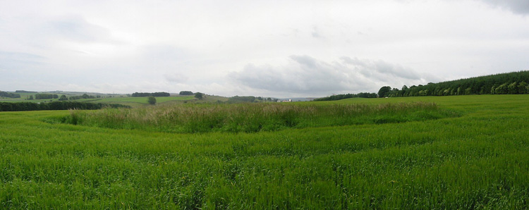
Shapbeck Plantation submitted by stu on 16th Jul 2004. NY552 188.
General view of the overgrown stone circle.
(View photo, vote or add a comment)
Log Text: Shapbeck Plantation Stone Circle: Our first stop of the day, whizzing off the M6 southbound at Eamont Bridge and travelling on the A6 through Clifton & Hackthorpe to Shapbeck Gate. There, a side road leads to a bridge across the River Leith, but there was no parking to be had. We turned back northwards up the A6 and parked in a layby some ¼ mile north of the footpath leading up to Shapbeck Plantation. We took our lives in our hands walking back to the footpath, with cars and motorbikes travelling fast along the road, and the verge was lumpy and bumpy and difficult to walk along.
Finally reaching the footpath, almost opposite the road leading to Southfield and Stonygill Bridge, we turned west over the fields towards Shapbeck Plantation, I was glad I had worn my wellies, as the gates into the fields were deep in muddy water. Careful of the stock in the first field, we crossed through the gate into a second field, where the footpath vanished – it had been ploughed out. Following the dry stone wall line up the hill towards the plantation, it was only when we had almost reached the top of the field that a fenced off area to the northern side of the field came into view.
Walking towards this, it was clear the farmer had been using this area as a dump for old metal items and other stones, although an inner and outer circle were clearly visible. It looked as if the circle had been built on a slight mound, with a ditch around the outside. At this time of year, there wasn't much vegetation, so it was possible to see lots of the stones.
Without the plantation, there would have been views 360 degrees around the site. Even today, this area was busy, busy, busy, with the A6, M6 and West Coast railway all intersecting and intermingling in the valley below. Walking across the fields, many of the smaller stones poking out of the earth had a very distinctly green tinge.
Definitely worth braving the traffic to visit this site.
White Cross (Three Howes Rigg)
Trip No.15 Entry No.1 Date Added: 10th Apr 2017
Site Type: Marker Stone
Country: England (Yorkshire (North))
Visited: Yes on 9th Apr 2017. My rating: Condition 2 Ambience 2 Access 5
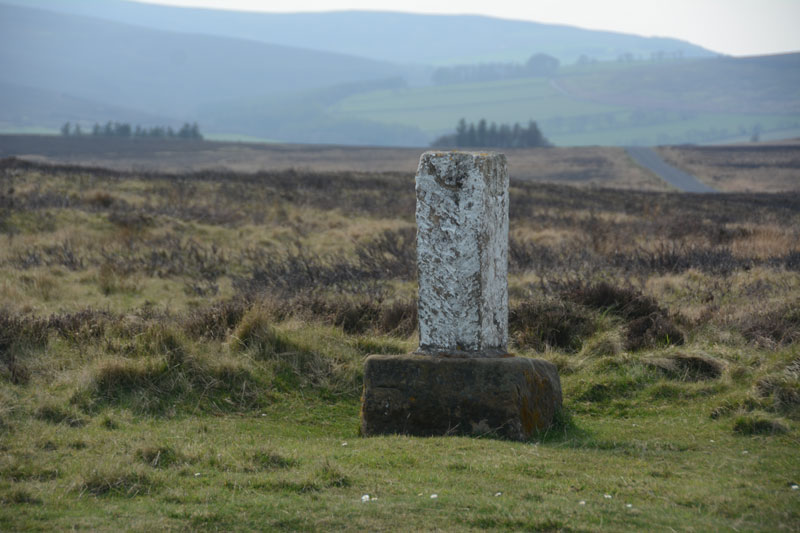
White Cross (Three Howes Rigg) submitted by Anne T on 10th Apr 2017. Standing on Smeathorns Road looking across to the stone and its earlier cross base, with the moors of the National Park in the distance to the west.
(View photo, vote or add a comment)
Log Text: White Cross, Three Howes Rigg, North Yorkshire: Approaching the Three Howes Tumuli on Smeathorns Road, we spotted this "White Cross" marked on the map at the road junction with Commondale Village. Stopping and running across the road in between the fast moving traffic, I took some photographs. This cross is listed by Historic England as entry 1250385, and is described as an "early to mid-C19 boundary stone on medieval base of wayside cross." The views across the National Park to the west would have been spectacular but for mist.
The Galloway Stone
Trip No.15 Entry No.2 Date Added: 3rd Apr 2017
Site Type: Natural Stone / Erratic / Other Natural Feature
Country: England (Cumbria)
Visited: Yes on 2nd Apr 2017. My rating: Condition 3 Ambience 2 Access 5
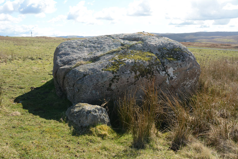
The Galloway Stone submitted by Anne T on 3rd Apr 2017. Looking south east over the Galloway Stone to the hills beyond.
(View photo, vote or add a comment)
Log Text: The Galloway Stone, near Orton, Cumbria: Spotted this named stone on the map as we drove towards Orton to find refreshments. There were many other large (but not quite as large as this) stones in the vicinity. With the M6 Northbound carriageway almost immediately behind, and above, this stone, I could have been forgiven for thinking this was left over from building the motorway.
In close up, the stone is clearly pink Shap granite, and had a red tint in the sunlight. A big surprise was find the bench mark with its large rivet on top of the stone.
Three Howes Rigg (West)
Trip No.15 Entry No.2 Date Added: 11th Apr 2017
Site Type: Round Barrow(s)
Country: England (Yorkshire (North))
Visited: Yes on 9th Apr 2017. My rating: Condition 2 Ambience 3 Access 5

Three Howes Rigg (West) submitted by Anne T on 11th Apr 2017. The larger of the two round barrows on the western side of the road at Three Howes Rigg. The larger boulders presumably stop people from parking and destroying the site, although it creates a handy layby to stop and enjoy all five of the barrows at this location (bar the traffic speeding by!). Sited at NZ 68106 10279.
(View photo, vote or add a comment)
Log Text: Three Howes Rigg (West), Smeathorns Road, North Yorkshire: Despite being called ‘Three Howes’, there are actual 5 barrows in total! It would be easy to whizz by these barrows, as they appear as slight mounds at the top of the ridge. With cars speeding by at a good 60mph or so, it’s difficult to slow down and park, but there is a space between the two barrows on the western side of the road, flanked by large boulders to protect the fourth and fifth barrows.
Once identified, they are obvious in the landscape. Having first stopped at White Cross some 500 metres to the north, being on access land, we tramped over the heather and moorland to take a closer look.
We started with the two barrows to the west of the road and worked our way northwards. The northern-most has been cut slightly by the road to its eastern side; the southern-most was heavily covered in calf-high bracken. We missed the inscribed stone in the middle of this one, but the carving seems to be relatively modern, looking at the Historic England entry.
Three Howes Rigg (East)
Trip No.15 Entry No.2 Date Added: 11th Apr 2017
Site Type: Round Barrow(s)
Country: England (Yorkshire (North))
Visited: Yes on 9th Apr 2017. My rating: Condition 3 Ambience 3 Access 5
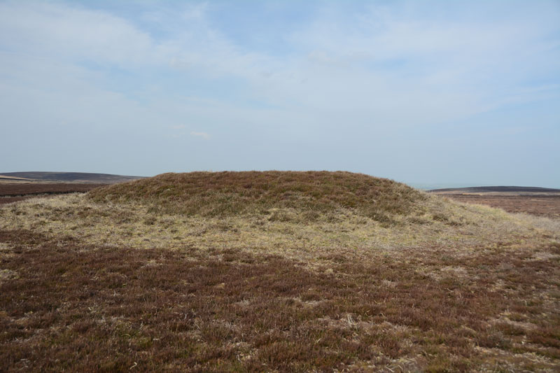
Three Howes Rigg (East) submitted by Anne T on 11th Apr 2017. The northern-most, most visible, of the three barrows on the eastern side of Smeathorns Road. As seen from the road.
(View photo, vote or add a comment)
Log Text: Three Howes Rigg (East), Smeathorns Road, North Yorkshire: Having stopped at White Cross and Three Howes Rigg (West) first, and having 'got our eye in', these barrows rise from the surrounding ground on access land. On the eastern side of Smeathorns Road, and clearly visible on UK Grid Finder, tramping across the heather moorland was easy on the feet.
Now largely used to feed the grouse (full feeding dishes on the tops of these barrows), they diminish in height from the north to the south. There is a fourth mound to the east of the middle barrow, but this looks more like a farmer's spoil heap rather than a barrow, and I couldn't find any reference to it on Pastscape or Historic England.
Looking at the map, there are so many barrows, crosses and other features around here, I'd like to spend more time in this area.
Four Stones Hill Standing Stones
Trip No.15 Entry No.3 Date Added: 3rd Apr 2017
Site Type: Standing Stones
Country: England (Cumbria)
Visited: Couldn't find on 2nd Apr 2017. My rating: Access 3
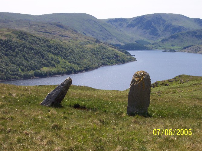
Four Stones Hill Standing Stones submitted by donstobbart on 11th Jun 2005. I have to agree with Nicoladidsbury that I did not feel any ambience when I visited this site. But I did get a great view of the lake!
(View photo, vote or add a comment)
Log Text: Four Stones Hill, Haweswater: Ashamed to say I was defeated by the large stiles with big drops and missing steps. Was so looking forward to going to see this site and from Google Earth, it seemed possible for me to walk this route. Did look for gates in the fields to avoid the stiles, but up by Lower Drybarrows, couldn't find any entry/exits; the one there was said very clearly "no public right of way". Perhaps I should have ignored those and tramped through the fields anyway, but it would have left me feeling guilty. Will try again. Note to self: parking was very difficult up by Winder Hill. Needed to wedge the car in besides a stone wall to leave ready access to the fields.
Millennium Stone Danby High Moor
Trip No.15 Entry No.3 Date Added: 10th Apr 2017
Site Type: Modern Stone Circle etc
Country: England (Yorkshire (North))
Visited: Yes on 9th Apr 2017. My rating: Condition 3 Ambience 3 Access 5
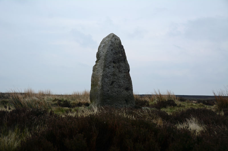
Millennium Stone Danby High Moor submitted by Anne T on 10th Apr 2017. Standing at the road junction of the moorland road from Ainthorpe and Knott Road, this stone sits over a metre above you.
(View photo, vote or add a comment)
Log Text: The Millennium Stone, Danby High Moor, North Yorkshire: Driving at a sedate pace along the moorland road from Wolf Pit Tumulus (which I realised as we got a phone signal back, that we’d picked up the wrong monument), I was really surprised to see what looked like a large standing stone at the junction of Knott Road. Immediately to our left was a small car park with an interpretation board (which didn’t mention this stone), and I spent a good half hour on the internet at home trying to find anything at all about it, which was a brief mention on the Hidden Teesside web site.
Getting out of the car to look more closely at this stone, my fleece and camera were almost blown away by the wind. The temperature had dropped from high teens to single figures in a very short while. I was glad to get back into the car, but pleased to have 'discovered' a stone not (yet) on the map! Next stop was the second 'White Cross' of the day - later discovered to be called 'Fat Betty'.
Fat Betty
Trip No.15 Entry No.4 Date Added: 10th Apr 2017
Site Type: Ancient Cross
Country: England (Yorkshire (North))
Visited: Yes on 9th Apr 2017. My rating: Condition 3 Ambience 4 Access 5
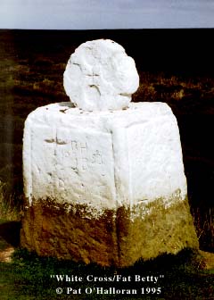
Fat Betty (White Cross) submitted by kelpie on 9th Jun 2002. NZ 68224 02001
This is reported as both a standing stone and a moorland cross (I prefer the latter).
(View photo, vote or add a comment)
Log Text: Fat Betty's Cross, Danby High Moor, North Yorkshire: From Wolf Pit Tumulus, carrying on down the road (New Way) over Danby High Moor, past the curiously named Lower Fryup Dale to the east, then over Seavey Hill, passing by the modern standing stone (Millennium Stone) at NZ 69699 01296, we turned west towards Rosedale Head. Where the Esk Valley Way crosses this road, there is a small, squat White Cross located to the north. Just a few metres up the Esk Valley Way footpath, stepping over a muddy ditch, we got the full force of the wind sweeping across this moorland. From a leisurely, warm lunch in Castleton an hour earlier, the temperature had dropped considerably, and I wished I’d brought a warmer coat!
The head of the cross bears four small circles on both sides, reminiscent of Anglo Saxon cross heads. There is considerable graffiti on the stone, together with offerings (see image of money at bottom of cross head).
Just over the road is Young Ralph’s Cross.
Young Ralph Cross
Trip No.15 Entry No.5 Date Added: 10th Apr 2017
Site Type: Ancient Cross
Country: England (Yorkshire (North))
Visited: Yes on 9th Apr 2017. My rating: Condition 3 Ambience 4 Access 5

Young Ralph Cross submitted by Anne T on 10th Apr 2017. The Young Ralph Cross sits close to the side of the road on Ledging Hill.
(View photo, vote or add a comment)
Log Text: Young Ralph Cross, Ledging Hill, North Yorkshire: Just down the road from Fat Betty Cross/White Cross, Young Ralph’s Cross sits almost opposite the road junction of the minor road (Knott Road) to Rosedale and the road northwards across Castleton Rigg to Castleton.
Turning right at the road junction, we parked on the minor road leading north west towards Westerdale. This road was very busy, and traffic moved very fast. Whilst standing at Fat Betty, I heard several cars sounding their horns at each other.
From a distance, this cross looks as if it is made out of concerete, but the Historic England entry says this wayside cross possibly dates from the 11th century. The cross base looks much, much older than the shaft and head.
The Historic England entry talks about much weathered interlace ornament and cable moulded border. I couldn’t see any of this, perhaps put off a closer look by the biting wind and cold.
I was keen to try and find the Old Ralph Cross, but by this time it was late, we were cold and it was time to head off home. There is so much to see in this area, it would be well worth a repeat visit.
