Contributory members are able to log private notes and comments about each site
Sites Anne T has logged on trip number: 42 (View all trips)
View this log as a table or view the most recent logs from everyone
Old Man's Grave (Edmunbyers)
Trip No.42 Entry No.1 Date Added: 30th Aug 2017
Site Type: Marker Stone
Country: England (County Durham)
Visited: Yes on 28th Aug 2017. My rating: Condition 3 Ambience 2 Access 4

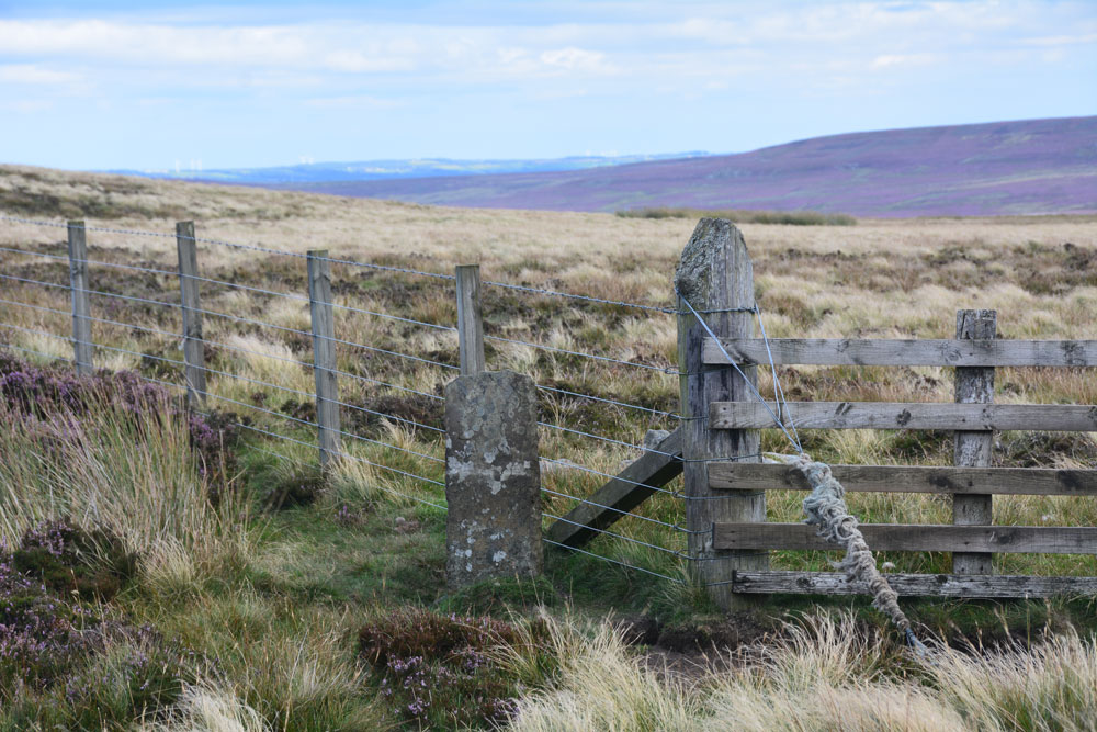
Old Man's Grave (Edmunbyers) submitted by Anne T on 30th Aug 2017. First view of the stone, which sits between two footpaths on the parish boundary between Edmundbyers and Hunstanworth. Marked on the OS map, I wondered if the installation of the corner fence post had disturbed its location.
(View photo, vote or add a comment)
Log Text: Old Man's Grave, Meadows Edge Road, Near Blanchland: We originally intended to go to Blanchland to look at a holy well marked on the OS map, not far from the town square, but the village show was on and it was impossible to park. We drove on across to the moors, intended to stop at a boundary stone on the way to Old Man’s grave, but the roads were too busy to stop.
I was expecting a cairn, but this is a small, relatively modern boundary marker, sited between two footpaths, and at the corner of a modern fence.
Not impressed, but stopped to photograph it anyway. Certainly stunning views, and I’m guessing at some time in the past this might have been a cairn with a way marker on top, or by, especially with it being located just up the hill from where Bale Hill turns into Meadows Edge, and where two different trackways led off the north east and south west off Meadows Edge across the moorland.
Dead Friar's Stone (Stanhope)
Trip No.42 Entry No.2 Date Added: 31st Aug 2017
Site Type: Marker Stone
Country: England (County Durham)
Visited: Yes on 28th Aug 2017. My rating: Condition 3 Ambience 3 Access 5

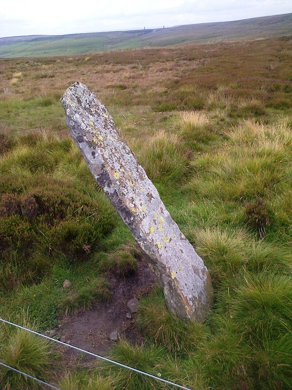
Dead Friar's Stone (Stanhope) submitted by Anne T on 31st Aug 2017. Standing at the edge of the parking area looking north east towards Edmundbyers.
(View photo, vote or add a comment)
Log Text: Dead Friar's Stone, Stanhope: From Old Man's Grave, just north of this stone, this was our second stop of the day - a curiously named stone next to Dead Friar’s quarry. Amusingly, husband thought a great slab of concrete lying next to the car park was the stone lying on its side! We looked again.
At a great viewpoint eastwards, although I thought this perhaps should have been a taller way marker rather than a boundary stone, given where it stands – at a bend of Meadows Edge (marked Dead Friar’s Road on the OS map), and where another smaller track heads off across the moorland westwards, then south, towards Rookhope.
The area around Rookhope always has ‘not very nice’ connotations for me, given my son-in-laws brother was killed in an accident green-laning on his trials bike just over 2 years ago, and I was glad to move on from this lonely spot.
Hunstanworth Moor south
Trip No.42 Entry No.3 Date Added: 29th Aug 2017
Site Type: Standing Stone (Menhir)
Country: England (County Durham)
Visited: Yes on 28th Aug 2017. My rating: Condition 3 Ambience 3 Access 5

Hunstanworth Moor south submitted by HarperFox on 20th Jul 2014. This is the southernmost of the two roadside stones on the road between Townfield and Rookhope. The other is similar in shape and dimensions but upright.
(View photo, vote or add a comment)
Log Text: Hunstanworth Moor South, Near Townhead: This stone is marked on the OS Map as ‘stone’, and was easily found, although it seems like a tall boundary marker along the road from Townhead to Rookhope. As we drove along the road, we passed the northern boundary stone (see below), which isn’t marked on the map and was unexpected.
Haven’t been able to find out anything about these – not even a photograph on Geograph, as Andy Curtis has usually been out and about photographing all these places before us.
We backtracked to photograph the northern boundary stone on our way back to see the remains of the Edmundbyers Cross. I was impressed by all the now disused lead mining buildings and spoil heaps around here. It must have really busy in the not so distant past.
Hunstanworth Moor north
Trip No.42 Entry No.4 Date Added: 29th Aug 2017
Site Type: Standing Stone (Menhir)
Country: England (County Durham)
Visited: Yes on 28th Aug 2017. My rating: Condition 3 Ambience 3 Access 5

Hunstanworth Moor north submitted by HarperFox on 20th Jul 2014. This is the northernmost of the two stones.
(View photo, vote or add a comment)
Log Text: Hunstanworth Moor North, Townhead: Being the day of the Blanchland and Hunstanworth Show, this road was very busy, and it was difficult to stop as the road was narrow and there were no obvious lay-bys or pull-off points (there being a nice ditch at the western side of the road and a steep bank up to the field on the east).
Spotted this stone as we were passing by on the way to the stone approx. 575m south and retraced our steps to photograph it.
Again, after having done searches on the internet, not been able to find out anything about it, like it’s ‘partner’ further up the hill.
Feldon Plain (Muggleswick)
Trip No.42 Entry No.5 Date Added: 29th Aug 2017
Site Type: Marker Stone
Country: England (Northumberland)
Visited: Yes on 28th Aug 2017. My rating: Condition 3 Ambience 3 Access 5

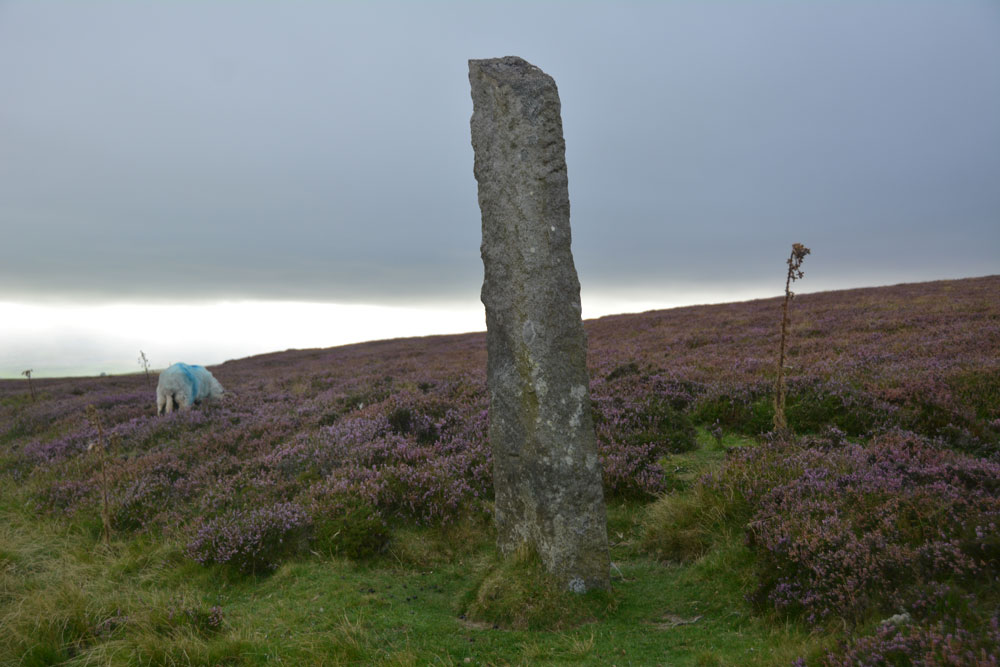
Feldon Plain (Muggleswick) submitted by Anne T on 29th Aug 2017. The stone (and sheep) as seen from the north east. There is a level mark almost at ground level, on the side facing the road. It certainly is in a lonely spot. It sits precisely on the parish boundary between Muggleswick and Hunstanwick (if I've read the map correctly) and also almost at the junction of two major routes across the moors.
(View photo, vote or add a comment)
Log Text: Marker Stone, junction of Meadows Edge & B6278: Despite quite an intensive search, I’ve not found any information on the internet (checked Pastscape, Historic England, National Geograph, etc).
Marked ‘BS’ on the OS map, this impressively large stone (in comparison to the others we saw on the way here) sits exactly on the Parish boundary between Muggleswick and Hunstanwick (if I’ve read the map correctly). Sitting right by the side of the B62787 to Edmundbyers, close to its junction with the Meadows Edge Road.
This is close to the remains of the Edmundbyers Cross Base, just to the north east, with Feldon Plain rising up gently behind it. It is a taller version of Hunstanworth North, again with the sloping top. It sits in a slight dip, as if the ground surface has built up around it, and there are a few packing stones visible at its base. Looks as if it has been here for a while.
Its shape echoes that of Hunstanworth Moor North, being long, thin & narrow with a sloping top.
Edmundbyers Cross (Muggleswick)
Trip No.42 Entry No.6 Date Added: 29th Aug 2017
Site Type: Ancient Cross
Country: England (Northumberland)
Visited: Yes on 28th Aug 2017. My rating: Condition 2 Ambience 3 Access 5

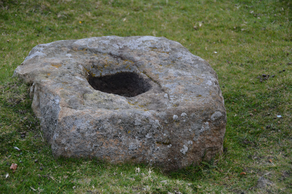
Edmundbyers Cross (Muggleswick) submitted by Anne T on 29th Aug 2017. Close up of the cross base, showing its socket hole.
(View photo, vote or add a comment)
Log Text: Remains of Edmundbyers Cross, Muggleswick: Marked in italic, old fashioned script on the OS map, I guess I was expecting something a little more exciting, such as a cross base with part of a shaft, but no. Just a cross base. Good job I knew what I was looking for as alongside the road there were other pieces of rectangular rock almost as large.
Sitting almost at the junction of the B6278 to Edmundbyers with the minor road leading almost to Smiddy Shaw Reservoir (just to the north of this road), it would have acted as a way marker. The cross base is located just over 1km from the boundary stone above.
When we got home, I was interested to read this from the Historic England entry: “Edmundbyers Cross is one of only three wayside crosses still in its original position in County Durham and the only known example on the route between Stanhope and Edmundbyers.”
