Contributory members are able to log private notes and comments about each site
Sites DrOlaf has logged. View this log as a table or view the most recent logs from everyone
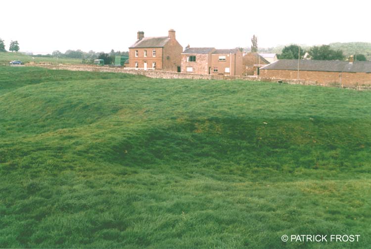
King Arthur's Round Table
Date Added: 21st Sep 2021
Site Type: Henge
Country: England (Cumbria)
Visited: Yes on 18th Sep 2021. My rating: Condition 3 Ambience 3 Access 4

King Arthur's Round Table submitted by Patrick Frost on 14th Oct 2002. King Arthur's Round Table in Cumbria.
(View photo, vote or add a comment)
Log Text: similar in form to the ure henges
Casterton
Date Added: 21st Sep 2021
Site Type: Stone Circle
Country: England (Cumbria)
Visited: Yes on 20th Sep 2021. My rating: Condition 3 Ambience 4 Access 3

Casterton submitted by Bladup on 8th Oct 2014. Casterton stone circle.
(View photo, vote or add a comment)
Log Text: about 17 stones with a few gaps. stones are only about 12-18 inches high, but quite regularly spaced. It is sited in a relatively level site on a steep hillside, near where a beck starts. Some trouble was taken to level the site, by embanking the eastern side. The site looks out across to the southern Cumbrian heights.
Kemp Howe
Date Added: 21st Sep 2021
Site Type: Stone Circle
Country: England (Cumbria)
Visited: Yes on 18th Sep 2021. My rating: Condition 2 Ambience 2 Access 4

Kemp Howe submitted by nicoladidsbury on 29th Mar 2004. This is the remains of what must have been a beautiful stone circle. The stones are pink granite and have a lovely glow. Unfortunately the ambience has been shattered by the "wonderful" victorians, who built the railway on top of it.
(View photo, vote or add a comment)
Log Text: some large lumps of granite-the ring must have been pretty impressive
Castle Dykes
Date Added: 21st Sep 2021
Site Type: Henge
Country: England (Yorkshire (North))
Visited: Yes on 21st Sep 2021. My rating: Condition 3 Ambience 5 Access 2

Castle Dykes submitted by rich32 on 7th Jul 2004. Castle Dykes Henge, nr Aysgarth, North Yorkshire (SD98228728)
The henge has a diameter of about 75m with the ditch being up to 2m in some places. There are entrances to the north, south & east, although only the eastern one is thought to be original and of antiquity.
This henge is fairly well preserved, but as seems obligatory with our henges its covered in cow poo. This photo (looking east) does not really do the site justice.
(View photo, vote or add a comment)
Log Text: the henge lies on a rise to the east of Addleborough hill, and sits directly between that hill and Pen hill to the east, two very distinctive hills. There are good long distance views to the east (North York Moors) and north to Carperby cairn. No attempt has been made to level the site so it takes the shape of the spur it is on. A small amount of rabbit damage.
Street House Farm
Date Added: 12th Sep 2021
Site Type: Barrow Cemetery
Country: England (Cleveland)
Visited: Yes on 11th Sep 2021. My rating: Condition -1 Ambience 1 Access 4

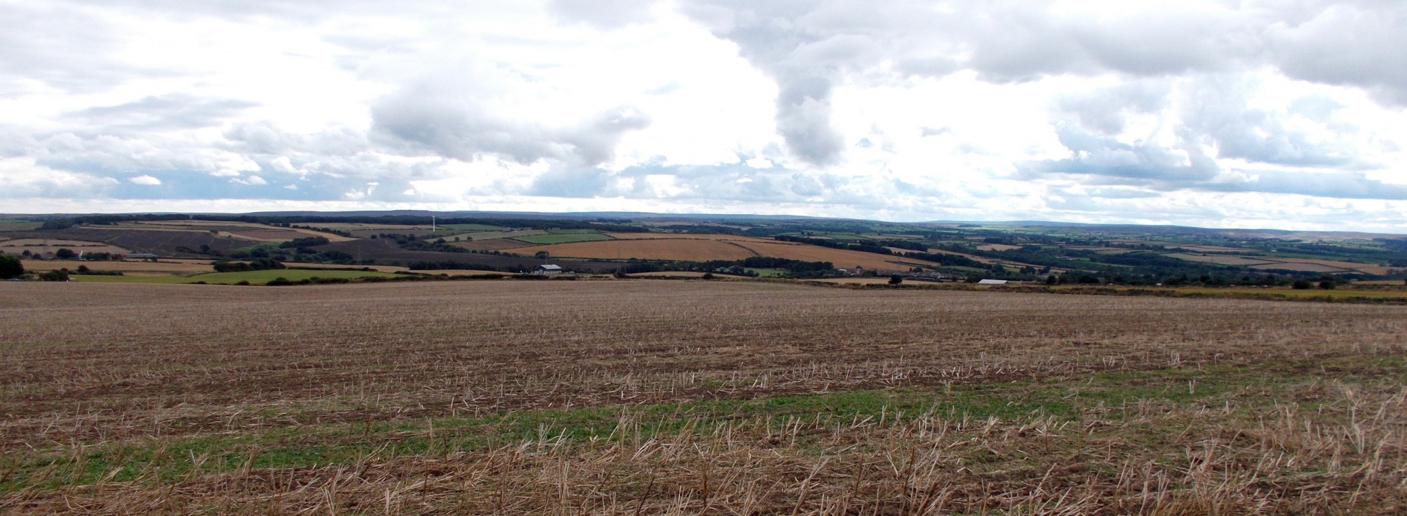
Street House Farm submitted by drolaf on 12th Sep 2021. view from the site of the neolithic longcairn/timber portal
(View photo, vote or add a comment)
Log Text: as with many such sites it is the excavation drawings that tell the story. It sits in a timescale overlapping with the neolithic saltworks, and 1500 years before the nearby timber 'wossit'
Yockenthwaite
Date Added: 12th Sep 2021
Site Type: Ring Cairn
Country: England (Yorkshire (North))
Visited: Yes on 10th Sep 2021. My rating: Condition 4 Ambience 5 Access 4
Yockenthwaite submitted by DavidRaven on 24th Jan 2004. Stormy weather coming from Langstrothdale Chase in the west.
(View photo, vote or add a comment)
Log Text: a lovely little kerb cairn/ring. a delightful walk along the Upper Wharfe, with its water-carved limestone. About 70 metres upstream from the ring is Yockenthwaite 'cave' a small fissure, from which some water issues, and also the eerie sound of an underground waterfall deep in the hillside. I wonder if this was there in the Bronze Age and had something to do with the siting of this ring. and what did they think the sound was? The river here is a disappearing/appearing one, as it discharges into several holes into underground aquifers, leaving downstream a dry bed, until a new water source enters it.
Nympsfield
Date Added: 22nd Jun 2021
Site Type: Long Barrow
Country: England (Gloucestershire)
Visited: Yes on 20th Jun 2021. My rating: Condition 3 Ambience 4 Access 4

Nympsfield submitted by AngieLake on 11th Oct 2015. A magical double rainbow (you can't see the upper arc here) over Nympsfield longbarrow, viewed from the rear of the mound. 22nd Sept.
(View photo, vote or add a comment)
Log Text: just one of several long barrows along the ridge, it lies in the steep escarpment edge but faces east.
Drakestone Camp
Date Added: 15th Jun 2021
Site Type: Misc. Earthwork
Country: England (Gloucestershire)
Visited: Yes on 16th Jun 2016. My rating: Condition 3 Ambience 4 Access 3
Drakestone Camp submitted by 4clydesdale7 on 6th Jul 2011. One of the middle banks and ditches
(View photo, vote or add a comment)
Log Text: None
Haresfield Beacon and Ring
Date Added: 15th Jun 2021
Site Type: Hillfort
Country: England (Gloucestershire)
Visited: Yes on 15th Jun 2017. My rating: Condition 3 Ambience 4 Access 3
Haresfield Beacon and Ring submitted by 4clydesdale7 on 24th Jun 2011. From the same spot looking NNW over the inside of the Fort
(View photo, vote or add a comment)
Log Text: None
Haresfield Beacon tumulus
Date Added: 15th Jun 2021
Site Type: Round Barrow(s)
Country: England (Gloucestershire)
Visited: Yes on 15th May 2016. My rating: Condition 3 Ambience 5 Access 3

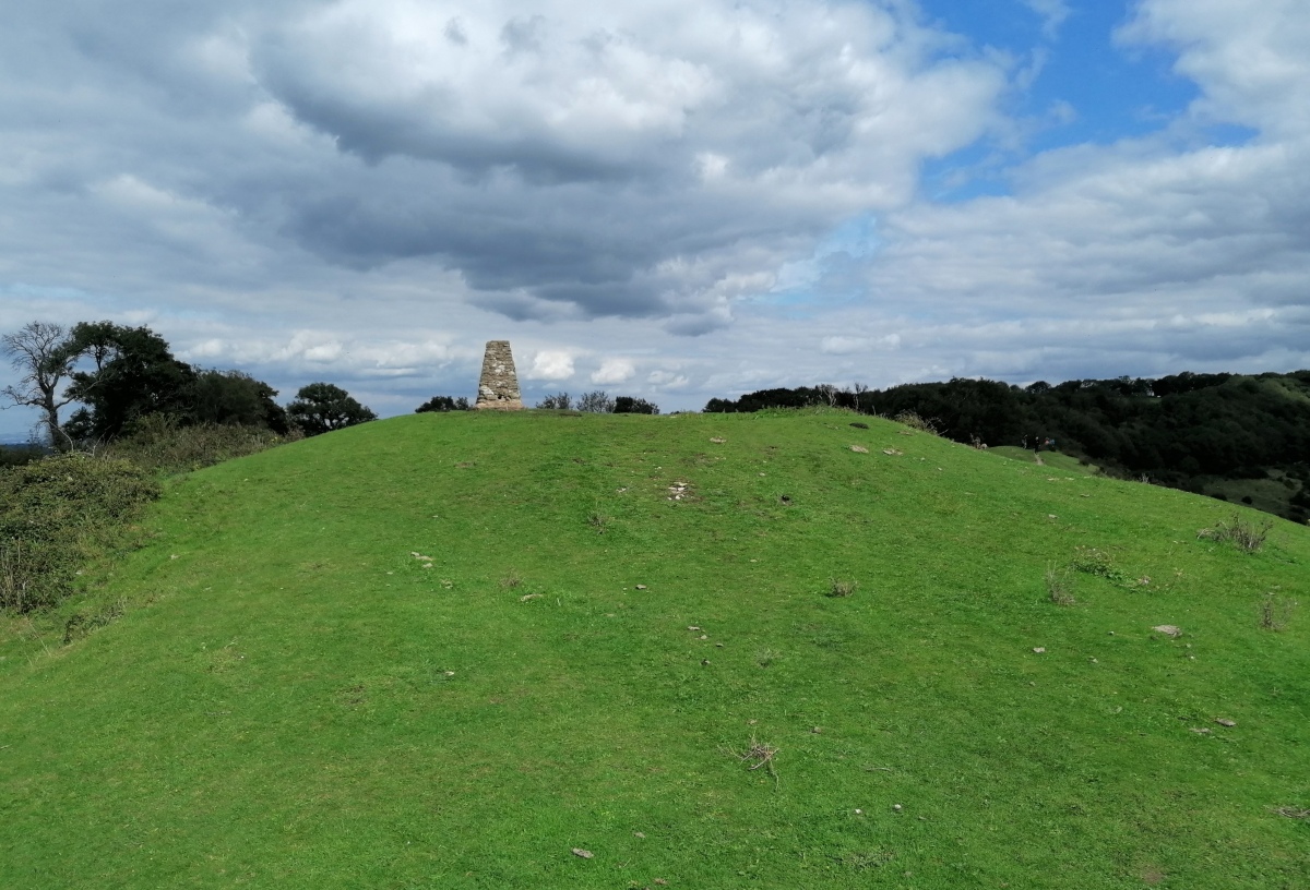
Haresfield Beacon tumulus submitted by TheCaptain on 3rd Sep 2020. The tumulus with trig point on top, at the western end of Haresfield Beacon.
(View photo, vote or add a comment)
Log Text: None
Catstones Ring
Date Added: 6th May 2021
Site Type: Misc. Earthwork
Country: England (Yorkshire (West))
Visited: Yes on 21st Jun 2017. My rating: Condition 2 Ambience 3 Access 4

Catstones Ring submitted by DavidRaven on 22nd Dec 2004. The earthwork that straddles Harden Moor, West Yorks. Showing the banks and ditch where they leave the moorland and enter pasture.
(View photo, vote or add a comment)
Log Text: good vantage point over the valley
Harden Moor Ring Cairn
Date Added: 5th May 2021
Site Type: Ring Cairn
Country: England (Yorkshire (West))
Visited: Yes on 5th May 2021. My rating: Condition 3 Ambience 4 Access 4
Harden Moor Ring Cairn submitted by rich32 on 11th Jun 2004. Harden Moor, nr Bingley, West Yorkshire (SE074386)
A ring cairn according to Defra, although some believe its a stone circle. Two other cairns are also nearby.
(View photo, vote or add a comment)
Log Text: a lovely little banked and kerbed ring cairn (not a stone circle) on a hill with outstanding views to Baildon, Ilkley et al.
Grubstones
Date Added: 2nd Jan 2021
Site Type: Stone Circle
Country: England (Yorkshire (West))
Visited: Yes on 26th Sep 2020. My rating: Condition 3 Ambience 3 Access 3

The Grubstones submitted by Bladup on 9th Oct 2014. Grubstones.
(View photo, vote or add a comment)
Log Text: None
Great Skirtful of Stones
Date Added: 2nd Jan 2021
Site Type: Cairn
Country: England (Yorkshire (West))
Visited: Yes on 26th Sep 2020. My rating: Condition 3 Ambience 3 Access 3
Great Skirtful of Stones submitted by DavidRaven on 9th Jul 2003. A massive cairn near the Grubstones circle. It sits in a very exposed part of the moor, over 1150 feet above sea level, overlooking the Wharfe valley. A fallen stone lies in the centre of the 'crater', like a recumbent menhir - though it may be nothing of the sort.
(View photo, vote or add a comment)
Log Text: None
Gardoms Edge 1
Date Added: 25th Oct 2020
Site Type: Rock Art
Country: England (Derbyshire)
Visited: Yes on 13th Jun 2017. My rating: Condition 4 Access 3

Gardoms Edge 1 submitted by PaulM on 1st Sep 2001. Gardom’s Edge Prehistoric Rock Art, Derbyshire GR: SK273730
One of the finest examples of prehistoric rock art in the Peak District. Discovered in 1965 on a large earthfast boulder 25m east of the enclosure , the design consists of a series of cup and ringmarks together with a small spiral and two circles that enclose multiple cupmarks. Unfortunately, the original boulder had to be reburied some years ago as the pattern was quickly eroding away, but an exact replica fibre glass cast now s...
(View photo, vote or add a comment)
Log Text: the 'stone' is a fibreglass in situ replica, but has a solid feel and in no way detracts from the setting
Cautley Spout Cairn
Date Added: 25th Oct 2020
Site Type: Cairn
Country: England (Cumbria)
Visited: Yes on 25th Jul 2020. My rating: Condition 3 Ambience 5 Access 4
Log Text: None
Little Skirtful of Stones
Date Added: 27th Sep 2020
Site Type: Ring Cairn
Country: England (Yorkshire (West))
Visited: Yes on 26th Sep 2020. My rating: Condition 3 Ambience 4 Access 3
Little Skirtful of Stones submitted by Rich32 on 4th Jan 2017. Vertical shot of the cairn, from about 30 metres. The visible area of stones is about 15 metres across, but significant stone robbing has taken place.
(View photo, vote or add a comment)
Log Text: None
Twelve Apostles (Yorks)
Date Added: 27th Sep 2020
Site Type: Stone Circle
Country: England (Yorkshire (West))
Visited: Yes on 13th Aug 2019. My rating: Condition 3 Ambience 4 Access 3
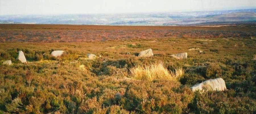
Twelve Apostles (Yorks) submitted by DavidRaven on 2nd Nov 2003. A stunning location! 12 apostles taken 25 October 2003. It looked like someone had lent a helping hand; several of the stones are propped up by smaller rocks at the base.
(View photo, vote or add a comment)
Log Text: None
Grey Croft
Date Added: 24th Sep 2020
Site Type: Stone Circle
Country: England (Cumbria)
Visited: Yes on 10th Aug 2019. My rating: Condition 3 Ambience 4 Access 3

Grey Croft submitted by baz on 7th Feb 2005. An incongruous juxtaposition? Grey Croft Stone Circle and Sellafield Nuclear Power Station.
(View photo, vote or add a comment)
Log Text: a lovely little circle of interesting local agglomerate stones
Carperby Stone Circle
Date Added: 24th Sep 2020
Site Type: Stone Circle
Country: England (Yorkshire (North))
Visited: Yes on 23rd Sep 2020. My rating: Condition 3 Ambience 4 Access 4

Carperby Stone Circle submitted by Bladup on 9th Feb 2013. You can see the Embankment curving around to the right at the ruined Carperby embanked stone circle with Ivy Scar above it.
(View photo, vote or add a comment)
Log Text: reminded me of the cockpit up near Orton. Larger stones at regular intervals around the bank. It sits south of the crag, on a sloping platform overlooking the Ure valley southwards.
and there is a small cairn about 50 metres away, between it and the crag. The prominent landmark is Addlebrough hill to the sww.
