Contributory members are able to log private notes and comments about each site
Sites JimChampion has logged. View this log as a table or view the most recent logs from everyone
Bottlebush Down barrows
Date Added: 19th Sep 2010
Site Type: Barrow Cemetery
Country: England (Dorset)
Visited: Yes on 11th Jan 2009
Bottlebush Down barrows submitted by JimChampion on 11th Jan 2009. Round barrows on Bottlebush Down, viewed from the agger of the Ackling Dyke Roman road, towards Handley Cross.
(View photo, vote or add a comment)
Log Text: None
Agglestone
Date Added: 19th Sep 2010
Site Type: Natural Stone / Erratic / Other Natural Feature
Country: England (Dorset)
Visited: Yes on 5th Jun 2009
Agglestone submitted by JimChampion on 5th Jun 2009. Approaching the Agglestone along the sandy path from the high ground to the south-west.
(View photo, vote or add a comment)
Log Text: None
Danby Beacon
Date Added: 19th Sep 2010
Site Type: Round Barrow(s)
Country: England (Yorkshire (North))
Visited: Yes on 30th Jul 2009
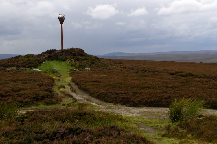
Danby Beacon submitted by JimChampion on 30th Jul 2009. The mound on the left is the Bronze Age burial mound re-used in more modern times as Danby Beacon. The beacon sculpture on the barrow was erected the Danby Beacon Trust in 2008, and first lit on the anniversary of Nelson's victory at the Battle of Trafalgar. The top of Beacon Hill, beyond the barrow, was the site of a major Second World War radar station.
(View photo, vote or add a comment)
Log Text: None
The King Barrow (Isle of Purbeck)
Date Added: 19th Sep 2010
Site Type: Round Barrow(s)
Country: England (Dorset)
Visited: Yes on 4th Jun 2010
The King Barrow (Isle of Purbeck) submitted by JimChampion on 4th Jun 2010. The King Barrow is the grassy mound in the centre of the photo. Apologies for the quality, this is a tightly-cropped photo taken through the heat haze from over half a km away, up on Ballard Down (just north of the trig pillar).
(View photo, vote or add a comment)
Log Text: None
The Ulwell Barrow
Date Added: 19th Sep 2010
Site Type: Round Barrow(s)
Country: England (Dorset)
Visited: Yes on 4th Jun 2010

The Ulwell Barrow submitted by JimChampion on 4th Jun 2010. Two-photo panorama of the Ulwell Barrow and the obelisk. The path to the right of the barrow continues up to the highest part of Ballard Down and then onwards along the ridge towards the end of the Purbeck Hills at Ballard Point.
(View photo, vote or add a comment)
Log Text: None
Badbury Rings
Date Added: 19th Sep 2010
Site Type: Hillfort
Country: England (Dorset)
Visited: Yes on 11th Jun 2010
Badbury Rings submitted by JimChampion on 11th Jun 2010. The cattle in the foreground were grazing the large field that includes the rings of Badbury. Beyond are the three round barrows alongside the track to the main car park.
(View photo, vote or add a comment)
Log Text: None
Park Hill Camp
Date Added: 19th Sep 2010
Site Type: Hillfort
Country: England (Wiltshire)
Visited: Yes on 19th Sep 2010

Park Hill Camp submitted by JimChampion on 19th Sep 2010. Iron age fort on the Stourhead estate, on Park Hill (ridge to the west of Six Wells Bottom). Interior of the camp is to the right, on the far side of the bank. There has been some recent clearance of beech trees from this part of the earthworks.
(View photo, vote or add a comment)
Log Text: None
Ibsley Common barrows
Date Added: 19th Sep 2010
Site Type: Barrow Cemetery
Country: England (Hampshire)
Visited: Yes on 10th Jun 2006

Ibsley Common barrows submitted by JimChampion on 10th Jun 2006. Honestly, its a bowl barrow. Located on Dorridge Hill at grid reference SU17881161, it is 12m in diameter and less than 1m high. Its northeast edge (on the left) is being worn away by users of this track across Ibsley Common. The English Heritage scheduling notes say that it is constructed of compacted gravel.
(View photo, vote or add a comment)
Log Text: None
Gorley Hill
Date Added: 19th Sep 2010
Site Type: Hillfort
Country: England (Hampshire)
Visited: Yes on 13th Jun 2006
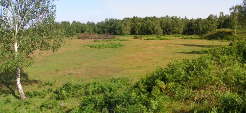
Gorley Hill submitted by JimChampion on 13th Jun 2006. Panoramic view of the southwest corner of Gorley Common, looking south. The hill fort once occupied this area, but gravel extraction in the 1950s and 1960s removed any evidence of the earthworks. A well-grazed plateau remains, surrounded on some sides by large embankments (the original ground level); the birch trees in the distance are growing on such a bank, and the corner of a bank protrudes from the right.
(View photo, vote or add a comment)
Log Text: None
Ferny Knap tumuli
Date Added: 19th Sep 2010
Site Type: Round Barrow(s)
Country: England (Hampshire)
Visited: Yes on 26th Jun 2006
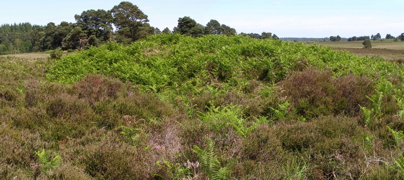
Ferny Knap tumuli submitted by JimChampion on 26th Jun 2006. A composite photo of the Ferny Knap bowl barrow. The mound is almost 2m high and is quite obvious on the featureless heath. Its companion, the bell barrow, is not as prominent and didn't want to be photographed today.
(View photo, vote or add a comment)
Log Text: None
Hinton Ampner tumuli
Date Added: 19th Sep 2010
Site Type: Round Barrow(s)
Country: England (Hampshire)
Visited: Yes on 27th Jun 2006
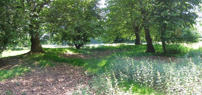
Hinton Ampner tumuli submitted by JimChampion on 27th Jun 2006. Looking south at the largest bowl barrow in Hinton Ampner Park (centred on grid reference SU59442784) on a very bright day. The barrow has a large central depression - usually a sign of robbing or antiquarian digging.
(View photo, vote or add a comment)
Log Text: None
Cheriton Long Barrow
Date Added: 19th Sep 2010
Site Type: Long Barrow
Country: England (Hampshire)
Visited: Yes on 27th Jun 2006

Cheriton Long Barrow submitted by JimChampion on 27th Jun 2006. Looking north at the side of the long barrow mound, which crosses the photo from left to right beyond the oilseed rape. The footpath across the field is on the other side of the barrow, this view is from the field gate on Lamborough Lane. The barrow is covered with grasses and so stands out in this field. It will probably be much more obvious when the oilseed crop has been harvested.
(View photo, vote or add a comment)
Log Text: None
Monument to a Horse
Date Added: 19th Sep 2010
Site Type: Modern Stone Circle etc
Country: England (Hampshire)
Visited: Yes on 28th Jun 2006
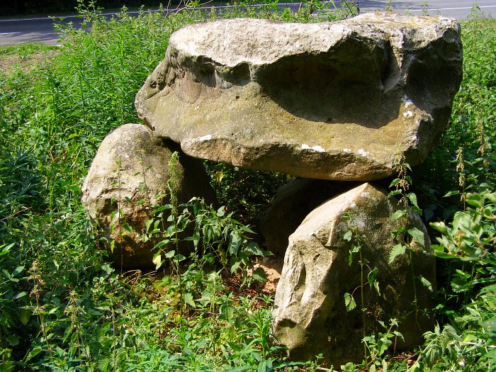
Monument to a Horse submitted by JimChampion on 28th Jun 2006. The largest of the standing tetralithons, and the one that many people notice as they hurtle past on the A272. At this time of year it is almost hidden by the surrounding nettles on the verge of the road.
(View photo, vote or add a comment)
Log Text: None
Glastonbury Lake Village Museum
Date Added: 19th Sep 2010
Site Type: Museum
Country: England (Somerset)
Visited: Yes on 9th Aug 2006

Glastonbury Lake Village Museum submitted by JimChampion on 9th Aug 2006. The rear courtyard at The Tribunal building - the Lake Village museum is upstairs and a preserved dugout canoe is just through the doorway on the left.
(View photo, vote or add a comment)
Log Text: None
Peat Moors Centre
Date Added: 19th Sep 2010
Site Type: Museum
Country: England (Somerset)
Visited: Yes on 9th Aug 2006
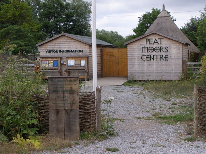
Peat Moors Centre submitted by JimChampion on 9th Aug 2006. This is as far as we got - its not open on Wednesdays :( As compensation you can turn a handle on the blue box and hear someone tell their memories of cider drinking and peat cutting.
(View photo, vote or add a comment)
Log Text: None
Glastonbury Lake Village
Date Added: 19th Sep 2010
Site Type: Ancient Village or Settlement
Country: England (Somerset)
Visited: Yes on 9th Aug 2006
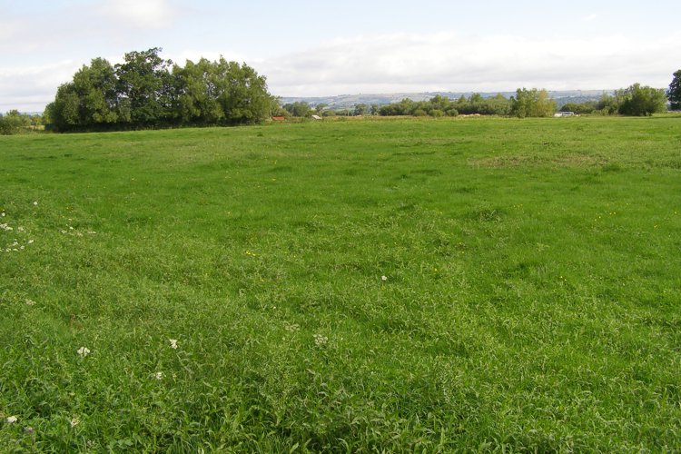
Glastonbury Lake Village submitted by JimChampion on 9th Aug 2006. A view across the field that is the site of the Glastonbury Lake Village (or Godney Lake Village as it was called during the original excavation). Not much to see these days, a few small bumps in a lush grassy field, surrounded by the ubiquitous drainage ditches.
(View photo, vote or add a comment)
Log Text: None
Sweet Track
Date Added: 19th Sep 2010
Site Type: Ancient Trackway
Country: England (Somerset)
Visited: Yes on 9th Aug 2006

Sweet Track submitted by JimChampion on 9th Aug 2006. The southern half of the course of the Sweet Track runs through Shapwick Heath NNR, which is open to the public - leaflets and maps are available from the English Nature office next to the Peat Moors Centre. This photo shows one of the interpretative boards (with braille) explaining what the track was, how it was discovered and how its remains are being protected today. A modern-day track runs alongside (visible bottom right) - it is made from recycled plastic bottles.
(View photo, vote or add a comment)
Log Text: None
Glastonbury Tor
Date Added: 19th Sep 2010
Site Type: Ancient Village or Settlement
Country: England (Somerset)
Visited: Yes on 11th Aug 2006
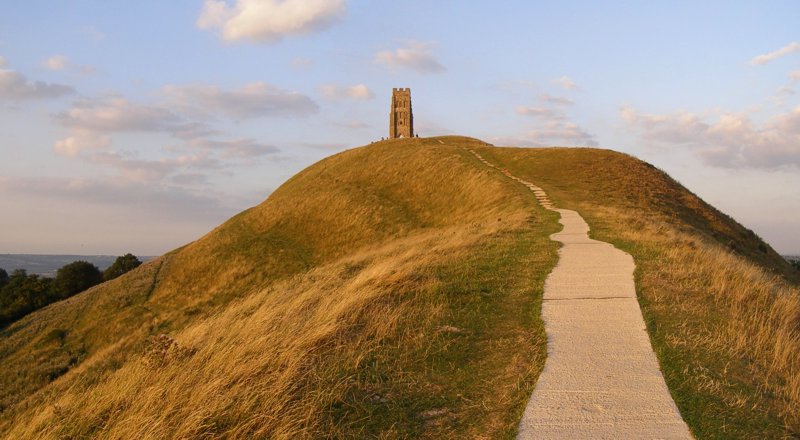
Glastonbury Tor submitted by JimChampion on 11th Aug 2006. Panorama of the Tor bathed in summer evening sunlight. The concrete path isn't pretty, but necessary given the huge numbers of visitors to the summit. Archaeological excavations on the Tor (imagine having to carry the equipment up here every day) have not found evidence of settlement before the Dark Ages, but flint tools and a Neolithic polished axe (an offering?) were discovered.
(View photo, vote or add a comment)
Log Text: None
St Joseph's Well
Date Added: 19th Sep 2010
Site Type: Holy Well or Sacred Spring
Country: England (Somerset)
Visited: Yes on 12th Aug 2006
St Joseph's Well submitted by JimChampion on 12th Aug 2006. Just to show that there really is no other angle on this well... I now realise that if I'd turned the camera the other way the flash would have been less intense on the near (left) portion of the arch. Live and learn. Apparently when the well was baled out during an investigation in 1991 they found hundreds of coins dated 1960 and later, which presumably shows when tourist numbers increased dramatically.
(View photo, vote or add a comment)
Log Text: None
Corfe Common
Date Added: 19th Sep 2010
Site Type: Barrow Cemetery
Country: England (Dorset)
Visited: Yes on 19th Aug 2006
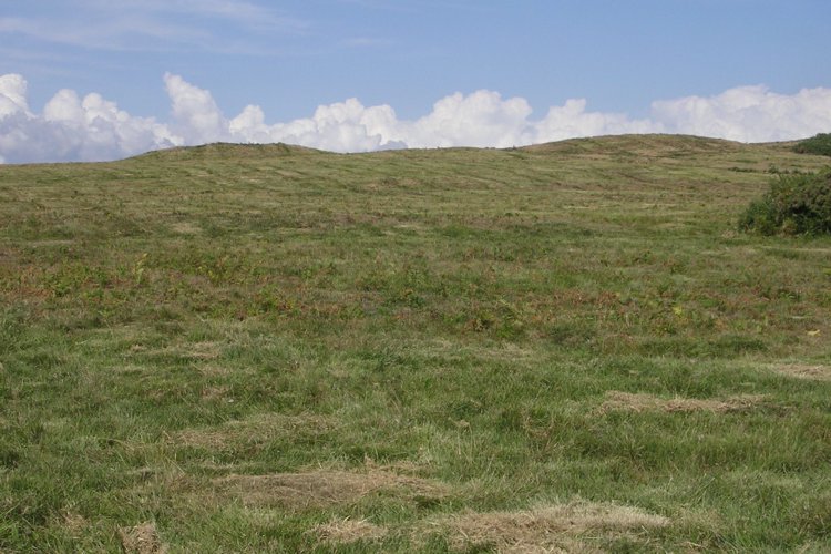
Corfe Common submitted by JimChampion on 19th Aug 2006. The two round barrows at SY964804 on the middle part of Corfe Common between the B3069 and A351 roads. The part of the common to the west of the B3069, which has many tumuli, is grazed by cows - the part in this photo looks like it has been machine mowed. The barrows are organised linearly along the ridge through the middle of the common, which is crossed by later hollow ways.
(View photo, vote or add a comment)
Log Text: None
