Contributory members are able to log private notes and comments about each site
Sites JimChampion has logged. View this log as a table or view the most recent logs from everyone
Seven Barrow Plantation
Date Added: 19th Sep 2010
Site Type: Barrow Cemetery
Country: England (Dorset)
Visited: Yes on 1st Jun 2006
Seven Barrow Plantation submitted by JimChampion on 1st Jun 2006. April 2006. One of the cemetery's round barrows, at grid reference SY64819251. This one has many beech trees growing on it.
(View photo, vote or add a comment)
Log Text: None
Tenants Hill enclosure
Date Added: 19th Sep 2010
Site Type: Ancient Village or Settlement
Country: England (Dorset)
Visited: Yes on 3rd Jun 2006

Tenants Hill enclosure submitted by JimChampion on 3rd Jun 2006. The medieval dew pond on Tenants Hill, confusing labeled as a "hut circle" on the Ordnance Survey maps. Strong afternoon sunshine is not best for bringing out these earthwork features, but there is different vegetation growing in the pond (nettles?). The bank behind the pond is the southern side of the Bronze Age enclosure. In the distance (center) is Long Barrow Hill.
(View photo, vote or add a comment)
Log Text: None
Corfe Common
Date Added: 19th Sep 2010
Site Type: Barrow Cemetery
Country: England (Dorset)
Visited: Yes on 19th Aug 2006
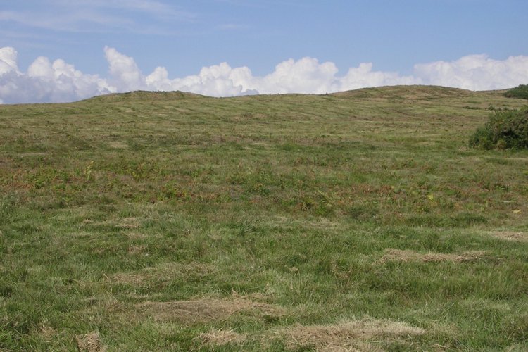
Corfe Common submitted by JimChampion on 19th Aug 2006. The two round barrows at SY964804 on the middle part of Corfe Common between the B3069 and A351 roads. The part of the common to the west of the B3069, which has many tumuli, is grazed by cows - the part in this photo looks like it has been machine mowed. The barrows are organised linearly along the ridge through the middle of the common, which is crossed by later hollow ways.
(View photo, vote or add a comment)
Log Text: None
Corfe Castle West Hill barrows
Date Added: 19th Sep 2010
Site Type: Round Barrow(s)
Country: England (Dorset)
Visited: Yes on 20th Aug 2006

Corfe Common submitted by JimChampion on 20th Aug 2006. A broad view of Corfe from the south, showing the Castle Hill between West Hill (left) and East Hill (right). There are round barrows on the summits of West and East Hills, and a linear cemetery of round barrows on Corfe Common (the area seen in front of the village, above the drystone wall).
(View photo, vote or add a comment)
Log Text: None
Afflington Barrow
Date Added: 19th Sep 2010
Site Type: Round Barrow(s)
Country: England (Dorset)
Visited: Yes on 21st Aug 2006
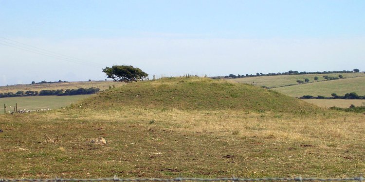
Afflington Barrow submitted by JimChampion on 21st Aug 2006. Looking at the Afflington Barrow from the Purbeck Way to the west.
(View photo, vote or add a comment)
Log Text: None
Hod Hill
Date Added: 19th Sep 2010
Site Type: Hillfort
Country: England (Dorset)
Visited: Yes on 17th Sep 2006

Hod Hill submitted by JimChampion on 17th Sep 2006. Looking west along the earthwork defences on the north side of the hillfort, from the top of the inner rampart at grid ref ST858108.
(View photo, vote or add a comment)
Log Text: None
Hellstone
Date Added: 19th Sep 2010
Site Type: Long Barrow
Country: England (Dorset)
Visited: Yes on 18th Sep 2006
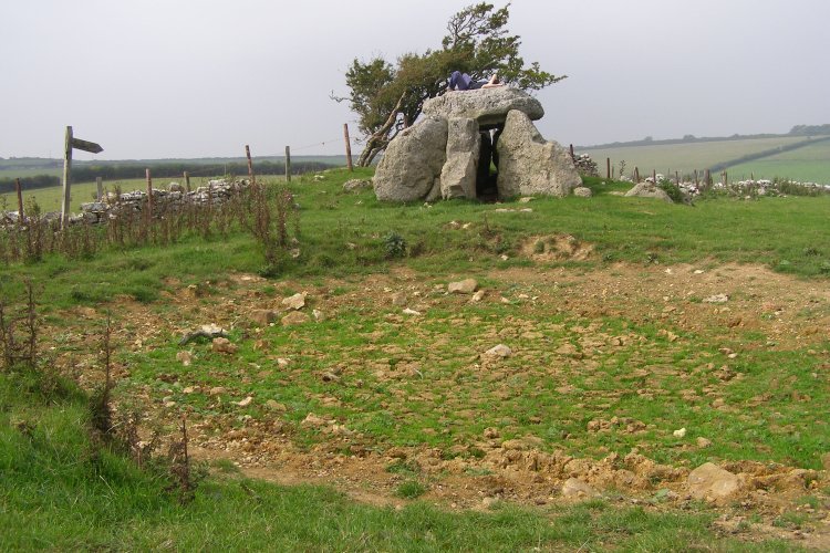
Hellstone submitted by JimChampion on 18th Sep 2006. September 2006. After a very dry summer the pond in front of the Hellstone is empty and grass is growing in its cracked bed.
(View photo, vote or add a comment)
Log Text: None
Southdown (Dorset)
Date Added: 19th Sep 2010
Site Type: Barrow Cemetery
Country: England (Dorset)
Visited: Yes on 28th Oct 2006

Southdown (Dorset) submitted by JimChampion on 28th Oct 2006. July 2005. View east towards the most westerly barrow of the group of four, from the gate at the top of the toll road down to Ringstead. Barrow grid reference: SY74678259.
(View photo, vote or add a comment)
Log Text: None
Smitten Corner
Date Added: 19th Sep 2010
Site Type: Barrow Cemetery
Country: England (Dorset)
Visited: Yes on 24th Dec 2006
Smitten Corner submitted by JimChampion on 24th Dec 2006. The two large barrows at Smitten Corner, from the inland coastal footpath. These barrows are easy to spot from the road from Martinstown to the Hardy Monument, and there is a gravel layby close by (next to the Forestry Commission's "Blackdown" sign). This view is from the other side of the barrows, walking along the footpath along the ridgeway from Upwey.
(View photo, vote or add a comment)
Log Text: None
Bronkham Hill
Date Added: 19th Sep 2010
Site Type: Barrow Cemetery
Country: England (Dorset)
Visited: Yes on 28th Dec 2006
Bronkham Hill submitted by JimChampion on 28th Dec 2006. Looking ESE at the prominent barrow at grid reference SY62358717. This field on top of Bronkham Hill is well-grazed by sheep - some of which can be seen to the right of the barrow next to their feeder. In the foreground there are many sheep footprints in the soil.
(View photo, vote or add a comment)
Log Text: None
Bishops Limekiln Car Park
Date Added: 19th Sep 2010
Site Type: Standing Stone (Menhir)
Country: England (Dorset)
Visited: Yes on 28th Dec 2006
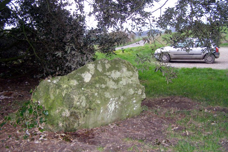
Bishops Limekiln Car Park submitted by JimChampion on 28th Dec 2006. I know nothing about this stone other than the fact it is listed here. I've often driven past the car park and wondered. Stopped off and found it under a tree in the car park. To emphasise the car parkiness of it, my filthy vehicle is visible on the right.
(View photo, vote or add a comment)
Log Text: None
Bind Barrow
Date Added: 19th Sep 2010
Site Type: Round Barrow(s)
Country: England (Dorset)
Visited: Yes on 28th Dec 2006

Bind Barrow submitted by JimChampion on 28th Dec 2006. View of Bind Barrow on its hilltop from within the Second World War pillbox on the side of the hill. The barrow is framed by the old doorway to the pillbox, which is now half-blocked by concrete.
(View photo, vote or add a comment)
Log Text: None
St Augustine's Well (Cerne Abbas)
Date Added: 19th Sep 2010
Site Type: Holy Well or Sacred Spring
Country: England (Dorset)
Visited: Yes on 28th Dec 2006
St Augustine's Well (Cerne Abbas) submitted by JimChampion on 28th Dec 2006. Springwater leaves the upper rectangular pool over a stone block with a semicircular channel cut into it, the fast flow produces some interesting ripple patterns.
(View photo, vote or add a comment)
Log Text: None
Maumbury Rings
Date Added: 19th Sep 2010
Site Type: Henge
Country: England (Dorset)
Visited: Yes on 28th Dec 2006
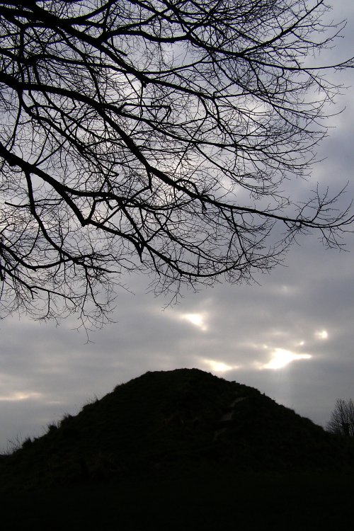
Maumbury Rings submitted by JimChampion on 28th Dec 2006. A low viewpoint makes the eastern side of the henge entrance look a bit Silbury-like. Very overcast and not a good day for taking pictures of this large grassy earthwork. The size of the bank is not a good indication of its original height - it was greatly added to when the Romans converted the henge into an amphitheatre.
(View photo, vote or add a comment)
Log Text: None
Hengistbury Head
Date Added: 19th Sep 2010
Site Type: Promontory Fort / Cliff Castle
Country: England (Dorset)
Visited: Yes on 21st Jan 2007

Hengistbury Head submitted by JimChampion on 21st Jan 2007. Two-photo composite of the double dykes, viewed from the beach end (rather than the Christchurch harbour end). The ditch has filled in somewhat in the intervening 2000 years. The dykes are now fenced off to reduce wear and tear from visitors' feet. There are some new information boards around the site as well.
(View photo, vote or add a comment)
Log Text: None
Rainbarrows
Date Added: 19th Sep 2010
Site Type: Round Barrow(s)
Country: England (Dorset)
Visited: Yes on 10th Apr 2007
submitted by on .
(View photo, vote or add a comment)
Log Text: None
Grey Mare Processional Way
Date Added: 19th Sep 2010
Site Type: Multiple Stone Rows / Avenue
Country: England (Dorset)
Visited: Yes on 17th Apr 2007
Grey Mare Processional Way submitted by JimChampion on 17th Apr 2007. June 2006. This stone lies alongside the footpath that approaches the Kingston Russell stone circle from the southeast, grid reference is approximately SY582873. It is possibly also called the "Goddess stone" (by Peter Knight) - this once is certainly moss covered. It would be easy to miss it in summer when the nettles etc. are high.
(View photo, vote or add a comment)
Log Text: None
Parsonage Hill
Date Added: 19th Sep 2010
Site Type: Long Barrow
Country: England (Dorset)
Visited: Yes on 28th Jul 2007
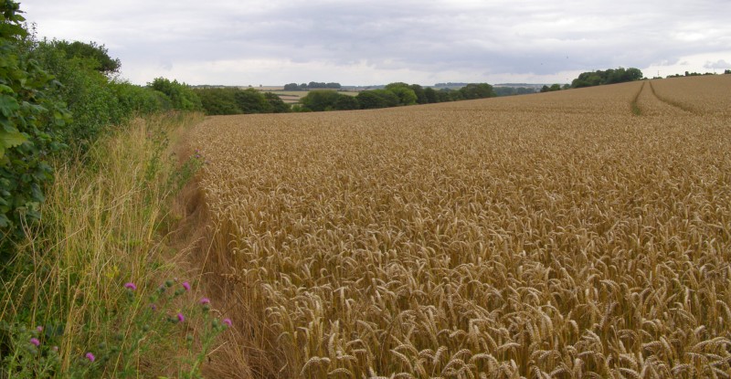
Parsonage Hill submitted by JimChampion on 28th Jul 2007. According to the map, the Parsonage Hill barrow should be here somewhere, in the foreground. I think its safe to say that it has been destroyed (or at least all obvious traces have been removed) by deep ploughing.
(View photo, vote or add a comment)
Log Text: None
Hambledon Hill south long barrow
Date Added: 19th Sep 2010
Site Type: Long Barrow
Country: England (Dorset)
Visited: Yes on 3rd Nov 2007

Hambledon Hill south long barrow submitted by JimChampion on 3rd Nov 2007. July 2007. Looking north along the reconstructed oval mound of this long barrow. It is just to the south of the neolithic enclosure on the summit of Hambledon Hill (in the background). There is a cross-dyke just to the south of the barrow that defends the approach to the summit from the Hanford spur of Hambledon Hill.
(View photo, vote or add a comment)
Log Text: None
Longlands barrow cemetery
Date Added: 19th Sep 2010
Site Type: Barrow Cemetery
Country: England (Dorset)
Visited: Yes on 26th Nov 2007

Longlands barrow cemetery submitted by JimChampion on 26th Nov 2007. Looking up from the Broadstone on the verge of the A35, towards one of the barrows in the Longlands cemetery. Sheep grazing. Rain.
(View photo, vote or add a comment)
Log Text: None
