Contributory members are able to log private notes and comments about each site
Sites JimChampion has logged. View this log as a table or view the most recent logs from everyone
Pentridge 3
Date Added: 19th Sep 2010
Site Type: Long Barrow
Country: England (Dorset)
Visited: Yes on 9th Apr 2005

Pentridge 3 submitted by JimChampion on 9th Apr 2005. April 2005. This long barrow, aligned on the NE terminal of the Dorset Cursus, has been almost ploughed out of existence. It is just visible as a very low mound occupying the centre of the photograph between the two pairs of tractor ruts. The bank on the left of the photo is the Romano-British Bokerley Dyke, which currently defines the Hampshire/Dorset boundary.
(View photo, vote or add a comment)
Log Text: None
Pentridge 4
Date Added: 19th Sep 2010
Site Type: Long Barrow
Country: England (Dorset)
Visited: Yes on 10th Apr 2005
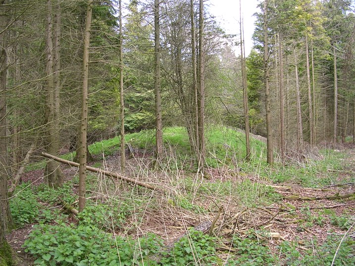
Pentridge 4 submitted by JimChampion on 10th Apr 2005. Looking north at the Dorset Cursus long barrow, surrounded by trees in Salisbury Plantation. The barrow was incorporated into the NW bank of the Cursus, some of which survives amongst the trees to the SW of this spot.
(View photo, vote or add a comment)
Log Text: None
Penbury Knoll
Date Added: 19th Sep 2010
Site Type: Hillfort
Country: England (Dorset)
Visited: Yes on 20th Apr 2005

Penbury Knoll submitted by JimChampion on 20th Apr 2005. April 2005. Composite image of Penbury Knoll (and Pentridge Hill) from Salisbury Plantation to the southwest.
(View photo, vote or add a comment)
Log Text: None
Thickthorn Round Barrows
Date Added: 19th Sep 2010
Site Type: Round Barrow(s)
Country: England (Dorset)
Visited: Yes on 22nd Apr 2005
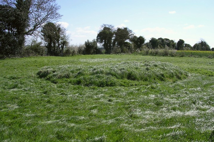
Thickthorn Round Barrows submitted by JimChampion on 22nd Apr 2005. April 2005. Looking east at one of the bowl barrows on Thickthorn Hill, 11m in diameter and just under 1m high, surrounded by a ditch and mutilated by excavation at its centre.
(View photo, vote or add a comment)
Log Text: None
Thickthorn Down (North)
Date Added: 19th Sep 2010
Site Type: Long Barrow
Country: England (Dorset)
Visited: Yes on 22nd Apr 2005
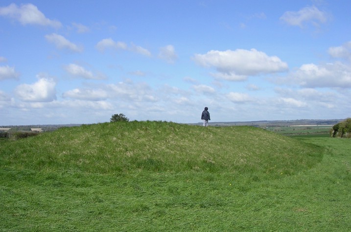
Thickthorn Down (North) submitted by JimChampion on 22nd Apr 2005. April 2005. Looking northwest at the long barrow immediately to the SE of the western terminal of the Dorset Cursus. The barrow is 47m long, 20m wide with a silted-up U-shaped ditch open at the nearest end.
(View photo, vote or add a comment)
Log Text: None
Thickthorn Down (South)
Date Added: 19th Sep 2010
Site Type: Long Barrow
Country: England (Dorset)
Visited: Yes on 22nd Apr 2005
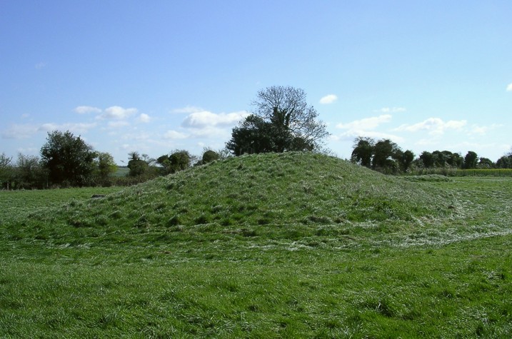
Thickthorn Down (South) submitted by JimChampion on 22nd Apr 2005. April 2005. Looking southeast at the long barrow with its traces of a U-shaped ditch (open at the other end). The grass has been recently cut and rolled (the rollers are resting in the barrow ditch on the far side).
(View photo, vote or add a comment)
Log Text: None
Blagdon Hill tumuli
Date Added: 19th Sep 2010
Site Type: Round Barrow(s)
Country: England (Dorset)
Visited: Yes on 23rd Apr 2005

Blagdon Hill tumuli submitted by JimChampion on 23rd Apr 2005. March 2005. Two bowl barrows on Blagdon Hill. The horse is standing on the bank of Grim's Ditch (whick merges with the smaller barrow) and the individual trees on the far left of the photo are growing on the Bokerley Dyke.
(View photo, vote or add a comment)
Log Text: None
Bokerley Dyke
Date Added: 19th Sep 2010
Site Type: Misc. Earthwork
Country: England (Dorset)
Visited: Yes on 23rd Apr 2005
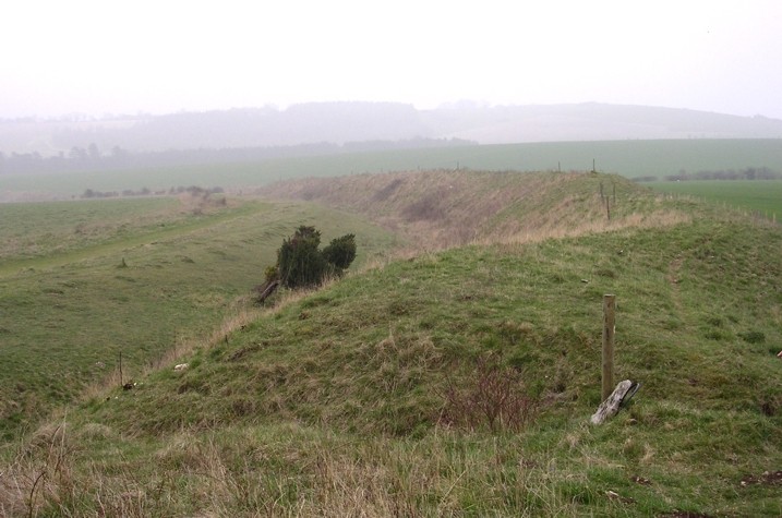
Bokerley Dyke submitted by JimChampion on 23rd Apr 2005. March 2005. Looking south along the sinuous Bokerley Dyke on a misty day with Hampshire on the left (the ditched side) and Dorset on the right. The Martin Down nature reserve is on the left and the field on the right contains the site of the Dorset Cursus northeastern terminal and two long barrows.
(View photo, vote or add a comment)
Log Text: None
Bokerley Dyke
Date Added: 19th Sep 2010
Site Type: Misc. Earthwork
Country: England (Dorset)
Visited: Yes on 23rd Apr 2005

Bokerley Dyke submitted by JimChampion on 23rd Apr 2005. March 2005. Looking south along the sinuous Bokerley Dyke on a misty day with Hampshire on the left (the ditched side) and Dorset on the right. The Martin Down nature reserve is on the left and the field on the right contains the site of the Dorset Cursus northeastern terminal and two long barrows.
(View photo, vote or add a comment)
Log Text: None
Kingston Russell 1
Date Added: 19th Sep 2010
Site Type: Long Barrow
Country: England (Dorset)
Visited: Yes on 24th Apr 2005

Kingston Russell 1 submitted by JimChampion on 24th Apr 2005. April 2005. Looking west along the remains of this neolithic long barrow, classed by some as a "bank barrow". It is in a sorry state, with an eroded bank cut through in several places by recent tracks and has barely noticeable ditches. The cows have left their usual mark.
(View photo, vote or add a comment)
Log Text: None
Culliford Tree
Date Added: 19th Sep 2010
Site Type: Barrow Cemetery
Country: England (Dorset)
Visited: Yes on 24th Apr 2005
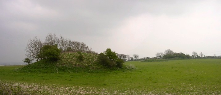
Culliford Tree submitted by JimChampion on 24th Apr 2005. April 2005. Looking east from Whitcombe Lane at an alignement of three round barrows in the Came Wood cemetery. The impressive Broadmayne bank barrow is on the same alignment, just the other side of the hedge. The ominous clouds signal the arrival of heavy rain.
(View photo, vote or add a comment)
Log Text: None
Whitcombe 1
Date Added: 19th Sep 2010
Site Type: Long Barrow
Country: England (Dorset)
Visited: Yes on 24th Apr 2005
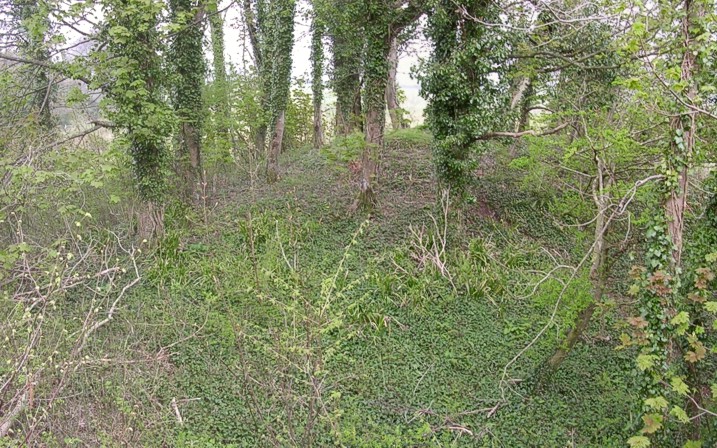
Whitcombe 1 submitted by JimChampion on 24th Apr 2005. April 2005. Not easy to photograph as the long barrow is overgrown in the corner of Came Wood. This is a view of the NE end of the barrow, with its overlying bowl barrow, taken from atop the roots of a fallen tree.
(View photo, vote or add a comment)
Log Text: None
Long Bredy Bank Barrow
Date Added: 19th Sep 2010
Site Type: Long Barrow
Country: England (Dorset)
Visited: Yes on 25th Apr 2005
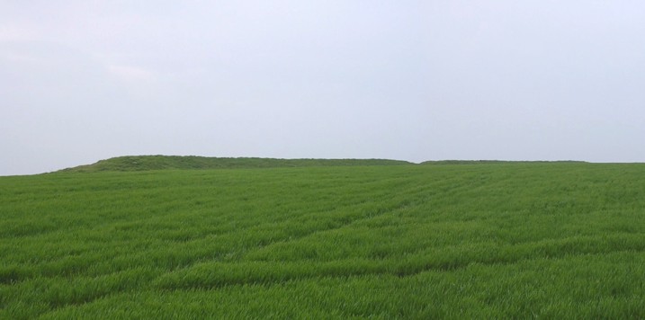
Long Bredy Bank Barrow submitted by JimChampion on 25th Apr 2005. April 2005. A composite view of the bank barrow, looking south from the field gate (standing on the gatepost to get a better view). The curvature of the appropriately named Long Barrow Hill means that it is difficult to see the barrow from this close distance. The break in the bank is clearly visible, occurring about a third of the way along the barrows 200m length.
(View photo, vote or add a comment)
Log Text: None
Kingston Russell Stone 3
Date Added: 19th Sep 2010
Site Type: Standing Stone (Menhir)
Country: England (Dorset)
Visited: Yes on 25th Apr 2005
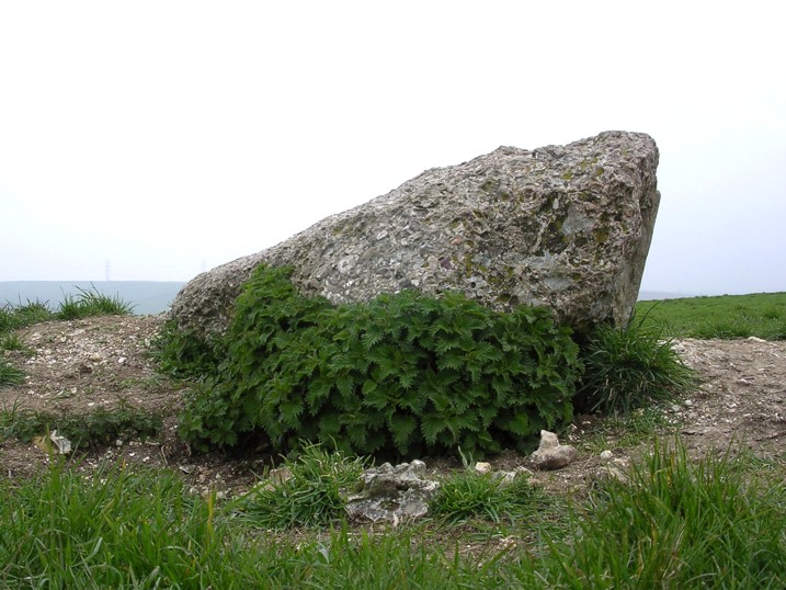
Kingston Russell Stone 3 submitted by JimChampion on 25th Apr 2005. April 2005. View of the east side of the conglomerate stone on top of the bowl barrow. The stone's dimensions are roughly 2x1x0.5m. The flinty barrow it stands on has been badly eroded by burrowing animals: from a distance the exposed chalk and soil is more visible than the stone itself.
(View photo, vote or add a comment)
Log Text: None
Kingston Russell 2
Date Added: 19th Sep 2010
Site Type: Long Barrow
Country: England (Dorset)
Visited: Yes on 25th Apr 2005

Kingston Russell 2 submitted by JimChampion on 25th Apr 2005. April 2005. Looking southwest at the low profile of the bank barrow. The earthworks are quite obvious if you're there, but its very difficult to photograph (no contrast, only grass on grass). The taller SE end is visible on the left of the photo and the trees are behind the barrow (along the field's edge) rather than growing on it.
(View photo, vote or add a comment)
Log Text: None
Long Bredy 2
Date Added: 19th Sep 2010
Site Type: Long Barrow
Country: England (Dorset)
Visited: Yes on 27th Apr 2005

Long Bredy 2 submitted by JimChampion on 27th Apr 2005. April 2005. Looking north at the long barrow, with its larger eastern end nearer the camera. The earthwork behind the western end is a modern farm reservoir with a level signal sticking out of the top.
(View photo, vote or add a comment)
Log Text: None
Martin's Down Bell Barrows
Date Added: 19th Sep 2010
Site Type: Round Barrow(s)
Country: England (Dorset)
Visited: Yes on 27th Apr 2005

Martin's Down Bell Barrows submitted by JimChampion on 27th Apr 2005. April 2005. The bowl barrow at grid ref SY570910, with its friend the OS trig point (a modern standing stone?) and The Knoll (near Pucknowle) in the mist in the distance. Taken whilst squatting in the ditch of the cross dyke that separates this promontory off from the rest of Martin's Down. This small round barrow is only 50m SW of the SW end of the Long Bredy bank barrow - most of the nearby round barrows are found nearer the other end of the bank barrow.
(View photo, vote or add a comment)
Log Text: None
Poor Lot Barrows
Date Added: 19th Sep 2010
Site Type: Barrow Cemetery
Country: England (Dorset)
Visited: Yes on 27th Apr 2005
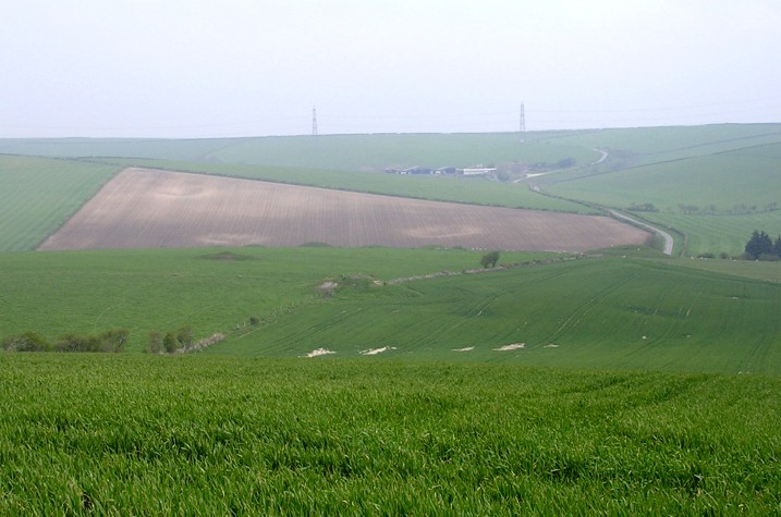
Poor Lot Barrows submitted by JimChampion on 27th Apr 2005. April 2005. Looking down at the Poor Lot barrow cemetery from Pitcombe Down. Huge numbers of lumps and bumps are visible, as well as the depressions of long-gone round barrows (in the foreground and on the opposite hillside). The busy A35 road is hidden in the valley.
(View photo, vote or add a comment)
Log Text: None
Holdenhurst Long Barrow
Date Added: 19th Sep 2010
Site Type: Long Barrow
Country: England (Dorset)
Visited: Yes on 8th May 2005

Holdenhurst Long Barrow submitted by JimChampion on 8th May 2005. January 1936. The first known deliberate use of a mechanical excavator to assist archaeological trench digging. The person in the picture is George Willmot, and the photo is believed to have been taken by Stuart Piggott who led the rescue work at the site. This photo is reproduced by the kind permission of David Allen, Senior Keeper of Archaeology with the Hampshire Museums service.
(View photo, vote or add a comment)
Log Text: None
Bindon Hill
Date Added: 19th Sep 2010
Site Type: Hillfort
Country: England (Dorset)
Visited: Yes on 14th May 2005

Bindon Hill submitted by JimChampion on 14th May 2005. The context of the fort, on top of Bindon Hill and towering over Lulworth Cove. The cove would have been an important harbour for early Iron Age settlers/invaders arriving from the continent, and it is suggested that the defensive earthworks of Bindon Hill were a hurried beach-head fortification to secure control of the cove.
(View photo, vote or add a comment)
Log Text: None
