Contributory members are able to log private notes and comments about each site
Sites JimChampion has logged. View this log as a table or view the most recent logs from everyone
Scratchbury Camp
Date Added: 19th Sep 2010
Site Type: Hillfort
Country: England (Wiltshire)
Visited: Yes on 22nd Apr 2007
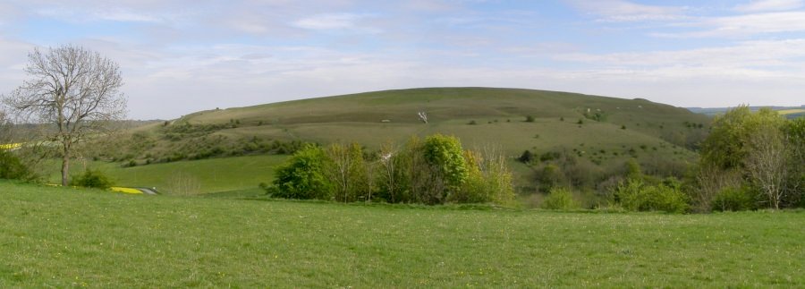
Scratchbury Camp submitted by JimChampion on 22nd Apr 2007. Two-photo composite image of Scratchbury Hill, from Middle Hill to the northwest. The double ramparts are clearly visible, as is the large barrow on the southwestern slope of the hill (to the right of this photo, within the ramparts).
(View photo, vote or add a comment)
Log Text: None
Battlesbury Camp
Date Added: 19th Sep 2010
Site Type: Hillfort
Country: England (Wiltshire)
Visited: Yes on 22nd Apr 2007
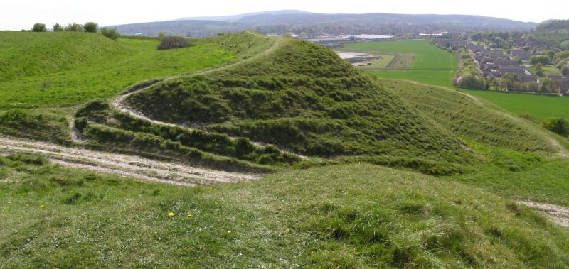
Battlesbury Camp submitted by JimChampion on 22nd Apr 2007. Two-photo composite image of the northwest entrance to Battlesbury hillfort, grid reference ST896458. An Iron Age cemetery was found outside this entrance (to the right). The strong colours are a result of shooting towards the sun.
(View photo, vote or add a comment)
Log Text: None
Middle Hill
Date Added: 19th Sep 2010
Site Type: Round Barrow(s)
Country: England (Wiltshire)
Visited: Yes on 24th Apr 2007
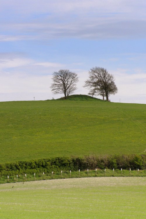
Middle Hill submitted by JimChampion on 24th Apr 2007. View southeast towards Middle Hill from the footpath on Battlesbury Hill. The row of white-topped posts indicates a cutting which contains a 'tank road' between the Warminster Training Centre and the Imber Range.
(View photo, vote or add a comment)
Log Text: None
Bratton Long Barrow
Date Added: 19th Sep 2010
Site Type: Long Barrow
Country: England (Wiltshire)
Visited: Yes on 25th Apr 2007
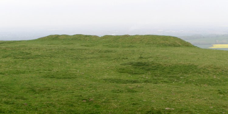
Bratton Long Barrow submitted by JimChampion on 25th Apr 2007. The Bratton Camp long barrow, viewed from the southeast. The barrow mound is long and very lumpy.
(View photo, vote or add a comment)
Log Text: None
Bratton Camp
Date Added: 19th Sep 2010
Site Type: Hillfort
Country: England (Wiltshire)
Visited: Yes on 25th Apr 2007
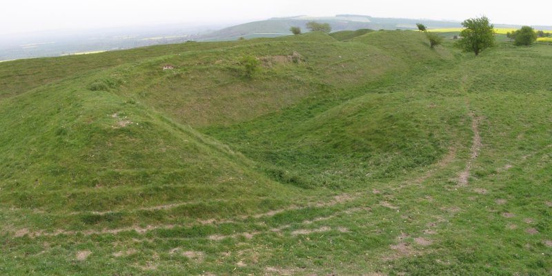
Bratton Camp submitted by JimChampion on 25th Apr 2007. A view of the southeast corner of Bratton Camp. The two banks are roughly the same height here on the gently sloping hill. In the foreground a path enters the hillfort (to the left) through one of the original entrances. This is a two-photo composite image, which explains some of the some of the distortion towards the edges.
(View photo, vote or add a comment)
Log Text: None
Chiselbury
Date Added: 19th Sep 2010
Site Type: Hillfort
Country: England (Wiltshire)
Visited: Yes on 28th Apr 2007
Chiselbury submitted by JimChampion on 28th Apr 2007. Two-photo composite image of the western side of Chiselbury. The single bank is in the centre, curving to the right. The hillfort interior is on the right and the external ditch is on the left. The yellow flowers are cowslips.
(View photo, vote or add a comment)
Log Text: None
Castle Ditches (Wiltshire)
Date Added: 19th Sep 2010
Site Type: Hillfort
Country: England (Wiltshire)
Visited: Yes on 29th Apr 2007
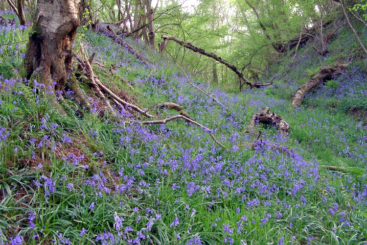
Castle Ditches (Wiltshire) submitted by JimChampion on 29th Apr 2007. The approach to the southeast side of Castle Ditches is flat, and the earthwork defences on this side are multiplied. This photo is a view along one of the ditches, from the eastern corner, with the hillfort interior towards the right. The earthworks are all densely wooded and at this time of year the ground is thick with bluebells.
(View photo, vote or add a comment)
Log Text: None
Sutton Down long barrow
Date Added: 19th Sep 2010
Site Type: Long Barrow
Country: England (Wiltshire)
Visited: Yes on 6th May 2007
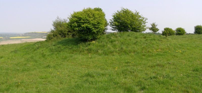
Sutton Down long barrow submitted by JimChampion on 6th May 2007. Two-photo composite image of the long barrow on Sutton Down. In the distance, to the left of the barrow, is the chalk scarp which is home to the Fovant Regimental Badges and Chiselbury hillfort.
(View photo, vote or add a comment)
Log Text: None
Buxbury Hill
Date Added: 19th Sep 2010
Site Type: Round Barrow(s)
Country: England (Wiltshire)
Visited: Yes on 6th May 2007
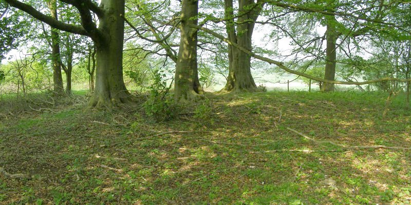
Buxbury Hill submitted by JimChampion on 6th May 2007. The Buxbury Barrow, barely recognisable under the beech trees on the edge of this wooded area on top of Buxbury Hill. This is a two-photo composite image of the site.
(View photo, vote or add a comment)
Log Text: None
Vernditch Chase (North)
Date Added: 19th Sep 2010
Site Type: Long Barrow
Country: England (Wiltshire)
Visited: Yes on 27th Jan 2008

Vernditch Chase (North) submitted by JimChampion on 27th Jan 2008. Composite image, from two separate photographs. Viewing the wasted barrow mound from the south-west.
(View photo, vote or add a comment)
Log Text: None
Alexander Keiller Museum
Date Added: 19th Sep 2010
Site Type: Museum
Country: England (Wiltshire)
Visited: Yes on 31st Dec 2008

Alexander Keiller Museum submitted by JimChampion on 31st Dec 2008. The door to the Barn Gallery at Avebury. The barn is kept very cool in order to preserve the structure of the 17th century building, so it only houses a few archaeological exhibits - according to the NT leaflet it 'tells the story of the landscape through a fully interactive display'. Most of the archaeology collection is in the nearby Stables Gallery. Both are covered by the same admission ticket, unless you are a member of the National Trust (in which case both galleries are free).
(View photo, vote or add a comment)
Log Text: None
Park Hill Camp
Date Added: 19th Sep 2010
Site Type: Hillfort
Country: England (Wiltshire)
Visited: Yes on 19th Sep 2010

Park Hill Camp submitted by JimChampion on 19th Sep 2010. Iron age fort on the Stourhead estate, on Park Hill (ridge to the west of Six Wells Bottom). Interior of the camp is to the right, on the far side of the bank. There has been some recent clearance of beech trees from this part of the earthworks.
(View photo, vote or add a comment)
Log Text: None
Devil's Humps Barrows
Date Added: 19th Sep 2010
Site Type: Barrow Cemetery
Country: England (West Sussex)
Visited: Yes on 26th Apr 2008
Devil's Humps Barrows submitted by JimChampion on 26th Apr 2008. View north-east along the ridge of Bow Hill from the cross dyke, showing the Devil's Humps barrows. The two barrows on the left are bell barrows, and those further on are bowl barrows.
(View photo, vote or add a comment)
Log Text: None
Ham Hill stone circle
Date Added: 19th Sep 2010
Site Type: Modern Stone Circle etc
Country: England (Somerset)
Visited: Yes on 22nd Aug 2005
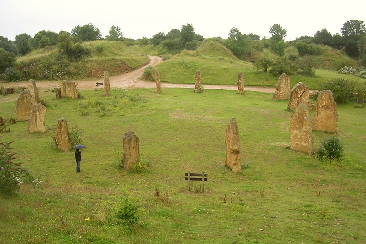
Ham Hill stone circle submitted by JimChampion on 22nd Aug 2005. The modern stone circle is surrounded by the old quarry's spoil heaps - this view, looking west, is from on top of one of these heaps. My umbrella-wielding assistant gives an idea of the scale, and an indication of the weather conditions.
(View photo, vote or add a comment)
Log Text: None
Glastonbury Lake Village Museum
Date Added: 19th Sep 2010
Site Type: Museum
Country: England (Somerset)
Visited: Yes on 9th Aug 2006

Glastonbury Lake Village Museum submitted by JimChampion on 9th Aug 2006. The rear courtyard at The Tribunal building - the Lake Village museum is upstairs and a preserved dugout canoe is just through the doorway on the left.
(View photo, vote or add a comment)
Log Text: None
Peat Moors Centre
Date Added: 19th Sep 2010
Site Type: Museum
Country: England (Somerset)
Visited: Yes on 9th Aug 2006
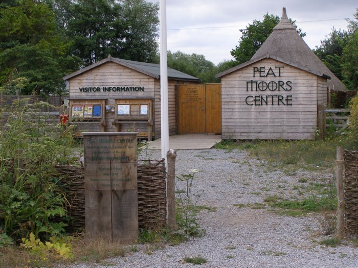
Peat Moors Centre submitted by JimChampion on 9th Aug 2006. This is as far as we got - its not open on Wednesdays :( As compensation you can turn a handle on the blue box and hear someone tell their memories of cider drinking and peat cutting.
(View photo, vote or add a comment)
Log Text: None
Glastonbury Lake Village
Date Added: 19th Sep 2010
Site Type: Ancient Village or Settlement
Country: England (Somerset)
Visited: Yes on 9th Aug 2006
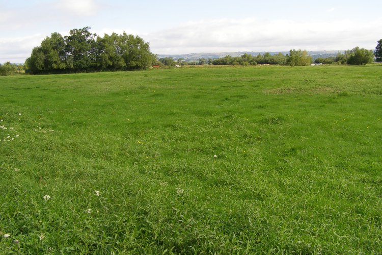
Glastonbury Lake Village submitted by JimChampion on 9th Aug 2006. A view across the field that is the site of the Glastonbury Lake Village (or Godney Lake Village as it was called during the original excavation). Not much to see these days, a few small bumps in a lush grassy field, surrounded by the ubiquitous drainage ditches.
(View photo, vote or add a comment)
Log Text: None
Sweet Track
Date Added: 19th Sep 2010
Site Type: Ancient Trackway
Country: England (Somerset)
Visited: Yes on 9th Aug 2006

Sweet Track submitted by JimChampion on 9th Aug 2006. The southern half of the course of the Sweet Track runs through Shapwick Heath NNR, which is open to the public - leaflets and maps are available from the English Nature office next to the Peat Moors Centre. This photo shows one of the interpretative boards (with braille) explaining what the track was, how it was discovered and how its remains are being protected today. A modern-day track runs alongside (visible bottom right) - it is made from recycled plastic bottles.
(View photo, vote or add a comment)
Log Text: None
Glastonbury Tor
Date Added: 19th Sep 2010
Site Type: Ancient Village or Settlement
Country: England (Somerset)
Visited: Yes on 11th Aug 2006
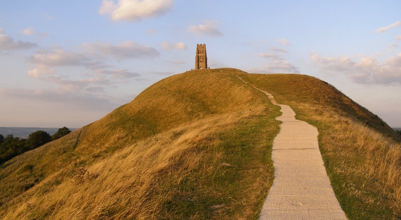
Glastonbury Tor submitted by JimChampion on 11th Aug 2006. Panorama of the Tor bathed in summer evening sunlight. The concrete path isn't pretty, but necessary given the huge numbers of visitors to the summit. Archaeological excavations on the Tor (imagine having to carry the equipment up here every day) have not found evidence of settlement before the Dark Ages, but flint tools and a Neolithic polished axe (an offering?) were discovered.
(View photo, vote or add a comment)
Log Text: None
St Joseph's Well
Date Added: 19th Sep 2010
Site Type: Holy Well or Sacred Spring
Country: England (Somerset)
Visited: Yes on 12th Aug 2006
St Joseph's Well submitted by JimChampion on 12th Aug 2006. Just to show that there really is no other angle on this well... I now realise that if I'd turned the camera the other way the flash would have been less intense on the near (left) portion of the arch. Live and learn. Apparently when the well was baled out during an investigation in 1991 they found hundreds of coins dated 1960 and later, which presumably shows when tourist numbers increased dramatically.
(View photo, vote or add a comment)
Log Text: None
