Contributory members are able to log private notes and comments about each site
Sites JimChampion has logged. View this log as a table or view the most recent logs from everyone
Bind Barrow
Date Added: 19th Sep 2010
Site Type: Round Barrow(s)
Country: England (Dorset)
Visited: Yes on 28th Dec 2006

Bind Barrow submitted by JimChampion on 28th Dec 2006. View of Bind Barrow on its hilltop from within the Second World War pillbox on the side of the hill. The barrow is framed by the old doorway to the pillbox, which is now half-blocked by concrete.
(View photo, vote or add a comment)
Log Text: None
Bindon Hill
Date Added: 19th Sep 2010
Site Type: Hillfort
Country: England (Dorset)
Visited: Yes on 14th May 2005

Bindon Hill submitted by JimChampion on 14th May 2005. The context of the fort, on top of Bindon Hill and towering over Lulworth Cove. The cove would have been an important harbour for early Iron Age settlers/invaders arriving from the continent, and it is suggested that the defensive earthworks of Bindon Hill were a hurried beach-head fortification to secure control of the cove.
(View photo, vote or add a comment)
Log Text: None
Bishops Limekiln Car Park
Date Added: 19th Sep 2010
Site Type: Standing Stone (Menhir)
Country: England (Dorset)
Visited: Yes on 28th Dec 2006
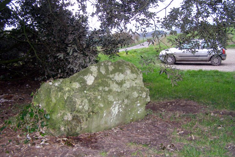
Bishops Limekiln Car Park submitted by JimChampion on 28th Dec 2006. I know nothing about this stone other than the fact it is listed here. I've often driven past the car park and wondered. Stopped off and found it under a tree in the car park. To emphasise the car parkiness of it, my filthy vehicle is visible on the right.
(View photo, vote or add a comment)
Log Text: None
Black Bush Plain
Date Added: 19th Sep 2010
Site Type: Barrow Cemetery
Country: England (Hampshire)
Visited: Yes on 10th Oct 2006
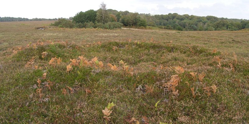
Black Bush Plain submitted by JimChampion on 10th Oct 2006. Looking north across Black Bush Plain with the bowl barrow at grid ref SU24831573 in the foreground. The barrow mound measures 10.5m in diameter and 0.6m high. A hollow in the centre of the mound suggests previous robbing or partial
excavation.
(View photo, vote or add a comment)
Log Text: None
Blagdon Hill tumuli
Date Added: 19th Sep 2010
Site Type: Round Barrow(s)
Country: England (Dorset)
Visited: Yes on 23rd Apr 2005

Blagdon Hill tumuli submitted by JimChampion on 23rd Apr 2005. March 2005. Two bowl barrows on Blagdon Hill. The horse is standing on the bank of Grim's Ditch (whick merges with the smaller barrow) and the individual trees on the far left of the photo are growing on the Bokerley Dyke.
(View photo, vote or add a comment)
Log Text: None
Blakey Topping
Date Added: 19th Sep 2010
Site Type: Stone Circle
Country: England (Yorkshire (North))
Visited: Yes on 7th Dec 2007
Blakey Topping submitted by JimChampion on 7th Dec 2007. August 2007. This stone is at the field gate, near to the larger standing stones to the south-west of Blakey Topping (just visible in the background).
(View photo, vote or add a comment)
Log Text: None
Bokerley Dyke
Date Added: 19th Sep 2010
Site Type: Misc. Earthwork
Country: England (Dorset)
Visited: Yes on 23rd Apr 2005
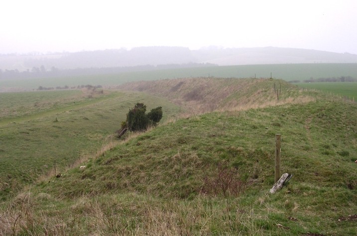
Bokerley Dyke submitted by JimChampion on 23rd Apr 2005. March 2005. Looking south along the sinuous Bokerley Dyke on a misty day with Hampshire on the left (the ditched side) and Dorset on the right. The Martin Down nature reserve is on the left and the field on the right contains the site of the Dorset Cursus northeastern terminal and two long barrows.
(View photo, vote or add a comment)
Log Text: None
Bokerley Dyke
Date Added: 19th Sep 2010
Site Type: Misc. Earthwork
Country: England (Dorset)
Visited: Yes on 23rd Apr 2005

Bokerley Dyke submitted by JimChampion on 23rd Apr 2005. March 2005. Looking south along the sinuous Bokerley Dyke on a misty day with Hampshire on the left (the ditched side) and Dorset on the right. The Martin Down nature reserve is on the left and the field on the right contains the site of the Dorset Cursus northeastern terminal and two long barrows.
(View photo, vote or add a comment)
Log Text: None
Boscawen Un
Date Added: 19th Sep 2010
Site Type: Stone Circle
Country: England (Cornwall)
Visited: Yes on 31st Dec 2004
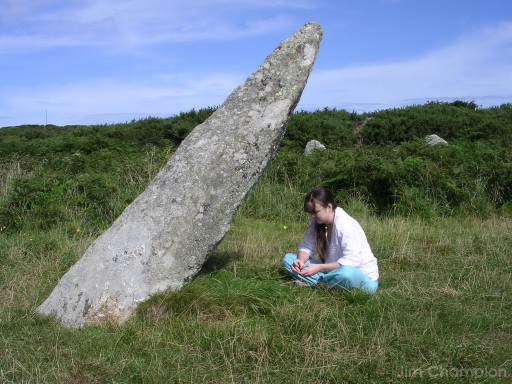
Boscawen Un submitted by JimChampion on 31st Dec 2004. Picture taken looking North on a hot August day, just before noon. The shadow cast by the 'gnomon' affords little shade.
(View photo, vote or add a comment)
Log Text: None
Boskednan A
Date Added: 19th Sep 2010
Site Type: Cairn
Country: England (Cornwall)
Visited: Yes on 1st Sep 2008
Boskednan A submitted by JimChampion on 1st Sep 2008. Kerb stones, I think, at the cairn at grid reference SW43263530, to the north-west of the Nine Maidens stone circle.
(View photo, vote or add a comment)
Log Text: None
Boskednan Menhir 2
Date Added: 19th Sep 2010
Site Type: Standing Stone (Menhir)
Country: England (Cornwall)
Visited: Yes on 31st Aug 2008
Boskednan Menhir 2 submitted by JimChampion on 31st Aug 2008. This triangular stone stands on the tumulus at grid reference SW43263530, to the north-west of the Nine Maidens stone circle. The ruin on the hill in the distance is the Greenburrow engine house at the Ding Dong mine.
(View photo, vote or add a comment)
Log Text: None
Boskednan stone circle
Date Added: 19th Sep 2010
Site Type: Stone Circle
Country: England (Cornwall)
Visited: Yes on 22nd Aug 2005

Boskednan stone circle submitted by JimChampion on 22nd Aug 2005. The portal stones illuminated by the last rays of the setting sun. The tallest one (on the left) has a diagonal groove present on this and the opposite side. The holes that the restored stones were raised from have been covered with pegged down foliage, presumably to encourage regrowth on the bare earth.
(View photo, vote or add a comment)
Log Text: None
Boslow Cross
Date Added: 19th Sep 2010
Site Type: Ancient Cross
Country: England (Cornwall)
Visited: Yes on 24th Oct 2007

Boslow Cross submitted by JimChampion on 24th Oct 2007. August 2007. The southern side of the Boslow Cross, alongside a grassy path.
(View photo, vote or add a comment)
Log Text: None
Bosullow Quoit
Date Added: 19th Sep 2010
Site Type: Modern Stone Circle etc
Country: England (Cornwall)
Visited: Yes on 12th Sep 2006

Bosullow Quoit submitted by JimChampion on 12th Sep 2006. This quoit-style roadside sculpture is much smaller than the ancient quoits found in its neighbourhood. The low angle makes it look bigger, and also hides the adjacent roads from view.
(View photo, vote or add a comment)
Log Text: None
Boswarthen Cross
Date Added: 19th Sep 2010
Site Type: Ancient Cross
Country: England (Cornwall)
Visited: Yes on 5th Jan 2008
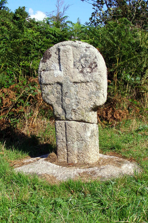
Boswarthen Cross submitted by JimChampion on 5th Jan 2008. August 2006. The north-western face of the cross, illuminated by bright summer afternoon sunshine.
(View photo, vote or add a comment)
Log Text: None
Bottlebush Down barrows
Date Added: 19th Sep 2010
Site Type: Barrow Cemetery
Country: England (Dorset)
Visited: Yes on 11th Jan 2009
Bottlebush Down barrows submitted by JimChampion on 11th Jan 2009. Round barrows on Bottlebush Down, viewed from the agger of the Ackling Dyke Roman road, towards Handley Cross.
(View photo, vote or add a comment)
Log Text: None
Bradford Peverell 2
Date Added: 19th Sep 2010
Site Type: Long Barrow
Country: England (Dorset)
Visited: Yes on 9th Apr 2006
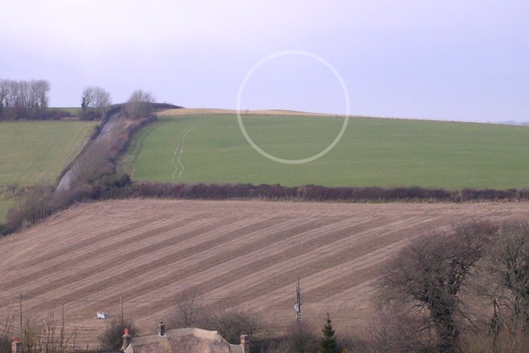
Bradford Peverell 2 submitted by JimChampion on 9th Apr 2006. Boxing Day 2005. Looking northwest towards the long barrow from the course of the Roman aqueduct at SY675914. I have circled the lump on the horizon which is all that remains of this barrow (looking at almost end-on). According to the Magic map there are several round barrows below in the green field.
(View photo, vote or add a comment)
Log Text: None
Bratton Camp
Date Added: 19th Sep 2010
Site Type: Hillfort
Country: England (Wiltshire)
Visited: Yes on 25th Apr 2007
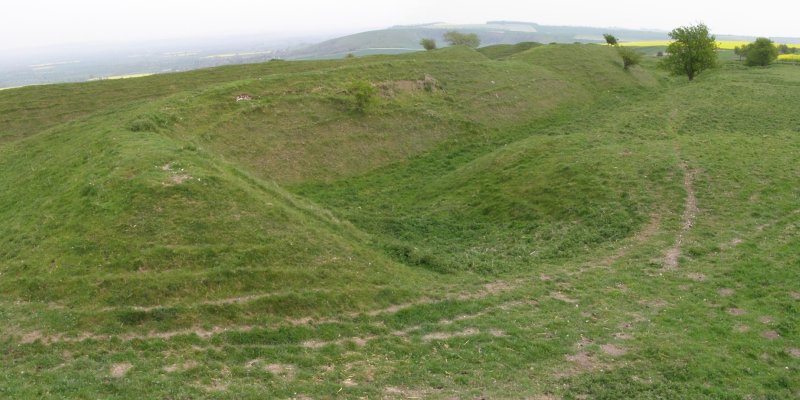
Bratton Camp submitted by JimChampion on 25th Apr 2007. A view of the southeast corner of Bratton Camp. The two banks are roughly the same height here on the gently sloping hill. In the foreground a path enters the hillfort (to the left) through one of the original entrances. This is a two-photo composite image, which explains some of the some of the distortion towards the edges.
(View photo, vote or add a comment)
Log Text: None
Bratton Long Barrow
Date Added: 19th Sep 2010
Site Type: Long Barrow
Country: England (Wiltshire)
Visited: Yes on 25th Apr 2007
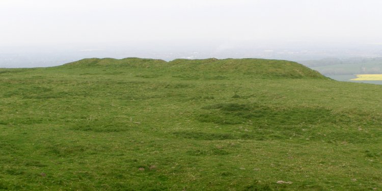
Bratton Long Barrow submitted by JimChampion on 25th Apr 2007. The Bratton Camp long barrow, viewed from the southeast. The barrow mound is long and very lumpy.
(View photo, vote or add a comment)
Log Text: None
Breamore Miz-Maze
Date Added: 19th Sep 2010
Site Type: Turf Maze
Country: England (Hampshire)
Visited: Yes on 30th May 2005

Breamore Miz-Maze submitted by JimChampion on 30th May 2005. May 2005. A composite image of the miz maze, taken from the vantage point of a tree stump to the north of the maze. It is in very good condition, and this is probably because of its relatively remote location and surrounding fence.
(View photo, vote or add a comment)
Log Text: None
