Contributory members are able to log private notes and comments about each site
Sites JimChampion has logged. View this log as a table or view the most recent logs from everyone
Hengistbury Head
Date Added: 19th Sep 2010
Site Type: Promontory Fort / Cliff Castle
Country: England (Dorset)
Visited: Yes on 21st Jan 2007

Hengistbury Head submitted by JimChampion on 21st Jan 2007. Two-photo composite of the double dykes, viewed from the beach end (rather than the Christchurch harbour end). The ditch has filled in somewhat in the intervening 2000 years. The dykes are now fenced off to reduce wear and tear from visitors' feet. There are some new information boards around the site as well.
(View photo, vote or add a comment)
Log Text: None
Rainbarrows
Date Added: 19th Sep 2010
Site Type: Round Barrow(s)
Country: England (Dorset)
Visited: Yes on 10th Apr 2007
submitted by on .
(View photo, vote or add a comment)
Log Text: None
Grey Mare Processional Way
Date Added: 19th Sep 2010
Site Type: Multiple Stone Rows / Avenue
Country: England (Dorset)
Visited: Yes on 17th Apr 2007
Grey Mare Processional Way submitted by JimChampion on 17th Apr 2007. June 2006. This stone lies alongside the footpath that approaches the Kingston Russell stone circle from the southeast, grid reference is approximately SY582873. It is possibly also called the "Goddess stone" (by Peter Knight) - this once is certainly moss covered. It would be easy to miss it in summer when the nettles etc. are high.
(View photo, vote or add a comment)
Log Text: None
Parsonage Hill
Date Added: 19th Sep 2010
Site Type: Long Barrow
Country: England (Dorset)
Visited: Yes on 28th Jul 2007

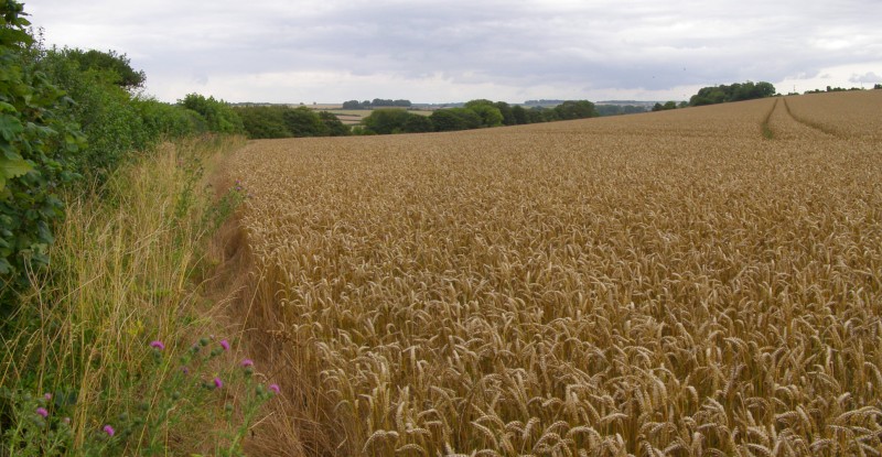
Parsonage Hill submitted by JimChampion on 28th Jul 2007. According to the map, the Parsonage Hill barrow should be here somewhere, in the foreground. I think its safe to say that it has been destroyed (or at least all obvious traces have been removed) by deep ploughing.
(View photo, vote or add a comment)
Log Text: None
Hambledon Hill south long barrow
Date Added: 19th Sep 2010
Site Type: Long Barrow
Country: England (Dorset)
Visited: Yes on 3rd Nov 2007

Hambledon Hill south long barrow submitted by JimChampion on 3rd Nov 2007. July 2007. Looking north along the reconstructed oval mound of this long barrow. It is just to the south of the neolithic enclosure on the summit of Hambledon Hill (in the background). There is a cross-dyke just to the south of the barrow that defends the approach to the summit from the Hanford spur of Hambledon Hill.
(View photo, vote or add a comment)
Log Text: None
Longlands barrow cemetery
Date Added: 19th Sep 2010
Site Type: Barrow Cemetery
Country: England (Dorset)
Visited: Yes on 26th Nov 2007

Longlands barrow cemetery submitted by JimChampion on 26th Nov 2007. Looking up from the Broadstone on the verge of the A35, towards one of the barrows in the Longlands cemetery. Sheep grazing. Rain.
(View photo, vote or add a comment)
Log Text: None
Wardstone Barrow
Date Added: 19th Sep 2010
Site Type: Round Barrow(s)
Country: England (Dorset)
Visited: Yes on 31st Dec 2007

Wardstone Barrow submitted by JimChampion on 31st Dec 2007. Looking north towards the Wardstone Barrow. The track on the right leads to Chideock Farm, and is a permissive footpath. There was originally another barrow in the field to the right, but it is destroyed. Presumably the wooden posts around this one mark the limit of the scheduled ancient monument.
It was a very grey and dull Christmas Eve, this was the only decent photo that I took of the site!
(View photo, vote or add a comment)
Log Text: None
Chaldon Down
Date Added: 19th Sep 2010
Site Type: Barrow Cemetery
Country: England (Dorset)
Visited: Yes on 3rd Jan 2008

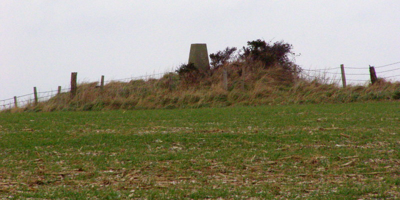
Chaldon Down submitted by JimChampion on 3rd Jan 2008. Christmas Eve 2007. Looking to the north-east towards the bowl barrow at grid reference SY78318125. This barrow is 14 metres in diameter and up to 1 metre in height, although it has been truncated on its northern side by the construction of a small covered reservoir. The barrow is on the very highest point of Chaldon Down, with views over the sea to the south and the heaths to the north. It is also hard to ignore the concrete Ordnance Survey triangulation pillar on top of the barrow mound.
(View photo, vote or add a comment)
Log Text: None
Scrubbity Barrows
Date Added: 19th Sep 2010
Site Type: Barrow Cemetery
Country: England (Dorset)
Visited: Yes on 6th Jan 2008
Scrubbity Barrows submitted by JimChampion on 6th Jan 2008. Looking north-east at the largest of the Scrubbity Barrows. It is nearly 2 metres tall and the mound is very overgrown with brambles and bushes. The other barrows are out of sight on the far side of a deer fence it Scrubbity Coppice. This one is alongside the track/footpath.
(View photo, vote or add a comment)
Log Text: None
Mistlebury
Date Added: 19th Sep 2010
Site Type: Hillfort
Country: England (Dorset)
Visited: Yes on 6th Jan 2008
Mistlebury submitted by JimChampion on 6th Jan 2008. On the northern side of Mistlebury, looking east. A causeway crosses the ditch from left to right, entering the fort (on the right) through a gap in the bank.
(View photo, vote or add a comment)
Log Text: None
Ballard Down
Date Added: 19th Sep 2010
Site Type: Round Barrow(s)
Country: England (Dorset)
Visited: Yes on 13th Apr 2008
Ballard Down submitted by JimChampion on 13th Apr 2008. The eastern bowl barrow, located at grid reference SZ03998130. The bridleway passes to the left, then through the gate on the left. The stone on the left side of the barrow is a footpath marker.
The mound is 15 metres in diameter and about 1 metre tall. It was partially excavated by J H Austen in 1857. The remains of a primary inhumation and secondary infant inhumation associated with animal bones and an urn were identified. The upper part of an inverted collared urn associated with pieces...
(View photo, vote or add a comment)
Log Text: None
The Harp Stone
Date Added: 19th Sep 2010
Site Type: Standing Stone (Menhir)
Country: England (Dorset)
Visited: Yes on 19th Apr 2008
The Harp Stone submitted by JimChampion on 19th Apr 2008. The Harp Stone is in the hedge in the foreground, on the far side of the field. In the distance the keep of Corfe Castle dominates the gap in the chalk ridge of the Purbeck Hills.
(View photo, vote or add a comment)
Log Text: None
Swyre Head
Date Added: 19th Sep 2010
Site Type: Round Barrow(s)
Country: England (Dorset)
Visited: Yes on 26th Apr 2008
Swyre Head submitted by JimChampion on 26th Apr 2008. Approaching the barrow at Swyre Head along the bridleway from the north-west (Kimmeridge and Smedmore Hill).
(View photo, vote or add a comment)
Log Text: None
Wimborne St Giles
Date Added: 19th Sep 2010
Site Type: Round Barrow(s)
Country: England (Dorset)
Visited: Yes on 6th Jul 2008
Wimborne St Giles submitted by JimChampion on 6th Jul 2008. The round barrow at grid reference SU03931217, viewed from the field gate on the B3081 road to the north.
(View photo, vote or add a comment)
Log Text: None
High Lea Farm
Date Added: 19th Sep 2010
Site Type: Barrow Cemetery
Country: England (Dorset)
Visited: Yes on 6th Jul 2008

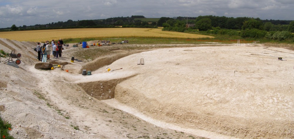
High Lea Farm submitted by JimChampion on 6th Jul 2008. The excavated round barrow at High Lea Farm, part of Bournemouth University's "Knowlton Prehistoric Landscape Project'. Seen from the spoil heap on the open day (Sunday 29 June 2008). The site was being prepared for mast-cam photographs two days later.
This is a composite image from two photographs.
(View photo, vote or add a comment)
Log Text: None
Bottlebush Down barrows
Date Added: 19th Sep 2010
Site Type: Barrow Cemetery
Country: England (Dorset)
Visited: Yes on 11th Jan 2009
Bottlebush Down barrows submitted by JimChampion on 11th Jan 2009. Round barrows on Bottlebush Down, viewed from the agger of the Ackling Dyke Roman road, towards Handley Cross.
(View photo, vote or add a comment)
Log Text: None
Agglestone
Date Added: 19th Sep 2010
Site Type: Natural Stone / Erratic / Other Natural Feature
Country: England (Dorset)
Visited: Yes on 5th Jun 2009
Agglestone submitted by JimChampion on 5th Jun 2009. Approaching the Agglestone along the sandy path from the high ground to the south-west.
(View photo, vote or add a comment)
Log Text: None
The King Barrow (Isle of Purbeck)
Date Added: 19th Sep 2010
Site Type: Round Barrow(s)
Country: England (Dorset)
Visited: Yes on 4th Jun 2010
The King Barrow (Isle of Purbeck) submitted by JimChampion on 4th Jun 2010. The King Barrow is the grassy mound in the centre of the photo. Apologies for the quality, this is a tightly-cropped photo taken through the heat haze from over half a km away, up on Ballard Down (just north of the trig pillar).
(View photo, vote or add a comment)
Log Text: None
The Ulwell Barrow
Date Added: 19th Sep 2010
Site Type: Round Barrow(s)
Country: England (Dorset)
Visited: Yes on 4th Jun 2010

The Ulwell Barrow submitted by JimChampion on 4th Jun 2010. Two-photo panorama of the Ulwell Barrow and the obelisk. The path to the right of the barrow continues up to the highest part of Ballard Down and then onwards along the ridge towards the end of the Purbeck Hills at Ballard Point.
(View photo, vote or add a comment)
Log Text: None
Badbury Rings
Date Added: 19th Sep 2010
Site Type: Hillfort
Country: England (Dorset)
Visited: Yes on 11th Jun 2010
Badbury Rings submitted by JimChampion on 11th Jun 2010. The cattle in the foreground were grazing the large field that includes the rings of Badbury. Beyond are the three round barrows alongside the track to the main car park.
(View photo, vote or add a comment)
Log Text: None
