Contributory members are able to log private notes and comments about each site
Sites JimChampion has logged. View this log as a table or view the most recent logs from everyone
Flower's Barrow
Date Added: 19th Sep 2010
Site Type: Hillfort
Country: England (Dorset)
Visited: Yes on 5th Jun 2005

Flower's Barrow submitted by JimChampion on 5th Jun 2005. June 2005. Looking across to Flower's barrow cliff fort from Mupe bay. A patch of sunlight is illuminating the hill and the outline of the ramparts can be made out against the sky. The right hand side of the fort is disappearing into the sea! We had walked far enough to get to this point, keeping on going to Flower's barrow was out of the question. Not an easy site to access!
(View photo, vote or add a comment)
Log Text: None
Figsbury Rings
Date Added: 19th Sep 2010
Site Type: Hillfort
Country: England (Wiltshire)
Visited: Yes on 23rd Jan 2005
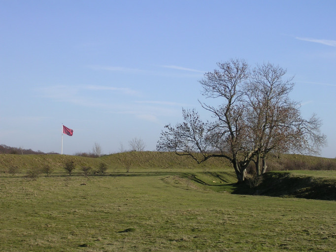
Figsbury Rings submitted by JimChampion on 23rd Jan 2005. January 2005. Looking at the NE section of the ramparts from within the rings. The highest portion of the rampart is visible behind the ash trees growing in the inner ditch. These are the only significant trees within the rings, which are now grazed to conserve the chalk grassland habitat. The red flag is a warning that the neighbouring MOD range is in use. From the ring you get an amazing view of the MOD's impact on the modern landscape north-east of Salisbury.
(View photo, vote or add a comment)
Log Text: None
Ferny Knap tumuli
Date Added: 19th Sep 2010
Site Type: Round Barrow(s)
Country: England (Hampshire)
Visited: Yes on 26th Jun 2006
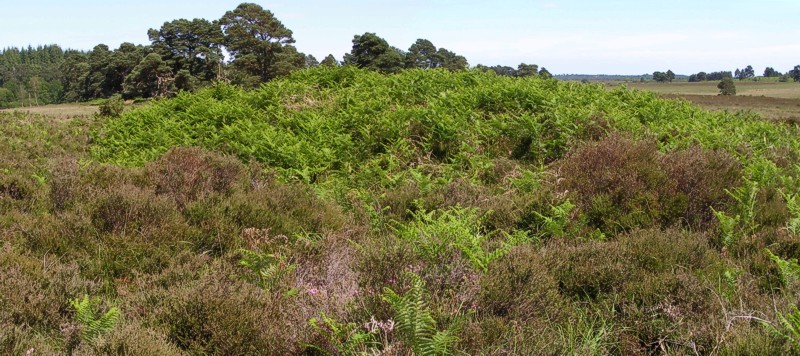
Ferny Knap tumuli submitted by JimChampion on 26th Jun 2006. A composite photo of the Ferny Knap bowl barrow. The mound is almost 2m high and is quite obvious on the featureless heath. Its companion, the bell barrow, is not as prominent and didn't want to be photographed today.
(View photo, vote or add a comment)
Log Text: None
Faulkland
Date Added: 19th Sep 2010
Site Type: Standing Stones
Country: England (Somerset)
Visited: Yes on 28th May 2007
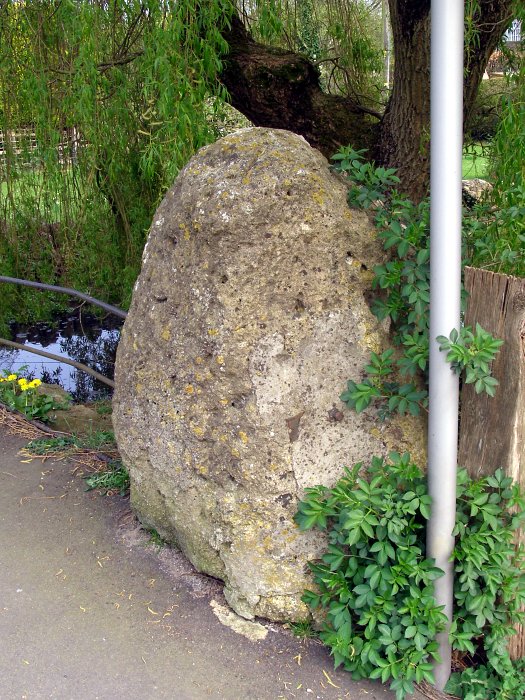
Faulkland submitted by JimChampion on 28th May 2007. A large stone by the pavement on the south side of the A366 road, beneath a willow tree alongside the village pond. Grid reference ST7388954534.
(View photo, vote or add a comment)
Log Text: None
Farley Mount
Date Added: 19th Sep 2010
Site Type: Round Barrow(s)
Country: England (Hampshire)
Visited: Yes on 29th May 2005

Farley Mount submitted by JimChampion on 29th May 2005. May 2005. The mound and 18th century obelisk from the northeast. An Iron Age enclosure occupied the land between here and the obelisk, although modern ploughing has removed much of the ditch and banks from view. The obelisk has been recently restored and gleams white in the sunlight: it was quite noticeable on this same afternoon from Danebury hillfort over 11 km away.
(View photo, vote or add a comment)
Log Text: None
Duck's Nest
Date Added: 19th Sep 2010
Site Type: Long Barrow
Country: England (Hampshire)
Visited: Yes on 30th May 2005
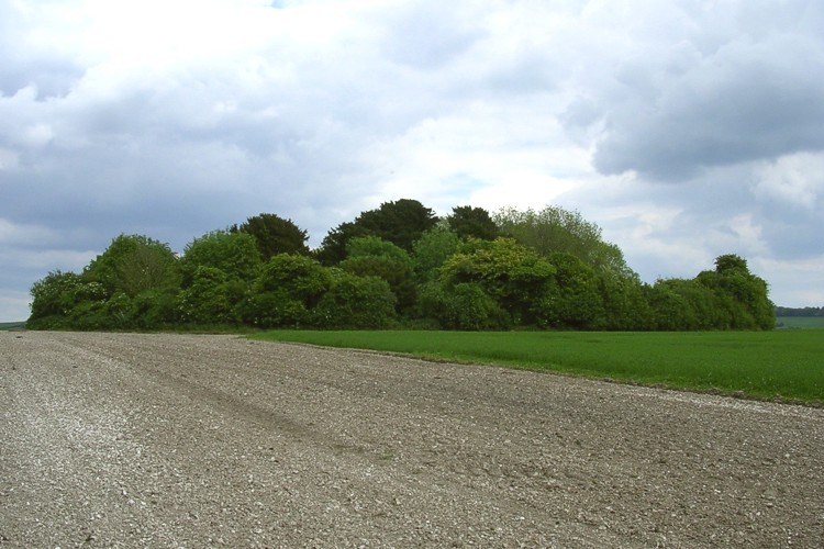
Duck's Nest submitted by JimChampion on 30th May 2005. May 2005. Looking east at the tree-covered profile of the Duck's Nest long barrow. Its got an unusual name, but I don't know the reason why...
(View photo, vote or add a comment)
Log Text: None
Dry Tree Menhir
Date Added: 19th Sep 2010
Site Type: Standing Stone (Menhir)
Country: England (Cornwall)
Visited: Yes on 15th Aug 2007
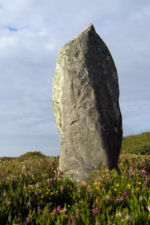
Dry Tree Menhir submitted by JimChampion on 15th Aug 2007. A low-angle view of the menhir, in its gorsey surroundings. I didn't previously know that this was here, but earlier in the day we'd been on the tour of the neighbouring Goonhilly Earth Station (a bit expensive for a lot of BT hype, but you can get buy-one-get-one-free vouchers from various leaflets and local papers) and on the bus tour of the site the guide pointed out the menhir and the surrounding round barrows.
(View photo, vote or add a comment)
Log Text: None
Dragon Hill
Date Added: 19th Sep 2010
Site Type: Natural Stone / Erratic / Other Natural Feature
Country: England (Oxfordshire)
Visited: Yes on 25th Sep 2006
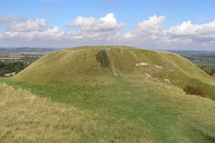
Dragon Hill submitted by JimChampion on 25th Sep 2006. The flat-topped mound from alongside the road. The grass to the left of the steps has been recently reinstated and covered with netting to give it a chance to recover.
(View photo, vote or add a comment)
Log Text: None
Dorset Cursus
Date Added: 19th Sep 2010
Site Type: Cursus
Country: England (Dorset)
Visited: Yes on 31st Mar 2005
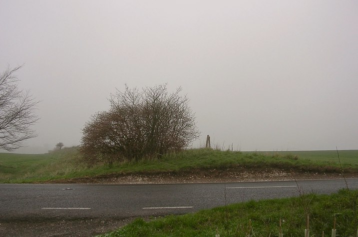
Dorset Cursus submitted by JimChampion on 31st Mar 2005. A cross-section of the southern bank of the cursus where it crosses the B3081 road (at grid ref SU018159) on Bottlebush Down. There are no such visible remains of the northern bank which crosses the road about 100m to the northwest. This slight bank is one of the few surviving parts of the neolithic cursus which once stretched for 6 miles along the undulating chalk downlands of Cranborne Chase.
(View photo, vote or add a comment)
Log Text: None
Dibden Bottom
Date Added: 19th Sep 2010
Site Type: Barrow Cemetery
Country: England (Hampshire)
Visited: Yes on 16th Jul 2008
Dibden Bottom submitted by JimChampion on 16th Jul 2008. Looking east towards the barrows, with the heath of Dibden Bottom beyond. The barrows are very low, but noticeable due to their location on a low promontory and the bracken that covers them (with nothing but heather surrounding them).
(View photo, vote or add a comment)
Log Text: None
Devil's Humps Barrows
Date Added: 19th Sep 2010
Site Type: Barrow Cemetery
Country: England (West Sussex)
Visited: Yes on 26th Apr 2008
Devil's Humps Barrows submitted by JimChampion on 26th Apr 2008. View north-east along the ridge of Bow Hill from the cross dyke, showing the Devil's Humps barrows. The two barrows on the left are bell barrows, and those further on are bowl barrows.
(View photo, vote or add a comment)
Log Text: None
Danebury Ring
Date Added: 19th Sep 2010
Site Type: Hillfort
Country: England (Hampshire)
Visited: Yes on 23rd Jan 2005

Danebury Ring submitted by JimChampion on 23rd Jan 2005. January 2005. View of Danebury's entrance from the nearby OS trig-point. The outer rampart on the southern side (to the left of the picture) is still wooded with beech trees, although the inner ramparts have been cleared.
(View photo, vote or add a comment)
Log Text: None
Danby Beacon
Date Added: 19th Sep 2010
Site Type: Round Barrow(s)
Country: England (Yorkshire (North))
Visited: Yes on 30th Jul 2009
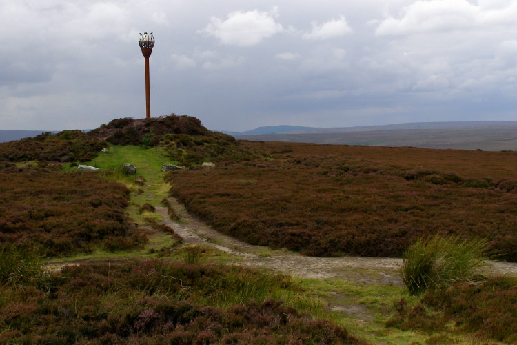
Danby Beacon submitted by JimChampion on 30th Jul 2009. The mound on the left is the Bronze Age burial mound re-used in more modern times as Danby Beacon. The beacon sculpture on the barrow was erected the Danby Beacon Trust in 2008, and first lit on the anniversary of Nelson's victory at the Battle of Trafalgar. The top of Beacon Hill, beyond the barrow, was the site of a major Second World War radar station.
(View photo, vote or add a comment)
Log Text: None
Damerham Knoll Camp
Date Added: 19th Sep 2010
Site Type: Hillfort
Country: England (Hampshire)
Visited: Yes on 30th May 2005
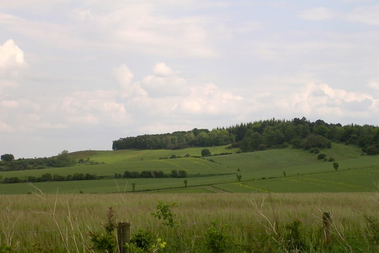
Damerham Knoll Camp submitted by JimChampion on 30th May 2005. May 2005. Looking south at Damerham Knoll from Toyd Down. The Iron Age camp is beneath the trees illuminated by a patch of sunlight - it is not on the very highest point of the knoll (where the trees are highest). The nearest trees on the knoll form the "Bokerley Dyke planation", although Bokerley Dyke itself is quite a few miles distant to the west.
(View photo, vote or add a comment)
Log Text: None
Culliford Tree
Date Added: 19th Sep 2010
Site Type: Barrow Cemetery
Country: England (Dorset)
Visited: Yes on 24th Apr 2005
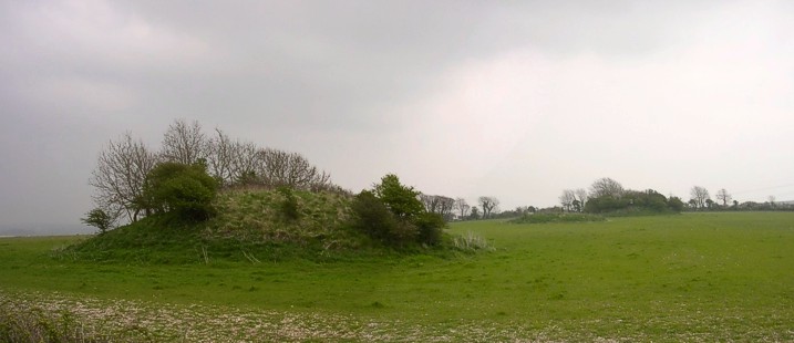
Culliford Tree submitted by JimChampion on 24th Apr 2005. April 2005. Looking east from Whitcombe Lane at an alignement of three round barrows in the Came Wood cemetery. The impressive Broadmayne bank barrow is on the same alignment, just the other side of the hedge. The ominous clouds signal the arrival of heavy rain.
(View photo, vote or add a comment)
Log Text: None
Creeg Tol
Date Added: 19th Sep 2010
Site Type: Rock Outcrop
Country: England (Cornwall)
Visited: Yes on 29th Aug 2008
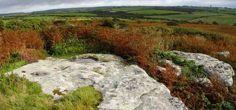
Creeg Tol submitted by JimChampion on 29th Aug 2008. View south-west from Creeg Tol, with the rock outcrop and basin(?) in the foreground. The dip in the horizon to the left is at Lamorna, the tower on the horizon to the right is St Buryan. The Boscawen-Un stone circle is a short distance to the south-east, just off to the left of this photo. This is a composite image from two photographs.
(View photo, vote or add a comment)
Log Text: None
Corfe Common
Date Added: 19th Sep 2010
Site Type: Barrow Cemetery
Country: England (Dorset)
Visited: Yes on 19th Aug 2006
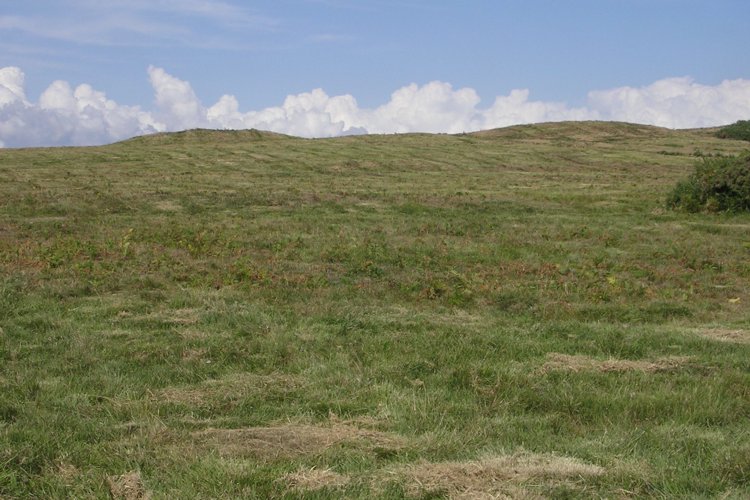
Corfe Common submitted by JimChampion on 19th Aug 2006. The two round barrows at SY964804 on the middle part of Corfe Common between the B3069 and A351 roads. The part of the common to the west of the B3069, which has many tumuli, is grazed by cows - the part in this photo looks like it has been machine mowed. The barrows are organised linearly along the ridge through the middle of the common, which is crossed by later hollow ways.
(View photo, vote or add a comment)
Log Text: None
Corfe Castle West Hill barrows
Date Added: 19th Sep 2010
Site Type: Round Barrow(s)
Country: England (Dorset)
Visited: Yes on 20th Aug 2006

Corfe Common submitted by JimChampion on 20th Aug 2006. A broad view of Corfe from the south, showing the Castle Hill between West Hill (left) and East Hill (right). There are round barrows on the summits of West and East Hills, and a linear cemetery of round barrows on Corfe Common (the area seen in front of the village, above the drystone wall).
(View photo, vote or add a comment)
Log Text: None
Clitters Cairn
Date Added: 19th Sep 2010
Site Type: Cairn
Country: England (Cornwall)
Visited: Yes on 27th Oct 2007
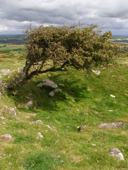
Clitters Cairn submitted by JimChampion on 27th Oct 2007. August 2007. This thorn tree protrudes from the rubble of Clitters Cairn. The hollow (on the right) in the centre of the cairn was created by antiquarian digging. Now the combination of tree and a 1 metre deep dip makes a good place for sheep to shelter on the bare moor.
(View photo, vote or add a comment)
Log Text: None
Cley Hill
Date Added: 19th Sep 2010
Site Type: Hillfort
Country: England (Wiltshire)
Visited: Yes on 16th Apr 2007

Cley Hill submitted by JimChampion on 16th Apr 2007. A three-photo composite of Cley Hill, from "Little Cley Hill" to the northeast, connected to the main hill by a saddle. This is an impressive piece of geomorphology, a chalk outlier of Salisbury Plain, with some human-added trimmings (the ramparts, lynchets and barrows).
(View photo, vote or add a comment)
Log Text: None
