Contributory members are able to log private notes and comments about each site
Sites JimChampion has logged. View this log as a table or view the most recent logs from everyone
St Levan's Well
Date Added: 19th Sep 2010
Site Type: Holy Well or Sacred Spring
Country: England (Cornwall)
Visited: Yes on 29th Aug 2008
St Levan's Well submitted by JimChampion on 29th Aug 2008. The back of St Levan's Well, in its spectacular setting above Porthchapel cove.
(View photo, vote or add a comment)
Log Text: None
St Michael's Mount
Date Added: 19th Sep 2010
Site Type: Ancient Village or Settlement
Country: England (Cornwall)
Visited: Yes on 1st Jan 2005

St Michael's Mount submitted by JimChampion on 1st Jan 2005. August 2004. "Diodorus Sicululs, the Greek historian writing in 70 CE called this island Ictis, and it was from here that Cornish tin was traded with Mediterranean countries." [from Celtic Britain by Homer Sykes, 1997]
(View photo, vote or add a comment)
Log Text: None
Stagbury Hill
Date Added: 19th Sep 2010
Site Type: Barrow Cemetery
Country: England (Hampshire)
Visited: Yes on 8th Jan 2005
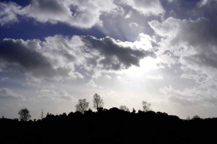
Stagbury Hill submitted by JimChampion on 8th Jan 2005. January 2005. Looking south at Stagbury Hill from Furzley Common. Winter sun streams through the clouds, the gorse and silver birch on the earthwork make an interesting sillhouette.
(View photo, vote or add a comment)
Log Text: None
Stockbridge Down Bowl Barrows
Date Added: 19th Sep 2010
Site Type: Round Barrow(s)
Country: England (Hampshire)
Visited: Yes on 25th Jan 2005

Stockbridge Down Bowl Barrows submitted by JimChampion on 25th Jan 2005. January 2005. A view of the largest bowl barrow on Stockbridge Down, looking south. It is not very high, and has a fairly recent (and tasteful) fence protecting it.
(View photo, vote or add a comment)
Log Text: None
Stockbridge Down field boundary
Date Added: 19th Sep 2010
Site Type: Misc. Earthwork
Country: England (Hampshire)
Visited: Yes on 25th Jan 2005

Stockbridge Down field boundary submitted by JimChampion on 25th Jan 2005. January 2005. Looking north-east along the bivallate field boundary on Stockbridge down. The earthworks curve to the left, and the south-facing ramparts of Woolbury hillfort can be seen in the distance. The earthworks are well preserved but difficult to photograph, especially on this dim rainy winter afternoon.
(View photo, vote or add a comment)
Log Text: None
Stocks farm long barrow
Date Added: 19th Sep 2010
Site Type: Long Barrow
Country: England (Hampshire)
Visited: Yes on 19th Feb 2005
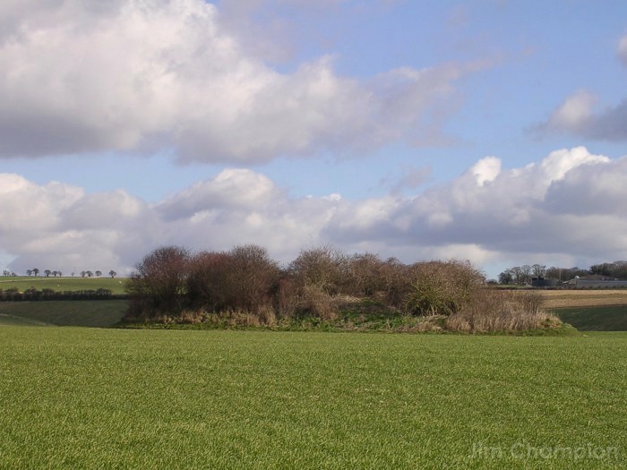
Stocks farm long barrow submitted by JimChampion on 19th Feb 2005. View of the "Giant's grave" barrow, as close as you can get without standing on private property.
(View photo, vote or add a comment)
Log Text: None
Stonehenge.
Date Added: 19th Sep 2010
Site Type: Stone Circle
Country: England (Wiltshire)
Visited: Yes on 4th Apr 2005
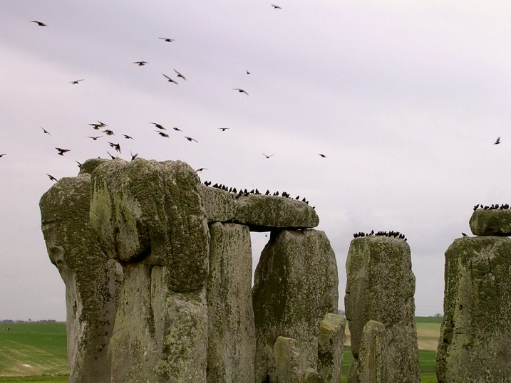
Stonehenge. submitted by JimChampion on 4th Apr 2005. 4 April 2005: like something from "The Birds" huge numbers of starlings swoop around Stonehenge and settle on the stones. Some birds of the crow family (not sure which ones) are busy making their nests in holes in the trilithons.
(View photo, vote or add a comment)
Log Text: None
Stoney Littleton
Date Added: 19th Sep 2010
Site Type: Chambered Cairn
Country: England (Somerset)
Visited: Yes on 18th Apr 2007
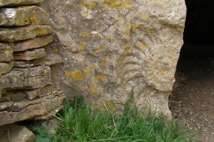
Stoney Littleton submitted by JimChampion on 18th Apr 2007. The famous ammonite cast, on the left-hand lintel of the entrance. Seen on the Portal meet 15 April 2007.
(View photo, vote or add a comment)
Log Text: None
Stowe's Pound
Date Added: 19th Sep 2010
Site Type: Ancient Village or Settlement
Country: England (Cornwall)
Visited: Yes on 31st Aug 2006
Stowe's Pound submitted by JimChampion on 31st Aug 2006. Remains of the rocky enclosure wall on top of Stowe's Hill known as Stowes Pound. The information on the displays at Minions village describe it as a neolithic inclosure. This view looks across the Tamar Valley towards Dartmoor.
(View photo, vote or add a comment)
Log Text: None
Strodgemoor Barrow
Date Added: 19th Sep 2010
Site Type: Round Barrow(s)
Country: England (Hampshire)
Visited: Yes on 17th Jul 2007
Strodgemoor Barrow submitted by JimChampion on 17th Jul 2007. Looking south along the eastern side of the barrow. The ditch is clearly visible in the foreground, curving off to the right. In the distance is Cranes Moor and Kingston Great Common.
(View photo, vote or add a comment)
Log Text: None
Sutton Down long barrow
Date Added: 19th Sep 2010
Site Type: Long Barrow
Country: England (Wiltshire)
Visited: Yes on 6th May 2007
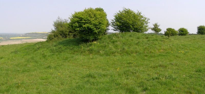
Sutton Down long barrow submitted by JimChampion on 6th May 2007. Two-photo composite image of the long barrow on Sutton Down. In the distance, to the left of the barrow, is the chalk scarp which is home to the Fovant Regimental Badges and Chiselbury hillfort.
(View photo, vote or add a comment)
Log Text: None
Sweet Track
Date Added: 19th Sep 2010
Site Type: Ancient Trackway
Country: England (Somerset)
Visited: Yes on 9th Aug 2006

Sweet Track submitted by JimChampion on 9th Aug 2006. The southern half of the course of the Sweet Track runs through Shapwick Heath NNR, which is open to the public - leaflets and maps are available from the English Nature office next to the Peat Moors Centre. This photo shows one of the interpretative boards (with braille) explaining what the track was, how it was discovered and how its remains are being protected today. A modern-day track runs alongside (visible bottom right) - it is made from recycled plastic bottles.
(View photo, vote or add a comment)
Log Text: None
Swyre Head
Date Added: 19th Sep 2010
Site Type: Round Barrow(s)
Country: England (Dorset)
Visited: Yes on 26th Apr 2008
Swyre Head submitted by JimChampion on 26th Apr 2008. Approaching the barrow at Swyre Head along the bridleway from the north-west (Kimmeridge and Smedmore Hill).
(View photo, vote or add a comment)
Log Text: None
Telegraph Hill Bowl Barrow
Date Added: 19th Sep 2010
Site Type: Round Barrow(s)
Country: England (Hampshire)
Visited: Yes on 19th Mar 2005
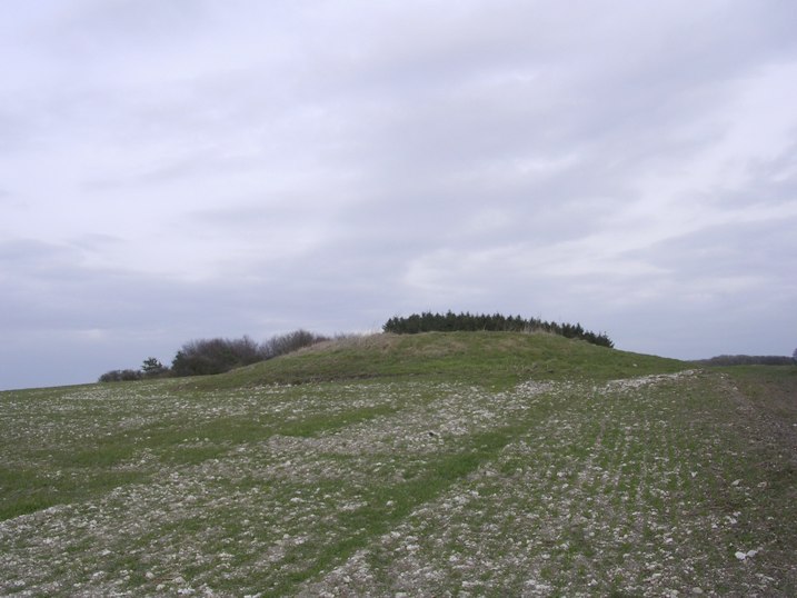
Telegraph Hill Bowl Barrow submitted by JimChampion on 19th Mar 2005. March 2005. The Telegraph Hill bowl barrow from the south with the trees of the Telegraph Hill plantation behind.
(View photo, vote or add a comment)
Log Text: None
Tenants Hill enclosure
Date Added: 19th Sep 2010
Site Type: Ancient Village or Settlement
Country: England (Dorset)
Visited: Yes on 3rd Jun 2006

Tenants Hill enclosure submitted by JimChampion on 3rd Jun 2006. The medieval dew pond on Tenants Hill, confusing labeled as a "hut circle" on the Ordnance Survey maps. Strong afternoon sunshine is not best for bringing out these earthwork features, but there is different vegetation growing in the pond (nettles?). The bank behind the pond is the southern side of the Bronze Age enclosure. In the distance (center) is Long Barrow Hill.
(View photo, vote or add a comment)
Log Text: None
Testwood Lakes
Date Added: 19th Sep 2010
Site Type: Museum
Country: England (Hampshire)
Visited: Yes on 5th May 2007
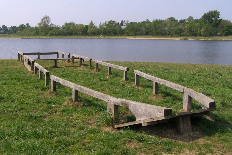
Testwood Lakes submitted by JimChampion on 5th May 2007. Part of a bronze age boat was discovered during the excavation of Meadow Lake, the most northerly in the Testwood Lakes complex. This photo shows a 'replica' of the kind of boat that the find came from. A plaque on the side of the boat reads 'Boats of this type were once used to cross the English Channel 3500 years ago. They were made of oak planks sewn together with twisted yew bark. The remains of a Bronze Age boat like this were found during the construction of the lakes in 1996.' The River B...
(View photo, vote or add a comment)
Log Text: None
The Devil's Bed and Bolster
Date Added: 19th Sep 2010
Site Type: Chambered Tomb
Country: England (Somerset)
Visited: Yes on 18th Apr 2007
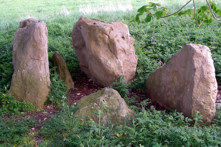
The Devil's Bed and Bolster submitted by JimChampion on 18th Apr 2007. Stones at what was presumably the entrance to the chambered tomb. They seem to have a faintly pink hue in this photo - they were partially illuminated by camera flash in the shade of the trees. Seen on the Portal meet 15 April 2007, thanks to Hamish's directions and TheCaptain's keen observations.
(View photo, vote or add a comment)
Log Text: None
The Dongas
Date Added: 19th Sep 2010
Site Type: Ancient Trackway
Country: England (Hampshire)
Visited: Yes on 23rd Jan 2005
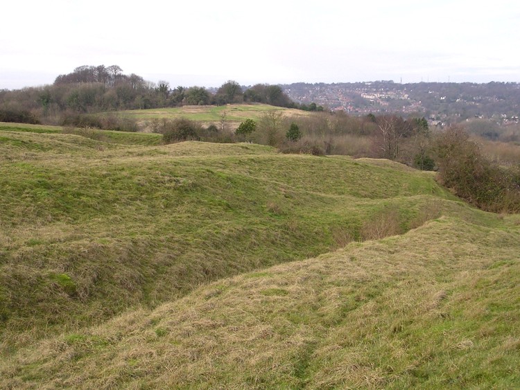
The Dongas submitted by JimChampion on 23rd Jan 2005. January 2005. The 'Dongas' trackways in the foreground, steep sided gulleys running NW towards Winchester (seen in the distance). The hillfort on St Catherine's Hill can be seen on the left.
(View photo, vote or add a comment)
Log Text: None
The Harp Stone
Date Added: 19th Sep 2010
Site Type: Standing Stone (Menhir)
Country: England (Dorset)
Visited: Yes on 19th Apr 2008
The Harp Stone submitted by JimChampion on 19th Apr 2008. The Harp Stone is in the hedge in the foreground, on the far side of the field. In the distance the keep of Corfe Castle dominates the gap in the chalk ridge of the Purbeck Hills.
(View photo, vote or add a comment)
Log Text: None
The Hurlers
Date Added: 19th Sep 2010
Site Type: Stone Circle
Country: England (Cornwall)
Visited: Yes on 16th Aug 2007
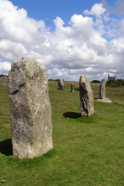
The Hurlers submitted by JimChampion on 16th Aug 2007. Stones in the southern part of the central stone circle on a very agreeable summer's afternoon. The concrete setting of one is clearly visible. If you approach the stone circles along the well-worn path from the car park then these are the first three standing stones that you come across. In the distance the old engine house is home to the Minions Heritage Centre.
(View photo, vote or add a comment)
Log Text: None
