Contributory members are able to log private notes and comments about each site
Sites JimChampion has logged. View this log as a table or view the most recent logs from everyone
Little Butser
Date Added: 19th Sep 2010
Site Type: Ancient Village or Settlement
Country: England (Hampshire)
Visited: Yes on 15th May 2005

Little Butser submitted by JimChampion on 15th May 2005. May 2005. A panoramic view of Little Butser, looking east from the much higher neighbouring northerly spur of Butser Hill. Cross dykes separate the Little Butser spur from Butser Hill proper (to the right).
The town in the distance is Petersfield and the A3 runs very close by. You can't miss Butser Hill as you drive south on the A3: its the massive one with a mast on top.
(View photo, vote or add a comment)
Log Text: None
Farley Mount
Date Added: 19th Sep 2010
Site Type: Round Barrow(s)
Country: England (Hampshire)
Visited: Yes on 29th May 2005

Farley Mount submitted by JimChampion on 29th May 2005. May 2005. The mound and 18th century obelisk from the northeast. An Iron Age enclosure occupied the land between here and the obelisk, although modern ploughing has removed much of the ditch and banks from view. The obelisk has been recently restored and gleams white in the sunlight: it was quite noticeable on this same afternoon from Danebury hillfort over 11 km away.
(View photo, vote or add a comment)
Log Text: None
Woolbury
Date Added: 19th Sep 2010
Site Type: Hillfort
Country: England (Hampshire)
Visited: Yes on 29th May 2005

Woolbury submitted by JimChampion on 29th May 2005. May 2005. Looking north from yet another Beacon Hill - this time in the Farley Mount country park. Woolbury hillfort can be seen in the middle distance, about 4 miles away. The visible southern side is gentle slope (Stockbridge Downs) but the far side is much steeper. It is also possible to see the heavily defended Danebury hillfort from this spot, but it was lost in the haze on this particular afternoon. The patchy sunlight makes interesting luminous patterns on the fields below.
(View photo, vote or add a comment)
Log Text: None
Whitsbury
Date Added: 19th Sep 2010
Site Type: Hillfort
Country: England (Hampshire)
Visited: Yes on 30th May 2005
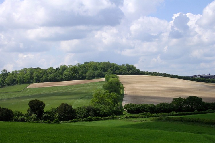
Whitsbury submitted by JimChampion on 30th May 2005. May 2005. Looking east across the dry valley at Whitsbury hillfort - its ramparts are hidden beneath the dense tree cover. The defences on the hill were first constructed in the early Iron Age, and were reinforced in medieval times. The grassy bank running up the centre of the photo is a medieval boundary earthwork. A Bronze Age boundary earthwork (Grim's Ditch) runs underneatht the hillfort but little remains of it at the surface in this area.
(View photo, vote or add a comment)
Log Text: None
Duck's Nest
Date Added: 19th Sep 2010
Site Type: Long Barrow
Country: England (Hampshire)
Visited: Yes on 30th May 2005
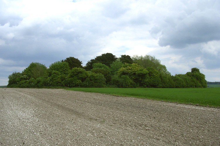
Duck's Nest submitted by JimChampion on 30th May 2005. May 2005. Looking east at the tree-covered profile of the Duck's Nest long barrow. Its got an unusual name, but I don't know the reason why...
(View photo, vote or add a comment)
Log Text: None
Damerham Knoll Camp
Date Added: 19th Sep 2010
Site Type: Hillfort
Country: England (Hampshire)
Visited: Yes on 30th May 2005
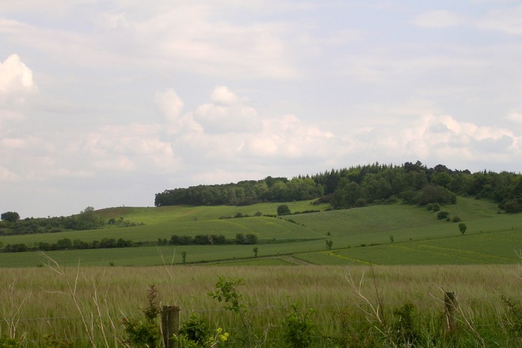
Damerham Knoll Camp submitted by JimChampion on 30th May 2005. May 2005. Looking south at Damerham Knoll from Toyd Down. The Iron Age camp is beneath the trees illuminated by a patch of sunlight - it is not on the very highest point of the knoll (where the trees are highest). The nearest trees on the knoll form the "Bokerley Dyke planation", although Bokerley Dyke itself is quite a few miles distant to the west.
(View photo, vote or add a comment)
Log Text: None
Giants Grave (Breamore)
Date Added: 19th Sep 2010
Site Type: Long Barrow
Country: England (Hampshire)
Visited: Yes on 30th May 2005
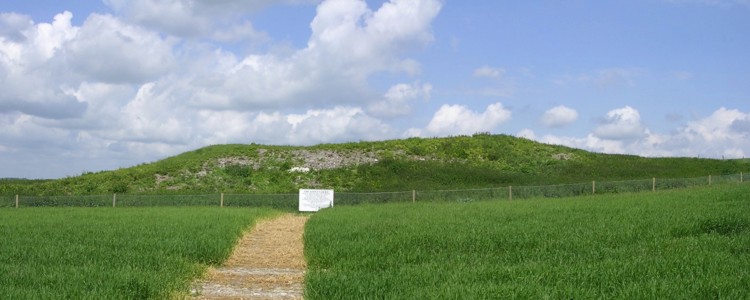
Giants Grave (Breamore) submitted by JimChampion on 30th May 2005. May 2005. Looking north at the Breamore Giant's Grave long barrow, with its new rabbit-proof-fence and sign which asks you to respect the monument and stay outside the perimeter fence. The axis of the barrow points uphill, which is unusual round these parts.
(View photo, vote or add a comment)
Log Text: None
Breamore Miz-Maze
Date Added: 19th Sep 2010
Site Type: Turf Maze
Country: England (Hampshire)
Visited: Yes on 30th May 2005

Breamore Miz-Maze submitted by JimChampion on 30th May 2005. May 2005. A composite image of the miz maze, taken from the vantage point of a tree stump to the north of the maze. It is in very good condition, and this is probably because of its relatively remote location and surrounding fence.
(View photo, vote or add a comment)
Log Text: None
Grans Barrow
Date Added: 19th Sep 2010
Site Type: Long Barrow
Country: England (Hampshire)
Visited: Yes on 30th May 2005

Grans Barrow submitted by JimChampion on 30th May 2005. May 2005. Looking SE at the Grans Barrow from the end of the nearby Knap Barrow. Two birdwatchers are in situ. The overhead power cables just make it into the picture.
(View photo, vote or add a comment)
Log Text: None
Woodbury Hill (Dorset)
Date Added: 19th Sep 2010
Site Type: Hillfort
Country: England (Dorset)
Visited: Yes on 5th Jun 2005

Woodbury Hill (Dorset) submitted by JimChampion on 5th Jun 2005. Here's the eastern bank of Woodbury's defences: but where's the ditch? The answer is that there used to be a second, outer rampart, but this was quarried away for its gravel. The remains of the outer rampart and the infilled ditch form a broad terrace on the eastern side of the hillfort.
(View photo, vote or add a comment)
Log Text: None
Poundbury
Date Added: 19th Sep 2010
Site Type: Hillfort
Country: England (Dorset)
Visited: Yes on 5th Jun 2005

Poundbury submitted by JimChampion on 5th Jun 2005. Looking south across the Frome valley at the ramparts of Poundbury hillfort. You can see its rectangular perimeter in this composite picture - no wonder the Romans liked the site. Parts of modern Dorchester can be seen poking out e.g. the keep-like military museum is on the left. (The line in the sky is a power cable that I couldn't get away from).
(View photo, vote or add a comment)
Log Text: None
Flower's Barrow
Date Added: 19th Sep 2010
Site Type: Hillfort
Country: England (Dorset)
Visited: Yes on 5th Jun 2005

Flower's Barrow submitted by JimChampion on 5th Jun 2005. June 2005. Looking across to Flower's barrow cliff fort from Mupe bay. A patch of sunlight is illuminating the hill and the outline of the ramparts can be made out against the sky. The right hand side of the fort is disappearing into the sea! We had walked far enough to get to this point, keeping on going to Flower's barrow was out of the question. Not an easy site to access!
(View photo, vote or add a comment)
Log Text: None
Beaulieu Heath (East)
Date Added: 19th Sep 2010
Site Type: Round Barrow(s)
Country: England (Hampshire)
Visited: Yes on 8th Jun 2005

Beaulieu Heath (East) submitted by JimChampion on 8th Jun 2005. Bowl barrow on Beaulieu Heath East at grid reference SU411036, looking SE at sunset. The stacks of Fawley refinery and the pylons from Calshot power station are a very modern backdrop to this ancient barrow.
(View photo, vote or add a comment)
Log Text: None
Frankenbury
Date Added: 19th Sep 2010
Site Type: Hillfort
Country: England (Hampshire)
Visited: Yes on 10th Jun 2005

Frankenbury submitted by JimChampion on 10th Jun 2005. Looking southeast across the Avon floodplain at the tree-covered Frankenbury promontory. The trees restrict the view from the hillfort, but in Iron Age times the slopes would no doubt have been cleared for an improved view over the valley below.
(View photo, vote or add a comment)
Log Text: None
Ladle Hill
Date Added: 19th Sep 2010
Site Type: Hillfort
Country: England (Hampshire)
Visited: Yes on 13th Jun 2005
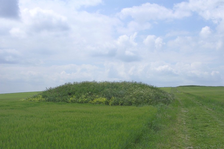
Ladle Hill submitted by JimChampion on 13th Jun 2005. Looking west at the Ladle Hill bell barrow beside the Wayfarer's Walk path on the way up to the hillfort. This scheduled barrow is nearly 20m in diameter and up to 1.6m high. Apparently there was once a saucer barrow on the other side of this barrow, but no visible traces of it remain.
(View photo, vote or add a comment)
Log Text: None
Nuthanger Down
Date Added: 19th Sep 2010
Site Type: Round Barrow(s)
Country: England (Hampshire)
Visited: Yes on 13th Jun 2005

Nuthanger Down submitted by JimChampion on 13th Jun 2005. The Nuthanger Down bowl barrow. The overgrown bell barrow is on the other side. Part of a horse jump is peeking in on the left. We had our lunch here, with excellent views over Hampshire to the south (and possibly the Isle of Wight?).
(View photo, vote or add a comment)
Log Text: None
Flowerdown Barrows
Date Added: 19th Sep 2010
Site Type: Barrow Cemetery
Country: England (Hampshire)
Visited: Yes on 14th Jun 2005
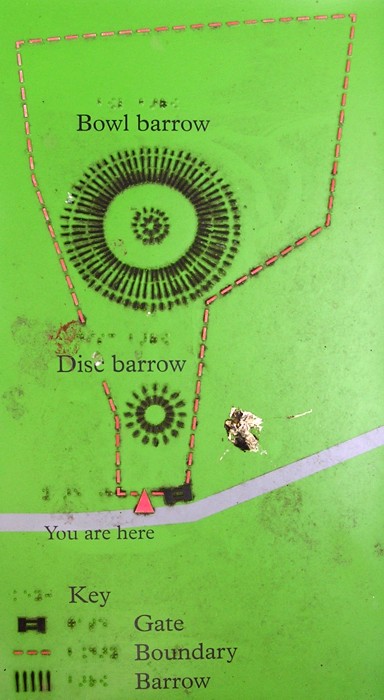
Flowerdown Barrows submitted by JimChampion on 14th Jun 2005. A plan of the Flowerdown barrows, courtesy of the English Heritage sign at the site. For the pedants reading this: the written labels on the barrows are the wrong way round (the large one is in fact the disc barrow). I've no idea if the braille labels are also incorrect.
(View photo, vote or add a comment)
Log Text: None
Yew Tree Heath
Date Added: 19th Sep 2010
Site Type: Round Barrow(s)
Country: England (Hampshire)
Visited: Yes on 4th Jul 2005
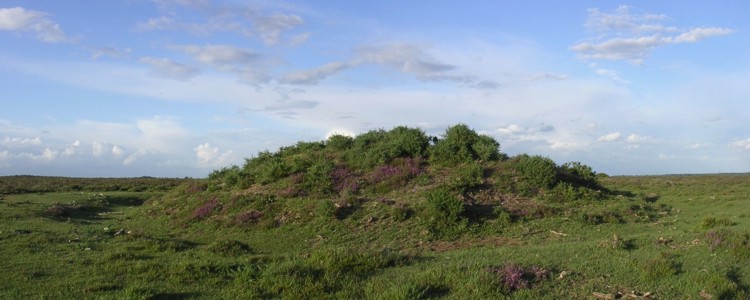
Yew Tree Heath submitted by JimChampion on 4th Jul 2005. Evening; composite image of the largest Yew Tree Heath bowl barrow at SU358065.
(View photo, vote or add a comment)
Log Text: None
Inkpen Long Barrow
Date Added: 19th Sep 2010
Site Type: Long Barrow
Country: England (Berkshire)
Visited: Yes on 24th Jul 2005

Inkpen Long Barrow submitted by JimChampion on 24th Jul 2005. A view of the east end of the barrow against the backdrop of rainclouds on a showery summer afternoon. The macarbe double-gibbet makes the site easy to find from the valley below. The erosion due to people walking the length of the barrow is visible in this picture: the info board says that various measures have been taken to try and limit wear and tear by the visitors to this great viewpoint.
(View photo, vote or add a comment)
Log Text: None
Maiden Castle Barrow Cemetery
Date Added: 19th Sep 2010
Site Type: Barrow Cemetery
Country: England (Dorset)
Visited: Yes on 26th Jul 2005
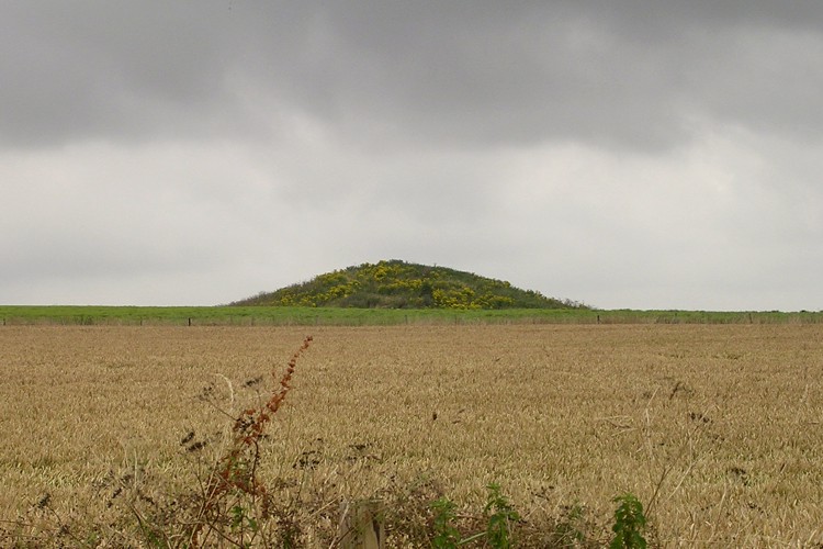
Maiden Castle Barrow Cemetery submitted by JimChampion on 26th Jul 2005. Looking north at the most prominent barrow of the cemetery, from the edge of the Maiden Castle visitors' car park. The barrow can also be seen from the nearby Dorchester by-pass, a few weeks earlier I was passing by and the barrow seemed to be stood amid a sea of blue cornflower.
(View photo, vote or add a comment)
Log Text: None
