Contributory members are able to log private notes and comments about each site
Sites JimChampion has logged. View this log as a table or view the most recent logs from everyone
Trink Hill
Date Added: 19th Sep 2010
Site Type: Round Barrow(s)
Country: England (Cornwall)
Visited: Yes on 29th Aug 2008
Trink Hill submitted by JimChampion on 29th Aug 2008. The triangulation pillar on Trink Hill, which stands on top of the remains of a tumulus. The hill in the middle distance, beyond the farm buildings, is Trencrom Hill - topped with the remains of an Iron Age hillfort/settlement.
(View photo, vote or add a comment)
Log Text: None
Truthwall Common barrows
Date Added: 19th Sep 2010
Site Type: Round Barrow(s)
Country: England (Cornwall)
Visited: Yes on 24th Oct 2007
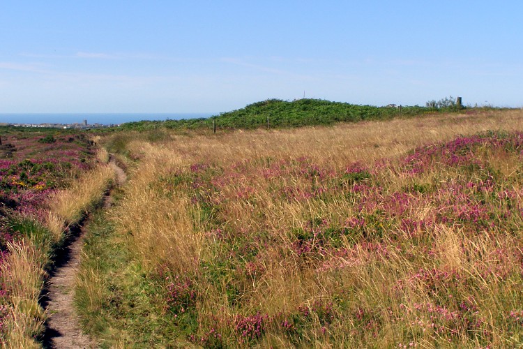
Truthwall Common barrows submitted by JimChampion on 24th Oct 2007. August 2007. The green bracken-covered mound is a round barrow at grid reference SW38903257. The path on the left leads from the Kenidjack Common holed stones to the Tregeseal East stone circle. In the distance (towards the left) is the small town of St Just.
(View photo, vote or add a comment)
Log Text: None
Twyford Down monument
Date Added: 19th Sep 2010
Site Type: Modern Stone Circle etc
Country: England (Hampshire)
Visited: Yes on 23rd Jan 2005
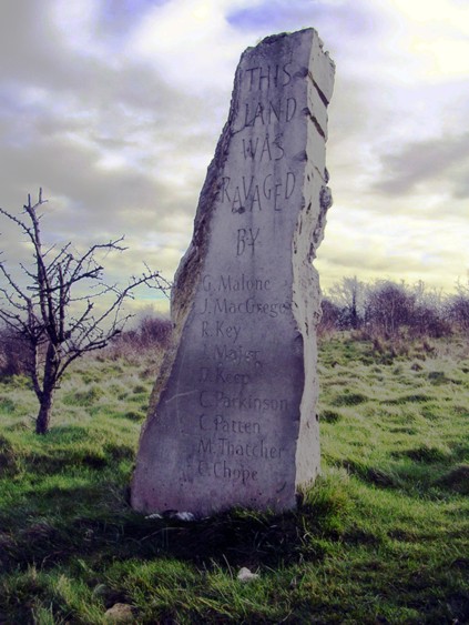
Twyford Down monument submitted by JimChampion on 23rd Jan 2005. January 2005. The modern standing stone overlooking the M3 cutting through Twyford Down and the 'Dongas' ancient trackway. The names of those accused of ravaging the land are inscribed. [The image is colour adjusted: gives it an 'illustrated' look]
(View photo, vote or add a comment)
Log Text: None
Twyford stone circle
Date Added: 19th Sep 2010
Site Type: Stone Circle
Country: England (Hampshire)
Visited: Yes on 5th Jun 2006

Twyford stone circle submitted by JimChampion on 5th Jun 2006. A view of the church of St Mary the Virgin at Twyford (Hampshire) looking southeast from Berry Lane. The present building dates from 1878, but there is supposed to be a stone circle beneath the original Norman tower's foundations.
(View photo, vote or add a comment)
Log Text: None
Uffington Castle
Date Added: 19th Sep 2010
Site Type: Hillfort
Country: England (Oxfordshire)
Visited: Yes on 25th Sep 2006
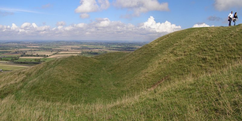
Uffington Castle submitted by JimChampion on 25th Sep 2006. Panoramic view of the western side of the hillfort, looking north from the original entrance. The fort is in a very lofty location above the patchwork fields of the Vale of the White Horse.
(View photo, vote or add a comment)
Log Text: None
Uffington White Horse
Date Added: 19th Sep 2010
Site Type: Hill Figure or Geoglyph
Country: England (Oxfordshire)
Visited: Yes on 31st Dec 2004
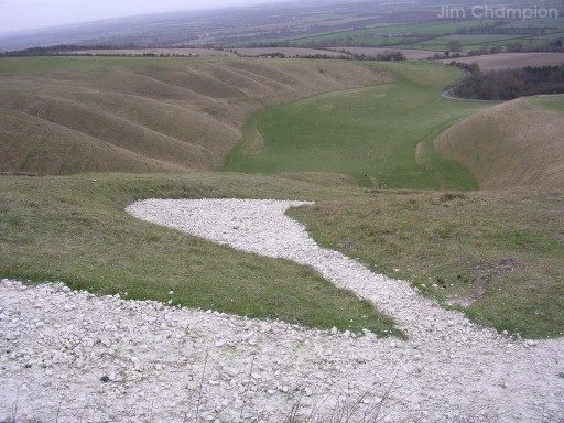
Uffington White Horse submitted by JimChampion on 31st Dec 2004. December 2004. An view from above the White Horse, looking down its hind leg towards the rippling Manger valley.
(View photo, vote or add a comment)
Log Text: None
Vernditch Chase (North)
Date Added: 19th Sep 2010
Site Type: Long Barrow
Country: England (Wiltshire)
Visited: Yes on 27th Jan 2008

Vernditch Chase (North) submitted by JimChampion on 27th Jan 2008. Composite image, from two separate photographs. Viewing the wasted barrow mound from the south-west.
(View photo, vote or add a comment)
Log Text: None
Vernditch Chase (South)
Date Added: 19th Sep 2010
Site Type: Long Barrow
Country: England (Hampshire)
Visited: Yes on 18th Apr 2005
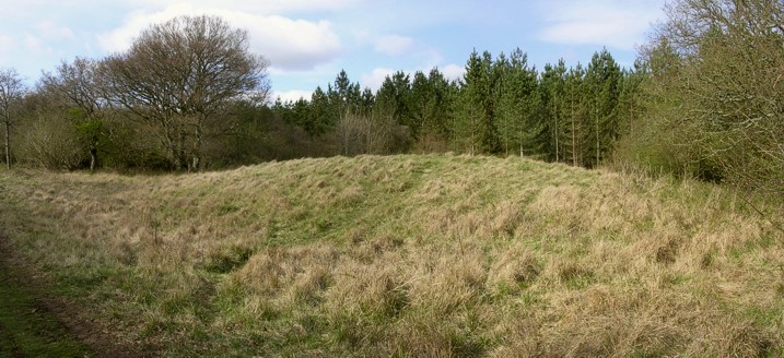
Vernditch Chase (South) submitted by JimChampion on 18th Apr 2005. April 2005. Composite view of the western side of the Vernditch Chase (South) long barrow.
(View photo, vote or add a comment)
Log Text: None
Wardstone Barrow
Date Added: 19th Sep 2010
Site Type: Round Barrow(s)
Country: England (Dorset)
Visited: Yes on 31st Dec 2007

Wardstone Barrow submitted by JimChampion on 31st Dec 2007. Looking north towards the Wardstone Barrow. The track on the right leads to Chideock Farm, and is a permissive footpath. There was originally another barrow in the field to the right, but it is destroyed. Presumably the wooden posts around this one mark the limit of the scheduled ancient monument.
It was a very grey and dull Christmas Eve, this was the only decent photo that I took of the site!
(View photo, vote or add a comment)
Log Text: None
Wayland's Smithy
Date Added: 19th Sep 2010
Site Type: Long Barrow
Country: England (Oxfordshire)
Visited: Yes on 31st Dec 2004

Wayland's Smithy submitted by JimChampion on 31st Dec 2004. December 2004. This barrow has a somewhat sinister air, surrounded by leafless trees on a gloomy winter's day. The barrow itself is remarkably long, as can be seen in this photo, and is flanked by small upright stones.
(View photo, vote or add a comment)
Log Text: None
West Kennet Avenue
Date Added: 19th Sep 2010
Site Type: Multiple Stone Rows / Avenue
Country: England (Wiltshire)
Visited: Yes on 10th May 2005
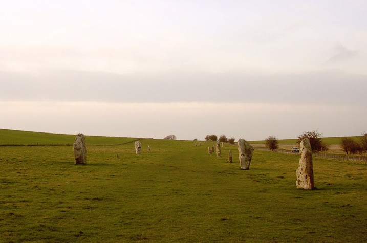
West Kennet Avenue submitted by JimChampion on 10th May 2005. February 2005. A popular view, but I like the quality of the light and colour in this particular picture with the the sun setting behind Walden Hill.
(View photo, vote or add a comment)
Log Text: None
West Kennett Long Barrow
Date Added: 19th Sep 2010
Site Type: Long Barrow
Country: England (Wiltshire)
Visited: Yes on 5th Apr 2005
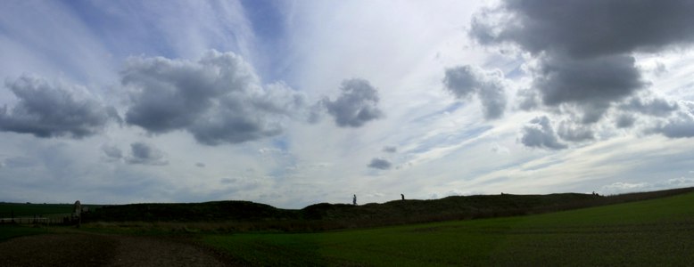
West Kennett Long Barrow submitted by JimChampion on 5th Apr 2005. April 2005. A long picture of a long barrow: composite of three photos showing the West Kennet Long Barrow in silhouette against the spring sunshine.
(View photo, vote or add a comment)
Log Text: None
Whispering Knights
Date Added: 19th Sep 2010
Site Type: Portal Tomb
Country: England (Oxfordshire)
Visited: Yes on 17th Feb 2005
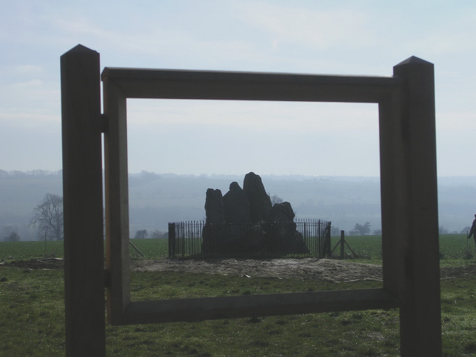
Whispering Knights submitted by JimChampion on 17th Feb 2005. February 2005. Work in progress at the Whispering Knights; an unfinished information board makes a natural frame for this wintry view of the stones.
(View photo, vote or add a comment)
Log Text: None
Whitcombe 1
Date Added: 19th Sep 2010
Site Type: Long Barrow
Country: England (Dorset)
Visited: Yes on 24th Apr 2005
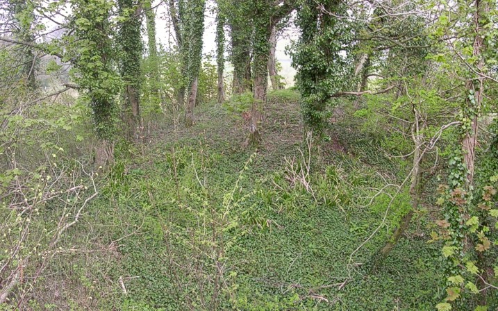
Whitcombe 1 submitted by JimChampion on 24th Apr 2005. April 2005. Not easy to photograph as the long barrow is overgrown in the corner of Came Wood. This is a view of the NE end of the barrow, with its overlying bowl barrow, taken from atop the roots of a fallen tree.
(View photo, vote or add a comment)
Log Text: None
Whitsbury
Date Added: 19th Sep 2010
Site Type: Hillfort
Country: England (Hampshire)
Visited: Yes on 30th May 2005
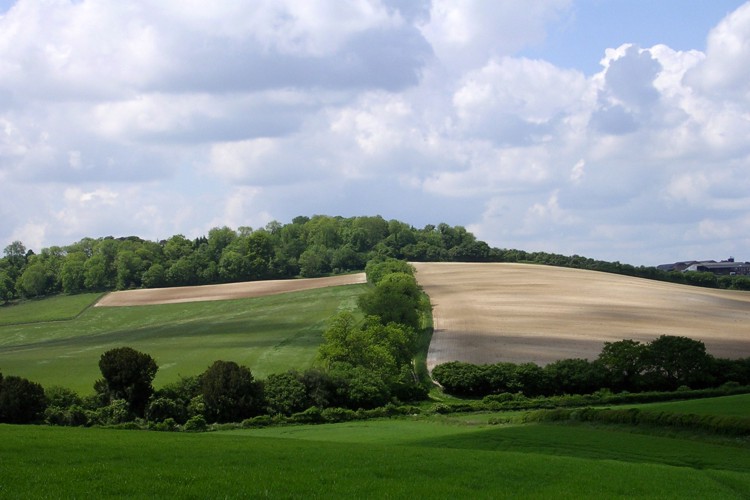
Whitsbury submitted by JimChampion on 30th May 2005. May 2005. Looking east across the dry valley at Whitsbury hillfort - its ramparts are hidden beneath the dense tree cover. The defences on the hill were first constructed in the early Iron Age, and were reinforced in medieval times. The grassy bank running up the centre of the photo is a medieval boundary earthwork. A Bronze Age boundary earthwork (Grim's Ditch) runs underneatht the hillfort but little remains of it at the surface in this area.
(View photo, vote or add a comment)
Log Text: None
Whitsbury Down
Date Added: 19th Sep 2010
Site Type: Long Barrow
Country: England (Wiltshire)
Visited: Yes on 26th Oct 2006
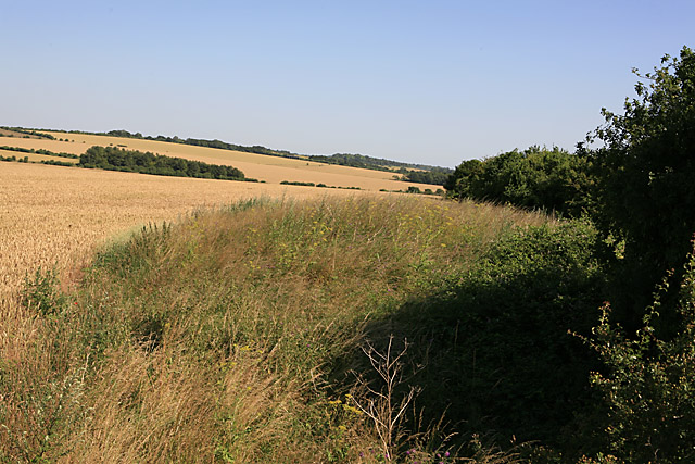
Whitsbury Down submitted by JimChampion on 26th Oct 2006. The barrow is separated from a byway by a high hedge and this is all I could see leaning over the fence. The view is along the back of the barrow. To get a better view one would need to revisit when the crop has been harvested.
(c) Peter Facey and licensed for reuse under this Creative Commons Licence: Attribution-ShareAlike 2.0
(View photo, vote or add a comment)
Log Text: None
Wimborne St Giles
Date Added: 19th Sep 2010
Site Type: Round Barrow(s)
Country: England (Dorset)
Visited: Yes on 6th Jul 2008
Wimborne St Giles submitted by JimChampion on 6th Jul 2008. The round barrow at grid reference SU03931217, viewed from the field gate on the B3081 road to the north.
(View photo, vote or add a comment)
Log Text: None
Woodbury Hill (Dorset)
Date Added: 19th Sep 2010
Site Type: Hillfort
Country: England (Dorset)
Visited: Yes on 5th Jun 2005

Woodbury Hill (Dorset) submitted by JimChampion on 5th Jun 2005. Here's the eastern bank of Woodbury's defences: but where's the ditch? The answer is that there used to be a second, outer rampart, but this was quarried away for its gravel. The remains of the outer rampart and the infilled ditch form a broad terrace on the eastern side of the hillfort.
(View photo, vote or add a comment)
Log Text: None
Wookey Hole Caves
Date Added: 19th Sep 2010
Site Type: Cave or Rock Shelter
Country: England (Somerset)
Visited: Yes on 26th Aug 2008
Wookey Hole Caves submitted by JimChampion on 26th Aug 2008. Fairly standard picture from one of the first caverns (The so-called Witch's Kitchen) at Wookey Hole caves. The water is the River Axe, which soon after this point emerges into the open. Bear in mind that the water level in the caves was raised by the construction of Wookey Hole mill in the 17th century (and even further back with the mill recorded in the Domesday Book). The caves were used by palaeolithic humans and again by people in the Iron Age. In the past hundred years they have been devel...
(View photo, vote or add a comment)
Log Text: None
Wookey Hole Caves Museum
Date Added: 19th Sep 2010
Site Type: Museum
Country: England (Somerset)
Visited: Yes on 26th Aug 2008
Wookey Hole Caves Museum submitted by JimChampion on 26th Aug 2008. I encountered this palaeolithic hunter-gatherer in the "Dinosaur Valley" at Wookey Hole. Hopefully it doesn't reinforce the idea that 'cavemen' co-existed with dinosaurs. His beard is looking a little green.
(View photo, vote or add a comment)
Log Text: None
