Contributory members are able to log private notes and comments about each site
Sites JimChampion has logged. View this log as a table or view the most recent logs from everyone
Broadmayne Bank Barrow
Date Added: 19th Sep 2010
Site Type: Long Barrow
Country: England (Dorset)
Visited: Yes on 5th Apr 2005
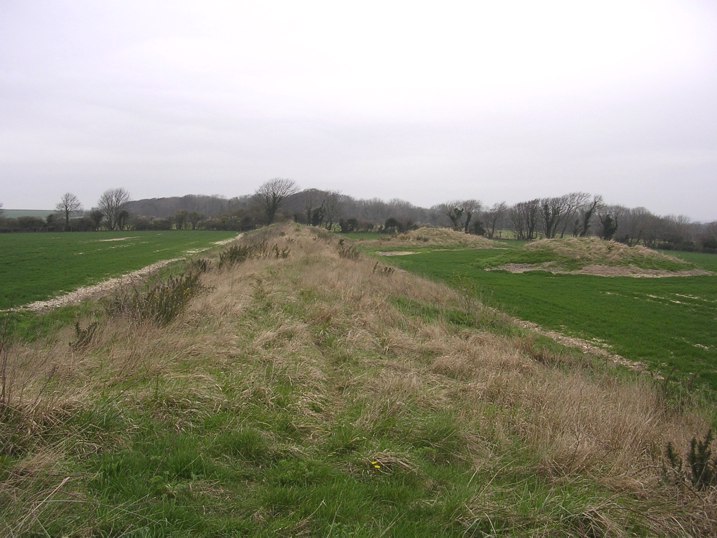
Broadmayne Bank Barrow submitted by JimChampion on 5th Apr 2005. Looking along the 600ft long bank barrow from the E end. Two neighboring round barrows are visible on the right, with Came Wood (home to a Bronze Age round barrow cemetery) on the horizon.
(View photo, vote or add a comment)
Log Text: None
Bronkham Hill
Date Added: 19th Sep 2010
Site Type: Barrow Cemetery
Country: England (Dorset)
Visited: Yes on 28th Dec 2006
Bronkham Hill submitted by JimChampion on 28th Dec 2006. Looking ESE at the prominent barrow at grid reference SY62358717. This field on top of Bronkham Hill is well-grazed by sheep - some of which can be seen to the right of the barrow next to their feeder. In the foreground there are many sheep footprints in the soil.
(View photo, vote or add a comment)
Log Text: None
Buckland Rings
Date Added: 19th Sep 2010
Site Type: Ancient Village or Settlement
Country: England (Hampshire)
Visited: Yes on 12th Mar 2005

Buckland Rings submitted by JimChampion on 12th Mar 2005. A view along the southern edge of the earthworks: the triple banks are quite densely wooded with beech and oak.
(View photo, vote or add a comment)
Log Text: None
Bury Hill (Hampshire)
Date Added: 19th Sep 2010
Site Type: Hillfort
Country: England (Hampshire)
Visited: Yes on 23rd Jan 2005

Bury Hill (Hampshire) submitted by JimChampion on 23rd Jan 2005. January 2005. View looking north from the western portion of the ditch between the two ramparts. The ditch is wide and deep, with plenty of yew, silver birch and beech trees. The ditch on the eastern side is less heavily wooded, and churned up by farm machinery. Plenty of wildlife here, but little in the way of pre-historic remains.
(View photo, vote or add a comment)
Log Text: None
Butser Ancient Farm
Date Added: 19th Sep 2010
Site Type: Museum
Country: England (Hampshire)
Visited: Yes on 1st May 2005

Butser Ancient Farm submitted by JimChampion on 1st May 2005. April 2005. The backside of one of the larger roundhouses at Butser Ancient Farm.
(View photo, vote or add a comment)
Log Text: None
Butser Hill
Date Added: 19th Sep 2010
Site Type: Ancient Village or Settlement
Country: England (Hampshire)
Visited: Yes on 1st May 2005
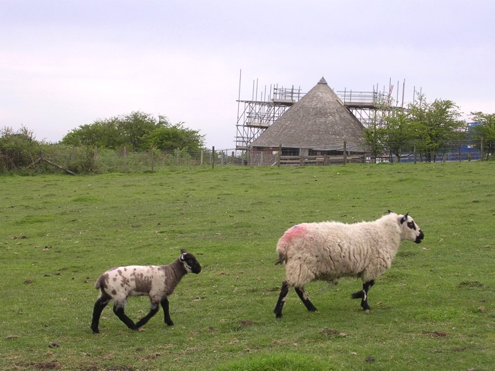
Butser Hill submitted by JimChampion on 1st May 2005. April 2005. On the left, the bank of one of the defensive earthworks on Butser Hill. In the foreground, sheep: the hill was home to a prehistoric farm and is still grazed by livestock. Dominating the picture: a modern tribute to the Iron Age roundhouse (covered with scaffolding) which houses the toilets between the car park and picnic area. Not quite as authentic as the buildings at the nearby Butser Ancient Farm.
(View photo, vote or add a comment)
Log Text: None
Buxbury Hill
Date Added: 19th Sep 2010
Site Type: Round Barrow(s)
Country: England (Wiltshire)
Visited: Yes on 6th May 2007
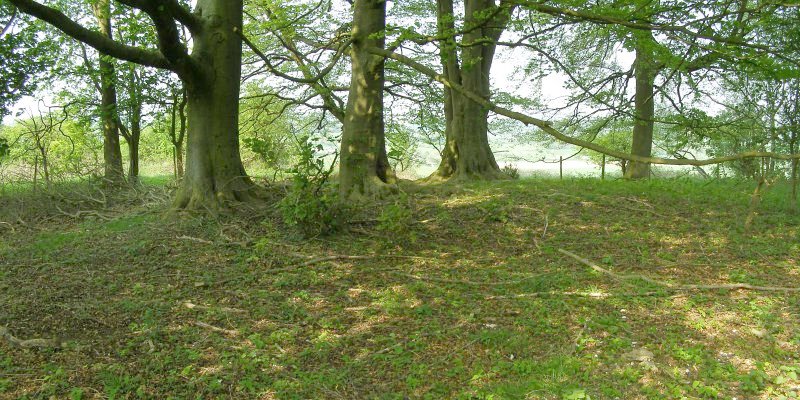
Buxbury Hill submitted by JimChampion on 6th May 2007. The Buxbury Barrow, barely recognisable under the beech trees on the edge of this wooded area on top of Buxbury Hill. This is a two-photo composite image of the site.
(View photo, vote or add a comment)
Log Text: None
Carn Euny Fogou
Date Added: 19th Sep 2010
Site Type: Souterrain (Fogou, Earth House)
Country: England (Cornwall)
Visited: Yes on 1st Jan 2005
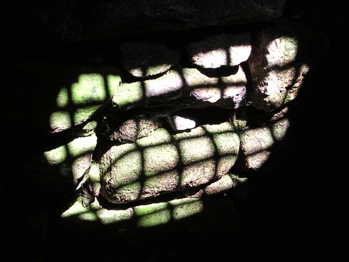
Carn Euny Fogou submitted by JimChampion on 1st Jan 2005. August 2004. This picture shows sunlight on the wall of the underground round chamber at Carn Euny. The shadow is cast by a grille in the centre of the roof. The chamber is pleasantly cool on this hot summers day.
(View photo, vote or add a comment)
Log Text: None
Carn Gluze
Date Added: 19th Sep 2010
Site Type: Chambered Cairn
Country: England (Cornwall)
Visited: Yes on 31st Dec 2004
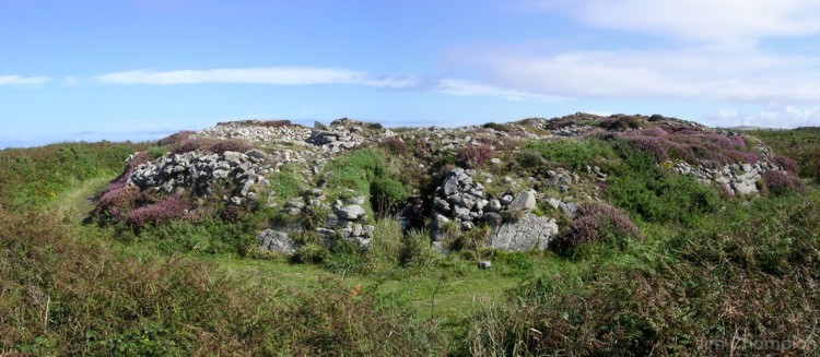
Carn Gluze submitted by JimChampion on 31st Dec 2004. August 2004. Composite image, taken whilst standing sea-ward of the barrow looking East. The fauna on the barrow is a feast of purples, greens and browns.
(View photo, vote or add a comment)
Log Text: None
Carn Lês Boel
Date Added: 19th Sep 2010
Site Type: Promontory Fort / Cliff Castle
Country: England (Cornwall)
Visited: Yes on 29th Aug 2008
Carn Lês Boel submitted by JimChampion on 29th Aug 2008. View across Mill Bay to the Carn Lês Boel headland, from Carn Boel. The headland is a 'cliff castle', although the remains are very slight. On the left is Nanjizal beach.
(View photo, vote or add a comment)
Log Text: None
Castle Ditches (Wiltshire)
Date Added: 19th Sep 2010
Site Type: Hillfort
Country: England (Wiltshire)
Visited: Yes on 29th Apr 2007
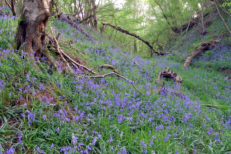
Castle Ditches (Wiltshire) submitted by JimChampion on 29th Apr 2007. The approach to the southeast side of Castle Ditches is flat, and the earthwork defences on this side are multiplied. This photo is a view along one of the ditches, from the eastern corner, with the hillfort interior towards the right. The earthworks are all densely wooded and at this time of year the ground is thick with bluebells.
(View photo, vote or add a comment)
Log Text: None
Castle Hill (Hampshire)
Date Added: 19th Sep 2010
Site Type: Hillfort
Country: England (Hampshire)
Visited: Yes on 15th Jan 2005

Castle Hill (Hampshire) submitted by JimChampion on 15th Jan 2005. January 2005. Looking at Castle Hill from Little Castle Common to the north-west. From this angle the steep natural defences can be appreciated.
(View photo, vote or add a comment)
Log Text: None
Castle Piece
Date Added: 19th Sep 2010
Site Type: Hillfort
Country: England (Hampshire)
Visited: Yes on 3rd Apr 2006
Castle Piece submitted by JimChampion on 3rd Apr 2006. View northeast from on top of the rampart at SU19970890 - the point being that there is not much to see of the earthworks here. The rampart is very slight and there are only traces of an external ditch. From this point the rampart curves round to the left. The fallen tree on the left has toppled from the rampart into the enclosed area. Go on... use your imagination!
(View photo, vote or add a comment)
Log Text: None
Cerne Abbas Giant
Date Added: 19th Sep 2010
Site Type: Hill Figure or Geoglyph
Country: England (Dorset)
Visited: Yes on 1st Jan 2005

Cerne Abbas Giant submitted by JimChampion on 1st Jan 2005. August 2004, taken from the car park by the A352 road. The giant is illuminated by afternoon sunshine between the clouds. Very vivid colours on this occasion.
(View photo, vote or add a comment)
Log Text: None
Chalbury
Date Added: 19th Sep 2010
Site Type: Hillfort
Country: England (Dorset)
Visited: Yes on 4th Apr 2005

Chalbury submitted by JimChampion on 4th Apr 2005. April 2005. Looking west from the top of Chalbury hillfort, the remains of the fortifications are in the foreground. The un-natural pits in the opposite hill are very striking, and I haven't yet found an explanation of them (the OS map and google give nothing). Their grid ref is something like SY687836: anyone know what they are?
(View photo, vote or add a comment)
Log Text: None
Chaldon Down
Date Added: 19th Sep 2010
Site Type: Barrow Cemetery
Country: England (Dorset)
Visited: Yes on 3rd Jan 2008
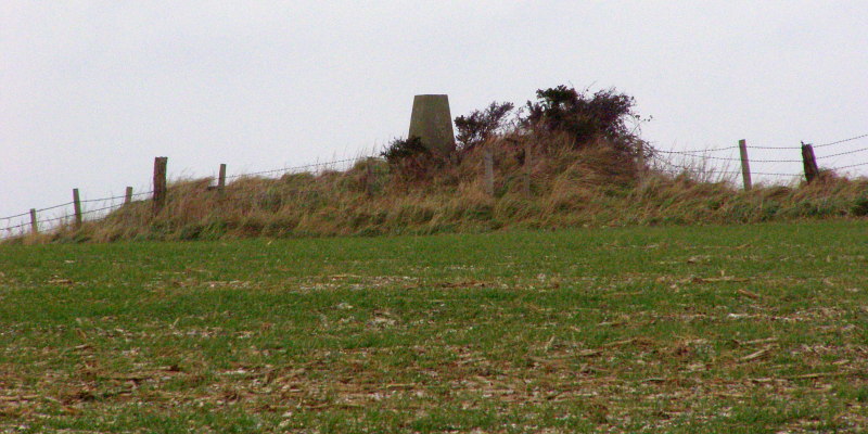
Chaldon Down submitted by JimChampion on 3rd Jan 2008. Christmas Eve 2007. Looking to the north-east towards the bowl barrow at grid reference SY78318125. This barrow is 14 metres in diameter and up to 1 metre in height, although it has been truncated on its northern side by the construction of a small covered reservoir. The barrow is on the very highest point of Chaldon Down, with views over the sea to the south and the heaths to the north. It is also hard to ignore the concrete Ordnance Survey triangulation pillar on top of the barrow mound.
(View photo, vote or add a comment)
Log Text: None
Cheriton Long Barrow
Date Added: 19th Sep 2010
Site Type: Long Barrow
Country: England (Hampshire)
Visited: Yes on 27th Jun 2006

Cheriton Long Barrow submitted by JimChampion on 27th Jun 2006. Looking north at the side of the long barrow mound, which crosses the photo from left to right beyond the oilseed rape. The footpath across the field is on the other side of the barrow, this view is from the field gate on Lamborough Lane. The barrow is covered with grasses and so stands out in this field. It will probably be much more obvious when the oilseed crop has been harvested.
(View photo, vote or add a comment)
Log Text: None
Chilworth Ring
Date Added: 19th Sep 2010
Site Type: Hillfort
Country: England (Hampshire)
Visited: Yes on 29th May 2006
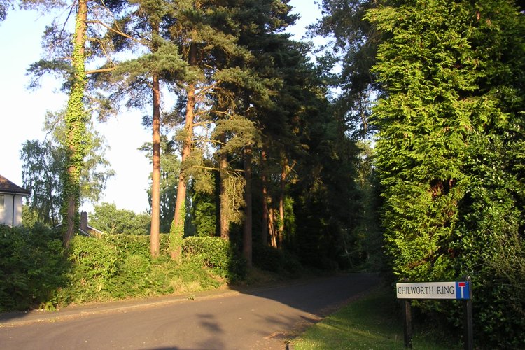
Chilworth Ring submitted by JimChampion on 29th May 2006. Chilworth Ring was turned into a circle of expensive detached houses in the mid-twentieth century CE.
(View photo, vote or add a comment)
Log Text: None
Chiselbury
Date Added: 19th Sep 2010
Site Type: Hillfort
Country: England (Wiltshire)
Visited: Yes on 28th Apr 2007
Chiselbury submitted by JimChampion on 28th Apr 2007. Two-photo composite image of the western side of Chiselbury. The single bank is in the centre, curving to the right. The hillfort interior is on the right and the external ditch is on the left. The yellow flowers are cowslips.
(View photo, vote or add a comment)
Log Text: None
Chun Castle
Date Added: 19th Sep 2010
Site Type: Hillfort
Country: England (Cornwall)
Visited: Yes on 13th May 2005
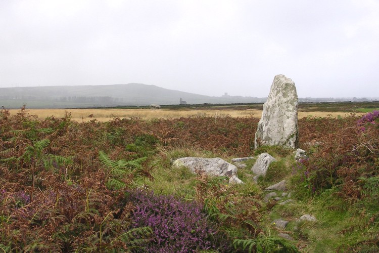
Chun Castle submitted by JimChampion on 13th May 2005. August 2004. Looking out from the gateway of Chun Castle, with Chun quoit in the middle distance (to the left of the engine house) and Pendeen church in the distance. This photo was taken just after I was caught in the Cornish rain here: there's no shelter nearby.
(View photo, vote or add a comment)
Log Text: None
