Contributory members are able to log private notes and comments about each site
Sites JimChampion has logged. View this log as a table or view the most recent logs from everyone
Bratton Camp
Date Added: 19th Sep 2010
Site Type: Hillfort
Country: England (Wiltshire)
Visited: Yes on 25th Apr 2007
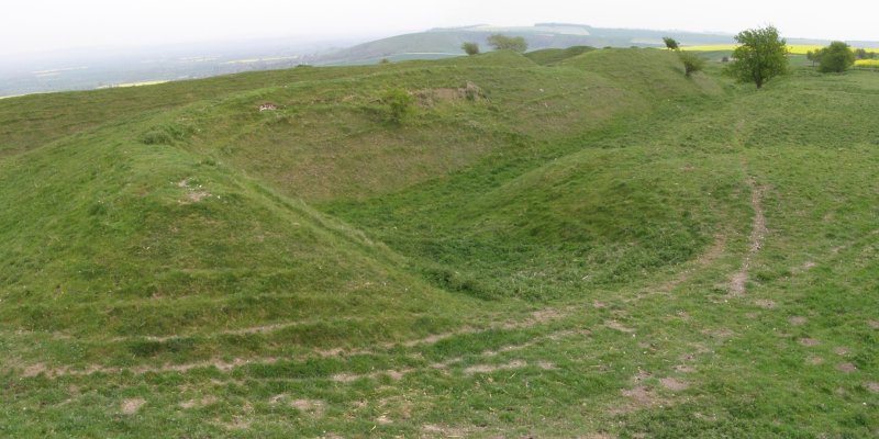
Bratton Camp submitted by JimChampion on 25th Apr 2007. A view of the southeast corner of Bratton Camp. The two banks are roughly the same height here on the gently sloping hill. In the foreground a path enters the hillfort (to the left) through one of the original entrances. This is a two-photo composite image, which explains some of the some of the distortion towards the edges.
(View photo, vote or add a comment)
Log Text: None
Chiselbury
Date Added: 19th Sep 2010
Site Type: Hillfort
Country: England (Wiltshire)
Visited: Yes on 28th Apr 2007
Chiselbury submitted by JimChampion on 28th Apr 2007. Two-photo composite image of the western side of Chiselbury. The single bank is in the centre, curving to the right. The hillfort interior is on the right and the external ditch is on the left. The yellow flowers are cowslips.
(View photo, vote or add a comment)
Log Text: None
Castle Ditches (Wiltshire)
Date Added: 19th Sep 2010
Site Type: Hillfort
Country: England (Wiltshire)
Visited: Yes on 29th Apr 2007
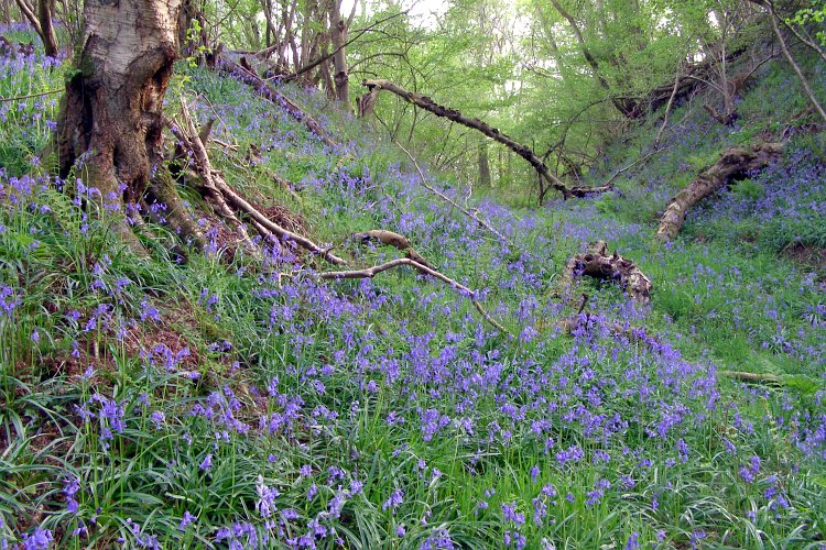
Castle Ditches (Wiltshire) submitted by JimChampion on 29th Apr 2007. The approach to the southeast side of Castle Ditches is flat, and the earthwork defences on this side are multiplied. This photo is a view along one of the ditches, from the eastern corner, with the hillfort interior towards the right. The earthworks are all densely wooded and at this time of year the ground is thick with bluebells.
(View photo, vote or add a comment)
Log Text: None
Testwood Lakes
Date Added: 19th Sep 2010
Site Type: Museum
Country: England (Hampshire)
Visited: Yes on 5th May 2007
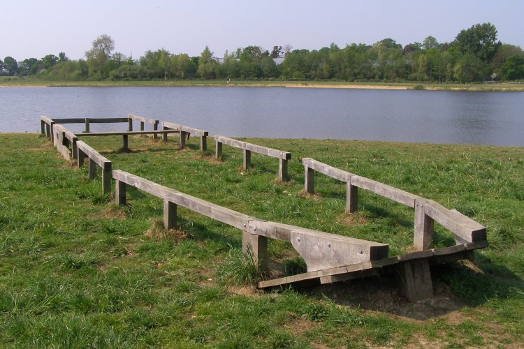
Testwood Lakes submitted by JimChampion on 5th May 2007. Part of a bronze age boat was discovered during the excavation of Meadow Lake, the most northerly in the Testwood Lakes complex. This photo shows a 'replica' of the kind of boat that the find came from. A plaque on the side of the boat reads 'Boats of this type were once used to cross the English Channel 3500 years ago. They were made of oak planks sewn together with twisted yew bark. The remains of a Bronze Age boat like this were found during the construction of the lakes in 1996.' The River B...
(View photo, vote or add a comment)
Log Text: None
Sutton Down long barrow
Date Added: 19th Sep 2010
Site Type: Long Barrow
Country: England (Wiltshire)
Visited: Yes on 6th May 2007
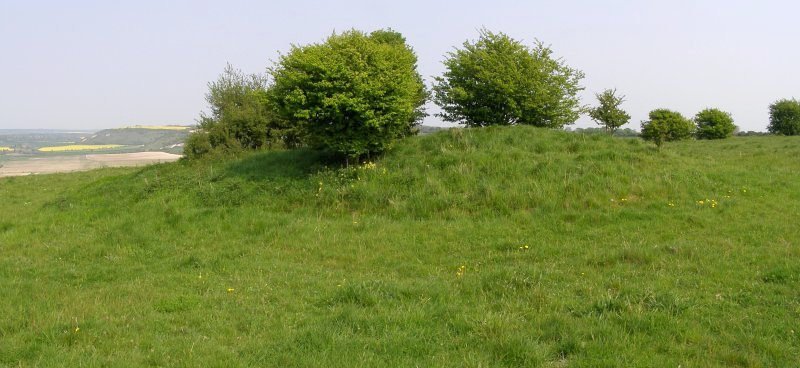
Sutton Down long barrow submitted by JimChampion on 6th May 2007. Two-photo composite image of the long barrow on Sutton Down. In the distance, to the left of the barrow, is the chalk scarp which is home to the Fovant Regimental Badges and Chiselbury hillfort.
(View photo, vote or add a comment)
Log Text: None
Buxbury Hill
Date Added: 19th Sep 2010
Site Type: Round Barrow(s)
Country: England (Wiltshire)
Visited: Yes on 6th May 2007
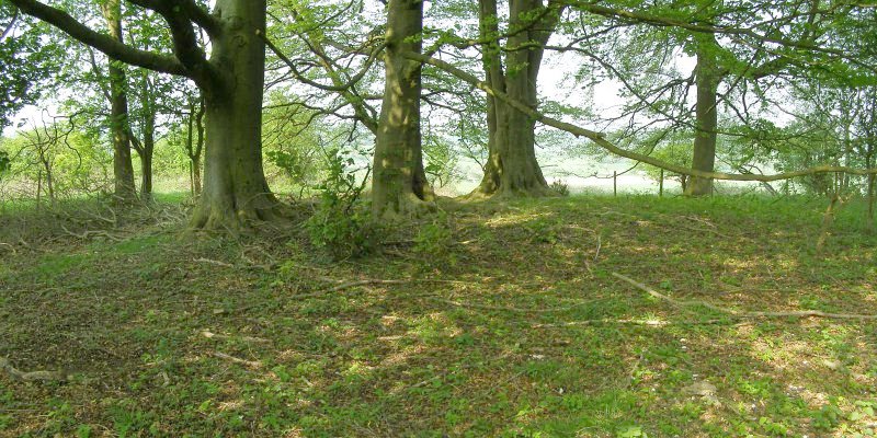
Buxbury Hill submitted by JimChampion on 6th May 2007. The Buxbury Barrow, barely recognisable under the beech trees on the edge of this wooded area on top of Buxbury Hill. This is a two-photo composite image of the site.
(View photo, vote or add a comment)
Log Text: None
Longslade View tumulus
Date Added: 19th Sep 2010
Site Type: Round Barrow(s)
Country: England (Hampshire)
Visited: Yes on 6th May 2007
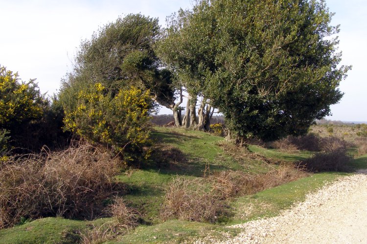
Longslade View tumulus submitted by JimChampion on 6th May 2007. March 2007. The gravel track on the right cuts across the east side of the bowl barrow, which is overgrown with holly and gorse bushes.
(View photo, vote or add a comment)
Log Text: None
Faulkland
Date Added: 19th Sep 2010
Site Type: Standing Stones
Country: England (Somerset)
Visited: Yes on 28th May 2007
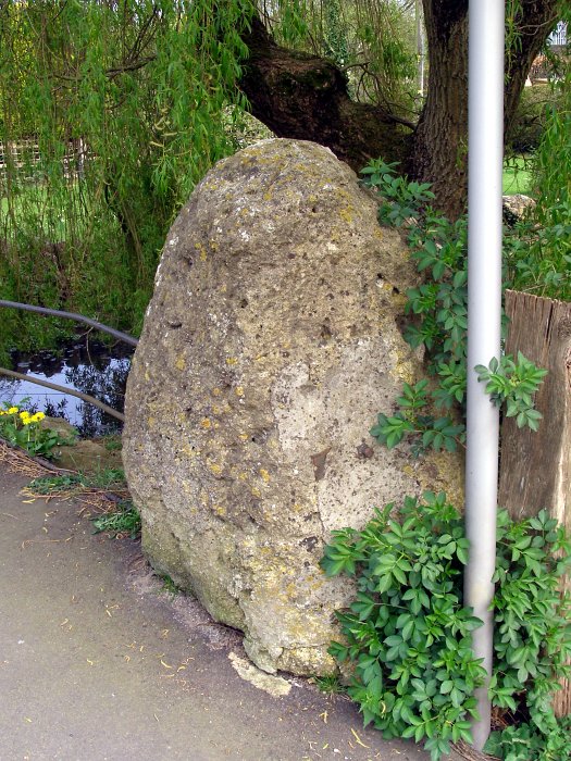
Faulkland submitted by JimChampion on 28th May 2007. A large stone by the pavement on the south side of the A366 road, beneath a willow tree alongside the village pond. Grid reference ST7388954534.
(View photo, vote or add a comment)
Log Text: None
Anderlingen Steinkistengrab (Hannover)
Date Added: 19th Sep 2010
Site Type: Chambered Tomb
Country: Germany (Lower Saxony, Bremen)
Visited: Yes on 14th Jul 2007
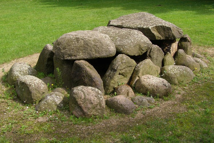
Anderlingen Steinkistengrab (Hannover) submitted by JimChampion on 14th Jul 2007. A reconstructed dolmen outside the Niedersächsischen Landesmuseum, central Hannover. It was originally discovered during sand extraction near Anderlingen, and moved here for public display. It was originally covered by an earth mound, 25 metres in diameter and 2 metres high. It is most famous for containing a stone with three human figures carved into it - Anderlingen's coat of arms features a representation of this carved stone.
(View photo, vote or add a comment)
Log Text: None
Niedersächsischen Landesmuseums Hannover
Date Added: 19th Sep 2010
Site Type: Museum
Country: Germany (Lower Saxony, Bremen)
Visited: Yes on 14th Jul 2007

Niedersächsischen Landesmuseums Hannover submitted by JimChampion on 14th Jul 2007. Looking down on the Niedersächsischen Landesmuseum building from the viewing gallery at the top of the New Town Hall (Neue Rathaus) in Hannover.
(View photo, vote or add a comment)
Log Text: None
Strodgemoor Barrow
Date Added: 19th Sep 2010
Site Type: Round Barrow(s)
Country: England (Hampshire)
Visited: Yes on 17th Jul 2007
Strodgemoor Barrow submitted by JimChampion on 17th Jul 2007. Looking south along the eastern side of the barrow. The ditch is clearly visible in the foreground, curving off to the right. In the distance is Cranes Moor and Kingston Great Common.
(View photo, vote or add a comment)
Log Text: None
Knaves Ash barrow
Date Added: 19th Sep 2010
Site Type: Round Barrow(s)
Country: England (Hampshire)
Visited: Yes on 17th Jul 2007
Knaves Ash barrow submitted by JimChampion on 17th Jul 2007. Close-up of the modern boundary stone set into the summit of the barrow mound. It has some letters and a date (19th century?) carved into it, but they have been weathered. There are several other boundary stones on the parish boundary between here and Lugden Barrow about 2 km to the south. The boundary is not just between the parishes of Burley and Ringwood, but also defines the old 'perambulation' of the Royal forest.
(View photo, vote or add a comment)
Log Text: None
Laurences Barrow
Date Added: 19th Sep 2010
Site Type: Round Barrow(s)
Country: England (Hampshire)
Visited: Yes on 21st Jul 2007
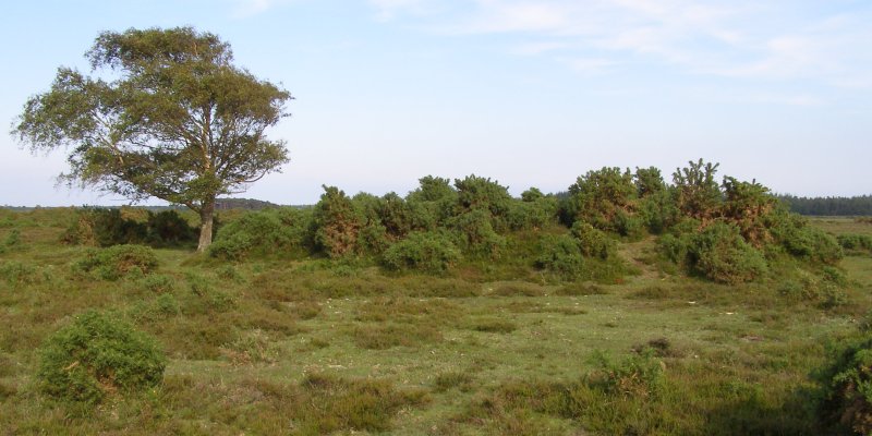
Laurences Barrow submitted by JimChampion on 21st Jul 2007. June 2007. Laurences Barrow, with the landmark windswept silver birch to the left of the mound. This view is looking from the north-west - in the distance (behind the silver birch tree) are the pines of Crockford Clump, and (to the right of the barrow) Norley Inclosure. The barrow mound itself is overgrown with gorse and has a slight hollow in its summit.
(View photo, vote or add a comment)
Log Text: None
Lugden Barrow
Date Added: 19th Sep 2010
Site Type: Round Barrow(s)
Country: England (Hampshire)
Visited: Yes on 23rd Jul 2007
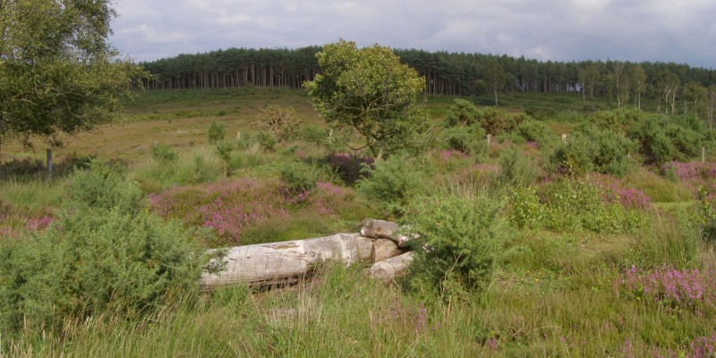
Lugden Barrow submitted by JimChampion on 23rd Jul 2007. Two-photo composite image of Lugden Barrow - the "vague mound" is in there somewhere beneath the gorse and heather. The pine trees beyond are part of the Dur Hill Inclosure.
(View photo, vote or add a comment)
Log Text: None
Parsonage Hill
Date Added: 19th Sep 2010
Site Type: Long Barrow
Country: England (Dorset)
Visited: Yes on 28th Jul 2007
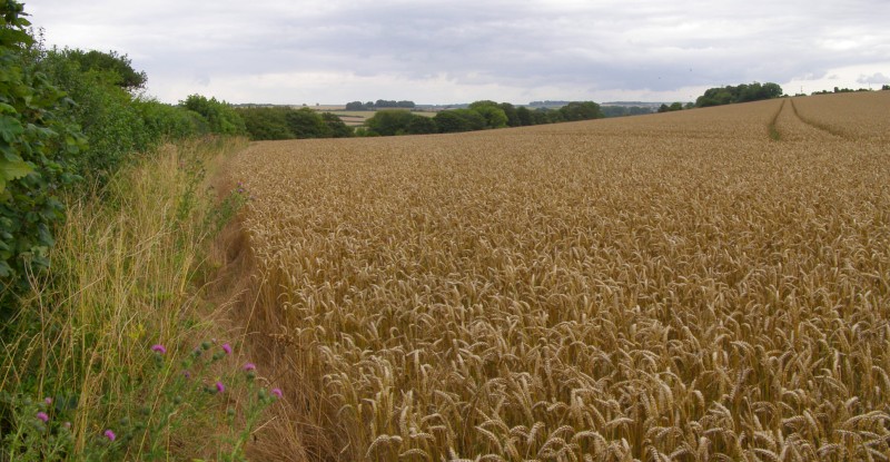
Parsonage Hill submitted by JimChampion on 28th Jul 2007. According to the map, the Parsonage Hill barrow should be here somewhere, in the foreground. I think its safe to say that it has been destroyed (or at least all obvious traces have been removed) by deep ploughing.
(View photo, vote or add a comment)
Log Text: None
Highdown barrows
Date Added: 19th Sep 2010
Site Type: Round Barrow(s)
Country: England (Isle of Wight)
Visited: Yes on 5th Aug 2007
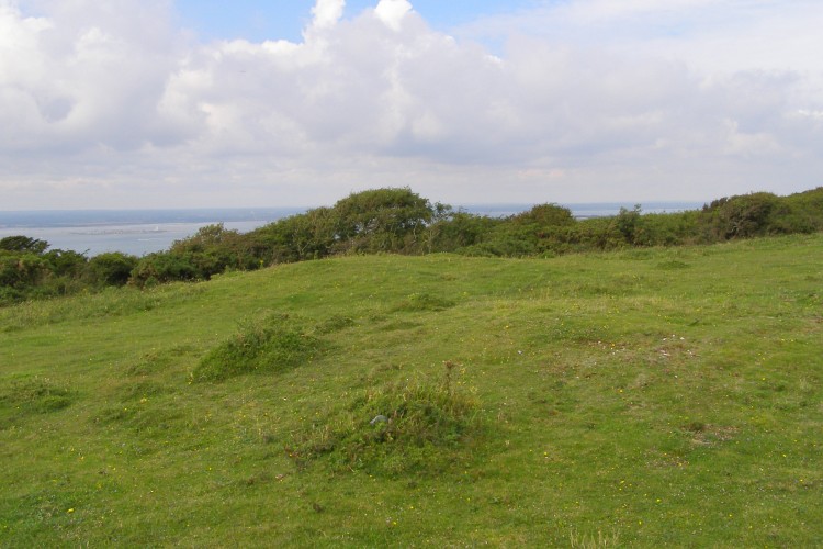
Highdown barrows submitted by JimChampion on 5th Aug 2007. Looking north at the pair of barrows, which are aligned north-aouth. Both mounds are around 10 metres in diameter and less than a metre high, the southern one being slightly smaller than the other.
Hurst Castle on Hurst Spit can be seen in the Solent to the north.
(View photo, vote or add a comment)
Log Text: None
Dry Tree Menhir
Date Added: 19th Sep 2010
Site Type: Standing Stone (Menhir)
Country: England (Cornwall)
Visited: Yes on 15th Aug 2007
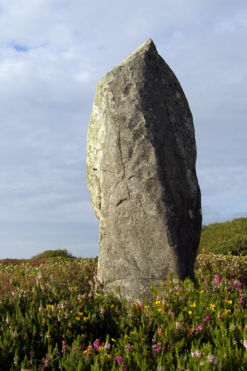
Dry Tree Menhir submitted by JimChampion on 15th Aug 2007. A low-angle view of the menhir, in its gorsey surroundings. I didn't previously know that this was here, but earlier in the day we'd been on the tour of the neighbouring Goonhilly Earth Station (a bit expensive for a lot of BT hype, but you can get buy-one-get-one-free vouchers from various leaflets and local papers) and on the bus tour of the site the guide pointed out the menhir and the surrounding round barrows.
(View photo, vote or add a comment)
Log Text: None
Prospidnick Menhir
Date Added: 19th Sep 2010
Site Type: Standing Stone (Menhir)
Country: England (Cornwall)
Visited: Yes on 15th Aug 2007
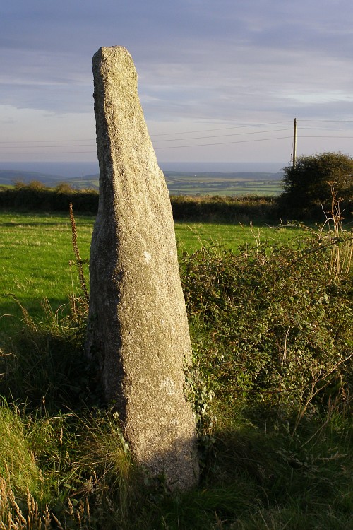
Prospidnick Menhir submitted by JimChampion on 15th Aug 2007. Looking towards the south-west at the Long Stone (or Prospidnick Menhir). The stone is illuminated by evening sunshine through a convenient break in the clouds. The last few miles to this spot involved an interesting drive down very narrow Cornish lanes.
(View photo, vote or add a comment)
Log Text: None
Trethevy Quoit
Date Added: 19th Sep 2010
Site Type: Burial Chamber or Dolmen
Country: England (Cornwall)
Visited: Yes on 15th Aug 2007
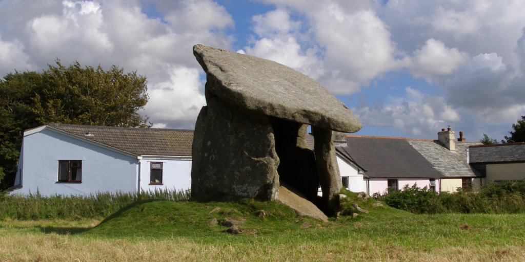
Trethevy Quoit submitted by JimChampion on 15th Aug 2007. Two-photo composite image of Trethevy Quoit. I was surprised to find that the quoit was right next to a row of houses, probably for two reasons. One - the other quoits I'd visited (in West Penwith) were all in fairly remote locations. Two - all the photographs I'd previously seen of it had been carefully composed in order to avoid or hide the houses. Here it is in all its back-garden glory.
(View photo, vote or add a comment)
Log Text: None
Nine Stones (Altarnun)
Date Added: 19th Sep 2010
Site Type: Stone Circle
Country: England (Cornwall)
Visited: Yes on 15th Aug 2007
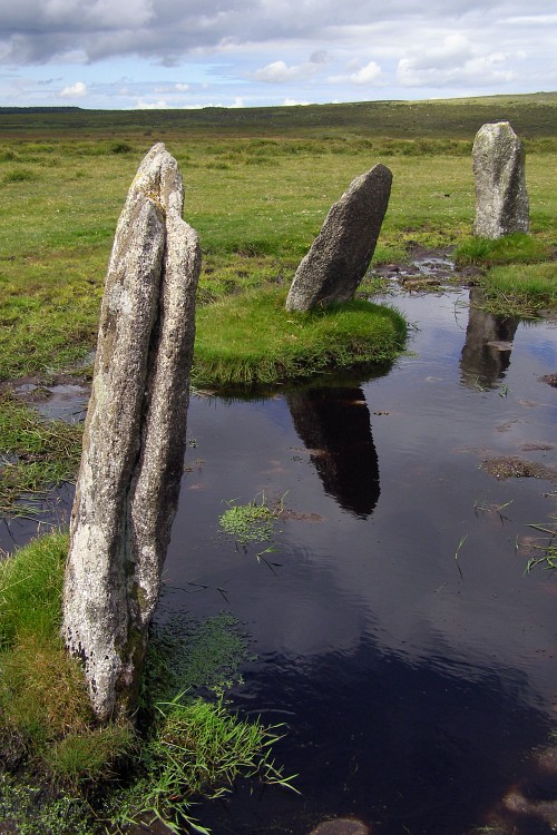
Nine Stones (Altarnun) submitted by JimChampion on 15th Aug 2007. Three of the stones in the south-western quadrant of this restored stone circle. The deep puddles are in holes created by cattle that use the stones as scratching posts - there aren't many trees or fences out here on East Moor.
(View photo, vote or add a comment)
Log Text: None
