Contributory members are able to log private notes and comments about each site
Sites JimChampion has logged. View this log as a table or view the most recent logs from everyone
The Hurlers
Date Added: 19th Sep 2010
Site Type: Stone Circle
Country: England (Cornwall)
Visited: Yes on 16th Aug 2007
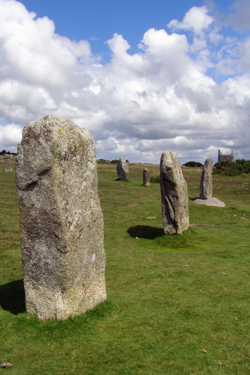
The Hurlers submitted by JimChampion on 16th Aug 2007. Stones in the southern part of the central stone circle on a very agreeable summer's afternoon. The concrete setting of one is clearly visible. If you approach the stone circles along the well-worn path from the car park then these are the first three standing stones that you come across. In the distance the old engine house is home to the Minions Heritage Centre.
(View photo, vote or add a comment)
Log Text: None
Kenidjack Common holed stones
Date Added: 19th Sep 2010
Site Type: Stone Row / Alignment
Country: England (Cornwall)
Visited: Yes on 23rd Oct 2007

Kenidjack Common holed stones submitted by JimChampion on 23rd Oct 2007. August 2007. These holed stones are located 'out of the way' on Kenidjack Common, although this well-worn path passes right through the middle of them.
(View photo, vote or add a comment)
Log Text: None
Rillaton Barrow
Date Added: 19th Sep 2010
Site Type: Round Barrow(s)
Country: England (Cornwall)
Visited: Yes on 23rd Oct 2007
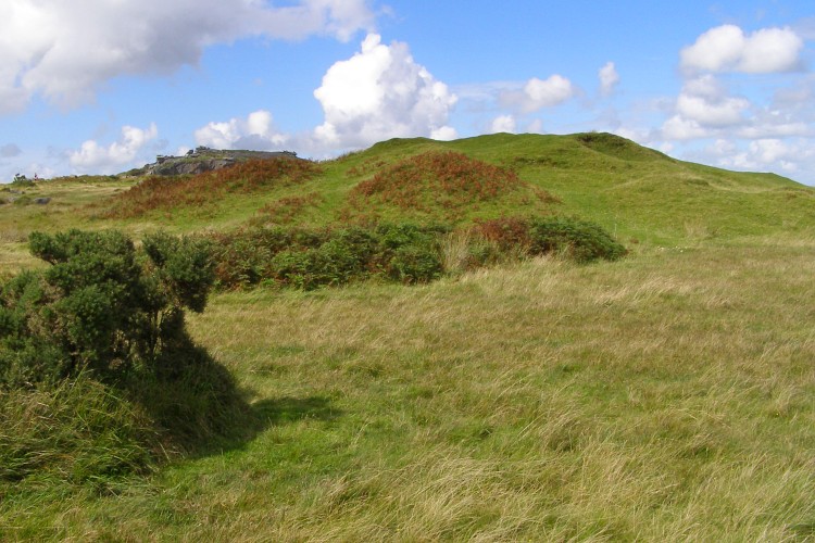
Rillaton Barrow submitted by JimChampion on 23rd Oct 2007. August 2007. Looking north at the lumpy form of Rillaton Barrow. Stowe's Hill is visible in the distance to the left of the barrow mound, including the Cheesewring.
(View photo, vote or add a comment)
Log Text: None
Treen Entrance Grave (SW)
Date Added: 19th Sep 2010
Site Type: Chambered Tomb
Country: England (Cornwall)
Visited: Yes on 23rd Oct 2007

Treen Entrance Grave (SW) submitted by JimChampion on 23rd Oct 2007. August 2007. Looking out north-west from inside the chamber of the entrance grave, towards the sea.
(View photo, vote or add a comment)
Log Text: None
Porthmeor Circle
Date Added: 19th Sep 2010
Site Type: Stone Circle
Country: England (Cornwall)
Visited: Yes on 23rd Oct 2007
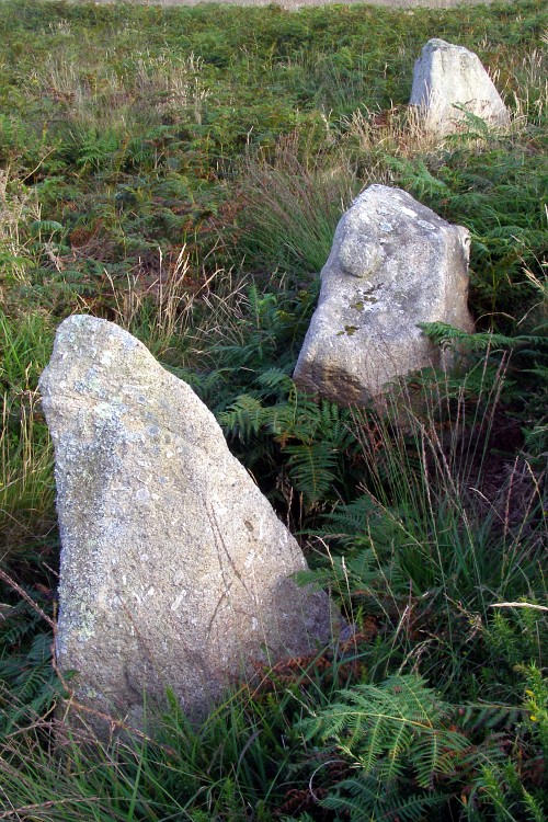
Porthmeor Circle submitted by JimChampion on 23rd Oct 2007. August 2007. Three upright stones in this embanked circle - easily visible from the nearby road across the common.
(View photo, vote or add a comment)
Log Text: None
Trencrom Castle Well
Date Added: 19th Sep 2010
Site Type: Holy Well or Sacred Spring
Country: England (Cornwall)
Visited: Yes on 24th Oct 2007

Trencrom Castle Well submitted by JimChampion on 24th Oct 2007. August 2007. View west from Trencrom Castle Well, with Castle-an-Dinas and the quarry in the distance towards the left.
(View photo, vote or add a comment)
Log Text: None
Alsia Well
Date Added: 19th Sep 2010
Site Type: Holy Well or Sacred Spring
Country: England (Cornwall)
Visited: Yes on 24th Oct 2007
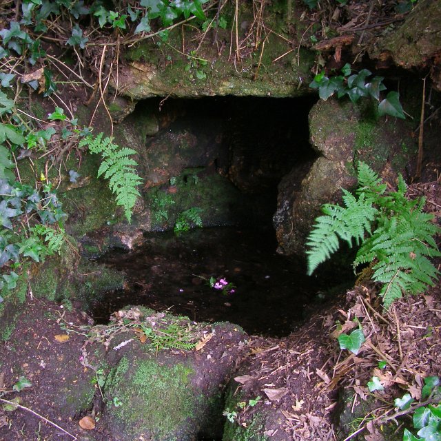
Alsia Well submitted by JimChampion on 24th Oct 2007. August 2007. The spring itself - to get to it you have to pass through an old iron gate and stoop beneath the bushes.
(View photo, vote or add a comment)
Log Text: None
Boslow Cross
Date Added: 19th Sep 2010
Site Type: Ancient Cross
Country: England (Cornwall)
Visited: Yes on 24th Oct 2007

Boslow Cross submitted by JimChampion on 24th Oct 2007. August 2007. The southern side of the Boslow Cross, alongside a grassy path.
(View photo, vote or add a comment)
Log Text: None
Portheras Barrow
Date Added: 19th Sep 2010
Site Type: Round Barrow(s)
Country: England (Cornwall)
Visited: Yes on 24th Oct 2007
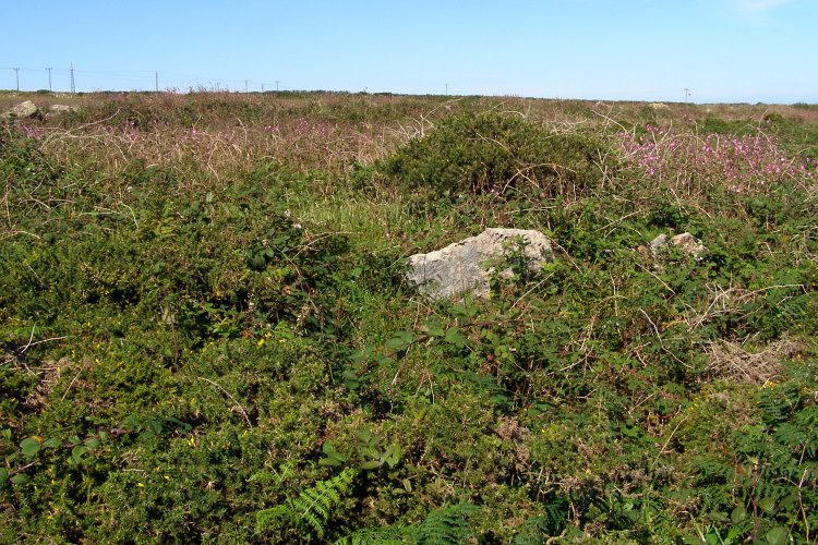
Portheras Barrow submitted by JimChampion on 24th Oct 2007. August 2007. The Portheras Barrow is somewhat overgrown with gorse - the mound is under there somewhere. The stone cist's capstone is visible, otherwise it would have been very difficult to find.
(View photo, vote or add a comment)
Log Text: None
Truthwall Common barrows
Date Added: 19th Sep 2010
Site Type: Round Barrow(s)
Country: England (Cornwall)
Visited: Yes on 24th Oct 2007
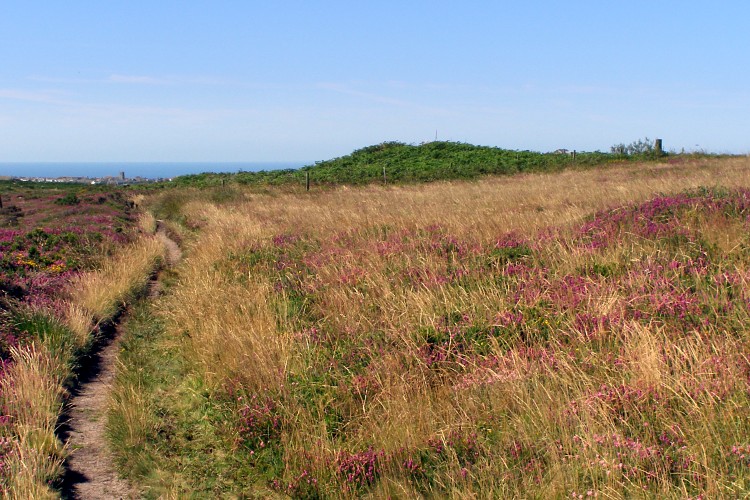
Truthwall Common barrows submitted by JimChampion on 24th Oct 2007. August 2007. The green bracken-covered mound is a round barrow at grid reference SW38903257. The path on the left leads from the Kenidjack Common holed stones to the Tregeseal East stone circle. In the distance (towards the left) is the small town of St Just.
(View photo, vote or add a comment)
Log Text: None
Goonhilly tumuli
Date Added: 19th Sep 2010
Site Type: Round Barrow(s)
Country: England (Cornwall)
Visited: Yes on 26th Oct 2007
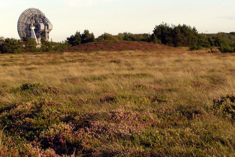
Goonhilly tumuli submitted by JimChampion on 26th Oct 2007. August 2007. In the distance, across the heath is a large heather-covered round barrow at grid reference SW72522158. I didn't get any closer as I was wearing shorts and the heath is covered with the evil cornish gorse that is ankle-high and very spiky. The dish in the background is "Arthur", the oldest of the satellite communication dishes at Goonhilly Satellite Earth Station.
(View photo, vote or add a comment)
Log Text: None
Sancreed Beacon Barrows
Date Added: 19th Sep 2010
Site Type: Round Barrow(s)
Country: England (Cornwall)
Visited: Yes on 26th Oct 2007

Sancreed Beacon Barrows submitted by JimChampion on 26th Oct 2007. August 2007. View north from Sancreed Beacon, with the northern barrow in the foregound (at grid reference SW41432949)- including the capstone of the cist.
(View photo, vote or add a comment)
Log Text: None
Clitters Cairn
Date Added: 19th Sep 2010
Site Type: Cairn
Country: England (Cornwall)
Visited: Yes on 27th Oct 2007
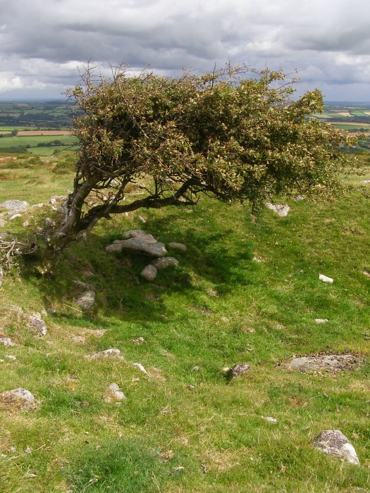
Clitters Cairn submitted by JimChampion on 27th Oct 2007. August 2007. This thorn tree protrudes from the rubble of Clitters Cairn. The hollow (on the right) in the centre of the cairn was created by antiquarian digging. Now the combination of tree and a 1 metre deep dip makes a good place for sheep to shelter on the bare moor.
(View photo, vote or add a comment)
Log Text: None
The Ridge Cairn
Date Added: 19th Sep 2010
Site Type: Cairn
Country: England (Cornwall)
Visited: Yes on 27th Oct 2007
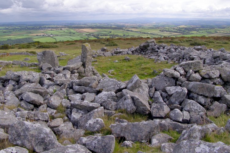
The Ridge Cairn submitted by JimChampion on 27th Oct 2007. August 2007. The remains of the Ridge Cairn in the foreground - the central region has been cleared to create a shelter for sheep.
(View photo, vote or add a comment)
Log Text: None
Hambledon Hill south long barrow
Date Added: 19th Sep 2010
Site Type: Long Barrow
Country: England (Dorset)
Visited: Yes on 3rd Nov 2007

Hambledon Hill south long barrow submitted by JimChampion on 3rd Nov 2007. July 2007. Looking north along the reconstructed oval mound of this long barrow. It is just to the south of the neolithic enclosure on the summit of Hambledon Hill (in the background). There is a cross-dyke just to the south of the barrow that defends the approach to the summit from the Hanford spur of Hambledon Hill.
(View photo, vote or add a comment)
Log Text: None
Longlands barrow cemetery
Date Added: 19th Sep 2010
Site Type: Barrow Cemetery
Country: England (Dorset)
Visited: Yes on 26th Nov 2007

Longlands barrow cemetery submitted by JimChampion on 26th Nov 2007. Looking up from the Broadstone on the verge of the A35, towards one of the barrows in the Longlands cemetery. Sheep grazing. Rain.
(View photo, vote or add a comment)
Log Text: None
High Bridestones (Yorks)
Date Added: 19th Sep 2010
Site Type: Stone Circle
Country: England (Yorkshire (North))
Visited: Yes on 7th Dec 2007
High Bridestones (Yorks) submitted by JimChampion on 7th Dec 2007. August 2007. The High Bridestones, on the moor. Just one of the megaliths is still standing, with small change firmly wedged into its many crevices. A megalithic shambles indeed. The heather in bloom says that it is summer, although the temperature (and wind) on this day was more like winter!
(View photo, vote or add a comment)
Log Text: None
Blakey Topping
Date Added: 19th Sep 2010
Site Type: Stone Circle
Country: England (Yorkshire (North))
Visited: Yes on 7th Dec 2007
Blakey Topping submitted by JimChampion on 7th Dec 2007. August 2007. This stone is at the field gate, near to the larger standing stones to the south-west of Blakey Topping (just visible in the background).
(View photo, vote or add a comment)
Log Text: None
Wardstone Barrow
Date Added: 19th Sep 2010
Site Type: Round Barrow(s)
Country: England (Dorset)
Visited: Yes on 31st Dec 2007

Wardstone Barrow submitted by JimChampion on 31st Dec 2007. Looking north towards the Wardstone Barrow. The track on the right leads to Chideock Farm, and is a permissive footpath. There was originally another barrow in the field to the right, but it is destroyed. Presumably the wooden posts around this one mark the limit of the scheduled ancient monument.
It was a very grey and dull Christmas Eve, this was the only decent photo that I took of the site!
(View photo, vote or add a comment)
Log Text: None
Chaldon Down
Date Added: 19th Sep 2010
Site Type: Barrow Cemetery
Country: England (Dorset)
Visited: Yes on 3rd Jan 2008
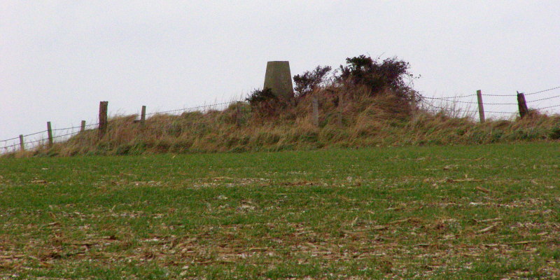
Chaldon Down submitted by JimChampion on 3rd Jan 2008. Christmas Eve 2007. Looking to the north-east towards the bowl barrow at grid reference SY78318125. This barrow is 14 metres in diameter and up to 1 metre in height, although it has been truncated on its northern side by the construction of a small covered reservoir. The barrow is on the very highest point of Chaldon Down, with views over the sea to the south and the heaths to the north. It is also hard to ignore the concrete Ordnance Survey triangulation pillar on top of the barrow mound.
(View photo, vote or add a comment)
Log Text: None
