Contributory members are able to log private notes and comments about each site
Sites JimChampion has logged. View this log as a table or view the most recent logs from everyone
Scratchbury Camp
Date Added: 19th Sep 2010
Site Type: Hillfort
Country: England (Wiltshire)
Visited: Yes on 22nd Apr 2007
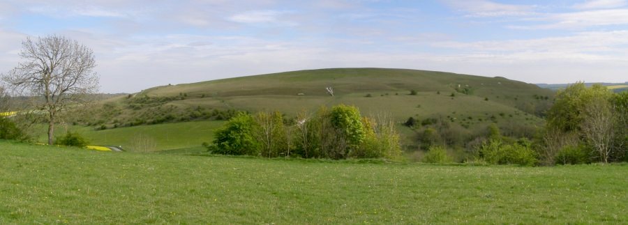
Scratchbury Camp submitted by JimChampion on 22nd Apr 2007. Two-photo composite image of Scratchbury Hill, from Middle Hill to the northwest. The double ramparts are clearly visible, as is the large barrow on the southwestern slope of the hill (to the right of this photo, within the ramparts).
(View photo, vote or add a comment)
Log Text: None
Sancreed Well
Date Added: 19th Sep 2010
Site Type: Holy Well or Sacred Spring
Country: England (Cornwall)
Visited: Yes on 2nd Sep 2006
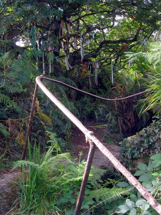
Sancreed Well submitted by JimChampion on 2nd Sep 2006. There are now two paths to Sancreed Well, this is the end of the older path which approaches from the southeast. The shiny iron railings are part of the landscaping work that took place in the late 19th century when the well and chapel were 'rediscovered' by the vicar of Sancreed. I supposed the remoteness of this site meant that the railings weren't taken for the "War effort" as in so many other places in the U.K. Behind the ferns is a large rectangular moulded fragment of a doorway which has ...
(View photo, vote or add a comment)
Log Text: None
Sancreed Beacon Barrows
Date Added: 19th Sep 2010
Site Type: Round Barrow(s)
Country: England (Cornwall)
Visited: Yes on 26th Oct 2007

Sancreed Beacon Barrows submitted by JimChampion on 26th Oct 2007. August 2007. View north from Sancreed Beacon, with the northern barrow in the foregound (at grid reference SW41432949)- including the capstone of the cist.
(View photo, vote or add a comment)
Log Text: None
Salisbury and South Wiltshire Museum
Date Added: 19th Sep 2010
Site Type: Museum
Country: England (Wiltshire)
Visited: Yes on 30th Apr 2005

Salisbury and South Wiltshire Museum submitted by JimChampion on 30th Apr 2005. March 2005: the front of Salisbury and South Wiltshire museum. The noticeboard features a recommendation from one of Bill Bryson's books: "Salisbury museum is outstanding and I urge you to go there at once."
(View photo, vote or add a comment)
Log Text: None
Round Clump
Date Added: 19th Sep 2010
Site Type: Long Barrow
Country: England (Hampshire)
Visited: Yes on 26th Oct 2006
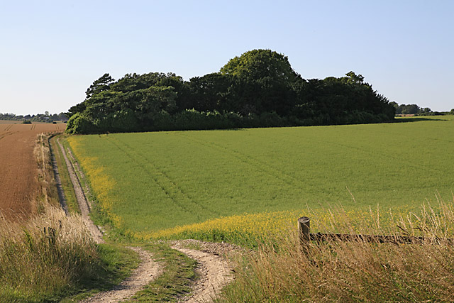
Round Clump submitted by JimChampion on 26th Oct 2006. Round Clump, near Coombe Bissett,
seen from the byway that skirts its western edge. The clump, which is a small wood, hides the long barrow.
(c) Peter Facey and licensed for reuse under this Creative Commons Licence: Attribution-ShareAlike 2.0
(View photo, vote or add a comment)
Log Text: None
Rollright Stones
Date Added: 19th Sep 2010
Site Type: Stone Circle
Country: England (Oxfordshire)
Visited: Yes on 17th Feb 2005

Rollright Stones submitted by JimChampion on 17th Feb 2005. February 2005. A worms-eye view looking north into the King's Men circle. Lovely winter morning sunshine on a somewhat eerie site.
(View photo, vote or add a comment)
Log Text: None
Rillaton Barrow
Date Added: 19th Sep 2010
Site Type: Round Barrow(s)
Country: England (Cornwall)
Visited: Yes on 23rd Oct 2007
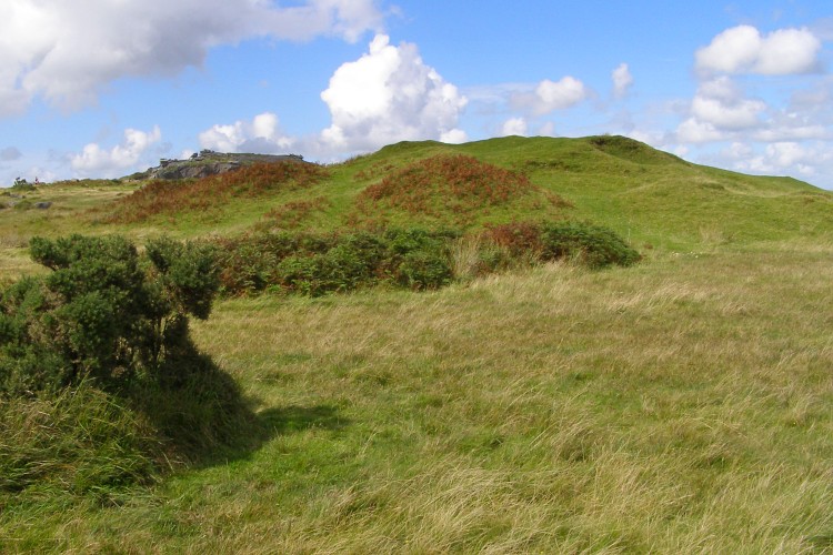
Rillaton Barrow submitted by JimChampion on 23rd Oct 2007. August 2007. Looking north at the lumpy form of Rillaton Barrow. Stowe's Hill is visible in the distance to the left of the barrow mound, including the Cheesewring.
(View photo, vote or add a comment)
Log Text: None
Rawlsbury Camp
Date Added: 19th Sep 2010
Site Type: Hillfort
Country: England (Dorset)
Visited: Yes on 8th Oct 2005
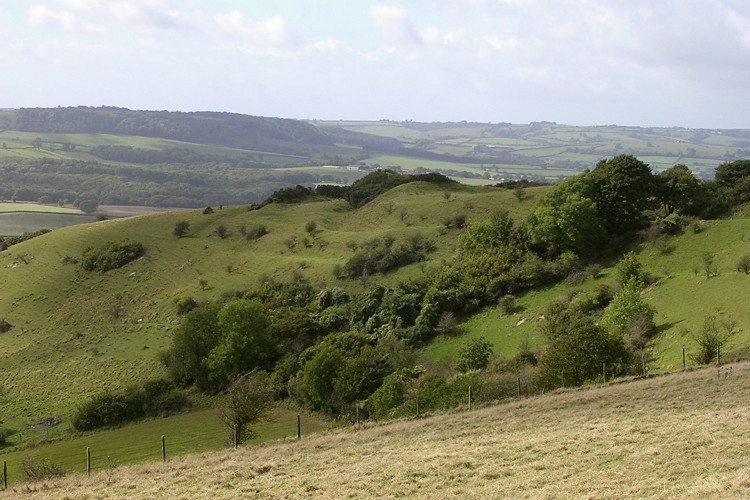
Rawlsbury Camp submitted by JimChampion on 8th Oct 2005. September 2005. Looking down at Rawlsbury hillfort from Bulbarrow Hill, in strong midday autumn sunlight. The ramparts follow the contours of the chalk spur that it sits on. In the distance are the tree-covered slopes of Nettlecombe Tout hillfort.
(View photo, vote or add a comment)
Log Text: None
Rainbarrows
Date Added: 19th Sep 2010
Site Type: Round Barrow(s)
Country: England (Dorset)
Visited: Yes on 10th Apr 2007
submitted by on .
(View photo, vote or add a comment)
Log Text: None
Pudding Barrow
Date Added: 19th Sep 2010
Site Type: Round Barrow(s)
Country: England (Hampshire)
Visited: Yes on 8th Jan 2005

Pudding Barrow submitted by JimChampion on 8th Jan 2005. January 2005. Looking south towards the Pudding Barrow. The new fence and barrier is clearly visible. The campsite is closed to vehicles in winter, but many walkers and cyclists passing by, and even one person on a scrambler motorbike. Presumably the fence is a deterrent to wheeled enthusiasts.
(View photo, vote or add a comment)
Log Text: None
Prospidnick Menhir
Date Added: 19th Sep 2010
Site Type: Standing Stone (Menhir)
Country: England (Cornwall)
Visited: Yes on 15th Aug 2007
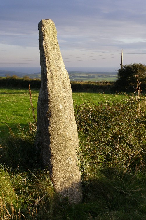
Prospidnick Menhir submitted by JimChampion on 15th Aug 2007. Looking towards the south-west at the Long Stone (or Prospidnick Menhir). The stone is illuminated by evening sunshine through a convenient break in the clouds. The last few miles to this spot involved an interesting drive down very narrow Cornish lanes.
(View photo, vote or add a comment)
Log Text: None
Poundbury
Date Added: 19th Sep 2010
Site Type: Hillfort
Country: England (Dorset)
Visited: Yes on 5th Jun 2005

Poundbury submitted by JimChampion on 5th Jun 2005. Looking south across the Frome valley at the ramparts of Poundbury hillfort. You can see its rectangular perimeter in this composite picture - no wonder the Romans liked the site. Parts of modern Dorchester can be seen poking out e.g. the keep-like military museum is on the left. (The line in the sky is a power cable that I couldn't get away from).
(View photo, vote or add a comment)
Log Text: None
Porthmeor Circle
Date Added: 19th Sep 2010
Site Type: Stone Circle
Country: England (Cornwall)
Visited: Yes on 23rd Oct 2007
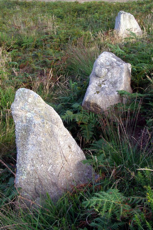
Porthmeor Circle submitted by JimChampion on 23rd Oct 2007. August 2007. Three upright stones in this embanked circle - easily visible from the nearby road across the common.
(View photo, vote or add a comment)
Log Text: None
Portheras Barrow
Date Added: 19th Sep 2010
Site Type: Round Barrow(s)
Country: England (Cornwall)
Visited: Yes on 24th Oct 2007
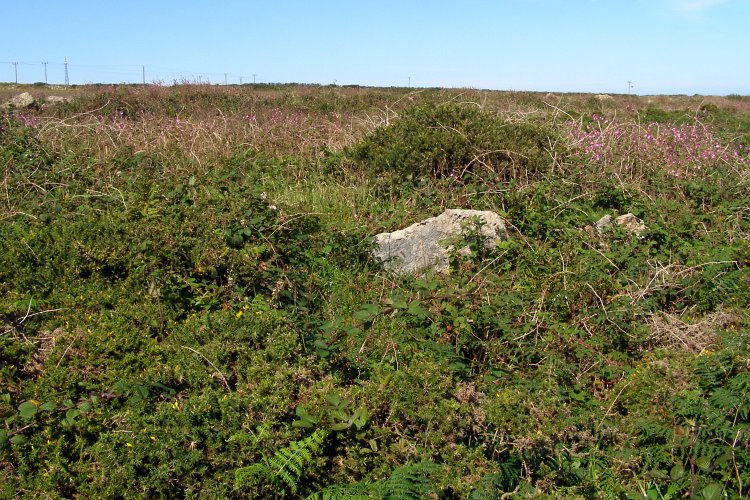
Portheras Barrow submitted by JimChampion on 24th Oct 2007. August 2007. The Portheras Barrow is somewhat overgrown with gorse - the mound is under there somewhere. The stone cist's capstone is visible, otherwise it would have been very difficult to find.
(View photo, vote or add a comment)
Log Text: None
Poor Lot Barrows
Date Added: 19th Sep 2010
Site Type: Barrow Cemetery
Country: England (Dorset)
Visited: Yes on 27th Apr 2005
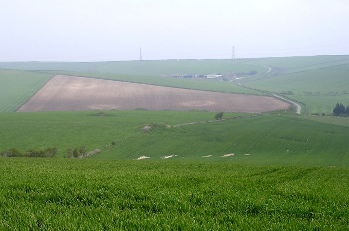
Poor Lot Barrows submitted by JimChampion on 27th Apr 2005. April 2005. Looking down at the Poor Lot barrow cemetery from Pitcombe Down. Huge numbers of lumps and bumps are visible, as well as the depressions of long-gone round barrows (in the foreground and on the opposite hillside). The busy A35 road is hidden in the valley.
(View photo, vote or add a comment)
Log Text: None
Pimperne Long Barrow
Date Added: 19th Sep 2010
Site Type: Long Barrow
Country: England (Dorset)
Visited: Yes on 9th Apr 2005
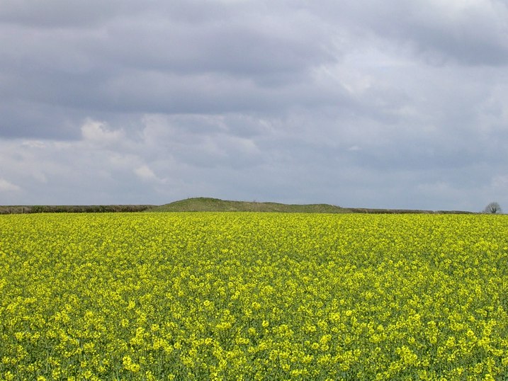
Pimperne Long Barrow submitted by JimChampion on 9th Apr 2005. April 2005. Looking NW at the Pimperne Long Barrow from the A354 roadside. If you are travelling towards Blandford Forum then the barrow is very conspicuous on the right hand side of the road: imagine how eye-catching it was when it was newly built (circa 3000 BCE) and white with chalk.
(View photo, vote or add a comment)
Log Text: None
Pentridge 4
Date Added: 19th Sep 2010
Site Type: Long Barrow
Country: England (Dorset)
Visited: Yes on 10th Apr 2005
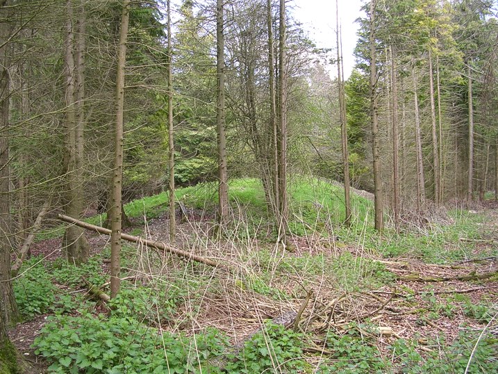
Pentridge 4 submitted by JimChampion on 10th Apr 2005. Looking north at the Dorset Cursus long barrow, surrounded by trees in Salisbury Plantation. The barrow was incorporated into the NW bank of the Cursus, some of which survives amongst the trees to the SW of this spot.
(View photo, vote or add a comment)
Log Text: None
Pentridge 3
Date Added: 19th Sep 2010
Site Type: Long Barrow
Country: England (Dorset)
Visited: Yes on 9th Apr 2005

Pentridge 3 submitted by JimChampion on 9th Apr 2005. April 2005. This long barrow, aligned on the NE terminal of the Dorset Cursus, has been almost ploughed out of existence. It is just visible as a very low mound occupying the centre of the photograph between the two pairs of tractor ruts. The bank on the left of the photo is the Romano-British Bokerley Dyke, which currently defines the Hampshire/Dorset boundary.
(View photo, vote or add a comment)
Log Text: None
Pentridge 2
Date Added: 19th Sep 2010
Site Type: Long Barrow
Country: England (Dorset)
Visited: Yes on 31st Mar 2005

Pentridge 2 submitted by JimChampion on 31st Mar 2005. March 2005. Composite image of the Pentridge 2 long barrow(s) looking south-west from the bank of Bokerley Dyke. This is a looooong barrow, with its SE end disappearing off the edge of the photo. The site of the Dorset Cursus' north-eastern terminal is just to the right of this picture, although it was not noticeable in the young wheat.
(View photo, vote or add a comment)
Log Text: None
Pentridge 1
Date Added: 19th Sep 2010
Site Type: Long Barrow
Country: England (Dorset)
Visited: Yes on 31st Mar 2005
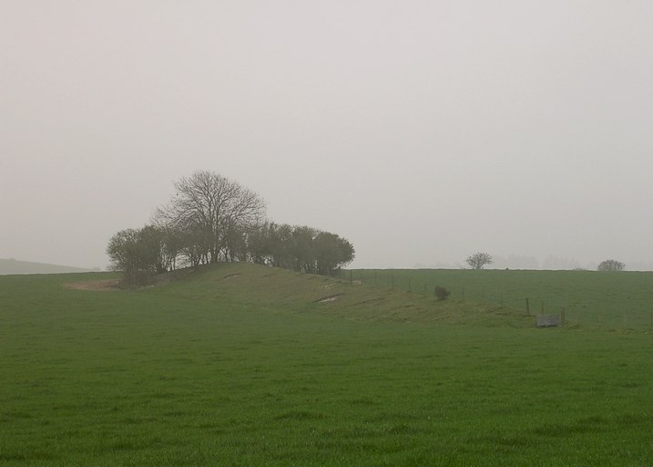
Pentridge 1 submitted by JimChampion on 31st Mar 2005. March 2005. Looking south at the long barrow from the bridleway on a rather misty day.
(View photo, vote or add a comment)
Log Text: None
