Contributory members are able to log private notes and comments about each site
Sites Markj99 has logged. View this log as a table or view the most recent logs from everyone
Kirkdale Burn
Date Added: 30th Mar 2025
Site Type: Cairn
Country: Scotland (Dumfries and Galloway)
Visited: Yes on 28th Mar 2025. My rating: Condition 3 Ambience 4 Access 3
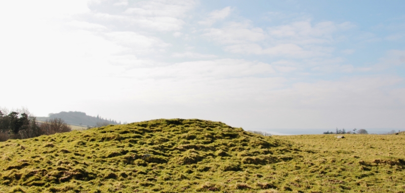
Kirkdale Burn submitted by SumDoood on 23rd Mar 2016. Kirkdale Burn from the north.
(View photo, vote or add a comment)
Log Text: It is all too easy to visit the Cairnholy Chambered Cairns instead of exploring the wider area. Somewhat belatedly, I decided to capture the Kirkdale Burn Cairn. This grassy mound is only a short walk from the Northern Chambered Cairn. Canmore lists multiple carved stones S of the cairn which I intend to investigate.
Cairnderry
Date Added: 25th Mar 2025
Site Type: Chambered Cairn
Country: Scotland (Dumfries and Galloway)
Visited: Yes on 24th Mar 2025. My rating: Condition 3 Ambience 5 Access 4
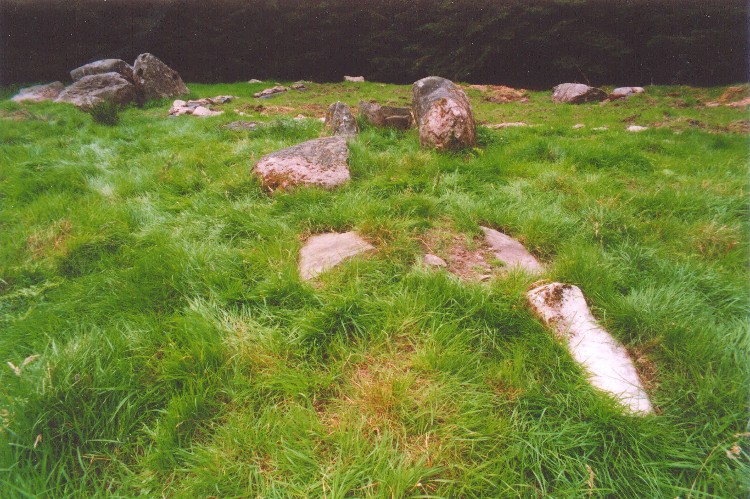
Cairnderry submitted by mickm on 17th Mar 2005. View of the cairn looking eastsoutheast up the passage to the northeast chamber. The south chamber is visible to top left and the outline of the 2002 excavations in the quadrant around the northwest chamber can be made out at the top of the picture.
(View photo, vote or add a comment)
Log Text: On my return visit I found Cairnderry in an improved condition: The kerb of the cairn was discernible and the exposed chambers in the centre of the cairn were free from vegetation. I was able to reconcile the remains of the cairn with the plan.
Cairnderry Cairn is an impressive monument with easy access from the A714, deserving of more visitors.
Cairnderry
Date Added: 25th Mar 2025
Site Type: Chambered Cairn
Country: Scotland (Dumfries and Galloway)
Visited: Yes on 11th Jun 2021. My rating: Condition 3 Ambience 5 Access 4

Cairnderry submitted by mickm on 17th Mar 2005. View of the cairn looking eastsoutheast up the passage to the northeast chamber. The south chamber is visible to top left and the outline of the 2002 excavations in the quadrant around the northwest chamber can be made out at the top of the picture.
(View photo, vote or add a comment)
Log Text: On my first visit to Cairnderry Cairn the perimeter and the chambers of the cairn were obscured by vegetation making interpretation difficult.
Balker Moor N
Date Added: 23rd Mar 2025
Site Type: Cairn
Country: Scotland (Dumfries and Galloway)
Visited: Yes on 19th Mar 2025. My rating: Condition 1 Ambience 4 Access 1

Balker Moor N submitted by markj99 on 23rd Mar 2025. Balker Moor N Cairn viewed from N.
(View photo, vote or add a comment)
Log Text: A visit to Balker Moor N Cairn has two problems: Firstly, the route to the cairn requires walking half a mile over uneven boggy moorland and secondly, the cairn is very difficult to find. All that remains is an earth bank on the N Arc of the cairn with several kerb stones. I didn't even mention that I had a close encounter with a stag on my first visit: A large stag accompanied by around 5 hinds were within 150 yards of the S cairn, far from safety. I held my ground nervously before they moved away.
Ballach-a-Heathry
Date Added: 21st Mar 2025
Site Type: Cairn
Country: Scotland (Dumfries and Galloway)
Visited: Yes on 19th Mar 2025. My rating: Condition 3 Ambience 4 Access 4
Ballach-a-Heathry submitted by markj99 on 25th Mar 2020. Field clearance stones on Ballach-a-Heathry cairn.
(View photo, vote or add a comment)
Log Text: When I revisited Ballach-a-Heathry Cairn it's condition was much improved. The large field clearance stones had been removed, leaving a grassy plateau sloping S-N. The perimeter of the cairn was more sharply defined with steep edges. The cairn has an irregular elongated oval footprint. It is situated c. 180 yards SW of a convenient gate with adjacent parking space.
Drumwhirn Cairn
Date Added: 13th Feb 2025
Site Type: Cairn
Country: Scotland (Dumfries and Galloway)
Visited: Yes on 8th Feb 2025. My rating: Condition 3 Ambience 5 Access 3
Drumwhirn Cairn submitted by markj99 on 12th Jul 2020. Extensive stone robbing on W side of Drumwhirn Cairn.
(View photo, vote or add a comment)
Log Text: This is actually my third visit to Drumwhirn Cairn, a damaged but still impressive mound of stones situated in arable land c. 0.33 mile E of Barclye Farm. My route to Drumwhirn Cairn is available on the main page.
Boscawen-Ros West
Date Added: 6th Feb 2025
Site Type: Standing Stone (Menhir)
Country: England (Cornwall)
Visited: Yes on 8th Feb 2019. My rating: Condition 3 Ambience 3 Access 3

Boscawen-Ros West submitted by maengurta on 13th Apr 2007. One of a pair of menhirs at Boscawen ros. This one in a hedge about 7 ft tall.
(View photo, vote or add a comment)
Log Text: I managed to locate this stone, incorporated in a hedge on the W margin of the field, c. 60 yards WSW of Boscawen-Ros E Standing Stone.
Blairbuy 11
Date Added: 1st Feb 2025
Site Type: Carving
Country: Scotland (Dumfries and Galloway)
Visited: Yes on 16th Nov 2011. My rating: Condition 3 Ambience 4 Access 3

Blairbuy 11 submitted by markj99 on 1st Feb 2025. Deep Plough Carving on Blairbuy 11 Carved Panel.
(View photo, vote or add a comment)
Log Text: Blairbuy 11 Carved Panel can be hard to spot due to the faint cup and ring markings. Walk 10 yards E from Blairbuy 6 to locate this flat rock at ground level.
Blairbuy 6
Date Added: 31st Jan 2025
Site Type: Rock Art
Country: Scotland (Dumfries and Galloway)
Visited: Yes on 12th Nov 2011. My rating: Condition 3 Ambience 5 Access 3
Blairbuy 6 submitted by SolarMegalith on 28th Sep 2013. Cups with single rings on Blairbuy 6 panel (photo taken on September 2013).
(View photo, vote or add a comment)
Log Text: This rock is on high ground on the edge of a small plantation. I observed a deep cup and ring marking, a shallow cup and ring marking and an unusual double parallel groove carving on the panel.
Blairbuy 1
Date Added: 24th Jan 2025
Site Type: Rock Art
Country: Scotland (Dumfries and Galloway)
Visited: Yes on 27th Aug 2011. My rating: Condition 3 Ambience 5 Access 3
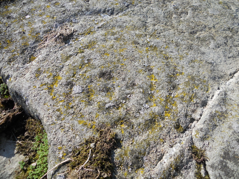
Blairbuy 1 submitted by markj99 on 27th Mar 2019. Blairbuy 1 cup and ring marking, close-up.
(View photo, vote or add a comment)
Log Text: As far as I can remember Blairbuy 1 was easy to find and easier to photograph than most cup and ring markings.
The Birchwood Monolith
Date Added: 20th Jan 2025
Site Type: Modern Stone Circle etc
Country: England (Cheshire)
Visited: Yes on 7th May 2017. My rating: Condition 5 Ambience 4 Access 3
The Birchwood Monolith submitted by TimPrevett on 24th Feb 2020. Slightly offset from the centre, looking south east. Birchwood Boulevard (to the rear) aligns clearly from the stone and path. Viewing the stone from the boulevard, the stone lines up exactly with the central road markings. Photo 23rd February 2020 with iPhone 6s.
A large modern monolith with likely observable solsticial alignments framed via a road to the south.
Around eight feet tall, the monolith's broad sides face north-north-west / south-south-east suggesting some solsticial or near sol...
(View photo, vote or add a comment)
Log Text: Despite the lack of nearby parking this modern standing stone is well worth a visit. The massive stone is beautifully framed by a horseshoe of trees planted on an earth bank.
An Carra
Date Added: 15th Jan 2025
Site Type: Standing Stone (Menhir)
Country: Scotland (South Uist)
Visited: Yes on 30th Jun 2011. My rating: Condition 4 Ambience 5 Access 3

An Carra submitted by SandyG on 20th May 2016. View from south (28 August 2015).
(View photo, vote or add a comment)
Log Text: When travelling to South Uist, An Carra is a must visit site. Stoneybridge Water Treatment Works has an access road off the A865 c. 600 yards before reaching Stoneybride, a small village in the middle of South Uist. There is room to park opposite the access road. Walk 0.5 miles up the road and the massive stone will appear on the L.
An Carra must be one of the largest standing stones in Scotland at 17 ft high and nearly 5 ft wide.
Auchmantle Fell (The Wee Cairn)
Date Added: 9th Jan 2025
Site Type: Cairn
Country: Scotland (Dumfries and Galloway)
Visited: Yes on 14th Jan 2024. My rating: Condition 2 Ambience 4 Access 3

Auchmantle Fell (The Wee Cairn) submitted by markj99 on 8th Jan 2025. NW Earth Bank of Auchmantle Fell (The Wee Cairn).
(View photo, vote or add a comment)
Log Text: Auchmantle Fell (The Wee Cairn) is the more difficult to locate cairn of the pair of ruined cairns on Auchmantle Fell . If you visit The Muckle Cairn first then head S for c. 135 yards across boggy moorland look out for a grassy circle in the moor with a prominent earth bank c. 1.5 feet high on the NW arc. See directions on Auchmantle Fell (The Muckle Cairn) main page.
Auchmantle Fell (The Muckle Cairn)
Date Added: 9th Jan 2025
Site Type: Cairn
Country: Scotland (Dumfries and Galloway)
Visited: Yes on 14th Dec 2024. My rating: Condition 2 Ambience 4 Access 3
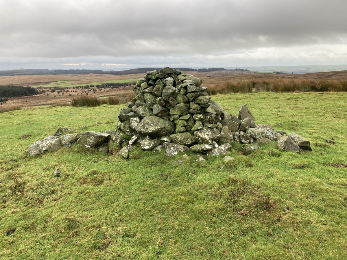
Auchmantle Fell (The Muckle Cairn) submitted by markj99 on 8th Jan 2025. Auchmantle Fell (The Muckle Cairn) viewed from N.
(View photo, vote or add a comment)
Log Text: Auchmantle Fell (The Muckle Cairn) is the more visible cairn of the pair of ruined cairns on Auchmantle Fell . A modern cairn c. 4 feet high dominates the small grassy platform. See main page for directions.
Auchensoul Hill
Date Added: 8th Jan 2025
Site Type: Cairn
Country: Scotland (South Ayrshire)
Visited: Yes on 29th Dec 2024. My rating: Condition 2 Ambience 5 Access 3
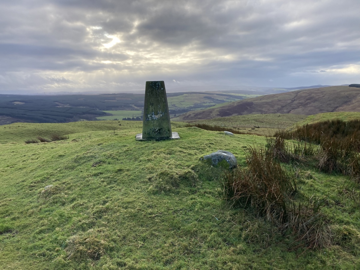
Auchensoul Hill submitted by markj99 on 7th Jan 2025. Auchensoul Hill Cairn viewed from NNE.
(View photo, vote or add a comment)
Log Text: Auchensoul Hill is located c. 0.8 mile WNW of Barr. You can park in the centre of the village then walk W to cross the Stinchar Bridge. Follow the road N to reach a signed footpath on the left. The vague path heads W uphill through moorland grass. Trees have been recently planted on the E slopes of Auchensoul Hill, surrounded by a deer fence. Continue W along the line of the deer fence until you reach a gate in the deer fence. Go through the gate into rough green pasture. Head NW up a steep slope towards the summit of Auchensoul Hill. It is a rocky knoll surmounted by an OS Trig Point at NX 26391 94548.
The vague path up to Auchensoul Hill is steep through boggy moorland ground,
requiring sturdy boots and GPS navigation ideally.
Claughreid
Date Added: 7th Jan 2025
Site Type: Stone Circle
Country: Scotland (Dumfries and Galloway)
Visited: Yes on 26th Dec 2024. My rating: Condition 3 Ambience 5 Access 1
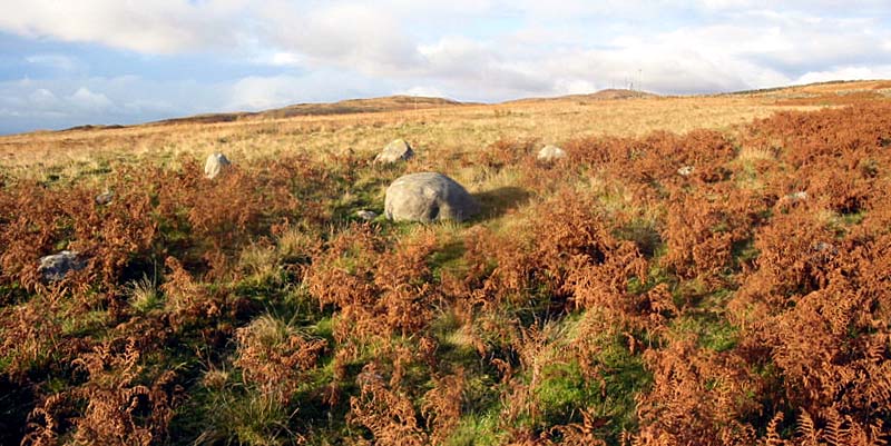
Claughreid submitted by stu on 17th Jul 2004. NX517560.
Similar to the Glenquickan circle just over the hill, here though the centre stone has fallen.
(View photo, vote or add a comment)
Log Text: Claughreid Stone Circle is difficult to locate due to its remote location over difficult ground. I was unwilling to trudge through boggy moorland so I devised an easier route via a track to Claughreid Farm: Turn off the A75 for Cairn Holy at NX 5164 5305. Follow the sign for Cairn Holy for c. 100 yards then bear right onto an unsigned single track road. Stay on this winding lane for c. 0.4 miles to reach an unsigned track on the left at NX 5207 5313. Follow this dead-end track for a mile to reach a small car park at the end: the track becomes increasingly rough and dirty closer to the end.
The walking route to Claughreid Stone Circle starts at the end of the public road from Barholm Farm to Claughreid Farm. Park up and walk along the track to Claughreid Farm. Head W through Claughreid Farm then head downhill. Cross over a ford then follow the track through a dry stane dyke. Continue NW for c. 300 yards to go through a gate in the dry stane dyke. Head NNE from the gateway on vague tracks for c. 100 yards to reach Claughreid Stone Circle, partially obscured in moorland. My walking route along this track can be viewed on Claughreid Stone Circle.
Cashtal-yn-Ard
Date Added: 21st Nov 2024
Site Type: Chambered Tomb
Country: Channel Islands and Isle of Man (Isle of Man)
Visited: Yes on 23rd Mar 2017. My rating: Condition 3 Ambience 5 Access 4
Cashtal-yn-Ard submitted by TimPrevett on 24th Jun 2015. A low shot atCashtal yn Ard tomb, 31st July 2014, taking in the flowers and the mountains. Magnificent place. We were here over an hour and had it to ourselves. A very exposed location in hard rain and very lovely in warm sunshine, both of which we had in the time here.
(View photo, vote or add a comment)
Log Text: Despite the narrow single track road to Cashtal yn Ard and difficult parking this ancient monument is a must visit. I approached Cashtal yn Ard from the SE passing by a ruined cottage. It is one of the most impressive multi-chambered cairns I have ever visited. On my visit the site was well maintained. I was lucky to have half an hour alone with these intriguing stones in good weather.
Ardilistry
Date Added: 20th Nov 2024
Site Type: Stone Circle
Country: Scotland (Isle of Islay)
Visited: Yes on 22nd Aug 2019. My rating: Condition 3 Ambience 5 Access 3

Ardilistry submitted by Bladup on 4th Feb 2013. Ardilistry 4 poster [It's really tiny]
(View photo, vote or add a comment)
Log Text: Ardilistry Four Poster is in imminent danger of becoming Ardilistry Three Poster. The W stone was only protruding c. 1 inch above the surface on my visit. I wonder how much of Ardilistry Four Poster lies below the marsh? Going, going, gone: Don't leave it too long!
Leskernick cist
Date Added: 20th Nov 2024
Site Type: Cist
Country: England (Cornwall)
Visited: Yes on 17th Mar 2014. My rating: Condition 1 Ambience 4 Access 3
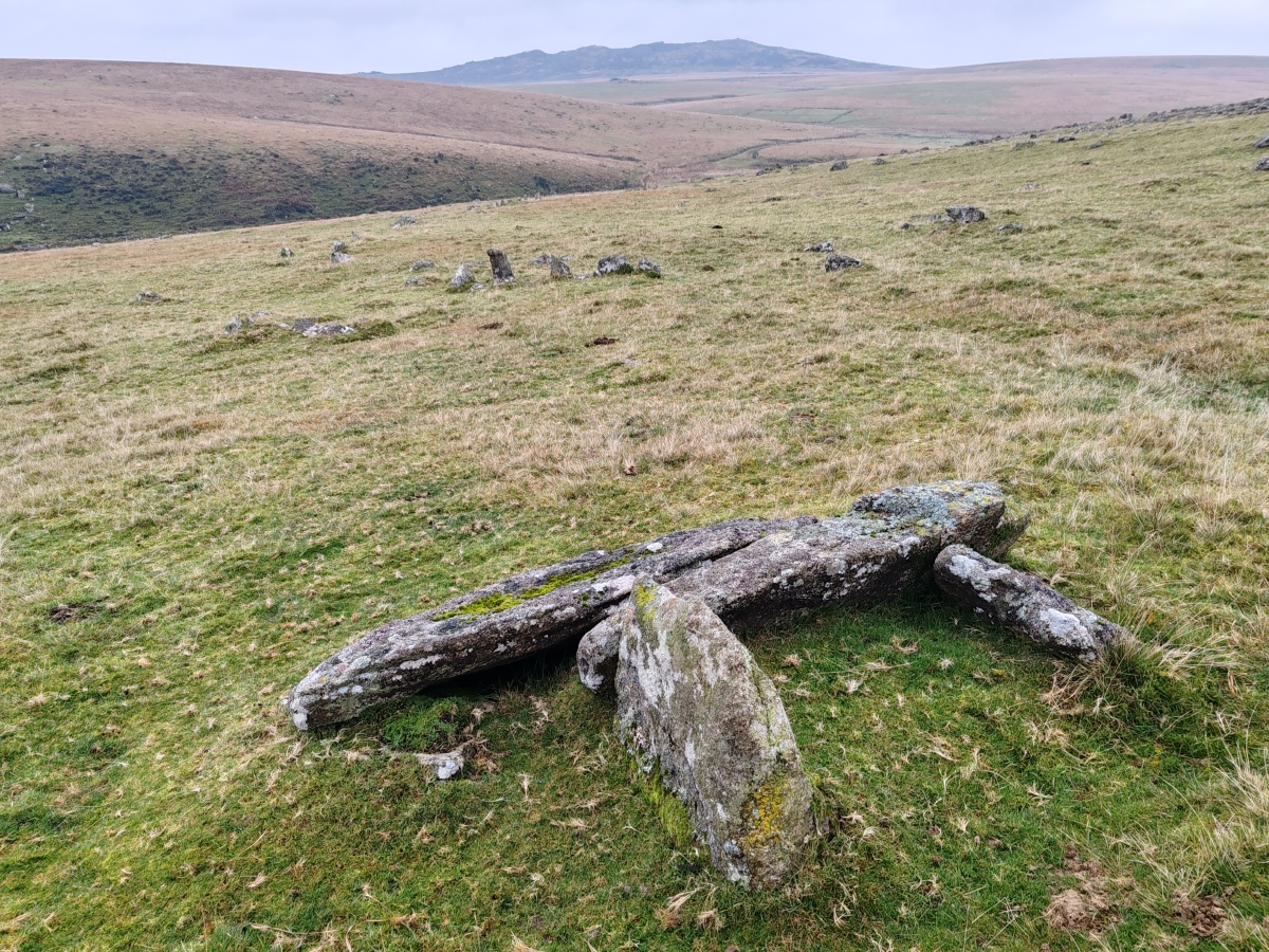
Leskernick cist submitted by Bladup on 19th Nov 2024. Leskernick cist with Brown Willy and part of the settlement in the background
(View photo, vote or add a comment)
Log Text: This ruined cist is in a featureless moor with many scattered stones. Good GPS navigation is vital to locate the cist. It only becomes apparent at close range.
Penny Well (Edinburgh)
Date Added: 7th Nov 2024
Site Type: Holy Well or Sacred Spring
Country: Scotland (Midlothian)
Visited: Yes on 22nd Jun 2012. My rating: Condition 1 Ambience 3 Access 5
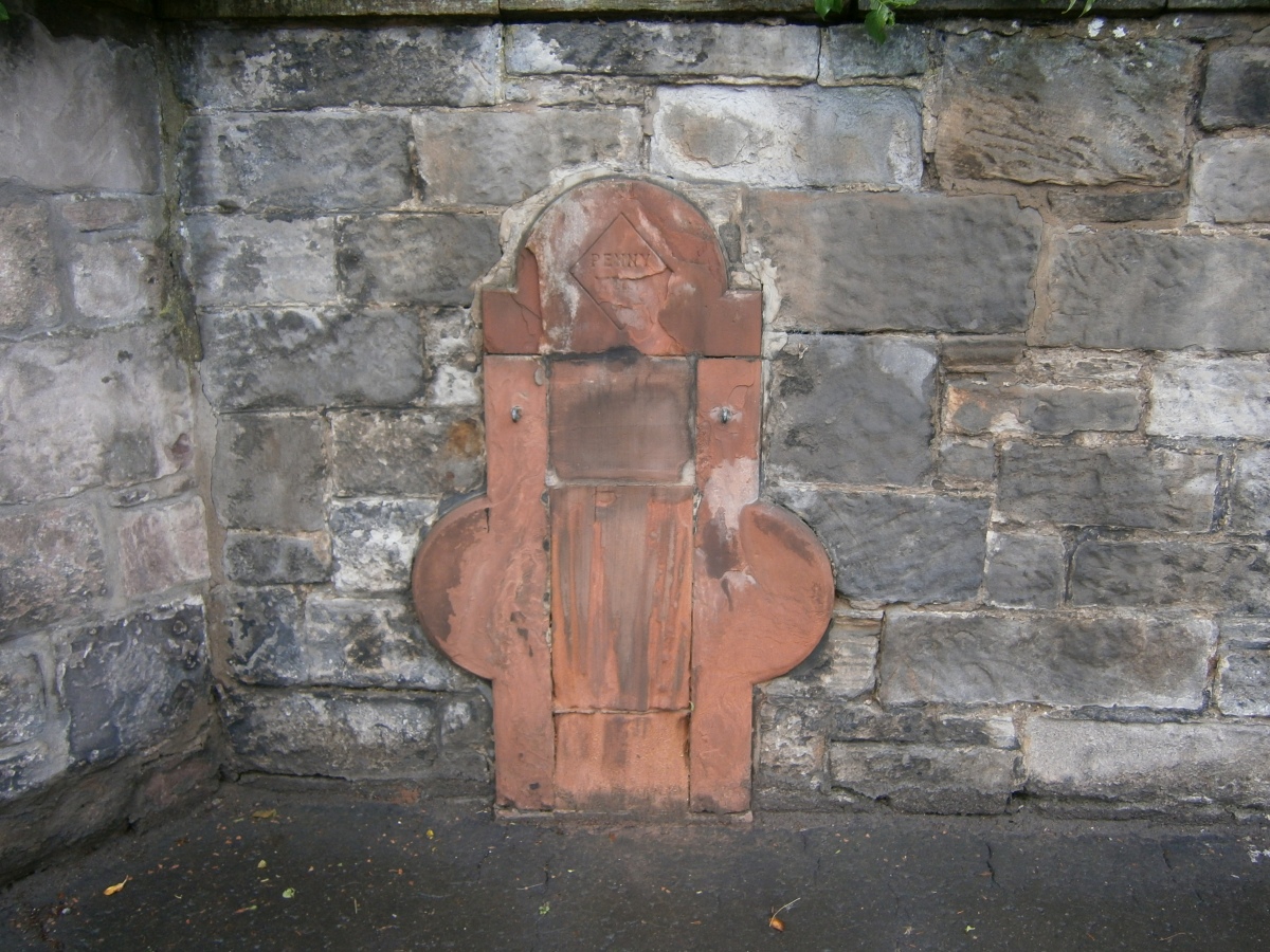
Penny Well (Edinburgh) submitted by markj99 on 1st Mar 2021. The Penny Well, Grange Loan, Grange in Edinburgh.
(View photo, vote or add a comment)
Log Text: I used to walk past The Penny Well, situated on the leafy Grange Loan, when I lived in Edinburgh. The site of the well has been preserved in red brick built into a stone wall.
