Contributory members are able to log private notes and comments about each site
Sites Markj99 has logged. View this log as a table or view the most recent logs from everyone
Apron Full of Stones
Date Added: 11th Apr 2021
Site Type: Ring Cairn
Country: England (Yorkshire (North))
Visited: Yes on 6th Apr 2014. My rating: Condition 3 Ambience 4 Access 3

Apron Full of Stones submitted by Blingo_von_Trumpenstein on 27th Mar 2017. Apron Full Of Stones ring cairn. Very obvious placement facing the gorge that contains Yordas cave.
(View photo, vote or add a comment)
Log Text: There is a convenient lay by c. 100ft WNW of Apron Full of Stones at SD7065578918. If Kingsdale Beck is in spate there is a bridge c. 200ft N of a lay-by at SD7023078010. The cairn is c. 0.5 mile walk by the river from this point.
Apron Full of Stones is a much reduced cairn however there is sufficient original structure to suggest how impressive it would have been in its low lying landscape. The proximity of Yordas Cave is a bonus.
Yordas cave
Date Added: 1st Jun 2024
Site Type: Cave or Rock Shelter
Country: England (Yorkshire (North))
Visited: Yes on 6th Apr 2014. My rating: Condition 4 Ambience 4 Access 4
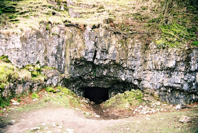
Yordas Cave submitted by andy_h on 27th Apr 2004. Previously a Victorian Showcave in which evidence of early human habitation was found. A wonderful place to spend an afternoon exploring with a torch. The highlight being the underground waterfall chamber at the back of the cave.
(View photo, vote or add a comment)
Log Text: The troglodyte in me can never pass up a chance to explore a cave. Yordas Cave is easily accessible with a bonus waterfall.
Ashlar Chair 01
Date Added: 15th Apr 2021
Site Type: Rock Outcrop
Country: England (Yorkshire (West))
Visited: Yes on 21st Jan 2009. My rating: Condition 3 Ambience 5 Access 2
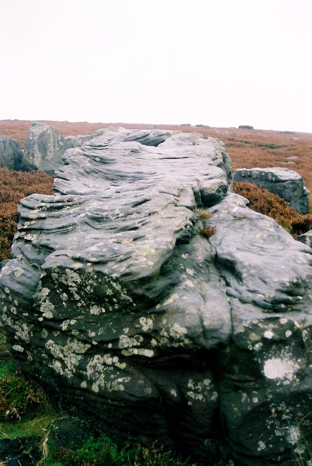
Ashlar Chair 01 submitted by andy_h on 17th Nov 2003. This heavily weathered rock lays at the meeting point of four moors. Ilkley Moor, Burley Moor, Morton Moor and Bingley Moor. Cup and ring carvings were recorded in the 19th C, but these have now weathered away and no trace remains.
Paul Bennett describes the rock as an 'Omphalus' or a universal centre. It's name probably comes from it's use by medieval masons. It was also used as a meeting point for the Pendle Witches.
SE1208 4483
(View photo, vote or add a comment)
Log Text: I have an attraction to sites which are difficult to reach. I would rather walk several miles over bleak moorland to find a random stone than walk 10 yards on a footpath to a more spectacular site by the roadside. Therefore Ashlar Chair was too tempting to ignore, a rough diamond in unforgiving terrain. I gained a great deal of satisfaction in finding Ashlar Chair, unspectacular as it is.
The Bridestones (Todmorden)
Date Added: 2nd Jun 2021
Site Type: Natural Stone / Erratic / Other Natural Feature
Country: England (Yorkshire (West))
Visited: Yes on 23rd Jan 2009. My rating: Condition 3 Ambience 5 Access 4
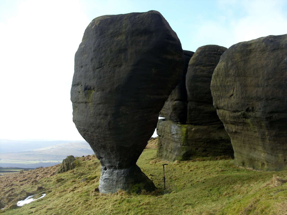
The Bridestones (Todmorden) submitted by markj99 on 2nd Jun 2021. The Bride Stone tapers to a narrow column at its base (c. 1m walking stick for scale).
(View photo, vote or add a comment)
Log Text: There is a large lay-by at SD 93769 26809 on Eastwood Road from Todmordern. A path starts here leading to the Bridestones after c. 500 yards on a muddy path (stout footwear recommended). The Bridestones are far enough away from the road to give the unusual weathered stones an isolated special ambiance. The Bride Stone herself is the star attraction, the Groom Stone lies broken by her side.
Pancake Rock
Date Added: 19th Dec 2022
Site Type: Rock Art
Country: England (Yorkshire (West))
Visited: Yes on 21st Jan 2009. My rating: Condition 3 Ambience 4 Access 3
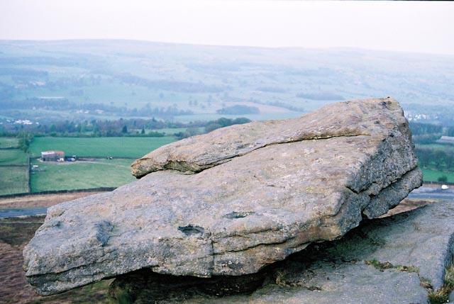
Pancake Stone, Ilkley Moor, West Yorkshire submitted by andy_h on 15th May 2003. The Pancake Stone is a weathered outcrop, perched ominously overlooking the Cow & Calf Hotel. The top is covered in Cup and Ring marks, but is now very worn.
(View photo, vote or add a comment)
Log Text: Pancake Rock is located in an area rich with rock art. The multiple cup marks may not be spectacular but a visit is worthwhile.
Cow and Calf Rocks
Date Added: 19th Dec 2022
Site Type: Rock Outcrop
Country: England (Yorkshire (West))
Visited: Yes on 21st Jan 2009. My rating: Condition 4 Ambience 4 Access 4

Cow and Calf Rocks submitted by andy_h on 10th Nov 2003. The most prominent landmark for miles around. There are no visible megalithic remains at this huge rock outcrop, but local folklore refers to this being a place worthy of strong consideration.
I've always found it a little strange that as the most prominent landmark for miles around, the Cow n' Calf didn't bear any cup n' ring marks as they can be found both to the left and the right of the outcrop. It is possible that any that may have been on the rock could have been lost under the onslaugh...
(View photo, vote or add a comment)
Log Text: They may not have a strong megalithic connection but the Cow and Calf Rocks have a massive presence, and are located close to Ilkley Moor Car Park.
Idol Stone
Date Added: 19th Dec 2022
Site Type: Rock Art
Country: England (Yorkshire (West))
Visited: Yes on 21st Jan 2009. My rating: Condition 4 Ambience 5 Access 3

Idol Stone submitted by andyb456 on 22nd Nov 2004. This stone is beautiful and need no description.
(View photo, vote or add a comment)
Log Text: The singular markings on the Idol Stone are a must visit for anyone interested in rock art.
Doubler Stones
Date Added: 19th Dec 2022
Site Type: Rock Art
Country: England (Yorkshire (West))
Visited: Yes on 21st Jan 2009. My rating: Condition 4 Ambience 5 Access 2
Doubler Stones submitted by DavidRaven on 18th May 2003. Two large rocks, weathered into curious forms. The upper surface of one has distinct cup-and-ring carvings. Even when the moor is teeming
with visitors, this backwater is usually empty of folk.
(View photo, vote or add a comment)
Log Text: These curious rocks are located on the edge of moorland. They are best accessed from the W via a track starting at SE 06585 46318 off Light Bank Lane.
Two Eggs (N) 02
Date Added: 21st Dec 2022
Site Type: Rock Art
Country: England (Yorkshire (West))
Visited: Yes on 21st Jan 2009. My rating: Condition 3 Ambience 4 Access 3
Two Eggs (N) 02 submitted by Rich32 on 2nd Aug 2019. This photo shows the 'Two Eggs' as found identified on the Ordnance Survey Maps. Both stones have cup-like natural depressions on the upper surface.
It's worth noting, whilst Ilkley Archaeology Group gave the same OS coordinates for the Two Eggs, they photographed completely different stones. Interestingly the stones they photographed are more 'egg-like' in shape. Maybe OS assigned the name to the wrong stones.
Image captured 10 May 2013.
Image Credit: Carved Stone Investigations...
(View photo, vote or add a comment)
Log Text: These two erratic boulders are significant presences on desolate moorland. They are a worthwhile visit despite the lack of visible rock art.
Two Eggs (S) 01
Date Added: 21st Dec 2022
Site Type: Rock Art
Country: England (Yorkshire (West))
Visited: Yes on 21st Jan 2009. My rating: Condition 3 Ambience 4 Access 3
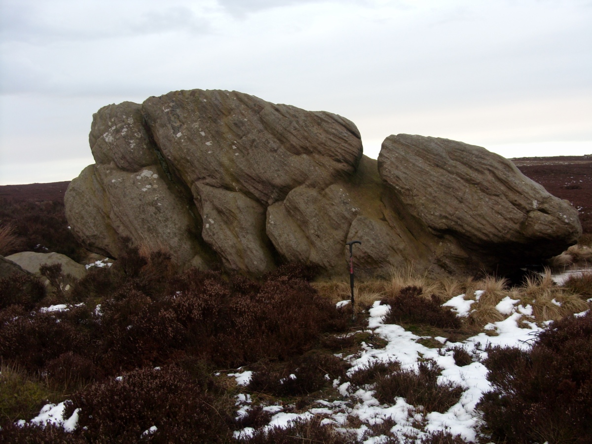
Two Eggs (S) 01 submitted by markj99 on 15th Apr 2021. Two Eggs (S) pictured with a c. 1m walking stick for scale.
(View photo, vote or add a comment)
Log Text: These two erratic boulders are significant presences on desolate moorland. They are a worthwhile visit despite the lack of visible rock art.
Barnenez Cairn
Date Added: 13th Oct 2023
Site Type: Chambered Cairn
Country: France (Bretagne:Finistère (29))
Visited: Yes on 20th Sep 2023. My rating: Condition 4 Ambience 5 Access 4

Barnenez Cairn submitted by neolithique02 on 22nd Feb 2014. Cairn de Barnenez Site in Bretagne:Finistère (29) France
Image copyright: Néolithique02, hosted on Flickr and displayed under the terms of their API.
(View photo, vote or add a comment)
Log Text: I was suffering from Stone-Fatigue after a week in and around Carnac. I opted to drive for 3 hours to Cairn de Barnenez as a relaxing change. The monument was well sign-posted. The entry fee was a reasonable 6 euros. The epic scale of Cairn de Barnenez was intimidating at first. There are 11 parallel dolmens in the cairn running SE-NW, however all but one of the passages are closed to the public. It took me 45 minutes to fully capture the essence of the monument. Cairn de Barnenez is a recommended visit.
Dolmen du Crapaud
Date Added: 23rd Sep 2023
Site Type: Burial Chamber or Dolmen
Country: France (Bretagne:Morbihan (56))
Visited: Yes on 13th Sep 2023. My rating: Condition 2 Ambience 5 Access 4
Dolmen du Crapaud submitted by thecaptain on 20th Jul 2006. Perched on its clifftop, overlooking the sea and a nice sandy beach, from certain angles this dolmen does indeed look like a toad poking its head up.
(View photo, vote or add a comment)
Log Text: Dolmen du Crapaud is located on a cliff edge SE of Plage des Granges, S of Pen Lan (Penn Lann). The remains of this site have been much reduced by coastal erosion. The chamber resembles a toad viewed from N, hence the french name Dolmen du Crapaud.
Dolmens des Grays
Date Added: 23rd Sep 2023
Site Type: Burial Chamber or Dolmen
Country: France (Bretagne:Morbihan (56))
Visited: Yes on 13th Sep 2023. My rating: Condition 2 Ambience 5 Access 4
Dolmens des Grays submitted by thecaptain on 19th Jul 2006. East along the coast from Penlann headland are found the remains of this large cairn.
It is difficult to make anything out nowadays, other than there are lots of large rocks on the remains of a large mound, overlooking the Villaine estuary.
Closer inspection shows this to have once been a large 30 metre diameter cairn, with at least three passage tombs within it, two of which still have a few capstones in position.
(View photo, vote or add a comment)
Log Text: Dolmens des Grays is located 5 minutes E along the coastal path starting in Pen Lan Car Park. At first sight the monument is a jumble of stones. There is an interpretation board, suggesting that the cairn consists of an amalgam of 3 separate tombs. It divides the cairn into Tomb A,B & C. They are in the N, SW & SE respectively.
Menhir La Motte de Beurre
Date Added: 23rd Sep 2023
Site Type: Standing Stone (Menhir)
Country: France (Bretagne:Morbihan (56))
Visited: Yes on 14th Sep 2023. My rating: Condition 3 Ambience 4 Access 5
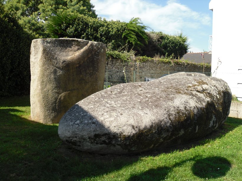
Menhir La Motte de Beurre submitted by regina on 12th Nov 2014. Site in Bretagne:Morbihan (56) France
(View photo, vote or add a comment)
Log Text: I found the Menhir du Bronzo by following the Sites des Megalithes sign opposite the Tourist Office. The broken menhir is located in a vacant plot on the left of Ruelle du Bronzo. The site has two large stones: the erect bottom half in the SW and the displaced top half lying to the NE. Each half of the broken stone measures c. 6 feet long.
Mane-Rethuel Dolmen
Date Added: 24th Sep 2023
Site Type: Burial Chamber or Dolmen
Country: France (Bretagne:Morbihan (56))
Visited: Yes on 14th Sep 2023. My rating: Condition 3 Ambience 3 Access 4
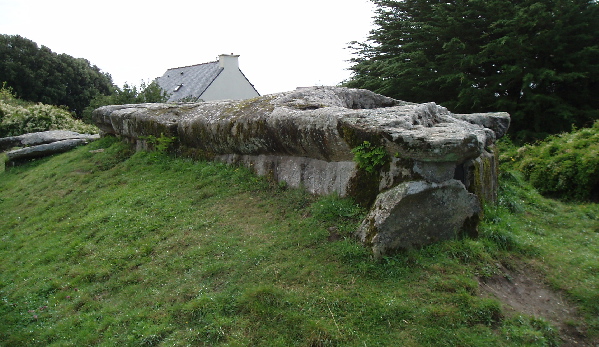
Mane-Rethuel dolmen submitted by AlexHunger on 21st Sep 2004. Dolmen de Mane-Rithual in central Locmariaquer viewed from North. Entrance is at oposite end.
(View photo, vote or add a comment)
Log Text: I followed directions to Dolmen de Mané Rutuel from the Tourist Office in Locmariaquer. After a 5 minute walk, I discovered that the long mound is closed to the public due to safety concerns. I was reduced to walking round a protective fence, making the best of limited views. Mané Rutuel is an impressive monument but a disappointing outcome.
Er-Grah tumulus
Date Added: 24th Sep 2023
Site Type: Chambered Tomb
Country: France (Bretagne:Morbihan (56))
Visited: Yes on 14th Sep 2023. My rating: Condition 3 Ambience 4 Access 4
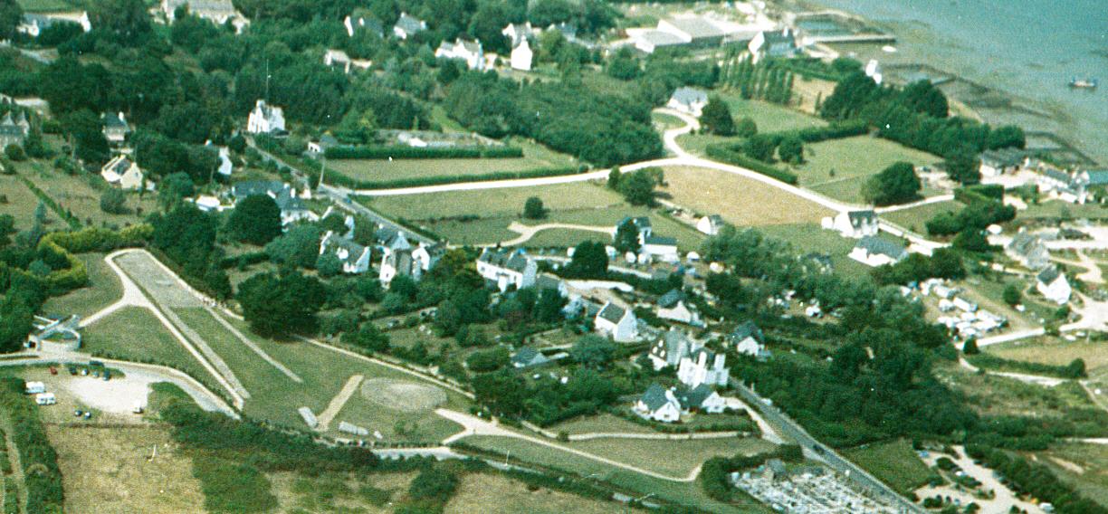
Er-Grah tumulus submitted by JJ on 8th Oct 2003. Er Grah tumulus, Grand Menhir Brisé, and La Table des Marchands, Locmariaquer.
Aerial photo copyright JJ Evendon
(View photo, vote or add a comment)
Log Text: Er-Grah Tumulus is one of Locmariaquer's big three sites. It is only accessible via the Site des Megalithes Visitor Centre for 6 euros. To be fair, there are three impressive monuments, unrestricted visiting time and free parking so what's not to like?
Er-Grah Tumulus has gravitas but it's long thin footprint make it difficult to capture a definitive image. The undoubted focus is the central tomb with its massive capstone, the cherry on the cake. I decided to walk slowly round Er-Grah Tumulus absorbing its antiquity as I strolled.
La Table des Marchands
Date Added: 24th Sep 2023
Site Type: Burial Chamber or Dolmen
Country: France (Bretagne:Morbihan (56))
Visited: Yes on 14th Sep 2023. My rating: Condition 3 Ambience 4 Access 4

La Table des Marchands submitted by JJ on 9th Nov 2002. La Table des Marchands
(View photo, vote or add a comment)
Log Text: La Table des Merchants is one of Locmariaquer's big three sites. It is only accessible via the Site des Megalithes Visitor Centre for 6 euros. To be fair, there are three impressive monuments, unrestricted visiting time and free parking so what's not to like?
La Table des Merchants is a cairn constructed in 1993 around the surviving naked dolmen for the preservation of the antiquity. It was interesting to see the carved rear stone and ceiling in the chamber. However, the new cairn reminds me of the reconstructed cairn at Newgrange. I prefer my ancient monuments unadulterated.
Grand Menhir Brisé
Date Added: 24th Sep 2023
Site Type: Standing Stone (Menhir)
Country: France (Bretagne:Morbihan (56))
Visited: Yes on 14th Sep 2023. My rating: Condition 3 Ambience 5 Access 4

Grand Menhir Brisé submitted by ermine on 27th Jun 2004. Grand Menhir Brisé, Locmariaquer.
A megalithic tragedy.
(View photo, vote or add a comment)
Log Text: Grand Menhir Brise is one of Locmariaquer's big three sites. It is only accessible via the Site des Megalithes Visitor Centre for 6 euros. To be fair, there are three impressive monuments, unrestricted visiting time and free parking so what's not to like?
Grand Menhir Brise consists of four massive recumbent stones which are though to have been parts of one of the largest ever menhirs, measuring c. 20 metres long. There is speculation as to whether the Grand Menhir Brise either broke on erection or as a result of an earthquake or was deliberately toppled. There is archaeological evidence of 19 socket holes forming a giant stone row, with Grand Menhir Brise as an end stone. Whatever the reality, there is no doubt that the Grand Menhir Brise is an impressive antiquity.
Kerpenhir Menhir
Date Added: 25th Sep 2023
Site Type: Standing Stone (Menhir)
Country: France (Bretagne:Morbihan (56))
Visited: Yes on 14th Sep 2023. My rating: Condition 4 Ambience 5 Access 4
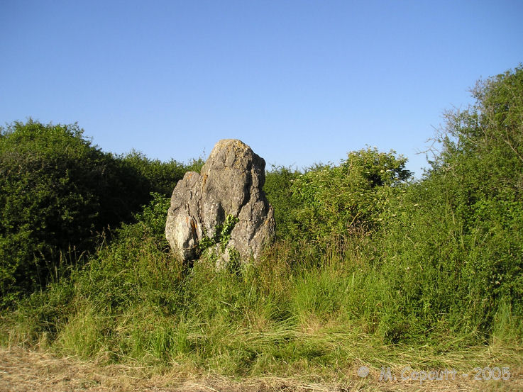
Kerpenhir menhir submitted by thecaptain on 29th May 2008. Splendidly positioned beside the sea near to the Pointe de Kerpenhir, this 3.5 metres tall menhir can be seen in the far hedge of a field, overlooking the entrance to the gulf of Morbihan.
(View photo, vote or add a comment)
Log Text: Menhir de Kerpenhir is a massive irregular standing stone on the coast c. 200m N of Société Nautique de Locmariaquer (Locmariaquer Sailing Club). The menhir is c. 3.5m high by 2.5m wide. It is orientated ENE-WSW on its broad faces.
There is a large car park off Route de Kerpenhir on Pointe de Kerpenhir, c. 2km SSE of Locmariaquer. Walk c. 40m N from the Car Park to reach a closed gate on the right. Follow a track W round the coast. After c. 350m turn left along a path. Follow this path W for c. 100m to reach Menhir de Kerpenhir.
Menhirs de Mané er Hroëck
Date Added: 25th Sep 2023
Site Type: Standing Stone (Menhir)
Country: France (Bretagne:Morbihan (56))
Visited: Yes on 14th Sep 2023. My rating: Condition 2 Ambience 4 Access 4

Menhirs de Mané er Hroëck submitted by regina on 17th Nov 2014. Standing menhir
(View photo, vote or add a comment)
Log Text: I stumbled on the recumbent stone while walking round the tumulus.
