Contributory members are able to log private notes and comments about each site
Sites Markj99 has logged. View this log as a table or view the most recent logs from everyone
Home Covert Tumulus
Date Added: 29th May 2021
Site Type: Round Barrow(s)
Country: England (Norfolk)
Visited: Yes on 28th Apr 2016. My rating: Condition 3 Ambience 4 Access 4
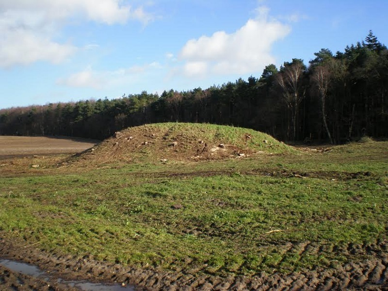
Home Covert Tumulus submitted by Runemage on 28th Feb 2014. Image from R Gadsby. Tumulus with trees removed.
(View photo, vote or add a comment)
Log Text: Home Covert Tumulus is easy to visit from a lay-by on the A1066. The tumulus is also known as Boudicca's Grave, one of several sites around Southern England claiming to be Boudicca's last resting place.
Hillend (Loanhead)
Date Added: 26th Nov 2023
Site Type: Hillfort
Country: Scotland (Midlothian)
Visited: Yes on 21st Apr 2023. My rating: Condition 2 Ambience 5 Access 3
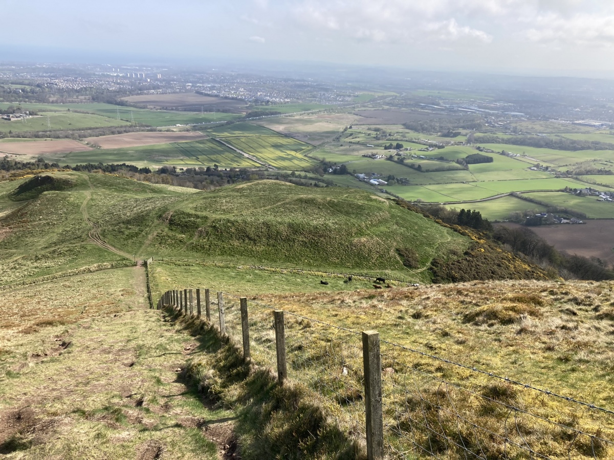
Hillend (Loanhead) submitted by markj99 on 25th Apr 2023. Hillend Hillfort viewed from SW.
(View photo, vote or add a comment)
Log Text: I parked at NT 24954 66968, a car park at the Hillend Ski Centre junction with the A702 on the S edge of Edinburgh. A path leading W starts here, before it turns to the SW. This path leads up to an elevated ridge which commands impressive views of Edinburgh. Caerketton Fort and Cairn are accessed by this moderately steep route. My route can be viewed on Caerketton Hill Cairn.
High Moor Hut Circle
Date Added: 13th Aug 2023
Site Type: Misc. Earthwork
Country: Scotland (Dumfries and Galloway)
Visited: Yes on 3rd Apr 2023. My rating: Condition 2 Ambience 4 Access 4

High Moor Hut Circle submitted by markj99 on 16th Apr 2023. High Moor Hut Circle viewed from NW.
(View photo, vote or add a comment)
Log Text: High Moor Hut Circle is easily accessible via a farm track off the B7005. See comment on site page for details.
High Gillespie
Date Added: 31st Mar 2023
Site Type: Passage Grave
Country: Scotland (Dumfries and Galloway)
Visited: Yes on 30th Mar 2023. My rating: Condition 2 Ambience 4 Access 1

High Gillespie submitted by mickm on 9th Jan 2005. High Gllespie, chambered long cairn viewed from the north. This is probably a Clyde type tomb. It contains an unusually large number of chambers (at least 6) and there are also 5 remaining stones of a flat facade at the eastern end. The cairn is crossed by a field wall, beyond which the western end has been completely destroyed.
(View photo, vote or add a comment)
Log Text: High Gillespie is accessible via a path. However, there are beef cattle in permanent residence at the start of the path. Beef cattle can be dangerous, beef cattle with calves ARE dangerous. I made a detour round the field then followed a rocky track N. A grass track veers off left of this track. Follow this wet and muddy track (wellies essential) to reach a ford. Turn left after the ford to a bridge crossing a fast flowing stream. Head S down the field to reach High Gillespie Cairn covered in whins on the S margin of the pasture.
High Baltersan
Date Added: 22nd Oct 2023
Site Type: Cairn
Country: Scotland (Dumfries and Galloway)
Visited: Yes on 11th Aug 2023. My rating: Condition 2 Ambience 4 Access 3
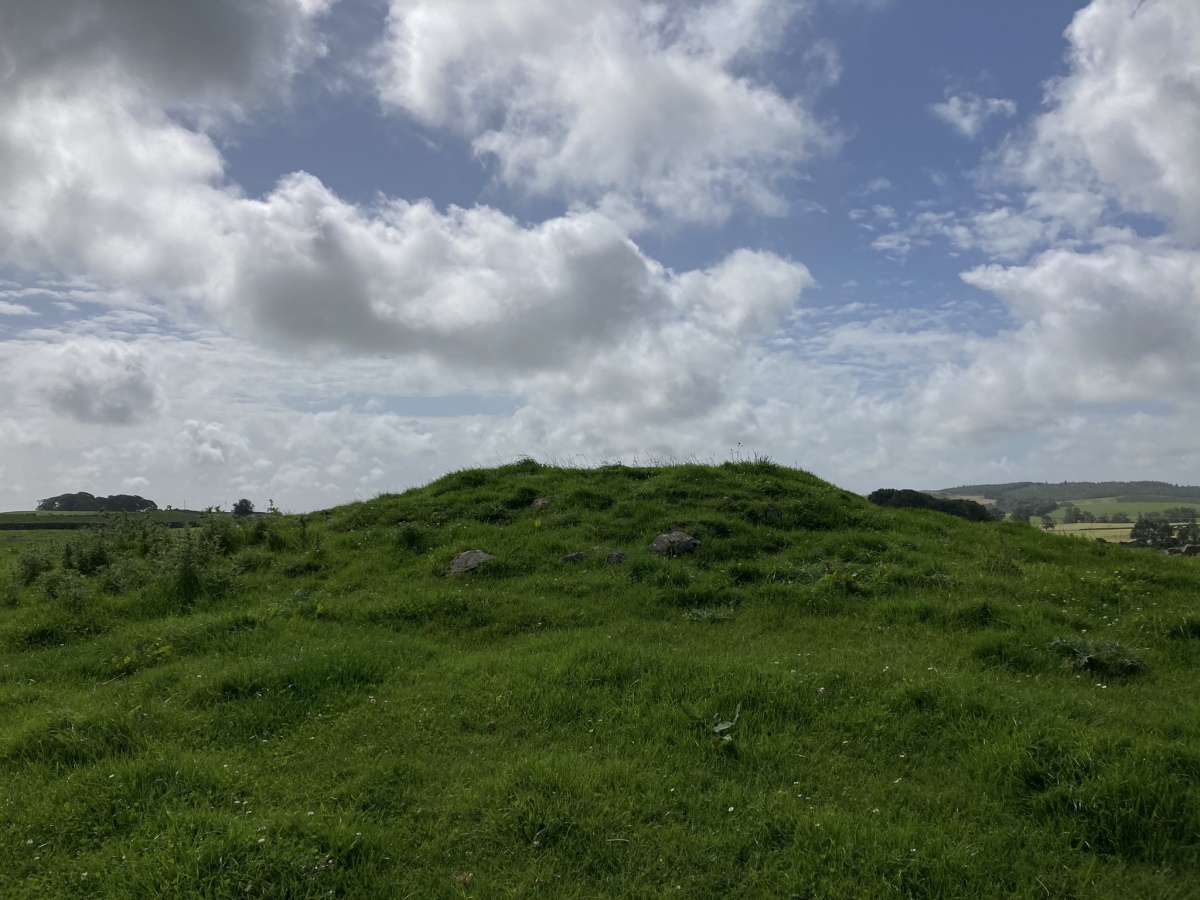
High Baltersan submitted by markj99 on 13th Aug 2023. High Baltersan Cairn viewed from north.
(View photo, vote or add a comment)
Log Text: Directions to High Baltersan Cairn: Take the Wigtown road off the A75 Newton Stewart roundabout. Stay on the road for c. 1.6 miles. Take a right turn down an unsigned single track road with passing places. After c. 0.7 miles turn left. Park up after c. 75 yards opposite a gate. High Baltersan Cairn is c. 160 yards ESE of the gate up a grassy slope, located c. 15 yards E of a natural rocky knoll. My route is viewable on High Baltersan Cairn.
Heel Stone
Date Added: 5th Jul 2023
Site Type: Standing Stone (Menhir)
Country: England (Wiltshire)
Visited: Yes on 4th Jun 2023. My rating: Condition 4 Ambience 5 Access 4
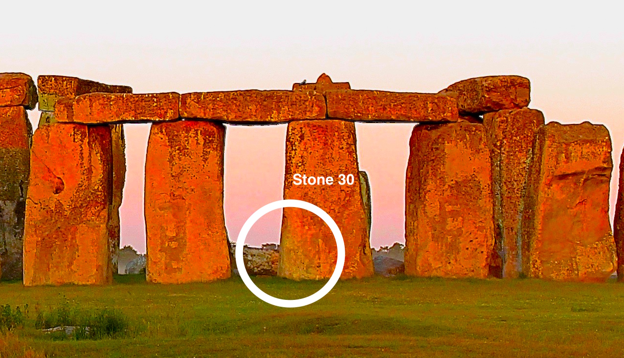
Heel Stone submitted by dodomad on 22nd Jun 2020. In this enhanced image the lower left corner of Stone 30 is in shadow - the Heelstone's shadow, confirming Terence Meaden's shadow casting hypothesis
Photo Credit: Simon Banton
(View photo, vote or add a comment)
Log Text: It is only possible to get close to the heel stone if you buy a ticket at the visitor centre, allowing a closer circuit of Stonehenge round the roped-off monument.
Hawk's Tor (South)
Date Added: 1st Jul 2023
Site Type: Stone Row / Alignment
Country: England (Cornwall)
Visited: Yes on 10th Mar 2014. My rating: Condition 4 Ambience 5 Access 3
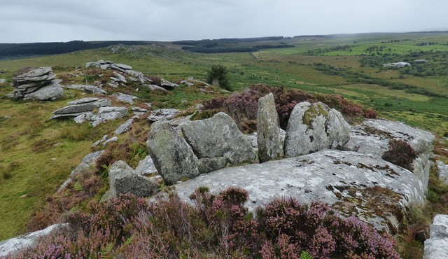
Hawk's Tor (South) submitted by SandyG on 29th Sep 2019. The Hawk's Tor (South) stone row, view from the east.
(View photo, vote or add a comment)
Log Text: I summited Hawk's Tor without any expectations. I was surprised to find these mysterious stones wedged into a crevice between rocks. Subsequently I discovered that this arrangement was considered to be a stone row.
Hautville's Quoit
Date Added: 18th Mar 2023
Site Type: Chambered Tomb
Country: England (Somerset)
Visited: Yes on 29th Aug 2014. My rating: Condition 1 Ambience 3 Access 3
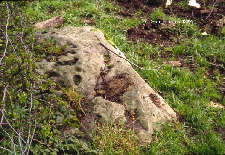
Hautville's Quoit submitted by bec-zog on 29th Oct 2003. Hautville Quoit. Late neolithic remnant. Located @ ST 602,638 (NNE 0f Stanton Drew Great Circle)
Aligns with centre of the Great Circle & the SW Circle.
Possibly part of a larger, now destroyed, structure.
(View photo, vote or add a comment)
Log Text: The remaining stone of Hauteville's Quoit half-buried next to a hedge requires more imagination than I have to reconstruct the monument. One for the completists.
Hardcroft
Date Added: 10th May 2022
Site Type: Cairn
Country: Scotland (Dumfries and Galloway)
Visited: Yes on 30th Oct 2020. My rating: Condition 3 Ambience 4 Access 1
Hardcroft submitted by markj99 on 1st Nov 2020. N-S Axis of Hardcroft Cairn.
(View photo, vote or add a comment)
Log Text: Hardcroft Cairn is easiest accessed from the Southern Upland Way. It is c. 600 yards W of the SUW junction with the Caves of Kilhern path. If you haven't visited the Caves of Kilhern it is an essential detour.
Haggstone Moor Standing Stone
Date Added: 10th Dec 2022
Site Type: Standing Stone (Menhir)
Country: Scotland (South Ayrshire)
Visited: Yes on 8th Dec 2022. My rating: Condition 3 Ambience 4 Access 3

Haggstone Moor Standing Stone submitted by markj99 on 9th Dec 2022. Location of Haggstone Moor Standing Stone viewed from SE.
(View photo, vote or add a comment)
Log Text: Glen App Wind Farm prohibits unauthorised vehicle access but allows access on foot, bike or horse. I had left my horse and bike at home, so I had to walk up the private road to NX 065 726. Expecting that the stone was recumbent, I rummaged through the rough grass and tree stumps. Unexpectedly, I found a horizontal stone at the base of a tree on NW side of the road. Moor Standing Stone may seem to be somewhat underwhelming, but I regard finding a recumbent stone at the given Grid Reference as a successful outcome.
Haggstone Moor Cairn
Date Added: 10th Dec 2022
Site Type: Cairn
Country: Scotland (South Ayrshire)
Visited: Yes on 7th Dec 2022. My rating: Condition 2 Ambience 4 Access 4
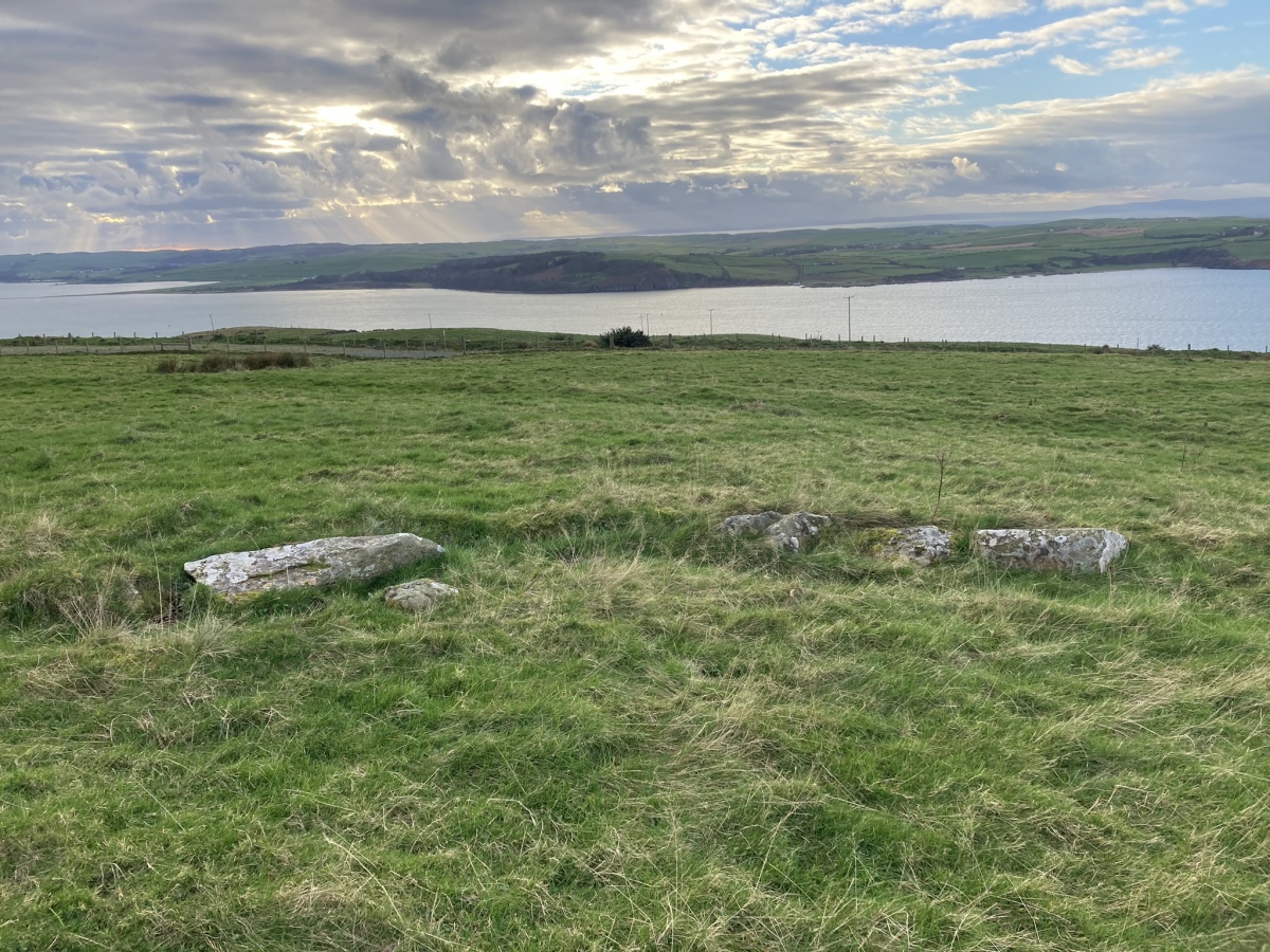
Haggstone Moor Cairn submitted by markj99 on 9th Dec 2022. SW Arc viewed from Centre of Haggstone Moor Kerb Cairn.
(View photo, vote or add a comment)
Log Text: Haggstone Moor Cairn is now more accessible thanks to the construction of Glen App Wind Farm. It's possible to park up at NX 06030 73112 on a section of Stranraer Coastal Path, avoiding a longer walk. The cairn is in a field adjacent to the SCP c. 0.5 miles W from here.
Gwallon Longstone
Date Added: 29th Mar 2023
Site Type: Standing Stone (Menhir)
Country: England (Cornwall)
Visited: Yes on 29th Jun 2019. My rating: Condition 4 Ambience 3 Access 3

Gwallon Longstone submitted by maengurta on 3rd Aug 2007. Suburbanite longstone.
(View photo, vote or add a comment)
Log Text: I was frustrated to find the stone was inaccessible in Penrice Community College grounds protected by a wire mesh fence. Perhaps I will revisit out of school hours.
Gurness
Date Added: 5th Jun 2021
Site Type: Broch or Nuraghe
Country: Scotland (Orkney)
Visited: Yes on 10th Aug 2012. My rating: Condition 2 Ambience 5 Access 5

Gurness submitted by PAB on 11th Jan 2021. 4.45am, the beautiful glow lighting up the stones. Worth getting up for such an experience, only an hour's sleep lost, and so much gained!
June 2016
(View photo, vote or add a comment)
Log Text: In most cases Antiquarians have to mentally reconstruct sites from several stones or grassy mounds. Gurness settlement is at the opposite end of the spectrum. There are multiple layers of occupancy preserved in an extensive network of stone walls representing exterior and interior features.
Gun Rith
Date Added: 5th Apr 2023
Site Type: Standing Stone (Menhir)
Country: England (Cornwall)
Visited: Yes on 18th Feb 2019. My rating: Condition 4 Ambience 4 Access 3

Gun Rith submitted by ocifant on 17th Feb 2004. Restored (Oct 2003), and set nicely into the new wall.
(View photo, vote or add a comment)
Log Text: Gun Rith is an impressive standing stone easy to visit from the Merry Maidens stone circle.
Guidebest
Date Added: 19th May 2024
Site Type: Stone Circle
Country: Scotland (Highlands)
Visited: Yes on 25th Jun 2014. My rating: Condition 2 Ambience 4 Access 3
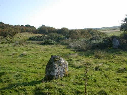
Guidebest submitted by steveco on 24th Feb 2002. Guidebest Stone Circle ND181351. A GPS was very helpful in finding this one.
(View photo, vote or add a comment)
Log Text: It is difficult to capture Guidebest Stone Circle in one photo due to its scale and the shrubs in the circle. Is it a coincidence that there is a large split stone in the circle, similar to the split stone at Latheron?
Greystell Castle
Date Added: 19th May 2024
Site Type: Broch or Nuraghe
Country: Scotland (Caithness)
Visited: Yes on 5th Sep 2021. My rating: Condition 2 Ambience 4 Access 3
Greystell Castle submitted by cosmic on 7th Oct 2007. Viewed from roadside
(View photo, vote or add a comment)
Log Text: There is a parking lay-by c. 400 yards N of Greystell Castle. I chose to walk S in the field towards Greystell Castle rather than walk along the verge of the busy A9.
Grey Hill (Shennas)
Date Added: 5th Feb 2024
Site Type: Cairn
Country: Scotland (Dumfries and Galloway)
Visited: Yes on 18th Jan 2024. My rating: Condition 2 Ambience 4 Access 1

Grey Hill (Shennas) submitted by markj99 on 5th Feb 2024. Grey Hill (Shennas) Cairn viewed from E.
(View photo, vote or add a comment)
Log Text: Grey Hill (Shennas) is not obvious from the narrow lane leading to Lagafatar Lodge. I found the cairn on Canmore Search Map. It is not easy to get to but that only that only made me more determined to find it. My directions are posted in comments on the main page.
Greenbarrow Downs
Date Added: 25th Sep 2022
Site Type: Barrow Cemetery
Country: England (Cornwall)
Visited: Yes on 9th Sep 2022. My rating: Condition 3 Ambience 4 Access 3
Greenbarrow Downs submitted by SandyG on 2nd Mar 2020. The cairn at SX 12995 72947. View from west.
(View photo, vote or add a comment)
Log Text: The Greenbarrow Barrows can easily be visited en route to Trehudreth Downs. The SE Barrow is the most impressive monument. Despite a GPS search I couldn't locate the third barrow.
Green Well of Scotland (Carsphairn)
Date Added: 14th May 2024
Site Type: Holy Well or Sacred Spring
Country: Scotland (Dumfries and Galloway)
Visited: Yes on 28th Apr 2024. My rating: Condition 4 Ambience 4 Access 4
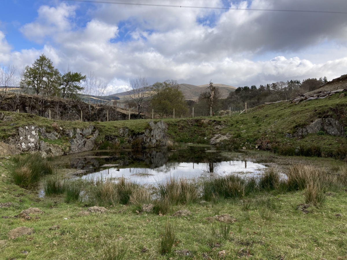
Green Well of Scotland (Carsphairn) submitted by markj99 on 30th Apr 2024. Green Well of Scotland viewed from SW. (28.04.24)
(View photo, vote or add a comment)
Log Text: The Green Well of Scotland (Carsphairn) can be easily visited as it is located close to the start of the Cairnsmore of Carsphairn path. Nearby parking is available.
Green Island (Milton Loch)
Date Added: 18th Dec 2023
Site Type: Misc. Earthwork
Country: Scotland (Dumfries and Galloway)
Visited: Yes on 22nd Jun 2023. My rating: Condition 3 Ambience 4 Access 3

Green Island (Milton Loch) submitted by markj99 on 28th Jun 2023. E Flank of Green Island (Milton Loch) Earthwork.
(View photo, vote or add a comment)
Log Text: Directions: Take the Park of Brandedleys turn off the A75 on the SW edge of Crocketford. Follow the road for c. 0.8 mile to Auchengibbert Farm. Bear left to Kirkgungeon for c. 0.2 mile to a passing place on the left. Park up and follow a vague path along the margin of the field to the W bank of Milton Loch. My route is viewable on Milton Loch Crannogs.
