Contributory members are able to log private notes and comments about each site
Sites Markj99 has logged. View this log as a table or view the most recent logs from everyone
Cow and Calf Rocks
Date Added: 19th Dec 2022
Site Type: Rock Outcrop
Country: England (Yorkshire (West))
Visited: Yes on 21st Jan 2009. My rating: Condition 4 Ambience 4 Access 4

Cow and Calf Rocks submitted by andy_h on 10th Nov 2003. The most prominent landmark for miles around. There are no visible megalithic remains at this huge rock outcrop, but local folklore refers to this being a place worthy of strong consideration.
I've always found it a little strange that as the most prominent landmark for miles around, the Cow n' Calf didn't bear any cup n' ring marks as they can be found both to the left and the right of the outcrop. It is possible that any that may have been on the rock could have been lost under the onslaugh...
(View photo, vote or add a comment)
Log Text: They may not have a strong megalithic connection but the Cow and Calf Rocks have a massive presence, and are located close to Ilkley Moor Car Park.
Court Cairn, The May
Date Added: 31st Oct 2023
Site Type: Cairn
Country: Scotland (Dumfries and Galloway)
Visited: Yes on 27th Sep 2020. My rating: Condition 1 Ambience 3 Access 3
Court Cairn, The May submitted by markj99 on 4th Oct 2020. Court Cairn, The May in situ.
(View photo, vote or add a comment)
Log Text: Directions to Court Cairn (The May): Take the A747 Port William turn off the A75 at Glenluce. Stay on the A747 for c. 6.6 miles to an unsigned left turn onto the B7005 at NX 27136 49953. Travel on the B7005 for c. 2.2 miles to reach a minor road signed for Kirkcowan. Court Cairn (The May) is 0.4 miles on the left at The May farm. There is room to park in a gateway adjacent to the field.
Corwall S
Date Added: 30th Oct 2023
Site Type: Cairn
Country: Scotland (Dumfries and Galloway)
Visited: Yes on 24th Jul 2023. My rating: Condition 3 Ambience 4 Access 3

Corwall S submitted by markj99 on 25th Jul 2023. Corwall S Cairn viewed from east.
(View photo, vote or add a comment)
Log Text: An old farm track winds up from the coastal road, A747 to Port William, at Chapel Finian. There is a large grassy car park at NX 2794 4876, on the right of the A747. Walk NE along the road for c. 175 yards to reach a wooden gate on your right, c. 40 yards SE of Chapel Finian, at NX 2786 4887. A vague farm track starts here. The track is overgrown at first but clears into a wide grassy track as it nears Corwall Farm. Two cairns can be accessed from this track. After c. 1 mile there is a gateway into open moor at NX 2855 4915. Corwall S Cairn is c. 270 yards ESE of this location. Retrace your steps WNW to return to the track. Continue N through semi-derelict Corwall Farm to reach a gateway at NX 2897 4946, just before a ruined cottage on your right. Corwall E Cairn is c. 275 yards ENE from here in a grassy field. There is a marker cairn on the cairn to guide you to it. My route can be viewed on Corwall Cairns.
Corwall E
Date Added: 30th Oct 2023
Site Type: Cairn
Country: Scotland (Dumfries and Galloway)
Visited: Yes on 24th Jul 2023. My rating: Condition 2 Ambience 4 Access 3

Corwall E submitted by markj99 on 25th Jul 2023. Corwall E Cairn viewed from the south.
(View photo, vote or add a comment)
Log Text: An old farm track winds up from the coastal road, A747 to Port William, at Chapel Finian. There is a large grassy car park at NX 2794 4876, on the right of the A747. Walk NE along the road for c. 175 yards to reach a wooden gate on your right, c. 40 yards SE of Chapel Finian, at NX 2786 4887. A vague farm track starts here. The track is overgrown at first but clears into a wide grassy track as it nears Corwall Farm. Two cairns can be accessed from this track. After c. 1 mile there is a gateway into open moor at NX 2855 4915. Corwall S Cairn is c. 270 yards ESE of this location. Retrace your steps WNW to return to the track. Continue N through semi-derelict Corwall Farm to reach a gateway at NX 2897 4946, just before a ruined cottage on your right. Corwall E Cairn is c. 275 yards ENE from here in a grassy field. There is a marker cairn on the cairn to guide you to it. My route can be viewed on Corwall Cairns.
Cork Stone
Date Added: 30th Jun 2022
Site Type: Natural Stone / Erratic / Other Natural Feature
Country: England (Derbyshire)
Visited: Yes on 22nd Jan 2009. My rating: Condition 3 Ambience 4 Access 3
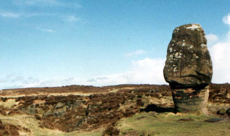
Cork Stone submitted by Vicky on 13th Nov 2001. The Cork Stone, Stanton Moor, Derbyshire GR: SK245628
The Cork Stone is one of a number of impressive natural outcrops on Stanton Moor. Composed of weathered sandstone it resembles a huge mushroom or cork. As with the Andle Stone nearby it is covered in graffiti from the 19th and 20th centuries and has steps carved into the side to allow access to the top.
(View photo, vote or add a comment)
Log Text: Additions to a site are normally detrimental however the steps and iron rungs added to the Cork Stone are an exception. The base of the stone is sturdy enough to allow people to climb up to the summit. There is a round rock basin on the flat top of the Cork Stone.
Core Hill
Date Added: 9th Oct 2022
Site Type: Hillfort
Country: Scotland (Dumfries and Galloway)
Visited: Yes on 8th Oct 2022. My rating: Condition 2 Ambience 3 Access 3

Core Hill submitted by markj99 on 9th Oct 2022. E Flank of Core Hill Fort.
(View photo, vote or add a comment)
Log Text: Core Hill is easily visited via a farm track opposite High Curghie Farm in Kirkmaiden. There is room to park up opposite the farm.
Coetan Arthur Dolmen
Date Added: 15th Apr 2021
Site Type: Chambered Tomb
Country: Wales (Pembrokeshire)
Visited: Yes on 27th Jul 2014. My rating: Condition 3 Ambience 5 Access 3

Coetan Arthur Dolmen submitted by Johnny on 25th Aug 2001. Coetan Arthur, St. David's Head, Dyfed
(SM725 281):
Impressively situated on the hillside close to St. David's Head, Coetan Arthur is the collapsed chamber of what is presumed to be a passage grave which also has a round barrow. The massive capstone measures approximately 5.9 meters by 2.6 meters and is supported on one side by an orthostat approximately 1.5 meters in height.
(View photo, vote or add a comment)
Log Text: Coetan Arthur Dolmen is in a superb coastal setting on St David's Head. The dolmen is perfectly proportioned. The capstone lies at a pleasing 20 degrees angle from horizontal.
This site is just picture perfect.
Claywarnies Cairn
Date Added: 26th Feb 2024
Site Type: Cairn
Country: Scotland (Dumfries and Galloway)
Visited: Yes on 10th Feb 2024. My rating: Condition 2 Ambience 4 Access 1

Claywarnies Cairn submitted by markj99 on 14th Feb 2024. Stone Structure in W Half of Claywarnies Cairn.
(View photo, vote or add a comment)
Log Text: Claywarnies cairn is secreted in forestry c. 1.5 miles NW of Penwhirn Reservoir. The first mile is a forest track suitable for a mountain bike. The second half of the journey involves forest rides, stream crossings and boggy moorland. Wellies and GPS Navigation are strongly recommended.
Claughreid
Date Added: 7th Jan 2025
Site Type: Stone Circle
Country: Scotland (Dumfries and Galloway)
Visited: Yes on 26th Dec 2024. My rating: Condition 3 Ambience 5 Access 1
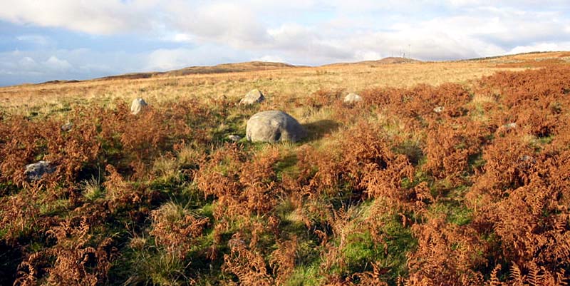
Claughreid submitted by stu on 17th Jul 2004. NX517560.
Similar to the Glenquickan circle just over the hill, here though the centre stone has fallen.
(View photo, vote or add a comment)
Log Text: Claughreid Stone Circle is difficult to locate due to its remote location over difficult ground. I was unwilling to trudge through boggy moorland so I devised an easier route via a track to Claughreid Farm: Turn off the A75 for Cairn Holy at NX 5164 5305. Follow the sign for Cairn Holy for c. 100 yards then bear right onto an unsigned single track road. Stay on this winding lane for c. 0.4 miles to reach an unsigned track on the left at NX 5207 5313. Follow this dead-end track for a mile to reach a small car park at the end: the track becomes increasingly rough and dirty closer to the end.
The walking route to Claughreid Stone Circle starts at the end of the public road from Barholm Farm to Claughreid Farm. Park up and walk along the track to Claughreid Farm. Head W through Claughreid Farm then head downhill. Cross over a ford then follow the track through a dry stane dyke. Continue NW for c. 300 yards to go through a gate in the dry stane dyke. Head NNE from the gateway on vague tracks for c. 100 yards to reach Claughreid Stone Circle, partially obscured in moorland. My walking route along this track can be viewed on Claughreid Stone Circle.
Clachaneasy Bridge
Date Added: 13th May 2021
Site Type: Cairn
Country: Scotland (Dumfries and Galloway)
Visited: Yes on 11th May 2021. My rating: Condition 2 Ambience 4 Access 1
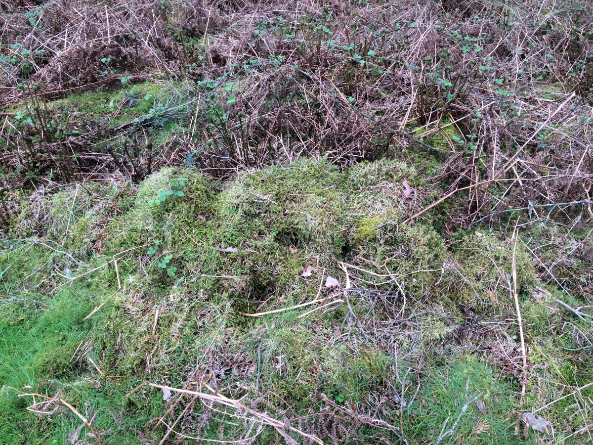
Clachaneasy Bridge submitted by markj99 on 12th May 2021. A row of moss-covered stones on Clachaneasy Bridge Cairn summit.
(View photo, vote or add a comment)
Log Text: I was intending to visit Glenhapple Cairn but was prevented by a no admission sign. I stumbled onto Clachaneasy Bridge Cairn by accident on my GPS. The cairn is located in dense forestry N of Clachaneasy Bridge. It is probably not worth visiting unless you are some kind of cairn completist.
Chalybeate Well (Dalry)
Date Added: 2nd Oct 2022
Site Type: Holy Well or Sacred Spring
Country: Scotland (Dumfries and Galloway)
Visited: Yes on 28th Oct 2022. My rating: Condition 1 Ambience 3 Access 3
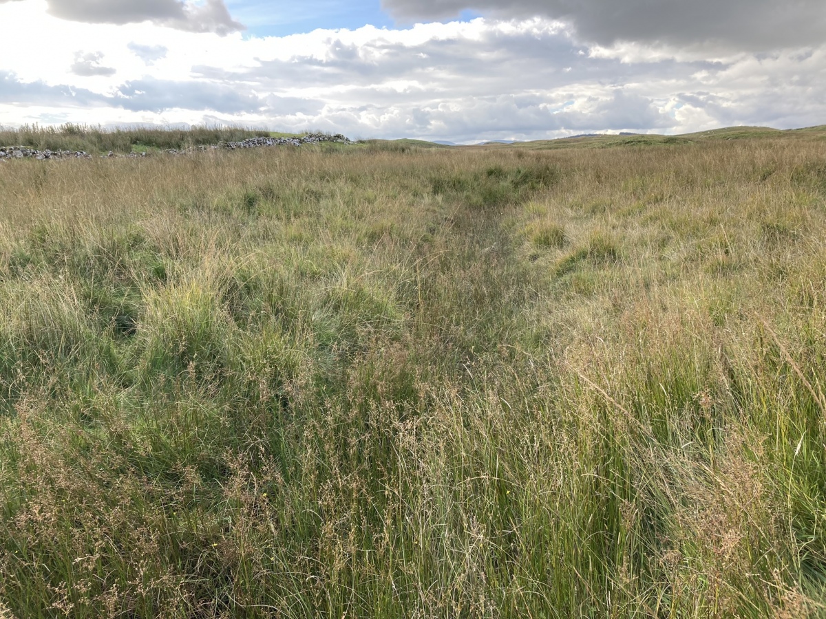
Chalybeate Well (Dalry) submitted by markj99 on 2nd Oct 2022. Chalybeate Well (Stroanfreggan) viewed from W.
(View photo, vote or add a comment)
Log Text: The site of Chalybeate Well (Dalry) is easy to access via the Southern Upland Way. A moorland stream runs through NX6488792815. I used my GPS to search a grid around the given NGR. There was no obvious well in the vicinity.
Cawdor
Date Added: 12th May 2021
Site Type: Standing Stone (Menhir)
Country: Scotland (Highlands)
Visited: Yes on 23rd Mar 2012. My rating: Condition 3 Ambience 3 Access 4

Cawdor submitted by Cosmic on 11th Nov 2003. Standing stone in a field at NH857508. It was near the end of the day so didn't get out to inspect - photos
taken from road to the West.
(View photo, vote or add a comment)
Log Text: Cawdor Stone was easy to visit but couldn't be accessed closely due to the field being in crop at my time of visit. Fortunately the stone is relatively close to the edge of the field for photographic purposes.
Caves of Kilhern
Date Added: 10th May 2022
Site Type: Chambered Cairn
Country: Scotland (Dumfries and Galloway)
Visited: Yes on 22nd Jun 2021. My rating: Condition 3 Ambience 5 Access 3
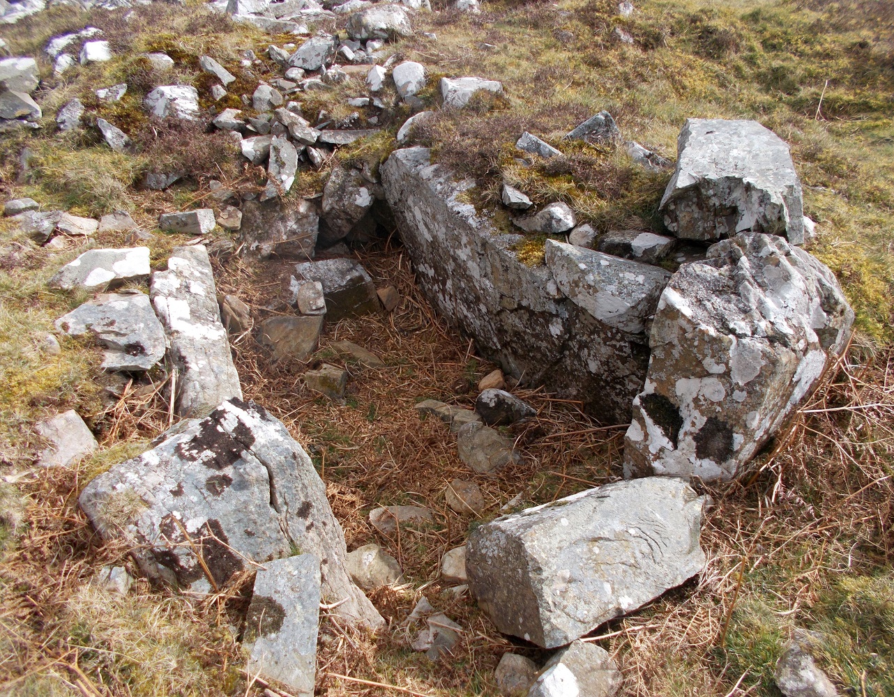
Caves of Kilhern submitted by drolaf on 3rd Apr 2022. SW cist
(View photo, vote or add a comment)
Log Text: The Caves of Kilhern Chambered Cairn is accessed via the Southern Upland Way path. A short detour from the path is signed. The Long Cairn has four exposed chambers making a detour from the SUW essential.
Caulside Burn Stone Setting
Date Added: 13th Nov 2018
Site Type: Stone Row / Alignment
Country: Scotland (Dumfries and Galloway)
Visited: Yes on 5th Nov 2018. My rating: Access 3
Log Text: While visiting the Cauldside Burn Cairn North I looked for the two stones first using GPS, then by grid searching the area S of the cairn. This was difficult due to tussocks of heather and uneven ground. I found no substantial stones in a 30 yards by 30 yards area.
Caulside Burn Cairn North
Date Added: 19th Nov 2018
Site Type: Cairn
Country: Scotland (Dumfries and Galloway)
Visited: Yes on 5th Nov 2018. My rating: Condition 2 Ambience 4 Access 3
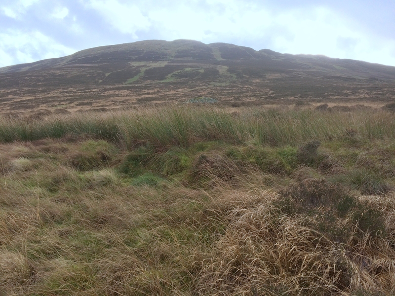
Caulside Burn Cairn North submitted by markj99 on 13th Nov 2018. Cauldside Cairn North from N, in line with Cauldside Cairn South & Cairnharrow Summit.
(View photo, vote or add a comment)
Log Text: This ruined cairn can be found by parking at Cambret Hill just above the cattle grid on the road to the Cambret Hill mast. Head downhill towards the summit of Cairnharrow opposite. Cauldside Cairn South, a large well preserved cairn will be visible half way up Cairnharrow across the valley. Cross the fence at the bottom of Cambret Hill and line up the summit of Cairnharrow with Cauldside Cairn South.
You should see a green area, a reed bank, stand out from the brown moorland around 100 yards straight ahead. The ground is boggy up to the cairn. The ruined cist is surrounded by reeds and an earth bank.
Castlehowe Scar Stone Circle
Date Added: 5th Mar 2023
Site Type: Stone Circle
Country: England (Cumbria)
Visited: Yes on 19th Feb 2023. My rating: Condition 2 Ambience 4 Access 5
Castlehowe Scar Stone Circle submitted by baz on 3rd May 2003. Castlehowe Scar Stone Circle (NY587155).
Ten stones form this small stone circle which is now huddled up against a drystone wall, in a field with a locked gate. On the other side of the wall, there appears to be a stone row.
(View photo, vote or add a comment)
Log Text: Castlehowe Scar Stone Circle is easy to visit, located adjacent to a minor road to Orton near Shap. This small stone circle consists of an assortment of rounded stones. Despite its stature this site is well worth a visit.
Castlecreavie Settlement
Date Added: 25th May 2021
Site Type: Ancient Village or Settlement
Country: Scotland (Dumfries and Galloway)
Visited: Yes on 24th May 2021. My rating: Condition 3 Ambience 4 Access 4
Castlecreavie Settlement submitted by SolarMegalith on 4th Oct 2016. Outline of the rampart in the NE part of the settlement (photo taken on September 2016).
(View photo, vote or add a comment)
Log Text: Castlecreavie Settlement is situated on the road to Castlecreavie Farm between Kirkcudbright and Dundrennan. There is room to park at NX 72424 49258, c. 500 yards up the narrow road to Castlecreavie Farm. There is a style leading up to Castlecreavie Settlement. The natural hillock has an enclosure measuring c. 75 yards NE-SW and 40 yards NW-SE. There are remains of a c. 4 feet rampart on the SW and NE of the enclosure. There are steep slopes all round except for the SW which slopes away at a shallow angle. There is a prominent terrace from c. 12 to 15 feet wide round the settlement, except on the SW side.
Castle Loch
Date Added: 29th Mar 2023
Site Type: Cairn
Country: Scotland (Dumfries and Galloway)
Visited: Yes on 27th Mar 2023. My rating: Condition 2 Ambience 4 Access 1

Castle Loch submitted by markj99 on 28th Mar 2023. Grass Track bisects Castle Loch Cairn on a NE-SW Alignment.
(View photo, vote or add a comment)
Log Text: Castle Loch Cairn may be in the middle of nowhere and a pale shadow of it's original state, however the splendid isolation of the location rewards a visit.
Cashtal-yn-Ard
Date Added: 21st Nov 2024
Site Type: Chambered Tomb
Country: Channel Islands and Isle of Man (Isle of Man)
Visited: Yes on 23rd Mar 2017. My rating: Condition 3 Ambience 5 Access 4
Cashtal-yn-Ard submitted by TimPrevett on 24th Jun 2015. A low shot atCashtal yn Ard tomb, 31st July 2014, taking in the flowers and the mountains. Magnificent place. We were here over an hour and had it to ourselves. A very exposed location in hard rain and very lovely in warm sunshine, both of which we had in the time here.
(View photo, vote or add a comment)
Log Text: Despite the narrow single track road to Cashtal yn Ard and difficult parking this ancient monument is a must visit. I approached Cashtal yn Ard from the SE passing by a ruined cottage. It is one of the most impressive multi-chambered cairns I have ever visited. On my visit the site was well maintained. I was lucky to have half an hour alone with these intriguing stones in good weather.
Casehill Cairn
Date Added: 17th Sep 2022
Site Type: Cairn
Country: England (Cornwall)
Visited: Yes on 11th Sep 2022. My rating: Condition 2 Ambience 3 Access 3

Casehill Cairn submitted by dooclay on 17th Jun 2022. Looking across the Cairn w/ Brown Willy beyond
(View photo, vote or add a comment)
Log Text: I found Casehill Cairn by following the wall from Casehill Farm. The most impressive feature of the monument is the kerb stone on the NE Arc, measuring c. 3 feet high by 15 feet wide.
