Contributory members are able to log private notes and comments about each site
Sites Markj99 has logged. View this log as a table or view the most recent logs from everyone
Law Knowe
Date Added: 23rd Nov 2023
Site Type: Cairn
Country: Scotland (South Lanarkshire)
Visited: Yes on 2nd May 2023

Law Knowe submitted by markj99 on 3rd May 2023. Law Knowe viewed from S.
(View photo, vote or add a comment)
Log Text: The location of Lab Knowe has been preserved for future antiquarians, however the grass mound with a modern stone marker cairn and information plaque is scant compensation for the destruction of an ancient cairn.
Captain's Bridge (Drummochreen) W
Date Added: 28th Nov 2023
Site Type: Hillfort
Country: Scotland (South Ayrshire)
Visited: Yes on 2nd May 2023. My rating: Condition 2 Ambience 4 Access 4
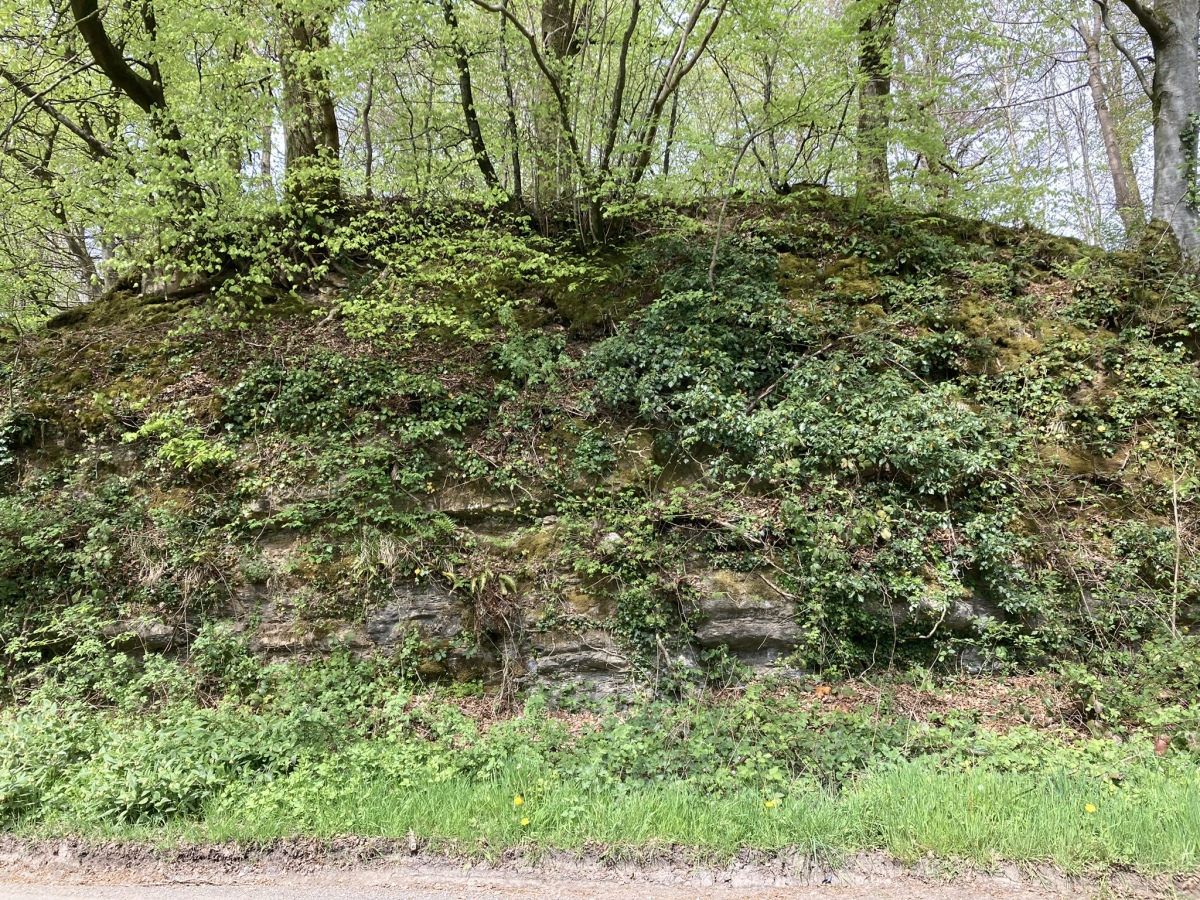
Captain's Bridge (Drummochreen) W submitted by markj99 on 15th May 2023. Captain's Bridge (Drummochreen) W Hillfort viewed from Captain's Bridge.
(View photo, vote or add a comment)
Log Text: Directions to Captain's Bridge (Drummochreen) W: Take the B741 Dailly road off the A77, N of Girvan. After c. 5 miles stay straight on for Maybole at the Dailly junction. Continue towards Maybole for c. 1.7 miles to a farm junction on the left at NS 28593 03605. Park up and walk c. 120 yards W along the dirt track to a green track on the left. Walk 5 yards along the green track. Look left to see the outer bank and ditch of the fort. Climb over the bank to enter the enclosure of Captain's Bridge (Drummochreen) W fort.
Barnsallie Fell
Date Added: 17th Nov 2023
Site Type: Cairn
Country: Scotland (Dumfries and Galloway)
Visited: Yes on 9th May 2023. My rating: Condition 2 Ambience 4 Access 3

Barnsallie Fell submitted by markj99 on 14th May 2023. Barnsallie Fell Cairn viewed from S.
(View photo, vote or add a comment)
Log Text: Take the A747 Portwilliam turn off the A75 at Glenluce. Follow the road for c. 1.8 miles to reach a left turn signed for Whithorn Way. Stay on this single track road for c. 1 mile to reach a left turn signed for Craigenveoch via a forest track. There is a lay-by on the edge of the loch after c. 100 yards if you want to park up. Continue on foot or by car for c. 0.2 miles to reach a parking place at Knock of Luce Wood. Walk c. 200 yards W along a grass track leading to a dead-end. Take the loch side path for on the left for c. 200 yards to reach NSF Scotland Woodland Garden. Take a path NW starting at the NSF Scotland info board. Head W towards an obvious gap in the stone wall. Wellies are required from this point. Cross a stream then head N parallel to the stone wall through boggy shrubby ground for c. 100 yards to reach Barnsallie Fell Cairn, shrouded in small trees.
Loch Heron
Date Added: 24th Nov 2023
Site Type: Crannog
Country: Scotland (Dumfries and Galloway)
Visited: Yes on 12th May 2023. My rating: Condition 2 Ambience 3 Access 5
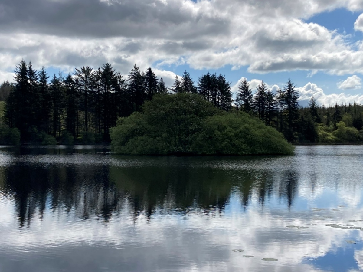
Loch Heron submitted by markj99 on 13th May 2023. Loch Heron NW Crannog viewed from W.
(View photo, vote or add a comment)
Log Text: Directions to Loch Heron Crannog: Take the North Street turn (signed for Whitecairn Farm Caravan Park) off Main Street in Glenluce. Follow this narrow road for c. 7 miles to reach a minor crossroads at Three Lochs Holiday Park. Take the right turn opposite the holiday park entrance onto a single track road. Follow the road for c. 0.25 mile to a lay-by on the right. The crannog can be viewed from here.
Cults Loch
Date Added: 15th Nov 2023
Site Type: Crannog
Country: Scotland (Dumfries and Galloway)
Visited: Yes on 15th May 2023. My rating: Condition 2 Ambience 4 Access 3
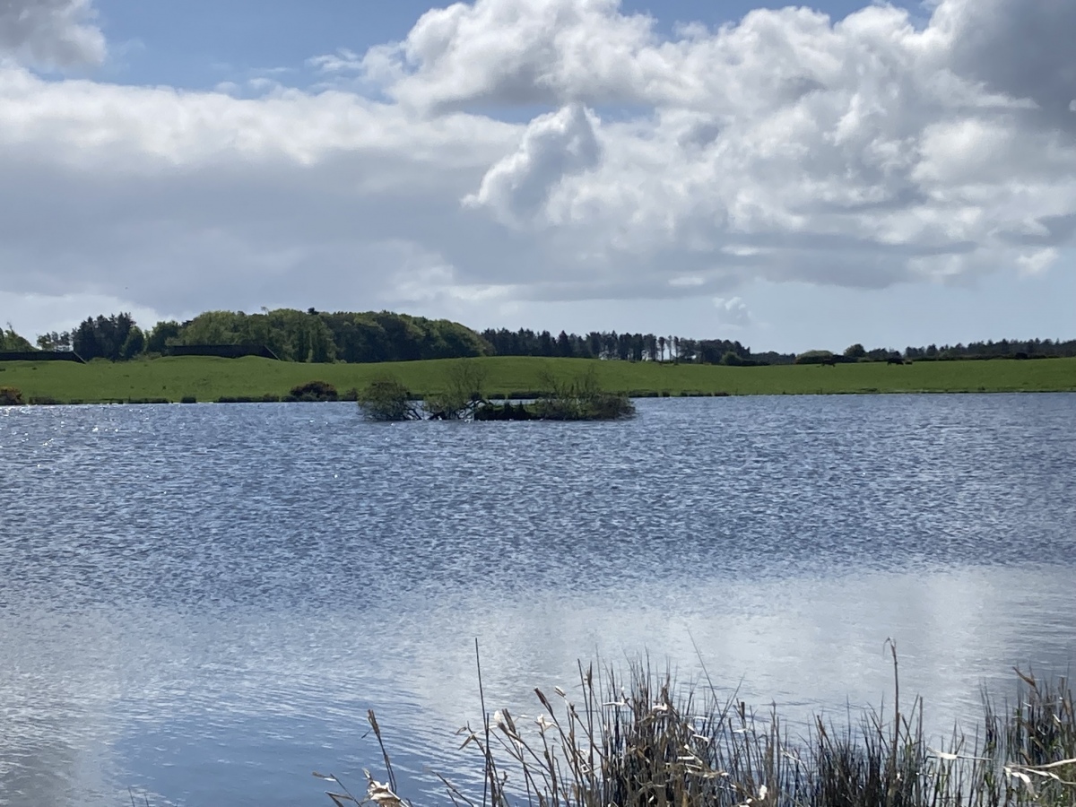
Cults Loch submitted by markj99 on 16th May 2023. Cults Loch Central Crannog viewed from N.
(View photo, vote or add a comment)
Log Text: Directions to Cults Loch Crannogs: Take the New Luce turn off the A75 at the petrol station on the SE edge of Castle Kennedy. After c. 0.5 mile take the right turn signed for Nivens Yard. Follow this potholed gravel track for c. 75 yards to a gate on the left. There is room to park at the gate. Walk E through the gate for c. 350 yards to reach a gate into a field on the left. Follow a track NE towards Cults Loch. The Central Crannog can be viewed from the W bank of the loch. The NW Crannog is located on a circular promontory in the NW corner of the loch. My route is viewable on Cults Loch Crannogs. On a cautionary note, there are often beef cattle in the field beside Cults Loch.
Lochrutton Loch
Date Added: 18th Dec 2023
Site Type: Crannog
Country: Scotland (Dumfries and Galloway)
Visited: Yes on 24th May 2023. My rating: Condition 2 Ambience 4 Access 4
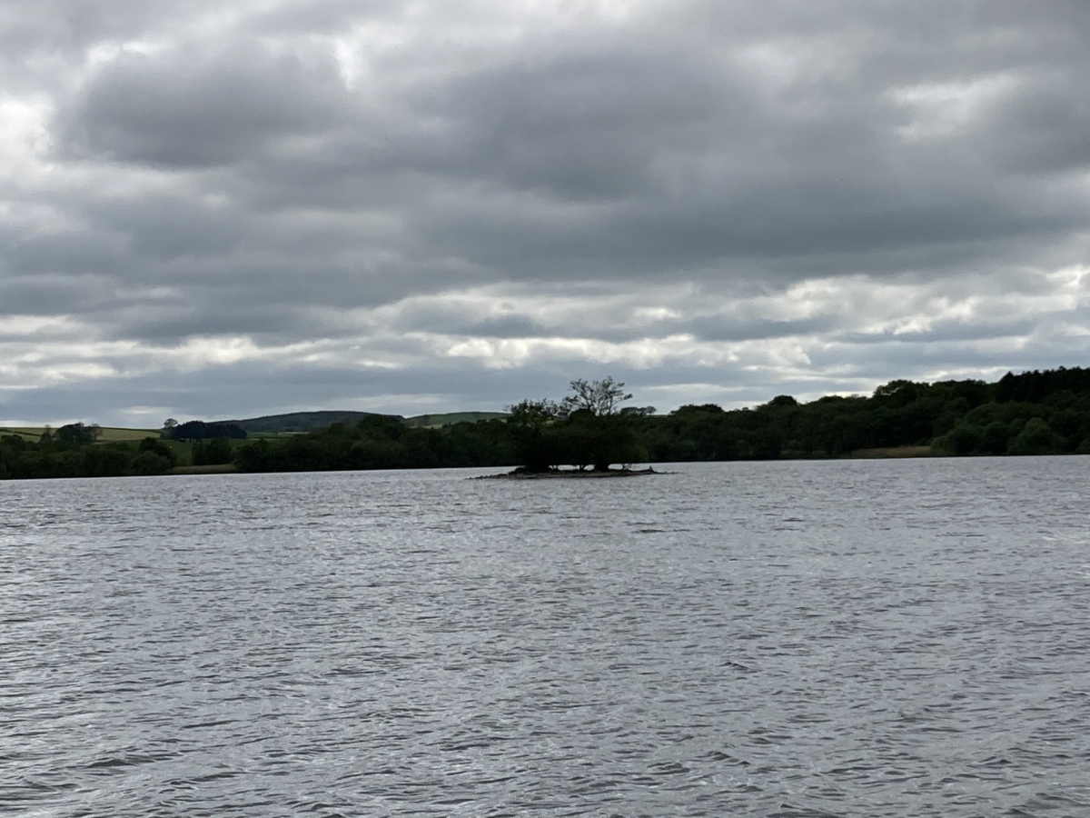
Lochrutton Loch submitted by markj99 on 25th May 2023. Lochrutton Loch Crannog viewed from NE.
(View photo, vote or add a comment)
Log Text: Lochrutton Loch Crannog is not spectacular, however, it is an easy walk on a path to view the crannog from the E bank of the loch.
Directions: Take the Lochfoot turn off the A75 at the Drummore Roundabout c. 3 miles W of Dumfries. After c. 0.7 mile you will reach a crossroads. Continue straight onto an unsigned narrow road for c. 0.3 miles to reach a lay-by on the left. A path for Lochrutton Loch starts here, heading W along a fence. As the path heads through a dry stane dyke turn left, heading S through the field towards a wooded promontory on the loch edge. The path continues W along the promontory for c. 100 yards to the water's edge. The crannog is a small isle in the middle of the loch, populated by several small trees, SW of the promontory. My walk can be viewed on Lochrutton Loch.
Moss Knowes
Date Added: 14th Nov 2023
Site Type: Natural Stone / Erratic / Other Natural Feature
Country: Scotland (South Ayrshire)
Visited: Yes on 27th May 2023. My rating: Condition 4 Ambience 4 Access 1
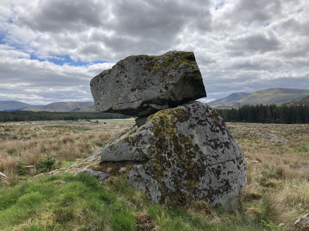
Moss Knowes submitted by markj99 on 28th May 2023. Moss Knowes Rocking Stone viewed from NW.
(View photo, vote or add a comment)
Log Text: On my return to Moss Knowe Rocking Stone, the pine forest had been felled. The stone was now on the edge of a large clearing, still intact.
Great Cursus, Stonehenge
Date Added: 5th Jul 2023
Site Type: Cursus
Country: England (Wiltshire)
Visited: Yes on 4th Jun 2023. My rating: Condition 2 Ambience 4 Access 3
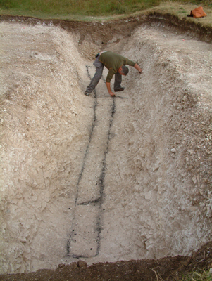
Great Cursus, Stonehenge submitted by TimPrevett on 10th Jun 2011. See the first comment on the Great Cursus page HERE for June 10th 2011 for more information.
Image copyright Mark Anstee - also much more on his website HERE
(View photo, vote or add a comment)
Log Text: The Great Cursus is a polar opposite of its more famous neighbour, Stonehenge Stone Circle. The Great Cursus blends into the landscape whereas Stonehenge Stone Circle stands out on the plain. If you take the path to the circle from the visitor centre the Great Cursus is visited on the way. The west end of the cursus has an information board in a clearing of the Fargo Plantation.
Great Cursus Barrows, Stonehenge
Date Added: 5th Jul 2023
Site Type: Round Barrow(s)
Country: England (Wiltshire)
Visited: Yes on 4th Jun 2023. My rating: Condition 3 Ambience 4 Access 3
Great Cursus Barrows, Stonehenge submitted by TimPrevett on 18th Aug 2004. One of the most impressive bell barrows - which we thought resembled landed 'flying saucers'.
(View photo, vote or add a comment)
Log Text: The Great Cursus Barrows are obvious on the horizon viewed from the stone circle. It is more prominent than the nearby Great Cursus. It's a shame that the majority of visitors to Stonehenge take the bus to and from the stone circle missing out on the less spectacular barrow cemetery and cursus.
Heel Stone
Date Added: 5th Jul 2023
Site Type: Standing Stone (Menhir)
Country: England (Wiltshire)
Visited: Yes on 4th Jun 2023. My rating: Condition 4 Ambience 5 Access 4
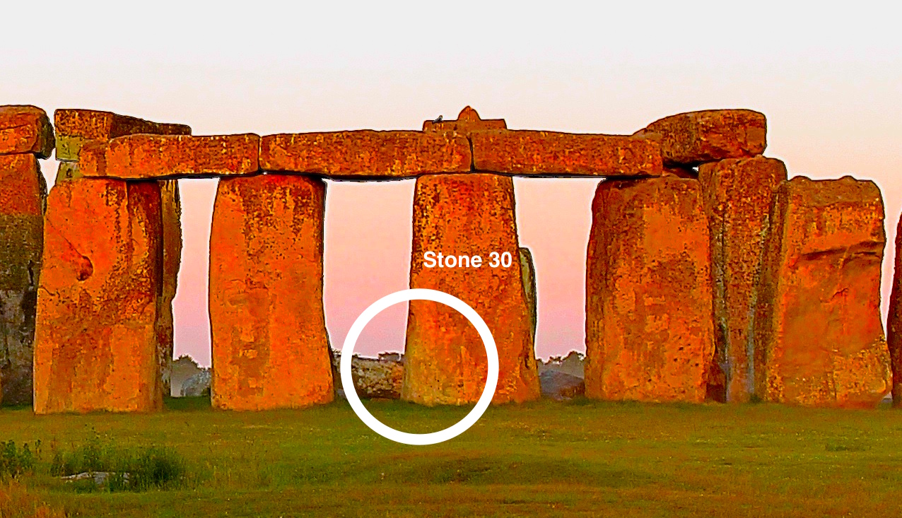
Heel Stone submitted by dodomad on 22nd Jun 2020. In this enhanced image the lower left corner of Stone 30 is in shadow - the Heelstone's shadow, confirming Terence Meaden's shadow casting hypothesis
Photo Credit: Simon Banton
(View photo, vote or add a comment)
Log Text: It is only possible to get close to the heel stone if you buy a ticket at the visitor centre, allowing a closer circuit of Stonehenge round the roped-off monument.
Stonehenge.
Date Added: 5th Jul 2023
Site Type: Stone Circle
Country: England (Wiltshire)
Visited: Yes on 4th Jun 2023. My rating: Condition 3 Ambience 5 Access 4

Stonehenge. submitted by AngieLake on 22nd Feb 2012. This old photo-postcard is captioned 'Altar Stone', with a small white arrow pointing to the enigmatic stone which lies partly buried underneath the fallen lintel [156] and upright [55] of the Great Trilithon.
(View photo, vote or add a comment)
Log Text: I was travelling to Cornwall on the A303 when Stonehenge popped up on the horizon. I was magnetically drawn to revisit one of the great wonders of the world. The difference between my 2 visits, 14 years apart, was that I appreciated the surrounding barrows near Stonehenge so much more.
Great Cursus W Barrow
Date Added: 7th Nov 2023
Site Type: Round Barrow(s)
Country: England (Wiltshire)
Visited: Yes on 4th Jun 2023. My rating: Condition 2 Ambience 4 Access 4
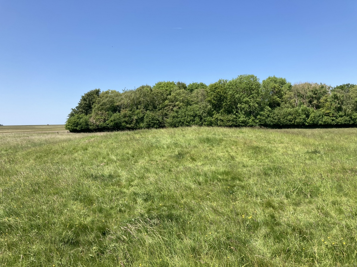
Great Cursus W Barrow submitted by markj99 on 1st Jul 2023. Great Cursus W Barrow viewed from S.
(View photo, vote or add a comment)
Log Text: Starting at the Stonehenge visitor centre, take the path E for c. 400 yards. Bear left onto a footpath heading for Fargo Plantation. Go through a gate after c. 400 yards. The Great Cursus starts here bisecting Fargo Plantation. Follow the path E for c. 100 yards to the start of the trees. Great Cursus W Barrow is c. 30 yards N of this point.
Longstone (St Mabyn)
Date Added: 14th Nov 2023
Site Type: Standing Stone (Menhir)
Country: England (Cornwall)
Visited: Yes on 5th Jun 2023. My rating: Condition 3 Ambience 3 Access 5
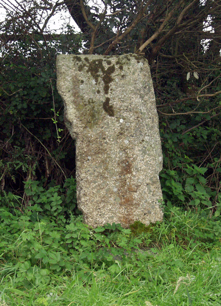
Longstone (St Mabyn) submitted by ocifant on 3rd Oct 2004.
(View photo, vote or add a comment)
Log Text: This remnant of an ancient monument has at least been saved, however it is a sad reminder of Man's lack of respect for ancient stones.
Penwine Cross
Date Added: 14th Nov 2023
Site Type: Ancient Cross
Country: England (Cornwall)
Visited: Yes on 5th Jun 2023. My rating: Condition 3 Ambience 3 Access 5

Penwine Cross submitted by Thorgrim on 4th Nov 2004. This cross stands at the crossroads next to the shattered remains of the Longstone (St Mabyn). It was found cemented into a farmyard wall in 1947 and erected on a new shaft in 1969.
(View photo, vote or add a comment)
Log Text: Hundreds of people pass by this curious corner every day. It is worthwhile to stop and contemplate the fates of the cross and standing stone at the Longstone junction.
Longstone Cross
Date Added: 14th Nov 2023
Site Type: Ancient Cross
Country: England (Cornwall)
Visited: Yes on 5th Jun 2023. My rating: Condition 3 Ambience 3 Access 5
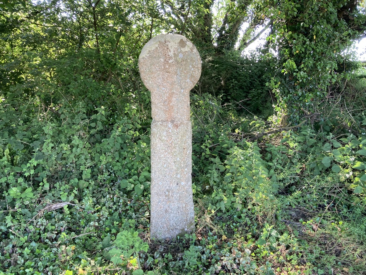
Longstone Cross submitted by markj99 on 20th Jun 2023. West face of Longstone Cross.
(View photo, vote or add a comment)
Log Text: Hundreds of people pass by this curious corner every day. It is worthwhile to stop and contemplate the fates of the cross and standing stone at the Longstone junction.
Waterpit Down
Date Added: 14th Nov 2023
Site Type: Ancient Cross
Country: England (Cornwall)
Visited: Yes on 5th Jun 2023. My rating: Condition 3 Ambience 4 Access 5

Waterpit Down submitted by markj99 on 15th Jun 2023. West Face of Waterpit Down Cross.
(View photo, vote or add a comment)
Log Text: It isn't easy to park at the cross. I parked c. 200 yards E in a wide gateway opposite a farm shed.
Fenterleigh
Date Added: 14th Nov 2023
Site Type: Ancient Cross
Country: England (Cornwall)
Visited: Yes on 5th Jun 2023. My rating: Condition 4 Ambience 4 Access 5
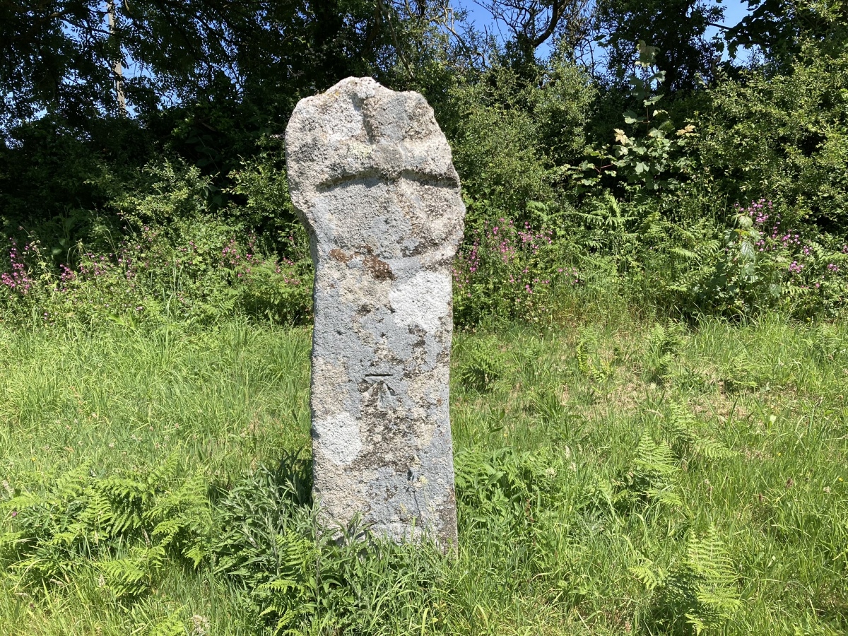
Fenterleigh submitted by markj99 on 15th Jun 2023. South Face of Fenterleigh Cross.
(View photo, vote or add a comment)
Log Text: Take the Davidstow road in the centre of Bossinay at SX 0656 8882. Follow the road for c. 0.5 mile to a crossroads. Turn left onto a minor road for c. 50 yards to park up in a passing place. Walk back up to the the crossroads. The ancient cross is on your left adjacent to the road.
Minions Platform Round Barrow
Date Added: 21st Jun 2023
Site Type: Cairn
Country: England (Cornwall)
Visited: Yes on 6th Jun 2023. My rating: Condition 2 Ambience 4 Access 3

Minions Platform Round Barrow submitted by thecaptain on 22nd Oct 2009. The platform cairn marked on OS Maps as "Minions Mound", but in reality is not.
View here to The Hurlers, with Stowe's Pound and the Rillaton Barrow on the horizon.
(View photo, vote or add a comment)
Log Text: The tumulus may not be well preserved but it is only 300 yards NW of Minions Car Park, so why not take a small detour before visiting the Hurlers.
Minions Mound
Date Added: 21st Jun 2023
Site Type: Round Barrow(s)
Country: England (Cornwall)
Visited: Yes on 6th Jun 2023. My rating: Condition 2 Ambience 3 Access 4

Minions Mound submitted by windowman on 21st Jan 2012. Minions Mound, a bronze age cairn that is situated by the car park for the Hurlers stone circle site. Easy to miss, many if not all the visitors to the car park are probably unaware just what this small mound is. The mound was damaged when the walls for the adjacent cottages were built, and half the mound was cut away, forming a 'D' shape. The cairn gave it's name to the village of Minions, which was previously called Cheewring Railway, a major junction point for the original Liskeard and Carad...
(View photo, vote or add a comment)
Log Text: The stone wall constructed round the mound may be protecting it for future antiquarians, however it also disguises the antiquity of the site.
Caradon Hill cairns
Trip No.3 Date Added: 27th Jun 2023
Site Type: Barrow Cemetery
Country: England (Cornwall)
Visited: Yes on 6th Jun 2023. My rating: Condition 3 Ambience 5 Access 3

Caradon Hill cairns submitted by markj99 on 27th Jun 2023. Caradon Hill Cairn XVII (SX 26966 70186) viewed from N. (08.06.23)
(View photo, vote or add a comment)
Log Text: I have conducted an extensive survey of the Bronze Age cairns on Caradon Hill on multiple visits, Some of the cairns are obvious due to their substantial remains. Other cairns are difficult to locate due to the rough moorland they are located in and their poor state of preservation. I found 10 cairns on my first visit to Caradon Hill. When I visited Historic England online to check the details of the cairns I discovered the extent of the cairn cemetery. Using Historic England as a guide I resolved to track down each of the 19 cairns listed on the site. My initial visit was on 23.02.23 and fourth (final) visit on 08.06.23. I have numbered the cairns I to XIX from N-S and E-W by location.
