Contributory members are able to log private notes and comments about each site
Sites Markj99 has logged. View this log as a table or view the most recent logs from everyone
Caves of Kilhern
Date Added: 10th May 2022
Site Type: Chambered Cairn
Country: Scotland (Dumfries and Galloway)
Visited: Yes on 22nd Jun 2021. My rating: Condition 3 Ambience 5 Access 3
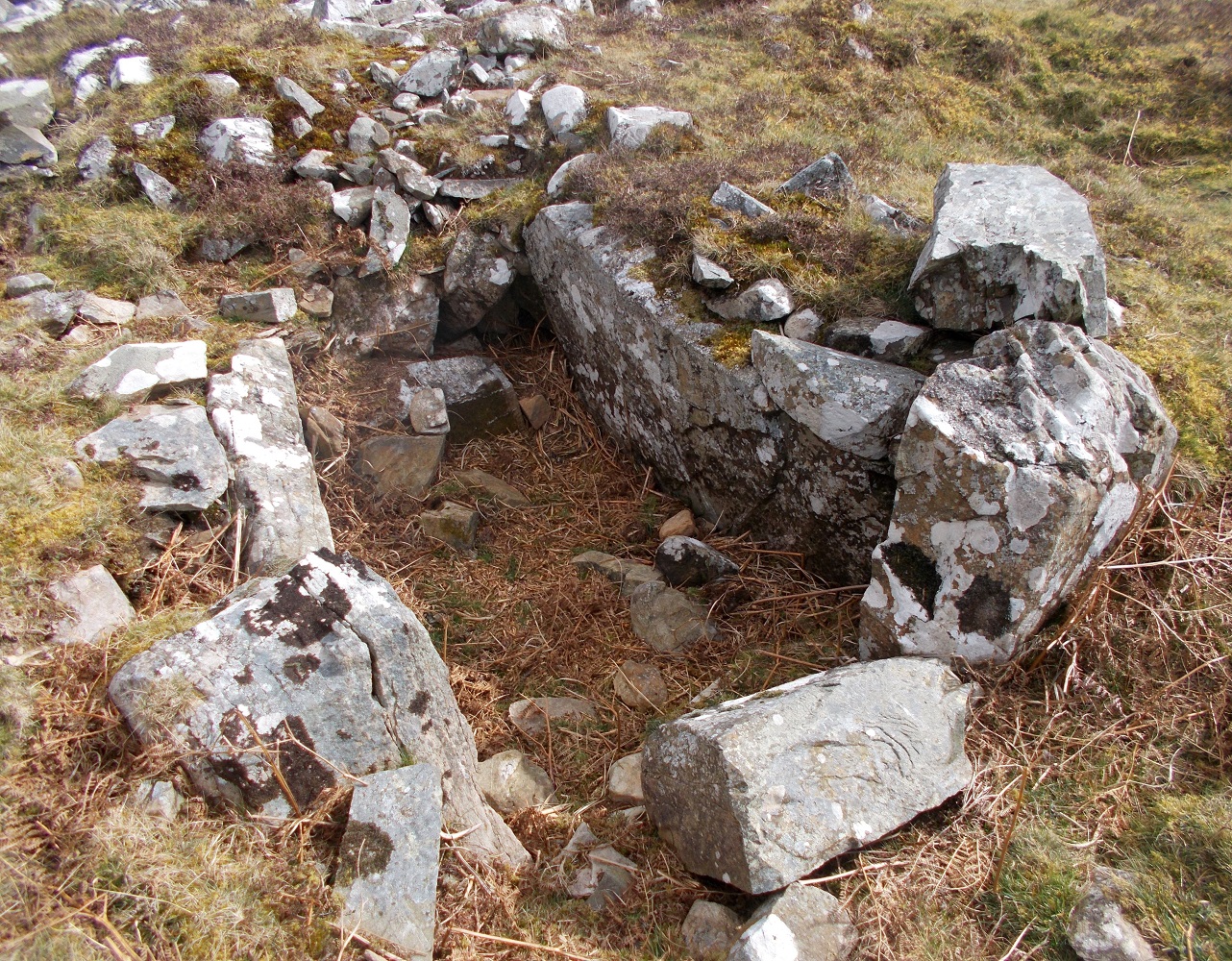
Caves of Kilhern submitted by drolaf on 3rd Apr 2022. SW cist
(View photo, vote or add a comment)
Log Text: The Caves of Kilhern Chambered Cairn is accessed via the Southern Upland Way path. A short detour from the path is signed. The Long Cairn has four exposed chambers making a detour from the SUW essential.
Hardcroft
Date Added: 10th May 2022
Site Type: Cairn
Country: Scotland (Dumfries and Galloway)
Visited: Yes on 30th Oct 2020. My rating: Condition 3 Ambience 4 Access 1
Hardcroft submitted by markj99 on 1st Nov 2020. N-S Axis of Hardcroft Cairn.
(View photo, vote or add a comment)
Log Text: Hardcroft Cairn is easiest accessed from the Southern Upland Way. It is c. 600 yards W of the SUW junction with the Caves of Kilhern path. If you haven't visited the Caves of Kilhern it is an essential detour.
Fauldinchie W
Date Added: 10th May 2022
Site Type: Misc. Earthwork
Country: Scotland (Dumfries and Galloway)
Visited: Yes on 5th May 2022. My rating: Condition 3 Ambience 4 Access 3

Fauldinchie W submitted by markj99 on 10th May 2022. Fauldinchie W Burnt Mound viewed from W.
(View photo, vote or add a comment)
Log Text: The Southern Upland Way is usually muddy so wellies are recommended. The location of the burnt mound in marshy ground make wellies essential.
Dranigower Hut Circle W
Date Added: 10th May 2022
Site Type: Ancient Village or Settlement
Country: Scotland (Dumfries and Galloway)
Visited: Yes on 2nd Dec 2020. My rating: Condition 2 Ambience 4 Access 3
Dranigower Hut Circle W submitted by markj99 on 3rd Dec 2020. East arc of Dranigower Hut Circle W.
(View photo, vote or add a comment)
Log Text: The best time to visit Dranigower Hut Circle W is Autumn to Spring when the vegetation is low because the hut circles are not easy to spot.
Dranigower Hut Circle E
Date Added: 10th May 2022
Site Type: Ancient Village or Settlement
Country: Scotland (Dumfries and Galloway)
Visited: Yes on 2nd Dec 2020. My rating: Condition 2 Ambience 4 Access 3
Dranigower Hut Circle E submitted by markj99 on 3rd Dec 2020. East arc of Dranigower Hut Circle E.
(View photo, vote or add a comment)
Log Text: The best time to visit Dranigower Hut Circle E is Autumn to Spring when the vegetation is low because the hut circles are not easy to spot.
The Thieves
Date Added: 9th May 2022
Site Type: Standing Stones
Country: Scotland (Dumfries and Galloway)
Visited: Yes on 7th May 2022. My rating: Condition 3 Ambience 5 Access 2

The Thieves submitted by mickm on 6th Feb 2005. View from the southwest.
(View photo, vote or add a comment)
Log Text: There is such a wealth of ancient sites on Drennandow Moor, however The Thieves Standing Stone are the best site to my eyes. I feel a magnetic attraction to Standing Stones generally so a pair of six footers are irresistible.
Penny Stone (Cambret Moor)
Date Added: 1st May 2022
Site Type: Rock Art
Country: Scotland (Dumfries and Galloway)
Visited: Yes on 27th Apr 2022. My rating: Condition 3 Ambience 4 Access 3
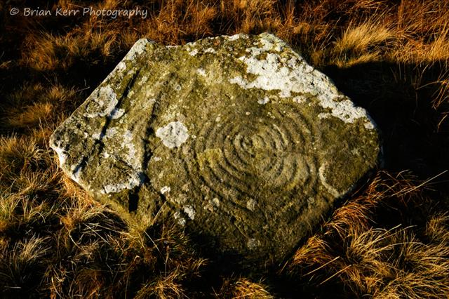
Penny Stone (Cambret Moor) submitted by wolfnighthunter on 2nd Dec 2008. Cambret Moor cup and ring carvings.
www.briankerrphotography.co.uk
(View photo, vote or add a comment)
Log Text: There is a significant concentration of ancient sites in Cambret Moor valley probably indicating its significance to the creators of the monuments. It must have been a spectacular vista in its original state. The sites are visited in a linear N-S route from Cambret Hill. The order of the route is Cambret Moor Cairn, Cambret Moor Worked Stone, The Penny Stone, Cauldside Burn N Cairn, Cauldside Burn Stone Setting, Cauldside Burn S Cairn, Cauldside Burn Stone Circle and Cairnharrow Summit Cairn. It is a c. 3 mile return route with c. 400m ascent over rough moorland. Good walking boots and GPS Navigation are required.
Cambret Moor Cairn
Date Added: 30th Apr 2022
Site Type: Cairn
Country: Scotland (Dumfries and Galloway)
Visited: Yes on 27th Apr 2022. My rating: Condition 2 Ambience 4 Access 3

Cambret Moor Cairn submitted by markj99 on 30th Apr 2022. Centre of Cambret Moor Cairn viewed from S.
(View photo, vote or add a comment)
Log Text: I found Cambret Moor Cairn by walking to the OS Grid Reference. It is almost invisible in rough moorland. The exposed cist was visible in a central circle confirming the description in Canmore. It is c. 100 yards N of Cambret Moor Worked Stone (Canmore ID 63681) and The Penny Stone (Canmore ID 63679).The cairn is on my OS Route for Cairnharrow Summit Cairn.
Cairnharrow Summit
Date Added: 30th Apr 2022
Site Type: Cairn
Country: Scotland (Dumfries and Galloway)
Visited: Yes on 27th Apr 2022. My rating: Condition 2 Ambience 5 Access 3

Cairnharrow Summit submitted by markj99 on 30th Apr 2022. Cairnharrow Summit Cairn viewed from W.
(View photo, vote or add a comment)
Log Text: Cairnharrow is c. 3 miles E of Creetown. Creetown Summit Cairn is easily visited via Cambret Hill. Take the R turn 100 yards before the Gem Rock Museum in Creetown signposted for Glenquicken Farm Trout Fishery. After c. 2.5 miles there is a lay-by opposite Glenquicken Stone Circle on the R side. Continue E for c. 1.1 miles to the access track to Cambret Hill mast. There is a lay-by at NX 52645 57987 0.5 miles up the track, just below the Cambret Hill mast. I have plotted a 1.25 mile route S to Cairnharrow Summit Cairn via 3 Cairns, 1 Stone Circle, 1 Cup and Ring Marked Stone and 1 Modern Worked Stone on my OS Mapping Routes (go to main page).
The Galloway Stone
Date Added: 25th Apr 2022
Site Type: Natural Stone / Erratic / Other Natural Feature
Country: England (Cumbria)
Visited: Yes on 5th Sep 2020. My rating: Condition 5 Ambience 4 Access 5
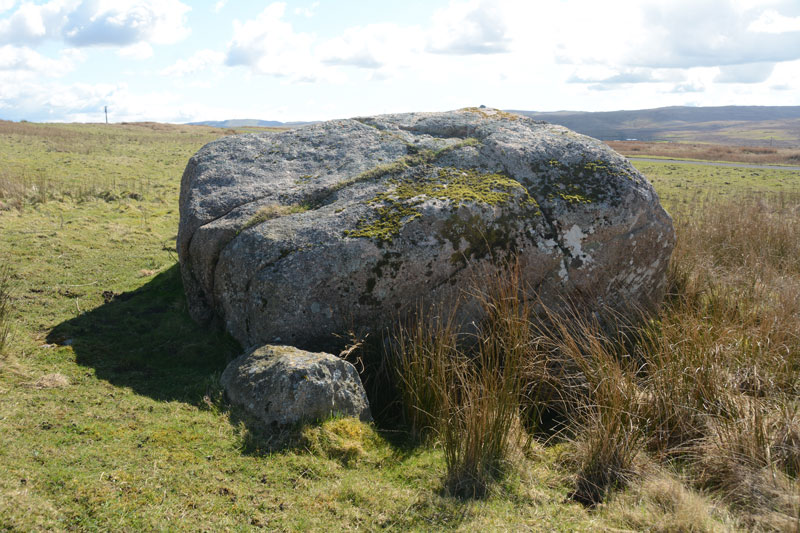
The Galloway Stone submitted by Anne T on 3rd Apr 2017. Looking south east over the Galloway Stone to the hills beyond.
(View photo, vote or add a comment)
Log Text: It nice to find a site that you don't have to walk 3 miles over moorland to visit.
The Galloway Stone is just such a site. Simply leave the M6 at Shap, turn L for Orton, then take the R turn to Salterwath just before the M6 underpass.
The Galloway Stone lies c. 50 yards to the L after 150 yards along this lane.
It looks like a large chunk of Shap Pink Granite so it can't be an erratic from Galloway.
The explanation for it's name may be that it was a marker on the Old Scotch Drove Road for turning onto the Galwaithegate or Galloway Road.
As an additional point of interest there is an Ordnance Survey Bench Mark Bolt on The Galloway Stone denoting a height of 98.8m.
West Cairngaan stone
Date Added: 25th Apr 2022
Site Type: Standing Stone (Menhir)
Country: Scotland (Dumfries and Galloway)
Visited: Yes on 21st Apr 2022. My rating: Condition 2 Ambience 3 Access 4
West Cairngaan stone submitted by cosmic on 17th Oct 2004. Unfortunately "It's fallen over!"
(View photo, vote or add a comment)
Log Text: West Cairngaan Stone has been given a spring clean since my last visit in 2011. All of the field clearance stones have been removed leaving West Cairngaan Stone high and dry on a E-W rocky earth plinth. It is visible from the West Tarbet Path which starts at West Cairngaan Farm. Follow the path E then turn S to reach a gate at NX 13093 31346. West Cairngaan Stone is located in an arable field c. 200 yards E of the gateway.
Stroanfreggan Craig
Date Added: 15th Apr 2022
Site Type: Hillfort
Country: Scotland (Dumfries and Galloway)
Visited: Yes on 11th Apr 2022. My rating: Condition 2 Ambience 4 Access 4

Stroanfreggan Craig submitted by markj99 on 15th Apr 2022. Stroanfreggan Craig Hillfort viewed from W.
(View photo, vote or add a comment)
Log Text: There is a signed path beside an extended lay-by at NX 63413 91837 on the B729 c. 0.5 miles W of Stroanfreggan. After c. 300 yards on the NW path turn W towards the obvious summit with a modern cairn on top.
Stroanfreggan Cairn
Date Added: 15th Apr 2022
Site Type: Cairn
Country: Scotland (Dumfries and Galloway)
Visited: Yes on 11th Apr 2022. My rating: Condition 3 Ambience 4 Access 4
Stroanfreggan Cairn submitted by markj99 on 14th Feb 2021. Stroanfreggan Cairn in profile. The large boulder outside the cairn is a remnant of a peristalith.
(View photo, vote or add a comment)
Log Text: Stroanfreggan Cairn is within 100 yards of the Southern Upland Way near Stroanfreggan hamlet. Despite being extensively robbed it is still an impressive monument. The massive capstone exposed in the E Arc is worth a visit on its one.
Benlaight North
Date Added: 22nd Mar 2022
Site Type: Cairn
Country: Scotland (Dumfries and Galloway)
Visited: Yes on 20th Mar 2022. My rating: Condition 2 Ambience 4 Access 3
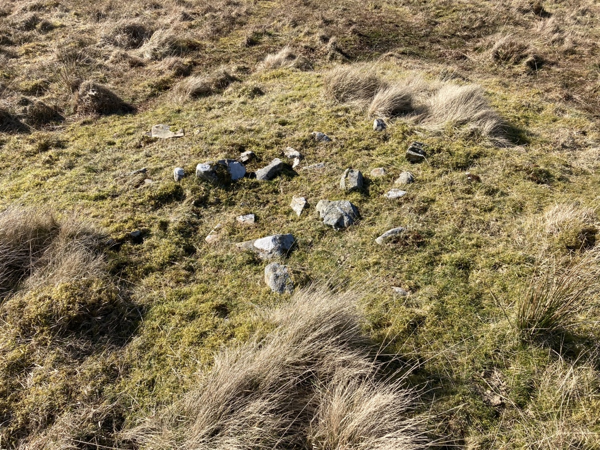
Benlaight North submitted by markj99 on 21st Mar 2022. Centre of Benlaight North Cairn viewed from E.
(View photo, vote or add a comment)
Log Text: Benlaight North Cairn is a probable small cairn in moorland c. 2 miles N of Glenluce. It is almost entirely robbed out. It is easily visited along with Benlaight South Cairn and Ballach-a-Heathry Cairn. Three for the price of one is always good value!
Benlaight South
Date Added: 21st Mar 2022
Site Type: Cairn
Country: Scotland (Dumfries and Galloway)
Visited: Yes on 20th Mar 2022. My rating: Condition 2 Ambience 3 Access 3

Benlaight South submitted by markj99 on 21st Mar 2022. Interior of Benlaight South Cairn viewed from E.
(View photo, vote or add a comment)
Log Text: Directions: Take the Three Lochs turn in the centre of Glenluce heading N. Stay on this road for c. 2.5 miles to reach a lay-by at NX 21619 60922. Head W into the field opposite for c. 50 yards. Turn left following the rough farm track for c. 200 yards to a gate. Benlaight South Cairn is c. 300 yards W of the gateway.
Benlaight South Cairn has been badly treated over time leaving a pale shadow of how it would have dominated the landscape when it was constructed.
Whiteholme Rig
Date Added: 13th Mar 2022
Site Type: Stone Circle
Country: Scotland (Dumfries and Galloway)
Visited: Yes on 19th May 2012. My rating: Condition 2 Ambience 3 Access 4

Whiteholme Rig submitted by Anne T on 7th Aug 2016. The first stone in this ancient monument that we saw from the edge of the adjacent field. The farmer hadn't made it easy for visitors to reach this stone circle, and it was a real shame the ground had been left to go wild, which made it difficult to make out any monument at all.
(View photo, vote or add a comment)
Log Text: The satisfaction of finding this stone circle exceeds the visual impact of the site. This shy retiring monument is the polar opposite of Stonehenge, a low lying circle of 7 recumbent stones set in a rural location.
Anwoth
Date Added: 11th Mar 2022
Site Type: Class I Pictish Symbol Stone
Country: Scotland (Dumfries and Galloway)
Visited: Yes on 7th Mar 2022. My rating: Condition 3 Ambience 5 Access 3

Trusty's Hill submitted by PaulH on 2nd Mar 2003. To W of Gatehouse of Fleet NX588560
Pictish symbols carved in living rock
The "teletubby" !
(View photo, vote or add a comment)
Log Text: The Z-Rod & Double Disc Pictish Symbol is common but the Sea Serpent and Sword motif on the top right of the panel could be unique.
Trusty's Hill
Date Added: 11th Mar 2022
Site Type: Hillfort
Country: Scotland (Dumfries and Galloway)
Visited: Yes on 7th Mar 2022. My rating: Condition 2 Ambience 4 Access 3

Trusty's Hill submitted by dodomad on 28th Jan 2017. Trusty's Hill aflame
Photo Credit:
© GUARD Archaeology Ltd
(View photo, vote or add a comment)
Log Text: I accessed Trusty's Hill from Rutherford's Monument but it is normally approched via Vinnie Hill on the outskirts of Gatehouse of Fleet. I found the remains of the hillfort difficult to interpret but the elevated site has panoramic views all round.
Rutherford's Well
Date Added: 11th Mar 2022
Site Type: Holy Well or Sacred Spring
Country: Scotland (Dumfries and Galloway)
Visited: Yes on 19th May 2019. My rating: Condition 3 Ambience 4 Access 4

Rutherford's Well submitted by kelpie on 13th Jul 2004. This well is accessed via the path to the right of the ruined church in Anwoth. The well is housed in a domed building and there is a low stone trough outside.
NX 58384 56221
(View photo, vote or add a comment)
Log Text: Directions: Take the minor road for Anwoth off the A75 c. 0.5 miles W of the Cardoness Castle Gatehouse of Fleet junction with the A75. Stay on this narrow road for c. 0.6 mile passing by the current Anwoth Church to reach the ruins of Anwoth Old Kirk. A path heads E from the car park S of the graveyard. Follow the path across a field to the edge of the wood. Rutherford's Well is visible c. 40 yards N of here.
Rutherford's Well itself is not spectacular but it can be combined with a visit to Anwoth Old Kirk. featured in the 1973 film The Wicker Man, and Rutherford's Monument further E.
Lingdowey Burn E
Date Added: 26th Feb 2022
Site Type: Cairn
Country: Scotland (Dumfries and Galloway)
Visited: Yes on 25th Feb 2022. My rating: Condition 2 Ambience 4 Access 3
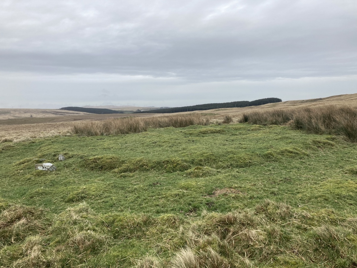
Lingdowey Burn E submitted by markj99 on 26th Feb 2022. Lingdowey Burn E Cairn viewed from W.
(View photo, vote or add a comment)
Log Text: Lingdowey Burn E is difficult to access across rough boggy ground SSW of Cairnerzean Farm SW Cairn. Wellies and GPS navigation are strongly recommended. The ruined cairn has a presence despite being entirely stone-robbed.
