Contributory members are able to log private notes and comments about each site
Sites Markj99 has logged. View this log as a table or view the most recent logs from everyone
Arthur's Stone
Date Added: 15th Apr 2021
Site Type: Chambered Tomb
Country: England (Herefordshire)
Visited: Yes on 25th Aug 2014. My rating: Condition 3 Ambience 3 Access 5

Arthur's Stone submitted by Adam Stanford on 21st Jul 2006. Taken during recent work to investigate the full extent of the covering mound for this monument. Cheers AS.
(View photo, vote or add a comment)
Log Text: There is no logical reason that the amount of effort required to reach a site should affect your interpretation of the site. However I have found that I undervalue sites adjacent to the roadside in comparison with sites in the middle of nowhere. That said, the remains of Arthur's Stone are quite impressive.
Arnsheen S
Date Added: 9th Dec 2022
Site Type: Cairn
Country: Scotland (South Ayrshire)
Visited: Yes on 5th Dec 2022. My rating: Condition 2 Ambience 4 Access 3
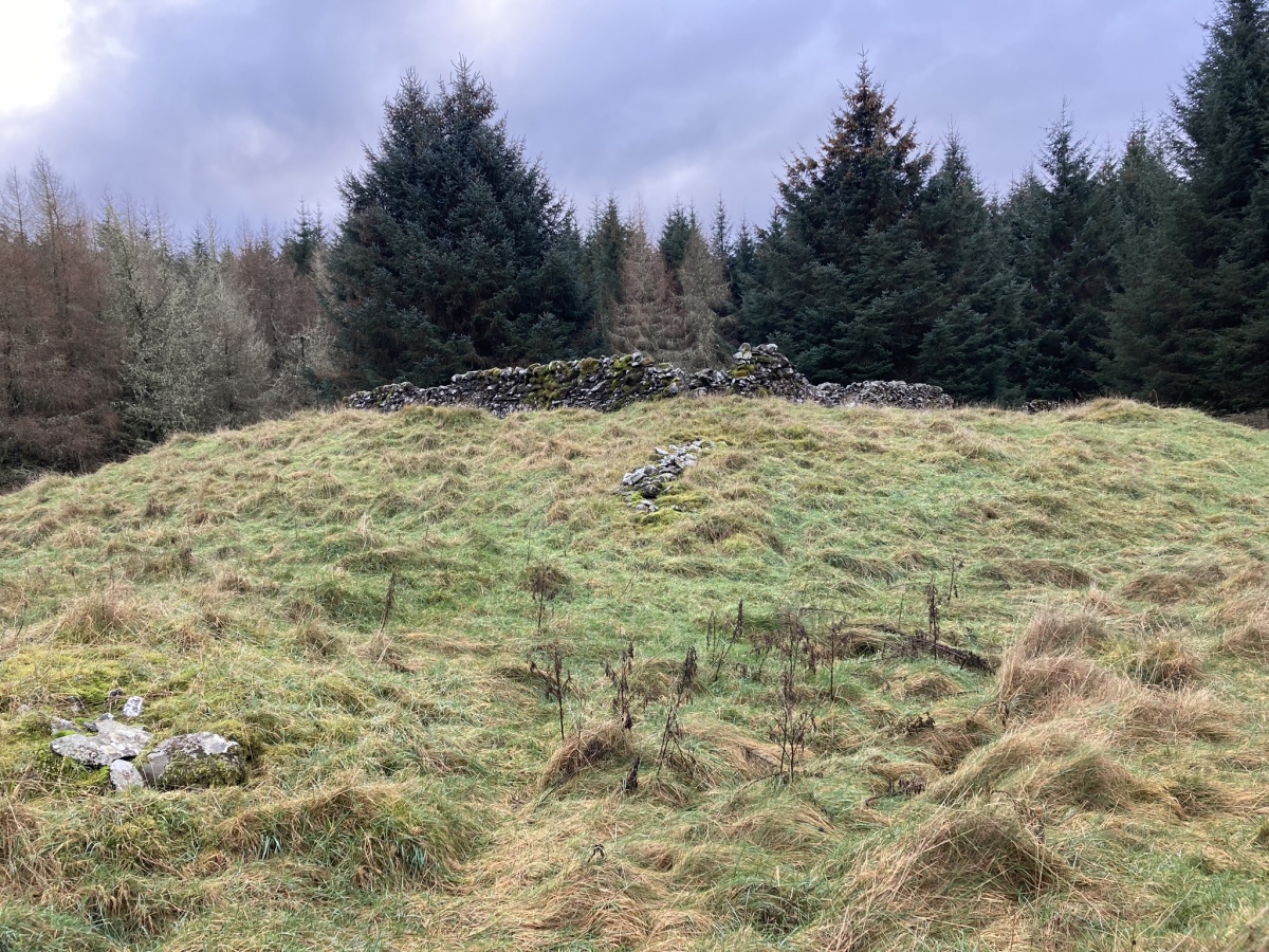
Arnsheen S submitted by markj99 on 8th Dec 2022. Arnsheen S Cairn viewed from N.
(View photo, vote or add a comment)
Log Text: Arnsheen Cairns are located c. 250 yards SW of a lay-by at NX 27713 77179 on the B7027 Barrhill road. They are easy to access via forest rides which are boggy but manageable. See directions on main page for details.
Arnsheen N
Date Added: 9th Dec 2022
Site Type: Cairn
Country: Scotland (South Ayrshire)
Visited: Yes on 5th Dec 2022. My rating: Condition 2 Ambience 4 Access 3
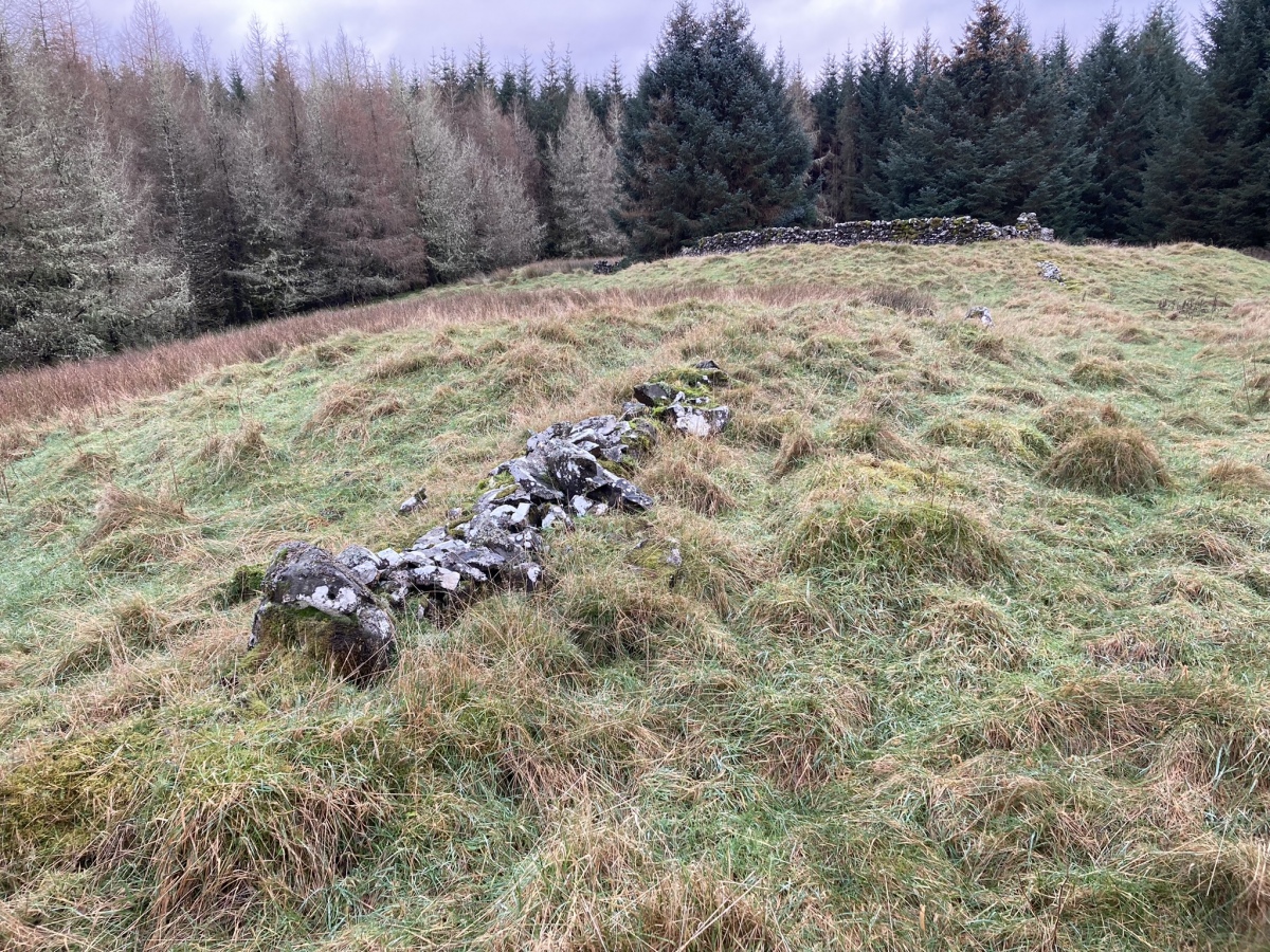
Arnsheen N submitted by markj99 on 8th Dec 2022. Arnsheen N Cairn viewed from N.
(View photo, vote or add a comment)
Log Text: Arnsheen Cairns are located c. 250 yards SW of a lay-by at NX 27713 77179 on the B7027 Barrhill road. They are easy to access via forest rides which are boggy but manageable. See directions on main page for details.
Ardvreck
Date Added: 14th Apr 2021
Site Type: Chambered Cairn
Country: Scotland (Sutherland)
Visited: Yes on 28th Jul 2015. My rating: Condition 2 Ambience 3 Access 4
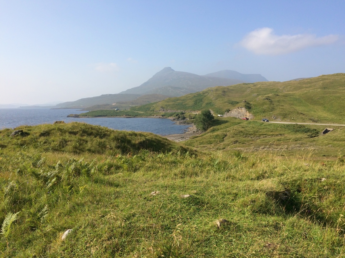
Ardvreck submitted by markj99 on 8th Sep 2021. Ardvreck Chambered Cairn viewed from SE looking towards Quinag.
(View photo, vote or add a comment)
Log Text: Ardvreck Chambered Cairn lies c. 250 yards NE of Ardvreck Castle. Therein lies the problem. Thousands of people walk past an anonymous grass mound transfixed by its more attractive companion. I myself was guilty of this on my first visit. It was only on my second visit to Ardvreck that I targeted the cairn using its grid reference.
Ardvannie
Date Added: 14th Apr 2021
Site Type: Chambered Cairn
Country: Scotland (Highlands)
Visited: Yes on 26th Apr 2012. My rating: Condition 3 Ambience 4 Access 4
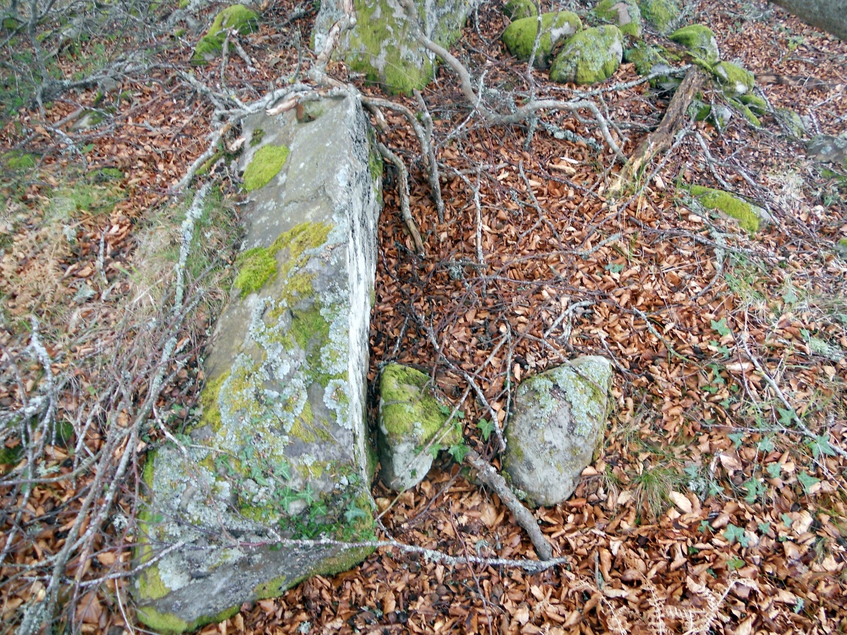
Ardvannie submitted by markj99 on 2nd Apr 2021. Structural remnants of the chamber on Ardvannie Cairn.
(View photo, vote or add a comment)
Log Text: Ardvannie Cairn is a forgotten cairn despite its proximity to the A836. I doubt many people visit and nature is slowly enveloping the remains.
Ardnave Loch
Date Added: 13th Apr 2021
Site Type: Crannog
Country: Scotland (Isle of Islay)
Visited: Yes on 22nd Aug 2019. My rating: Condition 3 Ambience 4 Access 3

Ardnave Loch submitted by markj99 on 13th Apr 2021. Ardnave Loch Crannog in SW corner Ardnave Loch.
(View photo, vote or add a comment)
Log Text: Unfortunately I visited Ardnave Loch during the rainy season (it runs from 1st January to 31st December) so the land around the loch was waterlogged. I would like to revisit in the dry season (if it exists).
Ardilistry
Date Added: 20th Nov 2024
Site Type: Stone Circle
Country: Scotland (Isle of Islay)
Visited: Yes on 22nd Aug 2019. My rating: Condition 3 Ambience 5 Access 3

Ardilistry submitted by Bladup on 4th Feb 2013. Ardilistry 4 poster [It's really tiny]
(View photo, vote or add a comment)
Log Text: Ardilistry Four Poster is in imminent danger of becoming Ardilistry Three Poster. The W stone was only protruding c. 1 inch above the surface on my visit. I wonder how much of Ardilistry Four Poster lies below the marsh? Going, going, gone: Don't leave it too long!
Ardestie
Date Added: 12th Apr 2021
Site Type: Souterrain (Fogou, Earth House)
Country: Scotland (Angus)
Visited: Yes on 18th Nov 2019. My rating: Condition 3 Ambience 3 Access 4
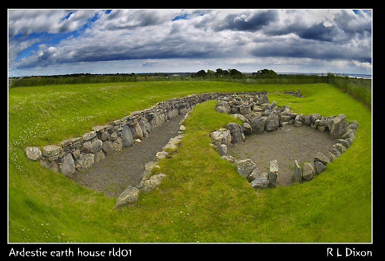
Ardestie submitted by rldixon on 14th May 2009. Ardestrie Earth House july 2006
(View photo, vote or add a comment)
Log Text: Ardestie Souterrain is easy to visit but it is a little over-restored and airy for my taste. I prefer a more subterranean experience in keeping with the original site.
Arden Fort
Date Added: 12th Apr 2021
Site Type: Hillfort
Country: Scotland (Dumfries and Galloway)
Visited: Yes on 17th Jan 2019. My rating: Condition 2 Ambience 4 Access 4
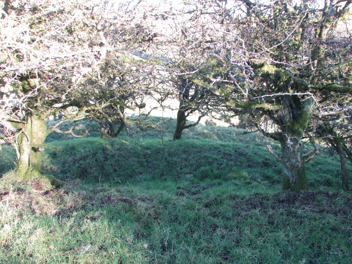
Arden Fort submitted by markj99 on 14th Nov 2020. Arden Fort Double Ramparts
(View photo, vote or add a comment)
Log Text: It takes some imagination to strip away the trees and whins however this small fort still retains a double rampart and ditch round a small enclosure. It is only 200 yards from a gateway c. 0.25 miles W of Twynholm.
Arbor Low 1
Date Added: 11th Apr 2021
Site Type: Stone Circle
Country: England (Derbyshire)
Visited: Yes on 16th Apr 2009. My rating: Condition 3 Ambience 5 Access 4
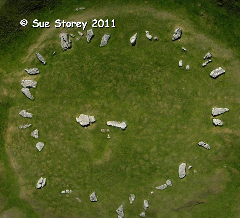
Arbor Low 1 submitted by SueS on 23rd Oct 2011. Aerial photo of the central prt of Arbor Low taken by a camera hanging on the kite line
(View photo, vote or add a comment)
Log Text: Arbor Low Henge and Stone Circle are easy to find by following English Heritage signs off the A515 between Buxton and Ashbourne.
Arbor Low Henge is well preserved but can be overshadowed by the circle of recumbent stones in the enclosure. There is some doubt as to whether the stones were ever standing adding mystery to an already impressive site.
Apron Full of Stones
Date Added: 11th Apr 2021
Site Type: Ring Cairn
Country: England (Yorkshire (North))
Visited: Yes on 6th Apr 2014. My rating: Condition 3 Ambience 4 Access 3

Apron Full of Stones submitted by Blingo_von_Trumpenstein on 27th Mar 2017. Apron Full Of Stones ring cairn. Very obvious placement facing the gorge that contains Yordas cave.
(View photo, vote or add a comment)
Log Text: There is a convenient lay by c. 100ft WNW of Apron Full of Stones at SD7065578918. If Kingsdale Beck is in spate there is a bridge c. 200ft N of a lay-by at SD7023078010. The cairn is c. 0.5 mile walk by the river from this point.
Apron Full of Stones is a much reduced cairn however there is sufficient original structure to suggest how impressive it would have been in its low lying landscape. The proximity of Yordas Cave is a bonus.
Anwoth
Date Added: 11th Mar 2022
Site Type: Class I Pictish Symbol Stone
Country: Scotland (Dumfries and Galloway)
Visited: Yes on 7th Mar 2022. My rating: Condition 3 Ambience 5 Access 3

Trusty's Hill submitted by PaulH on 2nd Mar 2003. To W of Gatehouse of Fleet NX588560
Pictish symbols carved in living rock
The "teletubby" !
(View photo, vote or add a comment)
Log Text: The Z-Rod & Double Disc Pictish Symbol is common but the Sea Serpent and Sword motif on the top right of the panel could be unique.
Antonine Wall (Croy Hill)
Date Added: 19th Oct 2023
Site Type: Misc. Earthwork
Country: Scotland (North Lanarkshire)
Visited: Yes on 6th Oct 2023. My rating: Condition 2 Ambience 4 Access 4

Antonine Wall (Croy Hill) submitted by markj99 on 18th Oct 2023. Antonine Wall (Croy Hill) viewed from WSW.
(View photo, vote or add a comment)
Log Text: On the N edge of Croy turn onto Nethercroy Road, signed for Croy Miner's Welfare Charitable Society. Follow this lane for c. 150 yards past new houses to a parking spot at the start of the John Muir/Croy Hill Path. After c. 250 yards go through a gate. Bear left to visit the remains of Antonine Wall then continue up the Croy Hill Path for c. 0.7 mile to reach Croy Hill Fort.
Andle Stone (Stanton Moor)
Date Added: 10th Apr 2021
Site Type: Natural Stone / Erratic / Other Natural Feature
Country: England (Derbyshire)
Visited: Yes on 22nd Jan 2009. My rating: Condition 3 Ambience 4 Access 3
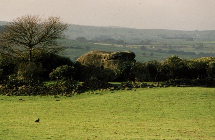
Andle Stone (Stanton Moor) submitted by PaulM on 1st Sep 2001. The Andle Stone, near Doll Tor Stone Circle, Stanton Moor, Derbyshire GR: SK241630
The Andle Stone or Oundle Stone is a dominating outcrop of sandstone, standing alone in the middle of a field, surrounded by a dry-stone wall and a mass of rhododendrons. Approximately 5m high by 4.5m wide, the rock is supposedly carved with ancient cupmarks on the, modern graffiti, a relatively recent inscription and climbing holes on the sides.
(View photo, vote or add a comment)
Log Text: The massive Andle Stone is impressive and the climb onto the top of the stone is challenging.
An Carra
Date Added: 15th Jan 2025
Site Type: Standing Stone (Menhir)
Country: Scotland (South Uist)
Visited: Yes on 30th Jun 2011. My rating: Condition 4 Ambience 5 Access 3

An Carra submitted by SandyG on 20th May 2016. View from south (28 August 2015).
(View photo, vote or add a comment)
Log Text: When travelling to South Uist, An Carra is a must visit site. Stoneybridge Water Treatment Works has an access road off the A865 c. 600 yards before reaching Stoneybride, a small village in the middle of South Uist. There is room to park opposite the access road. Walk 0.5 miles up the road and the massive stone will appear on the L.
An Carra must be one of the largest standing stones in Scotland at 17 ft high and nearly 5 ft wide.
Altnacealgach
Date Added: 10th Apr 2021
Site Type: Chambered Cairn
Country: Scotland (Highlands)
Visited: Yes on 31st Jul 2015. My rating: Condition 3 Ambience 5 Access 3
Altnacealgach submitted by markj99 on 12th Dec 2020. Approaching Altnacealgach Cairn from the east.
(View photo, vote or add a comment)
Log Text: Altnacealgach Cairn is accessible from Altnacealgach Motel if you have walking boots or wellies as it situated on a rough moorland slope. The c. 0.5 mile return trip is more than compensated by a heather clad cairn with a 45 degree arc of exposed stones in the SE.
Altigoukie Burn Cairn
Date Added: 24th Feb 2024
Site Type: Cairn
Country: Scotland (Dumfries and Galloway)
Visited: Yes on 1st Feb 2024. My rating: Condition 2 Ambience 4 Access 1
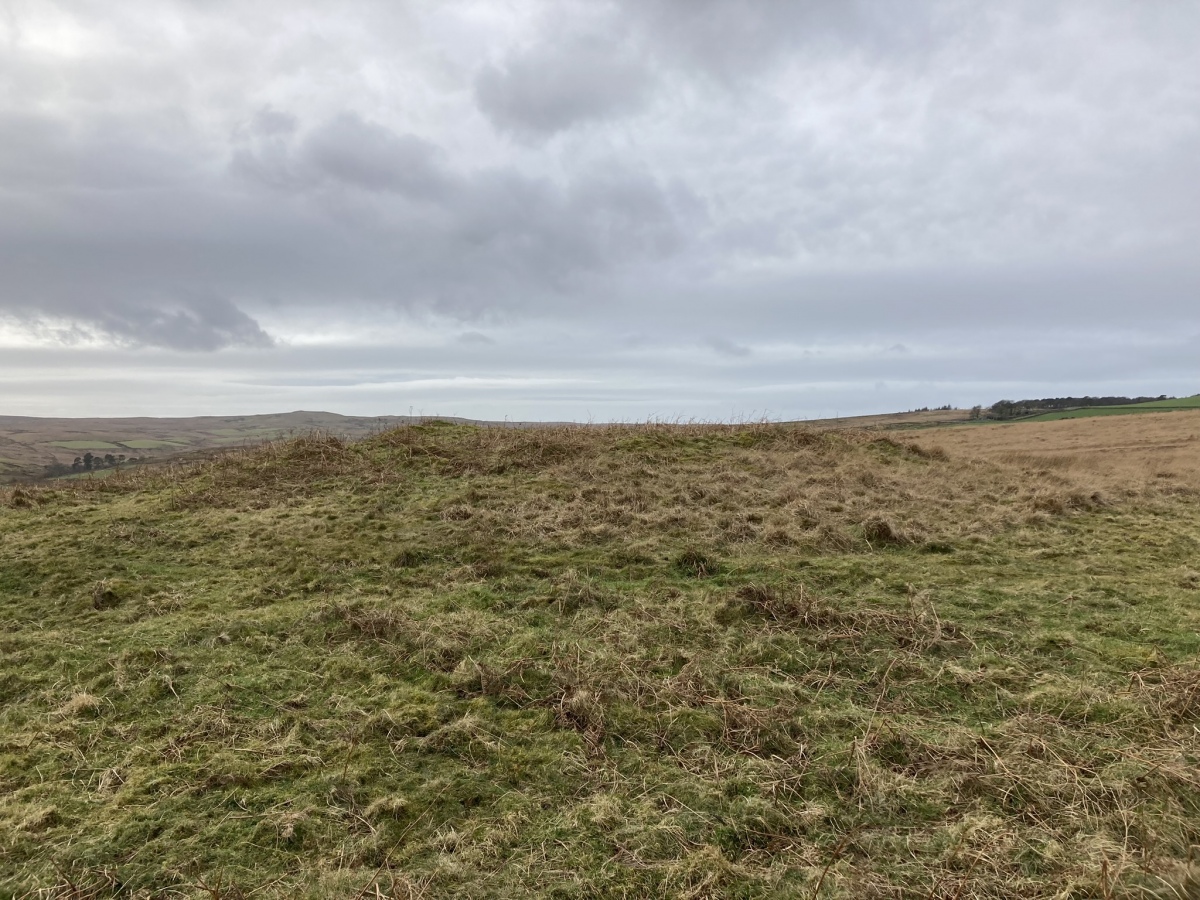
Altigoukie Burn Cairn submitted by markj99 on 10th Feb 2024. Altigoukie Burn Cairn viewed from E.
(View photo, vote or add a comment)
Log Text: I saw Altigoukie Burn Cairn on OS Mapping, however, actually reaching the cairn was no picnic. The cairn is a green spot in open moorland, accessed via a muddy track through Barlure farm. Wellies and GPS Navigation are required to follow my route on Altigoukie Burn Cairn and Burnt Mound.
Altigoukie Burn Burnt Mound
Date Added: 24th Feb 2024
Site Type: Misc. Earthwork
Country: Scotland (Dumfries and Galloway)
Visited: Yes on 1st Feb 2024. My rating: Condition 1 Ambience 3 Access 1

Altigoukie Burn Burnt Mound submitted by markj99 on 10th Feb 2024. Altigoukie Burn Burnt Mound viewed from NE.
(View photo, vote or add a comment)
Log Text: If you are going to visit Altigoukie Burn Cairn it is possible to visit Altigoukie Burn Burnt Mound. The grassy mound on the S bank of Altigoukie Burn is difficult to discern in situ. My route can be viewed on Altigoukie Burn Cairn and Burnt Mound.
Althing
Date Added: 10th Apr 2021
Site Type: Natural Stone / Erratic / Other Natural Feature
Country: Iceland
Visited: Yes on 11th Nov 2015. My rating: Condition 5 Ambience 4 Access 4
Althing submitted by DrewParsons on 10th May 2010. The Law Rock or Lögrétta is a high rock on European side of the chasm and was the site from which laws were passed and trials conducted. April 2010.
(View photo, vote or add a comment)
Log Text: Thingvellir National Park features Almannagjá, a slowly widening chasm between the European and American plates and Lögrétta, the Law Rock that is said to be the first site of Althing, the oldest surviving parliament in the world. Althing was established c. 930 AD.
Altarnun Cross B
Date Added: 14th Jun 2023
Site Type: Ancient Cross
Country: England (Cornwall)
Visited: Yes on 9th Jun 2023. My rating: Condition 2 Ambience 3 Access 5
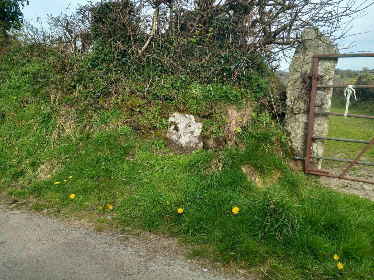
Altarnun Cross B submitted by dooclay on 11th Apr 2023. The Cross is built into a wall just past the first right leaving Altanun towards Fowey Moor
(View photo, vote or add a comment)
Log Text: The Short Cross is located c. 500 yards N of Altarnun at the start of a narrow lane leading to Tresibbett. I had to clear away vegetation to find the broken cross head embedded in the base of a stone wall.
