Contributory members are able to log private notes and comments about each site
Sites PAB has logged. View this log as a table or view the most recent logs from everyone
Mynydd Mawr Cairn
Date Added: 21st Sep 2011
Site Type: Cairn
Country: Wales (Gwynedd)
Visited: Yes on 3rd Sep 2011

Mynydd Mawr Cairn submitted by pab on 3rd Sep 2011. Mynydd Mawr Cairn.
A panorama looking over the largest of the 3 'shelters' which are now located within the cairn.
(View photo, vote or add a comment)
Log Text: None
Achmore
Date Added: 21st Sep 2011
Site Type: Stone Circle
Country: Scotland (Isle of Lewis)
Visited: Yes on 6th May 2011. My rating: Condition 2 Ambience 3 Access 5
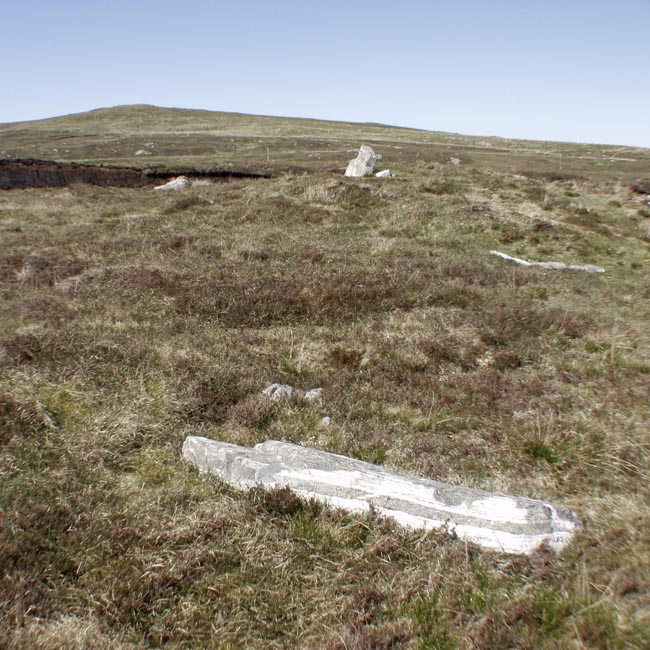
Achmore submitted by Tom_Bullock on 8th Dec 2004. Photo used by kind permission of Tom Bullock. More details of this location are to be found on his Stone Circles and Rows CD-ROM
(View photo, vote or add a comment)
Log Text: None
St Cybi's Well
Date Added: 18th Sep 2011
Site Type: Holy Well or Sacred Spring
Country: Wales (Gwynedd)
Visited: Yes on 8th Sep 2011. My rating: Condition 4 Ambience 5 Access 4

St Cybi's Well submitted by KiwiBetsy on 11th Dec 2004. St Cybi was a 6th century Cornishman who is said to have created this spring by striking a rock with his staff.
Climb the stone stile in the corner of the graveyard of the Parish Church in Langybi and then follow the fence line that runs at right angles to the graveyard wall. Once through the gorse at the far side of the field, a bridge will take you over a stream to the substantial ruins of St Cybi’s Wellhouse and the custodian’s house next to it. The well basin is in the centre of t...
(View photo, vote or add a comment)
Log Text: 2nd time lucky.... When we first visited, we had the same problem as Angie - following a sign for the well which seemed to point instead to a rather poor construction.
How fortunate we were to have had another chance while in the area this month - this is a very special place. In terms of access, it might be difficult to visit the well if you are anxious about livestock. There were some rather frisky young cattle in the field across which the fingerpost directs you. We went instead through the cemetery, but this still involves crossing their field a short distance.
Ty'n Y Pant Stone
Date Added: 7th Aug 2011
Site Type: Standing Stone (Menhir)
Country: Wales (Powys)
Visited: Yes on 20th Sep 2010
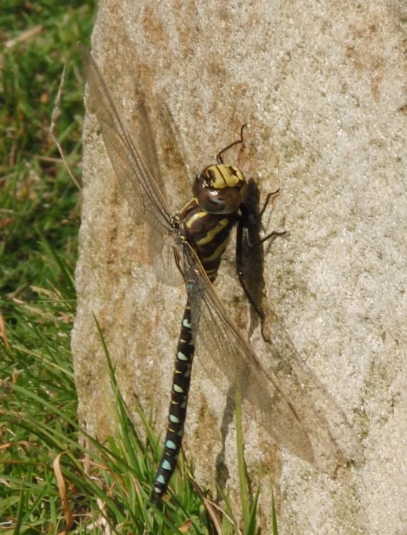
Ty'n Y Pant Stone submitted by pab on 7th Aug 2011. Ty'n Y Pant Stone. The dragonfly is of course one of the oldest surviving creatures, so it seemed only right for us to wait until he had soaked up some sunshine.
He obviously thinks Ty'n Y Pant Stone is worthy of close inspection...anyone know otherwise?
(View photo, vote or add a comment)
Log Text: None
Castell Coch, Trefin
Date Added: 6th Aug 2011
Site Type: Promontory Fort / Cliff Castle
Country: Wales (Pembrokeshire)
Visited: Yes on 11th Jun 2010. My rating: Condition 2 Ambience 4 Access 4
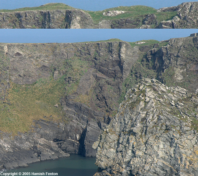
Castell Coch, Trefin submitted by h_fenton on 5th Feb 2008. the ramparts of the promontory fort shown in some detail in the top photo, main photo showing height of promontory above water. the interior of the fort it to the left.
Site visited: 2 April 2005
(View photo, vote or add a comment)
Log Text: None
Derlwyn Isaf
Date Added: 24th Jul 2011
Site Type: Cairn
Country: Wales (Carmarthenshire)
Visited: Yes on 23rd Jul 2011
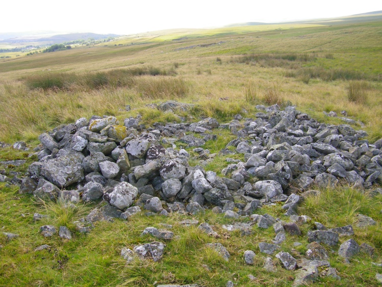
Derlwyn Isaf submitted by pab on 24th Jul 2011. Derlwyn Isaf Cairn.
(View photo, vote or add a comment)
Log Text: Visited on 23rd July while on a 'field visit' walk organised by the South Wales Geologists' Association, led by Alan Bowring.
We got to this towards the end of a 9 mile circular walk, but it could be reached fairly easily without doing all that - we started from car park next to playground in Ystradowen SN752124. The area around the hillock on which the cairn sits was (and probably is normally) very boggy.
Carn Fadog
Date Added: 24th Jul 2011
Site Type: Cairn
Country: Wales (Carmarthenshire)
Visited: Yes on 23rd Jul 2011

Carn Fadog submitted by pab on 23rd Jul 2011. Carn Fadog, described by COFLEIN as being damaged and hollowed out.
(View photo, vote or add a comment)
Log Text: Visited on 23rd July while on a 'field visit' walk organised by the South Wales Geologists' Association, led by Alan Bowring.
Focus for the walk was the local geology and industrial archaeology, so we didn't get up to the cairn itself and I cannot therefore report how damaged its centre now is. Definitely worth a walk though - we started from car park next to playground in Ystradowen SN752124 and did a circular 9 mile route via Bryn-henllys Bridge, mainly using the routes of old tramways once used in local quarrying activities.
There are some very boggy stretches - expect many little diversions to avoid!
Bedd-y-brenin
Date Added: 16th Jan 2011
Site Type: Cairn
Country: Wales (Gwynedd)
Visited: Yes on 4th May 2008
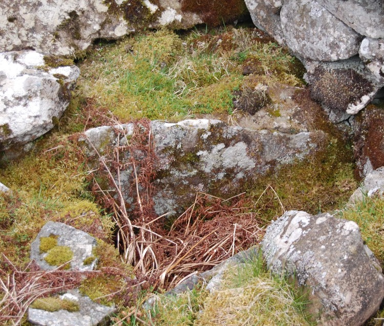
Bedd-y-brenin submitted by pab on 15th Jan 2011. Bedd-y-brenin - King's Grave. This image shows the cist alongside the later wall shelter.
(View photo, vote or add a comment)
Log Text: We went looking for this cairn from the north, after visiting the Bryn Seward stone alignment. This was definitely a mistake in terms of making headway, but we did come across the most fantastic erratic while stumbling through the forrest, and also saw the circle of stones which were clearly something significant.
From later research, these seem to be the hut circles listed by RCAHMW database.
The ‘path’ shown on OS maps through the forest cannot be relied upon, and the firebreak track through the conifers becomes a virtual river whenever it rains.
The cairn is actually very easily reached from the upper lane.
I first became aware of this cairn from some really helpful jottings I came across on the net a couple of years ago – I hope their journey comments and well-described routes inspire others too:
http://myweb.tiscali.co.uk/celynog/lakes.htm
Althing
Date Added: 16th Jan 2011
Site Type: Natural Stone / Erratic / Other Natural Feature
Country: Iceland
Visited: Yes on 2nd Jan 2011

Althing submitted by pab on 2nd Jan 2011. Site in Iceland
By way of contrast to Drew's photo from April 2010, this picture is of the same location, but looking at the Rock and flag from the other direction. This was taken in July 2002, when Iceland was really in bloom with wild flowers.
The Icelanders have a very keen pride in having had their democratic 'parliament' since such an early period.
(View photo, vote or add a comment)
Log Text: None
Carreg Bica Cairn
Date Added: 29th Dec 2010
Site Type: Round Cairn
Country: Wales (Powys)
Visited: Yes on 5th Oct 2010
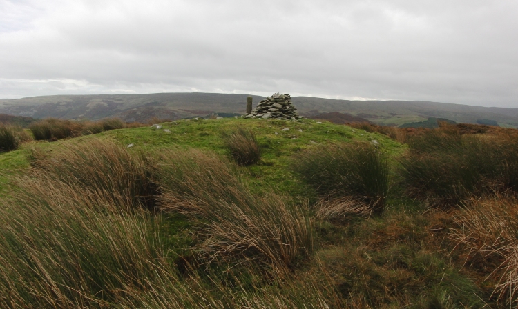
Carreg Bica Cairn submitted by PAB on 5th Oct 2010. Carreg Bica - general view, looking southeast. The shape of the barrow is clear and striking, providing excellent panoramic views.
The stone cairn is clearly a fairly 'modern' construct - and the marker is one of the boundary markers which go right round the Elan Valley Estate - about 65 miles apparently.
(View photo, vote or add a comment)
Log Text: None
Troy Town Maze
Date Added: 29th Dec 2010
Site Type: Turf Maze
Country: England (Isles of Scilly)
Visited: Yes on 26th Oct 2010
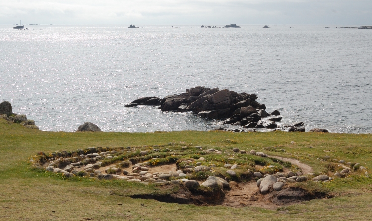
Troy Town Maze submitted by pab on 26th Oct 2010. Troy Town Maze: showing the extent of erosion in June 2009. This is the view looking west, with Bishop Rock Lighthouse visible top left, about 4 miles away.
In such as exposed location, it must be very difficult for the soil and turf to recover from the damage caused by visitors tracing the curves.
Photo: 21 June 2009
(View photo, vote or add a comment)
Log Text: None
Cwmyffynnon alignment
Date Added: 4th Oct 2010
Site Type: Natural Stone / Erratic / Other Natural Feature
Country: Wales (Gwynedd)
Visited: Yes on 3rd Oct 2010
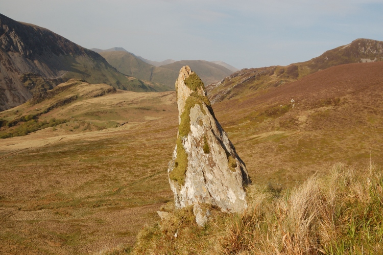
Cwmyffynnon alignment submitted by PAB on 3rd Oct 2010. On the slopes above the road between Lyn Nantlle and Ryd Ddu, there is a clear alignment. This may well be 'natural' but it is and almost certainly was formerly very significant. As for special - no doubt...
This photo is taken along a bearing of 042 - towards the many settlements and cairns on the Carneddau.
(View photo, vote or add a comment)
Log Text: None
Beddau Folau Chambered Cairn
Date Added: 3rd Oct 2010
Site Type: Cairn
Country: Wales (Powys)
Visited: Yes on 19th Sep 2010. My rating: Condition 3 Ambience 4 Access 3
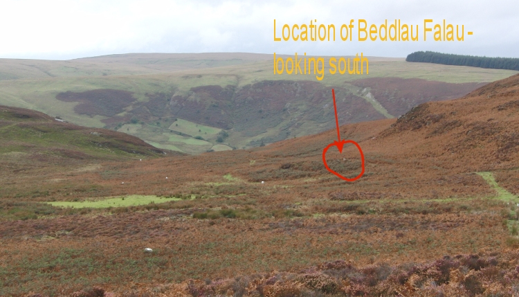
Beddau Folau Chambered Cairn submitted by PAB on 2nd Oct 2010. Beddau Folau Cairn, showing its location on the plateau above the Elan Valley, looking south.
(View photo, vote or add a comment)
Log Text: None
Llanddewigaer
Date Added: 30th Sep 2010
Site Type: Hillfort
Country: Wales (Pembrokeshire)
Visited: Yes on 23rd Apr 2010
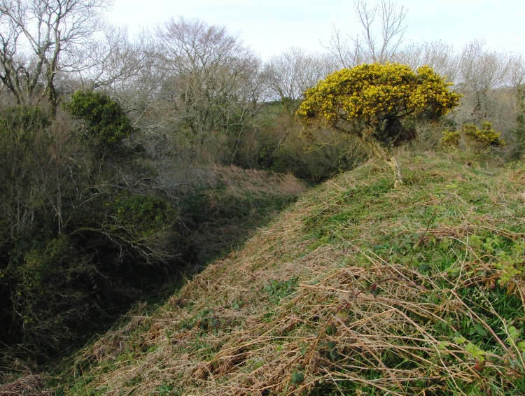
Llanddewigaer submitted by PAB on 10th Oct 2010. View along the top of the western rampart, facing north. To give an idea of the significant size of these defences, note the gorse bush - one of the other pictures I will be posting shows the same bush from the north.
(View photo, vote or add a comment)
Log Text: None
Carreg Samson, Abercastle
Date Added: 30th Sep 2010
Site Type: Chambered Tomb
Country: Wales (Pembrokeshire)
Visited: Yes on 26th Jun 2006
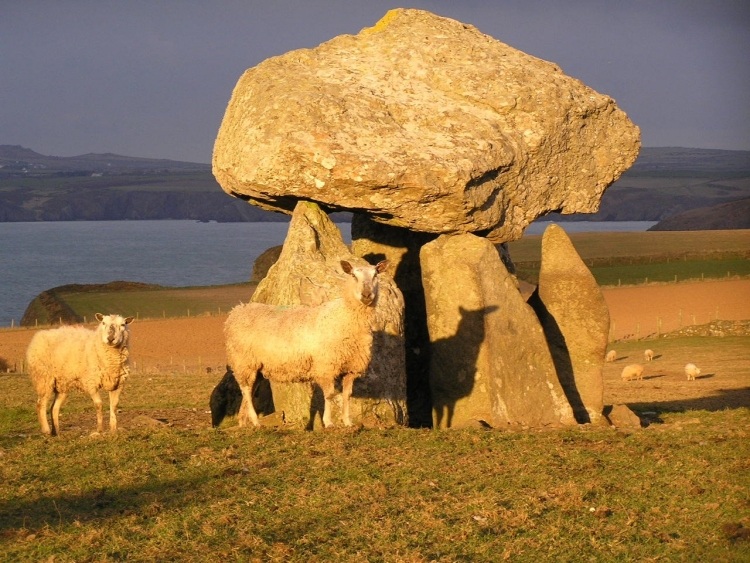
Carreg Samson, Abercastle submitted by pab on 26th Jun 2006. Confirming both the photo and the site as worthy winner of the Spring 2006 prize!
We loved the long late afternoon shadows, and the one of the 'principal sheep' made us realise that many ancient animal drawings make more sense if thought of as shadow tracings? The theory falls down rather for cave paintings though!
One wonderful thing about this site is the fact that there is a 'CL' campsite next to the field - what a view to wake up to!
(View photo, vote or add a comment)
Log Text: None
Golden Grove
Date Added: 18th Sep 2010
Site Type: Standing Stone (Menhir)
Country: Wales (Powys)
Visited: Yes on 9th Apr 2007
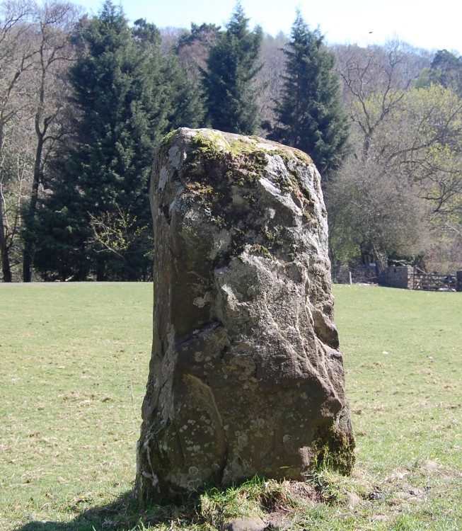
Golden Grove submitted by pab on 9th Apr 2007. Llangenny Stone, Easter 2007, looking West across to the river (Grwyne Fawr)
(View photo, vote or add a comment)
Log Text: None
St Thomas's Well (Wymondham)
Date Added: 18th Sep 2010
Site Type: Holy Well or Sacred Spring
Country: England (Norfolk)
Visited: Yes on 9th Apr 2007

St Thomas's Well (Wymondham) submitted by pab on 9th Apr 2007. No-one at the Abbey seemed to be aware of the location of the Well when I visited just before Easter!
I must admit though that I had not made the connection in my own head between St Thomas' Well and the fact that he Abbey is in a street called Becketswell Road..even though I had lived in the town for several years.
The temporary tennant of this property (who also had heard nothing of a well) was kind enough to let me take these pictures, but it is on private land.
(View photo, vote or add a comment)
Log Text: None
Little Walsingham Holy Well
Date Added: 18th Sep 2010
Site Type: Holy Well or Sacred Spring
Country: England (Norfolk)
Visited: Yes on 10th Apr 2007
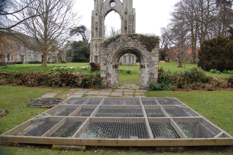
Little Walsingham Holy Well submitted by pab on 10th Apr 2007. Holy Well, located next to the ruins of Abbey of St Mary, in Little Walsingham. Site is now part of the Abbey Museum grounds, so a charge is payable (£3, in April 2007). It was not possible for me to remove the cover to have a proper look, but perhaps someone making a pre-arranged visit might be allowed to do so.
The main well was approximately 5m by 5m, with 2 circular wells very close by. There is scope for confusion as to whether this is the 'real well', as there is another one withi...
(View photo, vote or add a comment)
Log Text: None
Pen Cerrig-calch
Date Added: 18th Sep 2010
Site Type: Cairn
Country: Wales (Powys)
Visited: Yes on 11th Apr 2007
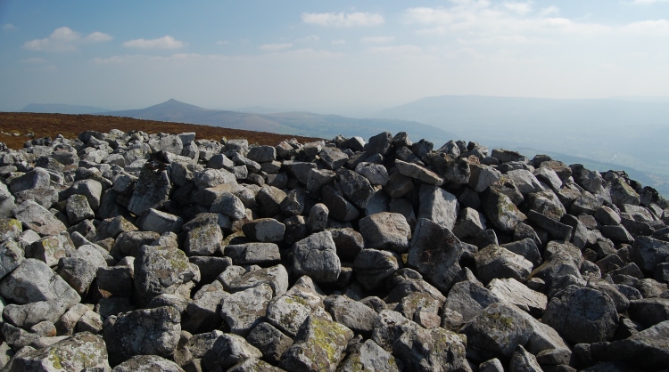
Pen Cerrig-calch submitted by pab on 11th Apr 2007. Cairn 1 as defined on the RCAHMW site, their reference "NPRN:306291, A centrally disturbed cairn, 16.5m in diameter and 1.1-2.5m high.". Glorious views across Llangattock and the ridge to the south.
(View photo, vote or add a comment)
Log Text: None
Coed Ynys Faen
Date Added: 18th Sep 2010
Site Type: Standing Stones
Country: Wales (Powys)
Visited: Yes on 11th Apr 2007

Coed Ynys Faen submitted by pab on 11th Apr 2007. Coed Ynys-faen, Stone 2, with track above.
After a very difficult clamber through the bracken and brambles on the steep hillside above the road, this stone was visible roughly in the position next to the track on the RCAHMW map for Stone 2. It was obvious that constructing the track above it had caused so much material to be displaced that it was almost completely covered.
I doubt whether it would be possible to get through most of the year - I happened to be there after a dry spell, be...
(View photo, vote or add a comment)
Log Text: None
