Contributory members are able to log private notes and comments about each site
Sites Smilemaker has logged. View this log as a table or view the most recent logs from everyone
Port Sonachan
Date Added: 16th Apr 2025
Site Type: Chambered Cairn
Country: Scotland (Argyll)
Visited: Yes on 6th Apr 2025. My rating: Condition 2 Ambience 5 Access 3
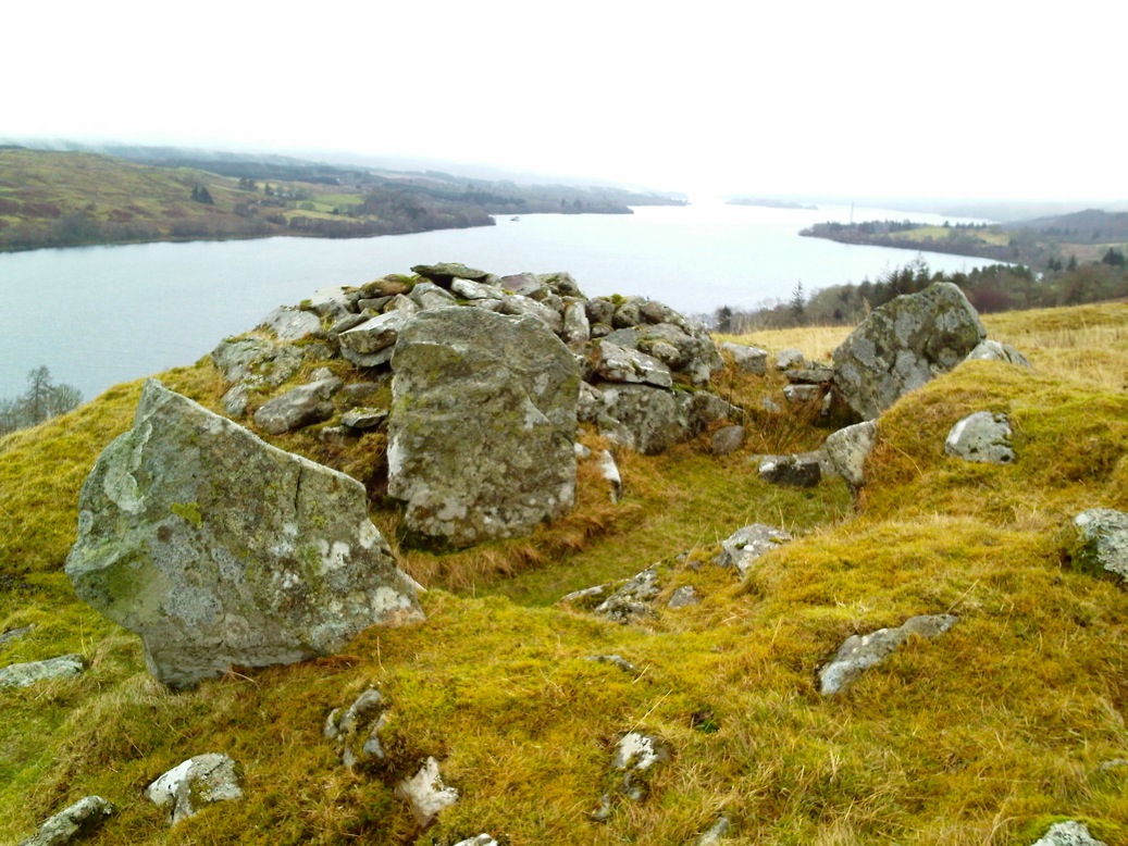
Port Sonachan submitted by crannog on 26th Jan 2012. OMG!!!!! AMAZING PLACE!!!!! So high up, what a view..... I could have stayed here all day .... difficult to get to, you need sturdy legs and footwear! (and a map!)
(View photo, vote or add a comment)
Log Text: A great site although not easy access with a substantial wall blocking the direct approach from the track opposite the hotel's pier. If you follow the track to the water tank area, there is easier access across a non-barbed fence. To see the site at its best, go in the late winter or early spring, before the bracken covers any features, particularly the stone lined ?bothy? on the eastern flank.
There is a virtual 3D model of the site available HERE
Leacach an Tigh Cloiche
Date Added: 10th Feb 2025
Site Type: Standing Stone (Menhir)
Country: Scotland (North Uist)
Visited: Yes on 8th Feb 2025
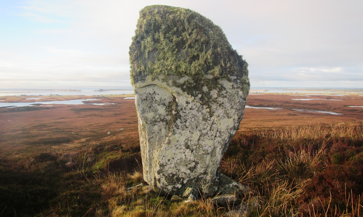
Leacach an Tigh Cloiche submitted by Smilemaker on 23rd Jan 2025. The impressive standing stone on the Northeast extremity of the Leacach an Tigh Cloiche site.
(View photo, vote or add a comment)
Log Text: I revisited the site on Saturday and created a 3D photo sequence. The resulting model can be seen on Sketchfab
Barp Hacklett
Date Added: 4th Feb 2025
Site Type: Chambered Cairn
Country: Scotland (North Uist)
Visited: Yes on 2nd Feb 2025. My rating: Condition 2 Ambience 4 Access 3
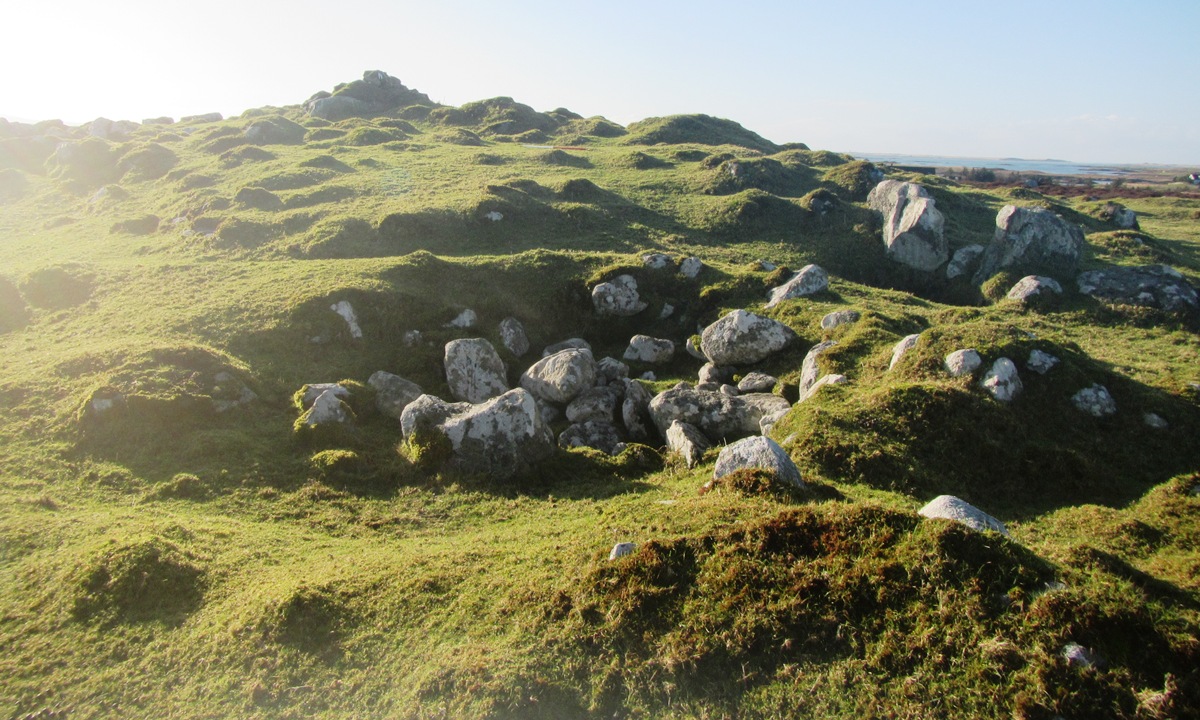
Barp Hacklett submitted by Smilemaker on 4th Feb 2025. One of the ruined shieling huts on the cairn's surface
(View photo, vote or add a comment)
Log Text: The site is more interesting than its Canmore description suggests, rising as a green mound, like an island above a 'sea' of deep heather. The surface has much masonry strewn across it, some employed to line and define sub-circular indentations - post-medieval Sheiling bothies. The highest point is defined by a drystone cairn.
Within the heather there are several boulders or bedrock exposures which are mostly hidden from view but may be related to the site.
At the north of the site there is a row of boulders which are aligned with the domed summit of Beinn na Coille, about two kilometres distant. From the site at least four crannogs can be seen in nearby lochs. These sites were investigated in 2022 as part of the Islands of Stone project.
I have created a virtual 3D model of the site, available online on my Sketchfab pages.
Dun Leiravay
Date Added: 2nd Feb 2025
Site Type: Stone Fort or Dun
Country: Scotland (North Uist)
Visited: Yes on 1st Feb 2023. My rating: Condition 2 Ambience 4 Access 3
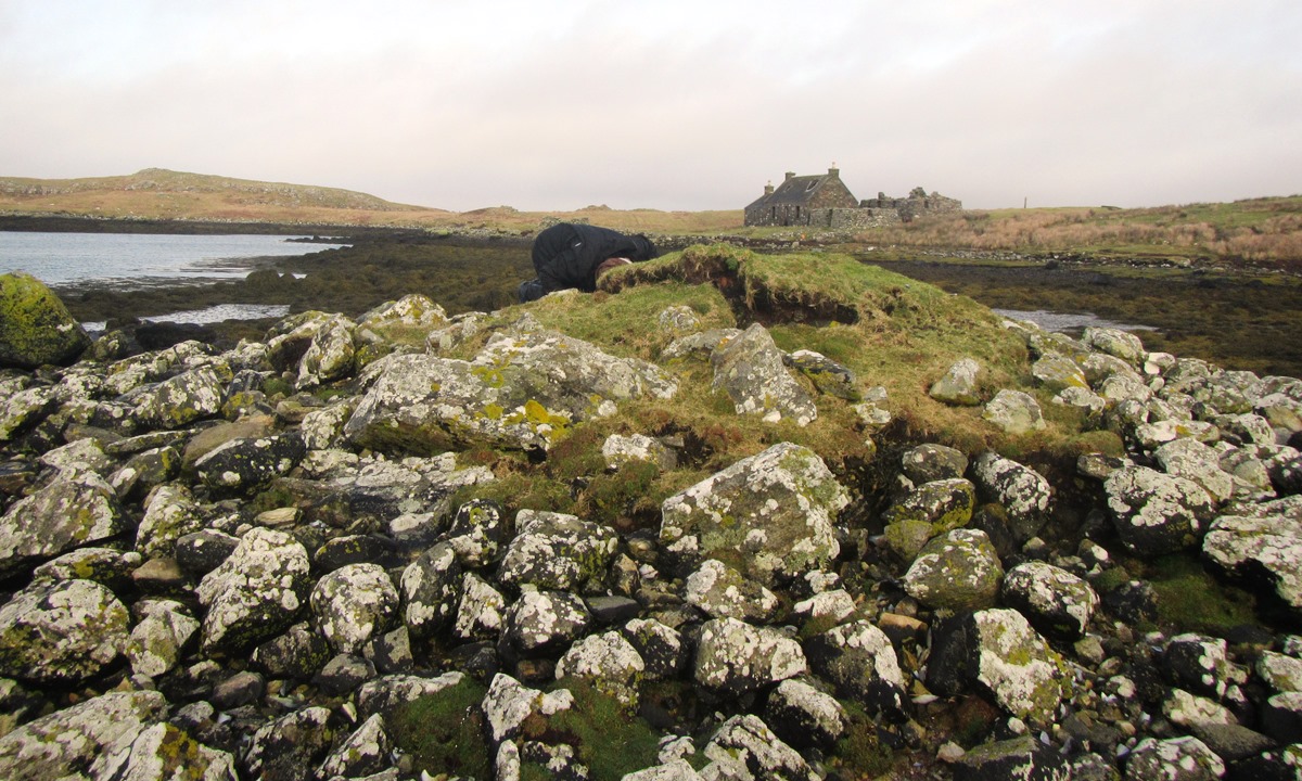
Dun Leiravay submitted by Smilemaker on 2nd Feb 2025. close up of the dun with Leireabhagh Farm behind
(View photo, vote or add a comment)
Log Text: I made an extensive survey of the Stromban peninsula and Leireabhagh Island from February to May 2023.
It was seen that the (then) reported position on Canmore of Dun Leireabhagh was incorrect, its true position is at NF 91212 67897.
In prehistory, the loch was fresh water, but with the slow sinking of the Uist islands, the waters of the minch have innundated the loch which is now open to the sea through two narrow sounds with strong currents when tides run through. The Dun itself appears to have 2 causeways, connecting it to both the Stromban peninsula and Leireabhagh Island, a rute used by sheep to cross at low tide!
Copies of the project outline and report are both available on request.
I created a virtual 3D model of the site
on my Sketchfab pages
Benbencula, Hacklett
Date Added: 1st Feb 2025
Site Type: Ancient Village or Settlement
Country: Scotland (North Uist)
Visited: Yes on 4th Oct 2023. My rating: Condition 3 Ambience 5 Access 2
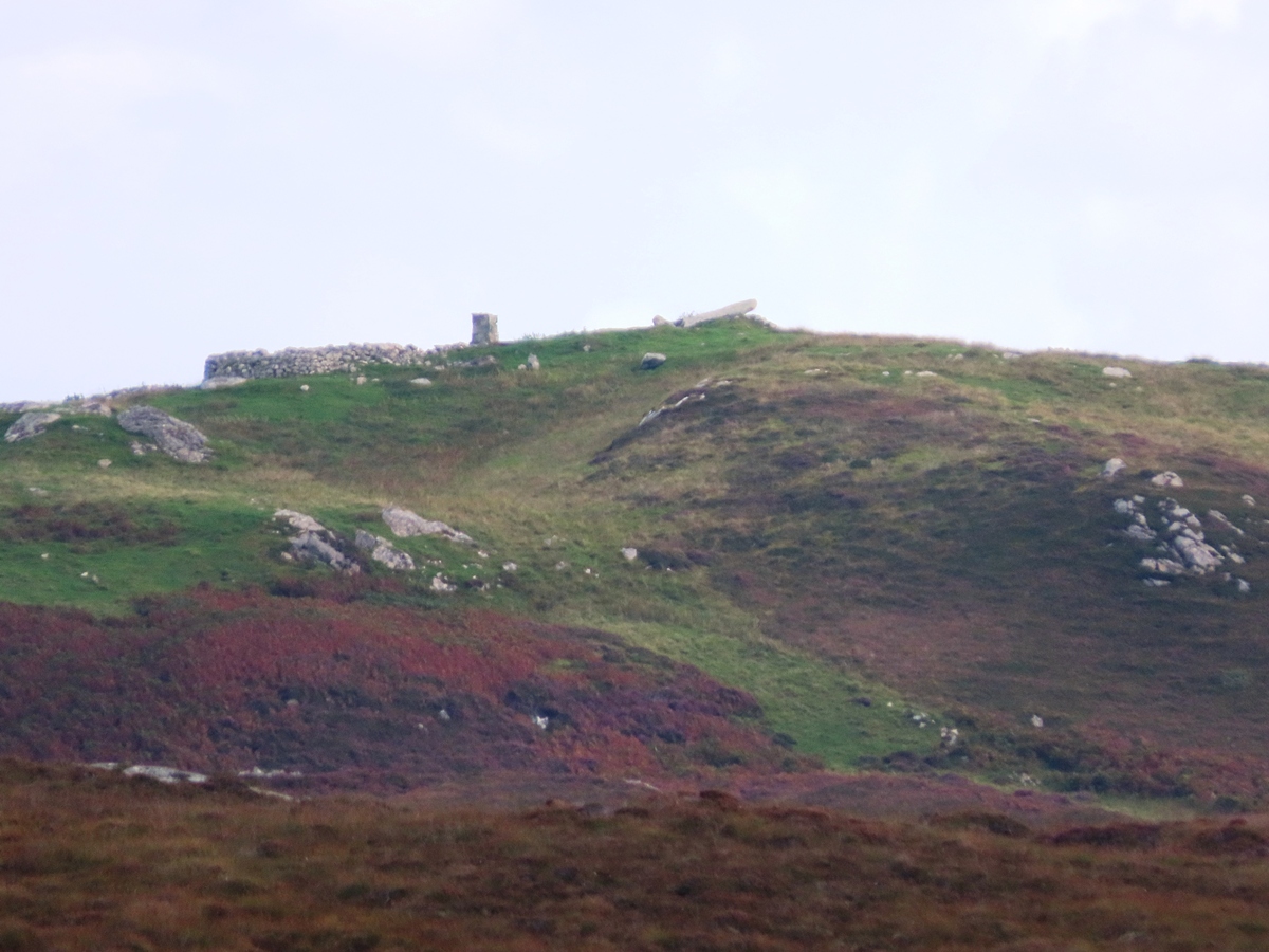
Benbencula, Hacklett submitted by Smilemaker on 1st Feb 2025. View from Souidheachadh Sealg Stone Circle of the Hacklet Stone on the skyline, resembling a ski jump for the midwinter sunrise.
(View photo, vote or add a comment)
Log Text: Not my first visit to this multiperiod site, but my most recent. Visit prompted by researching an interesting alignment of the Hacklet Stone to the midwinter solstice sunrise, when observed from the Stone Circle at Suidheachadh Beag (see Suidhheachadh Sealg on this site).
Previous suggestions have been that the Hacklet Strone is a toppled Standing Stone - however its position is, I believe, exactly as placed. The angulation of the stone means that an observer of the Solstice Sunrise would see the sun rise over the left edge of the stone, then appear to 'roll' along the stone and take off into the sky - a little like a ski-jump!
The Hacklet Stone has had a checkered history - at one stage it was reportedly used as part of a piggery, hence the walling shown in the photos.
There is a more recent 3D model available at https://sketchfab.com/3d-models/the-hacklet-stone-18e53a0c60204221b64d715fc9b76096
Dun Fhearchair
Date Added: 1st Feb 2025
Site Type: Stone Fort or Dun
Country: Scotland (Isle of Benbecula)
Visited: Yes on 31st Jan 2025. My rating: Condition 2 Ambience 2 Access 3
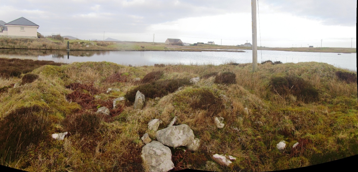
Dun Fhearchair submitted by Smilemaker on 1st Feb 2025. Stitched panorama of the site from the SW. Left foreground is the (?) ruined farm cottage, the cairn sits behind and to the right, supporting the electricity pole!
(View photo, vote or add a comment)
Log Text: Canmore rightly states that the cairn had reduced in size from c.45ft diameter in 1915 to 10 metres in 1965.
What was not recorded is the presence of a post-clearance farm cottage (now in a ruinous state) and the more recent erection of an electricity pole at the site. The presence of high voltage cables discouraged me from creating a virtual 3D survey of the site!
The original Dun would have taken up most of the ground area of the headland - indeed, it is possible that the headland itself was an artificial construction. There are several small islets on the loch behind but no evidence for causeways.
Leacach an Tigh Cloiche
Date Added: 23rd Jan 2025
Site Type: Standing Stone (Menhir)
Country: Scotland (North Uist)
Visited: Yes on 22nd Jan 2024. My rating: Condition 2 Ambience 5 Access 2

Leacach an Tigh Cloiche submitted by Smilemaker on 23rd Jan 2025. The impressive standing stone on the Northeast extremity of the Leacach an Tigh Cloiche site.
(View photo, vote or add a comment)
Log Text: The site at Leacach an Tigh Cloiche is complex, the earliest part comprises of a standing stone adjacent to a ruined chambered cairn. This has been overlaid by at least one medieval building and a handful of smaller structures, probably post medieval shieling huts, These later structures made use of much of the cairn material, although the mound and many of the curb stones are still identifiable.
The standing stone is as described and is very impressive. The whole site can be easily identified from the prehistoric settlement mounds in valley below, adjacent to Loch na Buaile Iochdraich, from where it appears as a skyline feature.
Not-so-Standing Stone
Date Added: 28th May 2024
Site Type: Standing Stone (Menhir)
Country: Scotland (North Uist)
Visited: Yes on 17th Mar 2024. My rating: Condition 3 Ambience 3 Access 4
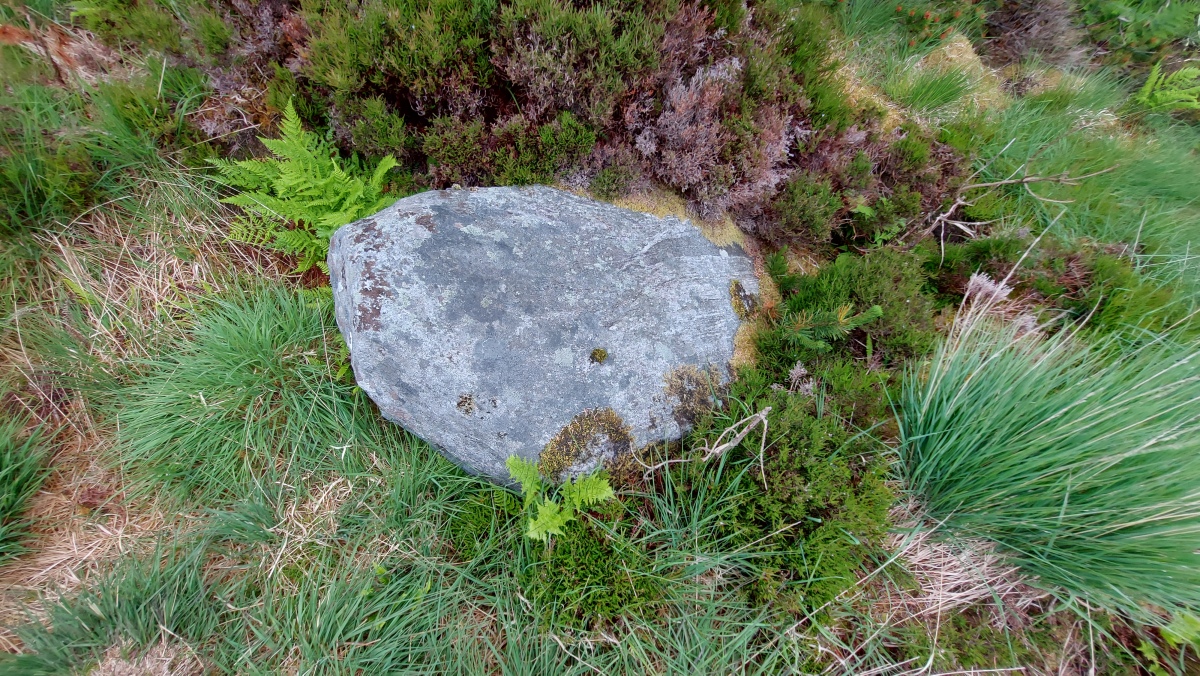
Not-so-Standing Stone submitted by cornishstargazer on 17th Aug 2023. Not-so-standing stone!
(View photo, vote or add a comment)
Log Text: Signage at Langass Woodland has been renewed and updated. New footpaths have been laid to make access to Hercules the Bear's grave easier. It also serves as a section of the Hebridean Way walking/cycling route.
Several local stones have been positioned in an upright position - if nothing else, as a homage to the neolithic heritage of the area.
Bheinn a Charra
Date Added: 4th May 2024
Site Type: Standing Stone (Menhir)
Country: Scotland (North Uist)
Visited: Yes on 19th Apr 2024. My rating: Condition 3 Ambience 4 Access 3

Bheinn a Charra submitted by h_fenton on 17th Sep 2018. Bheinn a Charra standing stone viewed from the south.
Scale: 1 metre
1 September 2018
(View photo, vote or add a comment)
Log Text: Visited during research for new book 'Uist Archaeology Walks with UCAG' (ISBN 978-1068619007), publishing May 2024.
Great site, visible from Committee Road when approaching from SW.
3D model at https://sketchfab.com/3d-models/beinn-a-charra-standing-stone-16ed8a9a191644fe84663003f7133b59.
First site along a walk out to Marrogh Cambered Cairn and Standing Stone.
Hacklett Standing Stone
Date Added: 12th Sep 2023
Site Type: Standing Stone (Menhir)
Country: Scotland (North Uist)
Visited: Yes on 13th Jun 2020. My rating: Condition 3 Ambience 3 Access 2

Hacklett Standing Stone submitted by Smilemaker on 12th Sep 2023. Another pole-mounted view of the stone showing more of the background area which features ruins of some agricultural buildings. Close to the site there are ruins of a larger farmstead - probably 19th Century, but some of the 'outbuildings' might have older provenance.
(View photo, vote or add a comment)
Log Text: An interesting site. (w3w ///cultivation.doormat.segmented) The stone is visible in the landscape from some distance but is likely to have been moved from its original position. It is now propped up at an angle and some old walling fits with Carmichael's assertion that it was fulfilling a new role as a pigpen roof. Although it is suggested this might have been a standing stone, an alternative possibility is that it was a dolmen capstone, although such structures are unusual on the Western Isles.
Access is a 4km+ walk out along footpath from the Market Stance recycling centre where there is good parking (w3w ///area.lightbulb.nozzle)
I have created a 3D photogrammetry model of the stone at https://sketchfab.com/3d-models/floday-cup-marked-rock-61ec4ba3887f41418479296ad771a823. This and my photographs feature a 0.5m range pole, aligned North-South (red to North)
Suidhheachadh Sealg
Date Added: 8th Sep 2023
Site Type: Stone Circle
Country: Scotland (Isle of Benbecula)
Visited: Yes on 17th Aug 2023. My rating: Condition 3 Access 3

Suidhheachadh Sealg submitted by Tom_Bullock on 13th Feb 2005. Photo used by kind permission of Tom Bullock. More details of this location are to be found on his Stone Circles and Rows CD-ROM.
(View photo, vote or add a comment)
Log Text: Sited on a ridge with good visibility from the surrounding hinterland. Only a single stone upstanding, others are either earthbound or toppled.
The circle incorporates a ruinous chambered cairn within its circumference with some of the cist stones prominently protruding from the ground
Nether Largie standing stone
Date Added: 8th Jul 2015
Site Type: Standing Stone (Menhir)
Country: Scotland (Argyll)
Visited: Yes on 10th Jun 2015. My rating: Condition 4 Access 4
Nether Largie standing stone submitted by caradoc68 on 18th Aug 2012. This standing stone is in the middle of a field, a short distance of the footpath. The farmer does not like you being there and might put a angry looking bull in the field to put visitors off. Cant find a lot written about this stone or why it seems to be leaning at 45 degrees and pointing to the southeast.
(View photo, vote or add a comment)
Log Text: It seems the site has been pretty much restored. This stone is now upright once more in the middle of a field of general pasture with easy access from he adjacent footpath.
I took a series of pictures using Gopro camera and pole for elevated access, from which a 3D photogrammetry picture was produced. Not sure if the site will allow the 3D image on the page, but it is accessible at https://sketchfab.com/models/75b8a5b76a9046b1a27062af9ff6df9f
