Contributory members are able to log private notes and comments about each site
Sites TheCaptain has logged. View this log as a table or view the most recent logs from everyone
La Grée Dolmen
Trip No.203 Entry No.304 Date Added: 26th Apr 2020
Site Type: Burial Chamber or Dolmen
Country: France (Pays de la Loire:Loire-Atlantique)
Visited: Couldn't find on 8th Jun 2005
Log Text: At the village of Avrillac, near St-André-des-Eaux, is marked a dolmen and menhir on my maps. I parked my van and had a good look all around, including a 3 kilometre walk around various lanes, but I saw nothing, and there was nobody to ask. Whatever megalithic remains there might be here are either in somebodies garden, or hidden away out of sight in the large wooded area. Having just crossed the Loire, I am now in Brittany, and I thought that finding these stones would get easier from now on, especially after the multitudes of signposted menjhirs I had found this afternoon.
La Grande Pierre Levée (Chantebrault)
Trip No.204 Entry No.119 Date Added: 13th Aug 2020
Site Type: Burial Chamber or Dolmen
Country: France (Poitou:Vienne (86))
Visited: Yes on 18th Jul 2005. My rating: Condition 4 Ambience 3 Access 4

La Grande Pierre Levée (Chantebrault) submitted by TheCaptain on 22nd Aug 2013. This dolmen is not far off the side of the road up on a windy ridge a couple of kilometres south of the village of St Laon.
(View photo, vote or add a comment)
Log Text: This dolmen is not far off the side of the road up on a windy ridge a couple of kilometres south of the village of St Laon. I cannot figure out what it is the remains of, it could be an allée couverte with lateral entry, or it could be a double chambered dolmen with the entrance between the two. What is either the main chamber, or two chambers, are about 10 metres from one end stone to the other, and it is about 2 metres in width. The chamber runs approximately east to west. Any entrance is probably in the middle of the south side, where some slabs are set at right angles. A single massive capstone remains sitting on top of the eastern end.
La Grande Motte
Trip No.203 Entry No.52 Date Added: 5th Apr 2020
Site Type: Chambered Tomb
Country: France (Poitou:Charente (16))
Visited: Saw from a distance on 16th May 2005

La Grande Motte submitted by thecaptain on 5th Dec 2005. On the hill high above Fontenille in Charente, there is a large tree covered mound, which can be seen from miles around.
Pity I didn’t get a good photograph as from certain angles it is most impressive looking.
(View photo, vote or add a comment)
Log Text: On the hill high above Fontenille can be seen another tree covered mound. This one was really tempting to go and walk to but it was a long way from anywhere I could drive to so I managed to keep away. Pity I didn’t get a good photograph as from certain angles its most impressive looking.
La Garnerie menhir
Trip No.203 Entry No.276 Date Added: 24th Apr 2020
Site Type: Standing Stone (Menhir)
Country: France (Pays de la Loire:Vendée (85))
Visited: Saw from a distance on 6th Jun 2005. My rating: Condition 4 Access 2

La Garnerie menhir submitted by thecaptain on 13th Dec 2005. La Garnerie menhir is a great big menhir in a field of barley, and there was no way I was going to get to it.
I would estimate it to be 4 to 5 metres tall and it is nicely rounded.
(View photo, vote or add a comment)
Log Text: This is a great big menhir in a field of barley, and there was no way I was going to get to it. I would estimate it to be 4 to 5 metres tall and it is nicely rounded. My gps position is to the field gate from where it can be seen.
La Garenne (La Rochepot)
Trip No.204 Entry No.211 Date Added: 27th Aug 2020
Site Type: Burial Chamber or Dolmen
Country: France (Bourgogne:Côte-d'Or (21))
Visited: Couldn't find on 3rd Aug 2005
Log Text: Dolmen to be found in the commune of La Rochepot, Côte-d'Or, but I could find nothing on maps to find it
La Ganterie
Trip No.203 Entry No.598 Date Added: 13th Jun 2020
Site Type: Passage Grave
Country: France (Bretagne:Côtes-D'Armor (22))
Visited: Yes on 28th Jun 2005. My rating: Condition 2 Ambience 2 Access 4
La Ganterie submitted by thecaptain on 7th Mar 2007. The allée couverte is signposted along a trackway into a wood, and just 50m along this well tended path the remains are to be found. It is almost impossible to see what is here though, as it is all extremely overgrown.
(View photo, vote or add a comment)
Log Text: Just beside the D.676 Dinan to Dol road, at the top of the hill to the east of the hamlet of La Ganterie where the road is a dual carriageway, there is a place to park. From here the allée couverte is signposted along a trackway into a wood, and just 50m along this well tended path the remains are to be found. It is almost impossible to see what is here though, as it is all totally overgrown. It might be a very long allée couverte going by the length of the bramble growth.
I find it very odd that the signposts and path are so well tended, yet the monument is so completely neglected. Never mind, it is still here with us.
La Ganterie
Trip No.208 Entry No.4 Date Added: 13th Jun 2020
Site Type: Passage Grave
Country: France (Bretagne:Côtes-D'Armor (22))
Visited: Yes on 20th Mar 2008. My rating: Condition 2 Ambience 2 Access 4

La Ganterie submitted by thecaptain on 9th Apr 2008. Revisiting this in March 2008, it was not so overgrown as it had been in June 2005, but it was still impossible to tell how long the allée couverte was, with the eastern end (right) all covered in very thick brambles and other bushes.
(View photo, vote or add a comment)
Log Text: Revisiting this in March 2008, and it was not so overgrown as it had been in June 2005, but it was still impossible to tell how long the allée couverte was, with the eastern end all covered in very thick brambles and other bushes. The more open western end has one or two capstones still sitting on top of their supports, with the two side walls of the allée being about 1.5 metres apart.
La Frise Dolmen
Trip No.203 Entry No.33 Date Added: 2nd Apr 2020
Site Type: Burial Chamber or Dolmen
Country: France (Pays de la Loire:Vendée (85))
Visited: Couldn't find on 15th May 2005

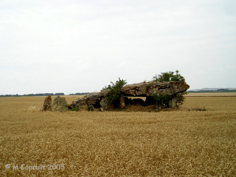
La Frise dolmen submitted by Rubis on 3rd Oct 2010. Coming from Les Magnils-Reigniers towards Corpe on the road D44, the dolmen can be found just a few meters before the crossroad of La Frise.
Site in Pays de la Loire: Vendée (85) France
(View photo, vote or add a comment)
Log Text: I could see no signs of this in the flat farmland, nor any signs or other indications
La Fage tumulus 1
Trip No.205 Entry No.238 Date Added: 6th Dec 2020
Site Type: Round Barrow(s)
Country: France (Languedoc:Lozère (48))
Visited: Yes on 25th Sep 2005. My rating: Condition 2 Ambience 3 Access 4
La Fage tumulus 1 submitted by theCaptain on 26th Apr 2010. Amongst the La Fage B menhirs, is the remains of a tumulus and dolmen. What there is to see is not much more than a low round mound with a few slabs of stones sticking out of the top.
There are others in the vicinity.
(View photo, vote or add a comment)
Log Text: Amongst the La Fage B menhirs, is the remains of a tumulus and dolmen. What there is to see is not much more than a low round mound with a few slabs of stones sticking out of the top. There are probably others in the vicinity.
La Fage Dolmen
Trip No.205 Entry No.241 Date Added: 6th Dec 2020
Site Type: Burial Chamber or Dolmen
Country: France (Languedoc:Lozère (48))
Visited: Yes on 25th Sep 2005. My rating: Condition 3 Ambience 3 Access 3
La Fage dolmen submitted by TheCaptain on 9th May 2010. Half a kilometre along the ridgetop path running southwest from the La Fage B menhirs, is a 2 metre by 1 metre wide slab lined dolmen within a mound of stones 12 metres in diameter, and now only 1 metre in height.
There is no capstone, but it is in a superb position.
(View photo, vote or add a comment)
Log Text: Half a kilometre along the ridgetop path running southwest from the La Fage B menhirs, is a 2 metre by 1 metre wide slab lined chamber within a mound of stones 12 metres in diameter, and now only 1 metre in height. There is no capstone, but it is in a superb position, not far from menhir K
La Draille Dolmen
Trip No.205 Entry No.189 Date Added: 25th Nov 2020
Site Type: Burial Chamber or Dolmen
Country: France (Languedoc:Hérault (34))
Visited: Yes on 20th Sep 2005. My rating: Condition 4 Ambience 4 Access 3

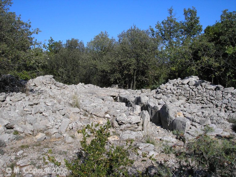
La Draille dolmen submitted by thecaptain on 10th Mar 2009. Seen here in its environment, the dolmen is contained within a large mound of stones with a drystone wall built over the top of it.
(View photo, vote or add a comment)
Log Text: Just to the north of the little town of Viols-le-Fort, take the little road towards Cazarils, and park by a little clearing in the wood after about 1.5 km, not quite at the top of the hill. Here there is a footpath into the woods, well marked with blue markers. Follow this zig-zag path for about 300 metres and you soon find the nice little Cazarils tombe ovale 1, with a bit further on the second one. At this point the blue paint marker points have become very faint, and are very hard to follow, and the path could go anywhere in this scrub. Take a track to the right, and after about 150 metres of zig zagging about through the scrub and over difficult loose stone you should reach this dolmen. Watch out in particular for a large pot hole before you get there, it looks to be very deep.
The dolmen is contained within a large mound of stones with a drystone wall built over the top of it. The chamber still has a capstone but is drystone walled, about 5m long by 2 m wide. It has a very long entrance passageway which is slab lined, and about 7 metres in length, leading off towards the south west at about 235° again. This number keeps cropping up around these parts.
La Croix-La Botte
Trip No.205 Entry No.49 Date Added: 21st Oct 2020
Site Type: Chambered Tomb
Country: France (Midi:Hautes-Pyrénées (65))
Visited: Yes on 5th Sep 2005. My rating: Condition 4 Ambience 3 Access 4

La Croix-La Botte submitted by thecaptain on 27th Jan 2006. To the west of the village of La Barthe-sur-Neste, and southeast of Capvern, along the hilltop beside the D.938 road, is a row of tumulus mounds.
The northwestern end tumulus is very well formed, 12 metres in diameter, 2 metres high and with a large cross on top.
(View photo, vote or add a comment)
Log Text: To the west of the village of La Barthe-sur-Neste, and southeast of Capvern, along the hilltop beside the D.938 road, is a row of tumulus mounds. Most are now obvious only because of the ferns and stuff left growing on them, but the northwestern end tumulus is very well formed, 12 metres in diameter, 2 metres high and with a large cross on top. The row extends for about 1 kilometre, and there were probably once many more mounds to be found here, now mostly ploughed out or destroyed by the road.
La Contrie du Rocher
Trip No.202 Entry No.34 Date Added: 26th Mar 2020
Site Type: Burial Chamber or Dolmen
Country: France (Pays de la Loire:Mayenne (53))
Visited: Yes on 29th Apr 2005. My rating: Condition 3 Ambience 5 Access 4

La Contrie du Rocher submitted by TheCaptain on 9th May 2005. La Contrie du Rocher
A splendid little Mayenne Allée Couverte found in an enchanting place in a bend in the stream in a bluebell filled wood.
(View photo, vote or add a comment)
Log Text: Another little Mayenne Allée Couverte a couple of kilometres north of Ernée which is signposted from there. It is found in the bottom of a little valley by a bend in a stream in a little woodland a few hundred metres walk along a little track from a farm.
The main chamber consists of 3 very large capstones resting on 6 pairs of uprights aligned on a bearing of 036° which sort of looks along the valley. The remains are about 6 metres in length but there are some remains which take the length of the structure to about 10 metres The entrance appears to be at the northeastern end but it is not definite as that end is quite ruined. It is quite low perhaps not much more than a metre at the current time and about 1.5 metres in width.
Some of the stones are very crude and massive blocks rather than nicely shaped slabs. There are many other large stones scattered around in this lovely little place. I give an ambience rating of 5 because at the time of my visit it was an enchanting place. The sun was going down and the birds were singing loudly. The stream which curves around the tomb was babbling away merrily and the whole wooded area was filled with wildflowers of all sorts bluebells aplenty and lots of purple flowers I didn’t recognise which looked like a sort of crocus. A marvellous little place I wish I could have spent more time at.
La Chaise du Diable
Trip No.202 Entry No.42 Date Added: 28th Mar 2020
Site Type: Natural Stone / Erratic / Other Natural Feature
Country: France (Pays de la Loire:Mayenne (53))
Visited: Yes on 30th Apr 2005

La Chaise du Diable submitted by TheCaptain on 9th May 2005. Le Gasseau Megaliths, or La Chaise du Diable, Sainte Gemmes-le-Robert, Mayenne.
These I could not determine fully, as I could not gain full access to either of the possible sites. It could be some large stones in a wooded area, or alternatively, and I think more likely, a large tor like hillock, with many stones scattered about on its slopes, many of which don’t look to be in natural positions.
(View photo, vote or add a comment)
Log Text: 2 kilometres east of the village of Sainte Gemmes- le-Robert are marked two dolmens or megalithic monuments on my ign map one north and the other south of a little crossroads. The southern one I could not determine fully as I could not gain full access to any of the possible sites. It could be some large stones in a wooded area or alternatively and I think more likely another large tor like hillock with many stones scattered about on its slopes many of which don’t look to be in natural positions.
La Chaise de César
Trip No.203 Entry No.400 Date Added: 14th May 2020
Site Type: Standing Stone (Menhir)
Country: France (Bretagne:Morbihan (56))
Visited: Yes on 13th Jun 2005. My rating: Condition 4 Ambience 5 Access 4

La Chaise de César submitted by Ogneslav on 11th Sep 2008. Site in Bretagne: Morbihan (56): La Chaise de César in the middle distance.
(View photo, vote or add a comment)
Log Text: Travelling along the Chemin des Megalithes, I was wondering what would surprise me next, and the first thing I come to along this path has done it already. What on Earth is this ? Loads of big stones in a wood just off the track.
At first it looked like another rectangle, but then I saw more stones. And more. And More. Some of them are quite big and well over 3 metres tall. Some are lined up, perhaps about 10 rows, with the biggest stone in each row lined up perpendicular to each other, making a massive checkerboard formation. But they are not all in straight lines. It is wonderful, I think I could spend hours here, but its already 6:00pm and I am getting further away, and not nearer to the van! Must get on.
The Chaise de César is no doubt the large chair like menhir at the end of one of the rows. I couldnt get up there to have a sit down - its too high for me alone. I have just had a look at the maps, and none of this is marked on there.
La Caune de l'Arago
Trip No.205 Entry No.86 Date Added: 28th Oct 2020
Site Type: Cave or Rock Shelter
Country: France (Languedoc:Pyrénées-Orientales 66)
Visited: Saw from a distance on 12th Sep 2005

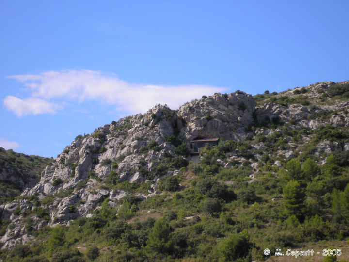
La Caune de l'Arago submitted by thecaptain on 16th Dec 2005. In a very pretty part of the world up on a cliff face above the vinyards, this is the cave where the skull of Tautavel man, one of the oldest known Europeans, was found.
This is of course all shut off to the public with buildings and shelters around it, as the excavations and research continue, 35 years after the finding of the ancient skull.
(View photo, vote or add a comment)
Log Text: In a very pretty part of the world up on a cliff face above the vinyards, this is the cave where Tautavel man was found. Its a kilometer or so south of the town, up on a rugged hill near where the river cuts a gorge through the hills. This is of course all shut off to the public with buildings and shelters around it, as the excavations and research continue, 35 years after the finding of the ancient skull.
La Butte du Hu
Trip No.202 Entry No.10 Date Added: 25th Mar 2020
Site Type: Chambered Cairn
Country: France (Normandie:Calvados (14))
Visited: Saw from a distance on 23rd Apr 2005
La Butte du Hu submitted by thecaptain on 8th Oct 2006. Plan of La Butte du Hu, Ernes, as shown on the sign at Colombiers-sur-Seulles.
(View photo, vote or add a comment)
Log Text: North of the village of Ernes several hundred metres up a farm track from the hamlet of Vey d’Ifs on the top of the ridge this large chambered tumulus can be seen just within a field growing crops so I did not enter.
La Borne-Percée
Trip No.204 Entry No.222 Date Added: 4th Sep 2020
Site Type: Standing Stone (Menhir)
Country: France (Bourgogne:Yonne (89))
Visited: Yes on 4th Aug 2005. My rating: Condition 3 Ambience 4 Access 5
La Borne-Percée submitted by thecaptain on 29th Nov 2006. In the Houssaye forests, high above the Yonne river southeast of Sens, and near to the village of Les Auberts can be found this menhir at a junction of forest tracks.
(View photo, vote or add a comment)
Log Text: In the Houssaye forests, high above the Yonne river southeast of Sens, and near to the village of Les Auberts can be found this menhir at a junction of forest tracks. Its very small, only 1.3 metres tall, but mounted on a plinth and easy to find. Near to the top is a hole which has been cut through it, to which legends and stories are aplenty.
La Bertrandoune Dolmen
Trip No.203 Entry No.113 Date Added: 6th Apr 2020
Site Type: Burial Chamber or Dolmen
Country: France (Midi:Lot (46))
Visited: Yes on 22nd May 2005. My rating: Condition 3 Ambience 3 Access 3
La Bertrandoune dolmen submitted by TheCaptain on 18th Jan 2011. This is a big single chambered dolmen about 3 m by 2 m a single capstone sitting on top of three uprights with still a good amount of its mound surrounding it.
(View photo, vote or add a comment)
Log Text: Further still round the “Circuit des Dolmens” after driving for miles along the rough stone mountain tracks and bashing my way through the undergrowth after several signposted things to see including several of the little huts they have round here and I come to this dolmen. By now I have realised that this “Circuit des Dolmens” is a walking circuit and not for driving round let alone doing it in reverse in a campervan and am getting desperate to get out of these woods and onto a proper road again which rather spoiled the enjoyment of what would be a lovely afternoons walk !.
This is a big single chambered dolmen about 3 m by 2 m a single capstone sitting on top of three uprights with still a good amount of its mound surrounding it. But there's no time to enjoy it I want to get down !
La Bertinière
Trip No.202 Entry No.53 Date Added: 28th Mar 2020
Site Type: Passage Grave
Country: France (Normandie:Orne (61))
Visited: Saw from a distance on 1st May 2005

La Bertinière submitted by TheCaptain on 11th May 2005. La Bertinière, La Sauvagère, Orne.
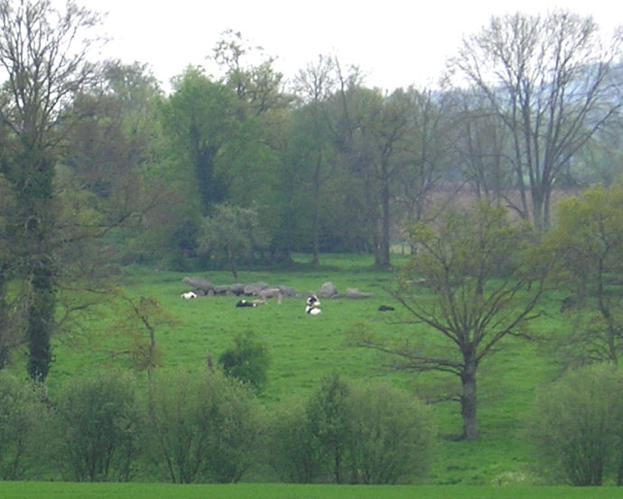
I estimate it to be about 10 cow lengths long, and a cow high.
(View photo, vote or add a comment)
Log Text: Despite being a monument of national historic importance and signposted as such half a kilometre walk from the main road I assume a new farmer has taken up residence and all the fields are now well fenced off with barbed and electric wire and countless signs so I wasn’t able to pay a proper visit. It can however be seen to the south of the main road west of the village and was in a field of cows. It looks to be a fairly large monument much bigger than most in these parts. I estimate it to be about 10 cow lengths long and a cow high.
