Contributory members are able to log private notes and comments about each site
Sites TheCaptain has logged. View this log as a table or view the most recent logs from everyone
Offa's Dyke at Tidenham Chase
Date Added: 7th Apr 2022
Site Type: Misc. Earthwork
Country: England (Gloucestershire)
Visited: Yes on 3rd Apr 2022. My rating: Condition 3 Ambience 4 Access 4
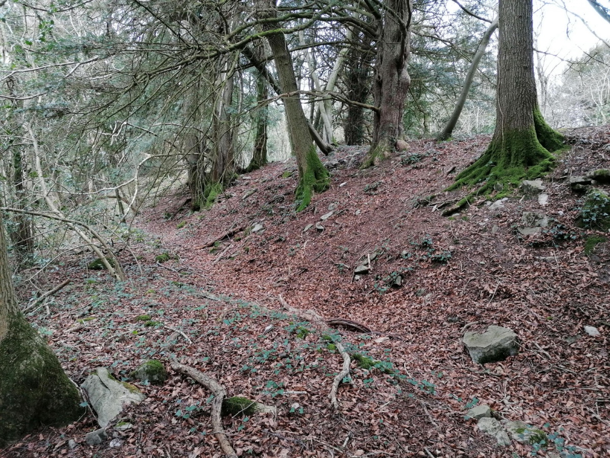
Offa's Dyke at Tidenham Chase submitted by TheCaptain on 7th Apr 2022. A walk up Offas Dyke from Chepstow to Brockweir, and not hammering down with rain this time, so I got a few snaps. The banks are not built as big as further north, but there is a lot of stone in the construction here, looking more like a wall in places.
(View photo, vote or add a comment)
Log Text: A walk up Offas Dyke from Chepstow to Brockweir, and not hammering down with rain this time, so I got a few snaps. The banks are not built as big as further north, but there is a lot of stone in the construction here, looking more like a wall in places.
Offa's Dyke near Brockweir
Date Added: 9th Sep 2020
Site Type: Misc. Earthwork
Country: England (Gloucestershire)
Visited: Yes on 27th May 2019. My rating: Condition 4 Ambience 4 Access 4
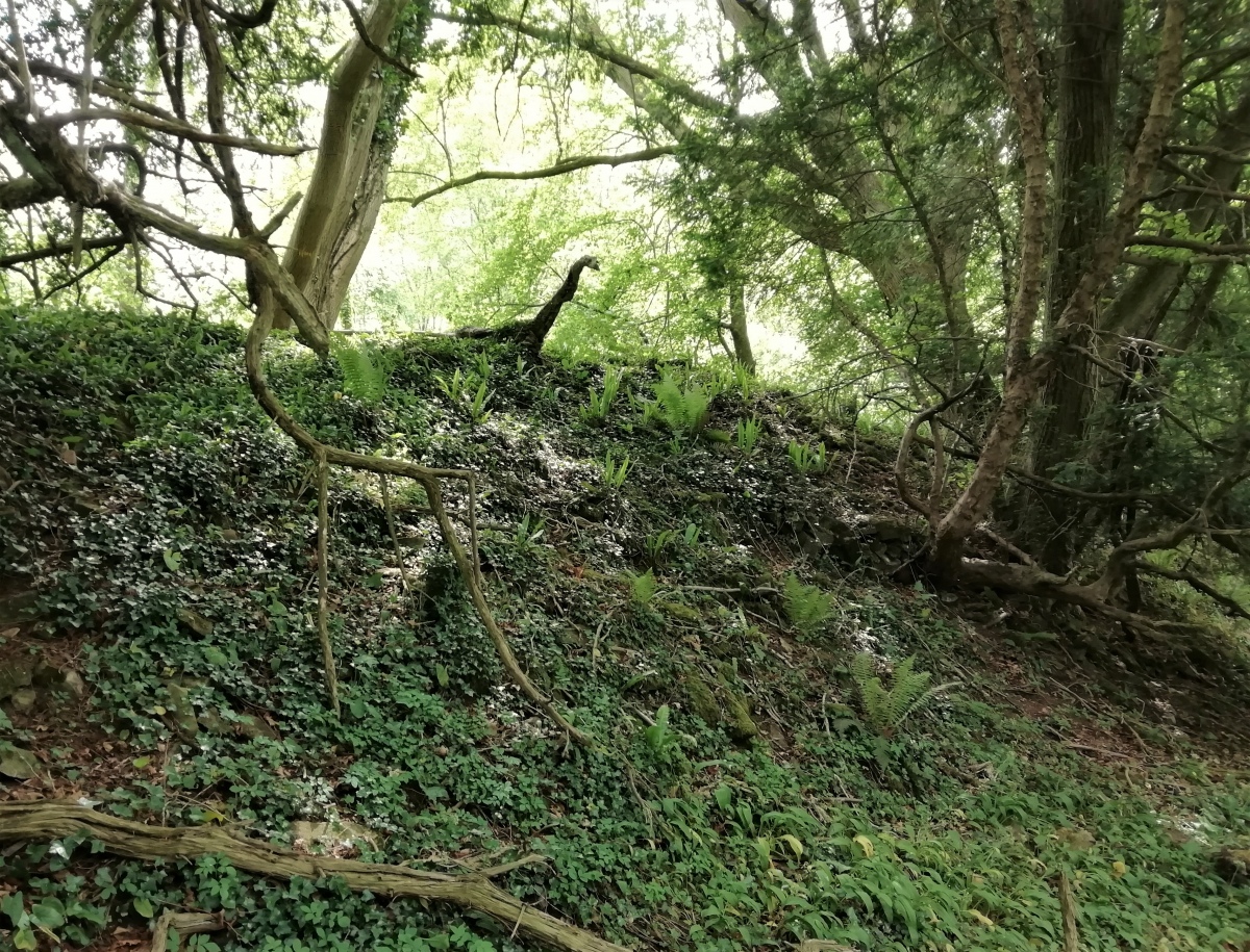
Offa's Dyke near Brockweir submitted by TheCaptain on 18th Apr 2020. Beware. There may be dragons and monsters
(View photo, vote or add a comment)
Log Text: Well preserved and significantly built section of Offa's Dyke high up on the eastern side of the River Wye near the village of Brockweir. The Offa's Dyke path is well used here, and in places offers splendid views over the river to Wales, especially at the well known "Devil's Pulpit" rock stack allowing intrepid visitors a superb vista of Tintern Abbey.
Ogmore Cross Shaft
Date Added: 28th Oct 2019
Site Type: Early Christian Sculptured Stone
Country: Wales (South Glamorgan)
Visited: Yes on 10th Oct 2018
Ogmore Cross Shaft submitted by coin on 26th Apr 2015. An early 11th C. incomplete shaft of a cross-slab, with inscriptions on both faces (enclosed by triple-moulded borders) Supposedly, the inscription reads:
EST / QUOD.DED[IT] / ARTHMAIL /AGRUM DO / ET GLIGUIS. / ET NERTAT ET FILIE : SU[A]
The slab was discovered at the castle in 1929 and built into the base.
Source: GGAT
(View photo, vote or add a comment)
Log Text: Day out exploring the south Wales coast. On the way back, stop off at Ogmore Castle, gleaming orange in the setting sun. Within the castle is mounted a stone which clearly has carvings on it, but in the dark shadow of the castle walls, it was impossible to make anything out clearly.
Old Bath Road Tumulus
Date Added: 8th Oct 2020
Site Type: Round Barrow(s)
Country: England (Wiltshire)
Visited: Yes on 4th Oct 1998

Old Bath Road Tumulus submitted by vieveforward on 23rd Mar 2017. Bronze Age round barrow with WW2 gun emplacement inserted into it. One of the brick entrances can be seen from this side. Visited in December 2014.
(View photo, vote or add a comment)
Log Text: Visit lots of ancient sites on a long off road cycle tour from Avebury to Windmill Hill, along the Wansdyke and back up Kennet Avenue
Old Castle Camp
Date Added: 29th Oct 2019
Site Type: Promontory Fort / Cliff Castle
Country: Wales (West Glamorgan)
Visited: Yes on 28th Jun 2015

Old Castle Camp submitted by TheCaptain on 28th Jun 2015. Looking along the banks at the northern side, with the magnificent view of Rhossili Bay beyond.
(View photo, vote or add a comment)
Log Text: None
Old Sodbury
Date Added: 9th Sep 2020
Site Type: Hillfort
Country: England (Gloucestershire)
Visited: Yes on 31st Jul 2020. My rating: Condition 4 Ambience 3 Access 4
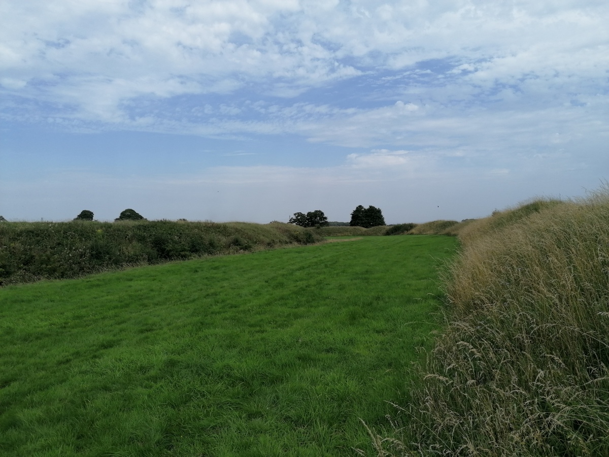
Old Sodbury submitted by TheCaptain on 4th Aug 2020. View east between the fortifications from the outer bank of Old Sodbury Camp
(View photo, vote or add a comment)
Log Text: Friday afternoon 10k walk, north from Old Sodbury along the Cotswold Edge through two ancient forts, past three old churches and lots of big houses to Horton Court. Back over fields through Little Sodbury. Stopped for a pint at the Dog afterwards.
Oldbury Standing Stone
Date Added: 9th Sep 2020
Site Type: Standing Stone (Menhir)
Country: England (Gloucestershire)
Visited: Yes on 3rd Jun 2020. My rating: Condition 3 Ambience 3 Access 4

Oldbury Standing Stone submitted by TheCaptain on 8th May 2016. On a warm sunny afternoon, I went for a good look for this, but found nothing to match the description. In fact, at some time in the past (since 1953) a whole load of drainage and seawall flood protection work has been done, which now contains the Oldbury Naite Rhine within substantial banks, with any of its little tributaries in the area now in underground culverts emptying through flap doors into the Rhine. The height of the banking is now well above what it would have been.
(View photo, vote or add a comment)
Log Text: Went for a look for this stone on a hot sunny June afternoon as part of a walk around Oldbury. Despite being 99% sure where it was to be found, I initially didn't find it as it was totally overgrown, and not under the new footpath gate, but an old wooden bit of fence to the side. With a bit of trampling on the long grass, I got to see the whole stone. Great to see it, it would be a splendid standing stone.
Oldbury-on-Severn Submerged Forest
Date Added: 9th Sep 2020
Site Type: Natural Stone / Erratic / Other Natural Feature
Country: England (Gloucestershire)
Visited: Saw from a distance on 3rd Jun 2020
Oldbury-on-Severn Submerged Forest submitted by 4clydesdale7 on 4th Jul 2011. As I stated like Atlantis risng
(View photo, vote or add a comment)
Log Text: It is now possible to walk all the way up the Severn Estuary past the tidal pool, and through the ex nuclear power station. Looking out at the tidal pool at low tide, all sorts of lumpy bumpy bits can be seen below the wall, quite possibly the remains of the petrified forest.
Oldwalls (E) Standing Stone
Date Added: 29th Oct 2019
Site Type: Standing Stone (Menhir)
Country: Wales (West Glamorgan)
Visited: Yes on 12th Jun 2013
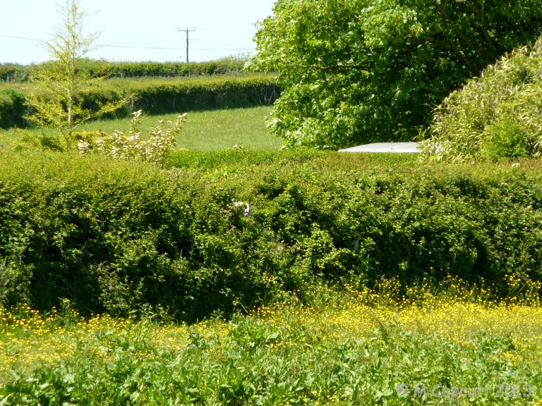
Oldwalls (E) Standing Stone submitted by TheCaptain on 12th Jun 2013. Well hidden in the hedge surrounding a paddock opposite the Greyhound Inn.
The top of this stone was just visible poking out of the top of the hedge.
(View photo, vote or add a comment)
Log Text: None
Oliver's Castle
Date Added: 8th Oct 2020
Site Type: Hillfort
Country: England (Wiltshire)
Visited: Yes on 3rd Jun 2002. My rating: Condition 3 Ambience 4 Access 3
Oliver's Castle submitted by Thorgrim on 31st Aug 2003. Accessible by footpath from Bromham or Roundway, this Iron Age promontory fort of 1.2 hectares is at SU 001646.
It has a single ditch and bank with post holes for gates in the eastern entrance.
(View photo, vote or add a comment)
Log Text: Part of a days off road cycling from Devizes. Lovely place, people flying radio controlled planes and gliders from up there. Horrifically muddy on the way down from the hills to the north.
Oppidum de la Blacarède
Trip No.205 Entry No.176 Date Added: 24th Nov 2020
Site Type: Ancient Village or Settlement
Country: France (Languedoc:Gard (30))
Visited: Saw from a distance on 19th Sep 2005
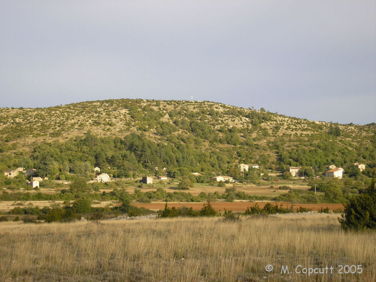
Oppidum de la Blacarède submitted by thecaptain on 3rd Dec 2009. To the northeast of the village of Rogues is a large rounded hill with remains of an Oppidum on the top.
(View photo, vote or add a comment)
Log Text: Just to the northeast of the village of Rogues is a large rounded hill with remains of an Oppidum on the top.
Oppidum de la Pointe de Lostmarc'h
Trip No.203 Entry No.496 Date Added: 27th May 2020
Site Type: Promontory Fort / Cliff Castle
Country: France (Bretagne:Finistère (29))
Visited: Yes on 19th Jun 2005. My rating: Condition 3 Ambience 4 Access 3

Oppidum de la Pointe de Lostmarc'h submitted by thecaptain on 1st Aug 2009. Just below the big Lostmarc'h headland with the alignements on top, there is a smaller headland which has been defended from the mainland by the creation of two rows of massive banks and ditches protecting it.
(View photo, vote or add a comment)
Log Text: Just below the big Lostmarc'h headland with the alignements on top, there is a smaller headland which has been defended from the mainland by the creation of two rows of massive banks and ditches protecting it.
On the headland apart from the inevitable remains of a chapel of some sort, there is also what appears to be the remains of some sort of cairn and burial chamber on the top. It wouldn't be unusual for one to be in such a place. There are 6 stones still sticking out of the ground here about 2.5 metres apart from each other, and stumps of others to be seen, which sort of make a rectangle inside a circular cairn.
It is very windblown here today, and misty which is a bit of a shame. The views would be tremendous on a clear day.
Oppidum de Nages
Trip No.205 Entry No.196 Date Added: 26th Nov 2020
Site Type: Ancient Village or Settlement
Country: France (Languedoc:Gard (30))
Visited: Saw from a distance on 21st Sep 2005

Oppidum de Nages submitted by thecaptain on 19th Apr 2008. On the top of the hill to the north of Nages are the remains of an oppidum.
This is a nice looking hill rising steeply from the plains, and with what looks to be a sculpted top.
Viewed here from the southwest.
(View photo, vote or add a comment)
Log Text: On the top of the hill to the north of Nages are the remains of an oppidum. This is a nice looking hill rising steeply from the plains, and with what looks to be a sculpted top.
Oppidum de Pech de Maho
Trip No.205 Entry No.96 Date Added: 8th Nov 2020
Site Type: Ancient Village or Settlement
Country: France (Languedoc:Aude (11))
Visited: Saw from a distance on 14th Sep 2005

Oppidum de Pech de Maho submitted by catweasel11 on 30th Jul 2006. I believe, when they rebuilt this, they forgot the gate that would allow for a flow of water.
Oppidum at village of Sigean
(View photo, vote or add a comment)
Log Text: A large hill, but I got distracted while trying to have a proper look, as there was a large accident being cleared up, and I couldn’t turn down the small road to have a close look.
Oppidum des Châteliers
Trip No.204 Entry No.297 Date Added: 11th Sep 2020
Site Type: Ancient Village or Settlement
Country: France (Centre:Indre-et-Loire (37))
Visited: Saw from a distance on 10th Aug 2005
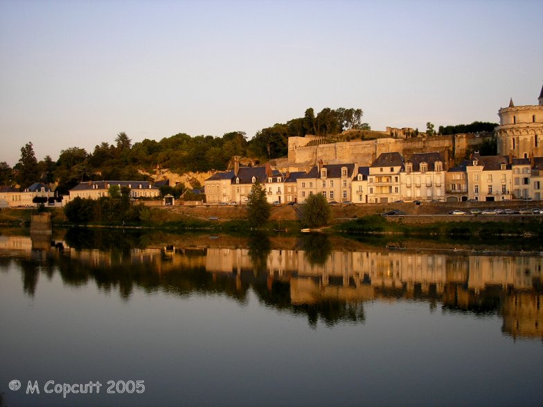
Oppidum des Châteliers submitted by TheCaptain on 9th Aug 2013. Not taken specifically for the remnants of the Oppidum, the green hilltop beyond the castle is where its remnants are.
(View photo, vote or add a comment)
Log Text: Long inhabited and fortified hilltop above the river Loire at Amboise.
Oratoire de St Guirec
Trip No.193 Entry No.3 Date Added: 13th Jul 2020
Site Type: Ancient Temple
Country: France (Bretagne:Côtes-D'Armor (22))
Visited: Yes on 29th May 1993. My rating: Access 4
Oratoire de St Guirec submitted by TheCaptain on 21st Jul 2020. Site in Bretagne:Côtes-D'Armor (22) France
The Oratoire de St Guirec on the beach named after St Guirec, the Welsh monk who allegedly landed here on his voyage from Britain in the 6th century, arriving in a stone trough pulled by angels.
(View photo, vote or add a comment)
Log Text: Cycling camping trip of north Brittany, day 1. Cycle Roscoff, Morlaix, Lannion, Ploumanac'h. Too far. 52 miles. Funny Rocks. Camp and head to Ploumanach for a big seafood dinner.
The Oratoire de St Guirec is situated on the beach named after St Guirec, the Welsh monk who landed here on his voyage from Britain in the 6th century, allegedly arriving in a stone trough pulled by angels. The original wooden statue has been replaced by one of stone, after becoming damaged by the local tradition for girls to stick a pin in its nose when they wanted to marry.
Oratoire de St Guirec
Trip No.214 Entry No.19 Date Added: 23rd Jul 2020
Site Type: Ancient Temple
Country: France (Bretagne:Côtes-D'Armor (22))
Visited: Yes on 17th Apr 2014. My rating: Condition 3 Ambience 4 Access 4
Oratoire de St Guirec submitted by TheCaptain on 21st Jul 2020. Site in Bretagne:Côtes-D'Armor (22) France
The Oratoire de St Guirec on the beach named after St Guirec, the Welsh monk who allegedly landed here on his voyage from Britain in the 6th century, arriving in a stone trough pulled by angels.
(View photo, vote or add a comment)
Log Text: Morning in Ploumenach with Dad, and take the time to walk all around the pink granite coast. It is superb in the morning sun. The Oratoire de St Guirec is situated on the beach named after St Guirec, the Welsh monk who landed here on his voyage from Britain in the 6th century, allegedly arriving in a stone trough pulled by angels. The original wooden statue has been replaced by one of stone, after becoming damaged by the local tradition for girls to stick a pin in its nose when they wanted to marry.
Ötzi Memorial
Date Added: 18th Sep 2010
Site Type: Marker Stone
Country: Italy (Lombardia)
Visited: Yes on 25th May 2010
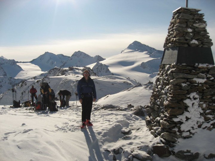
Ötzi Memorial submitted by TheCaptain on 25th May 2010. The Memorial to Ötzi the Iceman, found in 1991 on the Austria-Italy border close to the Hauslabjoch Pass.
(View photo, vote or add a comment)
Log Text: None
Ouldsbroom Cross
Date Added: 2nd Oct 2020
Site Type: Ancient Cross
Country: England (Devon)
Visited: Yes on 11th Apr 2019. My rating: Condition 3 Ambience 4 Access 5
Ouldsbroom Cross submitted by cazzyjane on 29th Nov 2014. Ouldsbroom Cross in the evening sun.
(View photo, vote or add a comment)
Log Text: None
Outre Tombes
Trip No.209 Entry No.12 Date Added: 13th Jun 2020
Site Type: Stone Circle
Country: France (Bretagne:Ille-et-Vilaine (35))
Visited: Yes on 12th Jun 2009. My rating: Condition 3 Ambience 3 Access 5

Outre Tombes submitted by thecaptain on 5th Jul 2009. There are several information plaques at the site.
(View photo, vote or add a comment)
Log Text: This horseshoe of megalithic stones has alternatively been considered as a megalithic enclosure (cromlech) or perhaps the stones once surrounding a dolmenic burial chamber. Seven stones are shaped in a sort of semi circle, of diameter about 7 metres.
This monument was classified as a historical monument in 1966, but by 1977 had disappeared, being the victim of an expansion of the local quarry at Vaujour. When this was discovered, the police were called in, but it was all thought to be too late. However, in 1989 it was found that most of the stones hadn't simply been destroyed, but had been moved and dumped into a nearby field, although one had gone through the stonecrusher. With the help of a plan and photograph of the site taken in 1962, the local people (with the help of the quarrying company) had the site recreated in 1998, just a few hundred metres from its original position.
There is also a small menhir erected at the site, the origins of which I do not know, but the stone does not look modern. Today, the site sits in a little meadow near to the top of the quarry, and can be found beside the little road which runs along the top of the hills to the northeast of the massive Vaujour quarries. There are several information plaques at the site, telling of its history and with diagrams and pictures.
