Contributory members are able to log private notes and comments about each site
Sites TheCaptain has logged. View this log as a table or view the most recent logs from everyone
The Butts (Godshill)
Date Added: 8th Feb 2022
Site Type: Round Barrow(s)
Country: England (Hampshire)
Visited: Yes on 2nd Feb 2022. My rating: Condition 2 Ambience 3 Access 3

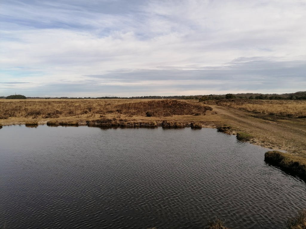
The Butts (Godshill) submitted by TheCaptain on 8th Feb 2022. The line of three can be seen beyond the pond
(View photo, vote or add a comment)
Log Text: Walk with friends in the New Forest over heathland through an old bombing range, hunting down a few tumuli, The Butts being first, three in line nearby a pond.
Leighterton Long Barrow
Date Added: 23rd Oct 2021
Site Type: Long Barrow
Country: England (Gloucestershire)
Visited: Yes on 14th Nov 2004

Leighterton Long Barrow submitted by thecaptain on 15th Nov 2004. View from the lane at the east by the village school.
(View photo, vote or add a comment)
Log Text: Massive long barrow to the east of the village of Leighterton, which can be seen walled in across a couple of fields. I could find no public access. The remains of this barrow are massive, and as is often the case, covered with trees. It looks to be one worthy of further exploration if possible.
Buckholt Wood
Date Added: 23rd Oct 2021
Site Type: Chambered Tomb
Country: England (Gloucestershire)
Visited: Saw from a distance on 14th Mar 2009. My rating: Condition 2 Ambience 2 Access 4
Buckholt Wood submitted by 4clydesdale7 on 17th Jun 2011. Fairly easy to find - near entrance to overspill car park for Woodchester Mansion - if you miss the Barrow which is not that conspicuous then look for the Glider Winch at the W end of the Airfield
(View photo, vote or add a comment)
Log Text: The remains of this badly damaged Long Barrow with possible Chambered Tomb can today be seen as a slight raise in the ground at the end of the Nympsfield Gliding Club – today to be seen just behind the winching equipment. This site has been badly damaged in the past by ploughing. I found nowhere obvious to park while driving north, and thought I’d come back later in the day, but didn’t. There seems to be a trackway nearby from where a better look could be had.
Hetty Pegler's Tump
Date Added: 23rd Oct 2021
Site Type: Passage Grave
Country: England (Gloucestershire)
Visited: Yes on 14th Apr 2009. My rating: Condition 3 Ambience 3 Access 4

Hetty Pegler's Tump submitted by thecaptain on 15th Mar 2009. The closure notice.
(View photo, vote or add a comment)
Log Text: March 2009 and Hetty Pegler`s Tump was closed and sealed off to the public, due to concerns over its safety, with the internal drystone walling collapsing due to vandalism and the weight of the capstones resting on these walls since the 19th century reconstruction. Scaffolding has been used to prop up the chambers, and the entrance passage and courtyard sealed and filled with earth.
Soldier's Grave
Date Added: 23rd Oct 2021
Site Type: Round Barrow(s)
Country: England (Gloucestershire)
Visited: Yes on 14th Mar 2009. My rating: Condition 3 Ambience 4 Access 4

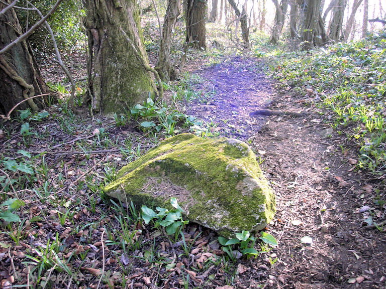
Soldier's Grave submitted by thecaptain on 10th Apr 2009. There are several fairly large bits of stone laying around nearby, which once may have formed part of the structure.
(View photo, vote or add a comment)
Log Text: This large round barrow can be found on the top of the Cotswold escarpment just into the woods at the northwest corner of the country park / picnic area, a couple of hundred yards to the north of Nympsfield long barrow. It is said to be a really unusual round barrow from the Neolithic, and not a Bronze Age round barrow at all! The top of the barrow has a very large depression in it, where it has been cut into in the past. From Grinsell - Barrows in England and Wales, “a boat-shaped hollow lined with dry-stone walling, in which were the remains of up to 44 individuals, mostly unburnt”. There are several fairly large bits of stone laying around nearby, which once may have formed part of the structure.
Nympsfield
Date Added: 23rd Oct 2021
Site Type: Long Barrow
Country: England (Gloucestershire)
Visited: Yes on 14th Mar 2009. My rating: Condition 3 Ambience 3 Access 5

Nympsfield submitted by AngieLake on 11th Oct 2015. A magical double rainbow (you can't see the upper arc here) over Nympsfield longbarrow, viewed from the rear of the mound. 22nd Sept.
(View photo, vote or add a comment)
Log Text: This Chambered long barrow with a pair of side chambers and an end chamber, is located in Coaley Peak picnic area, on the edge of the Cotswold Hills in Gloucestershire. Once covered by a mound 27m long by 18m wide and with a horned forecourt, it contained between 20 and 30 burials. These days it is an easy and pleasant place to visit, with plenty of parking, picnic areas etc nearby, and some splendid views from the edge of the Cotswold Hills over the Severn Valley below, and over to the Forest of Dean and the Welsh Hills.
The Toots (King's Stanley)
Date Added: 23rd Oct 2021
Site Type: Long Barrow
Country: England (Gloucestershire)
Visited: Yes. My rating: Condition 3 Ambience 4 Access 4

The Toots (King's Stanley) submitted by AngieLake on 21st Oct 2015. Facing WSW on 22nd Sept with the glare of the setting sun at Equinox highlighting the dips and bumps on top of The Toots. The River Severn is glimpsed in the distance, top right. Views are spectacular up here!
(View photo, vote or add a comment)
Log Text: Walking "The Selsey Circuit" of the Cotswold Way with San, and passed over the Toots. Snow on the hilltops!
The Toots (King's Stanley)
Date Added: 23rd Oct 2021
Site Type: Long Barrow
Country: England (Gloucestershire)
Visited: Yes on 14th Mar 2009. My rating: Condition 3 Ambience 4 Access 4

The Toots (King's Stanley) submitted by thecaptain on 22nd Apr 2009. The Toots - seen on the skyline of Selsley common above the church. Viewed here from Stroud
(View photo, vote or add a comment)
Log Text: Remains of a large unexcavated Long Barrow on the Cotswold escarpment slopes of Selsley Common, just to the south of Stroud in Gloucestershire. Possibly called 'The Toots' because of a hollow in the middle which makes it look as if it is composed of two mounds. The views on a good day from here are terrific, and the common is a favourite place for dogwalkers, kite flyers and model plane flying.
Belas Knap
Date Added: 23rd Oct 2021
Site Type: Long Barrow
Country: England (Gloucestershire)
Visited: Yes on 10th Aug 2021. My rating: Condition 5 Ambience 4 Access 3

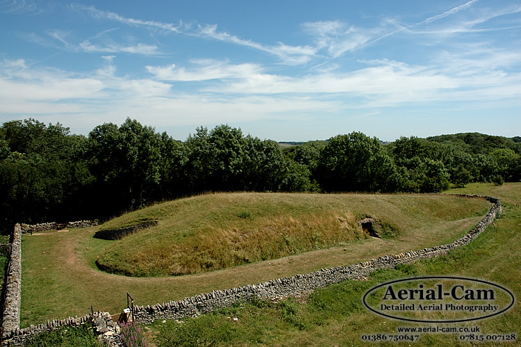
Belas Knap submitted by Adam Stanford on 19th Jul 2006. Taken with Aerial-Cam, at aprox 10M above ground level on a telescopic mast with remote control Nikon D70s camera system. This image shows the tapering of the mound from front to back (left to right). The camera was pointing in an Easterly direction. Cheers AS.
(View photo, vote or add a comment)
Log Text: A long Cotswold Way loop walk from Winchcombe, up to Belas Knap then over to Cleeve Hill via Postlip. A pint at the golf club, then up to the trig point and back to Winchcombe down the Isbourne valley.
Belas Knap
Date Added: 23rd Oct 2021
Site Type: Long Barrow
Country: England (Gloucestershire)
Visited: Yes on 2nd Apr 2006

Belas Knap submitted by Adam Stanford on 19th Jul 2006. Taken with Aerial-Cam, at aprox 10M above ground level on a telescopic mast with remote control Nikon D70s camera system. This image shows the tapering of the mound from front to back (left to right). The camera was pointing in an Easterly direction. Cheers AS.
(View photo, vote or add a comment)
Log Text: A visit to Belas Knap after a day with megalithic portal people starting at Rollright
Belas Knap
Date Added: 23rd Oct 2021
Site Type: Long Barrow
Country: England (Gloucestershire)
Visited: Yes on 6th Jul 1986

Belas Knap submitted by Adam Stanford on 19th Jul 2006. Taken with Aerial-Cam, at aprox 10M above ground level on a telescopic mast with remote control Nikon D70s camera system. This image shows the tapering of the mound from front to back (left to right). The camera was pointing in an Easterly direction. Cheers AS.
(View photo, vote or add a comment)
Log Text: A visit to Belas Knap following a visit to the fledgling Glos Warwicks Railway
Wareham Walls
Date Added: 21st Oct 2021
Site Type: Misc. Earthwork
Country: England (Dorset)
Visited: Yes on 18th Oct 2021. My rating: Condition 4 Ambience 3 Access 5
Wareham Walls submitted by TimPrevett on 28th Apr 2005. Looking up to the outside of the West Wall of Wareham. As I child I walked along these walls to the nearby primary and secondary schools - the walls seemed even more imposing than they do now; and they still seem imposing.
(View photo, vote or add a comment)
Log Text: A dull drizzly morning, so go for a look round Wareham, and walk all around the Saxon town walls, with the Saxon church of St. Martin-on-the-Walls on top by the northern entrance.
Corfe Castle West Hill barrows
Date Added: 21st Oct 2021
Site Type: Round Barrow(s)
Country: England (Dorset)
Visited: Yes on 16th Oct 2021. My rating: Condition 2 Ambience 5 Access 3

Corfe Common submitted by JimChampion on 20th Aug 2006. A broad view of Corfe from the south, showing the Castle Hill between West Hill (left) and East Hill (right). There are round barrows on the summits of West and East Hills, and a linear cemetery of round barrows on Corfe Common (the area seen in front of the village, above the drystone wall).
(View photo, vote or add a comment)
Log Text: A very steep walk up from Corfe Castle, where a slight mound can be found at the top of West Hill directly overlooking the Castle. A short distance to the west along the ridgetop and just below the ridgetop is a much more substantial circular earthwork which is a much better condition barrow. The ordnance survey feature marked tumulus aligns with this. Checking this and there is apparently the remains of three barrows here.
Knowle Hill Cross Dyke
Date Added: 21st Oct 2021
Site Type: Misc. Earthwork
Country: England (Dorset)
Visited: Yes on 16th Oct 2021. My rating: Condition 2 Ambience 4 Access 3

Knowle Hill Cross Dyke submitted by TheCaptain on 21st Oct 2021. On the top of the ridge
(View photo, vote or add a comment)
Log Text: Remains of a cross dyke is found crossing the top ridge of Knowle Hill, a kilometre or so from the Corfe Castle end. There are other cross dykes crossing this ridge at various places.
Knowle Hill Barrows
Date Added: 21st Oct 2021
Site Type: Round Barrow(s)
Country: England (Dorset)
Visited: Yes on 16th Oct 2021. My rating: Condition 2 Ambience 4 Access 3

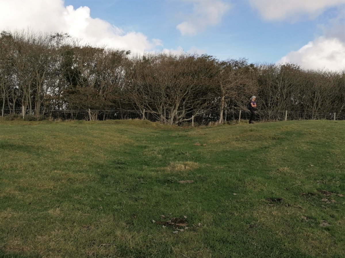
Knowle Hill Barrows submitted by TheCaptain on 21st Oct 2021. Remains of several small barrows are found on the top ridge of Knowle Hill, a kilometre or so from the Corfe Castle end.
(View photo, vote or add a comment)
Log Text: Remains of several small barrows are found on the top ridge of Knowle Hill, a kilometre or so from the Corfe Castle end.
Rempstone
Date Added: 20th Oct 2021
Site Type: Stone Circle
Country: England (Dorset)
Visited: Yes on 15th Oct 2021. My rating: Condition 3 Ambience 3 Access 4
Rempstone submitted by Postman on 24th Mar 2020. The tree stump bottom left has some..... erm equinox gifting, shiny stones some with fossils.
(View photo, vote or add a comment)
Log Text: A quick look during a weekend in Purbeck. I found about 8 or 9 stones in the woods at the side of the road, probably in a circular shape, mostly well overgrown with brambles and ferns, with no way of telling what was really there, and could not see more than two stones at a time! Many of the stones had coins placed on them. A bit further along was a sort of stone setting, perhaps once part of an avenue, of which there was no way of telling whether ancient or some sort of stone clearance.
Rempstone
Date Added: 20th Oct 2021
Site Type: Stone Circle
Country: England (Dorset)
Visited: Yes on 1st Sep 2002
Rempstone submitted by Postman on 24th Mar 2020. The tree stump bottom left has some..... erm equinox gifting, shiny stones some with fossils.
(View photo, vote or add a comment)
Log Text: Visit after a cycling weekend in Purbeck. I remember it being difficult to get into the wood to look at the stones, but once in there seeing a lot of stones seemingly littered around, with a few standing making a part of a small circle near to the road. Once known where it was, seeing one or two stones from the road as passing was possible, with one nice large stone stood at the edge of the woodland. Some of the stones had coins inserted into crevices.
Swyre Head
Date Added: 19th Oct 2021
Site Type: Round Barrow(s)
Country: England (Dorset)
Visited: Yes on 17th Oct 2021. My rating: Condition 3 Ambience 4 Access 3
Swyre Head submitted by JimChampion on 26th Apr 2008. The barrow on Swyre Head from the north-west. The permissive path from the coastal path at Rope Lake Head ends at the stile in the foreground, after a very steep climb up the escarpment.
(View photo, vote or add a comment)
Log Text: Walking with friends out to Swyre Head then down to the coast path and along to Kimmeridge and back along the ridge. This huge mound has beautiful views but is much modified for its previous use as a windmill base, now a perfect place for a sit.
The Harp Stone
Date Added: 19th Oct 2021
Site Type: Standing Stone (Menhir)
Country: England (Dorset)
Visited: Yes on 17th Oct 2021. My rating: Condition 3 Ambience 3 Access 3
The Harp Stone submitted by JimChampion on 19th Apr 2008. The Harp Stone stands on a bank that divided the medieval manorial estates of Herpston and Hyde. On the far side of the stone is a hollow way, an old route down the hill from Kimmeridge that eventually led to Creech on the far side of the chalk ridge.
(View photo, vote or add a comment)
Log Text: Walking with friends from Swyre head to Kimmeridge. Up to the ridge again after lunch, where I went down the other side to look for the Harp Stone before returning to the ridge to join with the others who had waited. I was expecting to see the stone in the hedge at the far side of the field like the pictures on the portal, but no such luck, as the hedge was very overgrown. At first I found a tree stump, then a shiny pile of bracken but no sign of the stone. Up and down the hedge a couple of times, but before I gave up I got the gps out and the detailed OS map, giving me the best info I could have to find the stone. Eventually I saw it in the hedge, all overgrown and hiding behing a couple of vicious blackthorn bushes, which made me bleed as I was trying to get a picture of the stone between them. Only the top few feet of it could be seen, but it was still there. I had a very satisfied walk back across the field and up to the ridge to meet the others I was out walking with before returning to Swyre Head.
Bown Hill Long Barrow
Date Added: 2nd Oct 2021
Site Type: Long Barrow
Country: England (Gloucestershire)
Visited: Couldn't find on 29th Sep 2021
Bown Hill Long Barrow submitted by 4clydesdale7 on 17th Jun 2011. Approaching from the riding School/Livery Stables this Long Barrow is impressive.
(View photo, vote or add a comment)
Log Text: Fabulous loop walk from Coaley Peak picnic area, starting at Nympsfield long barrow, down through Woodchester Park, back up through the vineyards to Selsey Common, and back along the Cotswold Way through the lovely woodland on the edge of the hills. Hoping to get a glimpse of this longbarrow over a couple of fields, but no such luck or obvious way through towards it, and I have a long way to go so not adding on any extra!
