Contributory members are able to log private notes and comments about each site
Sites TheCaptain has logged. View this log as a table or view the most recent logs from everyone
Stripple Stones
Date Added: 18th Sep 2010
Site Type: Stone Circle
Country: England (Cornwall)
Visited: Yes on 27th Nov 2008
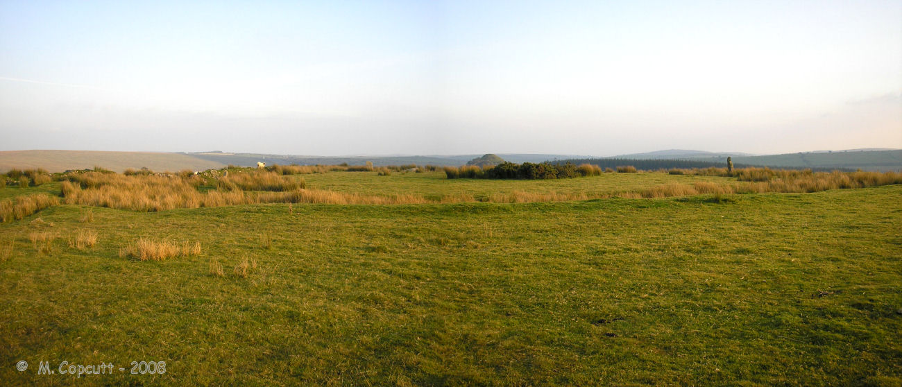
Stripple Stones submitted by thecaptain on 27th Nov 2008. The Stripple Stones Henge and Stone Circle.
Viewed here looking approx southwards.
(View photo, vote or add a comment)
Log Text: None
Trelew
Date Added: 18th Sep 2010
Site Type: Standing Stone (Menhir)
Country: England (Cornwall)
Visited: Yes on 12th Dec 2008
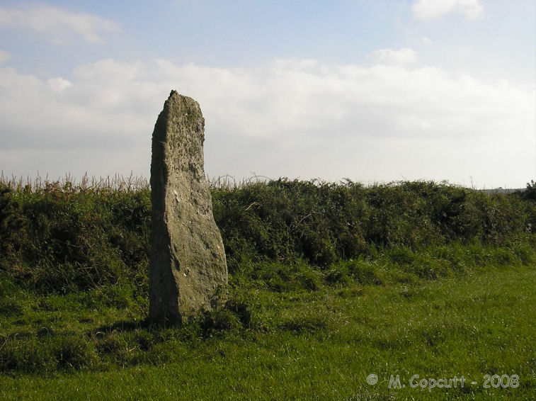
Trelew submitted by thecaptain on 12th Dec 2008. This nice 3 metre tall menhir looks different from every angle.
(View photo, vote or add a comment)
Log Text: None
Sticklepath stone circle
Date Added: 18th Sep 2010
Site Type: Stone Circle
Country: England (Devon)
Visited: Yes on 25th Jan 2009
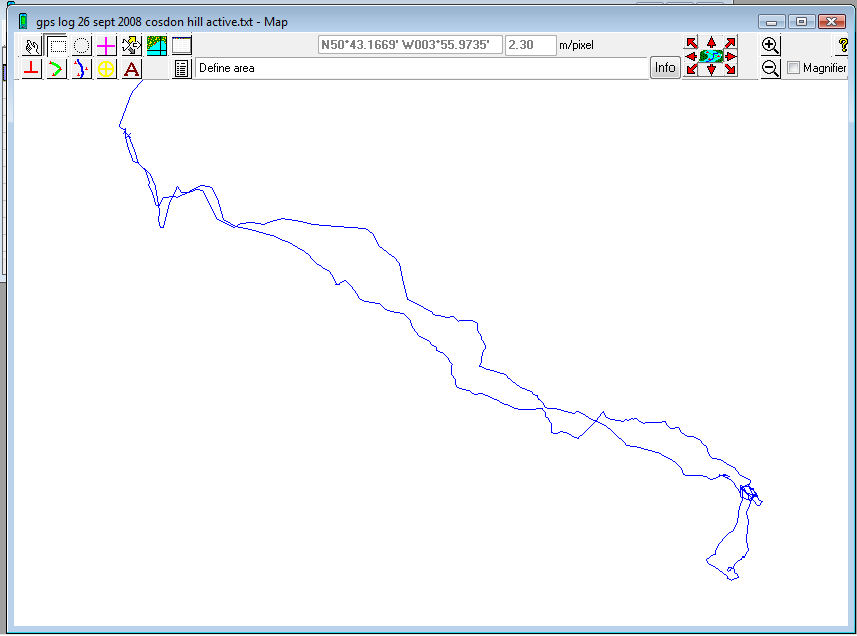
Sticklepath stone circle submitted by thecaptain on 25th Jan 2009. While clearing the data off my gps receiver before a trip to the Alps, I found this track of a walk from Belstone to Cosdon Hill last September on there, which I had never got round to download.
This is the track of my walk out to try and find more about the possible stone circle I found several years ago.
My car was parked at Belstone, top left, crossed the river Taw, and followed my gps up the northwest slopes of Cosdon Hill. Once I got there, I went south to find, and thus rule out, the...
(View photo, vote or add a comment)
Log Text: None
Cosdon Hill cairn 9
Date Added: 18th Sep 2010
Site Type: Round Cairn
Country: England (Devon)
Visited: Yes on 26th Jan 2009

Cosdon Hill cairn 9 submitted by thecaptain on 26th Jan 2009. The round cairn on the northwestern slopes of Cosdon Hill.
Viewed here looking north, some of the edge set kerb stones can be seen in amongst the long grass.
(View photo, vote or add a comment)
Log Text: None
Col des Ves
Date Added: 18th Sep 2010
Site Type: Standing Stone (Menhir)
Country: France (Rhone:Savoie (73))
Visited: Yes on 10th Feb 2009
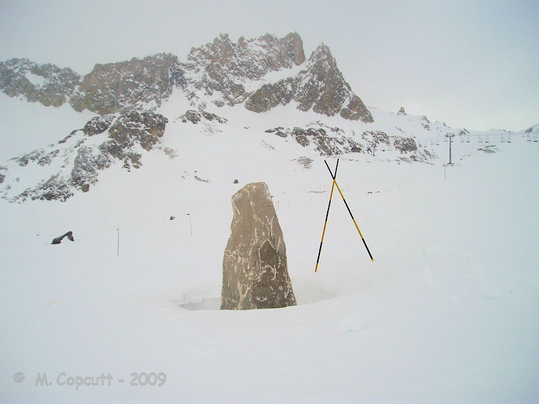
Col des Ves submitted by thecaptain on 10th Feb 2009. Is this an ancient menhir which has been re-erected, or a more modern marker stone ? I don't know. I can find nothing out about it. But here it stands, up in the high mountains above Tignes near to the Col des Ves.
(View photo, vote or add a comment)
Log Text: None
Avening burial chambers
Date Added: 18th Sep 2010
Site Type: Burial Chamber or Dolmen
Country: England (Gloucestershire)
Visited: Yes on 24th Mar 2009

Avening burial chambers submitted by thecaptain on 24th Mar 2009. The view of where the burial chambers are from the road.
(View photo, vote or add a comment)
Log Text: None
Gatcombe Lodge
Date Added: 18th Sep 2010
Site Type: Long Barrow
Country: England (Gloucestershire)
Visited: Yes on 24th Mar 2009

Gatcombe Lodge submitted by thecaptain on 24th Mar 2009. Having read several tales of people being stopped and questioned by rapidly arriving police here, I didn’t spend long, and just took a photo from the entry to the estate.
It looks to be the regular shapeless lumpy bumpy mess covered in trees.
(View photo, vote or add a comment)
Log Text: None
Table des Fées (Rocheville)
Date Added: 18th Sep 2010
Site Type: Passage Grave
Country: France (Normandie:Manche (50))
Visited: Yes on 5th Apr 2009
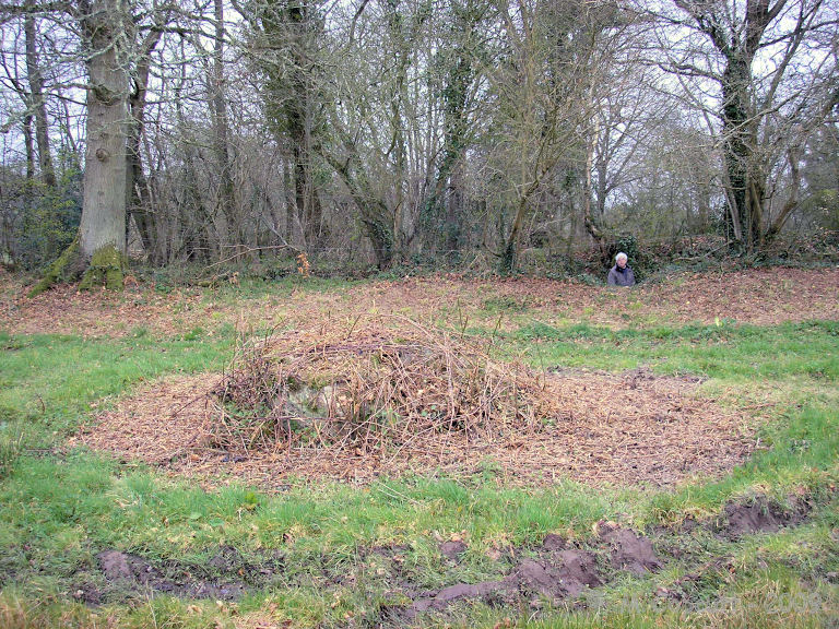
Table des Fées (Rocheville) submitted by thecaptain on 5th Apr 2009. La Table des Fées.
My Dad can be seen in the lane, with the gap through to the stone seen.
(View photo, vote or add a comment)
Log Text: None
The Toots (Oldbury)
Date Added: 18th Sep 2010
Site Type: Hillfort
Country: England (Gloucestershire)
Visited: Yes on 22nd Apr 2009

The Toots (King's Stanley) submitted by thecaptain on 22nd Apr 2009. The Toots - seen on the skyline of Selsley common above the church. Viewed here from Stroud
(View photo, vote or add a comment)
Log Text: None
Whitefield's Tump
Date Added: 18th Sep 2010
Site Type: Long Barrow
Country: England (Gloucestershire)
Visited: Yes on 9th May 2009
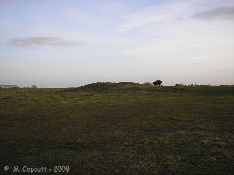
Whitefield's Tump submitted by thecaptain on 9th May 2009. Whitefield's Tump is a largely shapeless remains of a Long Barrow on the northwestern part of Minchinhampton Common.
(View photo, vote or add a comment)
Log Text: None
Newspaper Rock (Petrified Forest)
Date Added: 18th Sep 2010
Site Type: Rock Art
Country: United States (The Southwest)
Visited: Yes on 20th May 2009

Newspaper Rock (Petrified Forest) submitted by thecaptain on 20th May 2009. I believe that this is Newspaper Rock, its certainly in Petrified Forest National Park, Arizona.
From a visit in November 1990.
(View photo, vote or add a comment)
Log Text: None
Puerco Pueblo Petroglyphs
Date Added: 18th Sep 2010
Site Type: Rock Art
Country: United States (The Southwest)
Visited: Yes on 20th May 2009

Puerco Pueblo Petroglyphs submitted by thecaptain on 20th May 2009. Bird and Frog petroglyph, possibly part of Newspaper Rock, its certainly in Petrified Forest National Park, Arizona.
From a visit in November 1990.
(View photo, vote or add a comment)
Log Text: None
Montezuma Castle
Date Added: 18th Sep 2010
Site Type: Ancient Village or Settlement
Country: United States (The Southwest)
Visited: Yes on 25th May 2009
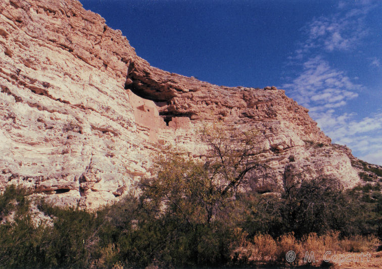
Montezuma Castle submitted by thecaptain on 25th May 2009. Montezuma Castle, on a hot day in November 1990.
(View photo, vote or add a comment)
Log Text: None
Tuzigoot Monument
Date Added: 18th Sep 2010
Site Type: Ancient Village or Settlement
Country: United States (The Southwest)
Visited: Yes on 26th May 2009
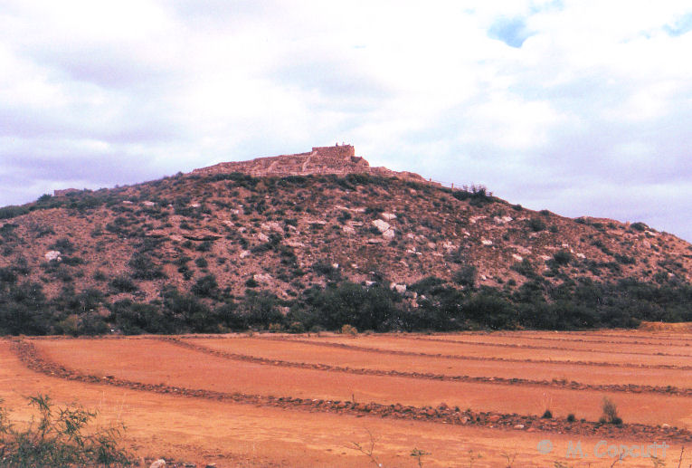
Tuzigoot Monument submitted by thecaptain on 26th May 2009. Tuzigoot Monument, pueblo built by the Sinagua culture.
Nov 1990.
(View photo, vote or add a comment)
Log Text: None
Puerco Pueblo.
Date Added: 18th Sep 2010
Site Type: Ancient Village or Settlement
Country: United States (The Southwest)
Visited: Yes on 28th May 2009

Puerco Pueblo. submitted by thecaptain on 28th May 2009. I believe these must be the Puerco Pueblo ancient ruins.
They are definitely somewhere in Petrified Forest national park, and the old photo is in my album on the same page as the petroglyph pictures!
(View photo, vote or add a comment)
Log Text: None
Agate House
Date Added: 18th Sep 2010
Site Type: Ancient Village or Settlement
Country: United States (The Southwest)
Visited: Yes on 28th May 2009
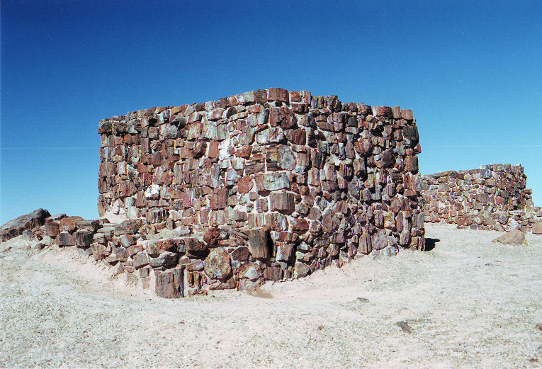
Agate House submitted by thecaptain on 28th May 2009. Agate House in Petrified Forest National Park.
picture from November 1990.
(View photo, vote or add a comment)
Log Text: None
Bristol City Museum
Date Added: 18th Sep 2010
Site Type: Museum
Country: England (Somerset)
Visited: Yes on 11th Aug 2009

Bristol City Museum submitted by thecaptain on 11th Aug 2009. As a part of the fabulous Banksy vs Bristol Museum exhibition this summer, a part of "Boghenge" (originally done at Glastonbury Festival in 2007) has been erected in the museum entrance.
(View photo, vote or add a comment)
Log Text: None
Furzehill Common Standing Stone
Date Added: 18th Sep 2010
Site Type: Standing Stone (Menhir)
Country: England (Devon)
Visited: Yes on 14th Sep 2009
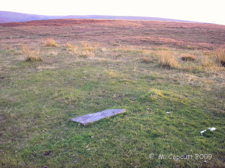
Furzehill Common Standing Stone submitted by thecaptain on 14th Sep 2009. The recently broken Furzehill Common standing stone, viewed here looking southwest over the common.
(View photo, vote or add a comment)
Log Text: None
Craddock Moor circle
Date Added: 18th Sep 2010
Site Type: Stone Circle
Country: England (Cornwall)
Visited: Yes on 22nd Sep 2009
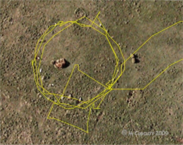
Craddock Moor circle submitted by thecaptain on 22nd Sep 2009. gps track plot of my wanderings round Craddock Moor stone circle on Sunday. Many of the stones can be seen in the picture.
I use an ageing Garmin etrex Venture pocket reciever, and the track is plotted out using GPSVisualizer, with only a few minutes fiddling.
I find it amazing the results that can now be obtained for things like this, using cheap, readily available technology, in a pocketsized device.
(View photo, vote or add a comment)
Log Text: None
Craddock Moor stone row
Date Added: 18th Sep 2010
Site Type: Stone Row / Alignment
Country: England (Cornwall)
Visited: Yes on 22nd Sep 2009

Craddock Moor stone row submitted by thecaptain on 22nd Sep 2009. gps track plot of my wanderings round Craddock Moor, along the embanked avenue and then the stone row on Sunday.
I use an ageing Garmin etrex Venture pocket reciever, and the track is plotted out using GPSVisualizer, with only a few minutes fiddling.
I find it amazing the results that can now be obtained for things like this, using cheap, readily available technology, in a pocketsized device.
(View photo, vote or add a comment)
Log Text: None
