Contributory members are able to log private notes and comments about each site
Sites TheCaptain has logged. View this log as a table or view the most recent logs from everyone
Hound Tor Ring Cairn
Date Added: 28th Sep 2020
Site Type: Ring Cairn
Country: England (Devon)
Visited: Yes on 26th Feb 2019. My rating: Condition 4 Ambience 5 Access 4

Hound Tor Ring Cairn submitted by h_fenton on 23rd Oct 2009. Hound Tor Ring Cairn, with Hound Tor in the background.
29 September 2009
(View photo, vote or add a comment)
Log Text: From the top of Hound Tor, I make my way south to look for the cairn and cist, but it is easy to find with obvious pathways leading to it. It is a splendid thing, about two thirds of a circle of contiguous surrounding stones with remains of a large cist box in the centre. I sit here for a fair while watching the sunlight fading on the Hound Tor rocks before heading back to the car.
Bowerman's Nose
Date Added: 28th Sep 2020
Site Type: Rock Outcrop
Country: England (Devon)
Visited: Saw from a distance on 26th Feb 2019. My rating: Ambience 5 Access 4

Bowerman's Nose submitted by Bladup on 25th Apr 2013. Bowerman's Nose.
(View photo, vote or add a comment)
Log Text: Drive down from Hound Tor passing Bowerman's Nose, but the sun has now gone, so decide not to go out to the fabulous looking rock column. One for another time. The drive down this little road is splendid, part of it being gated (I'd forgotten the joys of gated roads!), part through a stream bed , some over open common and some through woodland.
Joan Ford Newtake W
Date Added: 2nd Oct 2020
Site Type: Cairn
Country: England (Devon)
Visited: Yes on 11th Apr 2019. My rating: Condition 2 Ambience 3 Access 2

Joan Ford Newtake W submitted by Bladup on 19th Jan 2016. Joan Ford Newtake W, A little circle with a wall going though it and incorporating two stones. No trace of an internal cist.
(View photo, vote or add a comment)
Log Text: Having decided to walk further than the short loop, and to visit the Joan Forn Newtake and cross at the Swincome waterworks, I proceeded out across the moor in a west and southwest direction. Leaving the hardened trackway, I headed up to the hilltop on the way to the enclosure, and noted what were probably cairns, or perhaps hut circles. From there over to the corner of the enclosure wall with its gated entrance, at which I noted some reasonably sized stones, but stupidly didn't realise these were the remains of the Joan Ford Newtake W cairn circle, and didn't take pictures.
Kraps Ring
Date Added: 27th Sep 2020
Site Type: Ancient Village or Settlement
Country: England (Devon)
Visited: Yes on 18th Sep 2020. My rating: Condition 3 Ambience 4 Access 3
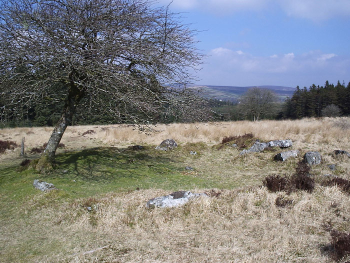
Kraps Ring submitted by simonsworn on 8th May 2005. Facing north from the isolated hut circle southwest of the settlement which is just over the ridge in the background.
(View photo, vote or add a comment)
Log Text: Time is getting on, and clouds seem to be coming over, and I am getting tired. What to do now, I don't want to give up and return the way I came, but completing the planned walk will be a lot further in distance. However, most of the rest of the walk will be on marked pathways, which is probably 3 times easier than tromping over open moorland, so I decide to carry on. So I head northwards downslope to Kraps Ring, past a lovely fallen tree which is still growing from its horizontal position, the branches now turning upwards. Then there is a lovely hut circle with a tree in its entrance. Then Kraps Ring itself. For some reason I was expecting some reasonably sized earthworks (no idea why, its not what you get on Dartmoor), but what I found was large low banks of stone, no doubt from a fallen wall with remnants of many hut circles within, rather like a smaller version of Grimspound. Again, I wonder the wisdom of the full walk via Postbridge which would involve a significant loss of altitude, so I decide to make a cut eastwards through the forest along what I assume is a track, but just turns out to be a firebreak or something. However walking through the forest adjacent to the break is pleasant and easy enough, encountering all sorts of toadstools and birds in the process, until I come to a fence at the side of the road from Postbridge to Bellever which is easy enough to get through. The walk is now much easier along the bridleway across open common land to Bellever where I decide to drop down to the river for a look at the pretty old clapper bridge in a wonderful riverside area of trees and grass. There are a couple of people having a picnic, and further down the river a couple fly fishing. Apart from all the no parking cones and other signs, there are no signs of the chaos that was supposedly here a month or so ago with masses camping out in the woodland. What a beautiful and idyllic place. Back to the bridleway which climbs up through the forest to Laughter Hole with its incredible lichen covered trees, and further up and eventually out onto the open moorland below Laughter Tor.
Laughter Tor row 1
Date Added: 27th Sep 2020
Site Type: Multiple Stone Rows / Avenue
Country: England (Devon)
Visited: Yes on 18th Sep 2020. My rating: Condition 3 Ambience 4 Access 3
Laughter Tor row 1 submitted by cazzyjane on 24th Jul 2014. The double stone row on Laughter Tor.
(View photo, vote or add a comment)
Log Text: Now I am nearly back to Dunnabridge, time to sit in the sun for a rest to take in the views and finish my supplies. Damn, I have left the fruit in the car! The stone row should be just along a bit more then up on my right. There it is, but it’s a struggle to get to it from here through the heather and gorse. The row which is a double row of some 160m in length remains with a good section at each end but with very few stones remaining in between. The bottom dozen or so of stones are clear to be found, including a possible end stone, making a double row which leads up to the hillside to the longstone, of which only the top can be seen in the distance. The track of the row has been very roughly cleared of vegetation, and although it is good to have it cleared, it looks like quite a bit of damage has been done to the ground, and possibly some of the remaining intermediate stones damaged. Most of the intermediate section of the alignment has probably been used to build the wall which I now have to cross to get to the top part, of which about a dozen stones make a reasonable section well before the longstone.
Headless Cross (Moretonhampstead)
Date Added: 28th Sep 2020
Site Type: Modern Stone Circle etc
Country: England (Devon)
Visited: Yes on 26th Feb 2019. My rating: Condition 3 Ambience 3 Access 5

Headless Cross (Moretonhampstead) submitted by AngieLake on 23rd Nov 2008. The Headless Cross, or Maximajor Stone (of Dartmoor Legend) marks the start of the NE end of the ridgeway track over Mardon Down.
Thought to be a replacement for a pre-existing ancient menhir.
(See site page for more.)
(View photo, vote or add a comment)
Log Text: Beautiful sunny week in February, the hottest on record with 21 degrees recorded at Kew. So I decided a day on Dartmoor was required, and that I should visit Mardon Down to see the stone circle and other monuments in the vicinity, plus visit a couple of pubs. Two hours to drive down, and I was out on the moors before 12:00, having parked in a car parking area opposite what is marked as the Headless Cross. Turns out that the stone here now is a fairly modern replacement for the original stone, which was broken by either a car accident or an act of vandalism, depending on what story you see. It also seems to state that this never was a cross in the traditional sense, but probably a menhir (known as the Maximajor Stone), which acted as a guide stone in more recent times, much like many of the moorland crosses.
Dunnabridge Pound
Date Added: 2nd Oct 2020
Site Type: Ancient Village or Settlement
Country: England (Devon)
Visited: Yes on 11th Apr 2019. My rating: Condition 4 Ambience 3 Access 5
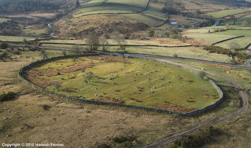
Dunnabridge Pound submitted by h_fenton on 27th Apr 2010. Dunnabridge Pound from the air.
Kite Aerial Photograph
7 April 2010 @ 9am
(View photo, vote or add a comment)
Log Text: The Judges Chair in deep shadow, so no good for photos, but a nice little sit down
Money Pit cairn
Date Added: 2nd Oct 2020
Site Type: Stone Circle
Country: England (Devon)
Visited: Yes on 11th Apr 2019. My rating: Condition 3 Ambience 3 Access 4
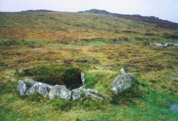
Money Pit cairn submitted by Bladup on 17th Jan 2015. Money Pit cairn.
(View photo, vote or add a comment)
Log Text: Looking lovely in the late afternoon sun
Yar Tor Summit
Date Added: 2nd Oct 2020
Site Type: Cairn
Country: England (Devon)
Visited: Yes on 11th Apr 2019. My rating: Condition 3 Ambience 4 Access 3

Yar Tor Summit submitted by AngieLake on 8th Mar 2005. Yar Tor Summit Cairn sits at 416m, overlooking a beautiful area of mid-Dartmoor. This view is of the approach from the south.
(View photo, vote or add a comment)
Log Text: Such a lovely day, I decided to go up to the top of Yar Tor to take in the views, despite my legs aching a bit by now. The top of the southern part of the tor has a clear ancient cairn built on top, but this has been made into a spiral shape, I believe during wartime when it was used as a lookout shelter. While stood at the top of Yar Tor, a couple of Wokka-Wokkas flew up the Dart valley below me before heading up the valley towards Princetown and over the moor. Strange to see them from above!
Ouldsbroom Cross
Date Added: 2nd Oct 2020
Site Type: Ancient Cross
Country: England (Devon)
Visited: Yes on 11th Apr 2019. My rating: Condition 3 Ambience 4 Access 5
Ouldsbroom Cross submitted by cazzyjane on 29th Nov 2014. Ouldsbroom Cross in the evening sun.
(View photo, vote or add a comment)
Log Text: None
Beardown Cairn and Cist
Date Added: 21st Sep 2021
Site Type: Cist
Country: England (Devon)
Visited: Yes on 20th Sep 2021. My rating: Condition 2 Ambience 3 Access 2

Beardown Cairn and Cist submitted by TheCaptain on 5th Mar 2017. Beardown Cairn and Cist, near the Lich Way on the heights between the Cowsic and West Dart rivers.
My friend Antony tries out the cist for size, during a memorable walk along the Lich Way across the moor at Easter 1988.
(View photo, vote or add a comment)
Log Text: Beautiful sunny day forecast, and the Army firing range not in use today, so head down to Dartmoor for a pilgrimmage to Beardown Man. Park at Holming Beam at 12:00 after a busy journey down, and I am the only one there. Start by walking over to the first Beardown Tor with its Army firing post observation huts. Making a schoolboy error I head off to what I think is the next Beardown Tor across grassy open moorland, not checking as I go. Once at the top I realise I have walked much further to Lydford Tor, and already passed the cairn and cist I wanted to visit again after the Antony trousers episode in 1988. Doh! Dartmoor lesson, concentrate on navigation and double check everything. Its now a complex task to get across the rough moor to the cist, which was a nightmare to find, eventually resorting to the gps only to find I was about 10 feet away, it has now become totally overgrown and I almost fall in. No way I could sit in the cist, could hardly see it!
Maiden Hill
Date Added: 23rd Sep 2021
Site Type: Cairn
Country: England (Devon)
Visited: Yes on 20th Sep 2021. My rating: Condition 2 Ambience 4 Access 2
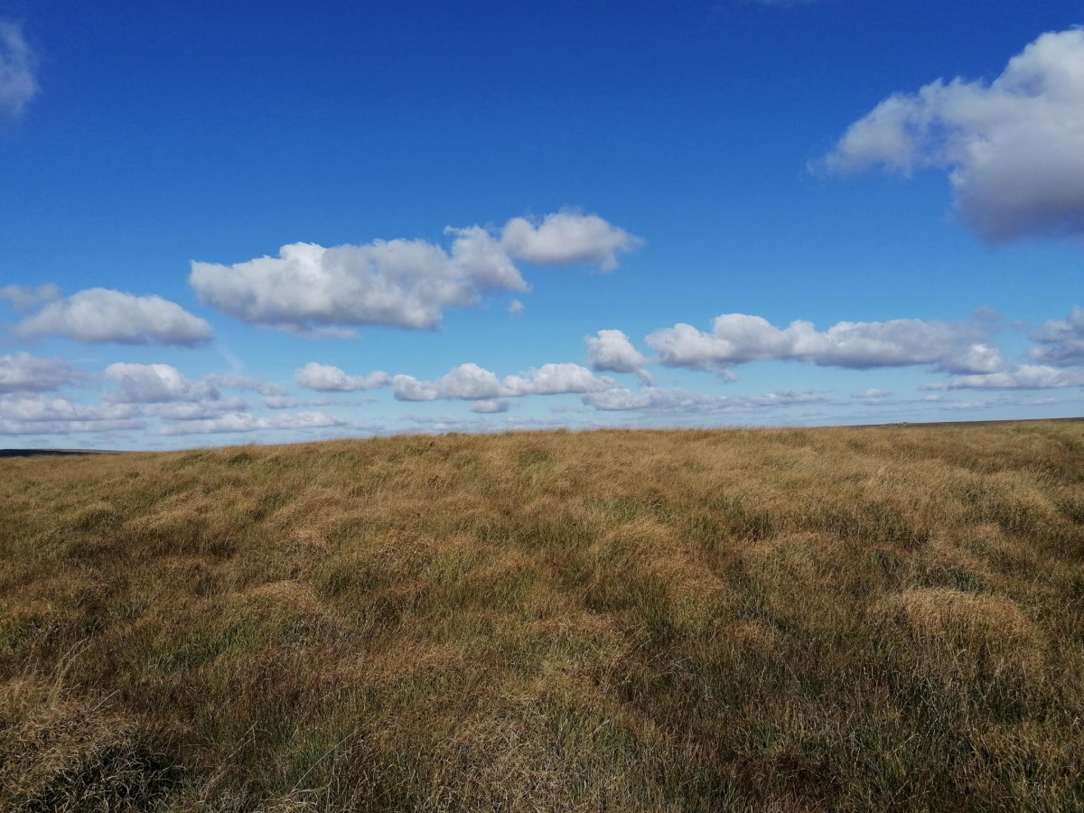
Maiden Hill submitted by TheCaptain on 23rd Sep 2021. A large raised area of grass which quite possibly does have a cairn underneath
(View photo, vote or add a comment)
Log Text: Day down to Dartmoor for a pilgrimmage to Beardown Man. From Devils Tor, looking to head on to Conies Down there seems two choices, either down and up the steep and deep Cowsic valley, or a longer route round the head of the valley further north, which I decide to take. The path is fairly good, and obviously used a fair bit by people on quad bikes, so is easy going except for the odd bit of bog. Onto the top of Maiden Hill, avoiding a large herd of ponies, and look for the cairn in the featureless long grass, finding only a large raised area of grass which quite possibly does have a cairn underneath.
Conies Down
Date Added: 25th Sep 2021
Site Type: Multiple Stone Rows / Avenue
Country: England (Devon)
Visited: Yes on 3rd Apr 1988. My rating: Condition 3 Ambience 4 Access 2

Conies Down submitted by Brian Byng on 7th Feb 2002. Conies Down Stone Row @ SX58597905 looking north
This row runs almost NS actual azimuth 10 deg. It is 172m long, difficult to find as the stones are small & only about 22 remain standing. The row runs slightly uphill to to a low mound possibly the remains of a burial - no
finds.
(View photo, vote or add a comment)
Log Text: Visited while on walk across Dartmoor on the Lich Way. Being new to Dartmoor Stone Rows, and not knowing how small the stones could be, I thought it to be very overgrown and insignificant. Knowing what I do now, its possibly quite a significant row!
Crow Tor
Date Added: 23rd Sep 2021
Site Type: Cairn
Country: England (Devon)
Visited: Yes on 20th Sep 2021. My rating: Condition 4 Ambience 4 Access 2
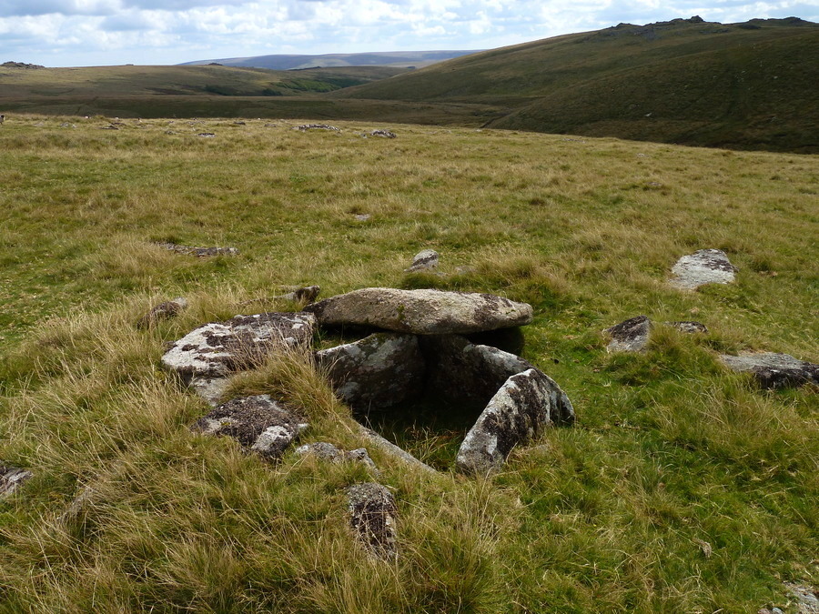
Crow Tor submitted by Bladup on 10th Dec 2017. Crow Tor Cairn and Cist.
(View photo, vote or add a comment)
Log Text: Day down to Dartmoor for a pilgrimmage to Beardown Man. From Beardown Cairn, and now back on the planned route but behind time, I see another chap out on the moor nearby, an old looking chap dressed in what looks like tweeds, and we exchange greetings. Head north towards Crow Tor, crossing a wall and small stream. Looking for the cairn below Crow Tor which is not marked on the map, and having an initial look where I think it is, I again resort to gps and there it is about 20 metres away. A lovely stone cairn with a fairly large cist inside, the capstones shifted off to one side. Up to Crow Tor to find somewhere to sit and have lunch, during which time a couple walking the other direction pass by and we exchange waves. I now head north across the featureless boggy high moorland to Rough Tor, with firing range huts, double checking it is the right one a couple of times!
Beardown Man
Date Added: 23rd Sep 2021
Site Type: Standing Stone (Menhir)
Country: England (Devon)
Visited: Yes on 20th Sep 2021. My rating: Condition 4 Ambience 5 Access 2
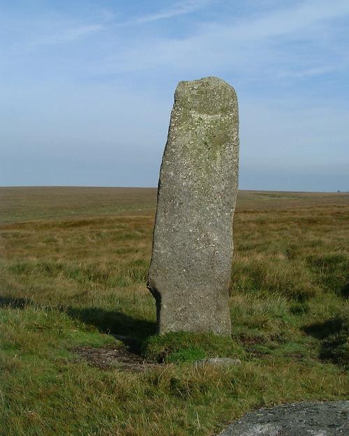
Beardown Man submitted by Brian Byng on 7th Feb 2002. Beardown Man looking north
(View photo, vote or add a comment)
Log Text: Day down to Dartmoor for a pilgrimmage to Beardown Man. Now at Rough Tor I have now learned (remembered) that when walking on the open moor, any sort of path in roughly the right direction is easier than trying to cross the untamed and boggy moor, so standing on the top of the tor taking in the magnificent vista all around in the sun, decide on a route across to Devil's Tor on a pathway which heads to the south of it to start with, but looks mostly fairly easy going. Then up to the top of the hill, and Beardown Man peeks its top over the horizon and grows taller as I approach. It's not at the top of the hill, just below the summit on the west side, but magnificent, twice my height, a lovely thin flat stone with views from north to south over the deep Cowsic valley on the west side, but nothing to the east, which I think odd. Its fabulous out here.
Conies Down
Date Added: 25th Sep 2021
Site Type: Multiple Stone Rows / Avenue
Country: England (Devon)
Visited: Yes on 20th Sep 2021. My rating: Condition 2 Ambience 4 Access 2

Conies Down submitted by Brian Byng on 7th Feb 2002. Conies Down Stone Row @ SX58597905 looking north
This row runs almost NS actual azimuth 10 deg. It is 172m long, difficult to find as the stones are small & only about 22 remain standing. The row runs slightly uphill to to a low mound possibly the remains of a burial - no
finds.
(View photo, vote or add a comment)
Log Text: Day down to Dartmoor for a pilgrimmage to Beardown Man. From Maiden Hill, I now head south to look for the stone row I have dim memories of from the 1988 Lich Way moorland crossing, and as I approach down the hillside, there is a large herd of cattle, some looking at me menacingly with their horns, so I reluctantly decide to give them a wide berth, and don't get to the top of the row where there are a large group including calves laying around. Heading further down I can get to the lower end of the row, and it is clearly there, stones spaced about 4 metres apart which appear white amongst the green grass, and is just how I remember it. From here its not going to be easy to get back as other than the Lich Way going east west, there is nothing resembling a path heading south, so I decide I have to make best way I can heading up and over towards Black Dunghill after first crossing around the top of the initial bogland. Its a difficult, boggy route, made slightly easier using the occasional animal track or quad bike track in a sort of zig zag fashion until I get to the top of the ridge by the unmarked hill, from where I can make out Black Dunghill with what looks a good path over it, which I head to. Getting tired now, and the sun dropping, I sit and eat my last sandwich with mild relief as I can see a good path leading all the way back to where the car is parked. Its a simple walk back to Holming Beam, but unfortunately I now have a wet bum from sitting down, made tolerable by the fantastic views, with Beardown Man clearly visible on the horizon up to the north. It can even be seen from the track by the car park, magnificent. Back to the car about 5:20, and there is another couple out here walking along the track, so thats now 5 people I have seen all day with over 5 hours out on the moor. Change out of wet boots, and head down for a pint in the setting sun at the Two Bridges Hotel after. Lovely.
Challacombe Down Cairn Circle
Date Added: 31st Jan 2023
Site Type: Cairn
Country: England (Devon)
Visited: Yes on 3rd May 2022. My rating: Condition 2 Ambience 4 Access 3
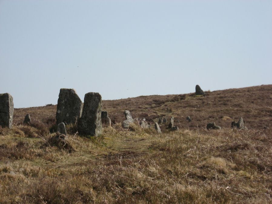
Challacombe Down Cairn Circle submitted by davep on 19th Aug 2019. The Challacombe Down Cairn Circle, set just to the west of the northern end of this triple stone row. From the Prehistoric Dartmoor Walks website (site 270).
(View photo, vote or add a comment)
Log Text: At the bottom end of the Challacombe stone rows, most of the stones are showing white amongst the heather. It is all a bit of a jumble, no doubt many of the stones moved during the extensive mining here, several of which seem to have been placed in surprising positions, with a sort of semicircular feature to one side.
Stannon Newtake West Cairn and row
Date Added: 4th Jun 2022
Site Type: Multiple Stone Rows / Avenue
Country: England (Devon)
Visited: Yes on 3rd May 2022. My rating: Condition 2 Ambience 3 Access 2

Stannon Newtake West Cairn and row submitted by TheCaptain on 8th May 2022. From the Stannon Newtake cairn with cist, I tried to get to the cairn with possible small stone row which is nearby down the hill. However, I could not get through all the chest height gorse and heather to find it. I think I saw the cairn and a couple of the larger stones further down, situated in a cleared area, lower left of this picture
(View photo, vote or add a comment)
Log Text: From the Stannon Newtake cairn with cist, I tried to get to the cairn with possible small stone row which is nearby down the hill. However, I could not get through all the chest height gorse and heather to find it. I do think that I saw a couple of the larger stones further down, standing in a cleared area. I later find out that the whole length of the White Ridge stone row has been cleared and links up with these stones, which are possibly the end of that long row.
Assycombe
Date Added: 28th Apr 2022
Site Type: Multiple Stone Rows / Avenue
Country: England (Devon)
Visited: Would like to visit
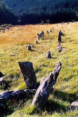
Assycombe submitted by stonedowser on 26th Feb 2002. This view is from the top end of the row looking downhill.
Ian.
(View photo, vote or add a comment)
White Ridge stone row
Date Added: 4th Jun 2022
Site Type: Stone Row / Alignment
Country: England (Devon)
Visited: Yes on 3rd May 2022. My rating: Condition 2 Ambience 3 Access 2
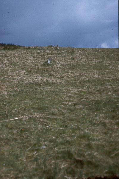
White Ridge stone row submitted by Brian Byng on 7th Feb 2002. White Ridge.
A double row @ SX 6541 8165 167m lg descending the hill from a ruined 8m dia
cairn. 41 stones still show. The cairn is on the skyline when viewed from the
bottom of the row. The end of the row has no obvious termination. The
elevation of the cairn from the bottom of the row is 3 degrees. The true
azimuth of the row is 7 degrees giving a declination of 42. A trawl through
astronomical objects around Bronze Age times suggests that the star Arcturus
would graze the cair...
(View photo, vote or add a comment)
Log Text: From the Stannon Newtake cairn with cist, I head north to the boundary wall where it is indicated on the map that the south end of White Ridge stone row is to be found (before it was discovered to run much further down the hill, which I didn't know at the time). Using my GPS I found the correct spot, and saw a couple of possible stones, then looking back south into the newtake, I could see s cleared strip of land going right down to where the cairn I couldn't get to is situated. Walking northwards, I noticed a sort of pathway which I followed, and found a few small stones, then saw a couple standing out against the horizon, confirming I was walking along the line of the stone row. I followed this north up to the top cairn, which is very denuded, but has several stones which can be made out. I have seen the stone row described as "one of the least impressive stone rows on the moor", but it has a few decent sections, and I have visited much worse.
