Contributory members are able to log private notes and comments about each site
Sites TheCaptain has logged. View this log as a table or view the most recent logs from everyone
Whittlestone
Date Added: 18th Sep 2010
Site Type: Standing Stone (Menhir)
Country: England (Gloucestershire)
Visited: Yes on 9th Jan 2007
Whittlestone submitted by thecaptain on 9th Jan 2007. In the centre of the village of Lower Swell, just off the village green to the northwest side can be found the Whittlestone.
It sits on a grassy bank with a little sign stating that it was once part of a neolithic burial chamber, and had originally been further up the hill near to the churchyard.
(View photo, vote or add a comment)
Log Text: None
The Horestone (Lower Swell)
Date Added: 18th Sep 2010
Site Type: Standing Stone (Menhir)
Country: England (Gloucestershire)
Visited: Yes on 10th Jan 2007
The Horestone (Lower Swell) submitted by thecaptain on 10th Jan 2007. The Horestone stands in a field to the southwest of the village of Lower Swell.
Almost certainly once part of a burial chamber from within a longbarrow, it's about 2 metres long, less than a metre in height and varies in thickness.
(View photo, vote or add a comment)
Log Text: None
Hangman's Stone (Northleach)
Date Added: 18th Sep 2010
Site Type: Standing Stone (Menhir)
Country: England (Gloucestershire)
Visited: Yes on 14th Jan 2007
Hangman's Stone (Northleach) submitted by thecaptain on 14th Jan 2007. The situation of the Hangman's Stone.
Easily found to the west of Northleach, near a radio mast.
(View photo, vote or add a comment)
Log Text: None
Dyrham Camp
Date Added: 17th Oct 2020
Site Type: Hillfort
Country: England (Gloucestershire)
Visited: Yes on 9th Sep 2007
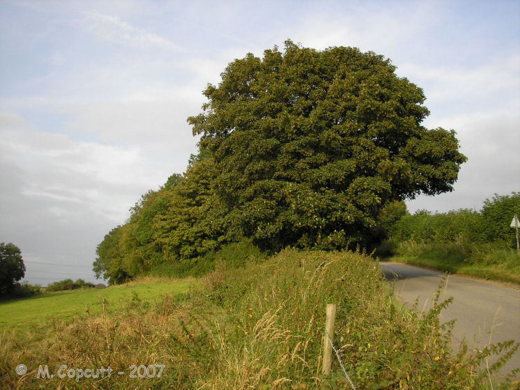
Dyrham Camp submitted by thecaptain on 28th Aug 2008. The western "point" of Hinton Hillfort, where it is cut into two by the little road up the hillside from the village of Hinton below.
(View photo, vote or add a comment)
Log Text: Dyrham Camp, otherwise known as Hinton Hillfort, is not so much a hillfort, but more a promontary fort, on a southwest facing spur of the Cotswold Hills north of Bath. Basically triangular in shape, it is cut into two by the little road up the hillside from the village of Hinton below. The northern part is mostly in woodland, and seems to be used as a rubbish dump these days. The hill edge has been shaped, and in places the bank and ditch is in fine condition, perhaps kept in shape in more recent times for drainage. The southern half of the fort is open pasture with a public footpath running through, and the steep southern slopes are sort of terraced, with several almost cliff like ramparts, below which are quite spectacular remains of ancient field systems. The eastern edge of the fort, where the land is flat on top of the Cotswold plateau, has a large ditch and bank in place across the headland. The ditch is about 10 metres wide and 2 metres deep, with a bank up to 4 metres high on the inside, which even these days is a fairly good barrier to entry.
St Anthony's Well (Cinderford)
Date Added: 18th Sep 2010
Site Type: Holy Well or Sacred Spring
Country: England (Gloucestershire)
Visited: Yes on 19th Nov 2008
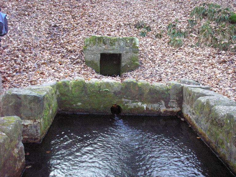
St Anthony's Well (Cinderford) submitted by thecaptain on 19th Nov 2008. St Anthony's Well near Cinderford in the Forest of Dean.
(View photo, vote or add a comment)
Log Text: None
Hetty Pegler's Tump
Date Added: 23rd Oct 2021
Site Type: Passage Grave
Country: England (Gloucestershire)
Visited: Yes on 14th Apr 2009. My rating: Condition 3 Ambience 3 Access 4

Hetty Pegler's Tump submitted by thecaptain on 15th Mar 2009. The closure notice.
(View photo, vote or add a comment)
Log Text: March 2009 and Hetty Pegler`s Tump was closed and sealed off to the public, due to concerns over its safety, with the internal drystone walling collapsing due to vandalism and the weight of the capstones resting on these walls since the 19th century reconstruction. Scaffolding has been used to prop up the chambers, and the entrance passage and courtyard sealed and filled with earth.
Avening burial chambers
Date Added: 18th Sep 2010
Site Type: Burial Chamber or Dolmen
Country: England (Gloucestershire)
Visited: Yes on 24th Mar 2009

Avening burial chambers submitted by thecaptain on 24th Mar 2009. The view of where the burial chambers are from the road.
(View photo, vote or add a comment)
Log Text: None
Gatcombe Lodge
Date Added: 18th Sep 2010
Site Type: Long Barrow
Country: England (Gloucestershire)
Visited: Yes on 24th Mar 2009

Gatcombe Lodge submitted by thecaptain on 24th Mar 2009. Having read several tales of people being stopped and questioned by rapidly arriving police here, I didn’t spend long, and just took a photo from the entry to the estate.
It looks to be the regular shapeless lumpy bumpy mess covered in trees.
(View photo, vote or add a comment)
Log Text: None
The Toots (King's Stanley)
Date Added: 23rd Oct 2021
Site Type: Long Barrow
Country: England (Gloucestershire)
Visited: Yes on 14th Mar 2009. My rating: Condition 3 Ambience 4 Access 4

The Toots (King's Stanley) submitted by thecaptain on 22nd Apr 2009. The Toots - seen on the skyline of Selsley common above the church. Viewed here from Stroud
(View photo, vote or add a comment)
Log Text: Remains of a large unexcavated Long Barrow on the Cotswold escarpment slopes of Selsley Common, just to the south of Stroud in Gloucestershire. Possibly called 'The Toots' because of a hollow in the middle which makes it look as if it is composed of two mounds. The views on a good day from here are terrific, and the common is a favourite place for dogwalkers, kite flyers and model plane flying.
Soldier's Grave
Date Added: 23rd Oct 2021
Site Type: Round Barrow(s)
Country: England (Gloucestershire)
Visited: Yes on 14th Mar 2009. My rating: Condition 3 Ambience 4 Access 4
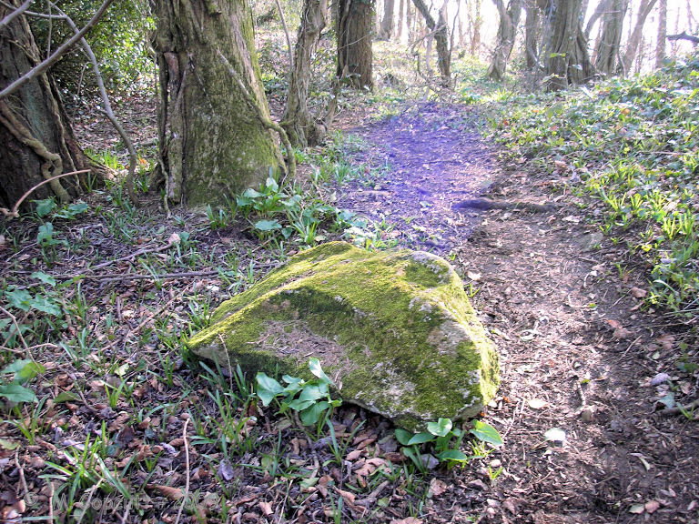
Soldier's Grave submitted by thecaptain on 10th Apr 2009. There are several fairly large bits of stone laying around nearby, which once may have formed part of the structure.
(View photo, vote or add a comment)
Log Text: This large round barrow can be found on the top of the Cotswold escarpment just into the woods at the northwest corner of the country park / picnic area, a couple of hundred yards to the north of Nympsfield long barrow. It is said to be a really unusual round barrow from the Neolithic, and not a Bronze Age round barrow at all! The top of the barrow has a very large depression in it, where it has been cut into in the past. From Grinsell - Barrows in England and Wales, “a boat-shaped hollow lined with dry-stone walling, in which were the remains of up to 44 individuals, mostly unburnt”. There are several fairly large bits of stone laying around nearby, which once may have formed part of the structure.
Randwick Long Barrow
Date Added: 27th Sep 2021
Site Type: Long Barrow
Country: England (Gloucestershire)
Visited: Yes on 14th Mar 2009. My rating: Condition 4 Ambience 4 Access 4
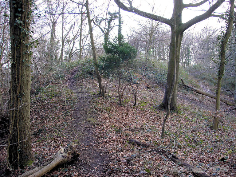
Randwick Long Barrow submitted by thecaptain on 13th Apr 2009. On the left of the picture here, at the northeastern end of the barrow, are the remains of a horned entrance with forecourt and a single stone lined chamber.
Remains of this chamber are supposedly still to be seen, but the barrow is heavily overgrown here, making any stone remains invisible to me when I visited.
(View photo, vote or add a comment)
Log Text: This massive Long Barrow is to be found within Standish Wood, at the top of the hills to the north of Stroud. The remaining mound is about 55 metres in length, up to half as wide, and still 4 metres in height. At the northeastern end are the remains of a horned entrance with forecourt and a single stone lined chamber. Remains of this chamber are supposedly still to be seen, but the barrow is heavily overgrown, making any stone remains invisible to me when I visited.
The barrow is set right on the hilltop, and almost surrounded by various quarrying and pits, some of which may date back almost as long as the barrow itself. Positioned within this thick Cotswold woodland, the place is very atmospheric, and supposedly a much more authentic setting than those barrows in open fields.
A bit further on in the woods to the northeast are a couple of other round barrows, and a crossdyke.
From Stroud, take the road north towards Randwick, and follow it up the hill, taking the little lane to the left when almost at the hilltop. There is a small parking area here, and a well maintained trackway north into the woods, from where the barrow is only a few hundred metres distant.
The Toots (Oldbury)
Date Added: 18th Sep 2010
Site Type: Hillfort
Country: England (Gloucestershire)
Visited: Yes on 22nd Apr 2009

The Toots (King's Stanley) submitted by thecaptain on 22nd Apr 2009. The Toots - seen on the skyline of Selsley common above the church. Viewed here from Stroud
(View photo, vote or add a comment)
Log Text: None
Whitefield's Tump
Date Added: 18th Sep 2010
Site Type: Long Barrow
Country: England (Gloucestershire)
Visited: Yes on 9th May 2009
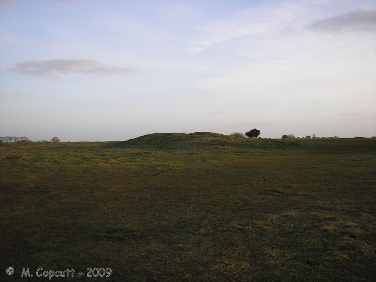
Whitefield's Tump submitted by thecaptain on 9th May 2009. Whitefield's Tump is a largely shapeless remains of a Long Barrow on the northwestern part of Minchinhampton Common.
(View photo, vote or add a comment)
Log Text: None
Querns Barrow
Date Added: 18th Sep 2010
Site Type: Chambered Tomb
Country: England (Gloucestershire)
Visited: Yes on 6th Apr 2010
Querns Barrow submitted by theCaptain on 6th Apr 2010. Querns Barrow seen here from the hospital entrance, looking southeast.
(View photo, vote or add a comment)
Log Text: None
Windmill Tump
Date Added: 18th Sep 2010
Site Type: Long Barrow
Country: England (Gloucestershire)
Visited: Yes on 16th May 2010
Windmill Tump submitted by TheCaptain on 16th May 2010. "Historic sites can be hazardous" !
The informative little English Heritage sign at this lovely long barrow.
(View photo, vote or add a comment)
Log Text: None
Redland Park
Date Added: 20th Dec 2013
Site Type: Standing Stone (Menhir)
Country: England (Gloucestershire)
Visited: Yes on 14th Dec 2013. My rating: Condition 2 Ambience 3 Access 5

Redland Park submitted by theCaptain on 20th Dec 2013. This stone of great antiquity sits near the southeastern corner of Redland Green, not far away from the entrance to the church.
(View photo, vote or add a comment)
Log Text: I can't believe that in 35 years of living in the Bristol area, that I have never visited this stone before. Although I have once or twice spent time looking for it on the wrong Green in Redland!
Rockhampton Standing Stone
Date Added: 19th May 2016
Site Type: Marker Stone
Country: England (Gloucestershire)
Visited: Yes on 8th May 2016. My rating: Condition 4 Ambience 4 Access 5
Rockhampton Standing Stone submitted by TheCaptain on 19th May 2016. Lovely limestone stone standing on a little grassy area at the junction of a couple of lanes. Nicely looked after, its a shame I am too late for the daffodils.
(View photo, vote or add a comment)
Log Text: Lovely limestone stone standing on a little grassy area at the junction of a couple of lanes, not actually in Rockhampton but the first junction along the road to the northeast from the village. Nicely looked after, its a shame I am too late for the daffodils.
Druid Stoke
Date Added: 16th Aug 2019
Site Type: Chambered Tomb
Country: England (Gloucestershire)
Visited: Yes on 15th Aug 2019. My rating: Condition 2 Ambience 2 Access 5

Druid Stoke submitted by TheCaptain on 16th Aug 2019. A few large stones remain in the parking area outside a large house near the top of Druid Hill, in the leafy suburb od Stoke Bishop, north of Bristol. The stones can be seen from the road through the gateway. (August 2019)
(View photo, vote or add a comment)
Log Text: How on Earth can I never have been to visit this before, as 43 years ago I lived only half a mile away! So, on a sunny day, after a visit to the expensive dentist, I stopped by for a look. A few large stones remain in the parking area outside a large house near the top of Druid Hill, in the leafy suburb od Stoke Bishop, north of Bristol. The stones can be seen from the road through the gateway.
Clifton Down Camp
Date Added: 29th Oct 2019
Site Type: Hillfort
Country: England (Gloucestershire)
Visited: Yes on 17th Aug 2011
Clifton Down Camp submitted by TheCaptain on 17th Aug 2011. Remains of the ramparts at the northwestern side
(View photo, vote or add a comment)
Log Text: None
Blaise Castle
Date Added: 6th Nov 2023
Site Type: Hillfort
Country: England (Gloucestershire)
Visited: Yes on 29th Aug 2011. My rating: Condition 4 Ambience 4 Access 4
Blaise Castle submitted by theCaptain on 1st Dec 2011. Some of the remaining ramparts on the northern side of the hill
(View photo, vote or add a comment)
Log Text: None
