Contributory members are able to log private notes and comments about each site
Sites TheWhiteRider has logged. View this log as a table or view the most recent logs from everyone
The Grickstone
Date Added: 25th Jun 2012
Site Type: Standing Stone (Menhir)
Country: England (Gloucestershire)
Visited: Yes on 21st Jun 2010. My rating: Condition 3 Ambience 4 Access 2
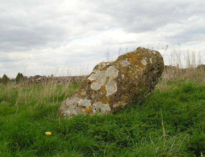
The Grickstone submitted by TheCaptain on 13th Apr 2004. Nice standing stone to the south of Grickstone farm, beside a footpath at the corner of a small wood. The stone has about 6 foot in length above ground, but due to the angle at which it leans, is only about 4 feet high. Nicely decorated with lichens. South Gloucestershire, ST777828.
(View photo, vote or add a comment)
Log Text: None
Horton Camp
Date Added: 25th Jun 2012
Site Type: Hillfort
Country: England (Gloucestershire)
Visited: Yes on 21st Jun 2010. My rating: Condition 2 Ambience 5 Access 4
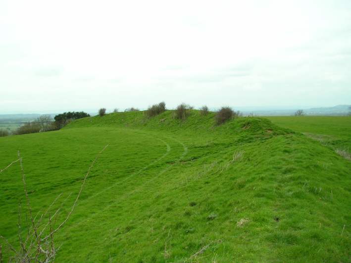
Horton Camp submitted by TheCaptain on 29th Mar 2004. Horton Camp Hillfort, South Gloucestershire, ST765845, March 2004.
View looking northwest along the remaining bank across the top of the hill. There is no sign of a ditch. The "inside" of the camp is to the left.
I may well be wrong, but I think that this bank may be a former internal division of what was once a much bigger camp taking in the entire promontary, not just the southern end.
(View photo, vote or add a comment)
Log Text: None
Uley Bury
Date Added: 25th Jun 2012
Site Type: Hillfort
Country: England (Gloucestershire)
Visited: Yes on 20th Jun 2010. My rating: Condition 4 Ambience 5 Access 4
Uley Bury submitted by DrewParsons on 27th Sep 2011. The south eastern entrance to the hill fort. September 2011.
(View photo, vote or add a comment)
Log Text: None
Windmill Tump
Date Added: 25th Jun 2012
Site Type: Long Barrow
Country: England (Gloucestershire)
Visited: Yes on 20th Jun 2010. My rating: Condition 3 Ambience 4 Access 4
Windmill Tump submitted by TheCaptain on 16th May 2010. Rodmorton Longbarrow (Windmill Tump) viewed from the end of the footpath along the field edge, at the way into the barrow from the west, March 2009.
(View photo, vote or add a comment)
Log Text: None
Long Stone (Minchinhampton)
Date Added: 25th Jun 2012
Site Type: Standing Stones
Country: England (Gloucestershire)
Visited: Yes on 20th Jun 2010. My rating: Condition 3 Ambience 3 Access 2
Long Stone (Minchinhampton) submitted by TimPrevett on 30th Dec 2009. Sunset 26/12/09 - an unplanned visit to a number of sites in the area.
No maps - just a vague 1970s guidebook - took us a couple hours to locate this having gone from Minchinhampton via Hampton Fields to Tetbury to Avening missing the stone at first by a narrow margin.
Having resigned ourselves to a long barrow this stone was spotted with just a few minutes before the sun went below the horizon.
A very impressive 7 feet tall stone, and make sure to see the smaller stone bisecting the wall ...
(View photo, vote or add a comment)
Log Text: None
Gatcombe Lodge
Date Added: 25th Jun 2012
Site Type: Long Barrow
Country: England (Gloucestershire)
Visited: Yes on 20th Jun 2010. My rating: Ambience 3 Access 4

Gatcombe Lodge submitted by thecaptain on 24th Mar 2009. Having read several tales of people being stopped and questioned by rapidly arriving police here, I didn’t spend long, and just took a photo from the entry to the estate.
It looks to be the regular shapeless lumpy bumpy mess covered in trees.
(View photo, vote or add a comment)
Log Text: None
The Tingle Stone
Date Added: 25th Jun 2012
Site Type: Long Barrow
Country: England (Gloucestershire)
Visited: Yes on 20th Jun 2010. My rating: Condition 2 Ambience 4 Access 2
The Tingle Stone submitted by TimPrevett on 29th Dec 2009. The Tingle Stone - sole remaining slab of a chamber upon the chambered long barrow. Apparently off a footpath.
(View photo, vote or add a comment)
Log Text: None
Whitefield's Tump
Date Added: 25th Jun 2012
Site Type: Long Barrow
Country: England (Gloucestershire)
Visited: Yes on 20th Jun 2010. My rating: Condition 2 Ambience 4 Access 4

Whitefield's Tump submitted by thecaptain on 9th May 2009. Whitefield's Tump is a largely shapeless remains of a Long Barrow on the northwestern part of Minchinhampton Common.
(View photo, vote or add a comment)
Log Text: None
The Toots (King's Stanley)
Date Added: 25th Jun 2012
Site Type: Long Barrow
Country: England (Gloucestershire)
Visited: Yes on 20th Jun 2010. My rating: Condition 3 Ambience 4 Access 4

The Toots (King's Stanley) submitted by thecaptain on 22nd Apr 2009. The Toots on Selsley common is a favourite place for model plane flying.
(View photo, vote or add a comment)
Log Text: None
The Paddocks
Date Added: 25th Jun 2012
Site Type: Stone Row / Alignment
Country: England (Shropshire)
Visited: Yes on 23rd Sep 2008
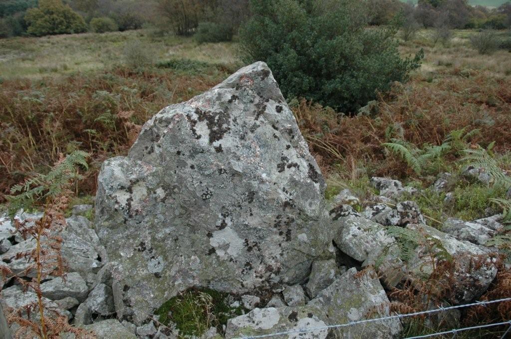
The Paddocks submitted by TheWhiteRider on 23rd Sep 2008. The Paddocks standing stone/stone row
(View photo, vote or add a comment)
Log Text: None
Dragon Hill
Date Added: 25th Jun 2012
Site Type: Natural Stone / Erratic / Other Natural Feature
Country: England (Oxfordshire)
Visited: Yes on 19th Jun 2007. My rating: Condition 4 Ambience 4 Access 4
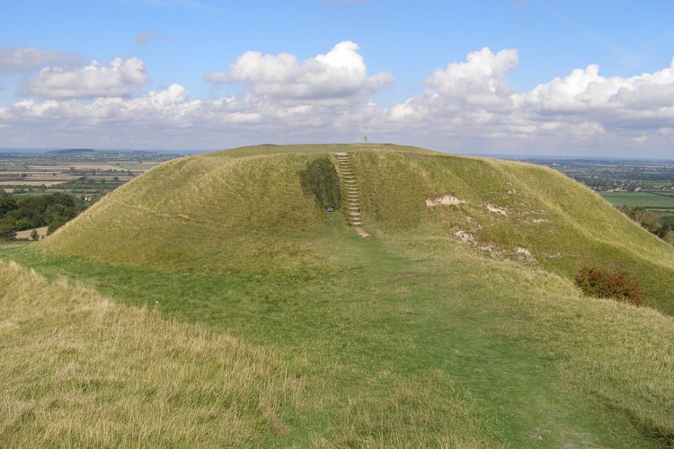
Dragon Hill submitted by JimChampion on 25th Sep 2006. The flat-topped mound from alongside the road. The grass to the left of the steps has been recently reinstated and covered with netting to give it a chance to recover.
(View photo, vote or add a comment)
Log Text: None
Sevenways Cave
Date Added: 25th Jun 2012
Site Type: Cave or Rock Shelter
Country: England (Staffordshire)
Visited: Yes on 8th Apr 2007

Sevenways Cave submitted by TheWhiteRider on 8th Apr 2007. Three of the entrances to Sevenways Cave, seen from the top of Thor's Cave.
(View photo, vote or add a comment)
Log Text: None
Radnor Wood Camp
Date Added: 25th Jun 2012
Site Type: Hillfort
Country: England (Shropshire)
Visited: Yes on 14th Mar 2007

Radnor Wood Camp submitted by TheWhiteRider on 14th Mar 2007. A section of the rampart of Radnor Wood Camp.
(View photo, vote or add a comment)
Log Text: None
Oak Farm Bowl Barrow
Date Added: 25th Jun 2012
Site Type: Round Barrow(s)
Country: England (Shropshire)
Visited: Yes on 14th Mar 2007

Oak Farm Bowl Barrow submitted by TheWhiteRider on 14th Mar 2007. The remains of this ploughed out barrow appear as little more than a slight mound, but its size appears accentuated because it is on high ground and the road is quite sunken. Taken from the Bicton Road.
(View photo, vote or add a comment)
Log Text: None
Rockhill Iron Age Enclosure
Date Added: 25th Jun 2012
Site Type: Misc. Earthwork
Country: England (Shropshire)
Visited: Yes on 1st Mar 2007

Rockhill Iron Age Enclosure submitted by TheWhiteRider on 1st Mar 2007. Rockhill Iron Age Enclosure.
(View photo, vote or add a comment)
Log Text: None
Pen-Y-Wern Hill
Date Added: 25th Jun 2012
Site Type: Stone Circle
Country: England (Shropshire)
Visited: Yes on 1st Mar 2007
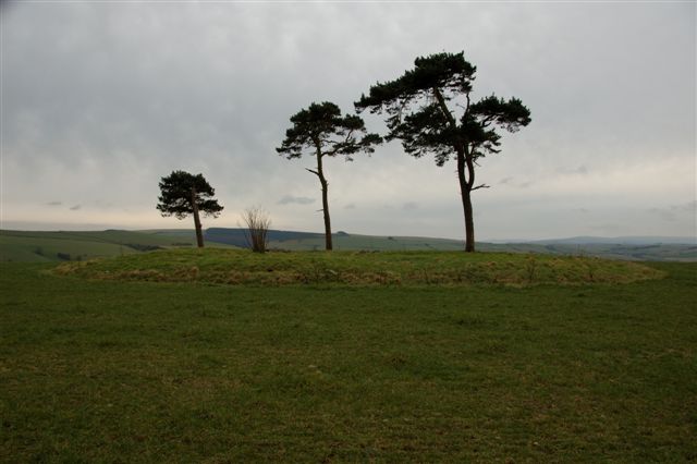
Pen-Y-Wern Hill submitted by TheWhiteRider on 1st Mar 2007. Pen-Y-Wern Stone Circle.
Last visited when there was a field of crops and missed the scale of the mound/cairn.
Sad to find old farm junk still scattered across this site.
(View photo, vote or add a comment)
Log Text: None
Pen-Y-Wern Conglomerate
Date Added: 25th Jun 2012
Site Type: Standing Stone (Menhir)
Country: England (Shropshire)
Visited: Yes on 1st Mar 2007
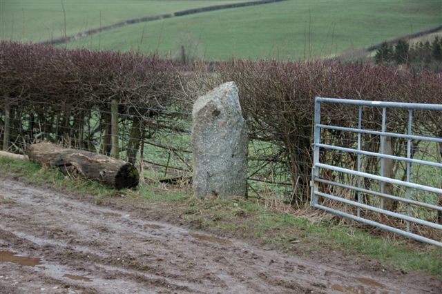
Pen-Y-Wern Conglomerate submitted by TheWhiteRider on 1st Mar 2007. Conglomerate.
(View photo, vote or add a comment)
Log Text: None
Caer Caradoc (Chapel Lawn)
Date Added: 25th Jun 2012
Site Type: Hillfort
Country: England (Shropshire)
Visited: Yes on 1st Mar 2007

Caer Caradoc (Chapel Lawn) submitted by TheWhiteRider on 1st Mar 2007. This view of Caer Caradoc was taken from close to the Pen-Y-Wern Stone Circle. Very impressive, despite a dull day.
(View photo, vote or add a comment)
Log Text: None
Stevenshill
Date Added: 25th Jun 2012
Site Type: Hillfort
Country: England (Shropshire)
Visited: Yes on 22nd Oct 2006
Stevenshill submitted by TheWhiteRider on 22nd Oct 2006. Stevenshill Hillfort. This is the view from the road looking up towards the top of the hill. The lighter area indicates roughly where the interior of the fort would have been. A low bank may still cross this field, but nothing could be discerned. It was described in 1977 as a "wide, much spread bank about 1m high maximum." About a quarter of the width of the image in from the left, on the tree line, is a possible section of remaining scarp bank.
(View photo, vote or add a comment)
Log Text: None
Cove Coppice
Date Added: 25th Jun 2012
Site Type: Barrow Cemetery
Country: England (Shropshire)
Visited: Yes on 22nd Oct 2006
Cove Coppice submitted by TheWhiteRider on 22nd Oct 2006. Cove Coppice. Nothing really to see here but a ploughed field.
The site of Stevenshill Hilfort can be seen as the highest group of trees on the horizon, just right of center.
(View photo, vote or add a comment)
Log Text: None
