Contributory members are able to log private notes and comments about each site
Sites TimPrevett has logged. View this log as a table or view the most recent logs from everyone
Stroudhenge (Gloucestershire)
Date Added: 7th Apr 2025
Site Type: Modern Stone Circle etc
Country: England (Gloucestershire)
Visited: Would like to visit
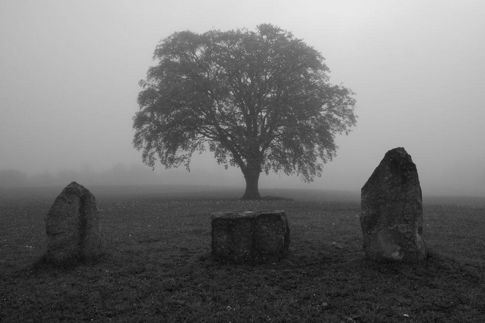
Stroudhenge (Gloucestershire) submitted by AKFisher on 2nd Dec 2024. Stroudhenge Stones with tree. Photo credit: Simon Blackbourn by permission.
(View photo, vote or add a comment)
Camp Barrow
Date Added: 7th Apr 2025
Site Type: Barrow Cemetery
Country: England (Gloucestershire)
Visited: Would like to visit
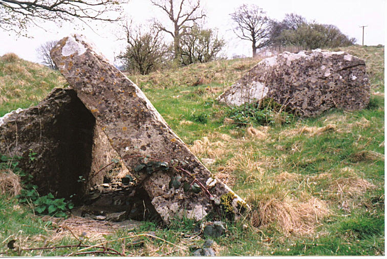
Camp Barrow North submitted by hamish on 23rd Feb 2004. Camp Barrow North - the remains of the Portal. SO914091.Near Bisley.
(View photo, vote or add a comment)
Lypiatt Cross
Date Added: 5th Jan 2025
Site Type: Ancient Cross
Country: England (Gloucestershire)
Visited: Would like to visit
Lypiatt Cross submitted by 4clydesdale7 on 12th Dec 2011. From the road immediately to the NW
(View photo, vote or add a comment)
The Horestone (Sullivan)
Date Added: 2nd Jan 2025
Site Type: Standing Stone (Menhir)
Country: England (Gloucestershire)
Visited: Would like to visit
The Horestone (Sullivan) submitted by 4clydesdale7 on 21st Oct 2011. The Sullivan Horestone/Milestone on the main road by Ridgmont
(View photo, vote or add a comment)
Museo Arqueológico Nacional
Date Added: 16th Jun 2017
Site Type: Museum
Country: Spain (Castilla La Mancha y Madrid)
Visited: Would like to visit

Museo Arqueológico Nacional submitted by thecaptain on 12th May 2007. The entrance to the splendid Spanish National Archaeology Museum, in Madrid.
Taking pictures inside is not encouraged.
(View photo, vote or add a comment)
Knocknarea
Date Added: 26th Apr 2011
Site Type: Passage Grave
Country: Ireland (Republic of) (Co. Sligo)
Visited: Would like to visit
Knocknarea submitted by musasa on 27th Sep 2005.
(View photo, vote or add a comment)
The Dasses
Date Added: 4th Jan 2025
Site Type: Ancient Village or Settlement
Country: Scotland (Midlothian)
Visited: Saw from a distance on 4th Aug 2024. My rating: Condition 1 Ambience 4 Access 3
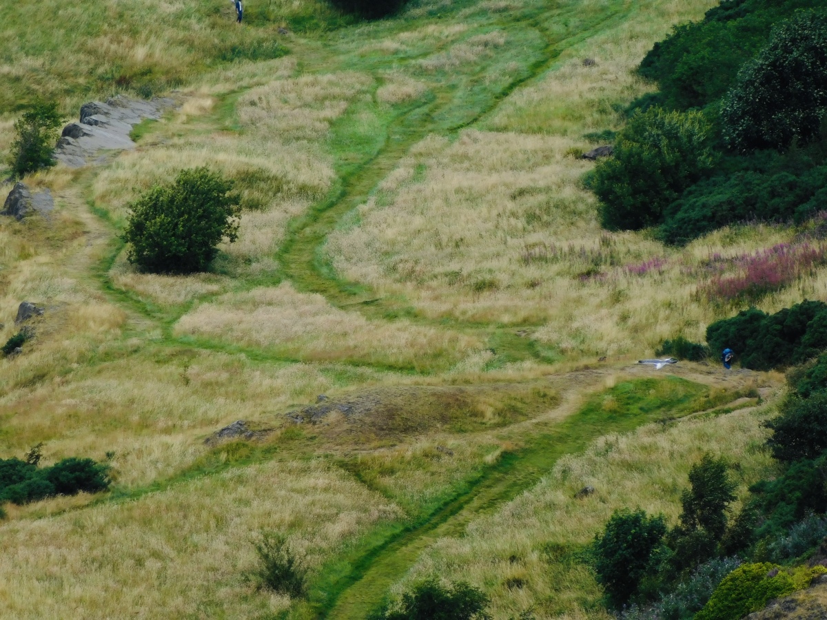
The Dasses submitted by TimPrevett on 4th Jan 2025. Six possible hut circles in this area, see person to the right for scale. The OS map denotes hut circles but the Canmore record becomes increasingly unsure as to their prehistoric origin. Can be seen looking north from Arthur’s Seat.
(View photo, vote or add a comment)
Log Text: The OS map denotes hut circles but the Canmore record becomes increasingly unsure as to their prehistoric origin. Can be seen looking north from Arthur’s Seat.
Randwick Barrows
Date Added: 2nd Mar 2025
Site Type: Round Barrow(s)
Country: England (Gloucestershire)
Visited: Yes on 2nd Mar 2025. My rating: Condition 2 Ambience 4 Access 4
Randwick Barrows submitted by 4clydesdale7 on 20th Jun 2011. The NE Round Barrow of the pair.
(View photo, vote or add a comment)
Log Text: Easily missed unless you’re paying active attention to find them. Only really noticed them in the last month in 16 years of walking past dozens of times. Looks like a “desire path” is forming from the cross dyke past these round barrows.
Randwick Cross Dyke
Date Added: 2nd Mar 2025
Site Type: Misc. Earthwork
Country: England (Gloucestershire)
Visited: Yes on 2nd Mar 2025. My rating: Condition 4 Ambience 4 Access 4
Randwick Cross Dyke submitted by 4clydesdale7 on 20th Jun 2011. The Cross Dyke looking SE from the Cotswold Way.
(View photo, vote or add a comment)
Log Text: Visiting very often over the last couple years, and have been less often over 16 years. today I visited the less visited end, and it’s quite a beauty of a cross dyke. No erosion from pedestrian, animal and wheeled recreation at the southern end. The north end is heavily cut across, and terminates in a very steep drop.
Seven Wells
Date Added: 2nd Mar 2025
Site Type: Holy Well or Sacred Spring
Country: England (Gloucestershire)
Visited: Yes on 2nd Mar 2025. My rating: Condition 4 Ambience 4 Access 5
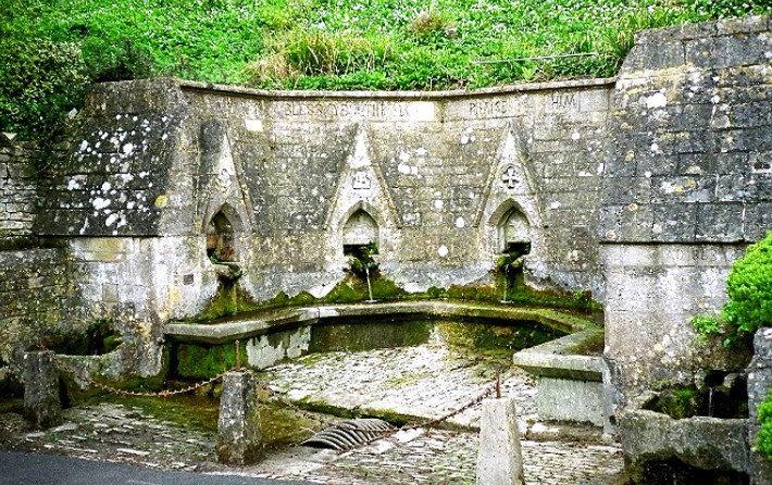
Seven Wells submitted by KiwiBetsy on 6th Dec 2004. Seven Wells is found in the delightful village of Bisley, built into the hillside below All Saint’s Church and graveyard.
A semicircle of five gothic arched recesses account for five wells with the water arising in the hillside being channelled into a shallow stone trough and then down into a subterranean gravel bottomed pool. Two other channels emerge from each end of the structure and their water falls into deeper stone troughs before overflowing and disappearing underground. That mak...
(View photo, vote or add a comment)
Log Text: Seven Wells, Bisley. As the name suggests, seven apertures of water flow into a magnificent presentation on the hillside. A number of older wells to the east still have water flowing. The incongruity is the whole area is hemmed in by parked cars, fabulous for disabled access but makes appreciation more difficult. The churchyard is a peaceful nature reserve too. All a worthwhile visit and a package of fascinating places in the village.
The Giant's Stone (Gloucestershire)
Date Added: 2nd Mar 2025
Site Type: Chambered Cairn
Country: England (Gloucestershire)
Visited: Yes on 2nd Mar 2025. My rating: Condition 2 Ambience 2 Access 3
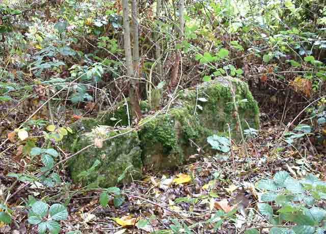
The Giant's Stone (Gloucestershire) submitted by baz on 15th Mar 2004. The Giant's Stone, well hidden in the undergrowth at the corner of a field. GPS: SO 91783 06122.
(View photo, vote or add a comment)
Log Text: From previous photos, it’s less overgrown than many of those - but early spring vegetation was already reaching over the stones. The ambience reflects the condition of the stones’ presentation - but also seeing them on a blue-sky March day.
Little John's Well (Hathersage)
Date Added: 16th Jan 2025
Site Type: Holy Well or Sacred Spring
Country: England (Derbyshire)
Visited: Yes on 22nd Jan 2025. My rating: Condition 3 Ambience 5 Access 3
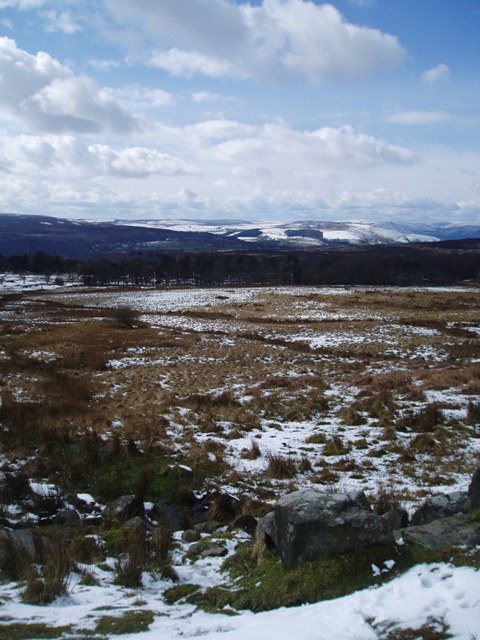
Little John's Well (Hathersage) submitted by HOLYWELL on 26th Mar 2008. The trough of Little John's well Hathersage
(View photo, vote or add a comment)
Log Text: Just adjacent the path, westward facing. Access up from the Longshaw Estate buildings, or down from the main road. Golden Hour here is mind blowingly beautiful, expansive views. The monument itself is ruinous but still very much in evidence, and on this visit the well was flowing vigorously with meltwater still draining from the moors.
Wet Withens
Date Added: 14th Jan 2025
Site Type: Stone Circle
Country: England (Derbyshire)
Visited: Yes on 14th Jan 2025. My rating: Condition 3 Ambience 5 Access 1
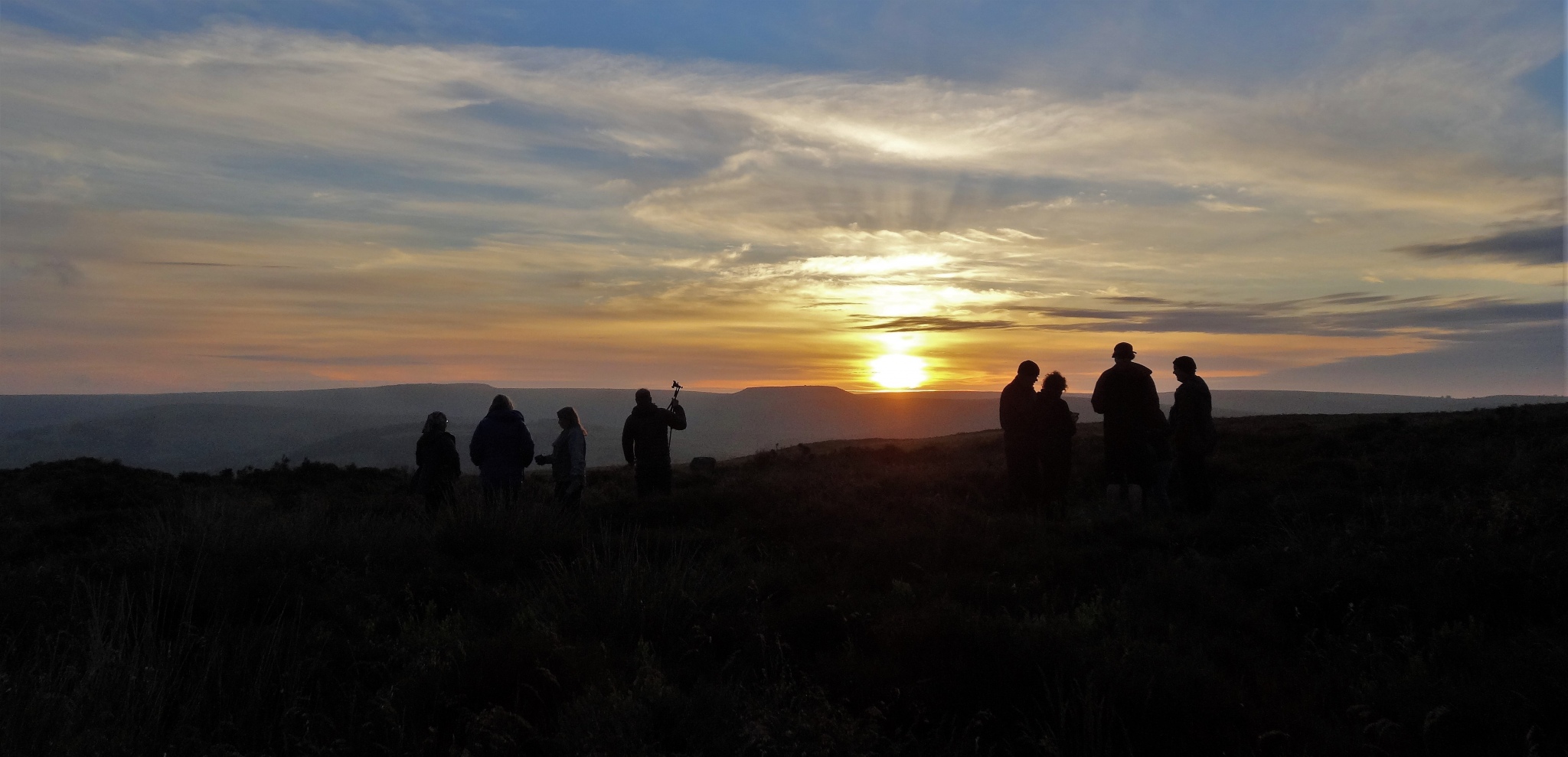
Wet Withens submitted by craig444 on 21st Jun 2021. Wet Withens Solstice Sunrise With a Nice Bunch of Folk
(View photo, vote or add a comment)
Log Text: Nightmare to find if you don’t know! Visited in the last hour of daylight today, thick fog at times. The track which is best used for approaching heavily waterlogged and unavoidably so in places, ankle deep, snowfall melting. Spectacular site, and seem to be able to appreciate it more than the previous visits in June 2010, 2003 and probably late 90s.
Eyam Moor III
Date Added: 14th Jan 2025
Site Type: Stone Circle
Country: England (Derbyshire)
Visited: Yes on 14th Jan 2025. My rating: Condition 1 Ambience 3 Access 3
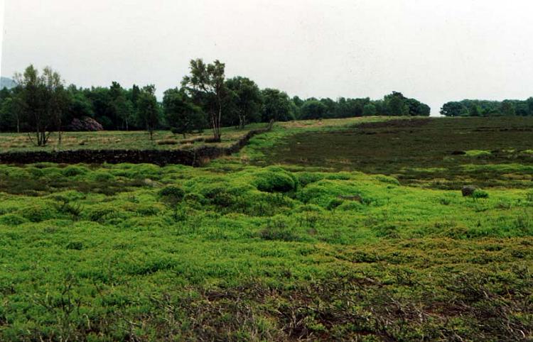
Eyam Moor 3 submitted by PaulM on 31st Aug 2001. General view of Eyam Moor III stone circle. GR:SK232788. Eyam Moor III is quite unusual in that it is one of only five surviving free-standing stone circles in the Peak District. The circle itself is approximately 13m by 12.5m in diameter. There are six stones in total, two of which are recumbent. The stones are of the typical Derbyshire height (up to 0.75m) although the collapsed ones would almost certainly have been taller, perhaps over a metre when standing.In the middle there is a dumbbell-...
(View photo, vote or add a comment)
Log Text: Like Eyam Moor 2, visited after 25 years at least today; one that takes a bit of a hunt. A little further off the path than 2. Could identify one stone, and the large robbed out centre with some cairn material, but very water logged after thawing of snowfall. All carpeted with the growth of Heather, fern and bilberry. The grid ref from the OS app stood inside the circle was SK 23128 78872.
Eyam Moor II
Date Added: 14th Jan 2025
Site Type: Stone Circle
Country: England (Derbyshire)
Visited: Yes on 14th Jan 2025. My rating: Condition 2 Ambience 3 Access 3
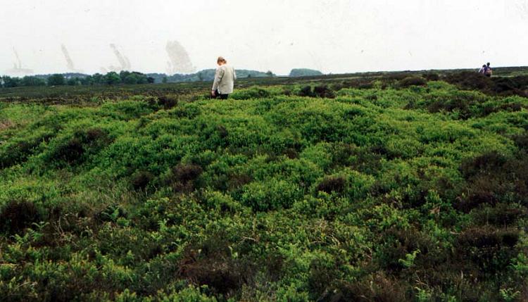
Eyam Moor 2 submitted by PaulM on 31st Aug 2001. General view of Eyam Moor II stone circle. GR:SK231789. Mentioned on several occasions by antiquarians, Eyam Moor II stone circle was only rediscovered in 1983, which is rather surprising considering its close proximity to the well used footpath.This embanked stone circle is now somewhat ruined and submerged. One of the smallest sites of Derbyshire, it is approximately 8m by 7.5m in diameter with only four low stones, ranging in height between 0.15m and 0.3m, set into the bank. The circle is co...
(View photo, vote or add a comment)
Log Text: Visited after 25 years at least today; one that takes a bit of a hunt. The embankment still visible and prominent if you can interpret it in the growth of Heather, fern and bilberry. The grid ref from the OS app stood inside the circle was SK 23163 78964.
Broomhill Barrows
Date Added: 3rd Jan 2025
Site Type: Barrow Cemetery
Country: England (Dorset)
Visited: Yes on 30th Dec 2024. My rating: Condition 2 Ambience 4 Access 2
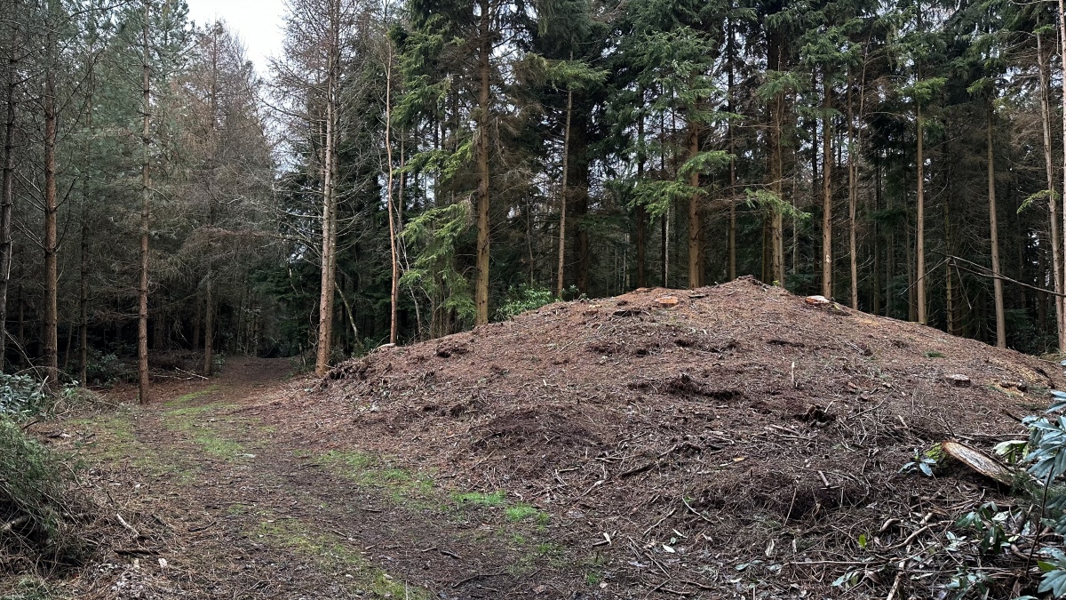
Broomhill Barrows submitted by TimPrevett on 3rd Jan 2025. The tallest, easternmost barrow, just as the track drops downhill heading east towards Bloxworth.
Three surviving round barrows on a spur, following the ridge east from Woodbury Hillfort, near Bere Regis. Situated in dense woodland, the barrows were covered with trees which look to have been cleared during 2024.
The barrows are immediately adjacent the track, and the woods have a very heavy ambience. Quite a walk from Bere Regis or Bloxworth, but very enjoyable.
(View photo, vote or add a comment)
Log Text: A long walk from either Bere Regis or Bloxworth, surprising to find these having been cleared of trees in the middle of dense woodland.
Blacknoll Hill
Date Added: 3rd Jan 2025
Site Type: Barrow Cemetery
Country: England (Dorset)
Visited: Yes on 29th Dec 2024. My rating: Condition 3 Ambience 4 Access 5

Blacknoll Hill submitted by TimPrevett on 8th Jul 2007. Some of the candidates for the six depleted barrows on Blacknoll Hill.
(View photo, vote or add a comment)
Log Text: Extensive vegetation clearance I assume during 2024 makes the barrows far more visible and can be appreciated better.
Woodbury Hill (Dorset)
Date Added: 3rd Jan 2025
Site Type: Hillfort
Country: England (Dorset)
Visited: Yes on 30th Dec 2024. My rating: Condition 3 Ambience 4 Access 4
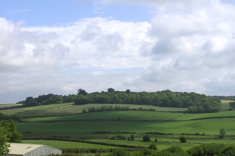
Woodbury Hill (Dorset) submitted by JimChampion on 5th Jun 2005. June 2005. Looking northeast across the Bere valley at Woodbury Hill from Bowcroft Hill. Appropriately for its name the hillfort looks woody, although its interior is under pasture. The hill doesn't look too steep from this angle: it is much more formiddable when viewed from the north and west (from the A31 road).
(View photo, vote or add a comment)
Log Text: Steep approach from the Bere Regis side, down and up steps bisecting a hollow way. View to the ramparts on the south and north, and cracking views from the path to the east from Bere Wood, looking west.
The Horestone (Rodborough)
Date Added: 3rd Jan 2025
Site Type: Standing Stone (Menhir)
Country: England (Gloucestershire)
Visited: Yes on 3rd Jan 2025. My rating: Condition 4 Ambience 4 Access 4
The Horestone (Rodborough) submitted by 4clydesdale7 on 21st Oct 2011. The Davis/Forbes Horestone - 1
(View photo, vote or add a comment)
Log Text: Visited on a bright winter day, the stone is slightly up from what has become a parking bay, well outside the last of the three properties in this cul-de-sac. The laurel seen in photos quite a few years back has been kept from swallowing seeing the stone. 10 digit grid reference from the OS app while leaning on the stone is SO 85742 02389, and I know some find it helpful, what3words is alongside.tame.forgot . The stone is well outside private property boundaries, but nevertheless one feels very conspicuous poking around!
The Bloody Stone
Date Added: 21st Feb 2023
Site Type: Marker Stone
Country: England (Merseyside)
Visited: Yes on 21st Feb 2023. My rating: Condition 2 Ambience 2 Access 5
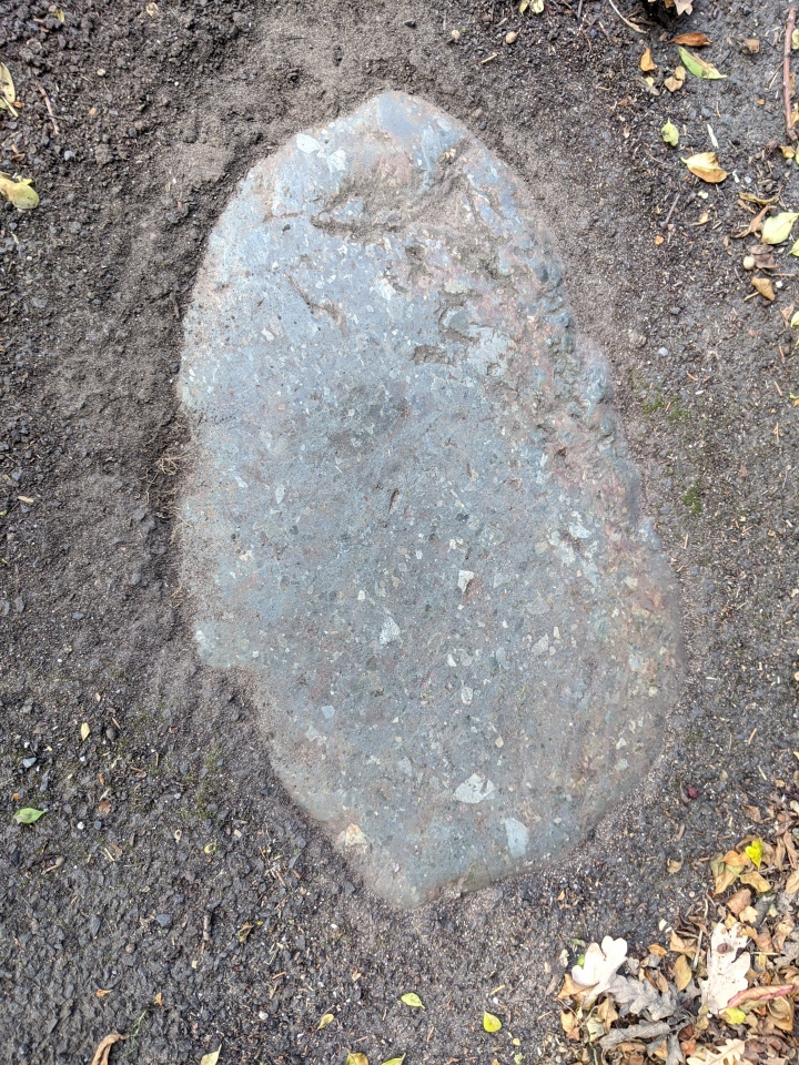
The Bloody Stone submitted by MonumentMen on 21st Sep 2020. The Bloody Stone - as seen tarmacked into the pavement on the Warrington Warrington bound A49 (close to Whitefield Avenue).
Google Maps reference: https://goo.gl/maps/YXYBdk52625zME977
(View photo, vote or add a comment)
Log Text: The adjoining hedge has been trimmed back, so The Bloody Stone is visible on the pavement on the east side of the north part of the bridge and descent over the railway.
