Contributory members are able to log private notes and comments about each site
Sites nddavies has logged. View this log as a table or view the most recent logs from everyone
Meinillwydion Stone Pair
Date Added: 25th Apr 2022
Site Type: Standing Stones
Country: Wales (Carmarthenshire)
Visited: Yes on 1st May 2011
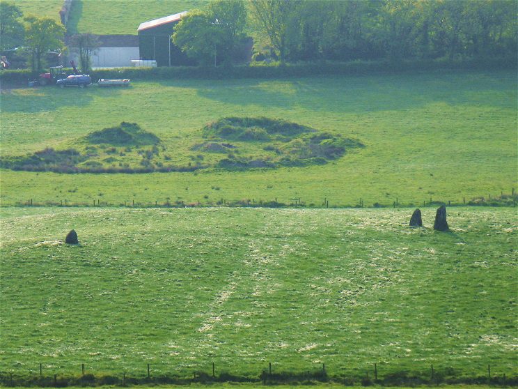
Meinillwydion Stone Pair submitted by nddavies on 1st May 2011. View west into the sunset from the road about 400m east, hence the poor photo quality.
Three stones are visible not two as Coflein describes. The close pair are at the north end. The smaller of these looks about the same size as the third stone at the south end.
Gridreferencefinder confirms that north to south is about 30m as Coflein describes.
(View photo, vote or add a comment)
Log Text: None
Ammanford Gorsedd Stone Circle
Date Added: 25th Apr 2022
Site Type: Modern Stone Circle etc
Country: Wales (Carmarthenshire)
Visited: Yes on 1st May 2011
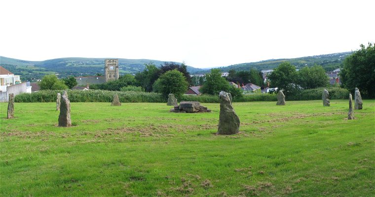
Ammanford Gorsedd Stone Circle submitted by nddavies on 1st May 2011. View of the stone circle looking downhill SSW past the church tower.
(View photo, vote or add a comment)
Log Text: None
Henrhyd Cairns
Date Added: 25th Apr 2022
Site Type: Cairn
Country: Wales (Carmarthenshire)
Visited: Yes on 1st May 2011
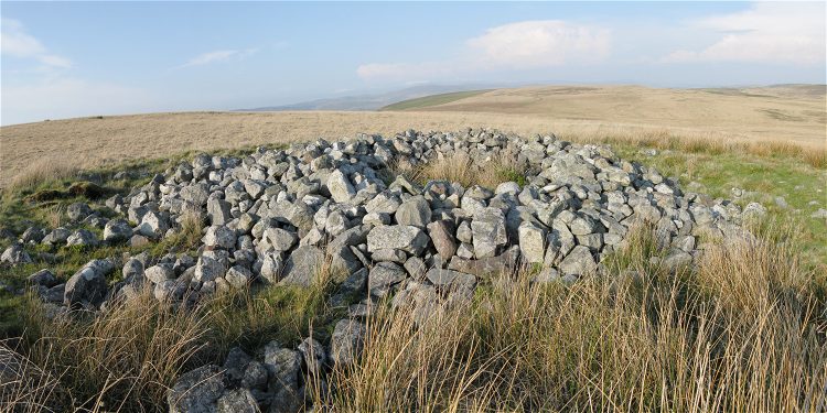
Henrhyd Cairns submitted by nddavies on 1st May 2011. The large cairn of the Henrhyd group. This view is east or northeast, looking down into the hole that has been formed in the middle of the cairn.
(View photo, vote or add a comment)
Log Text: None
Gwempa
Date Added: 1st May 2011
Site Type: Standing Stone (Menhir)
Country: Wales (Carmarthenshire)
Visited: Saw from a distance on 30th Apr 2011

Gwempa submitted by nddavies on 1st May 2011. View north from road to south of field. Zoom shot taken over tall bank and hedge.
(View photo, vote or add a comment)
Log Text: Approached on very narrow road that runs along the south edge of the field. Parking is practically non-existent. Hedge is 6ft high but the bottom is an earth bank that you can just about stand on to see over.
Cilymaenllwyd Stone
Date Added: 30th Apr 2011
Site Type: Early Christian Sculptured Stone
Country: Wales (Carmarthenshire)
Visited: Couldn't find on 30th Apr 2011. My rating: Access 4
Log Text: Absolutely no sign of the stone at coordinates SN47780148 - which is in the middle of a field accessed by a public footpath.
Ffairfach Standing Stone
Trip No.3 Entry No.8 Date Added: 30th Apr 2011
Site Type: Standing Stone (Menhir)
Country: Wales (Carmarthenshire)
Visited: Yes on 28th Apr 2011. My rating: Condition 4 Access 5
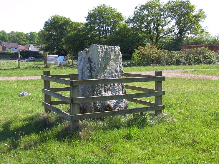
Ffairfach Standing Stone submitted by nddavies on 30th Apr 2011. View southwest, away from Llandeilo towards the back of the car park.
(View photo, vote or add a comment)
Log Text: The stone is also visible at a little distance from a gate at SN 6258 2160 which is in the same field as a public footpath.
Ffynnon Gwenlais
Trip No.3 Entry No.9 Date Added: 30th Apr 2011
Site Type: Holy Well or Sacred Spring
Country: Wales (Carmarthenshire)
Visited: Saw from a distance on 28th Apr 2011. My rating: Access 4
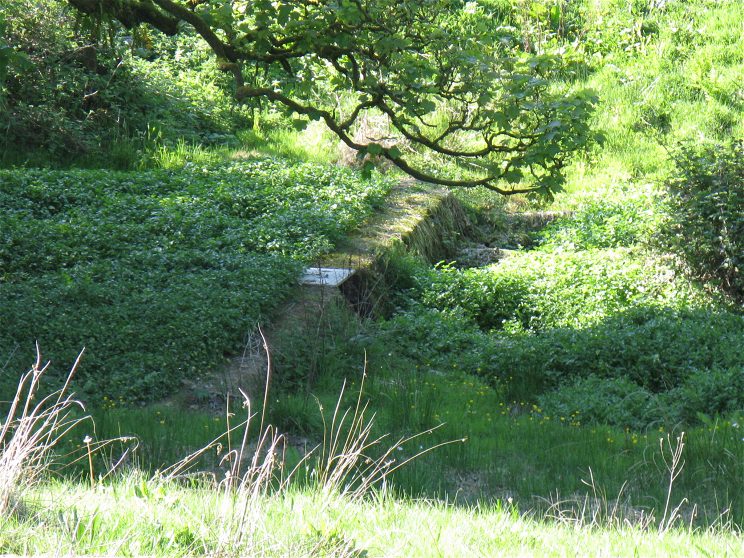
Ffynnon Gwenlais submitted by nddavies on 30th Apr 2011. This is a view from the public road south of the river. The direction is roughly NW.
A concrete dam or weir is visible with a rectangular drain cover in the middle of the top surface. I can't make out how far upstream the spring would be.
(View photo, vote or add a comment)
Log Text: I only viewed the site from the adjacent road. I will submit the photo I took showing some kind of concrete dam with a metal drain.
Access could be quite easy from the field directly to the north since a public right of way passes along its west edge and there is no fence on that farm driveway. No finger posts are present at the location to indicate access though.
I didn't have time to ask permission for a close visit.
Using UK gridref finder I estimate the coords of the weir to be SN60041609
Carregdwfn Round Cairn
Trip No.3 Entry No.7 Date Added: 30th Apr 2011
Site Type: Cairn
Country: Wales (Carmarthenshire)
Visited: Yes on 28th Apr 2011. My rating: Condition 3 Access 3
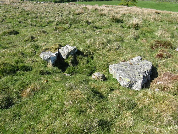
Carregdwfn Round Cairn submitted by nddavies on 29th Apr 2011. The central feature of the cairn with bare stones at the edge of a small depression.
(View photo, vote or add a comment)
Log Text: The cairn site lies in the low part of the col between two small hills.
The centre feature is obvious and there is definitely some kind of circular pattern to the surrounding rocks.
The site can be accessed by first walking along a public footpath on a farm track from the east and then 90m SW along a sheep track over the open hilltop.
Hen Grofft
Trip No.3 Entry No.6 Date Added: 29th Apr 2011
Site Type: Round Barrow(s)
Country: Wales (Carmarthenshire)
Visited: Saw from a distance on 28th Apr 2011
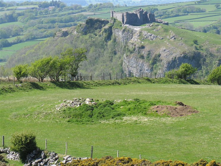
Hen Grofft submitted by nddavies on 29th Apr 2011. A view from the adjacent hill with Carreg Cennen Castle in the background.
(View photo, vote or add a comment)
Log Text: Beautiful view from adjacent hill with Carreg Cennen Castle in the background. Didn't need to enter field.
Y Naw Carreg
Trip No.1 Entry No.1 Date Added: 29th Apr 2011
Site Type: Stone Circle
Country: Wales (Carmarthenshire)
Visited: Yes on 22nd Apr 2011. My rating: Condition 2 Access 4
Log Text: Three stones and the central mound remain in a pasture field. The stones have all fallen. Drainage seems poor - it was a bone dry day but the reeds hint at soggy ground.
Access from the northwest may be problematic. The stile out from the field looked overgrown. Access is easy from the 4-way junction of paths just southeast. Approach this junction from the good paths west or southeast.
See photos on Geograph http://www.geograph.org.uk/photo/2377857 & http://www.geograph.org.uk/photo/2377858
Banc Crucorfod Round Cairn
Trip No.3 Entry No.4 Date Added: 29th Apr 2011
Site Type: Round Cairn
Country: Wales (Carmarthenshire)
Visited: Yes on 28th Apr 2011. My rating: Condition 3 Access 3
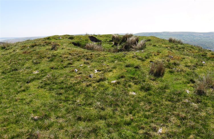
Banc Crucorfod Round Cairn submitted by nddavies on 29th Apr 2011. The grass has grown so smoothly over the crater it looks like an original feature. It's hard to tell where the natural hill stops and the cairn begins.
(View photo, vote or add a comment)
Log Text: The photo is taken from the upland side. There is a wide field of rocks strewn over the downward side but they don't photograph at all well looking down.
I approached from the road to the west but had to cross a low depression. I'd imagine it's easier to approach from the slightly higher road to the north with its closer parking space.
Penyrheolddu Ring Cairn
Trip No.3 Entry No.3 Date Added: 29th Apr 2011
Site Type: Ring Cairn
Country: Wales (Carmarthenshire)
Visited: Yes on 28th Apr 2011. My rating: Condition 1 Access 3
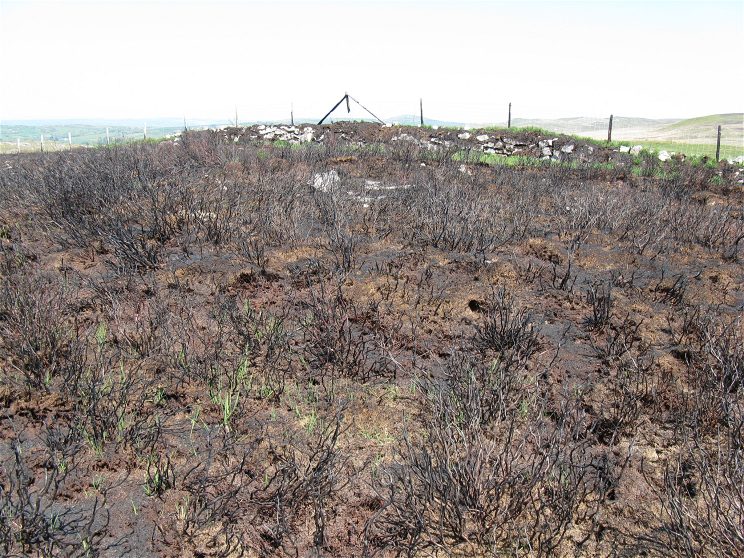
Penyrheolddu Ring Cairn submitted by nddavies on 29th Apr 2011. View to the NNE towards the field boundary.
The combination of tall gorse and a recent fire make it hard to discern any features but this is the indicated general location between the two standing stones.
(View photo, vote or add a comment)
Log Text: It's tempting to believe these three adjacent features (Standing stone in wall; Cairn; Recumbent standing stone) are all related since the two stones appear to have been on opposite sides of the cairn.
I couldn't really confirm the presence on the cairn. There was a vague raised circle of gorse growth but the charred stalks from the recent arson/stubble burning aren't helping matters
The site can be seen from the field boundary with open common land to the NE but actually lies within enclosed land. There is no particular footpath across the rough grazing common but it is just a few hundred metres walk from the road across the common to this part of the boundary.
Penyrheolddu Standing Stone
Trip No.3 Entry No.2 Date Added: 29th Apr 2011
Site Type: Standing Stone (Menhir)
Country: Wales (Carmarthenshire)
Visited: Yes on 28th Apr 2011. My rating: Condition 3 Access 3
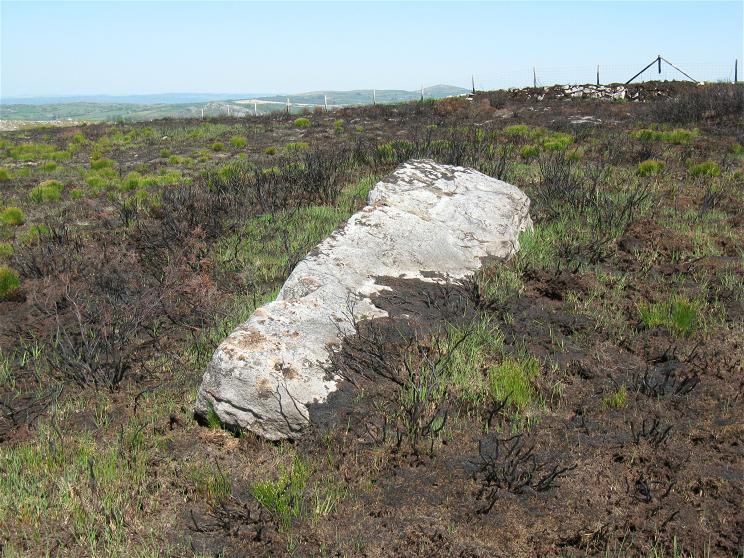
Penyrheolddu Standing Stone submitted by nddavies on 29th Apr 2011. Recumbent standing stone viewed from narrow tip towards base. Direction NNE.
(View photo, vote or add a comment)
Log Text: It's tempting to believe these three adjacent features (Standing stone in wall; Cairn; Recumbent standing stone) are all related since the two stones appear to have been on opposite sides of the cairn.
The stone can be seen from the field boundary with open common land to the NE but actually lies within enclosed land. There is no particular footpath across the rough grazing common but it is just a few hundred metres walk from the road across the common to this part of the boundary.
Recent arson/stubble burning means the site is a little unpleasant today.
The text of the Coflein entry is wrong in that both at the actual location, and according to Coflein's own coordinates the recumbent stone is actually WSW of the wall stone.
Pen-y-Coed Maen Hir
Trip No.3 Entry No.1 Date Added: 29th Apr 2011
Site Type: Standing Stone (Menhir)
Country: Wales (Carmarthenshire)
Visited: Yes on 28th Apr 2011. My rating: Condition 3 Access 3
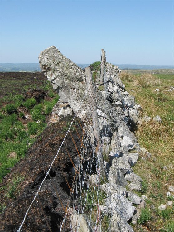
Pen-y-Coed Maen Hir submitted by nddavies on 29th Apr 2011. A view along the field boundary looking NW. Open land is to the right, enclosed land is to the left.
The stone stands quite proud of the wall but the rise of the land in the background is lessening the effect.
(View photo, vote or add a comment)
Log Text: It's tempting to believe these three adjacent features (Standing stone in wall; Cairn; Recumbent standing stone) are all related since the two stones appear to have been on opposite sides of the cairn.
This stone can be accessed from open common land across a few hundred metres of rough grazing from a nearby road.
