Contributory members are able to log private notes and comments about each site
Sites stonetracker has logged. View this log as a table or view the most recent logs from everyone
Shiloh Indian Mounds
Date Added: 9th Apr 2024
Site Type: Ancient Village or Settlement
Country: United States (The South)
Visited: Yes on 1st Apr 2024. My rating: Condition 4 Ambience 5 Access 4

Shiloh Indian Mounds submitted by AKFisher on 2nd Aug 2023. Burial mound at the Shiloh, Tennessee mound complex & village area. The complex is dated to AD 1200.
Photo courtesy Dr Greg Little, author of the Illustrated Encyclopedia of Native American Indian Mounds & Earthworks (2016).
(View photo, vote or add a comment)
Log Text: The mound site is very compact and easily accessible along a National Park Service road or via a foot trail. Park at either the Shiloh Indian Mounds Visitor Kiosk or in a paved pullout area next to Mound F. The latter is the closest to the mound and plaza complex itself and most of the mounds are within a several hundred yard radius.
Pinson Mounds State Archaeological Park
Date Added: 12th Apr 2024
Site Type: Artificial Mound
Country: United States (The South)
Visited: Yes on 1st Apr 2024. My rating: Condition 3 Ambience 5 Access 3

Pinson Mounds - Sauls Mound submitted by symbionspacesuit on 14th Feb 2010. Sauls Mound (Mound 9)
(View photo, vote or add a comment)
Log Text: Visited the Central or Inner section only. There's a lot to see here in this section alone if you include all of the mounds, habitation areas, other non-mound sites. It took me 3 hrs just to cover all of the Central area not including the museum. Most features with some exceptions are accessible via paved walkways so disabled access is good. Quite a bit of walking involved to see it all, and limited parking sites. The museum lot is the best base to start from for the Central area.
I will cover the western and eastern areas in a subsequent visit.
Pinson Mounds - Sauls Mound
Date Added: 12th Apr 2024
Site Type: Artificial Mound
Country: United States (The South)
Visited: Yes on 1st Apr 2024. My rating: Condition 4 Ambience 5 Access 3

Pinson Mounds - Sauls Mound submitted by symbionspacesuit on 14th Feb 2010. Sauls Mound (Mound 9)
(View photo, vote or add a comment)
Log Text: See main Pinson Mounds article for visit information
Pinson Mounds - Other Sites
Date Added: 19th Apr 2024
Site Type: Artificial Mound
Country: United States (The South)
Visited: Yes on 1st Apr 2024. My rating: Condition 3 Ambience 4 Access 3
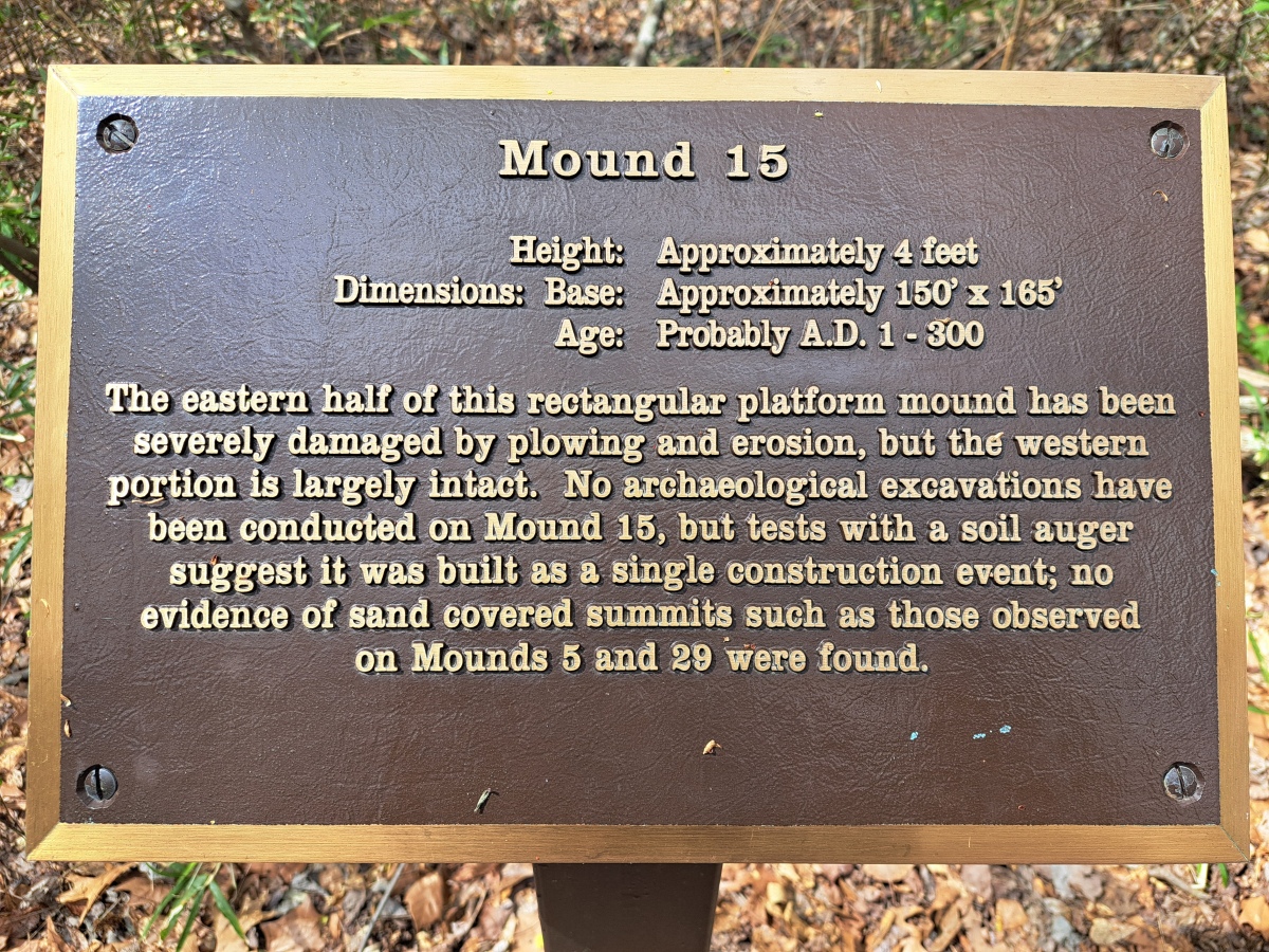
Pinson Mounds - Other Sites submitted by stonetracker on 24th Apr 2024. Mound 15 interpretation
(View photo, vote or add a comment)
Log Text: See Pinson Mounds main page for my visitor log comments.
Owl Creek
Date Added: 7th Dec 2024
Site Type: Artificial Mound
Country: United States (The South)
Visited: Yes on 1st Dec 2024. My rating: Condition 3 Ambience 4 Access 5
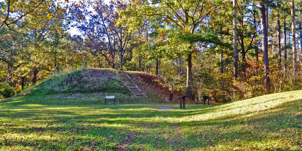
Owl Creek submitted by Creative Commons on 6th Jan 2019. Owl Creek Mounds The five Mississippian period platform mounds at this site were built between 1100 and 1200 A.D. The U.S. Forest Service owns two of the mounds including the largest 17-foot-high Mound I. Both are open to public visitation. Archeological excavations conducted at the site in 1991-1992 by Mississippi State University revealed the foundation remains of a ceremonial temple or elite residence that once stood atop Mound
www.nps.gov/nr/travel/mounds/owl.htm ...
(View photo, vote or add a comment)
Log Text: Site is as described. The portion managed by the Forest Service contains two extant mounds, including Mound 1 the largest in the group. Mound 1 is pretty close to its original rectangular platform shape. The adjacent Mound 2 looks like it has been damaged by plowing but still quite visible. I was unable to find any obvious evidence of the remaining 3 mounds across the street.
There is a parking lot right next to Mound 2 and Mound 1 is a very short distance away.
Bynum
Date Added: 7th Dec 2024
Site Type: Barrow Cemetery
Country: United States (The South)
Visited: Yes on 1st Dec 2024. My rating: Condition 3 Ambience 4 Access 4

Bynum submitted by bat400 on 6th Sep 2012. Bynum Mounds and Village site. There were originally six burial mounds (the smaller ones much eroded by the plow.) All six were fully excavated and the two largest mounds were reconstructed .
Photo by bat400, Oct 2011.
(View photo, vote or add a comment)
Log Text: Bynum is one of a half dozen or so mound sites spread out along the Natchez Trace, an ancient animal, Native American, and Euro American trail (now a highway) that traverses much of the state of Mississippi and parts of Alabama and Tennessee. The Trace is managed by the National Park Service. Commercial and residential development is prohibited within roughly several hundred yards east and west of the route, resulting in a forever wild strip of land that runs for over 300 miles through the Deep South part of the US.
Access to Bynum is via a short circular driveway that runs to the east at about mile marker 232.4 of the Trace. The two remaining mounds are easily viewed at a distance from the parking area, but I believe a paved walkway gets very close to the mounds. So it's accessible to the mobility impaired. .
Nabers Mound Cemetery Site
Date Added: 16th Dec 2024
Site Type: Artificial Mound
Country: United States (The South)
Visited: Yes on 1st Dec 2024. My rating: Condition 4 Ambience 4 Access 4

Nabers Mound Cemetery Site submitted by AKFisher on 25th Aug 2023. Obscure Mounds: "Nabors Mound Cemetery Mound" next to a golf course in Amory, Mississippi. Dated to AD 100.
Photo courtesy Dr Greg Little, author of the Illustrated Encyclopedia of Native American Indian Mounds & Earthworks (2016).
(View photo, vote or add a comment)
Log Text: A well-preserved Middle Woodland mound that was later used as a 19th to 20th century cemetery, no doubt benefiting its good condition. The property was acquired by the Archaeological Conservancy recently and it abuts a golf course development.
It's in a residential subdivision but on-street parking is not a problem and you can walk right up the mound. The mound is maybe 100 ft from the road, so the mobility-impaired can easily view it from a vehicle.
Bear Creek
Date Added: 19th Dec 2024
Site Type: Ancient Village or Settlement
Country: United States (The South)
Visited: Yes on 1st Dec 2024. My rating: Condition 4 Ambience 4 Access 4
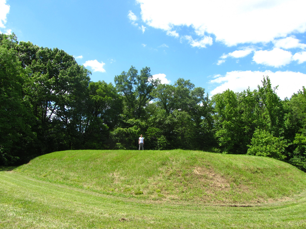
Bear Creek submitted by Flickr on 6th Jan 2019. Kristen for scale, Bear Creek mound Image copyright: alfred.crabtree (Alfred Crabtree), hosted on Flickr and displayed under the terms of their API.
(View photo, vote or add a comment)
Log Text: A very small Mississippian mound and village site on the Natchez Trace, right over the MS/AL line in MS.
There is a large parking area with some limited interpretation. There is only a single rectangular platform mound about 200 ft from the lot. For mobility-impaired visitors, the mound and village area can be easily seen from the parking area.
Pinson Mounds - Mound 28
Date Added: 22nd Dec 2024
Site Type: Artificial Mound
Country: United States (The South)
Visited: Yes on 1st Dec 2024. My rating: Condition 4 Ambience 4 Access 4

Pinson Mounds - Mound 28 submitted by symbionspacesuit on 14th Feb 2010. Mound 28
(View photo, vote or add a comment)
Log Text: Part of the Eastern Section of Pinson Mounds State Archaeological Park in Pinson TN. The state park hosts what is likely the largest Middle Woodland mound site in the US. An extensive trail system in the Eastern Section links Mounds 28, 29, 30 and the Eastern Citadel.
The easiest access point for this trail system is in the Group Lodge Area, which hosts a large parking lot with a trailhead and restroom facilities. The Group Lodge Area is on the left about 0.4 miles beyond the state park entrance gate. The Outer Loop trail heads east from there to Mound 28 and the other Eastern Section features.
Pinson Mounds - Mound 29
Date Added: 26th Dec 2024
Site Type: Artificial Mound
Country: United States (The South)
Visited: Yes on 1st Dec 2024. My rating: Condition 4 Ambience 4 Access 2
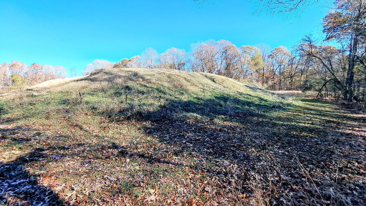
Pinson Mounds - Mound 29 submitted by stonetracker on 25th Dec 2024. Mound 29 from the SE side. The eastern edge of the circular enclosure is on the right side of the photo behind the tree line.
(View photo, vote or add a comment)
Log Text: A Middle Woodland rectangular platform mound in decent shape.
To get there, be prepared for a long-ish but mostly flat walk (from the Group Lodge parking area, it is about 1.5 miles round trip). First, see the visitor logs for trail access to Mound 28 and from there to the north wall of the Eastern Citadel. Once at the northern side of the enclosure, follow the wall about 300 ft east to an obvious gap with trail signage. Follow that trail south for 100-200 yds. Mound 29 will be directly ahead and obvious.
Pinson Mounds - Twin Mounds
Date Added: 29th Dec 2024
Site Type: Artificial Mound
Country: United States (The South)
Visited: Yes on 1st Dec 2024. My rating: Condition 3 Ambience 4 Access 3

Pinson Mounds - Twin Mounds submitted by davidmorgan on 30th Aug 2017. The Pinson Twin Mounds.
(View photo, vote or add a comment)
Log Text: From archaeological standpoint, an important twin burial mound site at Pinson in the Western Section.
To get there, park at the lot for Ozier Mound (see that visitor log for directions). Walk west a short distance to the south side of Ozier where there is a trail junction. Take that trail approximately 300 yards south through a field to Twin Mounds, which lie at the edge of the woods.
Windsor Mounds
Date Added: 1st Mar 2025
Site Type: Artificial Mound
Country: United States (The South)
Visited: Yes on 1st Feb 2025. My rating: Condition 3 Ambience 5 Access 3
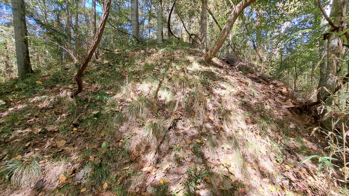
Windsor Mounds submitted by stonetracker on 19th Nov 2023. Mound A, the tallest. Site is very overgrown except in winter, so I had to approach closer than usual to get the shot. However it is only steps away from the parking area.
There are three other smaller mounds, all of them a hike, which I'll try on the next visit.
There was evidence uncovered of Mississippian occupation and artifacts on both Mounds A and B, plus later modern damage due to house and barn construction in the late 1700s. .
(View photo, vote or add a comment)
Log Text: Returned to this site and definitively located Mounds B and C (see photos and videos). Mound D is nearly indistinct in a large mowed field but fairly sure I found it based on earlier survey maps. D is located next to a field road several 100 yds south and east of Mound A. C is another 100-200 yds east of D, and is easily identified by its historic cemetery. Both are easy flat walks.
Mound B is a 100-200 yd bushwhack northeast of Mound A and north of Rodney Rd. Although there is no trail, it is an easy open walk in low vegetation seasons.
Refuge Mounds
Date Added: 3rd Mar 2025
Site Type: Artificial Mound
Country: United States (The South)
Visited: Saw from a distance on 1st Feb 2025. My rating: Condition 3 Ambience 4
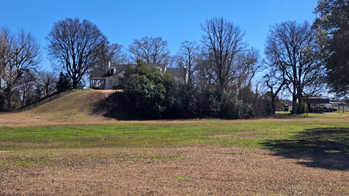
Refuge Mounds submitted by stonetracker on 2nd Mar 2025. The single remaining mound at Refuge, with a house on top.
(View photo, vote or add a comment)
Log Text: A much-studied Mississippian period mound site, but not on the official Mississippi Mound Trail. A house was built on the one remaining rectangular platform mound so the site is private. Unfortunately parking safely along busy Rte 454 is a challenge as there are no good pulloffs and a narrow shoulder. I found a somewhat wider section, parked there, and walked 100 yds to a point opposite the site for photos. The mound is 100-200 yds south of the modern road and close to the Mississippi River.
Pinson Mounds - Eastern Citadel
Date Added: 23rd Dec 2024
Site Type: Misc. Earthwork
Country: United States (The South)
Visited: Yes on 1st Dec 2024. My rating: Condition 3 Ambience 5 Access 2

Pinson Mounds - Eastern Citadel submitted by symbionspacesuit on 3rd Mar 2010. William Myer's map of the Eastern Citadel.
(View photo, vote or add a comment)
Log Text: For parking and trailhead access, see Pinson Mounds - Mound 28.
This is a large (semi) circular earthen enclosure in the Eastern Section of Pinson. It surrounds Mound 29, and Mound 30 lies just outside of and SE of the enclosure. The diameter of the semi-circular enclosure is 366 m and it encompasses approximately 6 square km. The northern and western sides are largely intact, whereas the eastern and southern parts are eroded and fragmented.
To get to the northern section of the enclosure from Mound 28, follow the Outer Loop trail south for about 0.15 mile to a side trail on the left. The side trail leads to an obvious embankment and gap in about 500 ft.
Pharr Mounds
Date Added: 20th Dec 2024
Site Type: Artificial Mound
Country: United States (The South)
Visited: Yes on 1st Dec 2024. My rating: Condition 3 Ambience 5 Access 2

Pharr submitted by bat400 on 6th Sep 2012. Panorama of all the mounds visible from the ridge of the Natchez Trace, overlooking the site.
Photo by bat400, October 2011.
(View photo, vote or add a comment)
Log Text: This is a large Middle Woodland site of 8 conical or rounded mounds spread out over a 80-90 acre field. It is located at milepost 286 of the Natchez Trace in MS, on the north bound side of the highway. The mounds today range in height from 2 to 18 ft. Generally speaking, the tallest mounds are closest to the road. Four mounds were either partially or fully excavated in the 1960s by the NPS.
There is a large car park overlooking the site, complete with interpretation and rest rooms. Although 4-5 mounds can be seen from the lot, they are a considerable distance away so binoculars are helpful. Trails interconnect many of the mounds, but there is a fair amount of walking involved. A circuit of Mounds A-D, the four closest, was just under a mile including the return trip to the parking area. I did not visit the others.
Pinson Mounds - Mound 30
Date Added: 24th Dec 2024
Site Type: Artificial Mound
Country: United States (The South)
Visited: Yes on 1st Dec 2024. My rating: Condition 3 Ambience 4 Access 2
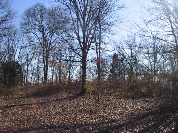
Pinson Mounds - Mound 30 submitted by symbionspacesuit on 3rd Mar 2010. Mound 30 from the north.
(View photo, vote or add a comment)
Log Text: This is classified as Middle Woodland rectangular platform mound lying just to the SE and outside of the Eastern Circular Enclosure. However, you would never know, as it has suffered much erosion over the centuries.
To get there, be prepared for a long-ish but mostly flat walk (from the Group Lodge parking area, it is about 1.6 miles round trip). First, see the visitor logs for trail access to Mound 28 and from there to the north wall of the Eastern Citadel. Once at the northern side of the enclosure, follow the wall about 300 ft east to an obvious gap with trail signage. Follow that trail into the enclosure south past Mound 29. Here the enclosure embankment is nearly flat and Mound 30 is visible about 300-400 ft SE of Mound 29.
Pinson Mounds - Ozier Mound
Date Added: 26th Dec 2024
Site Type: Artificial Mound
Country: United States (The South)
Visited: Yes on 1st Dec 2024. My rating: Condition 3 Ambience 4 Access 4

Pinson Mounds - Ozier Mound submitted by symbionspacesuit on 14th Feb 2010. Ozier (Mound 5)
(View photo, vote or add a comment)
Log Text: Ozier Mound (Mound 5) is one of several sites in the Western Section of the park. It is a rectangular platform mound, second in height only to Sauls' Mound.
Getting there is a bit obscure due to lack of signage. The easiest way is from Route 197 outside the park. Follow Route 197 east and look for the Pinson Reforestation Complex sign, which is about a mile west of the park entrance. Take a right and head south about a half mile to a dirt parking lot. There is a kiosk here with a trailhead that leads west in 100-200 yards to a very large, obvious Mound.
If you are within the park, follow the one way loop road nearly to the park exit. About 100 yds before the exit, take the dirt road on the left (unsigned and easy to miss) and follow it back about a mile south and west past a maintenance area to the dirt parking lot and trail head referenced above.
Mayersville Mounds
Date Added: 4th Mar 2025
Site Type: Artificial Mound
Country: United States (The South)
Visited: Saw from a distance on 1st Feb 2025. My rating: Condition 3 Ambience 2
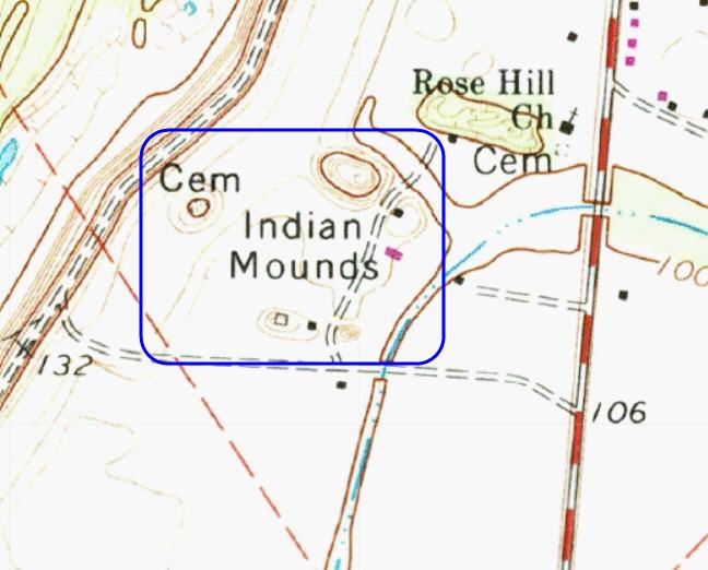
Mayersville Mounds submitted by stonetracker on 4th Mar 2025. Topo of the mound site. The five remaining mounds are all within the blue rectangle. The highest I believe is Mound A, although I have yet to see a map with mound IDs labeled.
(View photo, vote or add a comment)
Log Text: This site, a major Mississippian mound complex, was a disappointment due to access problems. It's all private roads to my knowledge, set well back from the main highway, and a number of the mounds are tree covered and obscured from a distance. The upshot is I didn't have time to knock on doors and get permission so maybe next time?
I did get a poor photo of what I think is the largest Mound A from the cemetery of a nearby church on State Route 1, which I'll post for what it's worth. The location coordinates given in the general description are for the same mound.
DePrato Mounds
Date Added: 5th Mar 2025
Site Type: Artificial Mound
Country: United States (The South)
Visited: Yes on 1st Feb 2025. My rating: Condition 2 Ambience 3

DePrato Mounds submitted by AKFisher on 5th Aug 2023.
Deprato Mounds in Louisiana. There are 5 barely distinguishable mounds there as so much sediment from flooding has covered them. It was the center of a large village established around AD 600.
Photo courtesy Dr Greg Little, author of the Illustrated Encyclopedia of Native American Indian Mounds & Earthworks (2016).
(View photo, vote or add a comment)
Log Text: Like many Louisiana mound sites, this site is on private land near a residential tract. It is just north of busy US Highway 84. There is no off-road parking area, so you must park on the shoulder of the highway and view it from there. It originally consisted of five mounds, but only three are barely discernable due to centuries of river flooding and sediment buildup. One was destroyed for highway construction and a house was built on the other, leveling it in the process. It is on the Louisiana Ancient Mounds Trail, so the state erected an interpretive sign near the site.
Frogmore Mound
Date Added: 5th Mar 2025
Site Type: Artificial Mound
Country: United States (The South)
Visited: Yes on 1st Feb 2025. My rating: Condition 3 Ambience 4 Access 5
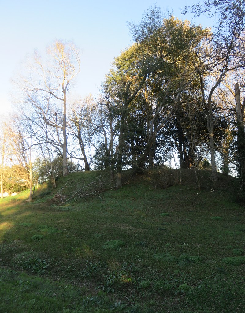
Frogmore Mound submitted by Andy B on 1st Nov 2019. Frogmore Mound (Frogmore, Louisiana) Frogmore, Louisiana is located between Ferriday and Jonesville in western Concordia Parish. It is noteworthy as the site of a series of ancient Native American earthworks (dating to 700-1200 AD) and the Frogmore Plantation, which dates to 1843. Both sites, along with the nearby historic Piazza Cotton Gin, are listed on the National Register of Historic Places. Image copyright: courthouselover, hosted on Flickr and displayed under the terms of their API.
(View photo, vote or add a comment)
Log Text: Like DePrato, Frogmore is on private property fronting Route 84, but in this case there is a convenient side street (Frogmore Plantation Rd) with a reasonable shoulder leading to a residential subdivision. I was able to pull slightly off the side street and park 100 ft from the mound.
