Contributory members are able to log private notes and comments about each site
Sites theCAptain has logged. View this log as a table or view the most recent logs from everyone
Long Meg
Date Added: 4th Aug 2023
Site Type: Standing Stone (Menhir)
Country: England (Cumbria)
Visited: Yes on 20th Sep 2022. My rating: Condition 4 Ambience 4 Access 4

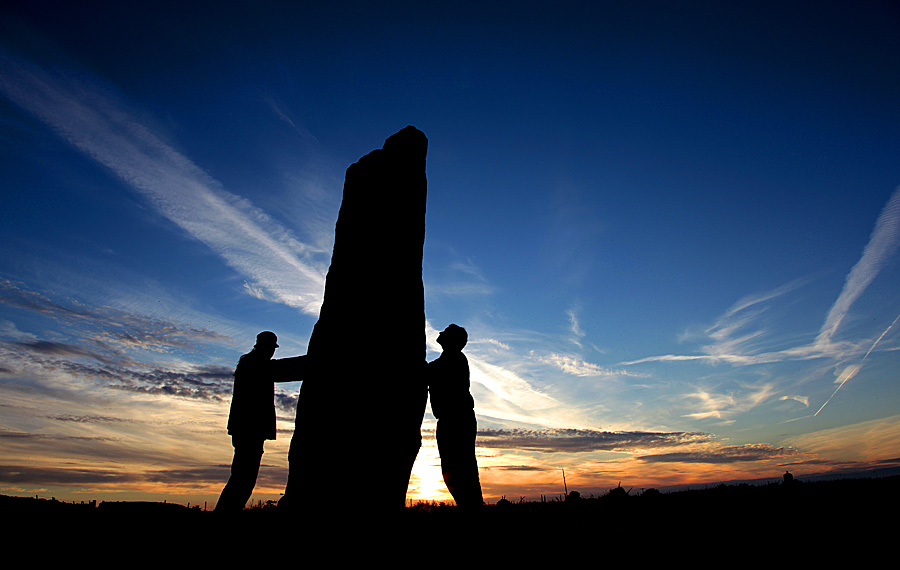
Long Meg submitted by JanF on 22nd Jun 2010. Long Meg (and her daughters) Stone Circle, Cumbria UK, is a magical place.. I watched the sunset on this special day in memory of my loved one.. Many others were here with me.. Complete strangers, but yet close friends..
(View photo, vote or add a comment)
Log Text: Before heading east over the Pennines, I have time to go and visit Long Meg. A new car park has been made which is well signposted, which leaves a 500 metre walk to the stone circle. I start my visit with Long Meg itself, as there are a few other people here who go the other way. What a lovely stone, standing proud overlooking the circle with its spirals and of course the face of Long Meg herself.
Long Holcombe (S)
Date Added: 18th Sep 2010
Site Type: Standing Stone (Menhir)
Country: England (Somerset)
Visited: Yes on 13th Apr 2007
Long Holcombe (S) submitted by thecaptain on 13th Apr 2007. When I eventually found the stone, which is almost lost among the long grass, it is only about 18 inches high, and it leans to the south, uphill.
I came to the conclusion that this stone is perhaps the last remaining stone of what was originally a stone setting of some kind, and that there was probably further stones in amongst the moor grass at one time.
(View photo, vote or add a comment)
Log Text: None
London Stone
Date Added: 29th Oct 2019
Site Type: Marker Stone
Country: England (Greater London)
Visited: Yes on 24th Nov 2013

London Stone submitted by theCaptain on 24th Nov 2013. I struggled to find The London Stone at first, not helped by looking for it at No 110, instead of No 111, and asked several people of its whereabouts, but nobody knew... Then by looking where I was expecting to find it, and walking the street a couple of times, my Dad said "whats this, is this it?"
Have to say its not quite what I was expecting, and is very disappointing, and not only just about impossile to see from outside, covered off from inside now.
Still, its still there, and I...
(View photo, vote or add a comment)
Log Text: None
Lockeridge Grey Wethers
Date Added: 8th Oct 2020
Site Type: Natural Stone / Erratic / Other Natural Feature
Country: England (Wiltshire)
Visited: Yes on 25th Jul 2002. My rating: Condition 3 Ambience 3 Access 4
Lockeridge Grey Wethers submitted by Wolfie on 19th Sep 2003. Natural sarsen stones
(View photo, vote or add a comment)
Log Text: None
Loanhead Of Daviot
Date Added: 29th Oct 2019
Site Type: Stone Circle
Country: Scotland (Aberdeenshire)
Visited: Yes on 3rd Aug 2017

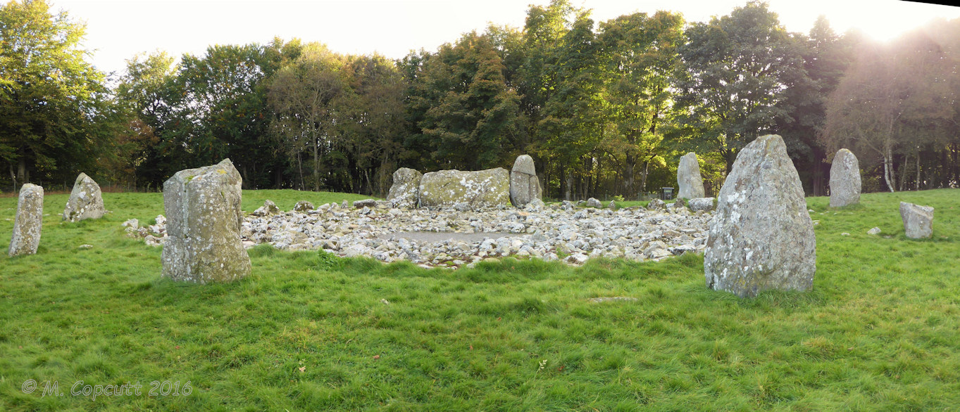
Loanhead Of Daviot submitted by TheCaptain on 3rd Aug 2017. The circle is well presented and kept tidy, the outer circle of large stones almost completely filled with a covering of small stones, presumably the remains of a cairn.
(View photo, vote or add a comment)
Log Text: None
llech Idris
Date Added: 29th Oct 2019
Site Type: Standing Stone (Menhir)
Country: Wales (Gwynedd)
Visited: Yes on 16th Jun 2017
llech Idris submitted by TheCaptain on 16th Jun 2017. Approaching the stone. The view up the valley is super, with lots of people out mountain biking and a farmer out with his dogs rounding up sheep.
(View photo, vote or add a comment)
Log Text: None
Llanvaches 2
Date Added: 18th Sep 2010
Site Type: Round Barrow(s)
Country: Wales (Monmouthshire)
Visited: Yes on 31st Mar 2004

Llanvaches 2 submitted by TheCaptain on 31st Mar 2004. Llanvaches - Round Barrows, Wentwood Forest, Monmouthshire, ST417946
View of the larger of the two barrows within Wentwood Forest.
(View photo, vote or add a comment)
Log Text: None
Llanrhidian Upper Stone
Date Added: 29th Oct 2019
Site Type: Standing Stone (Menhir)
Country: Wales (West Glamorgan)
Visited: Yes on 9th Jun 2013
Llanrhidian Upper Stone submitted by theCaptain on 9th Jun 2013. Tall stone standing high up on the village green at Llanrhidian, above the track to the church.
It stands about 2 m tall, and is quite wide, but very thin. I'ts downhill companion seems much more "real"!
(View photo, vote or add a comment)
Log Text: None
Llanrhidian Lower Stone
Date Added: 29th Oct 2019
Site Type: Standing Stone (Menhir)
Country: Wales (West Glamorgan)
Visited: Yes on 11th Jun 2013

Llanrhidian Lower Stone submitted by TheCaptain on 11th Jun 2013. Llanrhidian Lower Stone showing its position on the village green.
Site in West Glamorgan Wales
(View photo, vote or add a comment)
Log Text: None
Llanfihangel Rogiet
Date Added: 18th Sep 2010
Site Type: Standing Stone (Menhir)
Country: Wales (Monmouthshire)
Visited: Yes on 1st Apr 2004

Llanfihangel Rogiet submitted by TheCaptain on 1st Apr 2004. Llanfihangel Rogiet, Standing Stone in Monmouthshire, ST445878
Nice view of the stone from the northeast in a setting sun.
(View photo, vote or add a comment)
Log Text: None
Livernon quarry
Trip No.203 Entry No.138 Date Added: 10th Apr 2020
Site Type: Ancient Mine, Quarry or other Industry
Country: France (Midi:Lot (46))
Visited: Yes on 24th May 2005. My rating: Access 4

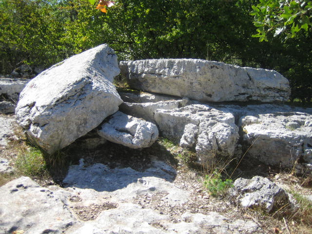
Livernon quarry submitted by MichelDRN on 14th Oct 2005. Building two dolmens is ongoing.These two cap stones are still waiting for transportation to their -for ever unknown- destination.
This site is located 500 m South from the Pierre Martine, NW of Livernon.
(View photo, vote or add a comment)
Log Text: Between the car parking area and the Pierre Martine is an outcropping of limestone pavement. This has in the past been used to extract slabs, which have been removed and used for building dolmens.
Little Roughtor Cairns
Date Added: 24th Jul 2022
Site Type: Cairn
Country: England (Cornwall)
Visited: Yes on 13th Sep 2014. My rating: Condition 2 Ambience 4 Access 3

Little Roughtor Cairns submitted by theCaptain on 11th Jan 2015. The granite outcrops at the top of Little RoughTor, halfway between Showery Tor and the main Roughtor summits are seen to have remains of cairn structures surrounding and attached to some of the significant granite outcrops.
(View photo, vote or add a comment)
Log Text: The granite outcrops at the top of Little RoughTor, halfway between Showery Tor and the main Roughtor summits are also seen to have remains of cairn structures surrounding and attached to some of the significant granite outcrops.
Little Lodge
Date Added: 18th Sep 2010
Site Type: Chambered Tomb
Country: Wales (Powys)
Visited: Yes on 14th May 2004

Little Lodge submitted by thecaptain on 14th May 2004. Little Lodge, Chambered Tomb, Powys, SO183380
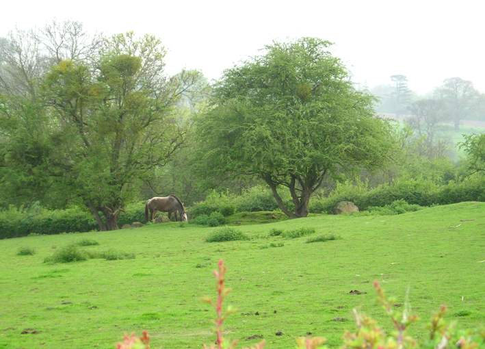
The remains as seen over the hedge from the lane. In a couple of places can be seen large stone slabs sticking out of the ground, which look to be the remains of two separate chambers. The horse is standing in the region of the southern chamber.
(View photo, vote or add a comment)
Log Text: None
Little Links Tor
Date Added: 30th Apr 2022
Site Type: Stone Row / Alignment
Country: England (Devon)
Visited: Would like to visit

Little Links Tor submitted by SandyG on 13th Jan 2018. Stone 3. View from north. This stone measures 0.76m long by 0.23m wide, stands up to 0.61m high and is orientated at 107°.
(View photo, vote or add a comment)
Little Kit's Coty
Date Added: 18th Sep 2010
Site Type: Burial Chamber or Dolmen
Country: England (Kent)
Visited: Yes on 2nd Sep 2004

Little Kit's Coty submitted by thecaptain on 2nd Sep 2004. The Countless Stones from the north side. There are many stones here, and trying to make out any semblance of what they once were is not easy.
(View photo, vote or add a comment)
Log Text: None
Liscuis 3 allée couverte
Trip No.203 Entry No.581 Date Added: 10th Jun 2020
Site Type: Passage Grave
Country: France (Bretagne:Côtes-D'Armor (22))
Visited: Yes on 26th Jun 2005. My rating: Condition 3 Ambience 3 Access 3

Liscuis 3 allée couverte submitted by greywether on 26th Jun 2005. Looking E.
(View photo, vote or add a comment)
Log Text: There are three allée couvertes here on the hilltop on the ridge overlooking the river Dourla, and beside the busy GR37 footpath. They are signposted from all around, and are several hundred metres walk uphill and along the ridge from a little car park. They are all suffering badly from neglect and vandalism, which is a great shame as I was reading a book from 25 years ago which says that they have only recently been discovered and are in a wonderful condition and almost complete. I guess it doesn't help that the rock is a very splitty dark grey slate type rock, which now it is exposed takes little to break it. While I was up there, many people walked past, many kicking the stones as they went, with children (and adults) jumping up and down on them.
This seems to be a V shaped dolmen rather than a pure allée couverte with its chamber widening from less than a metre wide to greater than two metres wide for the main part. Approximately 12 metres long, it has three capstones in place, and faces approximately west at 210°.
It is suffering very badly, not only from graffitti, but also official damage in the form of footpath sign paintings and markings. There is a separate cell at the back, with an entry doorstone, at an angle, making a triangular entrance.
Liscuis 2 allée couverte
Trip No.203 Entry No.582 Date Added: 10th Jun 2020
Site Type: Passage Grave
Country: France (Bretagne:Côtes-D'Armor (22))
Visited: Yes on 26th Jun 2005. My rating: Condition 4 Ambience 4 Access 3

Liscuis 2 allée couverte submitted by greywether on 26th Jun 2005. Looking S over the end cell.
(View photo, vote or add a comment)
Log Text: There are three allée couvertes here on the hilltop on the ridge overlooking the river Dourla, and beside the busy GR37 footpath. They are signposted from all around, and are several hundred metres walk uphill and along the ridge from a little car park. They are all suffering badly from neglect and vandalism, which is a great shame as I was reading a book from 25 years ago which says that they have only recently been discovered and are in a wonderful condition and almost complete. I guess it doesn't help that the rock is a very splitty dark grey slate type rock, which now it is exposed takes little to break it. While I was up there, many people walked past, many kicking the stones as they went, with children (and adults) jumping up and down on them.
A bit further along the ridge than the other two, and off the main path, this one seems to have suffered a bit less from the vandalism. It faces north at 010° and is about 14 metres long, up to 2.5 metres wide, and 2 metres high, with the southern 3 metres being a seperate cell, both ends narrow down to only a metre wide. It has a paved floor, but there is only one capstone remaining in place. It is still mostly within its mound.
Liscuis 1 allée couverte
Trip No.203 Entry No.583 Date Added: 10th Jun 2020
Site Type: Passage Grave
Country: France (Bretagne:Côtes-D'Armor (22))
Visited: Yes on 26th Jun 2005. My rating: Condition 3 Ambience 3 Access 3

Liscuis 1 allée couverte submitted by greywether on 26th Jun 2005. Well-preserved allee couverte with surviving stones marking the edge of the mound and an end cell. Photo from E showing end cell. June 1994.
(View photo, vote or add a comment)
Log Text: There are three allée couvertes here on the hilltop on the ridge overlooking the river Dourla, and beside the busy GR37 footpath. They are signposted from all around, and are several hundred metres walk uphill and along the ridge from a little car park. They are all suffering badly from neglect and vandalism, which is a great shame as I was reading a book from 25 years ago which says that they have only recently been discovered and are in a wonderful condition and almost complete. I guess it doesn't help that the rock is a very splitty dark grey slate type rock, which now it is exposed takes little to break it. While I was up there, many people walked past, many kicking the stones as they went, with children (and adults) jumping up and down on them.
Right beside the busy (on a June Sunday afternoon) GR37 footpath, this allée couverte is suffering badly from neglect and vandalism. The chamber is 11 metres in length, and oriented to the east at 070°. Just two capstones are in place on the chamber which varies from 1 metre wide at the ends, to 2 metres wide at the middle. Part of the surrounding mound survives. There is a terminal cell at the western end, and a doorstone at the eastern end.
Liniez Tumulus elliptique
Trip No.205 Entry No.265 Date Added: 13th Dec 2020
Site Type: Chambered Tomb
Country: France (Centre:Indre (36))
Visited: Saw from a distance on 27th Sep 2005
Log Text: Just outside the village of Liniez, along the D.926 road towards Vatan, and to the left of the road about a kilometre beyond the dolmen is the remains of a large tumulus. I found it difficult to stop here, and there was lots of fenced off land and woodland, so I didn't get to see this directly.
Lineover
Date Added: 16th Jun 2021
Site Type: Chambered Tomb
Country: England (Gloucestershire)
Visited: Yes on 14th Jun 2021. My rating: Condition 2 Ambience 3 Access 4
Lineover submitted by 4clydesdale7 on 17th Nov 2011. The Barrow from the South (taken from the N verge of the A436)
(View photo, vote or add a comment)
Log Text: Cotswold Way walk north around Cheltenham from Seven Springs to Cleeve Hill. Small detour for a look at the remains of Lineover longbarrow, in a field of cows
