Contributory members are able to log private notes and comments about each site
Sites theCAptain has logged. View this log as a table or view the most recent logs from everyone
Ty ar Boudiquet Dolmen
Trip No.203 Entry No.545 Date Added: 2nd Jun 2020
Site Type: Burial Chamber or Dolmen
Country: France (Bretagne:Finistère (29))
Visited: Yes on 23rd Jun 2005. My rating: Condition 5 Ambience 4 Access 5

Ty ar Boudiquet dolmen submitted by thecaptain on 29th Oct 2004. Brennilis Dolmen, an Allee Couvert still partially buried under its mound.
Found just outside the small village of Brennilis, about halfway between Brasparts and Huelgoat in western Brittany
(View photo, vote or add a comment)
Log Text: What a lovely monument this is! It's one of my favourites. It is easy to find, just at the northern edge of Brennilis village and clearly signposted, it has a little car park, a picnic area and it lives in a lovely large green and shady area, all very nicely looked after and with birdies tweeting away.
It is a rare dolmen in V form, which is thought to be a transitional stage between dolmens with entry passages (dolmen a couloir) and allée couvertes. It has been dated to about 3000BC.
It is almost complete, and has most of its earthern mound still with it, only a part of the back end has been destroyed by having a wall built through it. The chamber is about 14 metres long and varies in width from about 1 metre wide at the entrance, to nearly 3 metres at full width. The height also varies from about a metre to stand up height. The chamber opens at 125°. The main part of the is covered with three massive capstones, and has within it a standing stone which does not quite reach the roof. Perhaps a stele, but not smoothed and sculpted, or perhaps the remains of an internal wall.
Outside the chamber, the mound is almost complete, and even comes with most of its surrounding peristalith of stones. It is of an oval shape, approximately 17 metres long by 6 metres wide, and still up to 3 metres in height. Unfortunately the back end is cut by a wall and field boundary. The fairies house really is just that. A beautiful place for the little people to live.
Ty ar Boudiquet Dolmen
Trip No.187 Entry No.81 Date Added: 2nd Jun 2020
Site Type: Burial Chamber or Dolmen
Country: France (Bretagne:Finistère (29))
Visited: Yes on 9th Sep 1987. My rating: Condition 5 Access 5

Ty ar Boudiquet dolmen submitted by thecaptain on 29th Oct 2004. Brennilis Dolmen, an Allee Couvert still partially buried under its mound.
Found just outside the small village of Brennilis, about halfway between Brasparts and Huelgoat in western Brittany
(View photo, vote or add a comment)
Log Text: Cycling camping trip round Brittany 1987 day 10. Cycle from Telgruc up over the moors to Huelgoat.
Twyn-Yr-Oerfel B
Date Added: 22nd Mar 2020
Site Type: Round Barrow(s)
Country: Wales (Monmouthshire)
Visited: Yes on 21st Mar 2020. My rating: Condition 3 Ambience 3 Access 4

Twyn-Yr-Oerfel B submitted by TheCaptain on 29th Mar 2020. Following the ridgeway track to the south the barrow is right in front of you as you descend into the open land. It was surrounded by many large blocks of stone to prevent the off road drivers driving over it.
(View photo, vote or add a comment)
Log Text: The third cairn of four marked on the OS Map during a walk from the Sirhowy Country Park around the Cwmfelinfach valley, up the Sirhowy River and back along the Rhymney Ridgeway path.
Following the ridgeway track to the south and then east passing beween the large minimg tip and the forest along the stony track used by off road bikers, and the barrow is right in front of you as you descend into the open land. It was surrounded by many large blocks of stone to prevent the off road drivers driving over it, but this does not prevent the bikers.
While here there was the remains of a burnt out motorbike laying just beside it. The barrow is nicely formed apart from the tracks over it, and looked initially to have a large stone structure within, but I later read that it is built onto a natural rock outcrop, so this is probably part of it.
Twyn-Yr-Oerfel A
Date Added: 22nd Mar 2020
Site Type: Round Barrow(s)
Country: Wales (Monmouthshire)
Visited: Yes on 21st Mar 2020. My rating: Condition 3 Ambience 3 Access 4
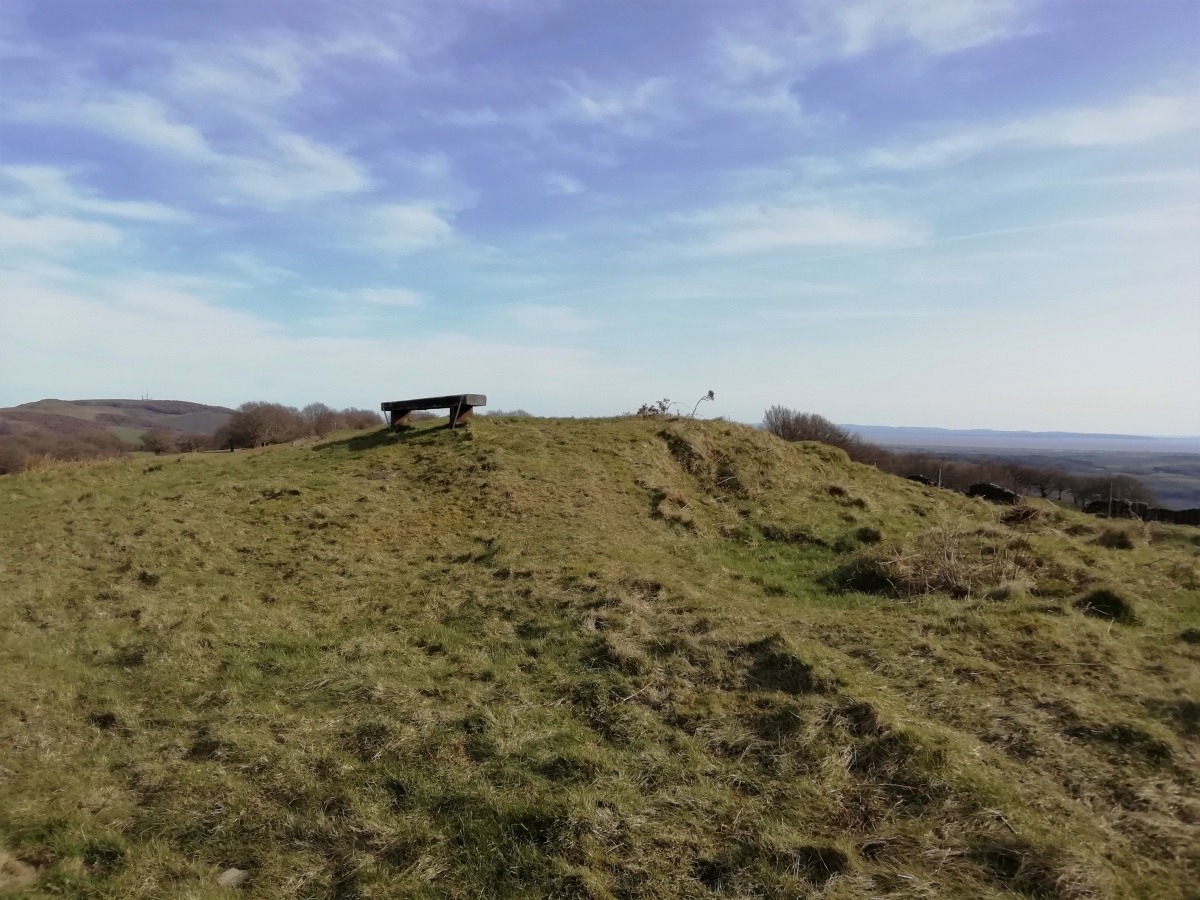
Twyn-Yr-Oerfel A submitted by TheCaptain on 25th Mar 2020. The easterly of the two barrows, this one is the more ruined, but easily found and identified. It has a large pit dug into the top and a bench positioned on the top.
The views from up here would be terriffic, but the whole area is not a great place to be with so many off road tracks all around making the whole area a mess of mud.
(View photo, vote or add a comment)
Log Text: The fourth and last cairn marked on the OS Map during a walk from the Sirhowy Country Park around the Cwmfelinfach valley, up the Sirhowy River and back along the Rhymney Ridgeway path.
A few hundred yards to the east of the previous barrow, this one is more ruined than that, but easily found and identified. It has a large pit dug into the top and a bench positioned on the top. The views from up here would be terriffic, but the whole area is not a great place to be with so many off road tracks all around making the whole area a mess of mud. The old mining tips don't help, so perhaps it is an improvement on a century ago.
Twyn-Y-Beddau
Date Added: 18th Sep 2010
Site Type: Round Barrow(s)
Country: Wales (Powys)
Visited: Yes on 17th May 2004
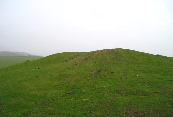
Twyn-Y-Beddau submitted by TheCaptain on 17th May 2004. Twyn-y-Beddau, Round Barrow, Powys, SO241386
Seen here from the north, this once nice round barrow has the obligatory depressions in the top and various other lumps and bumps from attempts to rob or excavate it. Unfortunately, it has now become used by the 4 wheel drive morons to drive over. The whole barrow and surrounding area is now badly scarred with wheel marks and ruts.
(View photo, vote or add a comment)
Log Text: None
Twyn Cae-Hugh
Date Added: 22nd Mar 2020
Site Type: Round Barrow(s)
Country: Wales (Monmouthshire)
Visited: Yes on 21st Mar 2020. My rating: Condition 3 Ambience 3 Access 4
Twyn Cae-Hugh submitted by TheCaptain on 25th Mar 2020. This was an easily seen tumulus of fairly large size just to the east of the trackway
(View photo, vote or add a comment)
Log Text: The second cairn of four marked on the OS Map during a walk from the Sirhowy Country Park around the Cwmfelinfach valley, up the Sirhowy River and back along the Rhymney Ridgeway path.
This was an easily seen tumulus of fairly large size just to the east of the trackway and walled off from it, which has helped with its survival. We stopped here for lunch sheltered from the wind and in the sun.
Twr-y-Fan Foel cairn
Date Added: 10th Apr 2023
Site Type: Cairn
Country: Wales (Powys)
Visited: Yes on 20th Jul 2017. My rating: Condition 2 Ambience 5 Access 2
Twr-y-Fan Foel cairn submitted by TheCaptain on 8th Sep 2017. Looking southeast to the Twr-y-Fan Foel cairn on its hilltop promontory position.
The cairn is about 11 metres diameter and becoming very eroded by the weather and all the walkers stopping here to admire the spectacular views from its cliff edge position.
(View photo, vote or add a comment)
Log Text: Along the ridge to the southeast of Fan Foel, Twr-y-Fan Foel cairn can be seen sitting on its hilltop promontory position. The cairn is again about 11 metres diameter and becoming very eroded by the weather and all the walkers stopping here to admire the spectacular views from its cliff edge position. Once again the two German lads were stood on top of it with no signs of moving on, so I just took a couple of quick photos and we carried on to get to the trig point on top of Fan Brycheiniog (802m) before them, so we could take our pictures without them in the way!
Two Barrows (Hamel Down)
Date Added: 2nd Jan 2023
Site Type: Round Barrow(s)
Country: England (Devon)
Visited: Yes on 6th Dec 2022. My rating: Condition 3 Ambience 4 Access 3

Two Barrows (Hamel Down) submitted by TheCaptain on 2nd Jan 2023. Looking for the second barrow, and I notice a slight rise under the corner of the walls
(View photo, vote or add a comment)
Log Text: Onwards southward slightly downhill to a field wall where there is another barrow with a Duke Stone on top, named as Two Barrows. Looking for the second, and it can be seen right under the corner of the walls, no doubt it has been used as a boundary corner for a long time.
Twinhoe
Date Added: 31st Aug 2024
Site Type: Stone Circle
Country: England (Somerset)
Visited: Yes on 29th Aug 2024. My rating: Condition 3 Ambience 3 Access 5
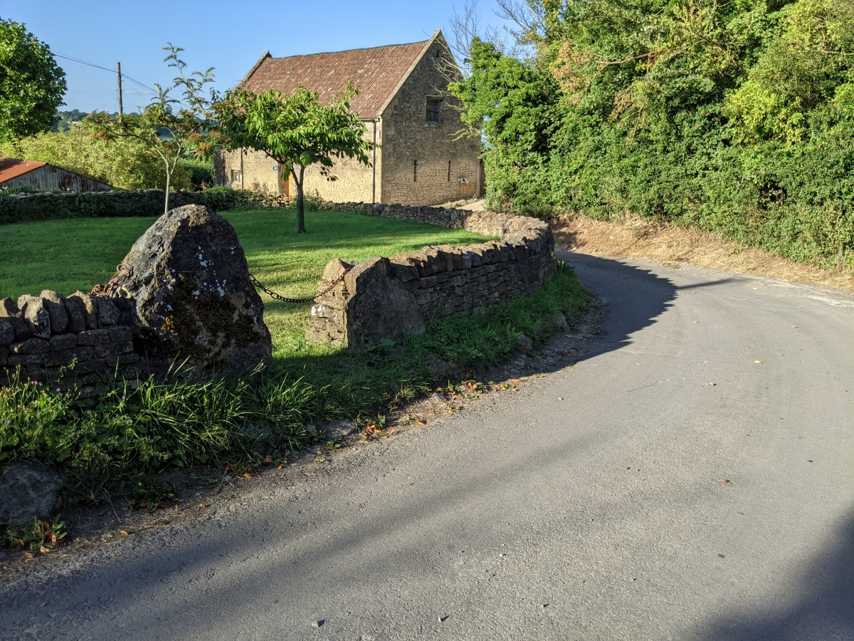
Twinhoe submitted by MythicAl on 12th Aug 2024. Ancient stone circle embedded into wall around small green at Mid Twinhoe
(View photo, vote or add a comment)
Log Text: I had to come and have a look at this. I can't be sure what this is. There are twelve large upright stones arranged equispaced in a semicircular wall around a green. This all looks like a fairly new construction to me, but were the larger stones there previously? The old country lane here makes a nice curve around the corner, and not the usual right angle. And just what is the green area within, not used for gardens or cropped fields?
Tuzigoot Monument
Date Added: 18th Sep 2010
Site Type: Ancient Village or Settlement
Country: United States (The Southwest)
Visited: Yes on 26th May 2009
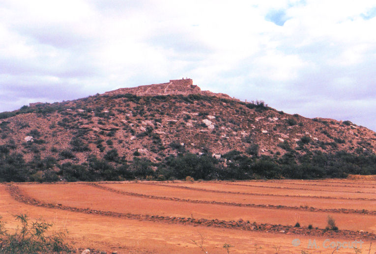
Tuzigoot Monument submitted by thecaptain on 26th May 2009. Tuzigoot Monument, pueblo built by the Sinagua culture.
Nov 1990.
(View photo, vote or add a comment)
Log Text: None
Tusson tumulus
Trip No.203 Entry No.38 Date Added: 2nd Apr 2020
Site Type: Chambered Tomb
Country: France (Poitou:Charente (16))
Visited: Saw from a distance on 15th May 2005
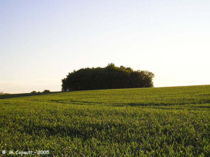
Tusson tumulus submitted by thecaptain on 5th Dec 2005. To the east of the historic village of Tusson there are four tumuli which lie in a line along the top of a ridge.
This is the most northerly, the name of which I am unsure.
(View photo, vote or add a comment)
Log Text: There are four tumulus here to the east of the village of Tusson which lie in a line along the top of a ridge. One of the central pair is enormous and deserves further exploration. The Pierre Blanche and Magnez dolmens are on the same line to the north.
Tusayan Ruins
Date Added: 18th Nov 2010
Site Type: Ancient Village or Settlement
Country: United States (The Southwest)
Visited: Yes on 6th Nov 1990
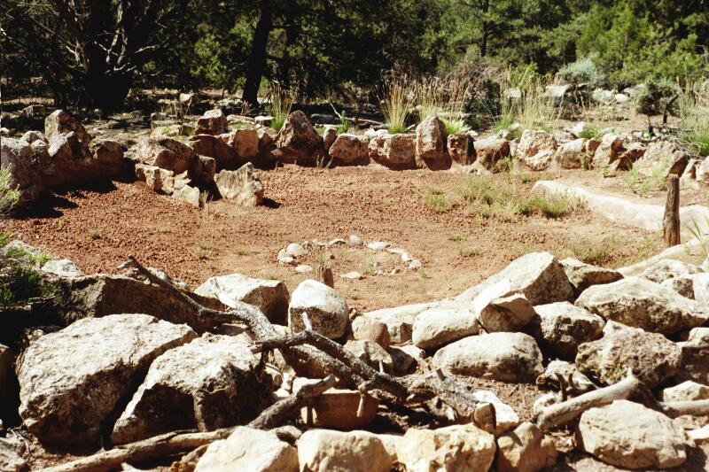
Tusayan Ruins submitted by bat400 on 6th Aug 2006. Large Kiva at Tusayan Ruins, Coconino County, Arizona.
The Tusayan ruins at the Grand Canyon National Park show two separate circular ruins that may have been ceremonial rooms, or Kivas. The smaller one appeared to have burned, was made into some other sort of space. This is the foundation of the larger Kiva, seemingly built later that the first.
There was a firepit in the center of the room and an airshaft (seen in the rear wall.) This is a common feature of both historic Kivas, and simi...
(View photo, vote or add a comment)
Log Text: None
Turoum-Bouchous Dolmen
Trip No.205 Entry No.58 Date Added: 25th Oct 2020
Site Type: Burial Chamber or Dolmen
Country: France (Aquitaine:Pyrénées-Atlantiques 64)
Visited: Couldn't find on 7th Sep 2005
Turoum-Bouchous dolmen submitted by irundarra on 1st Aug 2008. Site in Laruns (Bearn)
(View photo, vote or add a comment)
Log Text: I couldn’t find any evidence on any maps I had, and asked at the tourist information office and national park centre, but nobody knew anything about this dolmen.
Tumulus du Rocher
Trip No.203 Entry No.344 Date Added: 10th May 2020
Site Type: Chambered Tomb
Country: France (Bretagne:Morbihan (56))
Visited: Yes on 11th Jun 2005. My rating: Condition 5 Ambience 4 Access 4

Tumulus du Rocher submitted by greywether on 30th Jun 2005. Angled pasage grave with some decorated stones. The entrance.
(View photo, vote or add a comment)
Log Text: Signposted, and with a parking area, this is a great find. There is a little walk along a wooded headland above the Bono river, and not knowing what to expect here, I was more than pleasantly surprised. It is signposted "Tumulus et Tombettes", and as well as a big tumulus, there are the remains of half a dozen or more smaller tumuli approximately in a line along the ridgetop.
The large tumulus is 30 metres in diameter and about 5 metres in height, with a single entranceway in the southeastern side which is open to the public. Bring a torch. The entrance leads into a curving passage, which is approximately L shaped, and about 20 metres in length, two sections of about 10 metres each. The passageway is made up out of a mix of upright slabs and drystone walling, covered with capstones. It is not quite high enough to stand up in until the end of the passage, where it opens up to 2 metres wide and high. Several of the upright stones have carvings on them, axes, crooks, serpentines etc, but these were difficult to see in the dark with the poor light I had with me. FANTASTIC !
The tombettes vary in size from about 10 metres in diameter downwards, and most are nowadays fairly flat. Most consist of the outline of some sort of burial chamber, with a surrounding circle of stones. Various chamber types are to be seen, from simple rectangles to full length stone lined passages. I don't know why this place is not more well known, I didn't really know of it before I visited, and its one of my favourite sites so far. Think I'll go for another look inside the big mound.
Tumulus Des Mousseaux
Trip No.203 Entry No.26 Date Added: 1st Apr 2020
Site Type: Chambered Cairn
Country: France (Pays de la Loire:Loire-Atlantique)
Visited: Yes on 14th May 2005. My rating: Condition 5 Ambience 3 Access 5
Tumulus Des Mousseaux submitted by AlexHunger on 4th Jun 2005. Large Cairn with 2 chambers and entrances facing south East, spectacular capstones, some repaired. Excavated 1970s and restored in 1985. Similar to Malta temples, but smaller. In Pornic.
(View photo, vote or add a comment)
Log Text: This monument is signposted from all sorts of places and easy to find if approaching from the north but probably not so if coming from the south as the fortified harbour and seaside town of Pornic is a maze of small streets and indeed barred to a campervan. The tumulus is enclosed by houses and reaches right up to the roadside but does have its own little area with a sign telling about it but its all a bit busy and noisy. This is a superbly restored double chambered tomb enclosed in a triple stepped cairn. The two chambers both have double transept (side) chambers and open towards the southwest the southern one being double sided while the northern one is single sided and they are about 9 metres in length. The height of the chambers increases as you enter from about 1.8 metres at the entrance to well over 2.4 metres inside this being achieved because the capstones do not sit adjacent to one another but rest on top of each other as they progress inwards. Excavations showed this tomb to date to about 3500 BC. Obviously once known as the Dolmen des Mousseaux this has been renamed Tumulus des Mousseaux as can be seen on all the multitude of signposts pointing to it which have been changed !
Tumulus des Hogues
Trip No.202 Entry No.63 Date Added: 29th Mar 2020
Site Type: Round Barrow(s)
Country: France (Normandie:Orne (61))
Visited: Yes on 2nd May 2005. My rating: Condition 2 Ambience 3 Access 4
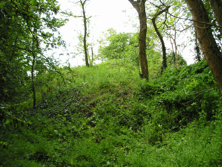
Tumulus des Hogues submitted by thecaptain on 1st Nov 2005. Tumulus des Hogues.
The second of the two round burial mounds here, this one has no obvious megalithic chamber to be seen, but its probably still inside.
(View photo, vote or add a comment)
Log Text: There are the remains of two burial mounds here the second one being about 50 metres to the southeast of the Dolmen des Bignes. The mound is much less disturbed than its neighbour but it has been dug into from its western side although there are no signs of any stones forming a chamber. Perhaps its still all in place underneath the mound ? The remains of the mound are about 3 metres high and again it has a diameter of about 15 metres.
The ambience of these burial mounds is spoiled by it obviously used as a place where the local youth (or others) go to have a drink leaving all their detritus behind. There are broken bottles and other rubbish all over the place.
Tumulus de Vierville
Trip No.201 Entry No.1 Date Added: 19th Mar 2020
Site Type: Chambered Tomb
Country: France (Normandie:Manche (50))
Visited: Yes on 19th Nov 2004. My rating: Access 1
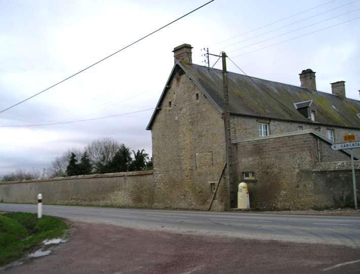
Tumulus de Vierville submitted by thecaptain on 14th Jan 2005. Tumulus de la Butte, Vierville, Manche.
Despite much research, and two visits to this site, I could find no traces of this supposedly wonderful monument, marked on many maps as a notable attraction. My research leads me to believe it is somewhere within this walled garden.
(View photo, vote or add a comment)
Log Text: Try as I might, early in the morning on the way to my sisters from the ferry, by driving up and down every lane and farm track around the village, I couldn’t find any sign of this, despite it being highlighted as a tourist place on the IGN maps. I asked a chap passing on his way to work on a bike if he knew anything of it with no luck, and also an old couple herding cows from one field to another, who said they had lived there all their lives but had also never heard of it. They seemed very intrigued as to what an Englishman was doing in their village asking for a monument and pointing at something on a map. It must have made their day, but it didn’t help me in any way.
After taking a last guess and driving half a mile up a muddy track to the top of a nearby hill, and walking round all the woodland on the top, all I could find was a couple of interested donkeys. An hour had now gone by, and it was time to get on. Not much of a tourist attraction ! Further investigation using more detailed local maps showed the tumulus positioned right opposite the road junction by the church. If accurate, this meant that the tumulus was either in the garden of a large house, or in a nearby farmyard.
Passing near by the site on the way back to the ferry, I stopped off for another look round, this time knowing where to look. There was absolutely no sign of anything to be seen in any farmyards unless it has been covered with either a barn or a dungheap. This left the only place for it to be as in the walled in garden of the large house pictured, which had absolutely no places to look through. I could find nobody around to ask, and didn’t want to just go and call at a perhaps random private house, so had to give up again. It wouldn’t surprise me if it is positioned somewhere under the trees to be seen in the walled garden.
Once home, lots of painstaking research on the internet has revealed nothing more than that it is on private land. Its gotta be in that walled garden. Or is it ?
Tumulus de Montaubert
Trip No.203 Entry No.155 Date Added: 16th Apr 2020
Site Type: Burial Chamber or Dolmen
Country: France (Midi:Aveyron (12))
Visited: Yes on 26th May 2005. My rating: Condition 2 Ambience 3 Access 3
Tumulus de Montaubert submitted by TheCaptain on 10th Apr 2011. Above Salles-la-Source, to the northeast, are roadsigns to the supposedly nicely restored Peyrelebade dolmens, which I did not find.
All I could find for sure while walking north in the scorching heat along the track towards Cadeyrac, was a fenced off small mound in a field to the west of the track.
(View photo, vote or add a comment)
Log Text: Above Salles-la-Source, to the northeast, are roadsigns to the supposedly nicely restored Peyrelevade dolmens, which I did not find. All I could find for sure while walking north in the scorching heat along the track towards Cadeyrac, was a small mound in a field to the west of the track, quite near to where I left the van.
Tumulus de la Boixe B
Trip No.203 Entry No.42 Date Added: 5th Apr 2020
Site Type: Chambered Tomb
Country: France (Poitou:Charente (16))
Visited: Yes on 16th May 2005. My rating: Condition 5 Ambience 5 Access 5

Tumulus de la Boixe B submitted by thecaptain on 4th Jul 2005. In this region to the north of Angoulême are many, many megalithic remains, most of which are almost totally unknown.
This is one of the known sites, the well restored and truly lovely Tumulus de la Boixe, well worth a visit.
(View photo, vote or add a comment)
Log Text: This wonderful tumulus can be found signposted just to the west of the D.116 as it runs through the Forêt-de-Boixe. Said to be one of about 15 such tombs here in the 19th century, but now mostly destroyed.
It’s a lovely tomb, which has been restored, with a chamber still contained fully within its cairn, which must be between 25 and 30 metres in diameter, with two walled and stepped rings around it. A large capstone is still visible from the top which covers the chamber. The entrance passage is slightly curved, and about 8 metres in length.
It looks to me as though many of the stones are new, and indeed some seem to be concrete slabs. There is a side chamber on the right as you go in, which has nicely carved entrance stones giving a fine rounded doorway, with a finely carved edging. Its all very dark inside and you need to take a torch, although the birds like it as it is for nesting inside. The chamber is rectangular, about 3 metres by 1.5 metres. The passageway into the main chamber is exceptionally well made, with most of the stones being very squared, which turns out to be a feature of many of the dolmens around here. The main chamber, more than 8 metres into the tumulus, is another rectangular structure formed with well fitting and squared slabs, and is about 5 metres by 3 metres, wit slab floorstones also.
At the opposite corner of this chamber to where the entrance is, is found another entranceway into a further chamber, this one being about 2 metres square, again made with fantastically fitted stone slabs. The entranceway is carved from two well fitted slabs, and has two grooves carved around it, rather like moulding round a more modern doorway. Above and to the right of this doorway, in the main chamber is a very visible axe carved onto the wall slabs.
Since visiting this tomb, I have found that there are said to be carvings of crooks and axes on one or two of the stones. The monument is in a lovely flower filled clearing in the forest, with the air filled with birdsong, a cuckoo being particularly prominent this morning. It has a noticeboard which states that it is dated to between 4500 and 3700 BC, and that the corridor side stones are original. I went back to my van to get a torch and returned.
Tumulus de Chateaurenaud
Trip No.203 Entry No.46 Date Added: 5th Apr 2020
Site Type: Burial Chamber or Dolmen
Country: France (Poitou:Charente (16))
Visited: Saw from a distance on 16th May 2005

Tumulus de Chateaurenaud submitted by TAUPIN on 15th Nov 2011. Site in Poitou:Charente (16) France
(View photo, vote or add a comment)
Log Text: Another big obvious wood covered tumulus up on the hills above the village. But to get to this one would have meant quite a long walk from anywhere I could have parked and there was no obvious way to it so I did not bother as there are many others to explore locally.
