Contributory members are able to log private notes and comments about each site
Sites theCAptain has logged. View this log as a table or view the most recent logs from everyone
La Hautière
Date Added: 12th Jun 2020
Site Type: Passage Grave
Country: France (Bretagne:Côtes-D'Armor (22))
Visited: Yes on 19th Sep 1992
La Hautière submitted by theCaptain on 18th Mar 2014. This is a fairly large allée couverte in a field to the east of the D.768 road between Créhen and Trégon, which had just been cropped for hay when I visited in 2005, so it was easy to get to.
(View photo, vote or add a comment)
Log Text: Cycling camping trip round Emerald Coast, day 2, Dinan, Corseul, St Caste. Roman tower, dolmens, Lunch at Le Guildo castle.
La Hogue
Trip No.202 Entry No.6 Date Added: 25th Mar 2020
Site Type: Chambered Tomb
Country: France (Normandie:Calvados (14))
Visited: Saw from a distance on 23rd Apr 2005
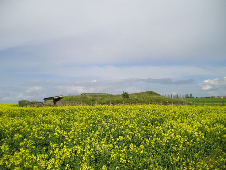
La Hogue submitted by TheCaptain on 6th May 2005. La Hogue Tumulus, Fontenay-le Marmion, Calvados
The excavated remains of this large round barrow with 12 internal burial chambers is fenced off within a field of rapeseed. What was once a guardian with a key to the site in the nearby house was today a lady who told me that “Il est fermée monsieur”.
(View photo, vote or add a comment)
Log Text: Despite being signed from the main road and having a Bar le Tumulus nearby the excavated remains of this large round barrow with 12 internal burial chambers is fenced off within a field of rapeseed. What was once a guardian with a key to the site in the nearby house was today a lady who told me that “Il est fermée monsieur”.
La Hoguette
Trip No.202 Entry No.7 Date Added: 25th Mar 2020
Site Type: Chambered Tomb
Country: France (Normandie:Calvados (14))
Visited: Yes on 23rd Apr 2005. My rating: Condition 1 Ambience 1 Access 5

La Hoguette submitted by TheCaptain on 6th May 2005. La Hoguette Tumulus, Fontenay-le Marmion, Calvados.
Despite all my records stating that this large round tumulus with 8 passage graves no longer exists, the remains are quite easy to find within the village. It remains today as a green grassy area within a housing estate, surrounded by roads called something like Rue la Tumulus and Rue La Hoguette. There is a large diameter mound with a slight hollow in the middle, and remains of some form of signpost.
(View photo, vote or add a comment)
Log Text: Despite all records stating that this large round tumulus with 8 passage graves is no longer there the remains are quite easy to find within the village. It remains today as a green grassy area within a housing estate surrounded by roads called something like Rue la Tumulus and Rue La Hoguette. There is a large diameter mound with a slight hollow in the middle and remains of some form of signpost.
La Hutte-aux-Gabelous
Trip No.202 Entry No.26 Date Added: 26th Mar 2020
Site Type: Passage Grave
Country: France (Pays de la Loire:Mayenne (53))
Visited: Yes on 24th Apr 2005. My rating: Condition 4 Ambience 5 Access 5

La Hutte-aux-Gabelous submitted by thecaptain on 27th Apr 2005. La Hutte aux Gabelous, Saint Mars-sur-la-Futaie, Mayenne A cracking little find this, its been 2/3rds restored and the other end left as it was found. I think a Gabelou is some sort of soldier employed to crack down on smugglers, but cannot be sure yet.
(View photo, vote or add a comment)
Log Text: What a fantastic find this little Allée Couvert is a couple of kilometres to the east of the village of St Mars beside the D534 near the crossing with the D118 and is to be found in a nice little wooded area with its own little car park and picnic site.
The monument is the remains of a little Allée Couvert about 18 metres long by 5 metres width which was excavated and part restored in 1992 the northwestern 2/3rds being restored to as original condition. the southeastern 1/3rd being left in as found condition.. The chamber has its major axis on an alignment of 140° and is about 1.8 metres in both width and height with an unknown length due to the east end being in ruined condition. There are 5 large capstones in place on top of 6 pairs of uprights with a nice large slab forming the end of the chamber. The entrance is at the eastern end of the southern side.
This monument is said to be fairly unique because of the rectangular nature of the external peristalith which is formed with contiguous upright slabs. The gap between the external walling and the main chamber is filled with stones for the restored part. Flints and pottery were found within the chamber from a whole range of periods.
I almost missed this as it was getting late in the day but decided to have a quick little detour on the way back to look at the little dolmen symbol marked on the map. I ended up spending quite a long time here it’s suddenly become one of my favourite little megalithic sites. I was even moved to just sit on one of the rocks at the end and do a little drawing.
La Justice tumulus
Trip No.203 Entry No.41 Date Added: 2nd Apr 2020
Site Type: Chambered Tomb
Country: France (Poitou:Charente (16))
Visited: Saw from a distance on 15th May 2005

Vieux Breuil tumulus submitted by thecaptain on 5th Dec 2005. To the east of the historic village of Tusson there are four tumuli which lie in a line along the top of a ridge.
The Pierre Blanche and Magnez dolmens are on the same line to the north.
(View photo, vote or add a comment)
Log Text: There are four tumulus here to the east of the village of Tusson which lie in a line along the top of a ridge. One of the central pair is enormous and deserves further exploration. The Pierre Blanche and Magnez dolmens are on the same line to the north.
La Loge au Loup
Trip No.204 Entry No.18 Date Added: 6th Jul 2020
Site Type: Burial Chamber or Dolmen
Country: France (Bretagne:Morbihan (56))
Visited: Yes on 11th Jul 2005. My rating: Condition 4 Ambience 5 Access 4

La Loge au Loup submitted by stollentroll on 14th Dec 2005. Dolmen La Loge au Loup.
(View photo, vote or add a comment)
Log Text: Easily found a few kilometres south of Trédion just to the west of the D.1 road to Elven, this nice site is signposted and has a parking place from where it’s a couple of hundred metres walk up into the lovely woodland on the ridgetop. I thought it to be a strange monument, which looks in some ways to be an Arc Boutté type allée couverte with a V dolmen built on top of it!
The passageway is about 9 metres long and faces 120°, with its paired stones leaning against each other. At the west end is a large capstone, 4 m by 3 m, sitting on top of extra support stones making a sort of chamber 2,5 metres wide, but it is filled up with the leaning stones of the passage. Its almost as if there is a complete V form dolmen built on top of the allée couverte using the same entrance, as there are extra rows of stones outside the passageway. Perhaps the allée couverte was built within the V dolmen. Around the outside are several other shaped stones, no doubt a peristalith of the original mound, of which much remains.
This is a lovely little place to sit in the shade on a hot day, and well worth a visit.
La Loge aux Sarrasins
Trip No.202 Entry No.17 Date Added: 26th Mar 2020
Site Type: Burial Chamber or Dolmen
Country: France (Normandie:Calvados (14))
Visited: Couldn't find on 17th Apr 2005
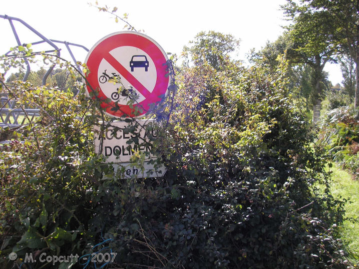
la Loge aux Sarrasins submitted by thecaptain on 28th Sep 2007. Despite the overgrown signs, this looked all very promising, and that I could add this elusive, rare Normandy dolmen to my list !
(View photo, vote or add a comment)
Log Text: Despite an accurate description of how to find this dolmen I could find nothing that looked like the picture from 1980. I did however find some large stones in about the right place a large single stone standing in the middle of the field and a couple of smaller ones with a small stone on top and a further large stone nearby. Perhaps I was looking in the wrong field but I think more likely is that this dolmen has recently been destroyed. A closer inspection of the photographs and I think that the large stone lying near the edge of the field might be the capstone from the dolmen upside down. A criminal shame that these things survive so long only to be destroyed in these modern times due to greed and laziness of a farmer.
Later note. Having seen the 1:25000 ign map of the area the dolmen is marked in a field further to the north than where I was looking beside the farm buildings which begs the question of what are the stones I did find.
La Loge aux Sarrasins
Trip No.211 Entry No.4 Date Added: 26th Mar 2020
Site Type: Burial Chamber or Dolmen
Country: France (Normandie:Calvados (14))
Visited: Yes on 9th Oct 2011. My rating: Condition 4 Ambience 3 Access 4
la Loge aux Sarrasins submitted by hrun95 on 21st Jun 2011. These photos were taken in 2007, in the garden of the owners. So it's a bit boring because you are in their propriety. I get there by the little path coming by la Chaudronniere.
Site in Normandie:Calvados (14) France
(View photo, vote or add a comment)
Log Text: Having gone to Vire for a Vide Grenier and country show, persuaded Trevor and Sara to visit this stone for another look. Followed the same path as last time, and this time, once at the corner of the garden, the dolmen was clear to be seen in the back garden. At Last!
Its a lovely looking little dolmen. I can only assume that last visit there was a shed in the way, preventing it being seen. To get a better view, went back to the cornfield, and walked along its edge and up along outside the garden. I noticed that a bit further to the west, behind the garage, there was a separate standing stone, a couple of metres tall.
La Loge Morinais
Trip No.204 Entry No.6 Date Added: 22nd Jun 2020
Site Type: Passage Grave
Country: France (Bretagne:Morbihan (56))
Visited: Yes on 9th Jul 2005. My rating: Condition 3 Ambience 4 Access 3
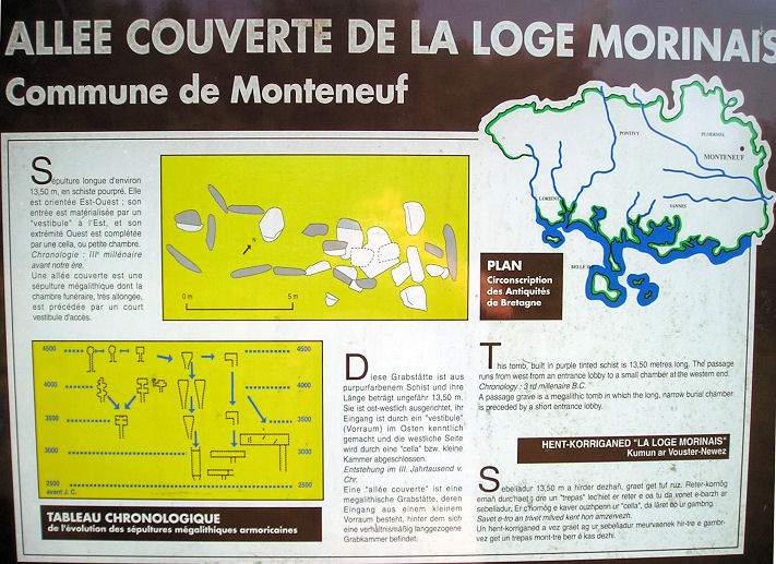
La Loge Morinais submitted by TheCaptain on 3rd Jun 2007. La Loge Morinais, near Monténeuf.
(View photo, vote or add a comment)
Log Text: This is the remains of an allée couverte made of the local purple schist, and can be found in the forest to the north east of the Monteneuf visitors centre, about a kilometre away along a signposted trail. It is about 13 metres long and has an orientation of due east to west. There is an entrance lobby at the east end, and an antichamber at the west, but no capstones remain in place.
It can be easily found from several places with signposted forest walks. The day I was here, there was a nearby target set up for the prehistoric shooting championships.
La Longue Pierre (St-Pierre-Eglise)
Trip No.201 Entry No.13 Date Added: 25th Mar 2020
Site Type: Standing Stone (Menhir)
Country: France (Normandie:Manche (50))
Visited: Yes on 22nd Nov 2004. My rating: Condition 4 Ambience 3 Access 4

La Longue Pierre (St-Pierre-Eglise) submitted by thecaptain on 22nd Dec 2004. La Longue Pierre, St-Pierre-Eglise. Seen here from the gate into the field.
(View photo, vote or add a comment)
Log Text: In a field beside a small lane to the north of St-Pierre-Eglise can be found this large menhir. It is signposted from the larger road running north towards Cosqueville, but I found nowhere to park up the small lane, so had to return to the larger road to park and then walk the few hundred metres back to the stone.
It is a very large stone, which stands at 4.2 metres high, perhaps the largest menhir remaining standing in Manche today. It is of roughly square section with an angled top. It is about 50 metres into a field beside the lane, and although many people had obviously been in to have a closer look, there was a sign requesting nobody enters the field, so I just looked from the gate.
La Longue Pierre (St-Pierre-Eglise)
Trip No.207 Entry No.7 Date Added: 25th Mar 2020
Site Type: Standing Stone (Menhir)
Country: France (Normandie:Manche (50))
Visited: Yes on 5th Apr 2007. My rating: Condition 4 Ambience 3 Access 4
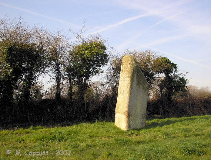
La Longue Pierre (St-Pierre-Eglise) submitted by TheCaptain on 29th Sep 2007. One of the "Three Princesses", this menhir stands 4.2 metres high, perhaps the largest menhir remaining standing in La Manche today.
(View photo, vote or add a comment)
Log Text: I was able to get right to this lovely stone this time, although in a rush as there was nowhere to park and I left the car blocking the little lane. The stone stands about 4 metres tall in a very swampy field, and I got soaking wet feet while walking up to the stone, but at least it washed clean all the mud from La Pierre Plantée. It now has a little information post at the gateway to the field, and is numbered on a marked walk around the village, so I must go and look for more information at St Pierre l'Eglise.
La Lue Dolmen
Trip No.204 Entry No.163 Date Added: 20th Aug 2020
Site Type: Burial Chamber or Dolmen
Country: France (Limousin:Haute-Vienne (87))
Visited: Yes on 21st Jul 2005. My rating: Condition 4 Ambience 3 Access 4

La Lue dolmen submitted by TheCaptain on 23rd Jul 2013. A couple of kilometres to the west of Berneuil can be found the dolmen de Lalue.
(View photo, vote or add a comment)
Log Text: To the west of Berneuil, travel a couple of kilometres along the D.83 and you come to this dolmen at a bend in the road, just after a crossroads, where it is about 30 metres into the field. It has a 4 m by 2 m chamber facing east, made of two long sidestones and with two smaller stones at the back of the chamber, which are made of a different coloured rock. I wonder if it has been "restored". It is covered by a large single capstone about 5m by 4m, but this is now cracked and broken into two pieces. There are traces of a small stone mound around it.
La Maison des Feins
Trip No.203 Entry No.600 Date Added: 13th Jun 2020
Site Type: Passage Grave
Country: France (Bretagne:Ille-et-Vilaine (35))
Visited: Yes on 28th Jun 2005. My rating: Condition 5 Ambience 5 Access 4

La Maison des Feins submitted by thecaptain on 15th Apr 2008. La Maison des Feins, Tressé, seen here from the "front" end, as approached through the forest.
So this will be the northern side from the east.
(View photo, vote or add a comment)
Log Text: This is a lovely little allée couverte, deep inside a lovely oak forest just to the east of the village of Tressé, and signposted from there. There is a parking area, and a signposted and guided walk footpath from there to find it, along with many other items of interest.
The allée is about 12 metres long, at an orientation of 155°, but it is not much more than a metre wide or high. Truly a house for the fairies. All but the end capstone are still in place, and at the back end there is a nice little additional cell. Within this cell are some exceptional carvings on the southern sidestone, of two pairs of breasts with their collars, on a cartouche giving them a big relief. There are also the remains of two pairs on the chevet stone, but these have been crudely hacked off in the past, leaving just the outlines.
Of course, there are many legends of the fairies who live here in this forest, including the story of a farmer who was given some everlasting bread by the fairies because their cow had become ill, and the farmer had helped them with it. The bread would stay fresh and last forever so long as he never told the story. Of course, one day the farmer did tell the story, and the loaf of bread turned to stone - a stone which can still be seen here today.
La Maison des Feins
Trip No.208 Entry No.5 Date Added: 13th Jun 2020
Site Type: Passage Grave
Country: France (Bretagne:Ille-et-Vilaine (35))
Visited: Yes on 20th Mar 2008. My rating: Condition 5 Ambience 5 Access 4

La Maison des Feins submitted by thecaptain on 16th Apr 2008. La Maison des Feins is about 12 metres long, but it is not much more than a metre wide or high. Truly a house for the fairies.
My Dad adds scale to the fairies house, viewed here from the southeastern end.
(View photo, vote or add a comment)
Log Text: None
La Meinge du Diable
Trip No.203 Entry No.286 Date Added: 24th Apr 2020
Site Type: Standing Stone (Menhir)
Country: France (Pays de la Loire:Vendée (85))
Visited: Couldn't find on 7th Jun 2005
La Meinge du Diable submitted by ocdolmen on 28th Aug 2009. Menhir of Meinge-du-Diable. Extrait of Pierres-Garatelles (covered rocky), the menhir of Meinge of the Devil is the only preserved megalith raised on Vairé's territory. If one believes the legend of it, this menhir was of use formerly of purpose to Satan and to an angel who played the meinge (sort of game of palet). The angel was so skillful as his palet (a big flat stone) lands right by the menhir. It was not there the same for Satan who sent the cliff to the middle road of the target. In fury...
(View photo, vote or add a comment)
Log Text: I found a signpost to this one, but despite walking along every track and footpath in the vicinity, I found no semblance of any menhir. I wish that when there are signposts from the road, they are followed up later. I must have walked many miles in the baking hot sun here. At least it should be doing me good.
La Mère aux Cailles
Trip No.204 Entry No.260 Date Added: 9th Sep 2020
Site Type: Standing Stone (Menhir)
Country: France (Centre:Eure-et-Loire (28))
Visited: Yes on 7th Aug 2005. My rating: Condition 3 Ambience 3 Access 3
La Mère aux Cailles submitted by thecaptain on 10th Feb 2007. La Mère aux Cailles.
Up a trackway called "Sentier des Roches", in a private orchard, is what I assume is a menhir, at least there is a 2.5 metre tall slab of rock standing upright.
(View photo, vote or add a comment)
Log Text: Marked on my ign map near to the village of Ymeray is the Dolmen de Chantecoq. I had a good look around, but could find no obvious signs to a dolmen of any kind, but there was a trackway called "Sentier des Roches" which I found near to the railway bridge, so I went for a walk up there. After several hundred metres was a little area being turned into a little public parkland, with picnic tables etc. Here there is a big natural outcropping of rocks, which may have been used for dolmen making. There is lots of it, and it makes very good slabs, and in many ways reminds me of the rock outcrops / quarries at Tinkinswood. A bit further up the track, in a private orchard, is what I assume is a menhir, at least there is a 2.5 metre tall slab of rock standing upright. But without any more information, it was difficult to know exactly what there is here.
La Motte a Poljeau
Trip No.203 Entry No.239 Date Added: 22nd Apr 2020
Site Type: Chambered Tomb
Country: France (Poitou:Charente (16))
Visited: Saw from a distance on 3rd Jun 2005
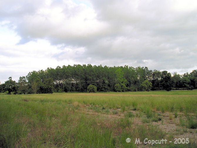
La Motte a Poljeau submitted by TheCaptain on 28th Jul 2007. To the north of the Couvoisier town of Jarnac, near the village of Métairies is marked a tumulus called La Motte a Poljeau.
(View photo, vote or add a comment)
Log Text: To the north of the Couvoisier town of Jarnac, near the village of Métairies is marked a tumulus. I thought I'd found a massive tumulus in about the right place in amongst some trees, but a closer inspection didn’t show there to be an obvious tumulus there. It was getting late, so i didnt look too much harder, as its time to stop for the day.
La Mouïse-Martin Dolmen
Trip No.204 Entry No.283 Date Added: 11th Sep 2020
Site Type: Burial Chamber or Dolmen
Country: France (Centre:Loire-et-Cher (41))
Visited: Yes on 8th Aug 2005. My rating: Condition 3 Ambience 3 Access 4
La Mouïse-Martin dolmen submitted by TheCaptain on 10th Aug 2011. The Mouïse-Martin dolmen was to be found in a field of tall sweetcorn just to the east of the little lane leading up to Mouïse-Martin farm.
(View photo, vote or add a comment)
Log Text: To the northeast of the village of Tripleville, the Mouïse-Martin dolmen can be found in a field of tall sweetcorn just to the east of the little lane leading up to Mouïse-Martin farm. Its about 80 metres from the road, and the capstone can be seen covered in grass high above the sweetcorn, so it's either sitting on some good support stones, or on a fairly big mound. The capstone looks to be roundish, about 3 metres in diameter, and fairly thick.
As I was writing this, a farmer drives by in his tractor, and stopped for a chat with me. He told me that if I wanted to walk to the dolmen it would be OK. I couldn't quite see how I was going to be able to do this without either pushing through all the maize, or I would have to go to the far end of the field and then a long walk between the rows. Time was getting on, so I decline his kind offer. What a nice attitude most of the farmers and landowners in France seem to have.
La Moustoir stèle
Trip No.204 Entry No.36 Date Added: 8th Jul 2020
Site Type: Standing Stone (Menhir)
Country: France (Bretagne:Morbihan (56))
Visited: Yes on 12th Jul 2005. My rating: Condition 4 Ambience 4 Access 5
La Moustoir stèle submitted by TheCaptain on 5th May 2011. Just round the southwest side of the little chapel at Moustoir can be found this nice granite stele. Its about 2.3 metres tall and nicely shaped, with a flat face facing to the southeast. Onto this face has been carved a cross.
(View photo, vote or add a comment)
Log Text: Just round the southwest side of the little chapel at Moustoir can be found this nice granite stele. Its about 2.3 metres tall and nicely shaped, with a flat face facing to the southeast. Onto this face has been carved a cross.
La Palanque de Peyre
Trip No.203 Entry No.232 Date Added: 22nd Apr 2020
Site Type: Standing Stone (Menhir)
Country: France (Aquitaine:Gironde (33))
Visited: Couldn't find on 3rd Jun 2005
Log Text: I had a look all around the region here, but with nothing marked on any of my maps, and nothing signed from the village, I gave up, as after all the time I had spent looking for Bignon I had to move on.
