Contributory members are able to log private notes and comments about each site
Sites theCAptain has logged. View this log as a table or view the most recent logs from everyone
Dolmen du Chausse
Trip No.205 Entry No.258 Date Added: 13th Dec 2020
Site Type: Burial Chamber or Dolmen
Country: France (Auvergne:Cantal (15))
Visited: Yes on 26th Sep 2005. My rating: Condition 4 Ambience 3 Access 4

Dolmen du Chausse submitted by thecaptain on 23rd Nov 2008. This little dolmen is still mostly contained within its large cairn of stones, except that it has been dug into from the southern side.
(View photo, vote or add a comment)
Log Text: Signposted as tumulus from the village of Mons, just to the east of junction 28 of the A.75 Autoroute near to St Flour. The trackway leads you back over the A.75 and then about another 300 metres. It is probably possible to drive to it, but I parked and walked.
The little dolmen is still mostly contained within its large cairn of stones, except that it has been dug into from the southern side. The cairn is about 16 metres in diameter and 2 metres high, made of loose small volcanic rocks. The dolmen has a capstone 3m by 2m sat on top of a chamber 2m by 1m, with two side slabs but no obvious backstone.
The chamber is full of rocks, and opens southwards with fine views, spoiled slightly by the A.75 motorway screaming past ! A nice place to visit, with lots of yellow mullens growing on and around. Apparently there are many legends attached to this tomb, but I am not sure what any of them are.
Plateau de Mons
Trip No.205 Entry No.259 Date Added: 13th Dec 2020
Site Type: Barrow Cemetery
Country: France (Auvergne:Cantal (15))
Visited: Saw from a distance on 26th Sep 2005
Log Text: On top of the plateau is a large collection of earthen barrows dating to the iron age which can be seen from the track.
Pierre du Tombeau
Trip No.205 Entry No.260 Date Added: 13th Dec 2020
Site Type: Standing Stone (Menhir)
Country: France (Auvergne:Puy-de-Dôme (63))
Visited: Yes on 26th Sep 2005. My rating: Condition 4 Ambience 2 Access 5
Pierre du Tombeau submitted by thecaptain on 13th Oct 2006. Pierre du Tombeau, Davayat menhir, Montotoute menhir. Take your pick for its name.
A little sign near to the menhir.
(View photo, vote or add a comment)
Log Text: Right in the middle of the village of Davayat, near to the traffic lights, this menhir resides in amongst the houses, and is half hidden in a garden yard. It is 4.8 metres high, leaning nicely, and is one of the biggest menhirs in the Auvergne region.
The menhir is perhaps lucky to survive right here between the houses, and in many respects perhaps owes its survival to it being seen as an important and sacred monument throughout history by the inhabitants of the village. There was once another large menhir nearby, but traces of this can no longer be found, it falling victim to agricultural "progress".
La Pierre Dolmen
Trip No.205 Entry No.261 Date Added: 13th Dec 2020
Site Type: Burial Chamber or Dolmen
Country: France (Centre:Indre (36))
Visited: Yes on 27th Sep 2005. My rating: Condition 3 Ambience 4 Access 4
La Pierre dolmen submitted by theCaptain on 16th Dec 2010. What I found here is probably the remains of an Angevin dolmen, made with a single backstone, two sidestones each side with two capstones, the rear one in place, the forward one broken and fallen into the chamber.
There are signs of an entry portal, now all a bit broken.
(View photo, vote or add a comment)
Log Text: It was a bit of a struggle to find this, due to several of the roads being closed for some reason. However, take the D.23 road southwest from Moulins-sur-Céphons towards St Martin-de-Lamps. About midway between the two is the hamlet of La Pierre, and there are signs to the dolmen. It is about 800 metres walk from the road, round the back of the houses.
What I found is probably the remains of an Angevin dolmen with a large 6 m by 3 m chamber, made with a single backstone, two sidestones each side with two capstones, the rear one in place, the forward one broken and fallen into the chamber. There are signs of an entry portal, now all a bit broken. Some of the stones are massive thick chunks, not nice slim slabs.
La Pierre cromlech
Trip No.205 Entry No.262 Date Added: 13th Dec 2020
Site Type: Stone Circle
Country: France (Centre:Indre (36))
Visited: Couldn't find on 27th Sep 2005
Log Text: While at the La Pierre dolmen, I could find no signs of any cromlech. Perhaps the form of the sideslabs of the dolmen was enough for this to once be thought of as a cromlech ?
Les Chateliers
Trip No.205 Entry No.263 Date Added: 13th Dec 2020
Site Type: Ancient Village or Settlement
Country: France (Centre:Indre (36))
Visited: Saw from a distance on 27th Sep 2005
Log Text: At the village of Moulins-sur-Céphons is a reconstruction of an ancient Gallic village. I did not visit.
Pierre Levée (Liniez)
Trip No.205 Entry No.264 Date Added: 13th Dec 2020
Site Type: Passage Grave
Country: France (Centre:Indre (36))
Visited: Yes on 27th Sep 2005. My rating: Condition 4 Ambience 3 Access 5
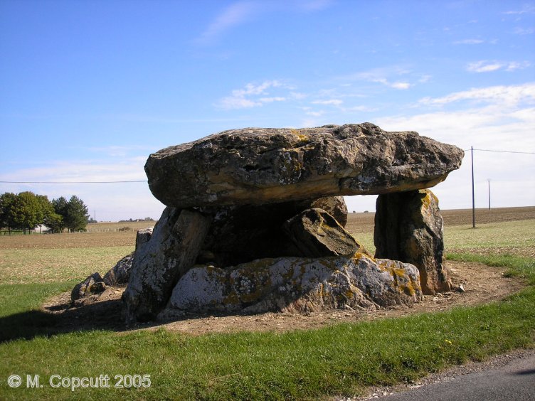
Pierre Levée (Liniez) submitted by thecaptain on 16th Jan 2009. The back cell of the chamber is still all nicely erect, making this a pleasant monument to visit. It is all orientated towards the east at 070°.
(View photo, vote or add a comment)
Log Text: Just outside the village of Liniez, along the D.926 road towards Vatan, and to the right of the road can be seen the remains of this allée couverte. It was probably an Angevin type allée couverte, but there are no obvious remains of the porchway. The remains of the chamber are 10 metres long by 4 metres wide, and it was probably covered by four capstones, of which three remain in various positions, from still in place at the back end, sloping in the middle and flat on the ground at the front. Several side slabs remain, as does the backslab, and there is evidence of a possible internal partition, although it could be bits of broken capstone. The back cell of the chamber is still all nicely erect, making this a pleasant monument to visit. It is all orientated towards the east at 070°.
Liniez Tumulus elliptique
Trip No.205 Entry No.265 Date Added: 13th Dec 2020
Site Type: Chambered Tomb
Country: France (Centre:Indre (36))
Visited: Saw from a distance on 27th Sep 2005
Log Text: Just outside the village of Liniez, along the D.926 road towards Vatan, and to the left of the road about a kilometre beyond the dolmen is the remains of a large tumulus. I found it difficult to stop here, and there was lots of fenced off land and woodland, so I didn't get to see this directly.
La Pierre Levée (Graçay)
Trip No.205 Entry No.266 Date Added: 13th Dec 2020
Site Type: Burial Chamber or Dolmen
Country: France (Centre:Cher (18))
Visited: Saw from a distance on 27th Sep 2005
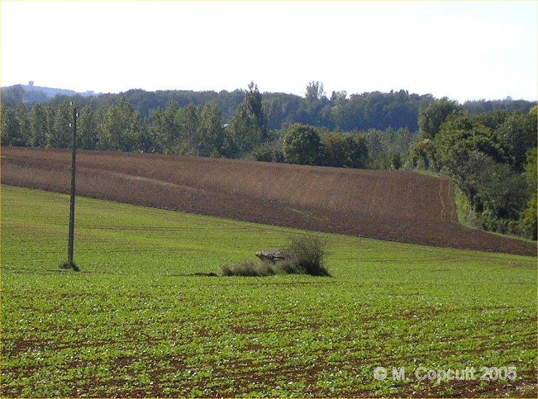
La Pierre Levée (Graçay) submitted by thecaptain on 19th Sep 2008. Just to the south of the D.68 road between Graçay and Nohant-en-Graçay, near to the hamlet of Les Villaines can be seen the remains of this dolmen, about 100 metres from the road in a field.
(View photo, vote or add a comment)
Log Text: Just to the south of the D.68 road between Graçay and Nohant-en-Graçay, near to the hamlet of Les Villaines can be seen the remains of this dolmen, about 100 metres from the road in a field. When I was here, the field had been recently planted, so I did not venture any nearer to the dolmen. It was hard to make out any details, but one capstone can be seen to be still raised above the ground on its supports.
Tréfoux deux menhirs
Trip No.205 Entry No.267 Date Added: 13th Dec 2020
Site Type: Standing Stones
Country: France (Centre:Indre (36))
Visited: Yes on 27th Sep 2005. My rating: Condition 3 Ambience 4 Access 4

Tréfoux deux menhirs submitted by thecaptain on 19th Sep 2008. Near to a corner in the road are two standing rocks, which are clearly not naturally like that. One is about 1 metre tall, the other about 1.2 metres tall.
(View photo, vote or add a comment)
Log Text: Marked on my ign map to the southeast of Bagneux are menhirs. Driving along the little road that passes them is lots of what looks like natural stone outcropping, and perhaps the remains of a dolmen. However, near to a corner in the road are two standing rocks, which are clearly not naturally like that. One is about 1 metre tall, the other about 1.2 metres tall. Around them are many more rocks. It is not difficult to see what is perhaps an alignment of 5 or 6 rocks with others fallen. Or perhaps it is the remains of an allée couverte type structure. I am not sure exactly what is going on here, but it is a nice spot in the forest. A bit further along the road to the west is what seems to be the remains of another fallen menhir or two.
Pierre Levée de Boisy
Trip No.205 Entry No.268 Date Added: 13th Dec 2020
Site Type: Standing Stone (Menhir)
Country: France (Centre:Indre (36))
Visited: Couldn't find on 27th Sep 2005
Log Text: The village of Bagneux has a signposted footpath of length 5.5 km which takes in three megalithic sites. One of these sites is this menhir. I didn't have time to do the full walk, and without a detailed map, and no obvious signs to the menhir, I didn't really know where to look. I have since found this menhir marked on a detailed map, and it would have perhaps been a fairly simple few hundred metres walk from the Bellevue farm.
Pierre Couverte de Bué
Trip No.205 Entry No.269 Date Added: 13th Dec 2020
Site Type: Burial Chamber or Dolmen
Country: France (Centre:Indre (36))
Visited: Yes on 27th Sep 2005. My rating: Condition 4 Ambience 5 Access 4
Pierre Couverte de Bué submitted by theCaptain on 14th Dec 2010. A couple of kilometres to the southeast of the village of Bagneux near to the hamlet of Bué, can be found this dolmen in a lovely situation in the forest.
(View photo, vote or add a comment)
Log Text: A couple of kilometres to the southeast of the village of Bagneux near to the hamlet of Bué, can be found this dolmen in a lovely situation in the forest. The dolmen is well signposted from all around, and from a parking place at Bué it is about 400 metres walk. The large capstone, 6m by 4m sits on top of a chamber 5m by 3m. It has a backstone and six sidestones in various positions of uprightness. The capstone is between 1 and 1.5 metres above the ground.
It has got its own bench nearby on which to sit and contemplate, with falling acorns a hazard, and a woodpecker pecking away amongst other things. This really is a lovely spot, and so gets a 5 for ambience.
I will make this my last megalithic site on my 6 months trip round France, it really is a nice place to finish on, and an unexpected dolmen at that.
It is now 2:30pm, and I really ought to be getting on driving back towards my sister's. Romorantin, Blois (roadworks), Vendome (Roadworks, big crane, school traffic), St-Calais (terrible traffic), Le Mans (rain, traffic jams), Alencon (slow traffic), Argentan, Flers (dug up, closed roads, diversions within diversions). It takes forever to find Vire, now in the complete dark, St-Lo (more diversions) and finally back to Sara's at about 9:30pm. I was amazed I didn't get tired or dozy at all while driving. Parked with 117630 km on the clock, 545 for today. Sausages and eggs (yummy), large beer, then to bed after seeing a depressing news on the telly. I've not missed missing all the bad news from around the world while away in my campervan.
Menhir de la Demoiselle de Bracqueville
Trip No.206 Entry No.5 Date Added: 25th Mar 2020
Site Type: Standing Stone (Menhir)
Country: France (Normandie:Calvados (14))
Visited: Yes on 28th Sep 2006. My rating: Condition 3 Ambience 3 Access 4
Menhir de la Demoiselle de Bracqueville submitted by thecaptain on 11th Oct 2006. To visit this stone, find your way from Beny-sur-Mer to the south along small tracks to Bracqueville farm. Park near to the farm, and walk about 500 metres along the track which passes in front of the farm till you get to a junction of trackways. Take the grassy track to the left, and the menhir is a further 500 metres along and just into the field on the left.
(View photo, vote or add a comment)
Log Text: Found this at last, on probably my third attempt. Find your way from Beny-sur-Mer to the south along small tracks to Bracqueville farm. Park near to the farm, and walk about 500 metres along the track which passes in front of the farm till you get to a junction of trackways. Take the grassy track to the left, and the menhir is a further 500 metres along and just into the field on the left.
Its about 1.4 metres tall, 0.7 metres wide and 0.3 metres thick, and leaning towards the north. The farmer has left very little room around it, and it has some very recent scrapes and damage done to it, no doubt from farm machinery. It is likely that this menhir often gets obscured by crops in the summer. Nice to have found it, its a nice stone. Stupidly I forgot to take my gps with me to get a proper position.
Menhir dit Pierre Debout (Reviers)
Trip No.206 Entry No.6 Date Added: 25th Mar 2020
Site Type: Standing Stone (Menhir)
Country: France (Normandie:Calvados (14))
Visited: Yes on 28th Sep 2006. My rating: Condition 2 Ambience 3 Access 4
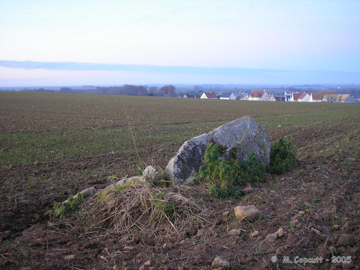
Menhir dit Pierre Debout (Reviers) submitted by thecaptain on 29th Dec 2005. Reviers menhir.
Just inland from the D-Day beaches can be found (when the crops are down) the sad remains of this menhir.
(View photo, vote or add a comment)
Log Text: As I am right here and passing by, thought I may as well stop and take a look in the daylight. The crops in the field are growing, or more likely its been left fallow, but the ploughs have been right up to the stone and its fairly difficult to spot, even with this small growth. The poor stone is in a very sorry state, and could do with some TLC. Shame its so woefully looked after, so close to the well maintained large barrow.
Carnac Plage Dolmen
Trip No.206 Entry No.35 Date Added: 23rd Mar 2025
Site Type: Burial Chamber or Dolmen
Country: France (Bretagne:Morbihan (56))
Visited: Yes on 29th Jun 2016. My rating: Condition 4 Ambience 3 Access 5

Carnac Plage dolmen submitted by Ogneslav on 19th Jul 2008. Carnac Plage dolmen
(View photo, vote or add a comment)
Log Text: In square Leblois in the seaside resort of Carnac plage can be found a dolmen and a menhir.
La Longue Pierre (St-Pierre-Eglise)
Trip No.207 Entry No.7 Date Added: 25th Mar 2020
Site Type: Standing Stone (Menhir)
Country: France (Normandie:Manche (50))
Visited: Yes on 5th Apr 2007. My rating: Condition 4 Ambience 3 Access 4
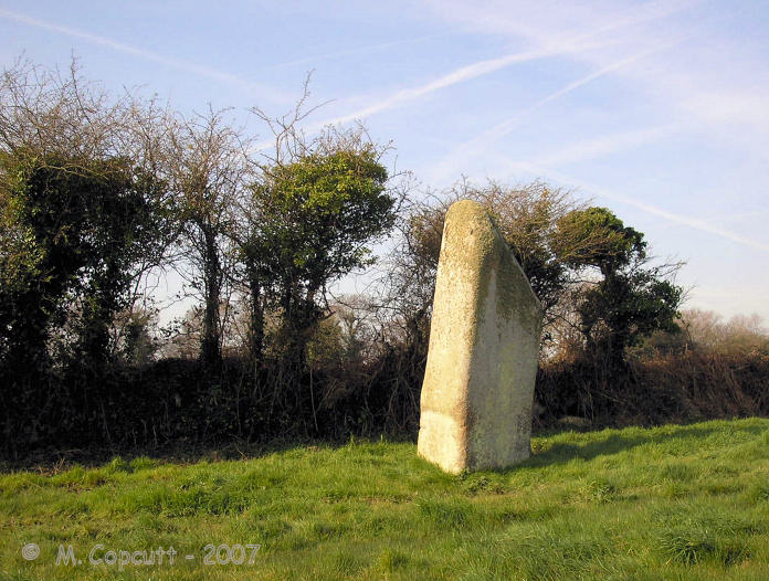
La Longue Pierre (St-Pierre-Eglise) submitted by TheCaptain on 29th Sep 2007. One of the "Three Princesses", this menhir stands 4.2 metres high, perhaps the largest menhir remaining standing in La Manche today.
(View photo, vote or add a comment)
Log Text: I was able to get right to this lovely stone this time, although in a rush as there was nowhere to park and I left the car blocking the little lane. The stone stands about 4 metres tall in a very swampy field, and I got soaking wet feet while walking up to the stone, but at least it washed clean all the mud from La Pierre Plantée. It now has a little information post at the gateway to the field, and is numbered on a marked walk around the village, so I must go and look for more information at St Pierre l'Eglise.
Dent de Gargantua
Trip No.208 Entry No.1 Date Added: 10th Jun 2020
Site Type: Standing Stone (Menhir)
Country: France (Bretagne:Ille-et-Vilaine (35))
Visited: Yes on 20th Mar 2008. My rating: Condition 4 Ambience 3 Access 5
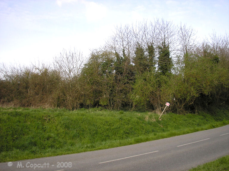
Dent de Gargantua submitted by thecaptain on 6th Apr 2008. Le Dent de Gargantua. The view from the roadside. It's in there, honestly !
(View photo, vote or add a comment)
Log Text: This 4 or 5 metre tall white quartz menhir is contained within a private orchard near to Chablé in the community of St Suliac, near the Rance estuary south of St Malo. Although it is very close to the road, getting to see it through the hedges which surround it is not easy. Not too long ago, there was an allée couverte nearby which has now been destroyed by the farmer, and also another menhir, Le Gravier de Gargantua.
Champ des Roches
Trip No.208 Entry No.2 Date Added: 10th Jun 2020
Site Type: Multiple Stone Rows / Avenue
Country: France (Bretagne:Côtes-D'Armor (22))
Visited: Yes on 20th Mar 2008. My rating: Condition 4 Ambience 5 Access 4

Champ des Roches submitted by thecaptain on 2nd Jul 2005. About 70 big white quartz stones arranged in 5 lines, perhaps 6, which are not quite parallel as they converge towards the east.
(View photo, vote or add a comment)
Log Text: None
Thiemblais menhir
Trip No.208 Entry No.3 Date Added: 10th Jun 2020
Site Type: Standing Stone (Menhir)
Country: France (Bretagne:Côtes-D'Armor (22))
Visited: Yes on 20th Mar 2008. My rating: Condition 5 Ambience 5 Access 4

Thiemblais menhir submitted by neolithique02 on 21st Feb 2014. Le menhir de Saint-Samson sur Rance (Côtes d'Armor) Site in Bretagne:Côtes-D''Armor (22) France
Image copyright: Néolithique02, hosted on Flickr and displayed under the terms of their API.
(View photo, vote or add a comment)
Log Text: My second visit to this most wonderful menhir, about 1:30pm, late March 2008, in a hazy sun, and some of the carvings on the front face can be seen. An hour or two earlier would have been better, as would a stronger sun. After a while, you "get your eye in" and more and more wonderful carvings come into view. I can see on here (with the eye of the knowing, and the full def picture) the animal (mid left, just above the quartz vein) and a couple of crosses and other bits and pieces.
Having got hold of a new book about the megalithes around Dinan, I can report that a revised picture of the carvings has been published in the last year or so, after various techniques have been used to make the carvings more prominent. These seem to agree more with what I saw several years ago and have been recorded in my photographs. Mind you, it seems that the "animal" on the mid left of the stone may have turned around, and its legs almost doubled in length !!! Now it is perhaps running to the right, rather than grazing to the left....
But to be serious for a while, this really is one of the most magnificent megalithic sites I have visited, and it has the capability of bringing emotions to the surface. Here is plain evidence of the cross symbol being used at important places 2500 years or more BC. And the importance of the animals....
And the shaping of the stone - look how flat the main face is, and how straight the upright edges are, even after about 5000 years of erosion. And this surely couldn't have been a one off ? Surely many more of these wonderful menhirs would have been carved and patterned ? Damn all those girls and floozies who have climbed and slid down the stone in their birth knickers in the hope of getting wed. The front face is almost polished smooth, with the carvings almost rubbed smooth.
La Ganterie
Trip No.208 Entry No.4 Date Added: 13th Jun 2020
Site Type: Passage Grave
Country: France (Bretagne:Côtes-D'Armor (22))
Visited: Yes on 20th Mar 2008. My rating: Condition 2 Ambience 2 Access 4

La Ganterie submitted by thecaptain on 9th Apr 2008. Revisiting this in March 2008, it was not so overgrown as it had been in June 2005, but it was still impossible to tell how long the allée couverte was, with the eastern end (right) all covered in very thick brambles and other bushes.
(View photo, vote or add a comment)
Log Text: Revisiting this in March 2008, and it was not so overgrown as it had been in June 2005, but it was still impossible to tell how long the allée couverte was, with the eastern end all covered in very thick brambles and other bushes. The more open western end has one or two capstones still sitting on top of their supports, with the two side walls of the allée being about 1.5 metres apart.
