Contributory members are able to log private notes and comments about each site
Sites theCAptain has logged. View this log as a table or view the most recent logs from everyone
La Berthellière
Trip No.202 Entry No.33 Date Added: 26th Mar 2020
Site Type: Polissoir
Country: France (Pays de la Loire:Mayenne (53))
Visited: Yes on 29th Apr 2005. My rating: Condition 4 Ambience 4 Access 4
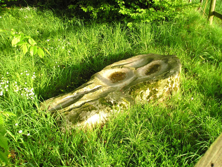
La Berthellière submitted by TheCaptain on 8th May 2005. La Berthellière polissoir, Montenay, Mayenne.
A lovely polissoir stone which has been polished fantastically smooth by thousands of years of stone tool making.
(View photo, vote or add a comment)
Log Text: A lovely polissoir stone found a couple of kilometres southeast of the village of Montenay near to the town of Ernée in Mayenne. The stone is signposted and found in a little wooded area about 50 metres down a lane from the farm of the same name.
The stone is flat on the ground about 2 metres in length and about half to three quarters of a metre wide. It has 3 big polishing bowls several sharpening grooves and several other polished features. It is a very hard looking stone which has been polished fantastically smooth by thousands of years of stone tool making.
I am starting to really like these polissoir stones they really bring the ancient people to life sitting here polishing away at their axes and tools. They say far more than any dolmen or menhir to me.
La Baraque Dolmen
Trip No.203 Entry No.182 Date Added: 19th Apr 2020
Site Type: Burial Chamber or Dolmen
Country: France (Midi:Aveyron (12))
Visited: Yes on 28th May 2005. My rating: Condition 4 Ambience 4 Access 4

La Baraque dolmen submitted by thecaptain on 19th Dec 2005. This is a nice little dolmen still well contained within its mound which can be found about 150 metres down the footpath to the north of the road to Baraque Farm
(View photo, vote or add a comment)
Log Text: This is a nice little dolmen still well contained within its mound which can be found about 150 metres down the footpath to the north of the road to Baraque Farm / Gite about 150 metres before you reach it. The chamber is only about 2 metres in length, 1 metre wide and 1 metre high, much smaller than a lot round here, but it is very neat, and has a little information sign.
La Baraque de l'Estrade
Trip No.205 Entry No.222 Date Added: 6th Dec 2020
Site Type: Burial Chamber or Dolmen
Country: France (Languedoc:Lozère (48))
Visited: Yes on 25th Sep 2005. My rating: Condition 5 Ambience 4 Access 4
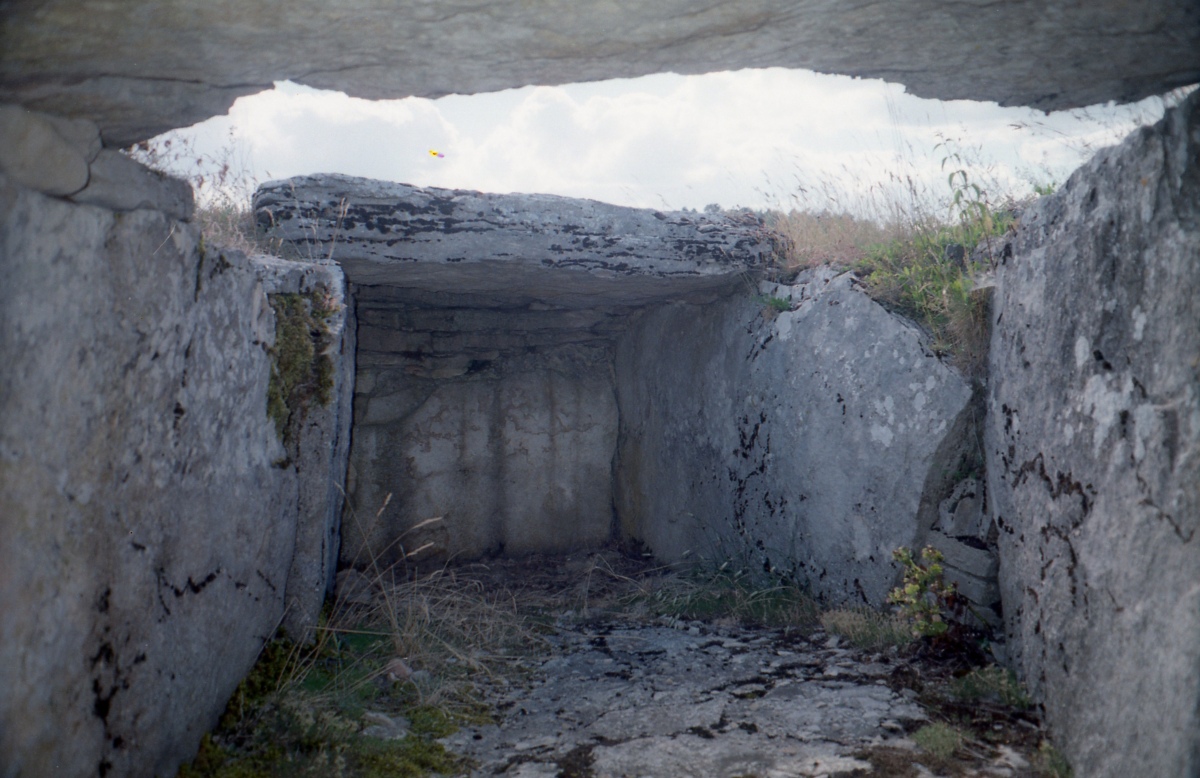
La Baraque de l'Estrade submitted by johnstone on 12th Apr 2020. The capstone in the middle is gone, gives a good look inside, July 22, 1999
(View photo, vote or add a comment)
Log Text: Further along the D.35 from Montmirat, just before the junction with the D.31, a decent sized tumulus can be seen in the fields on the left, about 80 metres from the road. The mound is oval, about 15m by 12m and up to 2 m high. In the centre of this is a sort of double dolmen, with two joined chambers, each having two side slabs and a capstone. The western of the two has a backstone, while the eastern has a drystone walled end. The total length of the chamber is about 6 metres, and up to 2 metres wide at the centre. The floor to the chambers is paved, and there is not much more than a metre in height below the capstones. The two chambers do not align directly, but the general orientation is east to west, at about 100°, and the chambers are completely contained within the mound. This has of course been restored, but a very nice find.
L'Usteau du Loup
Trip No.204 Entry No.196 Date Added: 24th Aug 2020
Site Type: Passage Grave
Country: France (Auvergne:Puy-de-Dôme (63))
Visited: Yes on 27th Jul 2005. My rating: Condition 3 Ambience 4 Access 4
L'Usteau du Loup submitted by thecaptain on 10th Sep 2006. On a little granite outcrop, near to the village sports ground, surrounded by high hills, it sits under an oak tree.
This is a megalithic monument which has been used for thousands of years, and was used until recently as a sort of changing room for the village football team which plays on the nearby sports field !
(View photo, vote or add a comment)
Log Text: To the south of St-Gervazy, near to the hamlet of Unsac, can be found the remains of this fine dolmen, perhaps the largest in the region, and which is signposted from nearby. On a little granite outcrop, near to the village sports ground, surrounded by high hills, it sits under an oak tree.
The chamber is rectangular, 5 metres long by 3 metres wide, is constructed with three granite side slabs each side, and opens to the east. There is in place one very large backstone, along with one smaller one. Unfortunately there are no capstones in place, although one lays fallen behind the chamber with another one nearby. The dolmen would have been almost tall enough to stand up in, and is much larger than any other dolmens I have seen round here.
This is a fine place for a wolf to live, and there are many legends and stories associated to the place. This is also a megalithic monument which has been used for thousands of years, and was used until recently as a sort of changing room for the village football team which plays on the nearby sports field !
L'Oeuf de Gargantua
Date Added: 18th Sep 2010
Site Type: Standing Stone (Menhir)
Country: France (Normandie:Manche (50))
Visited: Yes on 26th Apr 2007
L'Oeuf de Gargantua submitted by thecaptain on 26th Apr 2007. L'Oeuf de Gargantua is a granite stone which looks like a granite egg.
There are many legends and folk tales associated with it.
(View photo, vote or add a comment)
Log Text: None
L'Hotié de Viviane
Trip No.204 Entry No.12 Date Added: 4th Jul 2020
Site Type: Chambered Tomb
Country: France (Bretagne:Ille-et-Vilaine (35))
Visited: Yes on 10th Jul 2005. My rating: Condition 3 Ambience 5 Access 3

L'Hotié de Viviane submitted by TheCaptain on 6th Jun 2007. The site was excavated in 1982/1983, when pottery and polished axes were found, and it was carbon dated to about 3000 BC.
(View photo, vote or add a comment)
Log Text: This can be found about a kilometre walk from the same car park that is used to visit the Tombeau des Géants, but in the other direction. It is signposted. Just below and to the north of a ridge with tremendous views can be found this little grave, about 3 metres long and 1 metre wide, made with 1.5 metre tall side slabs. It is enclosed within a 12 metre diameter stone cairn with a ring of stones around the outside. It is supposedly a rarity in Brittany, but reminds me of a more complete version of the smaller tombelles near to the Rocher de Bono.
The site was excavated in 1982/1983, when pottery and polished axes were found, and it was carbon dated to about 3000 BC. It is also know b ythe name "Tombeau des Druides.
L'Etoile allée couverte
Trip No.204 Entry No.58 Date Added: 11th Jul 2020
Site Type: Passage Grave
Country: France (Bretagne:Morbihan (56))
Visited: Couldn't find on 13th Jul 2005
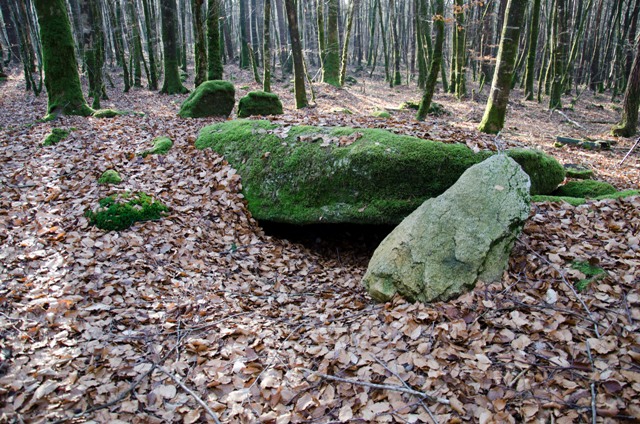
L'Etoile allée couverte submitted by Ogham on 19th Jan 2012.
The site is at 47 50.252N 003 00.745W taken with a hand held GPS.
(View photo, vote or add a comment)
Log Text: After all the time spent looking for the previous stones, I thought that I'd best not go on another long walk through the forest to try and find this one. My notes and books say that it is difficult to find, so I left it alone.
L'Eléphant
Trip No.200 Entry No.84 Date Added: 18th Jun 2020
Site Type: Rock Outcrop
Country: France (Midi:Tarn (81))
Visited: Yes on 24th Sep 2000. My rating: Ambience 4 Access 3

L'Eléphant submitted by johnstone on 22nd Nov 2018. In front of the granite elephant on Sep.12, 2018
(View photo, vote or add a comment)
Log Text: Celebrated rock formation thought to represent an elephant, in the Sidobre region to the east of Castres.
L'Aurière menhir
Trip No.204 Entry No.310 Date Added: 12th Sep 2020
Site Type: Standing Stone (Menhir)
Country: France (Pays de la Loire:Maine-et-Loire 49)
Visited: Couldn't find on 12th Aug 2005
Log Text: This menhir is by the little picnic area at the place where I was stopped from turning by another car going into there.
L'Armor menhir
Trip No.203 Entry No.567 Date Added: 3rd Jun 2020
Site Type: Standing Stone (Menhir)
Country: France (Bretagne:Côtes-D'Armor (22))
Visited: Couldn't find on 24th Jun 2005

L'Armor menhir submitted by theCaptain on 19th May 2014. The "classic" view of this menhir, taken from a few metres inside the garden having nipped up the driveway a bit.
(View photo, vote or add a comment)
Log Text: This menhir is in a private garden with a massive thick hedge surrounding it. I didn't get to see the stone, but it is supposedly about 2 metres in height.
L'Armor menhir
Trip No.214 Entry No.21 Date Added: 3rd Jun 2020
Site Type: Standing Stone (Menhir)
Country: France (Bretagne:Côtes-D'Armor (22))
Visited: Yes on 17th Apr 2014. My rating: Condition 3 Ambience 3 Access 5

L'Armor menhir submitted by theCaptain on 19th May 2014. This menhir is in a private garden which had a huge and thick hedge around it, making the menhir difficult, if not impossible to see. However, since my last visit, the (presumably new) owners of the house have cut the hedge beside the road, and indeed made a gap through which the menhir can now be clearly seen.
(View photo, vote or add a comment)
Log Text: This menhir is in a private garden which had a huge and thick hedge around it, making the menhir difficult, if not impossible to see. However, since my last visit, the (presumably new) owners of the house have cut the hedge beside the road, and indeed made a gap through which the menhir can now be clearly seen. The menhir is a pointed piece of granite, between 2 and 3 metres tall. A win for all.
L'Armoirie menhir
Trip No.204 Entry No.62 Date Added: 11th Jul 2020
Site Type: Standing Stone (Menhir)
Country: France (Bretagne:Morbihan (56))
Visited: Couldn't find on 13th Jul 2005
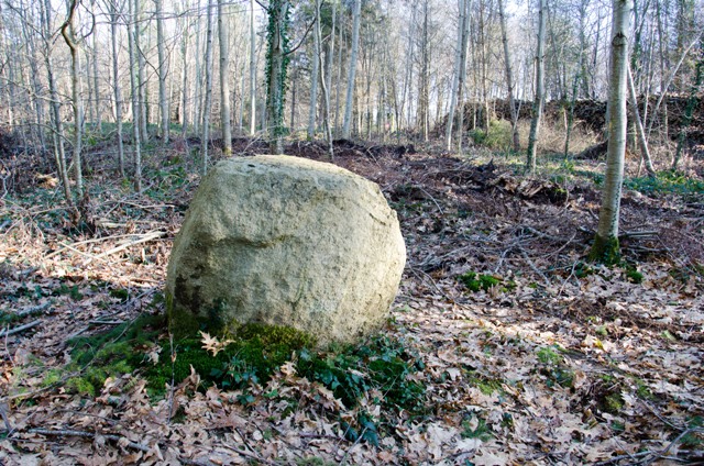
L'Armoirie menhir submitted by Ogham on 20th Jan 2012. Site in Bretagne:Morbihan (56) France
(View photo, vote or add a comment)
Log Text: I could not find the forest track which leads to this menhir, again there are no signposts obvious, and this stone is not even marked on the ign 1:25000 map, so I didn’t spend long looking.
Supposedly it’s a 1.5 metre tall menhir that has been broken, standing to the southwest of the alignement, between the D.779 and L'Armorie crossroads. So the menhir would be less imposing than most of the stones in the alignement.
L'alignement d'Espiaub
Trip No.205 Entry No.68 Date Added: 26th Oct 2020
Site Type: Stone Row / Alignment
Country: France (Midi:Haute-Garonne (31))
Visited: Yes on 9th Sep 2005. My rating: Condition 3 Ambience 5 Access 3

L'alignement d'Espiaub submitted by thecaptain on 8th Oct 2005. A view looking up the most readily identifiable stone row on Mail de Soupene mountain high up above Bagneres-de-Luchon.
This row is perhaps double, with a possible parallel row just at the edge of and in the bracken to the left.
(View photo, vote or add a comment)
Log Text: I have seen nothing definite about what is to be found up here, but it is possible to imagine/envisage that there are perhaps 4 or 5 lines of stones running across the hillside, with one or more crossing them, but it is very difficult to know exactly what is what. I walked down from the second set of cromlechs to something I could see, and found a manhole cover for a little cattle trough reservoir !
Looking back up the hillside from here, I would swear that I can see lines of stones coming down the hill from the first set of cromlechs. The stones are all in the bracken, but the bigger stones stand out above this. I think I can see 4 or 5 parallel rows of stones running down the hillside, with the stones looking evenly spaced. They extend to beyond where I am - perhaps 500 metres or more in total length, and I would estimate about 20 metres between rows. This is very difficult to photograph. But am I seeing things ? Not for nothing is there something up here called the Espiaube alignments.
While searching around on the slopes for closer signs of the parallel rows, and I still believe that I can see them, I clearly see a row running up and down the slope, across the lines of possible alignments. The top of the row starts at a spring, which has several large stones standing within a little pool, and continues downslope for about 100 metres, with perhaps more lost in the thick bracken. The stones are spaced evenly, about 8 metres apart from each other. I started to count the stones while walking up from the bottom, but part way up I am sure I saw another line running in parallel with the obvious one. The second line is in the bracken, while the first is in clear grass, as if lots of people have walked up and down here. This all reminds me very much of various Dartmoor and Exmoor rows.
L'Affiloire de Gargantua
Trip No.202 Entry No.59 Date Added: 28th Mar 2020
Site Type: Standing Stone (Menhir)
Country: France (Normandie:Orne (61))
Visited: Yes on 1st May 2005. My rating: Condition 4 Ambience 4 Access 4

L'Affiloire de Gargantua submitted by TheCaptain on 11th May 2005. Pierre de Gargantua, Craménil, Orne
A four metre high shaped menhir in a field near a marshy area, and perhaps with a spring close by.
(View photo, vote or add a comment)
Log Text: A four metre high shaped menhir in a field to the north of the little lane running west from Chêneduit to Craménil. It is across a field near a marshy area and perhaps with a spring close by. Many other stones lay around in the area.
l'Accomodement Menhir
Trip No.204 Entry No.102 Date Added: 20th Jul 2020
Site Type: Standing Stone (Menhir)
Country: France (Pays de la Loire:Maine-et-Loire 49)
Visited: Couldn't find on 16th Jul 2005
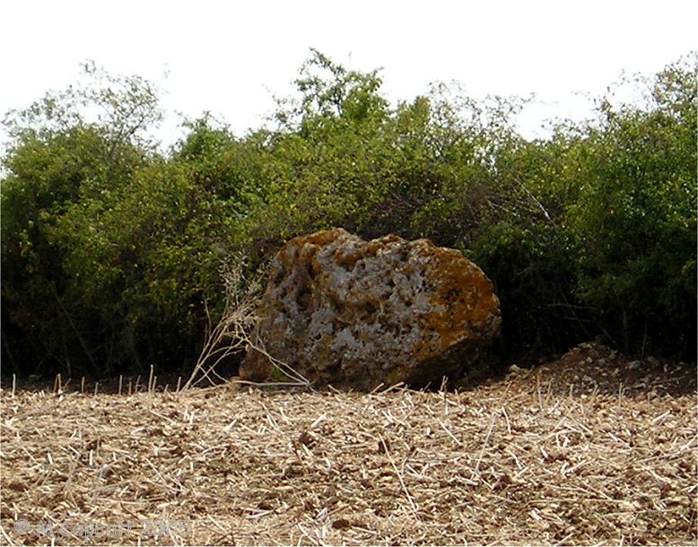
l'Accomodement Menhir submitted by TheCaptain on 28th Aug 2013. This menhir is about 3 metres in length, but only a metre high. I think probably it is broken.
(View photo, vote or add a comment)
Log Text: Somewhere between a new major road junction and a railway junction, in farmland. I tried, including driving round many farm tracks, but could find no signs of this at all.
l'Accomodement Menhir
Trip No.204 Entry No.112 Date Added: 20th Jul 2020
Site Type: Standing Stone (Menhir)
Country: France (Pays de la Loire:Maine-et-Loire 49)
Visited: Yes on 17th Jul 2005. My rating: Condition 2 Ambience 2 Access 4

l'Accomodement Menhir submitted by TheCaptain on 28th Aug 2013. This menhir is about 3 metres in length, but only a metre high. I think probably it is broken.
(View photo, vote or add a comment)
Log Text: Passing again, I tried again to find this menhir. This stone is actually right beside the railway cutting on the eastern side, just to the south of the new ring road, and visible from it. It is on the hilltop, but fallen - perhaps just put there when they were building the railway - who knows ? The stone is about 3 metres in length, but only a metre high. I think perhaps it is broken.
Kraps Ring
Date Added: 27th Sep 2020
Site Type: Ancient Village or Settlement
Country: England (Devon)
Visited: Yes on 18th Sep 2020. My rating: Condition 3 Ambience 4 Access 3
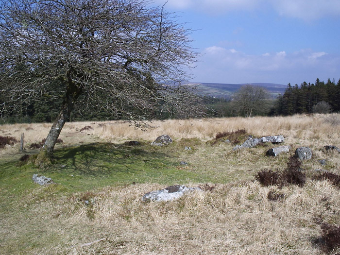
Kraps Ring submitted by simonsworn on 8th May 2005. Facing north from the isolated hut circle southwest of the settlement which is just over the ridge in the background.
(View photo, vote or add a comment)
Log Text: Time is getting on, and clouds seem to be coming over, and I am getting tired. What to do now, I don't want to give up and return the way I came, but completing the planned walk will be a lot further in distance. However, most of the rest of the walk will be on marked pathways, which is probably 3 times easier than tromping over open moorland, so I decide to carry on. So I head northwards downslope to Kraps Ring, past a lovely fallen tree which is still growing from its horizontal position, the branches now turning upwards. Then there is a lovely hut circle with a tree in its entrance. Then Kraps Ring itself. For some reason I was expecting some reasonably sized earthworks (no idea why, its not what you get on Dartmoor), but what I found was large low banks of stone, no doubt from a fallen wall with remnants of many hut circles within, rather like a smaller version of Grimspound. Again, I wonder the wisdom of the full walk via Postbridge which would involve a significant loss of altitude, so I decide to make a cut eastwards through the forest along what I assume is a track, but just turns out to be a firebreak or something. However walking through the forest adjacent to the break is pleasant and easy enough, encountering all sorts of toadstools and birds in the process, until I come to a fence at the side of the road from Postbridge to Bellever which is easy enough to get through. The walk is now much easier along the bridleway across open common land to Bellever where I decide to drop down to the river for a look at the pretty old clapper bridge in a wonderful riverside area of trees and grass. There are a couple of people having a picnic, and further down the river a couple fly fishing. Apart from all the no parking cones and other signs, there are no signs of the chaos that was supposedly here a month or so ago with masses camping out in the woodland. What a beautiful and idyllic place. Back to the bridleway which climbs up through the forest to Laughter Hole with its incredible lichen covered trees, and further up and eventually out onto the open moorland below Laughter Tor.
Kostivere Sliding Stone
Date Added: 27th Oct 2019
Site Type: Natural Stone / Erratic / Other Natural Feature
Country: Estonia
Visited: Yes on 19th Oct 2003

Kostivere Sliding Stone submitted by thecaptain on 2nd Nov 2003. Kostivere Sliding Stone. A sacred Cult Stone in Estonia, a few miles to the East of Tallinn. The stone is a glacial erratic, but has been used for ceremonial purposes for many thousands of years, and has the remains of a burial mound associated with it, and is covered in ancient cup marks. The legend associated with this stone is that it can cure infertility. Women slide down the rock bare bottomed, and their infertility will be cured.
(View photo, vote or add a comment)
Log Text: None
Kornevec Alignement
Trip No.204 Entry No.61 Date Added: 11th Jul 2020
Site Type: Stone Row / Alignment
Country: France (Bretagne:Morbihan (56))
Visited: Yes on 13th Jul 2005. My rating: Condition 3 Ambience 3 Access 4
Kornevec alignement submitted by theCaptain on 3rd Jan 2012. The Kornevec alignement is a row of menhirs, now nearly all fallen, which runs for about 300 metres through the forest on a bearing of 065°. The stones are all about 3 metres in length, and are spaced at about 4 metre intervals.
(View photo, vote or add a comment)
Log Text: This alignement can be found just to the south of Loge Charlotte, and is signposted. The alignement is a row of menhirs, now nearly all fallen, which runs for about 300 metres through the forest on a bearing of 065°. The stones are all about 3 metres in length, and are spaced at about 4 metre intervals.
Over 200 stones have been found here. It would be nice to see these stood up again, at least the non broken ones, and also a bit better looked after, as it is all very overgrown. The site is not helped by there being new trees planted in amongst the stones.
Knowlton Rings
Date Added: 18th Sep 2010
Site Type: Henge
Country: England (Dorset)
Visited: Yes on 27th May 2004
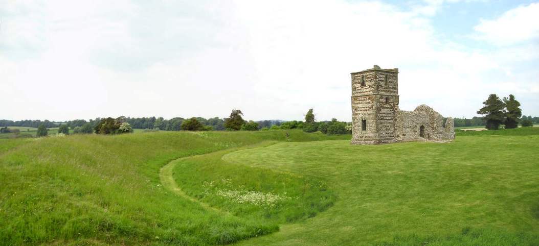
Knowlton Rings submitted by TheCaptain on 27th May 2004. Knowlton Circles, Dorset, SU024103.
Ruined church inside a lovely henge, viewed from the south.
I have been meaning to visit here for many years, and it was well worth it.
(View photo, vote or add a comment)
Log Text: None
