Contributory members are able to log private notes and comments about each site
Sites theCAptain has logged. View this log as a table or view the most recent logs from everyone
Longstone Cove
Date Added: 2nd Oct 2020
Site Type: Standing Stones
Country: England (Wiltshire)
Visited: Yes on 18th Sep 2019. My rating: Condition 3 Ambience 3 Access 4

Longstone Cove submitted by Humbucker on 5th Jan 2019. Longstones Cove basking in the sunlight on one of the last bright days of late Autumn 2018. The Ridgeway looms if the background.
(View photo, vote or add a comment)
Log Text: Legs working well after the first chiro session. Back to Avebury and walked around the henge and stones before a pint in the Red Lion. Still fairly early and legs feeling good, so walked down the route of the Beckhampton Avenue to Adam and Eve and a huge longbarrow before going back To Avebury and the car.
Longstone Cove
Date Added: 8th Oct 2020
Site Type: Standing Stones
Country: England (Wiltshire)
Visited: Yes on 4th Oct 1998. My rating: Condition 3 Ambience 3 Access 4

Longstone Cove submitted by Humbucker on 5th Jan 2019. Longstones Cove basking in the sunlight on one of the last bright days of late Autumn 2018. The Ridgeway looms if the background.
(View photo, vote or add a comment)
Log Text: Visit lots of ancient sites on a long off road cycle tour from Avebury to Windmill Hill, along the Wansdyke and back up Kennet Avenue
Longstone Hill cairn
Date Added: 21st Aug 2024
Site Type: Cairn
Country: England (Devon)
Visited: Yes on 2nd Aug 2024. My rating: Condition 2 Ambience 4 Access 3
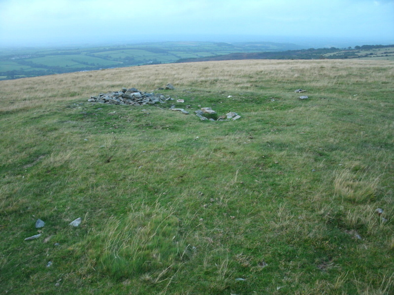
Longstone hill cairn submitted by Bladup on 5th Oct 2014. Longstone hill cairn.
(View photo, vote or add a comment)
Log Text: From the Longstone, I head northwards along the summit trackway which takes me past the stony cairn on my way down to the dam and back across to the car. Now very weary, I head for a well deserved pint at Betty Cottles.
Longstone Hill stone
Date Added: 21st Aug 2024
Site Type: Standing Stone (Menhir)
Country: England (Devon)
Visited: Yes on 2nd Aug 2024. My rating: Condition 2 Ambience 4 Access 3
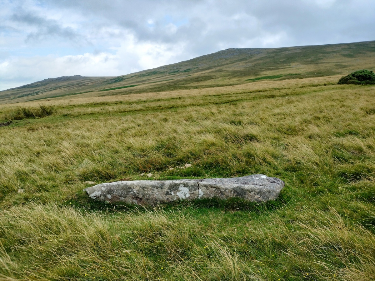
Longstone Hill stone submitted by TheCaptain on 21st Aug 2024. It certainly looks like a shaped menhir to me, and not just a piece of granite!
(View photo, vote or add a comment)
Log Text: After passing the large ring cairn, heading down from Yes Tor to Longstone Hill, there is no semblance of a pathway, but luckily the visibility is now good, and I can clearly see where I am heading towards, and the trackways across it. Its not too bad going down, and once on Longstone Hill, I find the fallen longstone fairly easily. It certainly looks like a shaped menhir to me, and not just a piece of granite!
Longstones Barrow
Date Added: 2nd Oct 2020
Site Type: Long Barrow
Country: England (Wiltshire)
Visited: Yes on 18th Sep 2019. My rating: Condition 3 Ambience 3 Access 4

Longstones Barrow submitted by SumDoood on 6th Sep 2019. 040919: From the WSW.
(View photo, vote or add a comment)
Log Text: Remains of a big longbarrow just to the north of Beckhampton roundabout, roughly in line with the Avebury western Avenue. I wonder how much this has been altered over the years, as the land around it is slightly raised making a much longer shape, perhaps double the remaining length. It also looks like the northeastern end has a horned courtyard entrance feature, but this is well within the yaised ground, and also looks too good to be original, as it is not slumped down enough to my eyes. Looking at historical records, and it is stated that "the mound has been severely mutilated and its terminals ploughed", and had been "much damaged by the digging chalk out of it and perhaps stones"
Longstones Barrow
Date Added: 8th Oct 2020
Site Type: Long Barrow
Country: England (Wiltshire)
Visited: Yes on 4th Oct 1998. My rating: Condition 3 Ambience 3 Access 4

Longstones Barrow submitted by SumDoood on 6th Sep 2019. 040919: From the WSW.
(View photo, vote or add a comment)
Log Text: Visit lots of ancient sites on a long off road cycle tour from Avebury to Windmill Hill, along the Wansdyke and back up Kennet Avenue
Los Millares
Date Added: 18th Sep 2010
Site Type: Ancient Village or Settlement
Country: Spain (Andalucía)
Visited: Yes on 10th Apr 2008
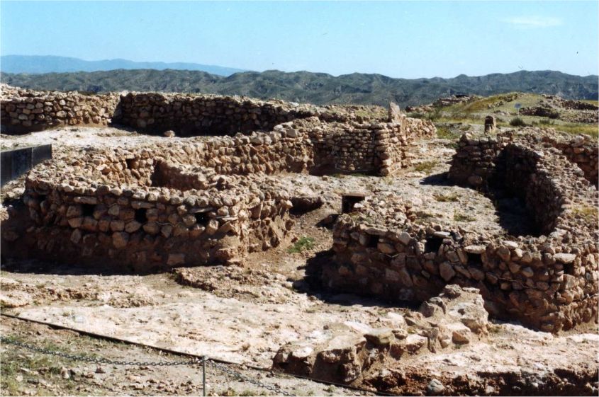
Los Millares submitted by thecaptain on 10th Apr 2008. Los Millares site is large, spectacular and very well maintained with some reconstructions for instructive purposes
(View photo, vote or add a comment)
Log Text: None
Lostmarc'h menhir
Trip No.203 Entry No.494 Date Added: 27th May 2020
Site Type: Standing Stone (Menhir)
Country: France (Bretagne:Finistère (29))
Visited: Yes on 19th Jun 2005. My rating: Condition 3 Ambience 4 Access 3

Lostmarc'h menhir submitted by thecaptain on 2nd Aug 2009. Lostmarc'h menhir stands in a commanding position on a headland overlooking the Atlantic Ocean, close to the Lostmarc'h alignments.
(View photo, vote or add a comment)
Log Text: Now, this is better, on top of a headland overlooking the Atlantic Ocean with a fine surf beach below to the south. The menhir is about 2.8 metres tall and in a commanding position, although not at the top, and as a result has a much better view. It can be seen from miles around coming from the south.
Lou Couraus Cromlechs
Trip No.205 Entry No.59 Date Added: 25th Oct 2020
Site Type: Stone Circle
Country: France (Aquitaine:Pyrénées-Atlantiques 64)
Visited: Yes on 7th Sep 2005. My rating: Condition 4 Ambience 5 Access 3

Lou Couraus Cromlechs submitted by thecaptain on 22nd Dec 2005. Lou Couraus Cromlechs.
I counted 16 circles up here of varying sizes. This is one of the smaller, but more complete examples.
(View photo, vote or add a comment)
Log Text: High up above the Ossau valley above the village of Bielle can be found several circles of stones, on a little shelf of land halfway up the mountainside, and in a wonderful viewpoint above the valley. From the village take the road up towards Col de Marie Blanc, and park at the Chapelle de Houndas after about 5 kilometres, and about 8 km before the Col. From here the cromlechs are easily reached, on a signposted walk along mountain trackways. Allow three hours for the return visit round the signposted footpath.
Unfortunately, the day I am here is not good for the weather, and I am mostly enveloped in cloud, so I am not getting the fantastic views, in fact most of my walk up the visibility is only 50 metres, which is a pity, because the big mountains around Col D'Aubisque should all be visible from here. After following the trackway for a couple of kilometres, the cromlechs are found a short distance up a steepish path to the left, and after lots of exploring, I counted what I thought to be 16 circles of various sizes.
The first cromlech I found, which I shall call Cromlech A (4), is right beside the track, and has a diameter of 6 metres, with 26 stones still in position, mostly contiguous around the outside, but with about 4 or 5 gaps. Within the circle are lots more stones, and perhaps the remnants of a central burial area, circular and about one metre in diameter. It is of course possible that these stones are the remains of a cairn, and the circular structure is a fluke (although after seeing more of these Pyrenean cromlechs later on my tour, the remains of burial cairns and cists in the centre of these circles is fairly common). A further look suggests that it may have had an entrance to the east, on 065°, between two larger white stones, with a dark one in between. This circle reminded me in many ways of that at Belstone on Dartmoor.
Cromlech B (2). This is a smaller circle, but very well formed, 4 metres in diameter, consisting of about 20 stones, with many more smaller pieces in place. The largest stone is about 0.7 metres high.
Cromlech C (1). This is about 9 metres in diameter with about 18 stones in place, with many more fallen. Some of these stones stand over a metre in height. The ground within is stony and slightly raised, suggesting the remains of a cairn. This circle is just 3 metres away from circle B at the closest point.
Cromlech D and more (6 to 15). Walking eastwards along the shelf of land from Cromlech A for 50 metres, and in a place where some of the vegetation has been cleared back can be seen many more circles of stone. It is not easy to count them, as although some are complete, several are partial, and many are buried in the undergrowth. Suffice to say that there are about a dozen circles here, made with smaller stones, and ranging in diameter from 2.5 metres to 5 metres. What I shall call circle 8 is a nicely formed circle 5 metres in diameter and with about 24 readily identifiable stones. It doesn't photograph well as it is underneath some bushes.
At last, after sitting and spending ages up here, the cloud has risen above me, and in fact there are patches of blue sky, although not as yet above the mountains. Its really beautiful up here, with birdies tweeting and bells ringing all around. How much longer should I stay though ? Perhaps its better to be getting back now, its gone 3:00pm. Ahhh, the cows have arrived. I can go back now the cows have come home ! Take many more pictures with the cows n them, the stones make good scratching posts. I get down to the van at 4:00, and its now mostly sunny. Time to tackle Aubisque and Soulor.
Louden Hill chamber
Date Added: 18th Sep 2010
Site Type: Burial Chamber or Dolmen
Country: England (Cornwall)
Visited: Yes on 25th Mar 2005
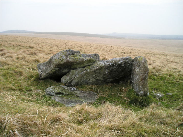
Louden Hill chamber submitted by TheCaptain on 25th Mar 2005. A possible burial chamber on the western slopes of Louden Hill, northwestern Bodmin Moor.
View of the stones here looking west at the end of a long day on the moor, with the darkness descending.
(View photo, vote or add a comment)
Log Text: None
Louden Hill circle
Date Added: 18th Sep 2010
Site Type: Stone Circle
Country: England (Cornwall)
Visited: Yes on 27th Mar 2005
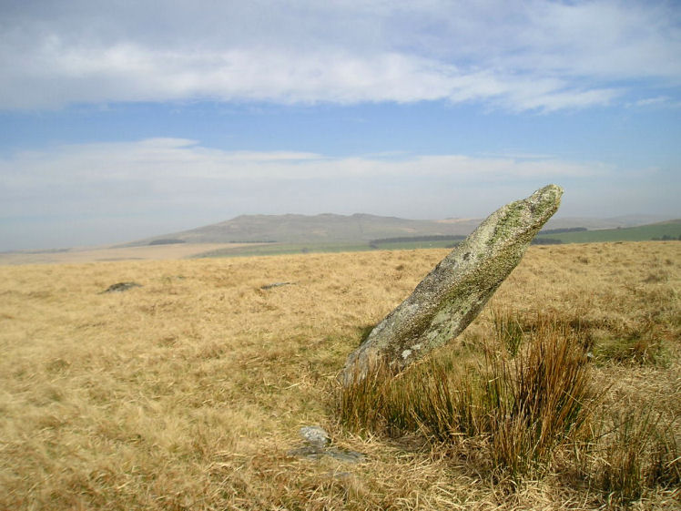
Louden Hill circle submitted by TheCaptain on 27th Mar 2005. Louden Hill stone circle.
The lovely triangular stone, and a couple of its fallen neighbours in the southern arc.
Brown Willy, Cornwalls highest mountain, is in the distance.
(View photo, vote or add a comment)
Log Text: None
Louden menhirs
Date Added: 18th Sep 2010
Site Type: Standing Stones
Country: England (Cornwall)
Visited: Yes on 12th Apr 2005
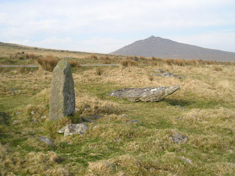
Louden menhirs submitted by TheCaptain on 12th Apr 2005. On the southern slopes of Louden Hill, where the new trackway descends the hill are the remains of an ancient settlement, remains of which can be seen all around in this picture.
Just to the south of the track is a fairly impressive stone standing upright. Closer inspection shows there to be others nearby. Far too big for a hut doorpost, is it a menhir ? or is it a more modern marker for the ancient trackway across the moor here ?
(View photo, vote or add a comment)
Log Text: None
Louden Tor
Date Added: 18th Sep 2010
Site Type: Natural Stone / Erratic / Other Natural Feature
Country: England (Cornwall)
Visited: Yes on 31st Mar 2005
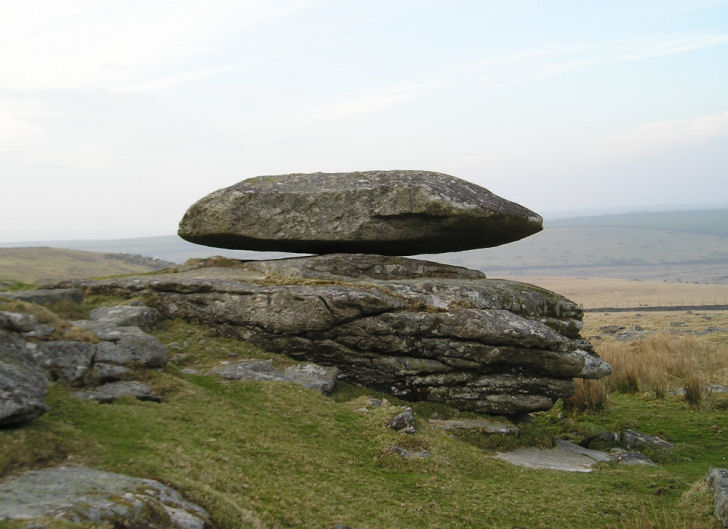
Louden Tor submitted by TheCaptain on 31st Mar 2005. Louden Tor Logan stone.
View looking north.
(View photo, vote or add a comment)
Log Text: None
Louden west
Date Added: 18th Sep 2010
Site Type: Ancient Village or Settlement
Country: England (Cornwall)
Visited: Yes on 2nd Apr 2005
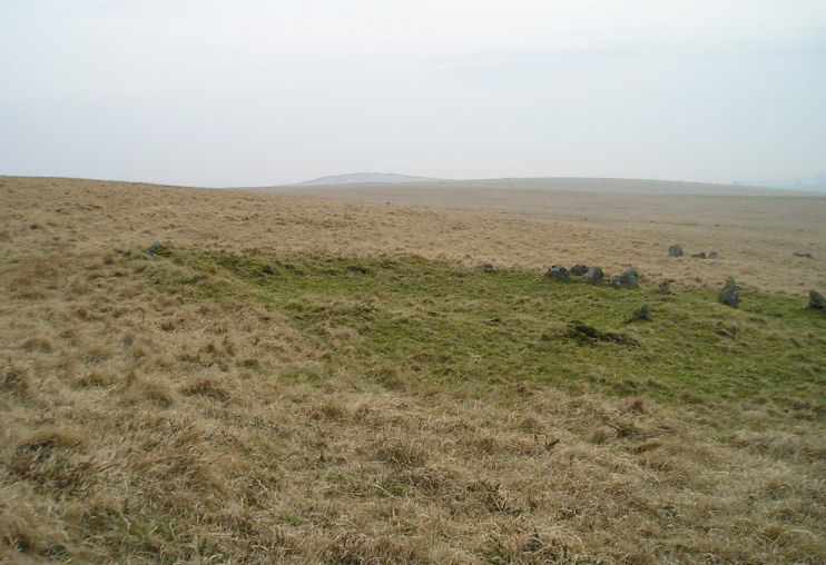
Louden west submitted by TheCaptain on 2nd Apr 2005. On the western slopes of Louden Hill are the remains of some very fine hut circles.
(View photo, vote or add a comment)
Log Text: None
Low Bridestones (N) (Yorks)
Date Added: 6th Dec 2024
Site Type: Standing Stones
Country: England (Yorkshire (North))
Visited: Yes on 17th Sep 2024. My rating: Condition 3 Ambience 3 Access 3

Low Bridestones (N) (Yorks) submitted by oldman on 22nd Apr 2018. A group of the Low Bride Stones near Grosmont on the North York Moors.
(View photo, vote or add a comment)
Log Text: From the High Bridestones I now drive down the hill to the northwest and am able to park in a big area where the bridleway crosses, and an entry road to a quarry. From here it is easy to walk out towards the Lower Bridestones, which I don’t remember finding before (I was being rushed), but it is now much easier with the detailed maps available through the Megalithic Portal which show three groups of stones. A couple of hundred yards along the bridleway and then head southeast up the slope to look for the first of three groups marked on the detailed OS map. Yes, theres the top of a stone peeking above the long grass. And another. Three in a line to start, then a good look around in the boggy ground and there are many stones to be found, maybe a couple of lines across the slope, but to be honest, they could be almost anything. I now see a couple of bigger stones standing above the long grass to the west of here, which must be the second group, so head over towards them, which is not quite so straightforward with the long couchgrass and a very boggy area between me and them. Approaching them and I can first see three stones standing in a line across the slope, and several confusing sheep, which look just like more. When I get to them, it is clear that there are many more stones here, again forming a perhaps a couple of lines around the hill, but its all a bit obscured in the long marsh grass, and a bit of a megalithic mess. The upper line seems to go on for a fair distance, with one stone after another to be found. Further over to the northeast a sort of circle of stones is shown on the map, so I wander over for a look. Without GPS and detailed map ths would be impossible to find, but I do get here and find a small cairn like pile of stones, but no semblance of a stone circle.
Low Bridestones (S) (Yorks)
Date Added: 7th Dec 2024
Site Type: Stone Row / Alignment
Country: England (Yorkshire (North))
Visited: Yes on 17th Sep 2024. My rating: Condition 4 Ambience 4 Access 3

Low Bridestones (S) (Yorks) submitted by Bladup on 14th Oct 2014. Low Bridestones.
(View photo, vote or add a comment)
Log Text: The sun is getting low and I consider giving up at this point, but I wisely decide that I do still have time to go and have a quick look for the southern of the three marked groups of stones, and I am very glad that I did. Walking southwards through some initially very difficult boggy ground with long couch grass, I find easier going up the hill a bit and then along what was presumably a sheep track. Then I see in the distance a row of about half a dozen stones standing proud of the moorland, showing clearly as shadows with the golden light of the settng sun behind. They look magnificent. Feeling good now that I have found them, I head over with a spring in my step, and not worrying about the boggy ground underfoot. Thank goodness I have my boots on! When I get there, the five or six large stones are clearly standing in an approximate straight line, but with many other smaller stones also with them. In the middle it seems to be a double row of stones about three or four feet apart, reminding me a bit of a Dartmoor double row. At the lower, southern end, any real form sort of disintegrates into a bit of raised ground with lots of stones almost in a heap. The light here is now just beautiful, all golden with a blue sky and green/brown moorland underfoot. Time to head back, and there looks to be a boggy stream between me and the bridle way back, but after a good look around I find a sheep track which leads me through the marsh ground and across to get me back to the bridleway. All my years of training on Dartmoor have paid off, as it is much easier going than much of that! Walking back to the north along the bridleway I see many large stones laying between the stony track and the nearby field wall. Could these possiby be the remnants of anther row of stones, or are they just large stones which have been moved and dumped out of the way of the track? Its hard to know. Back to the car and time to go for a celebratory pint. It has been another great day, with some grade 1 stone hunting this early evening, and I have a real feeling of achievement.
Low Longrigg NE
Date Added: 29th Oct 2019
Site Type: Stone Circle
Country: England (Cumbria)
Visited: Yes on 4th Oct 2017
Low Longrigg NE submitted by TheCaptain on 4th Oct 2017. Very hard to find in very long grass on very uneven and boggy ground, amongst many cairns all over the place.
Further up the ridge I again found what I thought was the remnants of a stone circle, but was not 100% convinced, but seemed too far from what I thought was the SW circle for them to both be correct.
(View photo, vote or add a comment)
Log Text: None
Low Longrigg SW
Date Added: 29th Oct 2019
Site Type: Stone Circle
Country: England (Cumbria)
Visited: Yes on 4th Oct 2017
Low Longrigg SW submitted by TheCaptain on 4th Oct 2017. Very hard to find in very long grass on very uneven and boggy ground, amongst many cairns all over the place. I found what I thought was the remnants of a stone circle, but was not 100% convinced.
(View photo, vote or add a comment)
Log Text: None
Lower Boscaswell Fougou
Date Added: 29th Jun 2023
Site Type: Souterrain (Fogou, Earth House)
Country: England (Cornwall)
Visited: Yes on 10th Jun 2023. My rating: Condition 3 Ambience 4 Access 4
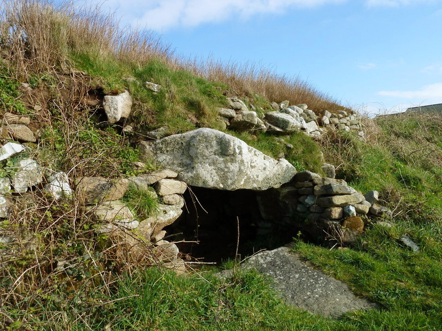
Lower Boscaswell Fougou submitted by Bladup on 7th Jun 2017. Lower Boscaswell Fogou.
(View photo, vote or add a comment)
Log Text: Dropping down from Carn Kenidjack, and after a slight detour to refresh myself at The North Inn, I head towards the coast and look for the Lower Boscaswell Fougou. Not being able to find it initially, I cheat and look it up on the portal. Ah, through the cow field and round the other side, over a stile and there it is. These days theres just a small chamber like space behind the opening, and daylight can be seen up a smaller side passage. Such a large stone area here, makes me wonder how big this might have once been. I'd better get on with my walk as time is getting on, and I have been getting further off route, so no time to try find the Pendeen one.
Lower Broadmoor
Date Added: 3rd Nov 2019
Site Type: Standing Stone (Menhir)
Country: Wales (Pembrokeshire)
Visited: Yes on 5th Oct 2015. My rating: Condition 4 Ambience 3 Access 4
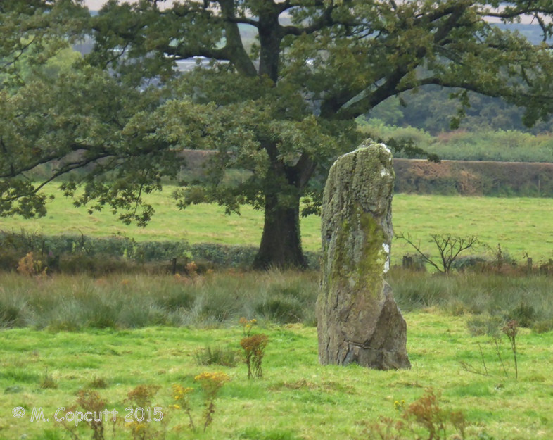
Lower Broadmoor submitted by TheCaptain on 21st Dec 2015. A 2.1 metre tall standing stone in a cattle field just to the south of Lower Broadmoor farm, a couple of kilometres to the north of Wolf's Castle in Pembrokeshire.
(View photo, vote or add a comment)
Log Text: A 2.1 metre tall standing stone in a cattle field just to the south of Lower Broadmoor farm, a couple of kilometres to the north of Wolf's Castle in Pembrokeshire. Not so easy to get to as it looks on the map, with many gates across the footpath and ankle deep mud caused by the cattle which use this track. When I saw a way into the field, it looked to be the best way to the stone, but a herd of young cattle saw me and came charging over towards me, so I skidaddled pretty quickly, getting wet in a boggy bit halfway up to my knees. I then satisfied myself with looking at this fine stone from the trackway, and noticed another huge stone in the hedge, which may have lost its top. Made me wonder if these were once a pair or more.
