Contributory members are able to log private notes and comments about each site
Sites theCAptain has logged. View this log as a table or view the most recent logs from everyone
Abri de Cro-Magnon
Date Added: 21st Oct 2020
Site Type: Cave or Rock Shelter
Country: France (Aquitaine:Dordogne (24))
Visited: Yes on 17th Sep 1978
Abri de Cro-Magnon submitted by thecaptain on 2nd Sep 2006. Abri de Cro-Magnon UNESCO World Heritage site.
It's nothing much to see, just a little rock shelter in the cliff face shaded by a couple of large chestnut trees, with a little walled and fenced area around it.
It is sadly hidden round the back of the hotel and almost forgotten.
(View photo, vote or add a comment)
Log Text: Hitch Hiking Trip round France in the summer of 1978. Camped for a couple of days at Les Eyzies to visit and wonder at the ancient sites here.
Musée National de Préhistoire
Date Added: 21st Oct 2020
Site Type: Museum
Country: France (Aquitaine:Dordogne (24))
Visited: Yes on 18th Sep 1978
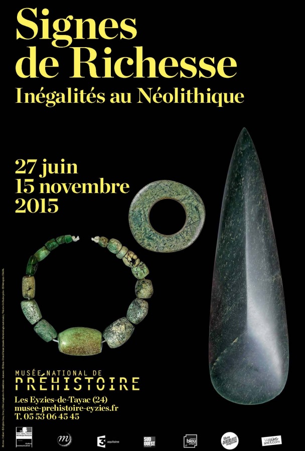
Musée National de Préhistoire submitted by dodomad on 5th Jul 2015. Exhibition: Signs of wealth. Inequalities in the Neolithic, running from 27th June 2015 to 15th November 2015
More details on our site page, in the comments section (click left)
(View photo, vote or add a comment)
Log Text: Hitch Hiking Trip round France in the summer of 1978. Camped for a couple of days at Les Eyzies to visit and wonder at the ancient sites here.
Font-de-Gaume
Date Added: 21st Oct 2020
Site Type: Cave or Rock Shelter
Country: France (Aquitaine:Dordogne (24))
Visited: Yes on 18th Sep 1978
Font-de-Gaume submitted by ocdolmen on 26th May 2006. Site in Aquitaine: Dordogne (24)
Entrance of Font de Gaume cave, Dordogne, France.
The entrance is on the right on the photo (the cave on the left is a dead end and presents no drawing)
Inside the cave, a great number of buffalos and horses drawings and some engraved drawings.
Magdalenian period (about 20.000 BCE)
One of the rare prehistoric cave with drawings still open to public.
(View photo, vote or add a comment)
Log Text: Hitch Hiking Trip round France in the summer of 1978. Camped for a couple of days at Les Eyzies to visit and wonder at the ancient sites here.
La Roque-Saint-Christophe
Date Added: 21st Oct 2020
Site Type: Ancient Village or Settlement
Country: France (Aquitaine:Dordogne (24))
Visited: Yes on 19th Sep 1978
La Roque-Saint-Christophe submitted by theCaptain on 6th Jan 2011. In a gigantic cliff face beside the river Vézère is found this World Heritage Site.
It's an entire troglodytic city which was inhabited continuously from 50000 years ago until a few centuries ago.
(View photo, vote or add a comment)
Log Text: Hitch Hiking Trip round France in the summer of 1978. Camped for a couple of days at Les Eyzies to visit and wonder at the ancient sites here.
Jõelähtme
Date Added: 27th Oct 2019
Site Type: Barrow Cemetery
Country: Estonia
Visited: Yes on 19th Oct 2003
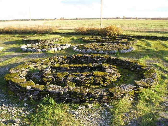
Jõelähtme submitted by thecaptain on 1st Nov 2003. Jõelähtme burial mounds. A few miles to the East of Tallinn, Estonia
(View photo, vote or add a comment)
Log Text: None
Rebala
Date Added: 27th Oct 2019
Site Type: Barrow Cemetery
Country: Estonia
Visited: Yes on 19th Oct 2003
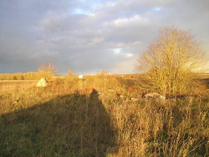
Rebala submitted by thecaptain on 1st Nov 2003. An unexcavated burial mound near Rebala. A few miles to the East of Tallinn, Estonia
There are many hundreds of these in this region
(View photo, vote or add a comment)
Log Text: None
Kostivere Sliding Stone
Date Added: 27th Oct 2019
Site Type: Natural Stone / Erratic / Other Natural Feature
Country: Estonia
Visited: Yes on 19th Oct 2003

Kostivere Sliding Stone submitted by thecaptain on 2nd Nov 2003. Kostivere Sliding Stone. A sacred Cult Stone in Estonia, a few miles to the East of Tallinn. The stone is a glacial erratic, but has been used for ceremonial purposes for many thousands of years, and has the remains of a burial mound associated with it, and is covered in ancient cup marks. The legend associated with this stone is that it can cure infertility. Women slide down the rock bare bottomed, and their infertility will be cured.
(View photo, vote or add a comment)
Log Text: None
Devil's Arrows
Date Added: 7th Jun 2022
Site Type: Stone Row / Alignment
Country: England (Yorkshire (North))
Visited: Yes on 13th May 2022. My rating: Condition 5 Ambience 4 Access 5
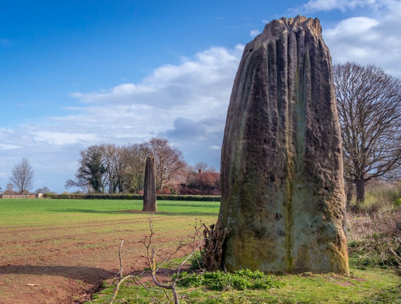
Devil's Arrows submitted by Humbucker on 27th Apr 2019. All three Devils Arrows looking from the north. The light improved for a brief few minutes & the sun made a brief appearance while I was there before turning into a flat, grey evening.
(View photo, vote or add a comment)
Log Text: Its not too far from York, so I went for a look at the Devil's Arrows, which were easy to find. Despite a new housing estate now encroaching and the very nearby A1 and A1(M), these are still at large in fields and feel wild and free. All three stones are magnificent and monsters with interesting rainules running down them. Magnificent.
St Nicholas (West Tanfield)
Date Added: 8th Oct 2022
Site Type: Ancient Cross
Country: England (Yorkshire (North))
Visited: Yes on 27th Sep 2022. My rating: Condition 3 Ambience 3 Access 4
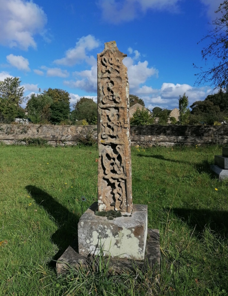
St Nicholas (West Tanfield) submitted by TheCaptain on 8th Oct 2022. In the churchyard is what looks like a very ancient cross shaft mounted on a block. Its obviously far older than anything else in the graveyard, but I saw nothing written on or about it.
(View photo, vote or add a comment)
Log Text: After visiting the Thornborough Henges on my way back from Northumberland, I call in to the Bull Inn at West Tanfield for a pint, and notice that there is something marked at the local church. A very interesting old place with pele tower outside; I cannot look inside the church as there is building work going on, but outside in the churchyard, there is what looks like a very interesting and ancient cross shaft mounted on a block. Its obviously far older than anything else in the graveyard, but I see nothing written on or about it.
Thornborough S
Date Added: 3rd Feb 2023
Site Type: Henge
Country: England (Yorkshire (North))
Visited: Yes on 27th Sep 2022. My rating: Condition 3 Ambience 3 Access 4
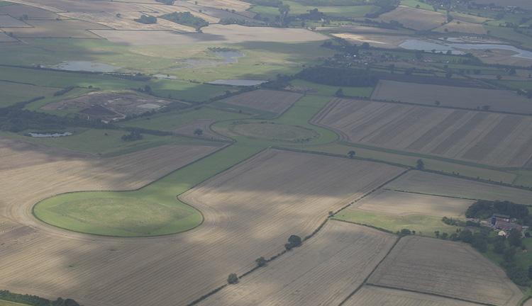
Thornborough S submitted by JJ on 23rd Aug 2004. Thornborough south henge
(View photo, vote or add a comment)
Log Text: Travelling home from Northumberland, and the weather forecast was good, so I decided to go the eastern route and break my journey to have a look at the Thornborough Henges. After a drive around several small roads, I found a place to park with access to the fields between the southern and central henges. I decided to go walk around the henges, and started with the southern one, a fair walk on a blowy day, but nice when the sun came out. The large henge is not so well formed as I had expected, no doubt worn down over the centuries, and not much to see other than the circular bank; the internal ditch is barely noticeable.
Thornborough Central
Date Added: 3rd Feb 2023
Site Type: Henge
Country: England (Yorkshire (North))
Visited: Yes on 27th Sep 2022. My rating: Condition 3 Ambience 3 Access 4

Thornborough Central submitted by Iain_P on 8th Sep 2016. This is an image taken from stitched together frames from a drone video, taken at sunrise a month ago (early August, 2016) For scale, you can just see our car in the bottom right.
(View photo, vote or add a comment)
Log Text: Crossing back across the roadway, I go in for a look and walk around the central henge. This banks of this one are more substantial, but in places are very damaged by badgers or rabbits. The internal ditch is again slight, but can be made out here. I walked north to try to get to the northern henge, but it was not possible to get across the northern road and in to see it.
Thornborough N
Date Added: 3rd Feb 2023
Site Type: Henge
Country: England (Yorkshire (North))
Visited: Yes on 27th Sep 2022. My rating: Condition 5 Ambience 4 Access 4
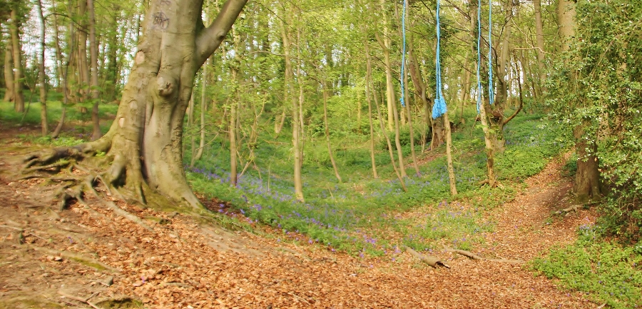
Thornborough N submitted by SumDoood on 24th Apr 2017. (Arriving only just in time, I had cut down the four Roman soldiers and told them to get their sorry European arses back to Boroughbridge, and not to bother my henge again. Meanwhile...) I was very impressed by this henge and the fact that it is still so complete, the ditch being on average 3.0m deep and the bank an average of 3.0m high.
(View photo, vote or add a comment)
Log Text: Back to the car for the small drive round to the woodland at the western side of the northern henge, and there was room to park, and then follow one of several paths into the woodland. This northern henge is much more like it, very well preserved, both the banks and internal ditch. The atmosphere in this woodland is much more pleasant than the open fields of the other two. Time to look for a pub and a pint.
Blakey Topping
Date Added: 27th Nov 2024
Site Type: Stone Circle
Country: England (Yorkshire (North))
Visited: Yes on 14th Sep 2024. My rating: Condition 2 Ambience 4 Access 3

Blakey Topping submitted by DavidRaven on 16th Apr 2007. The stones that sit in the shadow of Blakey Topping.
(View photo, vote or add a comment)
Log Text: Walk from Saltergate layby above the Hole of Horcum along Old Wife's Way to Newgate Foot and up to Blakey Topping and it's stone circle. One six foot standing stone and a stump in the field, with another stone standing at the gate, a flat stone in the field, and a couple of wooden posts. Is that another stone in the hedge I see?
Whitby Abbey
Date Added: 27th Nov 2024
Site Type: Early Christian Sculptured Stone
Country: England (Yorkshire (North))
Visited: Yes on 15th Sep 2024

Whitby Abbey submitted by pjlythe1 on 15th Mar 2020. Whitby Abbey
(View photo, vote or add a comment)
Log Text: Whitby Abbey in its bleak windblown position on top of the hill above the harbour is a good visit. It has to be said that I thought the weathering shapes and patterns of the stone remains made it truly memorable. The museum was also fascinating with many items of ancient historic interest.
Hunt House Road Standing Stone
Date Added: 9th Dec 2024
Site Type: Marker Stone
Country: England (Yorkshire (North))
Visited: Yes on 20th Sep 2024. My rating: Condition 3 Ambience 3 Access 5

Hunt House Road Standing Stone submitted by johndhunter on 18th Oct 2019. Stone at NZ 81929 00430 – Viewed looking north easterly, July 2019. The village on the right in the distance is Goathland , The arrow on the left in the distance indicates the area known as Allan Tofts, there are ancient fields and numerous pieces of rock art located here.
(View photo, vote or add a comment)
Log Text: Had an hour or so to spare, but it was foggy on the moor so had to be careful where I went. Decided that having a look for the stones beside the road from Goathland was sensible, then maybe walk over to the roman road. First one was easy, but nowhere obvious to park on the single track road out past the next two.
Hunt House Road Waymarkers
Date Added: 9th Dec 2024
Site Type: Marker Stone
Country: England (Yorkshire (North))
Visited: Yes on 20th Sep 2024. My rating: Condition 3 Ambience 2 Access 5

Hunt House Road Waymarkers submitted by johndhunter on 12th Jun 2022. Stone 2 at NZ 81833 00076 – East Face, September 2019.
(View photo, vote or add a comment)
Log Text: Had an hour or so to spare, but it was foggy on the moor so had to be careful where I went. Decided that having a look for the stones beside the road from Goathland was sensible, then maybe walk over to the roman road. First one was easy, but nowhere obvious to park on the single track road out past the next two.
High Bridestones (Yorks)
Date Added: 4th Dec 2024
Site Type: Stone Circle
Country: England (Yorkshire (North))
Visited: Yes on 17th Sep 2024. My rating: Condition 3 Ambience 4 Access 4
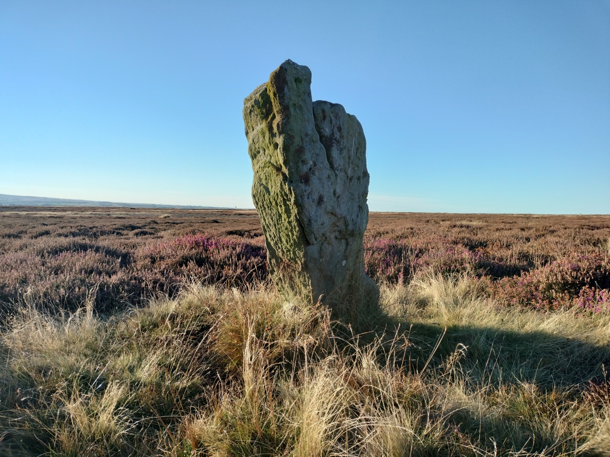
High Bridestones (Yorks) submitted by TheCaptain on 2nd Dec 2024. At the lower, northwestern end of the main alignment is another fairly large stander.
OK, I'm off
(View photo, vote or add a comment)
Log Text: After a day walking the beautiful coastline between Runswick bay and Staithes, I had an hour or two of beautiful sunshine left in the day, and made the decision to drive over onto the moor for a quick look for the Bridestones, of which I have vague memories from 27 years ago. In this weather, three upright stones standing can clearly be seen, so I walk over to the tallest, more than 6 feet tall. At this point, three other large stones can be seen flat to the ground along with several smaller ones. My memory tells me they were in a circle, but that doesn't really look to be the case to me today. To the northwest, slightly down the hill, can be seen several other standers in a rough line, and walking down along the row the I come to another group of several stones, but this time nothing more than a few feet tall. There are many other smaller stumps and flat stones can be seen before progressing down to another fairly large stander. Back at the top, there is another short stander off to the southeast, and what appear to be several moor, but which turn out to be sheep munching! Its all a bit of a mess, but I dont think this should be given stone circle status, it's more like a stone row to me. A megalithic disaster indeed.
Low Bridestones (N) (Yorks)
Date Added: 6th Dec 2024
Site Type: Standing Stones
Country: England (Yorkshire (North))
Visited: Yes on 17th Sep 2024. My rating: Condition 3 Ambience 3 Access 3

Low Bridestones (N) (Yorks) submitted by oldman on 22nd Apr 2018. A group of the Low Bride Stones near Grosmont on the North York Moors.
(View photo, vote or add a comment)
Log Text: From the High Bridestones I now drive down the hill to the northwest and am able to park in a big area where the bridleway crosses, and an entry road to a quarry. From here it is easy to walk out towards the Lower Bridestones, which I don’t remember finding before (I was being rushed), but it is now much easier with the detailed maps available through the Megalithic Portal which show three groups of stones. A couple of hundred yards along the bridleway and then head southeast up the slope to look for the first of three groups marked on the detailed OS map. Yes, theres the top of a stone peeking above the long grass. And another. Three in a line to start, then a good look around in the boggy ground and there are many stones to be found, maybe a couple of lines across the slope, but to be honest, they could be almost anything. I now see a couple of bigger stones standing above the long grass to the west of here, which must be the second group, so head over towards them, which is not quite so straightforward with the long couchgrass and a very boggy area between me and them. Approaching them and I can first see three stones standing in a line across the slope, and several confusing sheep, which look just like more. When I get to them, it is clear that there are many more stones here, again forming a perhaps a couple of lines around the hill, but its all a bit obscured in the long marsh grass, and a bit of a megalithic mess. The upper line seems to go on for a fair distance, with one stone after another to be found. Further over to the northeast a sort of circle of stones is shown on the map, so I wander over for a look. Without GPS and detailed map ths would be impossible to find, but I do get here and find a small cairn like pile of stones, but no semblance of a stone circle.
Low Bridestones (S) (Yorks)
Date Added: 7th Dec 2024
Site Type: Stone Row / Alignment
Country: England (Yorkshire (North))
Visited: Yes on 17th Sep 2024. My rating: Condition 4 Ambience 4 Access 3

Low Bridestones (S) (Yorks) submitted by Bladup on 14th Oct 2014. Low Bridestones.
(View photo, vote or add a comment)
Log Text: The sun is getting low and I consider giving up at this point, but I wisely decide that I do still have time to go and have a quick look for the southern of the three marked groups of stones, and I am very glad that I did. Walking southwards through some initially very difficult boggy ground with long couch grass, I find easier going up the hill a bit and then along what was presumably a sheep track. Then I see in the distance a row of about half a dozen stones standing proud of the moorland, showing clearly as shadows with the golden light of the settng sun behind. They look magnificent. Feeling good now that I have found them, I head over with a spring in my step, and not worrying about the boggy ground underfoot. Thank goodness I have my boots on! When I get there, the five or six large stones are clearly standing in an approximate straight line, but with many other smaller stones also with them. In the middle it seems to be a double row of stones about three or four feet apart, reminding me a bit of a Dartmoor double row. At the lower, southern end, any real form sort of disintegrates into a bit of raised ground with lots of stones almost in a heap. The light here is now just beautiful, all golden with a blue sky and green/brown moorland underfoot. Time to head back, and there looks to be a boggy stream between me and the bridle way back, but after a good look around I find a sheep track which leads me through the marsh ground and across to get me back to the bridleway. All my years of training on Dartmoor have paid off, as it is much easier going than much of that! Walking back to the north along the bridleway I see many large stones laying between the stony track and the nearby field wall. Could these possiby be the remnants of anther row of stones, or are they just large stones which have been moved and dumped out of the way of the track? Its hard to know. Back to the car and time to go for a celebratory pint. It has been another great day, with some grade 1 stone hunting this early evening, and I have a real feeling of achievement.
House Crag (Howl Moor)
Date Added: 11th Dec 2024
Site Type: Stone Circle
Country: England (Yorkshire (North))
Visited: Yes on 20th Sep 2024. My rating: Condition 2 Ambience 4 Access 3
House Crag (Howl Moor) submitted by johndhunter on 5th Sep 2019. See my comment in comments section at the bottom of the site page. This is a partial view of the area in question. The large stone centre left in the image is at SE 81654 98214,It is viewed looking northerly, August 2019.
(View photo, vote or add a comment)
Log Text: I had an hour or so to spare, but it was foggy on the moor so had to be careful where I went. Decided that having a look for the stones beside the road from Goathland was sensible, then maybe over to the roman road. A closer look at the Mega Portal map showed this (possible) stone circle fairly near, and not far from what appeared to be a decent path, so I gave it a go. Perhaps stupidly, as I had deemed it not far, I went without my bag, therefore no paper map or compass, relying on the phone app alone in the fog, something I would never have done in the past. Anyways, it was a decent track up to the top of the hill, so then came time to hunt for the stones, as seen on the portal. I proceeded across the open moor from the path to where marked on the portal map, but nothing. So call up the portal site page and see that the accuracy rating was not good, but that comments from JohndHunter did give a better reference. Now a fair distance from the track which would lead me back, and in very limited visibility, I was unsure of proceeding in case my battery went flat or I lost the signal, but my curiosity got the better of me, aided by the thought that all I needed to do was head back in the direction I had come, keeping the hill edge to my right and at some point I would get to the track. Anyways, all worked out just fine, and I found the stones as seen in the pictures. At first they just seemed like a jumble of mostly large stones laying on the ground, but then I got to a point where a good arc of stones could be made out, or maybe several arcs. A few of the stones were definitely once standing and set into the ground. Having seen the Bridestones, and in the past Commondale, I personally decided that this indeed could once have been a stone circle. The fog was getting thicker, not aided by it starting to get dark, so I decided to head back, across the moor to the track and then back down to the car, all in taking about an hour. All was good, and I had a real feeling of achievement, so went for a well deserved pint at the Mallyan Spout Hotel.
