Contributory members are able to log private notes and comments about each site
Sites theCAptain has logged. View this log as a table or view the most recent logs from everyone
Horton Down
Date Added: 8th Oct 2020
Site Type: Chambered Tomb
Country: England (Wiltshire)
Visited: Yes on 4th Oct 1998
Log Text: Visit lots of ancient sites on a long off road cycle tour from Avebury to Windmill Hill, along the Wansdyke and back up Kennet Avenue
Wansdyke
Date Added: 8th Oct 2020
Site Type: Misc. Earthwork
Country: England (Wiltshire)
Visited: Yes on 4th Oct 1998

Wansdyke submitted by Thorgrim on 9th Jun 2005. Section of the Wansdyke where it crosses the road between Fyfield and Alton Priors. Wansdyke stretches for 45 miles from Bristol to Marlborough and can be walked for much of the way. As it is still quite high, it is free from 4x4 off road vandalism and can be a much pleasanter walk than the unfortunate and much abused Ridgeway.
(View photo, vote or add a comment)
Log Text: Visit lots of ancient sites on a long off road cycle tour from Avebury to Windmill Hill, along the Wansdyke from SU040666 to SU099647, then back up Kennet Avenue
East Kennett longbarrow
Date Added: 8th Oct 2020
Site Type: Long Barrow
Country: England (Wiltshire)
Visited: Saw from a distance on 4th Oct 1998
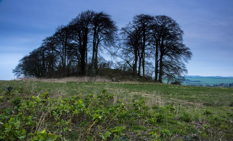
East Kennett longbarrow submitted by Humbucker on 21st Nov 2017. East Kennet Longbarrow. Without the leaves on the trees you can appreciate just how big this longbarrow is!
(View photo, vote or add a comment)
Log Text: Visit lots of ancient sites on a long off road cycle tour from Avebury to Windmill Hill, along the Wansdyke and back up Kennet Avenue
East Kennett garden feature
Date Added: 8th Oct 2020
Site Type: Modern Stone Circle etc
Country: England (Wiltshire)
Visited: Yes on 4th Oct 1998
East Kennett garden feature submitted by JJ on 24th Dec 2005. A view of the East Kennet avenue and circle. These must be modern stones, does anyone have more information?
(View photo, vote or add a comment)
Log Text: Visit lots of ancient sites on a long off road cycle tour from Avebury to Windmill Hill, along the Wansdyke and back up Kennet Avenue
The Sanctuary.
Date Added: 8th Oct 2020
Site Type: Stone Circle
Country: England (Wiltshire)
Visited: Yes on 4th Oct 1998
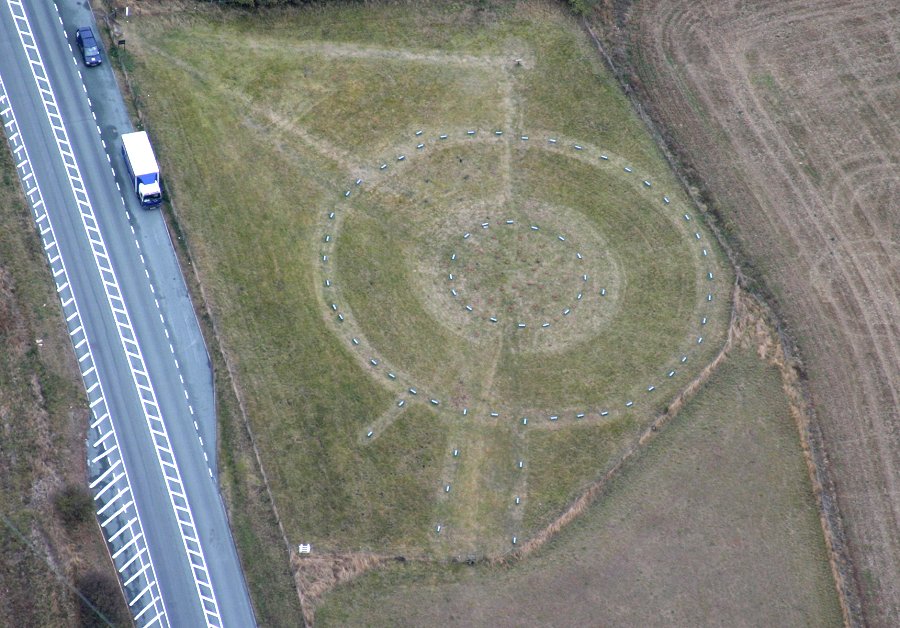
The Sanctuary. submitted by JJ on 4th Nov 2003. Aerial Photograph copyright JJ Evendon
(View photo, vote or add a comment)
Log Text: Visit lots of ancient sites on a long off road cycle tour from Avebury to Windmill Hill, along the Wansdyke and back up Kennet Avenue
Silbury Hill
Date Added: 8th Oct 2020
Site Type: Artificial Mound
Country: England (Wiltshire)
Visited: Yes on 4th Oct 1998
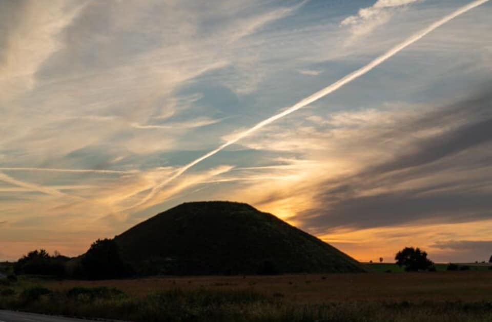
Silbury Hill submitted by Scanner on 27th Sep 2019. Silbury Hill by Simon Ferguson
(View photo, vote or add a comment)
Log Text: Visit lots of ancient sites on a long off road cycle tour from Avebury to Windmill Hill, along the Wansdyke and back up Kennet Avenue
Falkner's Circle
Date Added: 8th Oct 2020
Site Type: Stone Circle
Country: England (Wiltshire)
Visited: Yes on 4th Oct 1998
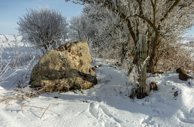
Falkner's Circle submitted by Humbucker on 16th Feb 2019. The last stone of Falkners Circle - taken in the snow earlier in February.
(View photo, vote or add a comment)
Log Text: Visit lots of ancient sites on a long off road cycle tour from Avebury to Windmill Hill, along the Wansdyke and back up Kennet Avenue
West Kennet Avenue
Date Added: 8th Oct 2020
Site Type: Multiple Stone Rows / Avenue
Country: England (Wiltshire)
Visited: Yes on 4th Oct 1998
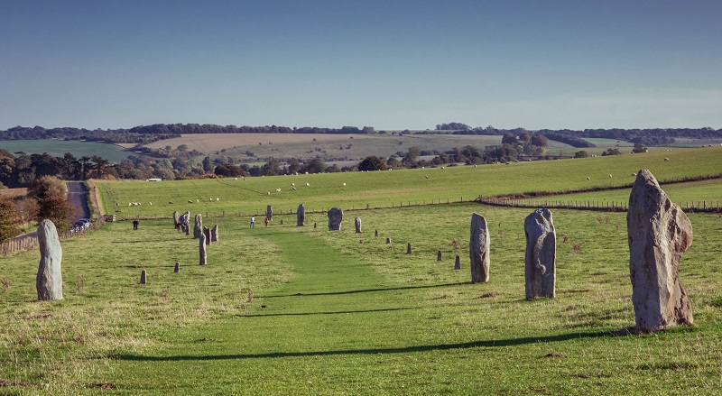
West Kennet Avenue submitted by Humbucker on 12th Jan 2019. West Kennet Avenue in the summer. Looking south towards West Kennet.
(View photo, vote or add a comment)
Log Text: Visit lots of ancient sites on a long off road cycle tour from Avebury to Windmill Hill, along the Wansdyke and back up Kennet Avenue
Luckington II
Date Added: 6th Mar 2022
Site Type: Chambered Tomb
Country: England (Wiltshire)
Visited: Yes on 6th Mar 2022. My rating: Condition 2 Ambience 3 Access 4

Luckington II submitted by TheCaptain on 8th Mar 2022. On the southern side of the lane opposite the Giant's Caves longbarrow is the large unkempt raise of the Luckington 2 longbarrow. I didn't go for a root around, and sitisfied myself with a few pics from over the hedge.
(View photo, vote or add a comment)
Log Text: Windy grey walk round Badminton estate, then a look at the Luckington long barrows, finishing with a pint at the Old Royal Ship. On the southern side of the lane opposite the Giant's Caves longbarrow is the large unkempt raise of the Luckington 2 longbarrow. I didn't go for a root around, and sitisfied myself with a few pics from over the hedge.
Giant's Caves
Date Added: 6th Mar 2022
Site Type: Chambered Cairn
Country: England (Wiltshire)
Visited: Yes on 6th Mar 2022. My rating: Condition 3 Ambience 3 Access 4

Giant's Caves submitted by thecaptain on 16th Apr 2004. Giant’s Caves, Chambered Tomb, Luckington, Wiltshire, ST820830
Overall view from the south of this fantastic long barrow, which lies on an east west axis, in a field just to the north of a little stream on the edge of the Badminton estate. The initial impression is that it is fairly ruinous, but closer inspection reveals that there is much left here. Although the ends of the barrow appear to have been removed at sometime in the past, the remaining central part show what a large structure th...
(View photo, vote or add a comment)
Log Text: A lot of the large trees and overgrowth has gone since I was last here 19 years ago, but its still overrun with brambles etc, and not in a good condition. The remains of three chambers are easily found with large side slabs still in place, but there is also a worrying heap of large slabs piled nearby, no doubt once part of the structures. I didn't do too much delving to see what else I could find.
Memorial stone to Richard Jefferies and Alfred Williams
Date Added: 18th Apr 2022
Site Type: Modern Stone Circle etc
Country: England (Wiltshire)
Visited: Yes on 17th Apr 2022. My rating: Condition 4 Ambience 4 Access 4

Memorial stone to Richard Jefferies and Alfred Williams submitted by TheCaptain on 18th Apr 2022. On the northern slopes of Burderop Down, Just to the east of Barbury Castle, stands this monument to two local authors, with great views over Swindon and the plains to the north.
Seen here looking east
(View photo, vote or add a comment)
Log Text: To the east of Barbury Castle, just below the ridge of Burderop Down, on the northern slopes below the wood and with great views over the plains to the north of the downs, is seen a stone standing. Closer inspection shows it to be concreted in place, and with two plaques mounted on it, as a memorial to Richard Jefferies and Alfred Williams, two local authors, and erected in 1939.
Barbury Castle
Date Added: 18th Apr 2022
Site Type: Hillfort
Country: England (Wiltshire)
Visited: Yes on 17th Apr 2022. My rating: Condition 4 Ambience 4 Access 4
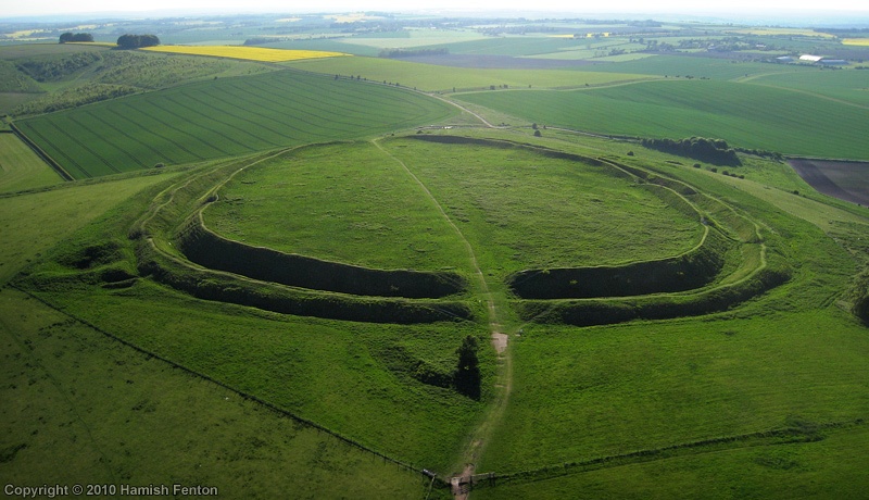
Barbury Castle submitted by h_fenton on 24th May 2010. Barbury Castle (hillfort), an Aerial Photograph taken from the east.
May 2010
(View photo, vote or add a comment)
Log Text: Easter visit to Barbury Castle and a walk on bits of The Ridgeway. This is a lovely well defined hillfort with full double ramparts and good views all around. Several other circular features and pits which may be the remains of ancient barrows and relatively modern flint pits. Interesting to see the views north from the ramparts, the old Wroughton airfield now covered with a solar farm.
Barbury Castle Barrows
Date Added: 24th Apr 2022
Site Type: Barrow Cemetery
Country: England (Wiltshire)
Visited: Yes on 17th Apr 2022. My rating: Condition 2 Ambience 3 Access 4
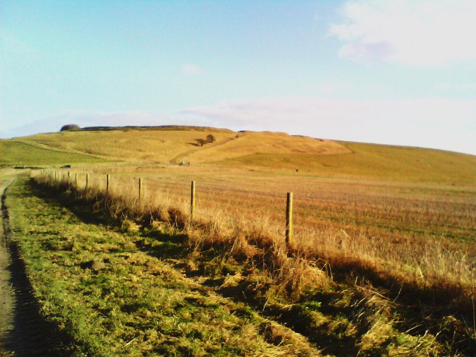
Barbury Castle Barrows submitted by custer on 30th Jan 2011. On left hand side of the path leading up to the Barbury castle hill fort can be seen a disc shape in the grass. A low mound is also just below this.
(View photo, vote or add a comment)
Log Text: Around Barbury Castle are several other circular features and pits, some of which may be the remains of ancient barrows alond with some relatively modern flint pits. Following the Ridgeway west, there is a clear disc barrow on the slopes down from the castle, and some round barrows in the saddle below the hills.
Draycot Foliat Bowl Barrow
Date Added: 24th Apr 2022
Site Type: Round Barrow(s)
Country: England (Wiltshire)
Visited: Yes on 17th Apr 2022. My rating: Condition 3 Ambience 3 Access 3
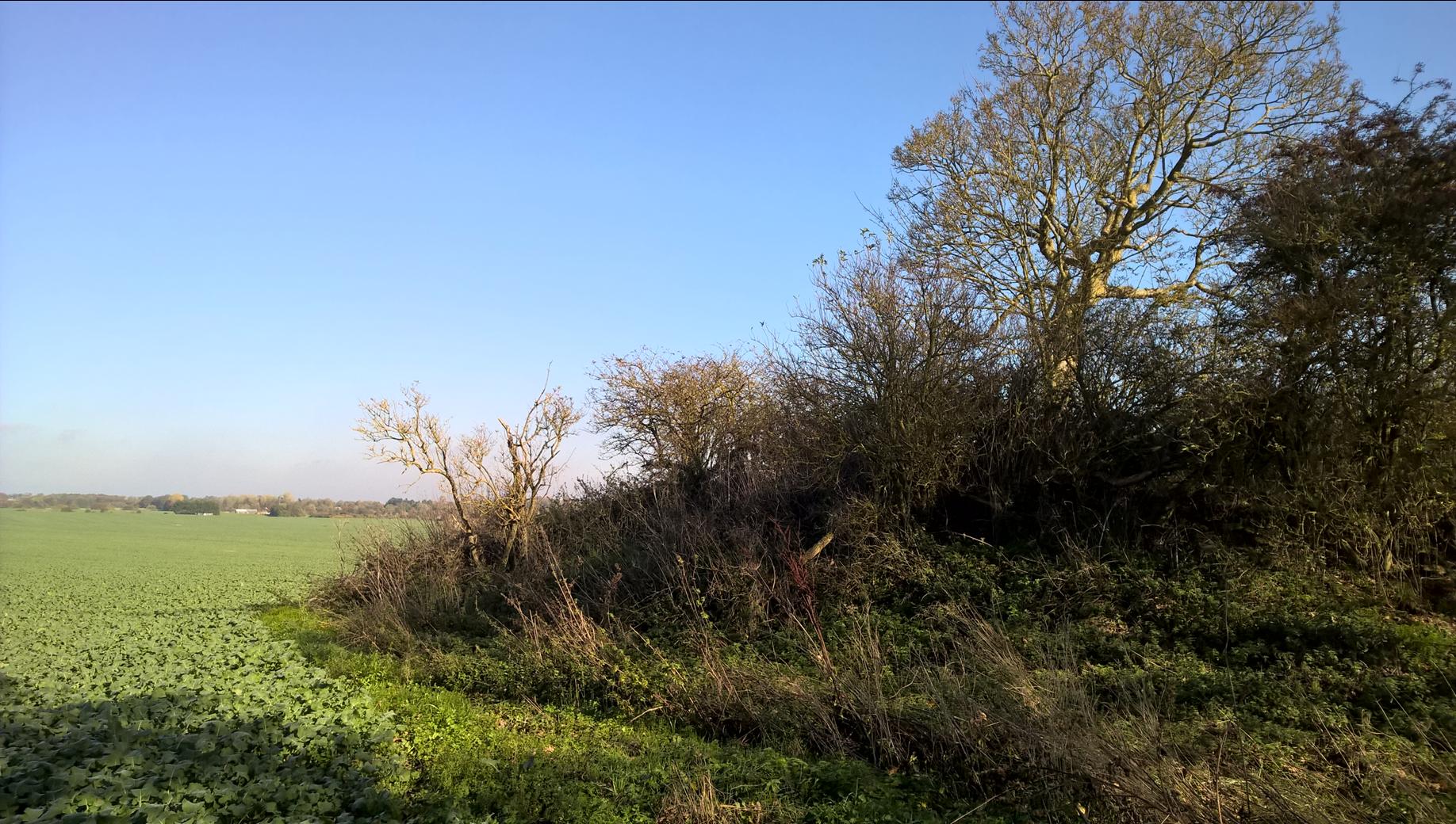
Draycot Foliat Bowl Barrow submitted by HarryTwenty on 7th Jan 2019. The barrow is buried under trees. Looking NE.
(View photo, vote or add a comment)
Log Text: Not the nicest of walks along the old Ridgeway which is now a dusty/muddy/rutted gravel farm track, with several bits fenced and rerouted, I eventually get to the first of two barrows marked. On the north of the track is a large overgrown mound, which is well dug by badgers. A bit further east and to the south of the track where the other barrow is marked, there is nothing to see other than a difference in the growth of the yellow flowering rapeseed.
Burderop Down Disc Barrow
Date Added: 24th Apr 2022
Site Type: Round Barrow(s)
Country: England (Wiltshire)
Visited: Yes on 17th Apr 2022. My rating: Condition 4 Ambience 4 Access 3
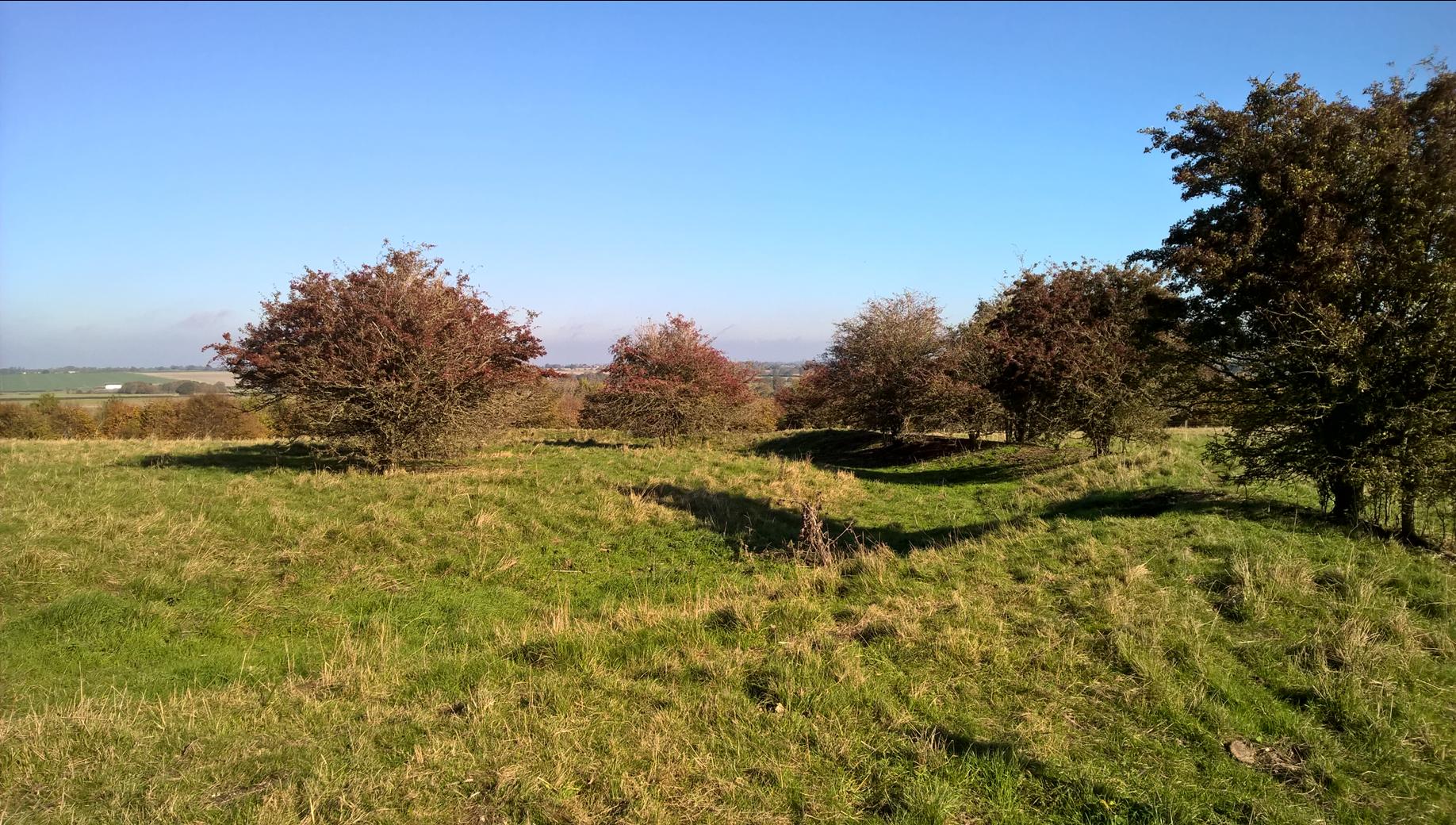
Burderop Down Disc Barrow submitted by HarryTwenty on 4th Jan 2019. Looking NE at the barrow across the ditch. The trees on the right are growing along the top of the bank. The shadow of the nearest one falls down into the ditch and up the other side onto the barrow showing you the slope.
(View photo, vote or add a comment)
Log Text: Eventually finding my way back west and up the hill through the recently diverted and fenced pathways, I pass by the large circular ring barrow, now getting a bit overgrown from the other pictures I have seen. Up to the top of the hill and a good view over the site is had.
Fairy Toot
Date Added: 18th Sep 2010
Site Type: Long Barrow
Country: England (Somerset)
Visited: Yes on 11th Apr 2004

Fairy Toot submitted by TheCaptain on 11th Apr 2004. Fairy Toot Long Barrow, Nempnett Thrubwell, North Somerset, ST521618.
The sad remains of the Fairy Toot long barrow, looking northwest from midway along the eastern side. Remains of a sheepshed can be seen, built right in the middle of this once great barrow. Most of the rest of the mound has been cleared.
(View photo, vote or add a comment)
Log Text: None
Felton Bowl Barrows T28 & T29
Date Added: 18th Sep 2010
Site Type: Round Barrow(s)
Country: England (Somerset)
Visited: Yes on 14th Apr 2004
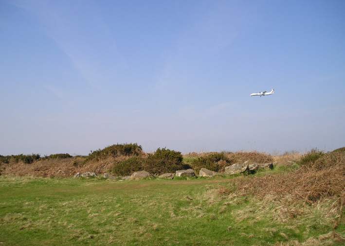
Felton Bowl Barrows T28 & T29 submitted by TheCaptain on 14th Apr 2004. Felton Hill Barrows, Felton Common, North Somerset. ST519648.
The central mound, complete with ditch and surrounding stone circle.
Felton Common lies directly under the flight path to Bristol Lulsgate airport, at the eastern end of the runway. This airfield was very active during the second world war, and it is known that there was much military activity on Felton Common during that period. It would not surprise me if the barrows had been substantially rearranged during that period, perhap...
(View photo, vote or add a comment)
Log Text: None
Butcombe Barrow
Date Added: 18th Sep 2010
Site Type: Round Barrow(s)
Country: England (Somerset)
Visited: Yes on 15th Apr 2004

Butcombe Barrow submitted by TheCaptain on 15th Apr 2004. Butcombe Barrow, Butcombe, North Somerset. ST516627
This impressively situated bowl barrow lies just below the top of a hillock near Bicknell Farm, with splendid views south over Blagdon Lake to the Mendip Hills, and west to the sea. The barrow is about 25 metres in diameter, and traces of its external ditch are still clearly visible. Excavations have obviously been made in the past here, and there is the usual hollow in the top.
(View photo, vote or add a comment)
Log Text: None
Brent Knoll Camp
Date Added: 18th Sep 2010
Site Type: Hillfort
Country: England (Somerset)
Visited: Yes on 27th Apr 2004
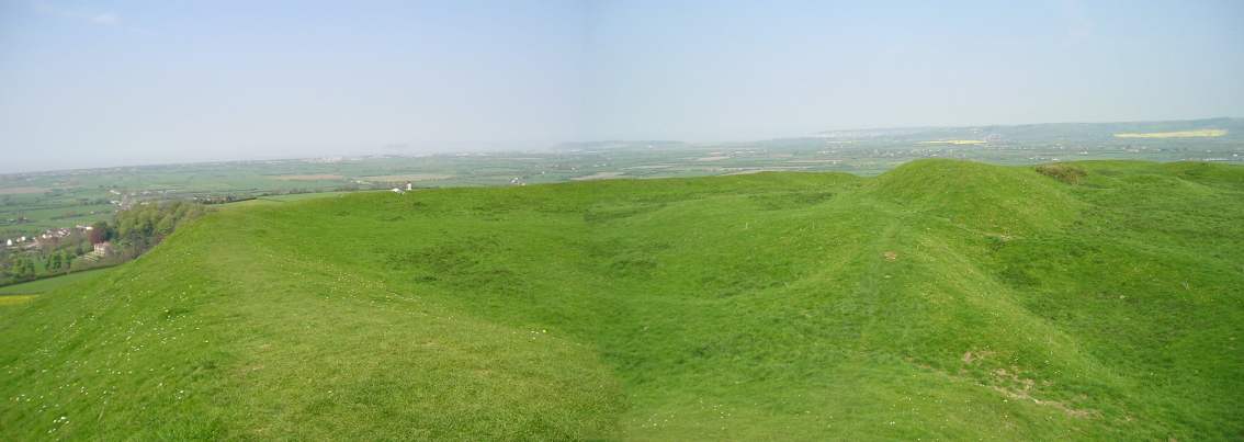
Brent Knoll Camp submitted by TheCaptain on 27th Apr 2004. Brent Knoll Hillfort, Somerset. ST341510.
Over the years the knoll has been sculpted and adapted my man for various uses. Bronze Age and Iron Age people set up forts and encampments on the summit which became a focus for religious activity. The Romans built a temple and fortifications there, and referred to the hill as “The Mount of Frogs”. Legend claims this hill to be the site of Mons Badonicus, with its King Arthur connections. The Anglo-Saxons made good use of the Knoll, and on its e...
(View photo, vote or add a comment)
Log Text: None
Maes Knoll
Date Added: 18th Sep 2010
Site Type: Hillfort
Country: England (Somerset)
Visited: Yes on 29th Apr 2004

Maes Knoll submitted by TheCaptain on 29th Apr 2004. Maes Knoll Hillfort, Norton Malreward, North Somerset, ST600660.
The remains of this Iron age hillfort lie at the eastern end of the Dundry Hill ridge just to the south of Bristol. The hillfort consists of a fairly large flat open area, roughly triangular in shape, that has been fortified by ramparts and shaping of the steep sided hilltop around the northern, eastern and southwestern sides of the hill. The western end of the fort is made across a narrow neck of the ridge of high land, and co...
(View photo, vote or add a comment)
Log Text: None
