Contributory members are able to log private notes and comments about each site
Sites theCAptain has logged. View this log as a table or view the most recent logs from everyone
Allée Couverte de Pinterville
Trip No.202 Entry No.90 Date Added: 30th Mar 2020
Site Type: Passage Grave
Country: France (Normandie:Eure (27))
Visited: Couldn't find on 4th May 2005
Log Text: Despite driving around this village and its environs thoroughly and looking at the village map and having the ign 1:25000 map I could find no signs of this.
Menhir dit le Caillou de Gargantua
Trip No.202 Entry No.89 Date Added: 30th Mar 2020
Site Type: Standing Stone (Menhir)
Country: France (Normandie:Eure (27))
Visited: Couldn't find on 3rd May 2005
Log Text: I spent ages driving round all the roads of this hilltop village high above the river Eure (mostly because I could never find anywhere to turn a campervan) but could find no evidence of this menhir. The double village has no signs or anything to signify the presence of a menhir but hey are obviously very proud of their water tower and a bit of roman road.
Pierre Frite de Breuilpont
Trip No.202 Entry No.88 Date Added: 30th Mar 2020
Site Type: Standing Stone (Menhir)
Country: France (Normandie:Eure (27))
Visited: Couldn't find on 3rd May 2005
Log Text: As for the other menhirs in this river valley I could find no evidence of this menhir. The roads are terribly kept and there are almost no places to turn a campervan so I travelled over much more roads than I would have otherwise done.
Garennes-sur-Eure Menhir
Trip No.202 Entry No.87 Date Added: 30th Mar 2020
Site Type: Standing Stone (Menhir)
Country: France (Normandie:Eure (27))
Visited: Couldn't find on 3rd May 2005
Log Text: Despite a good look around I could find nothing. I drove around many roads looking all over the place but it was a nasty busy road alongside the river at going home time which didn’t help.
Dolmen dit Gravier de Gargantua 2
Trip No.202 Entry No.86 Date Added: 30th Mar 2020
Site Type: Burial Chamber or Dolmen
Country: France (Normandie:Eure (27))
Visited: Couldn't find on 3rd May 2005
Log Text: Despite a good look around I could find no evidence of either of these. Why oh why do these villages in Normandy not look after and promote these sites ? Not even a map of the area in the village which makes these sites in Eure even more difficult to find than those in the rest of Normandy.
Dolmen dit Gravier de Gargantua 1
Trip No.202 Entry No.85 Date Added: 30th Mar 2020
Site Type: Burial Chamber or Dolmen
Country: France (Normandie:Eure (27))
Visited: Couldn't find on 3rd May 2005
Log Text: Despite a good look around I could find no evidence of either of these. Why oh why do these villages in Normandy not look after and promote these sites ? Not even a map of the area in the village which makes these sites in Eure even more difficult to find than those in the rest of Normandy.
Alignement des Bruyères
Trip No.202 Entry No.81 Date Added: 30th Mar 2020
Site Type: Stone Row / Alignment
Country: France (Normandie:Eure (27))
Visited: Couldn't find on 3rd May 2005

Alignement des Bruyères submitted by HOMER27000 on 21st Apr 2011. Alignement des Bruyères
Site in Normandie:Eure (27) France
(View photo, vote or add a comment)
Log Text: I carelessly missed this alignment of three menhirs by not looking carefully at all the information I had with me. I looked in the village for details but there were none I could find. It is supposedly in a field down near the hamlet of Les Bruyeres. So much for my thinking that some unknown being was helping me out today !
Trun menhir
Trip No.202 Entry No.66 Date Added: 29th Mar 2020
Site Type: Standing Stone (Menhir)
Country: France (Normandie:Orne (61))
Visited: Couldn't find on 2nd May 2005
Log Text: There is a menhir somehow incorporated into a southern corner of the church tower of this village where I stopped right by it to buy food and look at the village maps. How stupid I was to miss this one forgetting its existence only while I was there. Its why I went there ! Guess the lateness of getting my lunch was taking its toll.
Menhir dit la Droite Pierre (Chênedouit)
Trip No.202 Entry No.58 Date Added: 28th Mar 2020
Site Type: Standing Stone (Menhir)
Country: France (Normandie:Orne (61))
Visited: Couldn't find on 1st May 2005
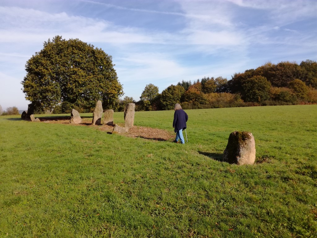
Menhir dit la Droite Pierre (Chênedouit) submitted by oldman on 4th Nov 2017. Site in Normandie:Orne (61) France
(View photo, vote or add a comment)
Log Text: Stupidly I forgot to look for this 2.3 metre high menhir to the west of the village in my rush to get to the Pierre de Gargantua.
Menhir d'Outres
Trip No.202 Entry No.55 Date Added: 28th Mar 2020
Site Type: Standing Stone (Menhir)
Country: France (Normandie:Orne (61))
Visited: Couldn't find on 1st May 2005
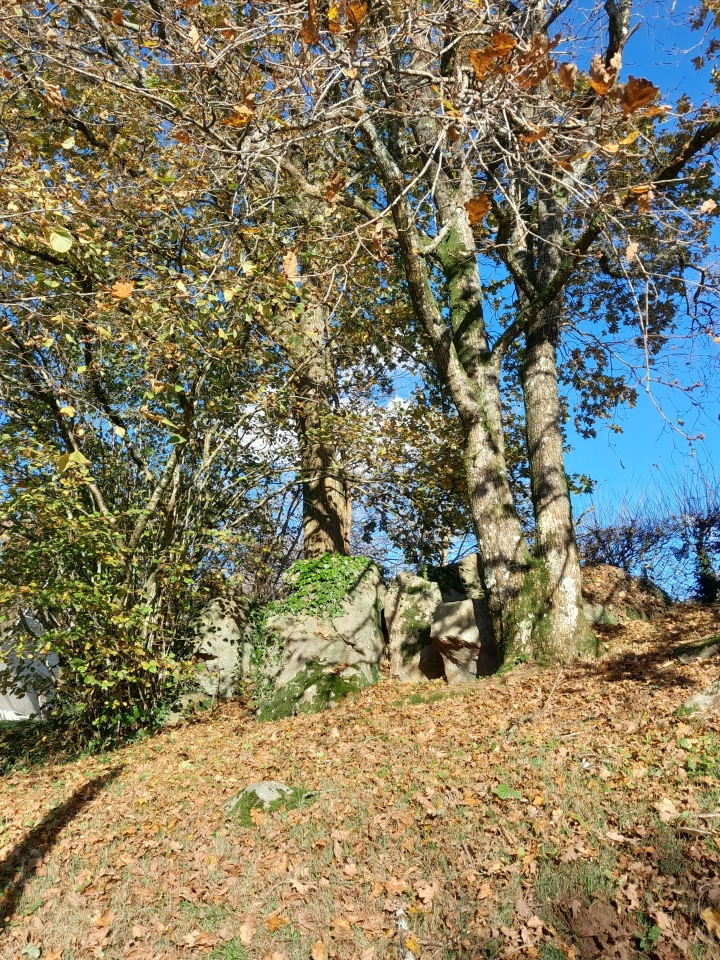
Menhir d'Outres submitted by foz750 on 25th Nov 2023. Site in Normandie:Orne (61) France
(View photo, vote or add a comment)
Log Text: Marked on my map pretty much near the centre of the village of Joué-de-Bois but I failed to find this menhir.
Bignon Menhir
Trip No.202 Entry No.51 Date Added: 28th Mar 2020
Site Type: Standing Stone (Menhir)
Country: France (Pays de la Loire:Mayenne (53))
Visited: Couldn't find on 1st May 2005
Bignon Menhir submitted by karolus on 10th Jan 2019. Site in Pays de la Loire:Mayenne (53) France
(View photo, vote or add a comment)
Log Text: To the southwest of the dolmen is supposedly a menhir and it is marked both on my ign map and on the local maps and footpath signposts. However it is probably to be found in very thick woodland and try as hard as I did I found no sight of it.
Bas Villette Dolmen
Trip No.202 Entry No.40 Date Added: 28th Mar 2020
Site Type: Burial Chamber or Dolmen
Country: France (Pays de la Loire:Mayenne (53))
Visited: Couldn't find on 30th Apr 2005
Log Text: I could find nothing here despite it being marked on my ign map. It is perhaps in private woodland.
Menhir de la Roche (Gorron)
Trip No.202 Entry No.24 Date Added: 26th Mar 2020
Site Type: Standing Stone (Menhir)
Country: France (Pays de la Loire:Mayenne (53))
Visited: Couldn't find on 24th Apr 2005
Menhir de la Roche (Gorron) submitted by SMD on 25th Oct 2007. Site in Pays de la Loire:Mayenne (53)
(View photo, vote or add a comment)
Log Text: Unlike all the rest of the menhirs in this area I could find no signpost to this one despite it being clearly marked on the ign map and there being a large warehouse called Menhir Meubles or similar in the vicinity. After a while looking around I gave up not finding this one.
Les Cartesières
Trip No.202 Entry No.18 Date Added: 26th Mar 2020
Site Type: Passage Grave
Country: France (Normandie:Manche (50))
Visited: Couldn't find on 24th Apr 2005
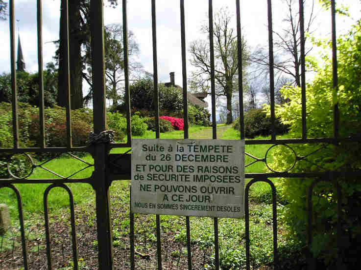
Les Cartesières submitted by TheCaptain on 7th May 2005. Les Cartesières allée couverte, St Symphorien-des-Monts, Manche.
This T shaped gallery grave is found in a zoo park. However, on the day of my visit, this park was well and truly shut, and looked like it hadn’t been open in many years.
(View photo, vote or add a comment)
Log Text: This T shaped gallery grave is the only one of this kind surviving in Normandy and is to be found in a zoo park near to the village. However on the day of my visit this park was well and truly shut and looked like it hadn’t been open in many years and was becoming very decrepit. No chance of getting in to see the monument.
Later note. Having seen the 1:25000 ign map of the area the dolmen is marked beside the little lane which runs down to the lakes along the western edge of the park. In fact its probably almost exactly where I stopped and had a look around to see if I could spot anything. If I am in the area again I will know where to look.
La Loge aux Sarrasins
Trip No.202 Entry No.17 Date Added: 26th Mar 2020
Site Type: Burial Chamber or Dolmen
Country: France (Normandie:Calvados (14))
Visited: Couldn't find on 17th Apr 2005
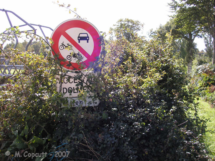
la Loge aux Sarrasins submitted by thecaptain on 28th Sep 2007. Despite the overgrown signs, this looked all very promising, and that I could add this elusive, rare Normandy dolmen to my list !
(View photo, vote or add a comment)
Log Text: Despite an accurate description of how to find this dolmen I could find nothing that looked like the picture from 1980. I did however find some large stones in about the right place a large single stone standing in the middle of the field and a couple of smaller ones with a small stone on top and a further large stone nearby. Perhaps I was looking in the wrong field but I think more likely is that this dolmen has recently been destroyed. A closer inspection of the photographs and I think that the large stone lying near the edge of the field might be the capstone from the dolmen upside down. A criminal shame that these things survive so long only to be destroyed in these modern times due to greed and laziness of a farmer.
Later note. Having seen the 1:25000 ign map of the area the dolmen is marked in a field further to the north than where I was looking beside the farm buildings which begs the question of what are the stones I did find.
Menhir dit Pierre de la Hoberie
Trip No.202 Entry No.15 Date Added: 26th Mar 2020
Site Type: Standing Stone (Menhir)
Country: France (Normandie:Calvados (14))
Visited: Couldn't find on 23rd Apr 2005
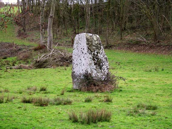
Menhir dit Pierre de la Hoberie submitted by Rida on 27th Feb 2011. Site in Normandie:Calvados (14) France
Menhir dit Pierre de la Hoberie
(View photo, vote or add a comment)
Log Text: This 3.1 metre tall menhir is said to be in the field downhill from the Ferme de Hoberie southwest of the village of Ussy. I could find nowhere to park and see no way through the farm without going through fields of cows so didn’t bother as I was in a rush to get back.
Pierre Tourneresse (Gouvix)
Trip No.202 Entry No.8 Date Added: 25th Mar 2020
Site Type: Standing Stone (Menhir)
Country: France (Normandie:Calvados (14))
Visited: Couldn't find on 23rd Apr 2005
Pierre Tourneresse (Gouvix) submitted by Rida on 29th Jan 2011. Site in Normandie:Calvados (14) France
(View photo, vote or add a comment)
Log Text: Not marked on my ign map and finding no map within the village I gave up without really trying to find the supposed menhir near here. I believe it is in the grounds of the local chateau and wasn’t going to spend a lot of time being unable to find it.
Menhir de la Demoiselle de Bracqueville
Trip No.202 Entry No.4 Date Added: 25th Mar 2020
Site Type: Standing Stone (Menhir)
Country: France (Normandie:Calvados (14))
Visited: Couldn't find on 23rd Apr 2005
Menhir de la Demoiselle de Bracqueville submitted by thecaptain on 11th Oct 2006. la Demoiselle de Bracqueville, near Caen in Calvados. Its about 1.4 metres tall, and leans towards the north.
The farmer has left very little room around it, and it has some very recent scrapes and damage done to it, no doubt from farm machinery.
(View photo, vote or add a comment)
Log Text: Despite being marked on the ign map and having a description of how to find this 1.4 metre tall stone I could find no reasonable place to park down the farm track to Bracqueville before a 500 metre walk so didn’t bother. I could see no sign of the stone from anywhere in the vicinity.
Menhir dit Pierre Debout (Reviers)
Trip No.202 Entry No.3 Date Added: 25th Mar 2020
Site Type: Standing Stone (Menhir)
Country: France (Normandie:Calvados (14))
Visited: Couldn't find on 29th Dec 2005
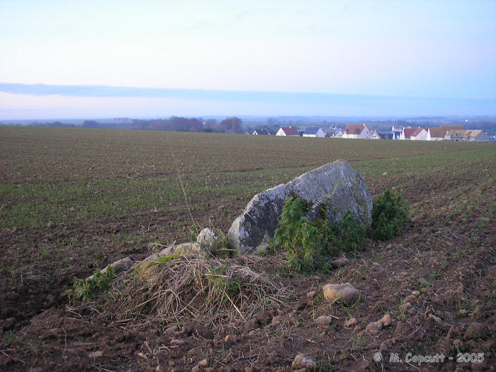
Menhir dit Pierre Debout (Reviers) submitted by thecaptain on 29th Dec 2005. Reviers menhir.
Just inland from the D-Day beaches can be found (when the crops are down) the sad remains of this menhir.
(View photo, vote or add a comment)
Log Text: Despite being marked on the ign map and having a good look all around I could find no sign of any menhir here. Perhaps it is fallen and somewhere within a field of oilseed Rape.
Later note. Having seen the 1:25000 ign map of the area the menhir is marked fairly close to the corner of the road and farm track right where I was looking originally. As I suspected the menhir must be fallen and hidden within the crop.
Pierrelaye menhir
Trip No.201 Entry No.6 Date Added: 25th Mar 2020
Site Type: Standing Stone (Menhir)
Country: France (Normandie:Calvados (14))
Visited: Couldn't find on 21st Nov 2004

Pierrelaye menhir submitted by Rida on 6th Feb 2011. Site in Normandie:Calvados (14) France
(View photo, vote or add a comment)
Log Text: On a wet Sunday afternoon, following the disappointment of not getting to see the Pierre Dialan dolmen, my family encouraged me to go and find the nearby Menhir de Pierrelaye, which is marked on the IGN maps to the north of the village of Villers-Bocage.
My first attempt to get to see this 3 metre high stone was via the lane from the southeast, but upon reaching a farmyard there was no further way through. To much amusement getting out from here involved reversing all the way back up this lane to the road junction, a distance of about a mile ! Not to be beaten, I drove round the lanes to try and get a look from the northwest of where the stone is marked. The collection of farms and houses here is known as Pierrelaye, and indeed have signposts to Pierrelaye, but I could see no traces of a Menhir.
While turning round in a farmyard, an old farmer came out to see what was going on, so we asked in bad French where the stone was. After a while, he obviously realised what we were looking for and pointed up the hillside and said “Non monsieur, Fermée” while making arm gestures which made it clear I wasn’t going to see the stone. I assume it is on private land, and he wasn’t going to give me permission to go have a look. I have found information which tells that the stone is 3 metres high, with a base width of 2,5 metres, made of schist. It is situated in the middle of a field in a little valley.
