Contributory members are able to log private notes and comments about each site
Sites theCAptain has logged. View this log as a table or view the most recent logs from everyone
Bretteville Allée Couverte
Trip No.201 Entry No.10 Date Added: 25th Mar 2020
Site Type: Passage Grave
Country: France (Normandie:Manche (50))
Visited: Yes on 22nd Nov 2004. My rating: Condition 4 Ambience 3 Access 5

Bretteville Allée Couverte submitted by thecaptain on 7th Dec 2004. L'Allée Couverte de Bretteville, just to the east of Cherbourg, Normandy.
Seen here from its western side.
(View photo, vote or add a comment)
Log Text: To the southeast of Bretteville, just a few miles east of Cherbourg, can be found the Allée Couverte de Bretteville, also known as “La Sepulture a Entrée Laterale de Bretteville-en-Saire”. It is clearly signposted from the D.901 road, and has its own little field and car park.
About 16 metres in length, it runs in a NW - SE direction with internal width and height about a metre, and has seven capstones still in place. The entrance is to the side of the allée at the south near the southeast end, and this leads in to a lovely portal holed doorstone blocking off the major northern part of the chamber. The southeast end of the monument has several lateral slabs radiating outwards from the main structure.
A very nice monument to visit, but it’s a pity about the rubbish and graffiti from which it suffers.
Bretteville-le-Rabet
Trip No.202 Entry No.9 Date Added: 25th Mar 2020
Site Type: Ancient Mine, Quarry or other Industry
Country: France (Normandie:Calvados (14))
Visited: Yes on 23rd Apr 2005. My rating: Condition 2 Ambience 2 Access 5

Bretteville-le-Rabet submitted by TheCaptain on 8th May 2005. Bretteville-le-Rabet flint quarries, Calvados.
I spent just 5 minutes looking around the edge of this freshly ploughed field and found four bits of worked flint, including a nice scraper tool.
(View photo, vote or add a comment)
Log Text: Not marked on any map I was told of this place by a man who collects flint artefacts I met at Cairon so I went for a quick look. Nothing much to see but the fields here were freshly ploughed and within 5 minutes of looking along the edges of the fields by the roadside I had found 4 worked flint artefacts.
Bright Angel Trail
Date Added: 18th Nov 2010
Site Type: Rock Art
Country: United States (The Southwest)
Visited: Yes on 5th Nov 1990

Bright Angel Trail submitted by thecaptain on 2nd Jun 2009. The Bright Angel Trail is one of the few trails which cross the Grand Canyon, and descends into the canyon from the Grand Canyon Village on the southern rim. The trail is an ancient one, originally used by the Havasupai Indians to reach their gardens low down in the canyon.
Just beyond the first tunnel on the trail down the side of the canyon can be seen some ancient petroglyphs, where there are animals, hand and footprints, and many enigmatic symbols.
(View photo, vote or add a comment)
Log Text: None
Brightwell Barrow
Date Added: 18th Sep 2010
Site Type: Round Barrow(s)
Country: England (Oxfordshire)
Visited: Yes on 28th Mar 2004

Brightwell Barrow submitted by TheCaptain on 28th Mar 2004. Brightwell Barrow - Wittenham Clumps, Oxfordshire.
Brightwell Barrow as seen along the ridge from Castle Hill.
(View photo, vote or add a comment)
Log Text: None
Brillaud Dolmen
Trip No.205 Entry No.72 Date Added: 15th Jun 2020
Site Type: Burial Chamber or Dolmen
Country: France (Midi:Ariège (09))
Visited: Yes on 10th Sep 2005. My rating: Condition 3 Ambience 4 Access 3
Brillaud dolmen submitted by theCaptain on 20th Dec 2010. First view of the dolmen. arriving from the east along a well maintained and signed footpath along a lovely ridgetop.
(View photo, vote or add a comment)
Log Text: At Cap-Del Pouech, I looked carefully at my maps and found that I could drive halfway to this dolmen and hopefully park up by La Page farm, which will save on the walking. From there, it was a 25 minute walk along a well maintained and signed footpath along a lovely ridgetop, but difficult underfoot on the bare and slippery limestone and mud.
It is in fact two dolmens, both within most of their stony mounds which are adjoined. The east dolmen has a chamber 3 metres by 1.5 metres, open towards the east, with two side slabs and a capstone still in place. The back stone has broken and fallen. The western dolmen is a bit of a wreck, and only faint remains of the chamber can be seen. The overall mound is about 20 metres in length, by 10 metres wide, and seems to have some large slabs in its perimeter, defining the outside shape.
On a good day, the views from up here would be superb, the high Pyrenees to the south, and the plain of Toulouse to the north, but today its just clouds. Good job I didnt try and get to the third (Couminges) dolmen on the walk, as its already 5:30 by the time I get back to the van !
Bringnerault Alignement
Date Added: 18th Sep 2010
Site Type: Standing Stones
Country: France (Bretagne:Ille-et-Vilaine (35))
Visited: Yes on 17th Jul 2010
Bringnerault alignement submitted by TheCaptain on 17th Jul 2010. Further to the south of stone No.3 is now a pond, on the far side of which is a large stone, 2 metres plus in length.
(View photo, vote or add a comment)
Log Text: None
Bristol City Museum
Date Added: 18th Sep 2010
Site Type: Museum
Country: England (Somerset)
Visited: Yes on 11th Aug 2009

Bristol City Museum submitted by thecaptain on 11th Aug 2009. As a part of the fabulous Banksy vs Bristol Museum exhibition this summer, a part of "Boghenge" (originally done at Glastonbury Festival in 2007) has been erected in the museum entrance.
(View photo, vote or add a comment)
Log Text: None
Brisworthy
Date Added: 29th Oct 2019
Site Type: Stone Circle
Country: England (Devon)
Visited: Yes on 10th Jun 2017

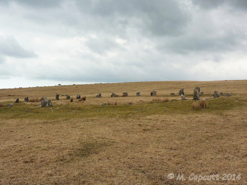
Brisworthy submitted by TheCaptain on 10th Jun 2017. Brisworthy stone circle seen as approaching from the east
(View photo, vote or add a comment)
Log Text: None
Broad Barrow (Hamel Down)
Date Added: 31st Dec 2022
Site Type: Round Barrow(s)
Country: England (Devon)
Visited: Yes on 6th Dec 2022. My rating: Condition 3 Ambience 4 Access 3

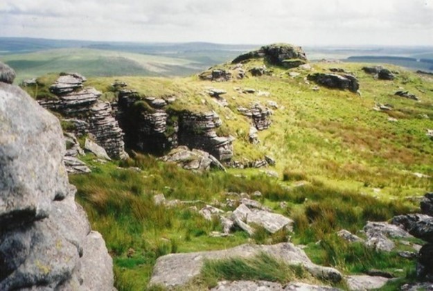
Broad Barrow (Hamel Down) submitted by TheCaptain on 31st Dec 2022. Broad Barrow is at the top the highest point of Hamel Down at 532m. Seen here from the south
(View photo, vote or add a comment)
Log Text: Walking on to the south, there is an obvious large cairn know as Broad Barrow atop the highest point of the down at 532m. This is one of the largest cairns on Dartmoor, but mostly an earthen construction, unlike many of the others. In its southern edge is an excavated stone structure, whether the remains of an old chamber or a more modern construction I do not know. In the central area on top is what looks like a grave, with a dug stony area and a "headstone", put here by the Duke of Somerset as a boundary marker in 1854.
Broad Stone (Dorset)
Date Added: 18th Sep 2010
Site Type: Stone Circle
Country: England (Dorset)
Visited: Yes on 18th Nov 2007

Broad Stone (Dorset) submitted by TheCaptain on 18th Nov 2007. Some of us mega Portal admins met up for lunch and a chat in Dorset today. And despite the apalling weather, we made the effort out of the pub to check out a few old things.
Here we are at the poor old Broadstone. Poor abused thing. We tidied it up a bit, making sure it doesn't become comletely buried.
(View photo, vote or add a comment)
Log Text: None
Bronkham Hill
Date Added: 29th Oct 2019
Site Type: Barrow Cemetery
Country: England (Dorset)
Visited: Yes on 9th May 2019

Bronkham Hill submitted by TheCaptain on 9th May 2019. A small surface hole has opened up to a huge sink hole on Bronkham Hill, West Dorset.
"The sink hole now appears stable and the National Trail is open. Sink holes occur naturally, but our advice is always take care and if you have concerns report them to Dorset Council."
For more information, see News from Dorset Council
(View photo, vote or add a comment)
Log Text: None
Broomend of Crichie Avenue
Date Added: 29th Oct 2019
Site Type: Multiple Stone Rows / Avenue
Country: Scotland (Aberdeenshire)
Visited: Yes on 27th Jul 2017
Broomend of Crichie Avenue submitted by TheCaptain on 27th Jul 2017. Just a couple of stones remain of this 500m long stone avenue, which once lead away to the south from the henge, and also northwards from the henge to the now destroyed stone circle. There are supposedly a couple more stones and some burial cists to be found at the southern end of the avenue, but this appeared to be within the grounds of a private complex.
(View photo, vote or add a comment)
Log Text: None
Broomend of Crichie Pictish Symbol Stone
Date Added: 29th Oct 2019
Site Type: Class I Pictish Symbol Stone
Country: Scotland (Aberdeenshire)
Visited: Yes on 27th Jul 2017
Broomend of Crichie Pictish Symbol Stone submitted by TheCaptain on 27th Jul 2017. The pictish stone now erected within the henge is a splendid stone, the carvings on which can clearly be made out.
(View photo, vote or add a comment)
Log Text: None
Broomend Of Crichie Stone Circle / Henge
Date Added: 29th Oct 2019
Site Type: Henge
Country: Scotland (Aberdeenshire)
Visited: Yes on 27th Jul 2017

Broomend Of Crichie Stone Circle / Henge submitted by TheCaptain on 27th Jul 2017. Composite panorama of the henge and stones looking south
(View photo, vote or add a comment)
Log Text: None
Broussardière Menhir
Trip No.202 Entry No.36 Date Added: 26th Mar 2020
Site Type: Standing Stone (Menhir)
Country: France (Pays de la Loire:Mayenne (53))
Visited: Yes on 29th Apr 2005. My rating: Condition 4 Ambience 3 Access 4

Broussardière Menhir submitted by TheCaptain on 8th May 2005. La Broussardière menhir, Montaudin, Mayenne.
It is found near the the road from Larchamp to Montflaux, near a little pond beside a stream.
(View photo, vote or add a comment)
Log Text: This menhir is about 2.5 to 3 metres in height and about 1.5 metres in width. It is found just a few yards away from the side of the road from Larchamp to Montflaux near a little pond beside a stream and is easy to see despite the very frisky bullocks in the adjacent field trying to get at me!
Brown Willy Barrow Cemetery
Date Added: 24th Jul 2022
Site Type: Barrow Cemetery
Country: England (Cornwall)
Visited: Yes on 13th Jun 2022. My rating: Condition 3 Ambience 4 Access 2

Brown Willy Barrow Cemetery submitted by Bladup on 13th Feb 2014. Brown Willy. This view is taken from near the summit cairn and is looking south towards the other cairn.
(View photo, vote or add a comment)
Log Text: Up to the top of Brown Willy, where there is a large cairn, with trig point and modern rearrangements on the northern top, where I eat my pasty. Walk south along the ridgetop, and there is a really splendid cairn at the southern top.
Brown Willy Cairn S
Date Added: 24th Jul 2022
Site Type: Cairn
Country: England (Cornwall)
Visited: Yes on 13th Jun 2022. My rating: Condition 4 Ambience 5 Access 2

Brown Willy Cairn S submitted by TheCaptain on 24th Jul 2022. On a lesser summit at the southern end of the ridgetop is a large round cairn
(View photo, vote or add a comment)
Log Text: Walk south along the Brown Willy ridgetop, and there is a really splendid cairn at the southern top.
Bruniquel Cave
Trip No.200 Entry No.70 Date Added: 18th Jun 2020
Site Type: Cave or Rock Shelter
Country: France (Midi:Tarn-et-Garonne (82))
Visited: Saw from a distance on 27th Aug 2000

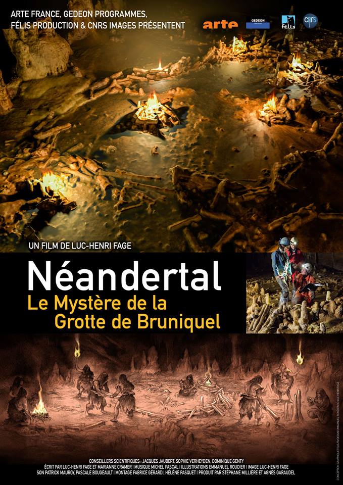
Bruniquel Cave submitted by TheCaptain on 26th Mar 2019. From Portail des Mégalithes de la Francophonie
At The 11Ème Festival International du Film d'Archéologie de Nyon, archaeological news will be in the spotlight with the presentation, in preview, of the film "the mystery of the cave of bruniquel". this documentary presents the recent research that allowed the dating of a structure made by neanderthal man in a cave 175 000 years ago: it would therefore be the oldest human construction known to this day.
Director Luc-Henri Fage will b...
(View photo, vote or add a comment)
Log Text: Drive north from Toulouse to explore Bruniquel, Penne, Gorges d’Aveyron, Caussade
Bruyère d'Usclas
Trip No.205 Entry No.143 Date Added: 11th Nov 2020
Site Type: Burial Chamber or Dolmen
Country: France (Languedoc:Hérault (34))
Visited: Yes on 17th Sep 2005. My rating: Condition 5 Ambience 4 Access 4

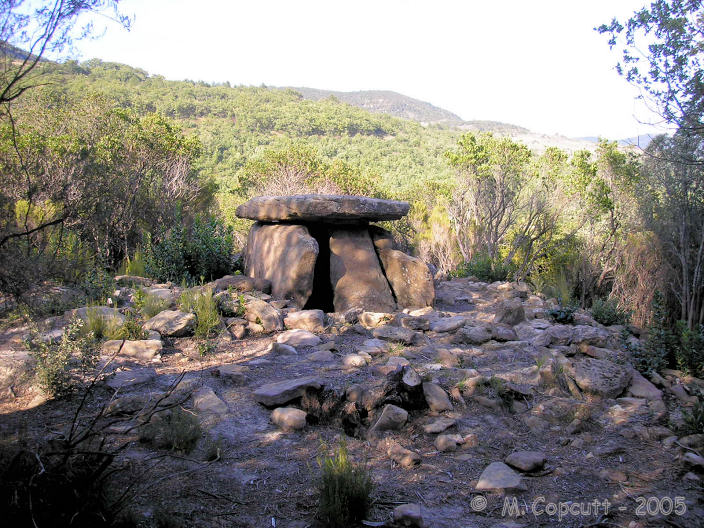
Bruyère d'Usclas submitted by TheCaptain on 27th Oct 2007. This is a lovely dolmen, up on the forested hill near to the St Michel de Grandmont Priory.
It has much in common with the nearby dolmen de Coste-Rouge, a similar sized (but not so high) chamber set in a circle of stones, many of which are the red volcanic rock.
(View photo, vote or add a comment)
Log Text: This is a lovely dolmen, but was a bit of a bugger to find, despite a large signpost. Taking the road from Lodeve east to Saint-Michel-de-Grandmont, travel 800 metres further than the entrance to the priory. Here there is a junction with two large forest tracks and a parking area, with a large sign pointing down the first forest track to "Dolmen Bruyère d'Usclas".
I walked miles, and saw no evidence of the dolmen, but found three ladies sitting in the forest. I asked them and they pointed out the error of my ways - I had gone way too far and walked round in much of a big circle around the hilltop. From the parking at the junction, only walk about 200 metres (about 150m past a big tank), then look for a little path down the hillside into the forest on the left. It is marked with a little pile of stones, but I do mean little ! Fifty metres down this path through the trees is the dolmen.
It has much in common with the nearby dolmen de Coste-Rouge, a similar sized (but not so high) chamber set in a circle of stones, many of which are the red volcanic rock. The capstone, which is unfortunately broken at the back, sits on four perfectly fitted support stones, with the side stones angled inwards. The front stone does not have the oven door, but the entrance is to one side, which shows evidence of a carved and enlarged opening area. The chamber is about 2.5 m long by 2 m in width. The stones are fitted so well that almost no light gets in apart from through the entrance.
Bryn Cader Faner
Date Added: 18th Sep 2010
Site Type: Ring Cairn
Country: Wales (Gwynedd)
Visited: Yes on 9th Mar 2004

Bryn Cader Faner submitted by thecaptain on 9th Mar 2004. Bryn Cader Faner.
This is the truly wonderful sight as you approach this cracking circle up the hillside.
On a nice day, there is a lovely walk from Harlech, past Moel Goedog to Llyn Trawsfynydd along an ancient trackway, which passes several standing stones, several cairns and a few circles. This is the pick of them all.
(View photo, vote or add a comment)
Log Text: None
