Contributory members are able to log private notes and comments about each site
Sites theCAptain has logged. View this log as a table or view the most recent logs from everyone
Truc de Marti
Trip No.205 Entry No.192 Date Added: 25th Nov 2020
Site Type: Ancient Village or Settlement
Country: France (Languedoc:Hérault (34))
Visited: Saw from a distance on 20th Sep 2005

Truc de Marti tombe ovale submitted by johnstone on 30th Mar 2020. Tombe #3, June 26, 2000
(View photo, vote or add a comment)
Log Text: I went to have a look at this hilltop site, but time was getting on, and I could find no quick way up to the top of the hill, which has the remains of a prehistoric village and up to 9 burial chambers on it. I had a look, but could see nothing resembling a path at all, and the place was all very overgrown with rough scrub. I decided that I would probably get lost up there, so I headed off to find a campsite.
Viols Musée de Préhistoire
Trip No.205 Entry No.191 Date Added: 25th Nov 2020
Site Type: Museum
Country: France (Languedoc:Hérault (34))
Visited: Saw from a distance on 20th Sep 2005
Log Text: Once a prehistory museum in the little town of Viols-le-Fort, but now closed with the building used for something else. The collection includes the statue menhir found at nearby prehistoric village of Truc de Marti.
Oppidum de la Blacarède
Trip No.205 Entry No.176 Date Added: 24th Nov 2020
Site Type: Ancient Village or Settlement
Country: France (Languedoc:Gard (30))
Visited: Saw from a distance on 19th Sep 2005
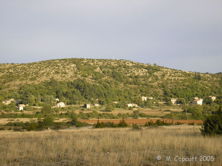
Oppidum de la Blacarède submitted by thecaptain on 3rd Dec 2009. To the northeast of the village of Rogues is a large rounded hill with remains of an Oppidum on the top.
(View photo, vote or add a comment)
Log Text: Just to the northeast of the village of Rogues is a large rounded hill with remains of an Oppidum on the top.
Menhir de Landre 2
Trip No.205 Entry No.164 Date Added: 24th Nov 2020
Site Type: Standing Stone (Menhir)
Country: France (Languedoc:Gard (30))
Visited: Saw from a distance on 19th Sep 2005
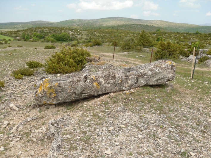
Menhir de Landre 2 submitted by regina on 22nd Jun 2011. Site in Languedoc:Gard (30) France
Menhir de Landre 2
(View photo, vote or add a comment)
Log Text: About 100 metres to the south of Landre menhir 1, atop the adjacent hillock can be found this fallen menhir. As for menhir 1, this was too well fenced in, and I didn't get to visit it.
Menhir de Landre 1
Trip No.205 Entry No.163 Date Added: 24th Nov 2020
Site Type: Standing Stone (Menhir)
Country: France (Languedoc:Gard (30))
Visited: Saw from a distance on 19th Sep 2005
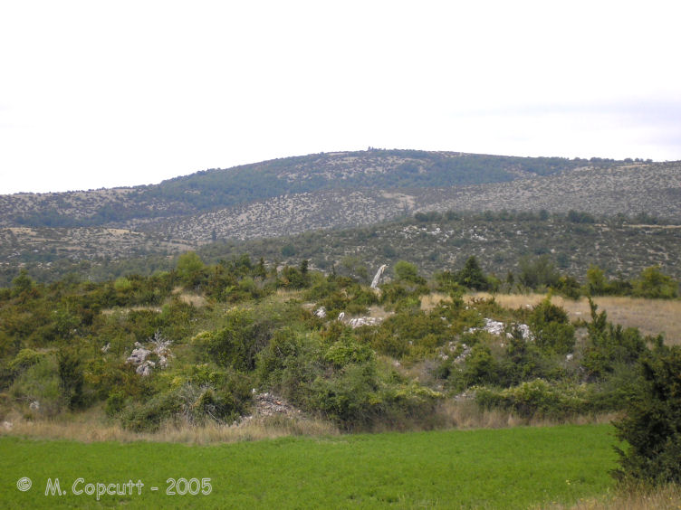
Menhir de Landre 1 submitted by thecaptain on 1st Aug 2008. This menhir stands up on top of its little hillock, about 70 metres to the side of the road.
(View photo, vote or add a comment)
Log Text: From the Planas junction, take the small road towards Le Landre. After a couple of kilometres, just after passing over the brow of a hill, and you can see this menhir up on top of its little hillock, about 70 metres to the left of the road. It was all well fenced in when I visited, behind a little cropped field, so I couldn't get to the stone. It looks about 2.5 metres tall, and leans at quite an angle. Splendid views from here to the north, and the Cevennes.
Serre de la Gleisa
Trip No.205 Entry No.158 Date Added: 15th Nov 2020
Site Type: Standing Stone (Menhir)
Country: France (Languedoc:Gard (30))
Visited: Saw from a distance on 19th Sep 2005. My rating: Condition 3 Ambience 3 Access 3
Serre de la Gleisa submitted by theCaptain on 12th Dec 2009. Serre de la Gleisa menhir is perhaps 100 metres from the road and well fenced in, so I couldnt get to it.
It looks about 2.5 metres tall, and slab shaped.
(View photo, vote or add a comment)
Log Text: Take the road towards Blandas from Montdardier, and after a few kilometres there is a big junction of ways. On the left, 100 metres or so before the junction, up the hill, can be seen this menhir, perhaps 100 metres from the road and well fenced in, so I couldn't get to it. It looks about 2.5 metres tall, and slab shaped.
Oppidum de Pech de Maho
Trip No.205 Entry No.96 Date Added: 8th Nov 2020
Site Type: Ancient Village or Settlement
Country: France (Languedoc:Aude (11))
Visited: Saw from a distance on 14th Sep 2005

Oppidum de Pech de Maho submitted by catweasel11 on 30th Jul 2006. I believe, when they rebuilt this, they forgot the gate that would allow for a flow of water.
Oppidum at village of Sigean
(View photo, vote or add a comment)
Log Text: A large hill, but I got distracted while trying to have a proper look, as there was a large accident being cleared up, and I couldn’t turn down the small road to have a close look.
Bélesta Museum of prehistory
Trip No.205 Entry No.88 Date Added: 28th Oct 2020
Site Type: Museum
Country: France (Languedoc:Pyrénées-Orientales 66)
Visited: Saw from a distance on 12th Sep 2005

Bélesta Museum of prehistory submitted by thecaptain on 3rd Mar 2006. Supposedly excellent museum located in the chateau in centre of the village of Bélesta in Pyrénées-Orientales.
(View photo, vote or add a comment)
Log Text: Blimey, the roads round here are twisty and tight. There was no way I was able to park the van anywhere near the village for a look at this. So I had to give up totally on any thoughts of a visit to this supposedly excellent museum.
Puijols tumulus
Trip No.205 Entry No.87 Date Added: 28th Oct 2020
Site Type: Artificial Mound
Country: France (Languedoc:Pyrénées-Orientales 66)
Visited: Saw from a distance on 12th Sep 2005
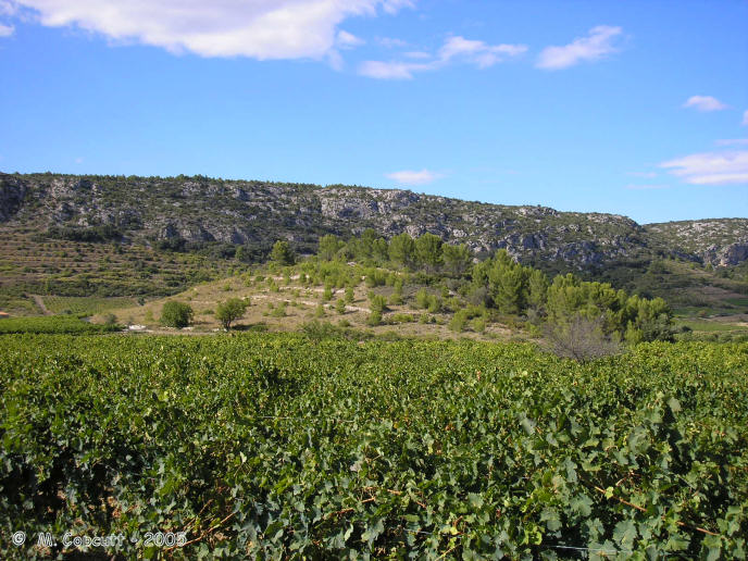
Puijols tumulus submitted by thecaptain on 4th Mar 2006. To the northwest of the village of Tautavel is a massive mound, which must be about 100 metres in diameter and 20 metres high, complete with terracing where grapes have been grown on it !
A local map clearly marks it as a tumulus.
(View photo, vote or add a comment)
Log Text: Just to the northwest of the village of Tautavel, on the opposite side of the river, is a massive tumulus, which must be about 100 metres in diameter and 20 metres high, complete with terracing and grapes growing on it !
La Caune de l'Arago
Trip No.205 Entry No.86 Date Added: 28th Oct 2020
Site Type: Cave or Rock Shelter
Country: France (Languedoc:Pyrénées-Orientales 66)
Visited: Saw from a distance on 12th Sep 2005
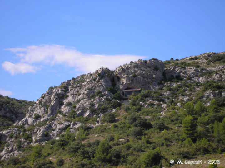
La Caune de l'Arago submitted by thecaptain on 16th Dec 2005. In a very pretty part of the world up on a cliff face above the vinyards, this is the cave where the skull of Tautavel man, one of the oldest known Europeans, was found.
This is of course all shut off to the public with buildings and shelters around it, as the excavations and research continue, 35 years after the finding of the ancient skull.
(View photo, vote or add a comment)
Log Text: In a very pretty part of the world up on a cliff face above the vinyards, this is the cave where Tautavel man was found. Its a kilometer or so south of the town, up on a rugged hill near where the river cuts a gorge through the hills. This is of course all shut off to the public with buildings and shelters around it, as the excavations and research continue, 35 years after the finding of the ancient skull.
Estaque tumulus
Trip No.205 Entry No.47 Date Added: 21st Oct 2020
Site Type: Chambered Cairn
Country: France (Midi:Hautes-Pyrénées (65))
Visited: Saw from a distance on 5th Sep 2005
Log Text: To the west of the village of La Barthe-sur-Neste, and northeast of the row of tumuli along the ridgetop road, can be found the remains of the Estaque tumulus. This is a very large mound, now contained beyond the confines of a rubbish facility, and not easy to access, although it can just about be seen from the road.
Musée de Lespugue
Trip No.205 Entry No.43 Date Added: 21st Oct 2020
Site Type: Museum
Country: France (Midi:Haute-Garonne (31))
Visited: Saw from a distance on 5th Sep 2005. My rating: Access 5
Musée de Lespugue submitted by TheCaptain on 28th Nov 2010. In the central square of the little village of Lespugue is a museum, which has an exhibition of 35,000 years of Lespugue.
(View photo, vote or add a comment)
Log Text: In the central square of the little village of Lespugue is a museum, which, as many European museums are, is closed on a Monday. This museum has an exhibition of 35,000 years of Lespugue. Outside the museum in a little grassy park is a 10 times lifesize copy of the Venus de Lespugue, a pregnant woman figure dated to 33,000BC, carved from a mammouth tusk which was found in a cave just below the village.
Musée de Préhistoire (Aurignac)
Trip No.205 Entry No.42 Date Added: 21st Oct 2020
Site Type: Museum
Country: France (Midi:Haute-Garonne (31))
Visited: Saw from a distance on 5th Sep 2005
Musée de Préhistoire (Aurignac) submitted by theCaptain on 29th Nov 2010. In the centre of Aurignac village is the prehistory museum, with all sorts of finds and items found in the local caves.
However, when I visited in September 2005, it was closed, with a notice stating that it had been closed in May 2004 by the Mairie, for an indefinite period.
(View photo, vote or add a comment)
Log Text: In the centre of Aurignac village is the prehistory museum, with all sorts of finds and items found in the local caves. It is situated underneath a little village square with parking available. However, when I visited, it was closed, with a notice stating that it had been closed in May 2004 by the Mairie, for an indefinite period. I have no idea why.
Doghouse Hill
Date Added: 18th Oct 2020
Site Type: Ancient Village or Settlement
Country: England (Dorset)
Visited: Saw from a distance on 15th Oct 2020

Doghouse Hill submitted by TheCaptain on 18th Oct 2020. Seen from the top of Golden Cap, Doghouse Hill is the central of the three hilltops in the mid distance, just inland from the headland cliffs.
(View photo, vote or add a comment)
Log Text: Seen from a distance during a walk from Seatown up the coast path up and over the Golden Cap and around Stanton St Gabriel and back.
Verrières tumulus
Trip No.205 Entry No.14 Date Added: 13th Oct 2020
Site Type: Chambered Cairn
Country: France (Poitou:Vienne (86))
Visited: Saw from a distance on 30th Aug 2005
Log Text: On the village map, about half a kilometre to the southeast of the dolmen, and to the northeast of the road to Lussac-les-Chateaux. I had a walk towards this after getting the van partly sorted, but couldn’t find anything definite. There was however, a mound in a field which has growth on it, which was in the right sort of place. Pity I couldn't get to it and have a proper look, and by now its started to get dark.
Great Arthur
Date Added: 11th Oct 2020
Site Type: Chambered Cairn
Country: England (Isles of Scilly)
Visited: Saw from a distance on 8th Sep 1986
Great Arthur submitted by Thorgrim on 14th Aug 2004. Three entrance graves and two cairns joined by a prehistoric wall are located on this tiny island.
(View photo, vote or add a comment)
Log Text: During a 2 week sailing trip with friends, I left the rest of the crew to sail L'Aurian from St Mary's all the way round the Western Rocks and in to New Grimsby harbour, Tresco for the night. I spent the day walking round the entire coast of St Mary's visiting many ancient sites, before catching a ferry over to Bryher in the evening and getting picked up by the crew.
Nornour
Date Added: 11th Oct 2020
Site Type: Ancient Village or Settlement
Country: England (Isles of Scilly)
Visited: Saw from a distance on 8th Sep 1986
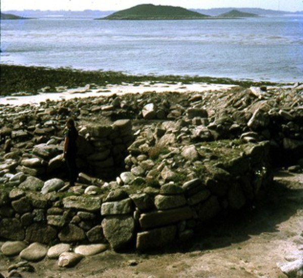
Nornour submitted by Thorgrim on 4th Nov 2003. The island of Nornour (SV 944147) is less than four acres in size and is joined to Great Ganilly at low tide. Yet the excavations of the early '70's revealed the remains of a major settlement which was occupied from the middle of the Bronze Age to the Romano-British Iron Age. Nornour clearly reveals the effects of rising sea levels, as this tiny scrap of land could never have supported such a thriving community. Many more houses are doubtless lost beneath the sea and right up until Tudor ...
(View photo, vote or add a comment)
Log Text: During a 2 week sailing trip with friends, I left the rest of the crew to sail L'Aurian from St Mary's all the way round the Western Rocks and in to New Grimsby harbour, Tresco for the night. I spent the day walking round the entire coast of St Mary's visiting many ancient sites, before catching a ferry over to Bryher in the evening and getting picked up by the crew.
East Kennett longbarrow
Date Added: 8th Oct 2020
Site Type: Long Barrow
Country: England (Wiltshire)
Visited: Saw from a distance on 4th Oct 1998
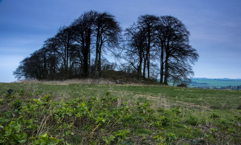
East Kennett longbarrow submitted by Humbucker on 21st Nov 2017. East Kennet Longbarrow. Without the leaves on the trees you can appreciate just how big this longbarrow is!
(View photo, vote or add a comment)
Log Text: Visit lots of ancient sites on a long off road cycle tour from Avebury to Windmill Hill, along the Wansdyke and back up Kennet Avenue
Falkner's Circle
Date Added: 2nd Oct 2020
Site Type: Stone Circle
Country: England (Wiltshire)
Visited: Saw from a distance on 25th Sep 2020
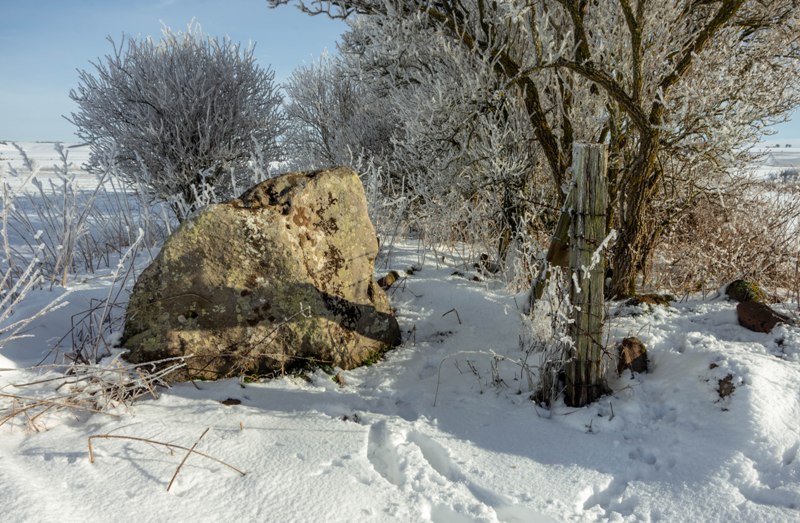
Falkner's Circle submitted by Humbucker on 16th Feb 2019. The last stone of Falkners Circle - taken in the snow earlier in February.
(View photo, vote or add a comment)
Log Text: Climbing over Waden Hill before walking up the avenue back to Avebury, got a good view of the site of Falkners Circle with its singular stone glowing in the afternoon sun.
Silbaby
Date Added: 2nd Oct 2020
Site Type: Misc. Earthwork
Country: England (Wiltshire)
Visited: Saw from a distance on 25th Sep 2020
Silbaby submitted by marcgreenman on 21st Sep 2020. Approaching waden hill, tree and nettle coverage can be clearly seen from here this also gives an approximate idea of the mound's size
(View photo, vote or add a comment)
Log Text: Walking along the fields beside the stream, get clear views of Silbaby mound, recently declared to be not prehistoric but medieval, and officially named The Waden Mound. There is a dead tree in front of it with a large hollow near the top which makes it look like an owl from a distance.
